We'll be heading out on snow surveys again in the next couple of days. But I can say that the pack this year is quickly approaching that of last and IF the warm spring continues will drop below last years just as fast.
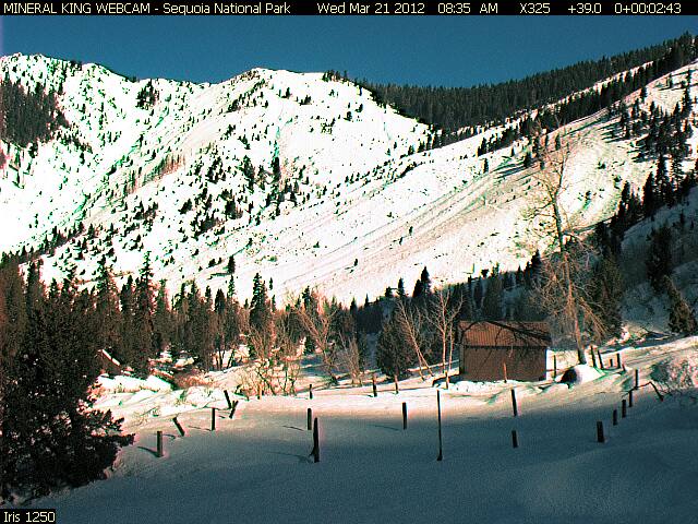
What is different this year is that most all the snow came in December. After that, due to cold temps and low sun angle, there was not much lost during the winter months, so the pack remained relatively static. The exception to that, is the south facing slopes as shown in the Mineral King webcam. From what I've seen out there this winter, a lot of the south slopes have been cooked dry after months of sun.
If this trend continues, like a few years ago (don't remember which year), this summer the south slopes will be exceptionally dry.
Here's the current graph showing this years trend compared to last, wet, and dry,
Screen Shot 2013-03-22 at 11.57.35 AM.png
Since the courses we measure aren't south facing, the graphs will not show the loss of snow on those slopes.
You do not have the required permissions to view the files attached to this post.


