
Day 1:
The night before my hike, I stayed in the campground near the Cottonwood Pass trailhead. It rained before I turned in. Next day, after drying my tent a bit and checking my pack, I was on the trail by 8:30. I reached Cottonwood Pass around 10:30; took some photos and had lunch early. I was already a bit winded, due to a too-heavy pack and lack of conditioning. After passing Chicken Spring Lake, I made fast progress along the PCT, despite intermittent light rain and some thunder further to the west.
 On the PCT; looking SW toward Big Whitney Meadow
Lucky for me, I missed the hail (experienced first-hand by passing hikers) which had fallen a few miles north of my location. When I got to just west of Cirque Peak, rain increased; I hunkered down under a tree for a while, but decided - being a bit damp and cold anyway, despite my rain jacket - that I could generate warmth if I just kept walking. Arriving at Lower Soldier Lake - really tired by now - I found huge numbers of mosquitoes and not many good campsites, so I backtracked to just south of the lake, where I found better camping and (somewhat) fewer bugs.
 Gloomy afternoon at Soldier Lake
Odd Note: Once in my tent that night, I heard a low, rhythmic sound coming from across the creek, somewhere between a “boom” and a muffled “whoop” - maybe 5 beats, a 30 second gap, and it then it would repeat. “What is that noise?”, I thought !! ... (to be continued).
Day 2:
A night of bad sleep from the altitude (along with fatigue from yesterday’s hike) resulted in a late start around 10:00, on a day trip to Miter Basin. A quick look at the slope above the North shore of the lake (together with my bum ankle and being solo), I decided to backtrack south and hit the Rock Creek trail going north. It was a beautiful day, with white puffy clouds replacing the solid gray of the previous day. I had easy stream crossings (knee-deep at most) and photographed lots of flowers along with the surrounding landscape. I spotted what I knew to be some kind of Grouse. After my trip ended, I looked it up and found it was a female Sooty Grouse; I then figured out the “booming” noise from the previous evening was a male (same species) doing his mating thing - mystery solved.
https://www.youtube.com/watch?v=_JAnbgaWBIk
 walking through meadows up Rock Creek
 view in lower Miter Basin
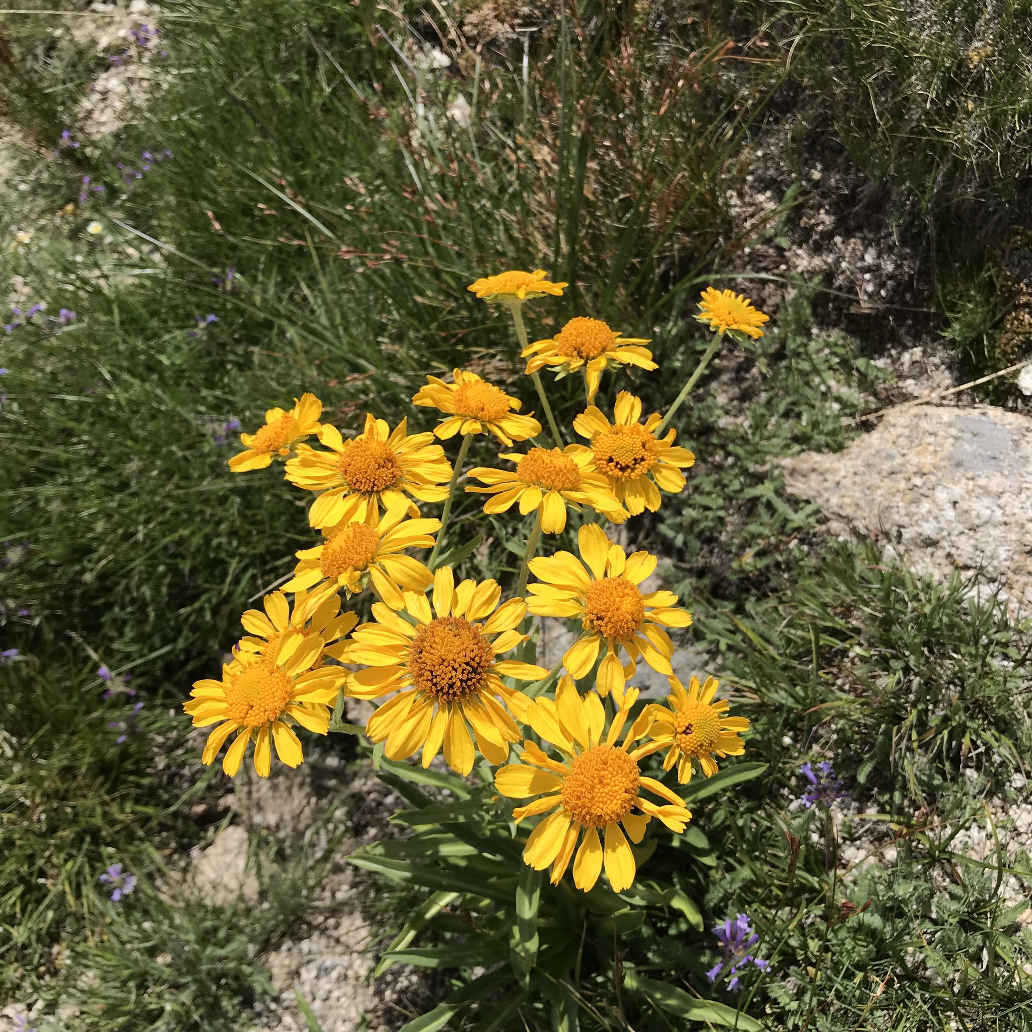 Miter Basin - flowers
I crossed the lower part of the basin - the trail lower down along the creek now long gone - and came to the cascade at the Sky Blue Lake outlet. From reading other trip reports, I knew to try the oft-mentioned route on the immediate right of the outlet, and found it mostly an easy walk-up on well-placed granite ramps, with only one place I needed a hand-hold to boost up from. Considering I have a fear of falling (not quite the same as fear of heights) and I did it with no uneasiness, it seems do-able for any hiker able to reach it in the first place.
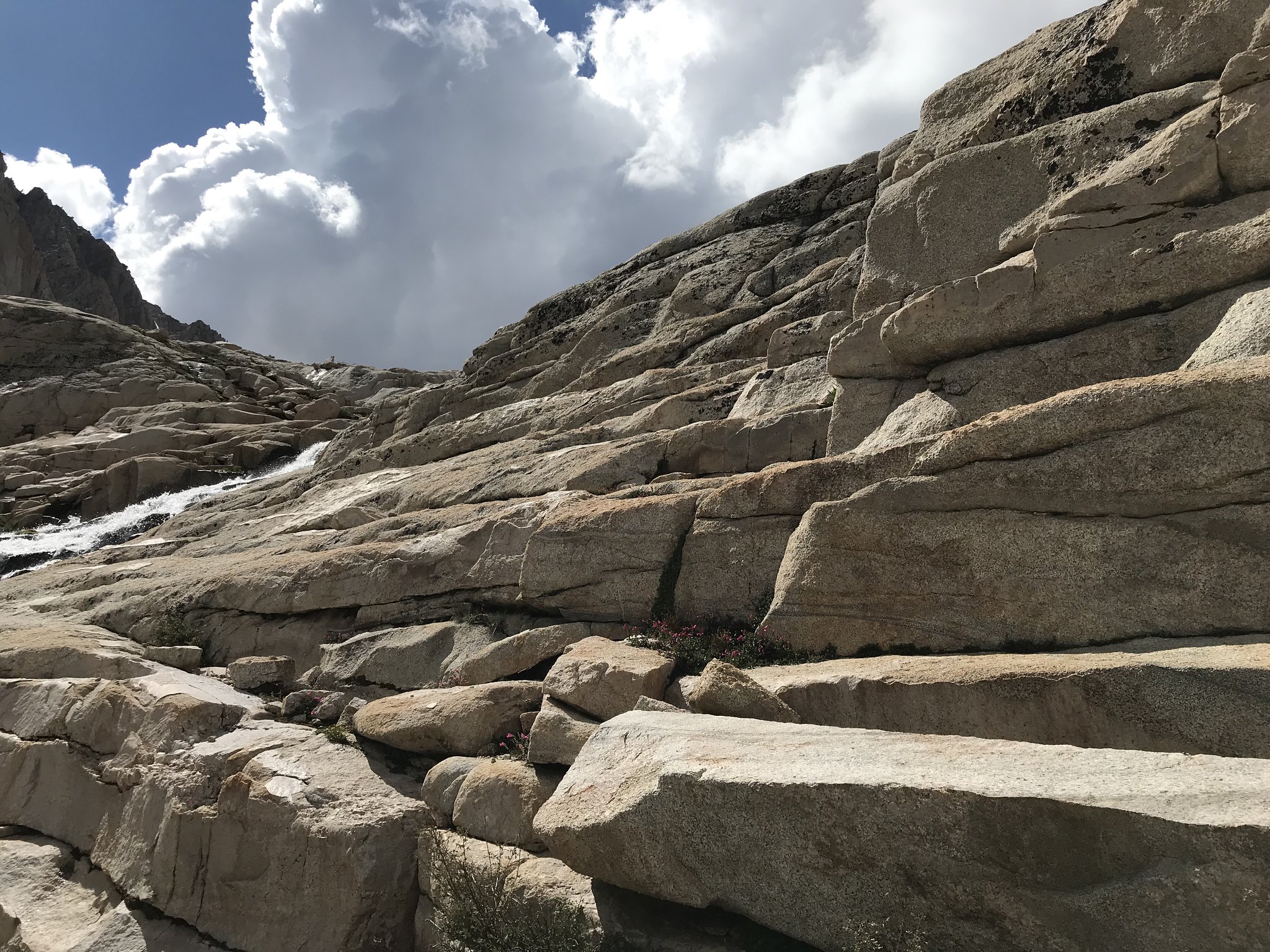 approach to the outlet of Sky Blue Lake
 Sky Blue Lake - outlet at lake level
I topped out and reached the lake shore a little after 2:00, so I hung out taking more photos and having lunch.
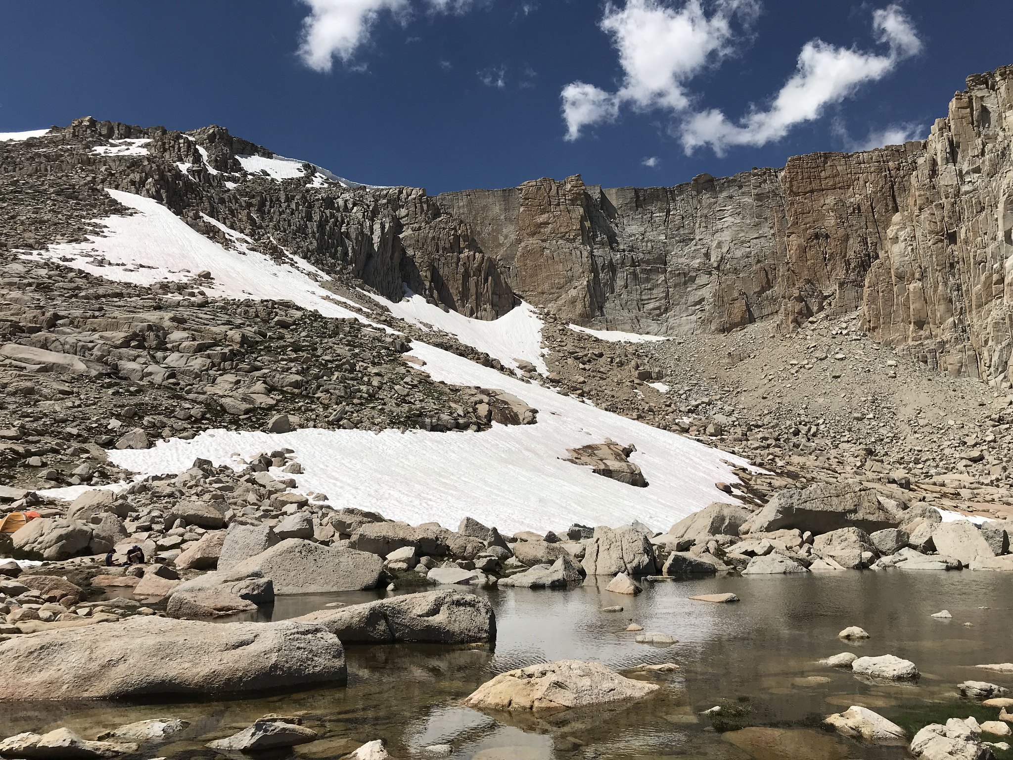
 Sky Blue Lake
My original plan was to proceed on to the upper un-named lake above Sky Blue, or to head eastward to Iridescent Lake. But my late start (and desire to end the day tired rather than exhausted) suggested I should save these for a return trip in the future. I roughly traced my route back down the basin.
 heading back toward Soldier Lake
However, I did decide to try a “shortcut” route back to Soldier Lake, veering away from Rock Creek and contouring along the low ridge to the east, eventually turning east and down to reach the northwest corner of the lake.
 descent to Soldier Lake - NW shore
I was pleased with myself, until I was unable to find a good “use” trail around the North end of the lake and I ended up walking through a good bit of marshy stuff (just as mosquitoes were swarming) to finally hit the east-side trail back to my camp just south of the lake. Mission (mostly) accomplished for today.
Day 3:
After another late start (!!), I reached New Army Pass in a little over 2 hours, with lots of stops to take photos (and catch my breath).
 trail to New Army Pass - easy so far ...
The trail up seemed endless to me, maybe because it just sweeps up in sort of a smooth, gradually increasing slope - compared to, say, Glen Pass, which seems to have a more varied approach combined with a more dramatic finish.
 New Army Pass Trail - nice stairs !
 almost there ... but you’d never know it
 Yes !! made it to the top
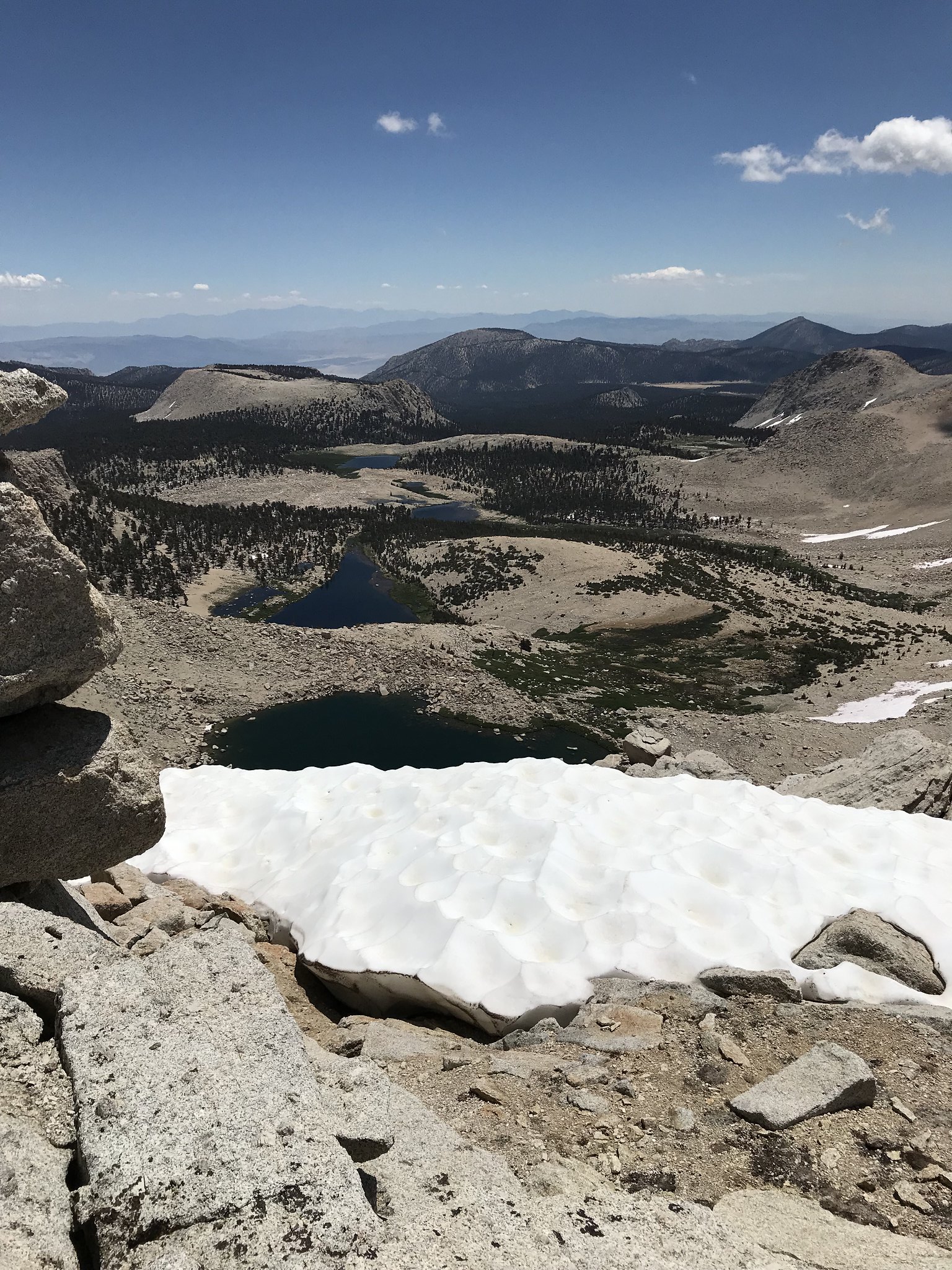 nice view of Cottonwood Lakes (mind the cornice)
I took a lunch break at the top, and chatted with a few of the people (maybe a dozen) hanging out on the summit. My walk up had been about 3 miles, with an almost 1,500’ elevation gain, so I was relieved that I would soon be going downhill ... until someone showed me the sketchy-looking start of the “workaround” route, which avoided the still-substantial cornice across the regular descent point to the east.
 the “safe” route starts through this gap ...
 ... and then you see THIS
You can’t see the route past this point until you start doing it, but lots of average-looking people seemed to have no problem with it. Once I started (and watched people ahead of me for route guidance), it wasn’t bad; mostly scrambling over/around fairly solid chunks of granite, except for crossing a brief section of snow (see photo) ... which probably caused me to hyperventilate a bit. Don’t get me wrong - I LIKE steep snow, but only when I have a nice pair of skis under me.
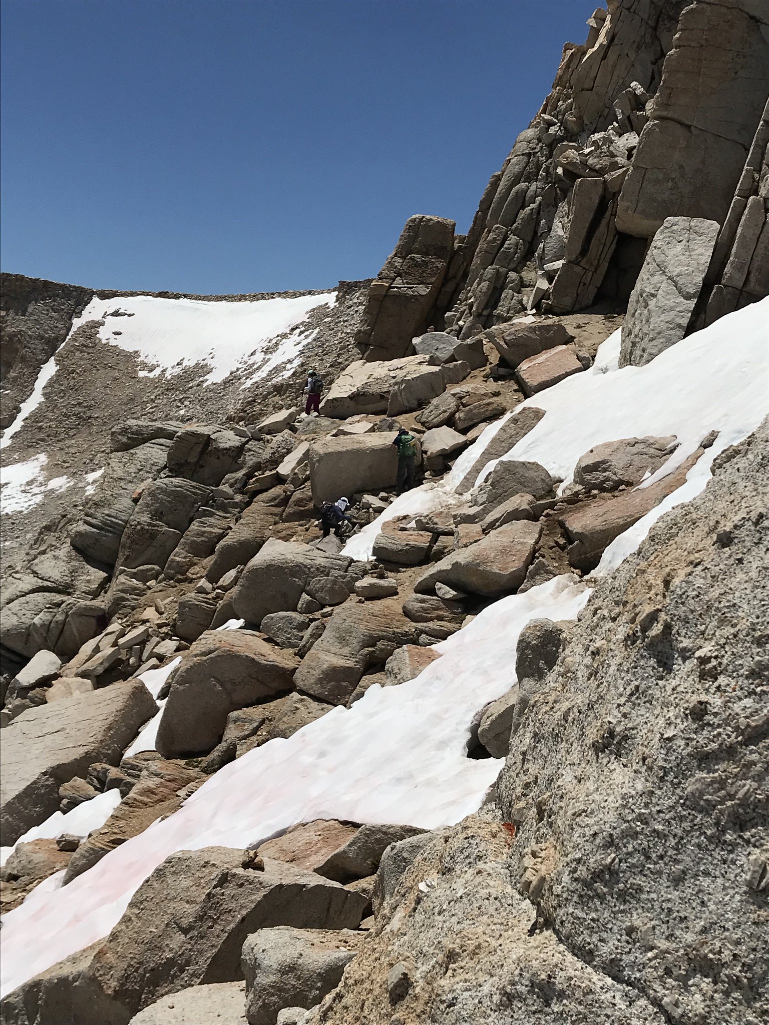 next, cross through this ... zoom to see folks crossing
A little more rock-scrambling past the snowy stretch and I was back on the official (extremely well-constructed) trail - about 10 minutes after I dropped down from the top.
 ahhh, now THAT’S better
The remaining descent was uneventful; I made quick progress, even accounting for frequent stops to take photos. I found High Lake (along with a nice tarn/pond and its inlet stream above it) to be quite nice:
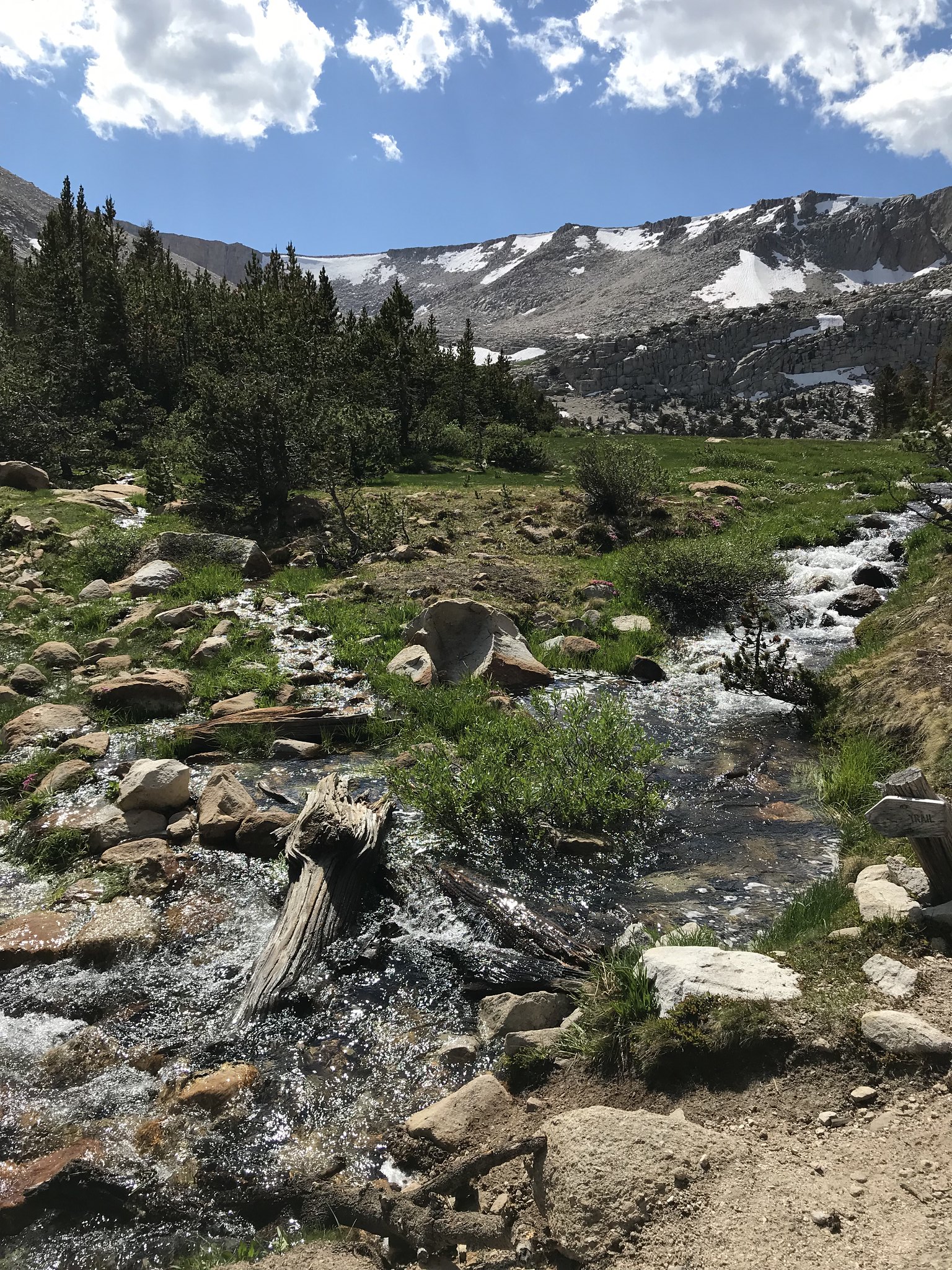
 nice pond at inlet to High Lake
Continuing on, I took a short break at Long Lake - where I found a patch of snow nearby (under some trees) and sat in the shade so I could ice my aching foot for a bit. Thus rested, I proceeded on, first noting the pleasant stretch of creek flowing out of Long Lake -
 outlet stream below Long Lake
Reaching Cottonwood Lake #2, I quickly chose a wide, sandy (but shadeless) place to camp, as I was too tired to search further. This lake had fewer campers than at Long Lake, so at least I enjoyed the solitude; however, the shore was quite “reedy” and somewhat lacking in good rocks to sit on while using my pump filter.
Day 4:
Hit the trail around 8:30 (getting somewhat faster, finally), wanting to visit the upper Cottonwood Lakes (#3, 4, 5). Passing Lake #1 (yup, looks a lot like Lake #2), I was deep in thought and missed the next trail junction heading toward the upper lakes. Unfortunately, the trail had been going steeply downward; realizing my mistake, I then had to make up about 3/4 mile (round-trip) and the lost elevation -ugh! Reaching the missed junction, I passed through yet another pleasant meadow (tons of those on this trip), passing a nice un-named lake, and soon caught my first glimpse of “Old” Army Pass, before reaching Lake #3. Not really stopping, I continued on to Lake #4 and #5.
 here are some REALLY big trees !
 Cottonwood Lake #3
 Cottonwood Lake #3
 Cottonwood Lakes #4 and #5
 meadow wildflowers - John Muir Wilderness
These are nice lakes in a beautiful setting, but I tend to experience a last-day anxiousness to finish the trip; even on a 6-day trip, I’m happy though day 5, then antsy to exit on the 6th. So, I sat down for lunch and rested a bit, then did a fast walk (on the “high” trail, until it joins back to the main trail) down to the Cottonwood Lakes trailhead. I then did a very quick x-country walk to the Cottonwood Pass Trailhead (avoiding a longer road walk) and retrieved my truck for the drive back down Horseshoe Meadow Road to Lone Pine ... which, by the way, is the longest stretch I’ve ever driven continuously in low gear in my life.
A few things I learned - PLEASE skip this part if you want.
Being a retired engineer, I’m conditioned to do post-mortem on poor choices that were made, so I just can’t help myself
1. I suffer from TMS syndrome - too much stuff. For this trip, I packed a headlamp, extra batteries, AND a small flashlight, AND my phone has a light. An extra pair of pants I never wore. And on and on. I also had almost 2 days of spare food (about 2 lbs). This seemed prudent, as recent troubles with my ankle and low back suggested the possibility of needing layover or shortened days if I got injured. But the increased odds of injury - from the pounding and loss of balance from being pack-heavy - likely balanced (even outweighed) the perceived safety of having extra food and other stuff.
2. Having less stuff to manage (and a simpler morning routine) would help me get going earlier each morning. Of course, so would a good night’s sleep (comfier pad and some Benadryl ?). Earlier starts would help me avoid bad afternoon weather, as well as increase my available time to resolve whatever jam I might find myself in, if I’m solo and off-trail.
3. I realized that (for cross-country travel), I am too dependent on GPS navigation. I carry a topo map & compass on all trips, but need more practice - I took a training class or two back in the 90’s, but I wasn’t very quick at it then - and am far worse now. Perhaps setting aside one day of cross-country (abstaining from GPS on a future trip) is in order.

