
Backpacker Magazine’s Nov 2010 edition featured “The Last Best Place”, a story about a secret valley hidden in the High Sierra. As I read, I thought: “We found a best place.” Unlike the Secret Valley of the story, our best place exists. We were privileged to visit a basin that had no use trails, blazes, ducks, campfire rings, and only one long unused camp site with a huckleberry bush growing out of the stone cooking fireplace.
So what good is a trip report that doesn’t specify the location? Well, it’s about the journey, about finding your own best place. You get the idea. There’s lots of trail-less basins in the Sawtooths.
The magazine story is available here: http://www.backpacker.com/last-best-sec ... ions/15019" onclick="window.open(this.href);return false;
Prologue
The winter after our 2009 Sawtooth trip, Chris and I both identified the same off-trail destination. Susan decided not to go, but my oldest son Joseph was “in”, and the trip was on.
Vowing not to make the same errors, we packed all packs a day before and including our first day’s clothing and trail head meal. The boys ordered you-bake pizza and, as soon as I got home from work, we ate, threw packs in the rig, and were on the road. With cruise control set at 74, we flew east on I84, not quite the fastest car on the road. Our 2009 trip started in onerous heat—so we aimed for a predawn start. We monitored the temp as we traveled thru the desert—damn, its rising. Five hours in we refuel at Baker City, the temperature still in the 80’s. Chris takes the helm and I crawl into the back seat for a few hours of sleep.
The next thing I know, the rig is jouncing around. I open my eyes and see the dim outline of a hill going by. We are on the dirt approach road—what’s the temp? 34 degrees—what?? You’re kidding!!
Nope, it’s frickin cold as I change into my hiking clothes. We pop the carafe of coffee and chow down our breakfast selections; mine especially memorable—a baconator sandwich—that’s chunky peanut butter, 4 slices of crunchy bacon, and generous marion berry jam on whole grain bread.
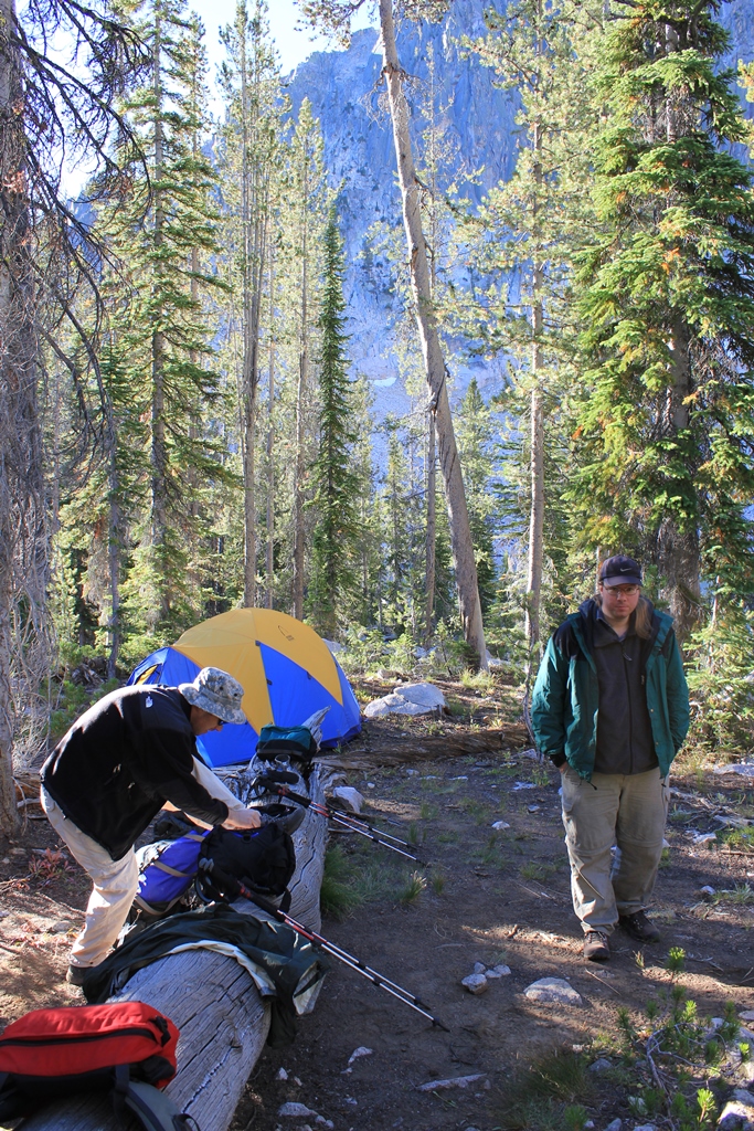
Day 1. Trail head to Bear Camp, 13 miles.
As I munch I watch the night sky. Incredibly clear, bright starlight; Jupiter blazes, a crescent moon is setting in the west. We step onto the trail at 3:30 AM—our headlamps, being just above our eyes, don’t provide shadow clues to the rocks and roots waiting to trip us. The forest closes in and, absorbed in avoiding the trip points, we hardly notice the miles passing by. It isn’t until 9AM that the sun catches us and we break for lunch.
Our Lunch Stop
Resuming, the temp has climbed but isn’t onerous. We soon arrive at our intended camp site to find it occupied by pack stock. Judging by the piles of poop and abundant flies, these folks have camped awhile, and we continue up trail to a back-up camp we’ve read about in trip accounts.
We find the camp easily and it is clean and spacious, the only items of concern being a pile of throwing rocks and a sharpened 7’ pike pole lying next to the tent area. Bear camp.
Excellent day’s work guys—we’ve made it far further with lots less discomfort than our first day last year. But we are beat and are bedded down by dark.
Day 2. Bear Camp into our best place.
I start stirring as soon as I can read my watch, brrrrrrr its cold, but not freezing. We take our time breaking camp. We start up the trail, keeping a close eye on the canyon walls for landmarks. Finding them, we crash thru brush, and start up the wall.
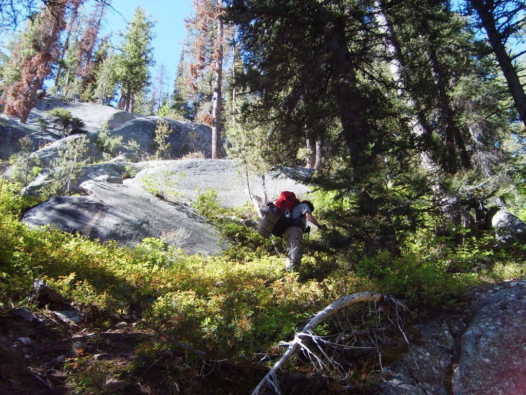
The slope is sparsely timbered and grassy. We climb up till we come into rocks.

Here we find a deer path that circumvents some of the rocks, but we can’t avoid them entirely.
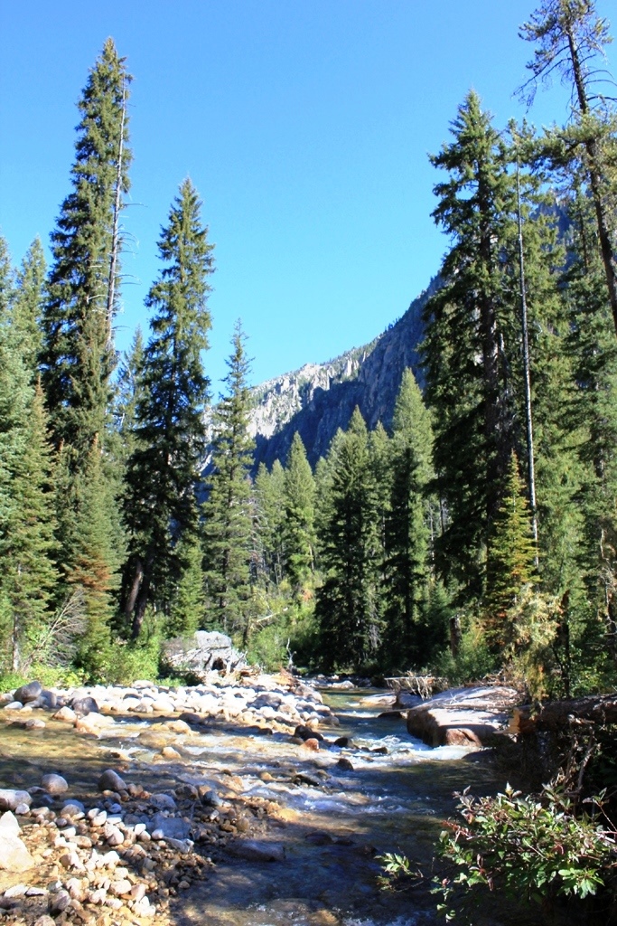
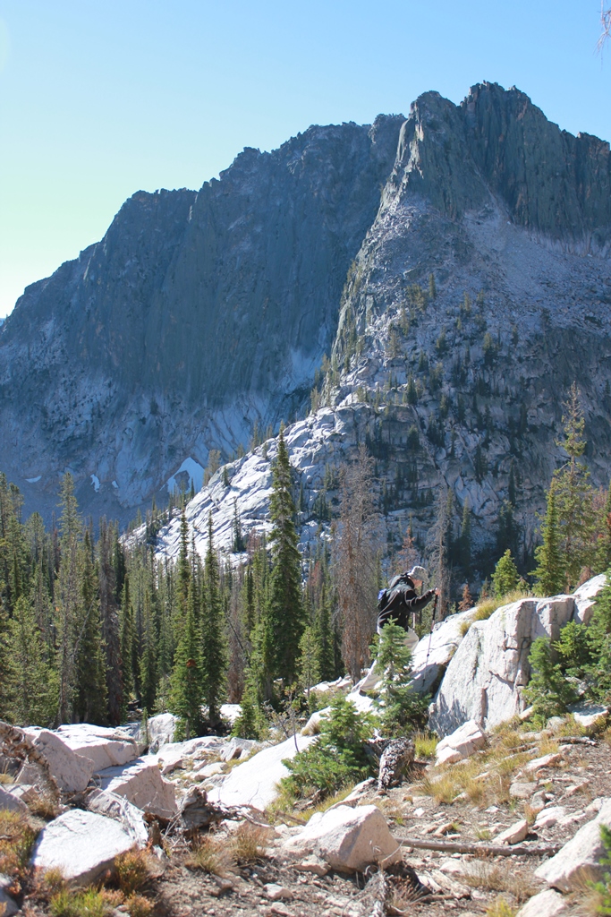
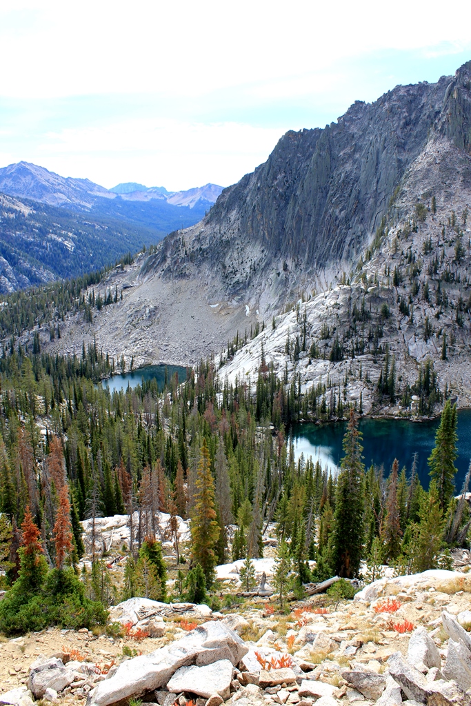
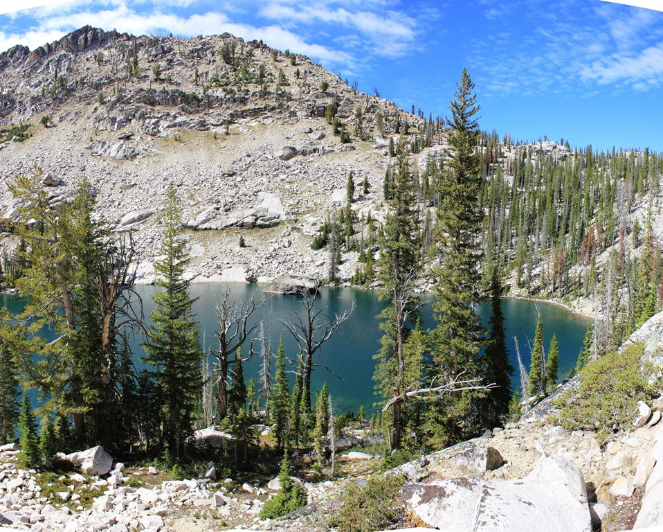
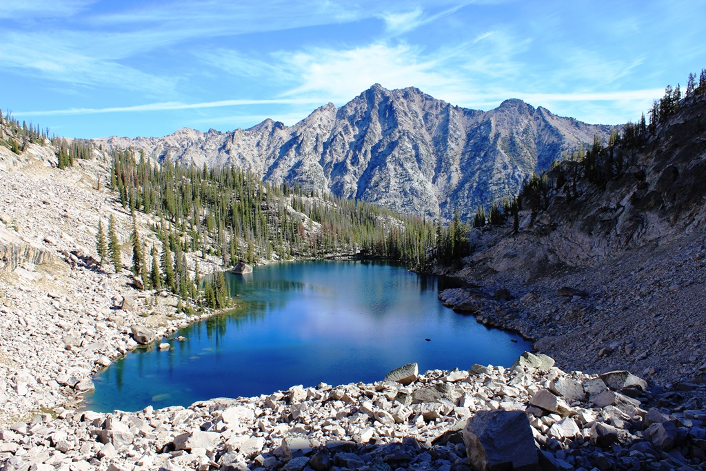
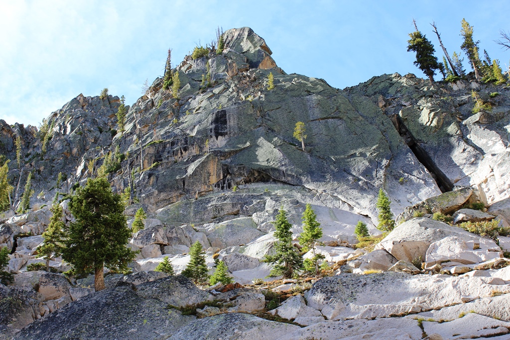
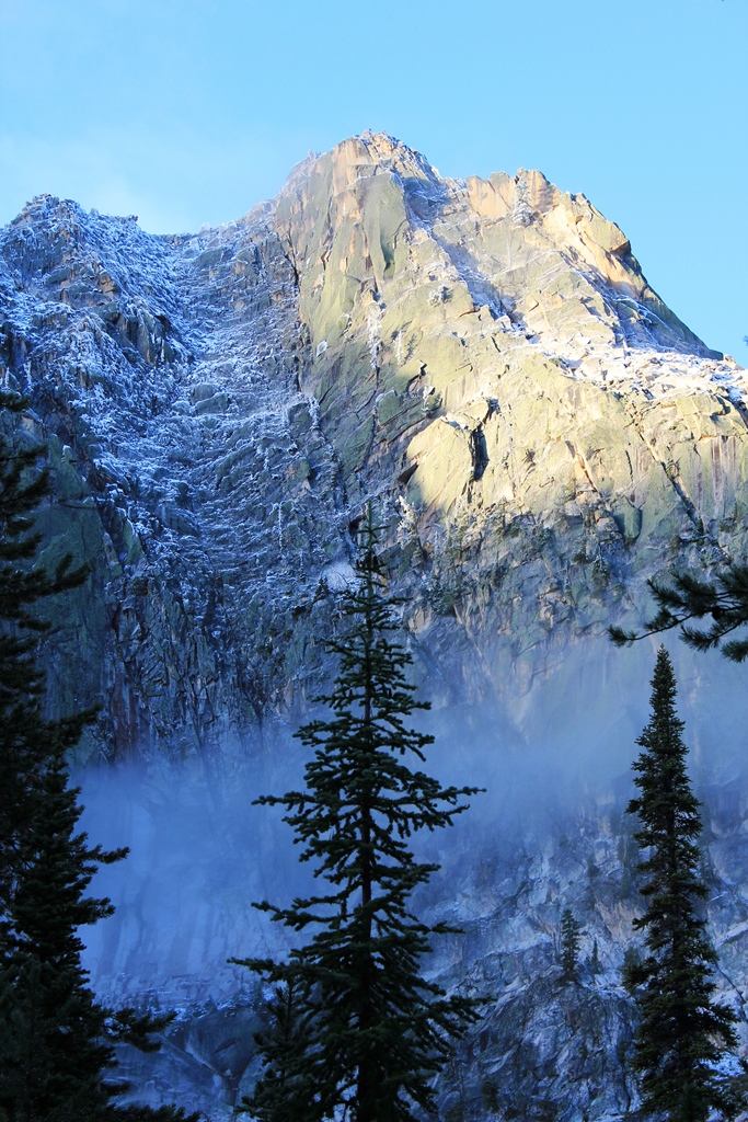
Climbing over them and ever higher, we finally break into a hanging valley. We head across granite ramps and wooded areas to a small lake.
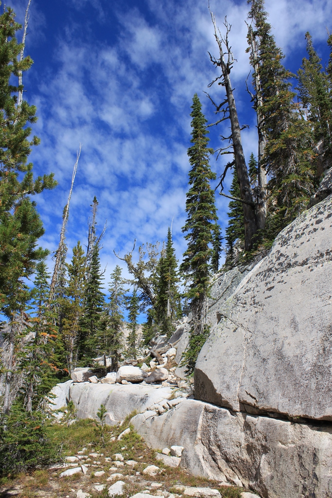
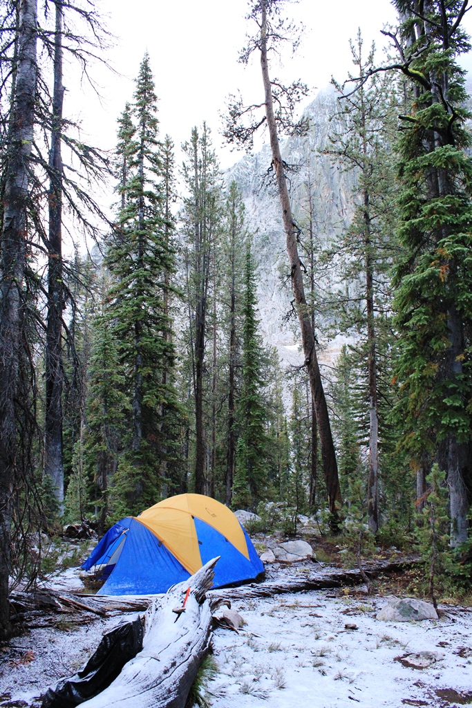
Finding no camp sites—no signs of human use at all—we establish a camp behind trees some distance from and above the lake. Positives: OK cook rock and tent area plus a good sit log. Negatives: quite a few widow makers and freshly overturned rocks (bear activity). Even tho the sky is mostly clear, it starts to snow.
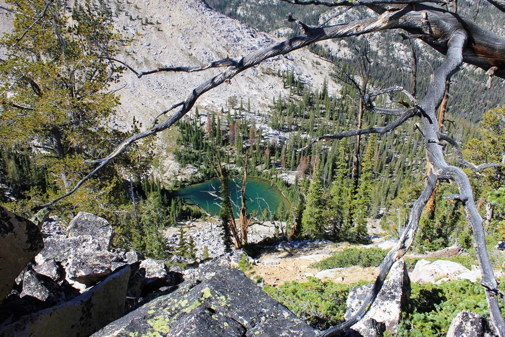
Camp set up, we explore the inlet stream up to the next lake—need to find a good place to get water. 300 yards from camp is a great place right at a small waterfall. We follow the creek past several more waterfalls and pools to another lake, where we are caught in a heavier snow flurry. We hunker under some trees. What a contrast to last year!
Day 3. Day hike North West.
Our plan is to base camp for a few days—each day exploring a different area.
Today’s excursion is to a third lake and the ridge separating the basin we are in from the cirque to the NW. We retrace our steps to the second lake,

from which we head up a side valley to the third, which, while interesting on the map, turns out to be a green, shallow pool whose only real positive is that it is rock rimmed, not muddy.

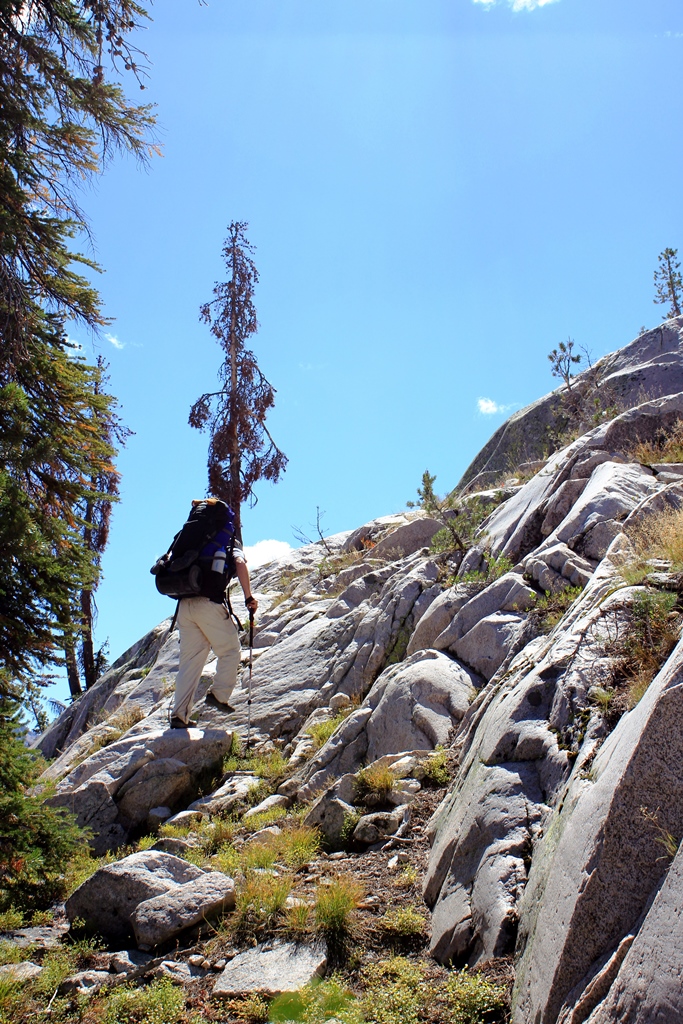
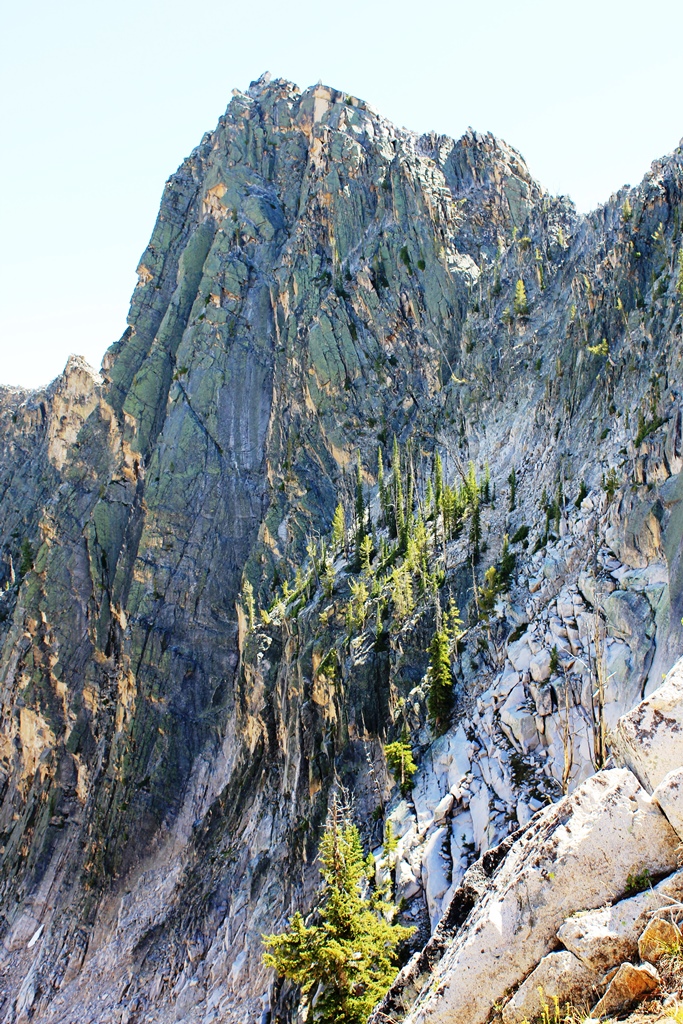
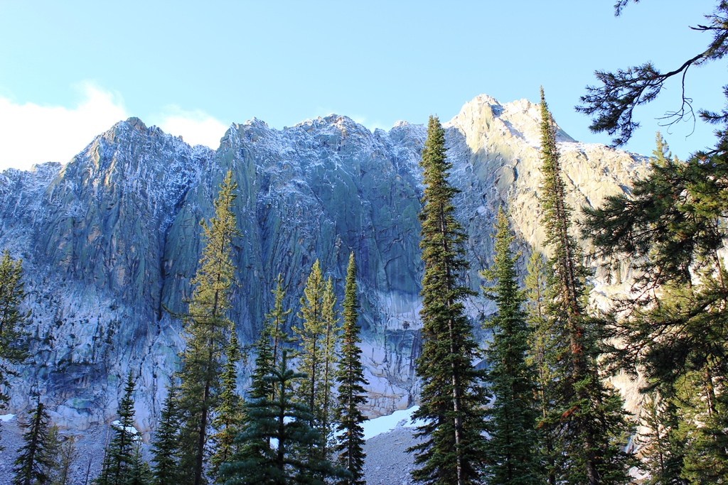
Climbing to the ridgeline, we can look North and NW. While we had thought of exploring the NW cirque, the down climb is steep and loose and we can’t see very far down slope because it steepens even more. We can see the terrain above us, which looks easier, and we climb to the cirque wall’s high point. As we do, we find fresh mountain goat scat and tracks, but don’t see a single goat.
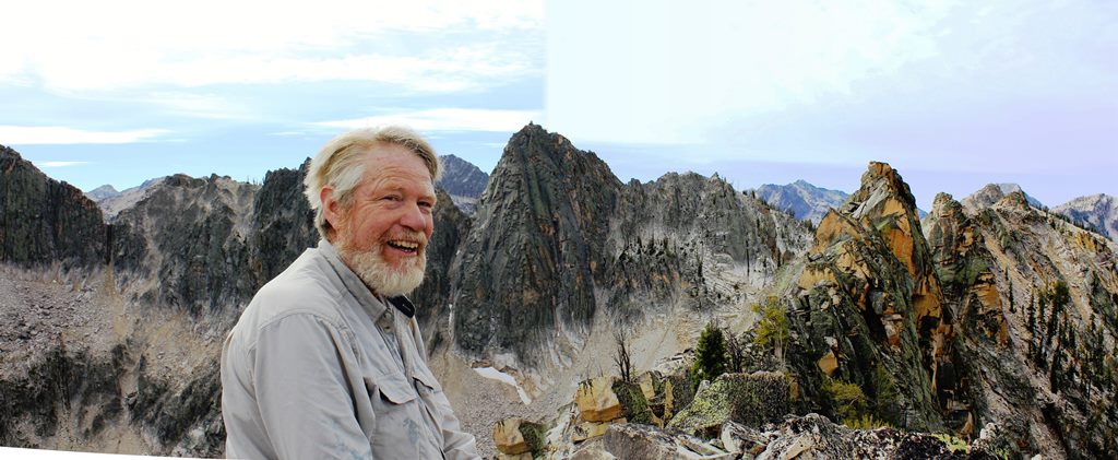
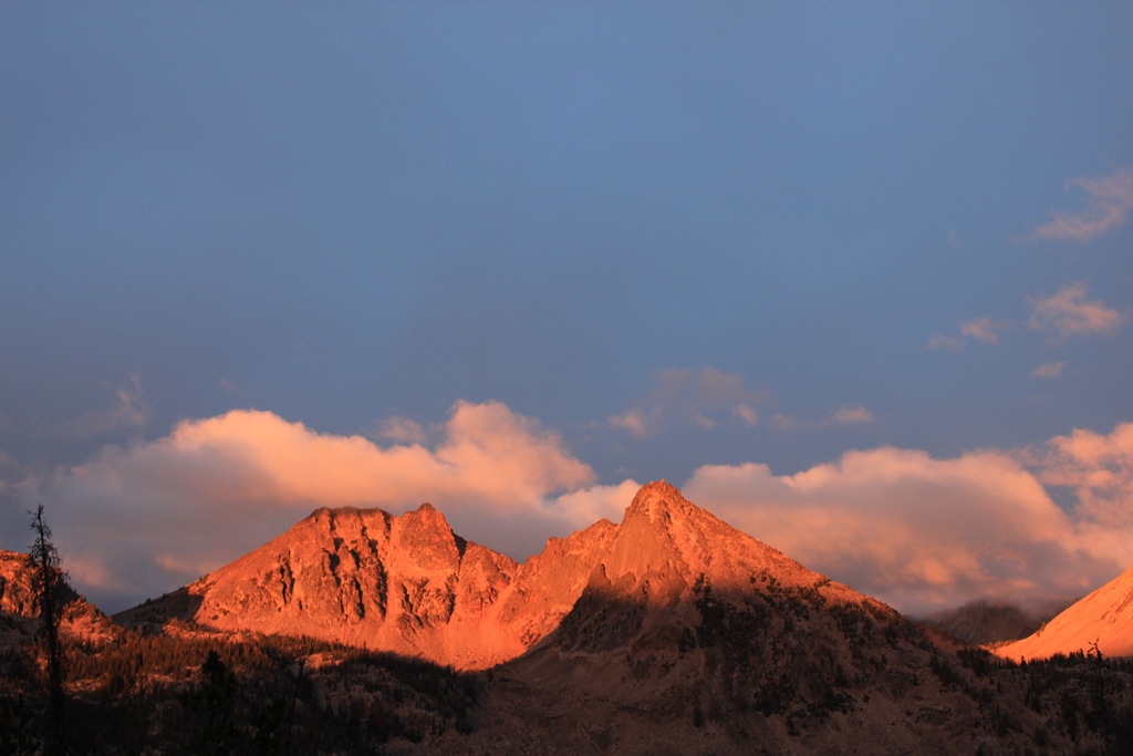
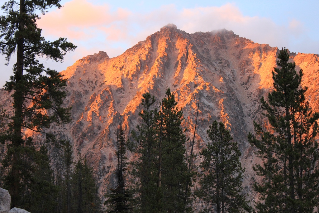
Chris snaps my photo with our basin’s south rim as a backdrop. A spur ridge runs from our location south to this south rim. The connecting spur ridge is crested by a series of gendarmes or “sawteeth”, the type of formation which gives the Sawtooths their name.
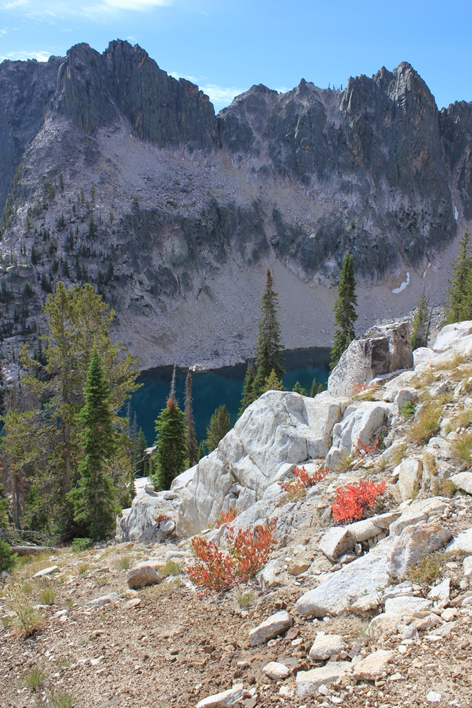
We have a great view of the largest lake as we descend.
We spend the afternoon exploring the granite shelves above our camp.
Day 4. A Day Hike In Different
The next day the kids and I sally forth in different directions. I head to a saddle between the southern rim and the ridge that ended in yesterday’s high point. My route takes me thru talus along the largest lake, over a rock glacier, under granite cliff bands, and over scree to the saddle. As I pass the lake I catch movement in the water—I turn to see a 12”+ trout has broken surface. It is warm enough today that insects are out!

From the saddle, I can see both to the West and the cliff wall to my east. Below to the west lies a small lake and east, a hanging forest sits perched on the cliff face. On the ridge crest are many weathered snags.
Day 5. S of our camp.
The day starts gray and gets grayer.

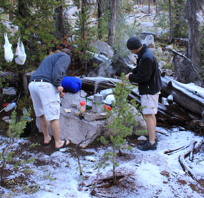
The wind is out of the South and there is no color or contrast to the landscape. Then it starts to rain. We retreat to camp, where, nearby, a large glacial erratic has a conveniently dry overhang. Here we cook dinner and are enjoying hot cocoas when I notice the vivid color across the canyon.
Later that night both Joseph and I answer to those hot cocoas. The sky is incredibly bright with stars—so bright you can see by starlight. It is one of those nights you can’t figure out the constellations because there are too many bright stars. But it is too damn cold to solve the sky puzzle.
Day 6. Lower is Balmier?
The next morning we wake to 2” of snow. The wind has backed around from S to NW so I declare the weather improving. And momentarily it does—we enjoy a hot breakfast under a broken blue sky—and decide to explore lower elevation areas we passed thru on our way in.
As we descend, the snow cover goes away. But the precipitation starts up, first rain, then snow. We have a very odd sensation of looking into a deep, dark valley with high speed snow flakes streaming by, like we were in an airplane. Soon we retreat to camp, where we spend the rest of the day playing poker and listening to Chris recount Simpsons episodes.
That night it warms up. We hear the drip drip from the snow melting in the trees. I get up and find the snow gone and stars out. But shortly after getting back in the tent, I hear scritch scritch scritching on the tent fly.
Day 7. Time to go.
The next morning we wake to a dusting of new snow.
The sky is mostly clear, so we decide to take a slow start to the day in hopes of packing dry stuff. Immediately fog moves in. Finally it moves on, but clouds on the opposite side of the valley block the sun, so we give up and pack up wet.
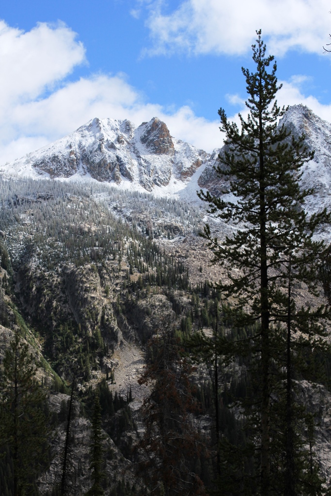
As we start out, we can see that the higher peaks have gotten a lot more snow.
We make it half way out. Joseph’s back is bothering him, so we stop mid-afternoon, eat early, and set the alarm for 2:30 AM. Skies are bright blue, but being deep in a valley, we are in shadow by 4:30 PM, and it quickly gets cold.
Day 8. Wolves All Around.
Damn that alarm goes off soon. Everything glints with frost. We pack up, eager to get on the trail to warm up.
The two days of rain has packed and consolidated the sandy trail surface. On the nearly blank slate we see deep fresh prints, a couple deer moving ahead of us. Then big canine tracks as wide as your hand and almost as long. Chris, who is a little behind Joseph and I, asks us to stop. We hear howling, first one wolf, then as many as six or seven others join in chorus, some sounding very close.
The wolves are not happy. The trail surface is now covered with their tracks, both coming and going. Have we interrupted their hunt? Did we drive two deer into them? Are they warning us off? One wolf howls again and again and again. His voice is a loud, not very high pitched howl that breaks, turning low, gravelly, and guttural at the end. Other howls answer from different directions.
Getting cold, we start moving again, and as soon as we move the howling escalates—they are watching. The sky is lightening now, but the cold intensifies. The trail tread becomes increasingly frozen, until it is like concrete—even the carbide tips of our trekking poles bounce off. So we are glad for the sun, which now touches the highest points.
9 AM and we are out. It is the Saturday after Labor Day, and there is but one car in the TH lot, a beater with two 50lb bags of dog food in the back seat. Try that in Yosemite, I thought.
Save for two people who walked by our camp without noticing us the first day, we have seen no one. We have been in an untouched spot, maybe a “best spot”, for eight days.
We stop at a McDonald’s in Emmett, ID. CNBC is playing on two televisions inside; three stories repeat over and over: the anniversary of 9/11, a gas main has blown up in San Francisco—was it terrorism, and a heated debate swirling about allowing a new Mosque near ground zero.
Are we glad to be back to “civilization”, safe from the wolves, or what?


