If you've been searching for the best source of information and stimulating discussion related to Spring/Summer/Fall backpacking, hiking and camping in the Sierra Nevada...look no further!
Interesting the way my mind works. Must have seen that or a similar image somewhere because that is where I vaguely thought it was even though I've never been there. Have been nearby though on the way up Goddard.
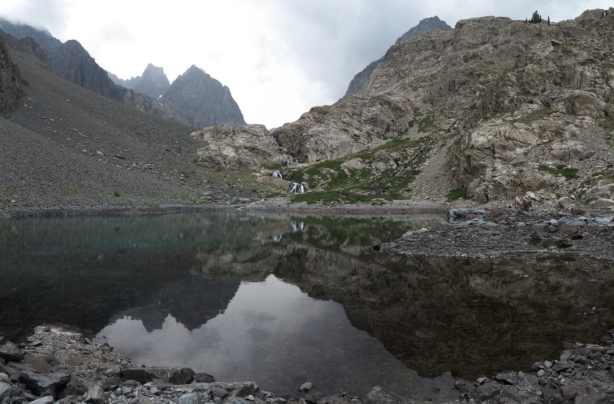
No one has id'd it Mike so it must be obscure. Will add a few clues I see.
1) Per the rules it must actually have a name so not some no name pond haha and that eliminates much. Apparently a part of a larger lake than viewed else it would not be a lake.
2) To this person, it does not look like the Southern Sierra but rather the more ice cap ground down Central south of Sonora Pass and per below on the east side. Very similar to what one sees at Summit Lake on the divide but is not there.
3) Whitebark pines, red mountain heather, and timberline show elevation likely 9k and above.
4) There is a rock glacier at mid frame left indicating snow likely blows in winter over the ridge line there and drops down on side indicating that faces north. Another clue to direction is the red mountain heather would not be there if that was facing sunny south.
5) The rock glacier is also an indication the background ridge could be the Sierra Crest.
6) This could be morning sun on a dim monsoon day with the sun off to the left per shadows. Late summer the sun rises due east then rotates a bit southeast while moving west.
7) If that is the case then center frame could be facing south-southwest or southwest. And if so it would be a lake without a ridge due south but rather one with a open view like one on the north side wall bench of an east to west trending canyon.
8) Peak top at center shows a curving ridge line that likely is a steep face below that ridge towards the north.