
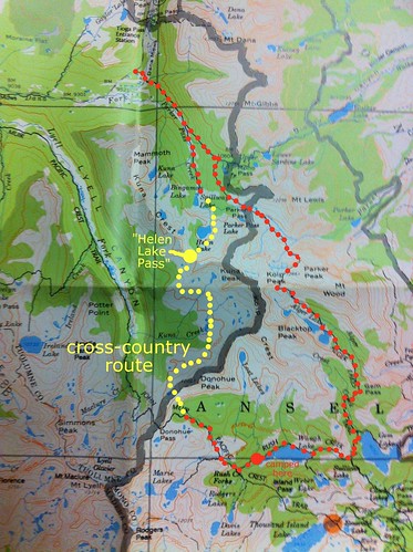
I completed a circuit this weekend starting and ending at Mono Pass trailhead in Yosemite. We connected five high passes: Parker, Koip, Gem, Donohue, and an unnamed saddle that I call "Helen Lake Pass." [Update: Secor calls this saddle Kuna Pass]. Our route combined trail with cross-country trekking, and there were two short sections of class 2-3 scrambling. Our journey started along the same path as VitaminC's recent loop around Mono Pass (link), but we diverged from the trail east of Donohue Pass.
The route overview is shown below. Red dots are trail, yellow dots are cross-country.
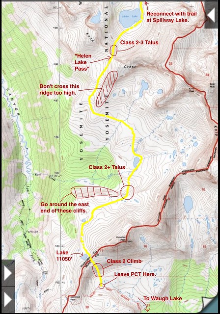
Here is a zoom on the cross-country section.
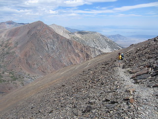
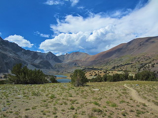
We started hiking on Saturday morning from the Mono Pass trailhead. At Parker Pass, we refilled our water from a tarn near the summit, and then followed the trail beyond the Yosemite boundary and towards the switchbacks up Parker Peak. The switchbacks are well-graded, and an hour later we reached Koip Peak Pass. We enjoyed the views of Mono Lake, then descended to Alger Lakes for lunch.

Parker Pass
On the Northern Switchbacks of Koip Peak
Alger Lakes (in the Ansel Adams Wilderness)
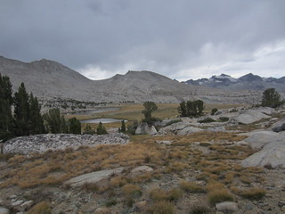
After lunch, we followed the trail over Gem Pass, and then dropped down to Gem Lake. At this point we were getting tired, so we slowed our pace to a stroll and enjoyed the afternoon walk up to Waugh Lake. This stretch of Rush Creek has dozens of great camping spots, and we passed several groups of fishermen. Finally, we arrived at Waugh Lake and made camp. We cooked sausages and veggies over a small fire near the western shore.

Unexpected Rabbit
Gem Pass from the north
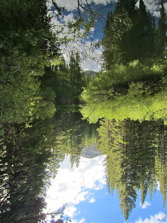
Rush Creek Reflection
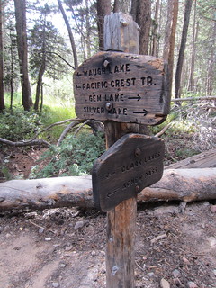
Junction of Waugh Lake / Pacific Crest Trail
Waugh Lake
On Sunday, we started hiking at 7:00. By 8:30, we arrived at the intersection with the Marie Lakes trail, where we encountered HST member DesertDawg, along with a group of people involved in a search and rescue operation for DesertDawg's friend. Surprisingly, my cellphone had one bar of service (AT&T), and DesertDawg used it to call 911 in Lee Vining. Someone else in the group produced another cellphone, along with a satellite phone, and then all of a sudden multiple calls and SMS messages were happening. Eventually, it was known that a helicopter was en route and a ground team was a few miles away. At this point, there wasn't much more we could do for DesertDawg, so we continued along the PCT.
Our cross-country route began where the PCT turns south to climb Donohue Pass. We left the PCT/JMT and ascended the easy class 2 saddle immediately west of Donohue Peak. We ate lunch at the top, at Lake 11050', and very enjoyed the scenery above Lyell Canyon. At this point, a dark storm erupted over Mount Ritter and the Minarets, and heavy sheets of rain marched across the Cathedral Range. The sky above the Kuna Crest, however, remained clear.
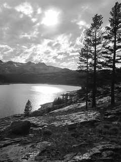
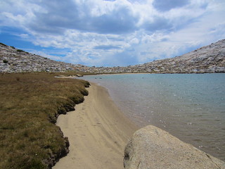
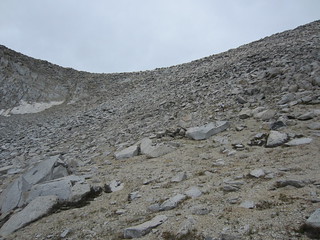
We followed the route shown in my map above. The terrain is gentle around the Kuna Creek headwaters, with the exception of a couple cliffs that I've marked on the map. After a few hours of traversing across the basin, we reached the easy ramp up to "Helen Lake Pass." This pass has no official name, but it's the saddle south of Helen Lake. [Update: Secor calls this pass both Kuna Pass and Kuna Crest Saddle]. Whatever its name, the east side of this pass is relatively steep and covered with big talus; It's easy class 3 without exposure for the top 200 feet, and then it becomes class 2 down to the lake. I think crossing this pass is not especially dangerous, but it does require patience. Down from the talus, we followed the eastern side of Helen Lake outflow, crossing a beautiful set of grassy terraces on our way to Spillway Lake. At this point, we were approaching total exhaustion. We followed the trail back to Mono Pass trailhead, and ended the trip with an amazing sunset over Yosemite.

Rush Creek Basin
Lake 11050'

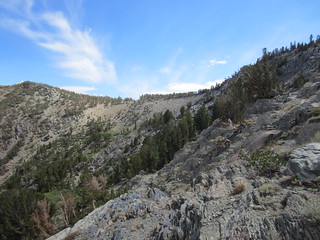
Kuna Peak, West Basin (Yosemite National Park)
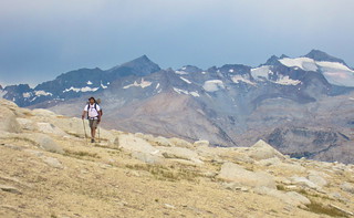
Kuna Creek Headwaters

Hello from the Kuna Creek Headwaters
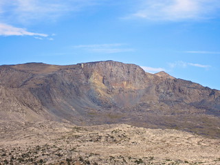
Kuna Peak, West Face Detail
On "Helen Lake Pass"
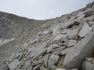
Class 3 rock on the top east side of Helen Lake Pass
Class 2 slopes on the lower east side of Helen Lake Pass
Above Helen Lake
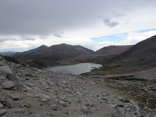
Above Spillway Lake

Slogging back to the trailhead.
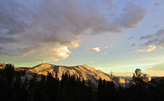
Last Sun on Clouds Rest.
Thanks for reading my trip report! I posted more photos on my Flickr stream (link).


