
I drove up in the morning of my permit entry day and got to the trailhead parking lot a bit before noon. I checked out the surrounding meadow areas a bit, noting the numerous Sphinx moths feeding on the abundant wildflowers.
video: moth
https://flic.kr/p/2pmR3tY
Day 1 -
after last-minute dithering over my gear (why can’t I ever dispense with this step ?), I got going at 1:00 and headed up the trail. There were nice waterfalls in a couple spots, and yet more flowers (and moths) on my way to a short rest stop at Gilbert Lake.

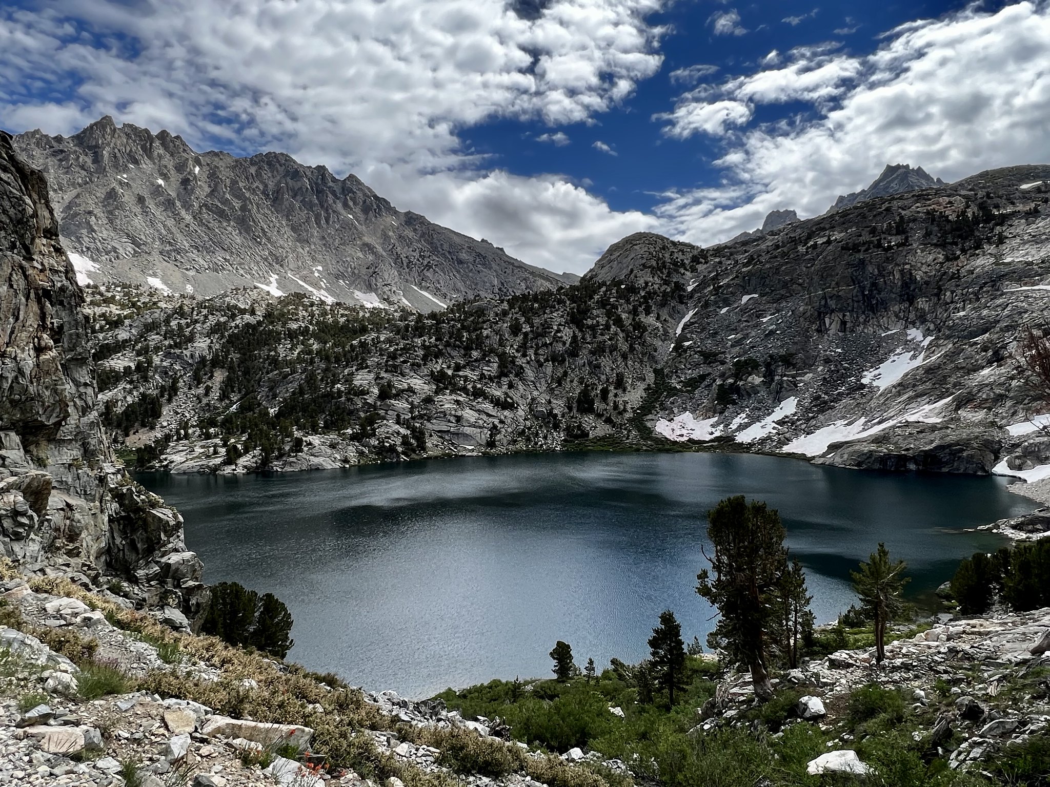
Gilbert Lake
I had originally planned on an easy first day, with a side-trip to Matlock Lake to camp. Reaching the relevant turnoff, I decided instead to press on. I hadn’t done sufficient research to investigate Heart Lake as a camping option, so I also decided to skip it and head over the pass. Around elevation 10,900’, I encountered my first snow walk (it wasn’t too concerning) -
 Kearsarge Pass Trail - Aug 8, 2023
 I soon had a nice view of Heart Lake from above -
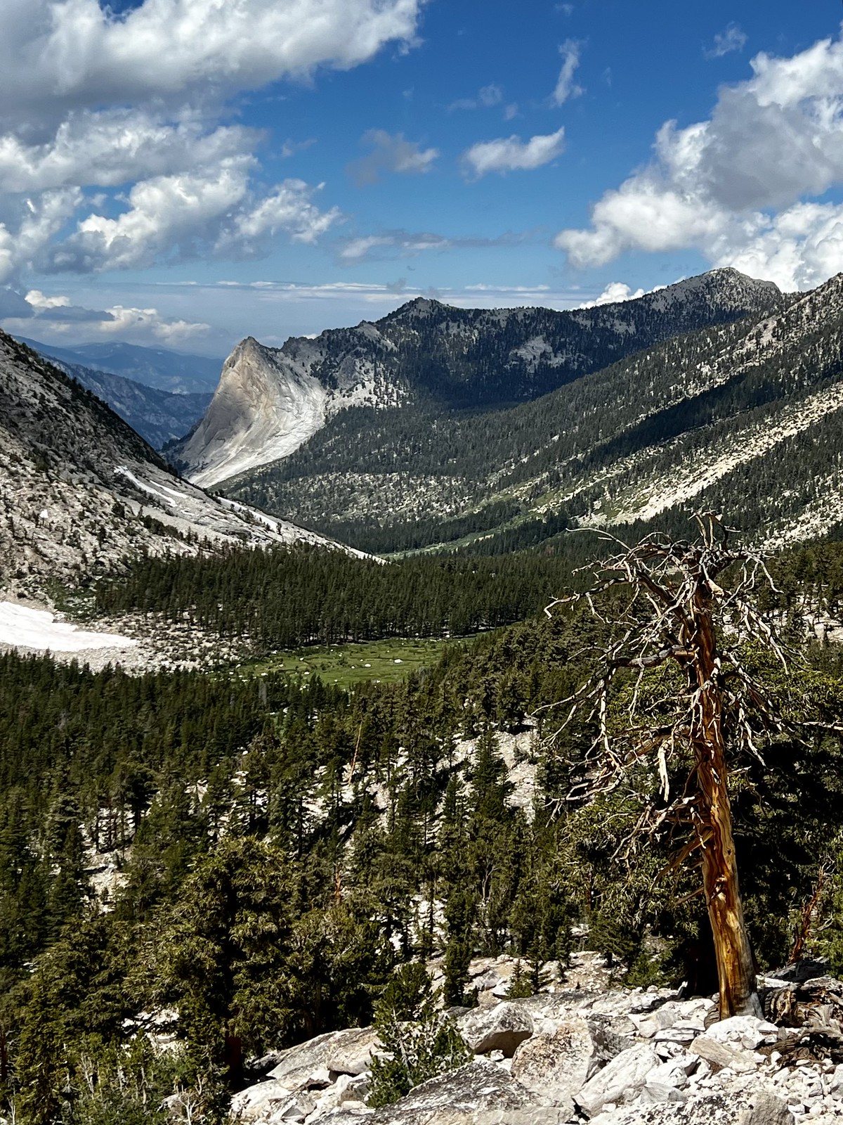
 Heart Lake from Kearsarge Pass trail
 A bit farther on (and similarly far below the trail), Big Pothole Lake appeared, still covered completely with ice and snow. Soon, I saw the final agonizing (for me) ramp of trail up to the pass, but seeing people at the top gave me a bit of encouragement, and I topped out on the pass around 5:30 pm.
video: top of Kearsarge Pass
https://flic.kr/p/2pn2Q75
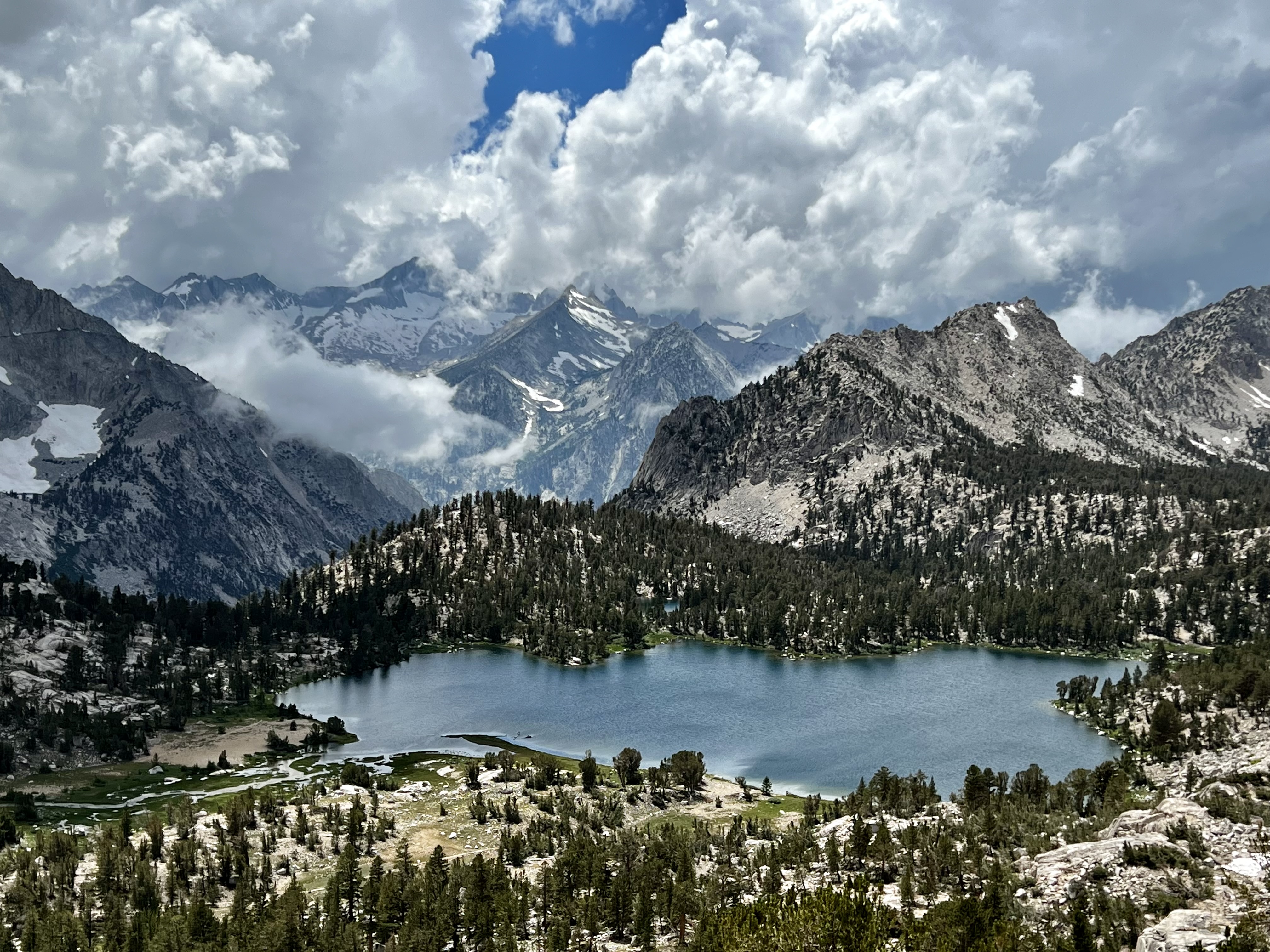
and here’s a somewhat acceptable view of the Kearsarge Lakes area, and the impressive peaks beyond -
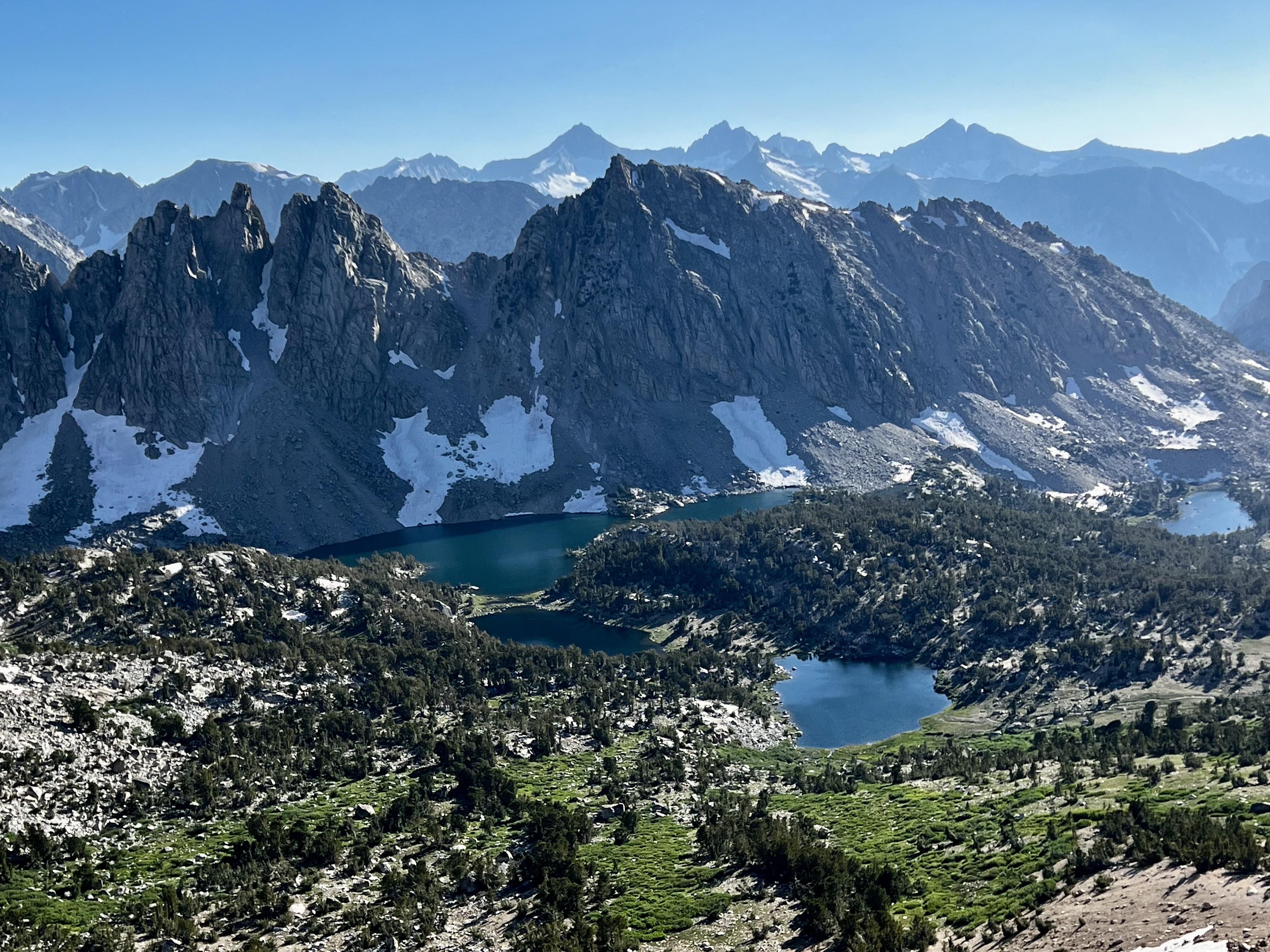 Kearsarge Lakes & Kearsarge Pinnacles
Dropping down from the pass, I took the turnoff to Kearsarge Lakes. Reaching the first lake (by now fairly exhausted) and chose a tent site around 6:45. After setting up, I took a few more photos, did the usual camp stuff, and turned in.
Day 2 -
I took my time getting ready to start this morning, and walked down to the lake a bit after 9:00, and felt fortunate to find such calm conditions for a photo:
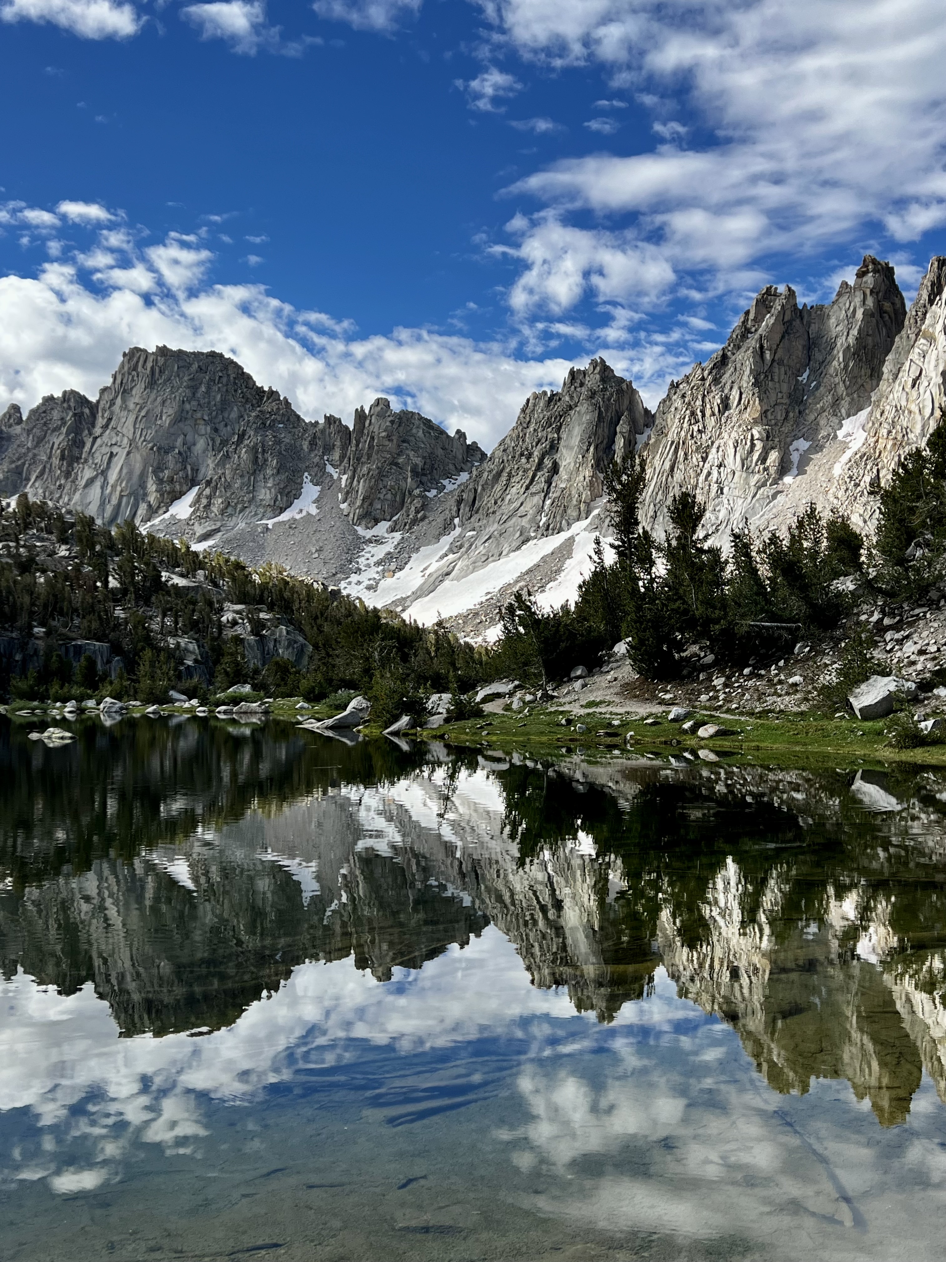 Kearsarge Pinnacles Reflection
I got going, heading west on the Bullfrog Lake trail, and soon reached the lake itself. It’s an attractive lake, with a view of North Guard lined up behind it, but my photos of it this morning didn’t really do it justice.
When I reached the trail junction with the JMT, I found a good overlook to try and assess the flow in Bubbs Creek; even though I was 3/4 miles or so away (and a thousand feet of elevation above it), I could see it was raging; certainly not crossable (to my taste) had I planned to head down to the East Creek trail to reach East Lake and points beyond.
Heading north on the JMT, I reached the trail signage for the Kearsarge (high trail) and Charlotte Lake turnoffs, poking up in the middle of a large-ish seasonal lake. Amused, I took a few photos and then, inadvertently and distractedly, headed toward Charlotte. I lost about 200’ in elevation before realizing my error and adjusting myself back upslope to regain the JMT.
Continuing, I got a few photos of where I would have ended up -
 Charlotte Creek drainage & Charlotte Dome
… and continued on until I began encountering snow patches (and the usual seasonal tarns) as I made my way toward Glen Pass. The snow wasn’t bad, but slowed me down a bit; especially at one point where I meandered around a bit trying to get back on trail heading up the switchbacks. And I did get to see a Pika, which in itself put my day in the “win” column.
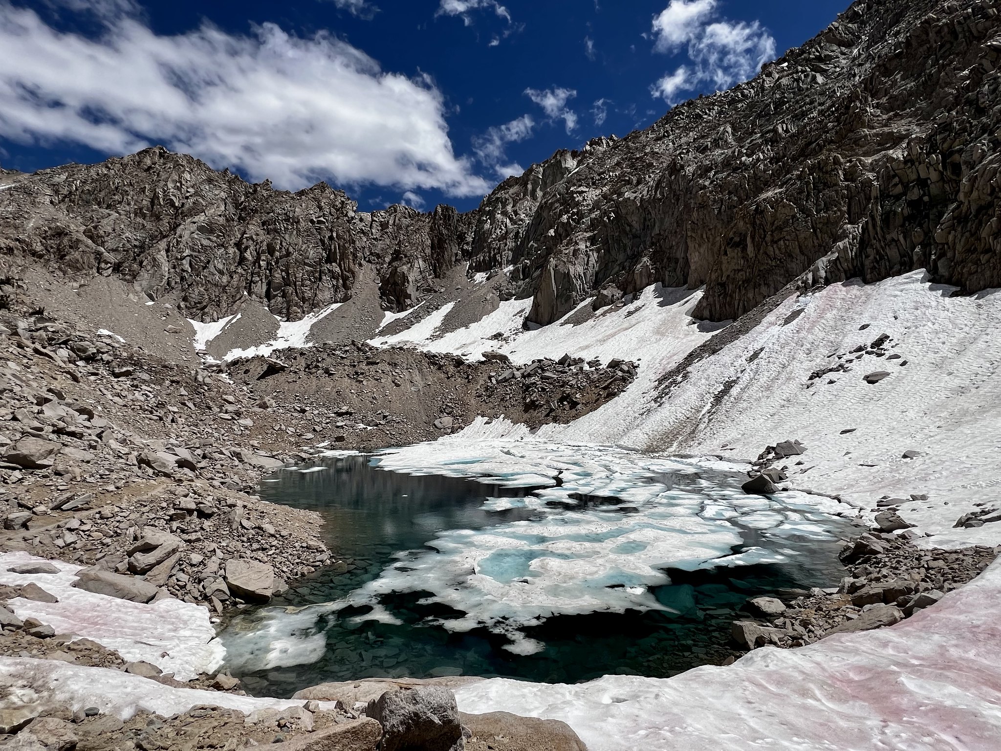 tarn located a bit south of Glen Pass
 Pika
PikaI reached the summit of Glen Pass around 3:30 -
video: top of Glen Pass
https://flic.kr/p/2oWfo2S
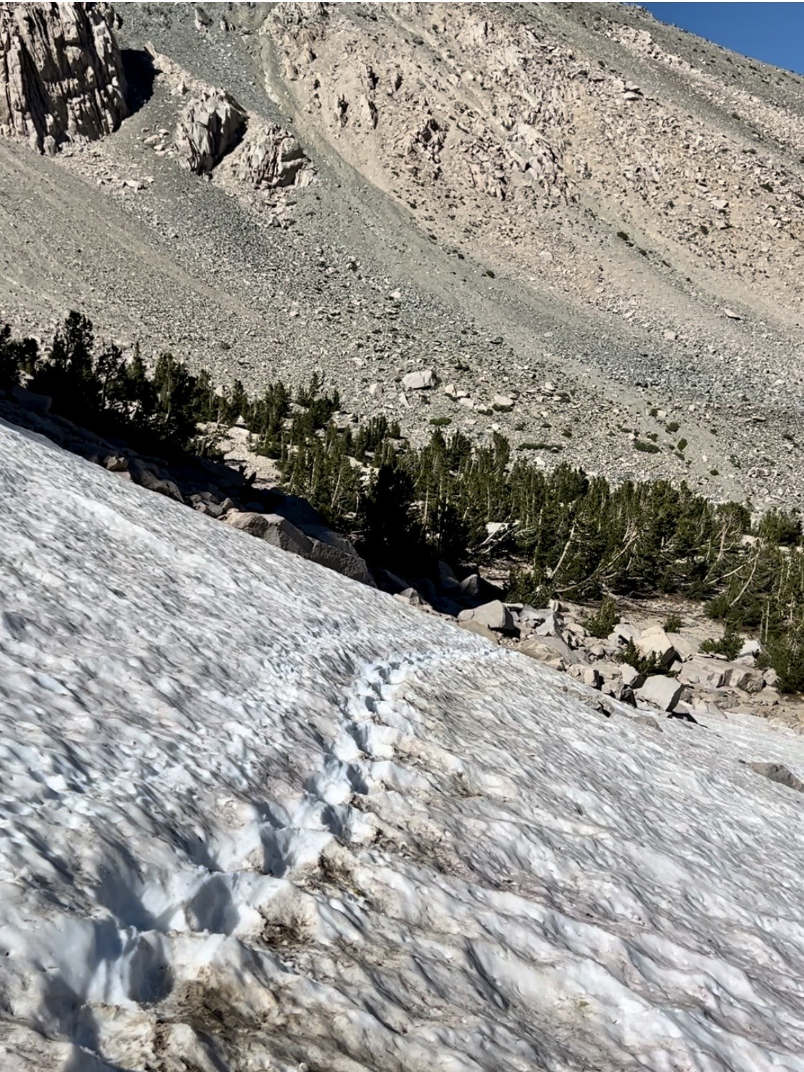
… had a bit of a rest, then started to head down the north side. Researching before my trip, I had seen mention of the long “snow trench” dug (or tramped ?) to facilitate traversing the large snow field lingering on this side, so I was happy to find it. I actually took this photo on my “Day 4”, but am showing it (with a fellow hiker pointed out for scale) here:
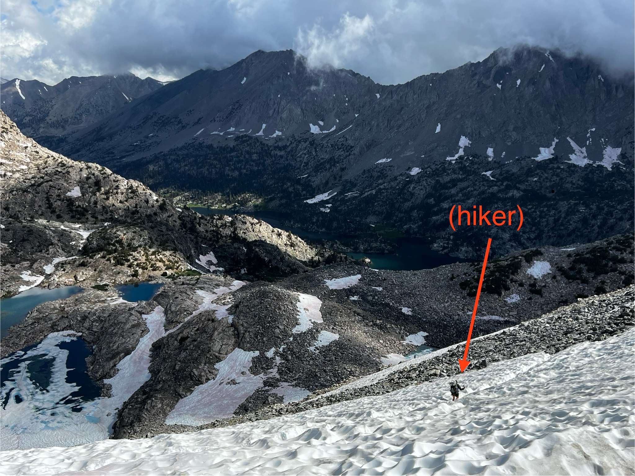 snow field on north side of Glen Pass
I got to the other end of the “trench” with no difficulty. However, the snow covered the next switchback turn, so I had to scramble down to get down to the next (snow-free) segment. I slipped on the loose rock and set off a mini slide, drawing a little blood from my now scraped-up shin. Nothing serious, but not a confidence-booster either.
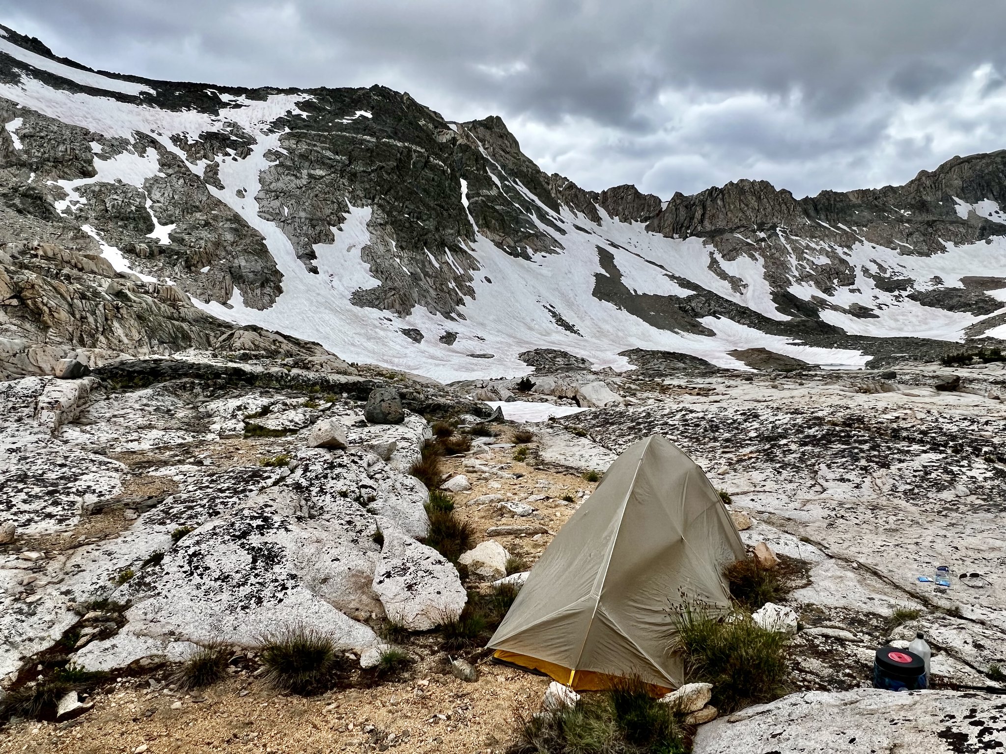
I continued down to about the 11,300’ contour and, needing to call it a day, found a marginal (but acceptable) spot on top of a granite boulder to set up for the night. I got a bit of rain that night, but not terrible. Here’s a photo of my site, taken 7:30 AM the next day -
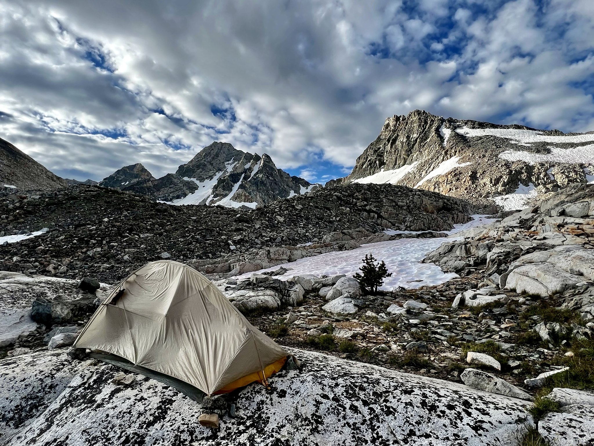 my 2nd night tent site - 7:30 AM on Day 3
Day 3 -
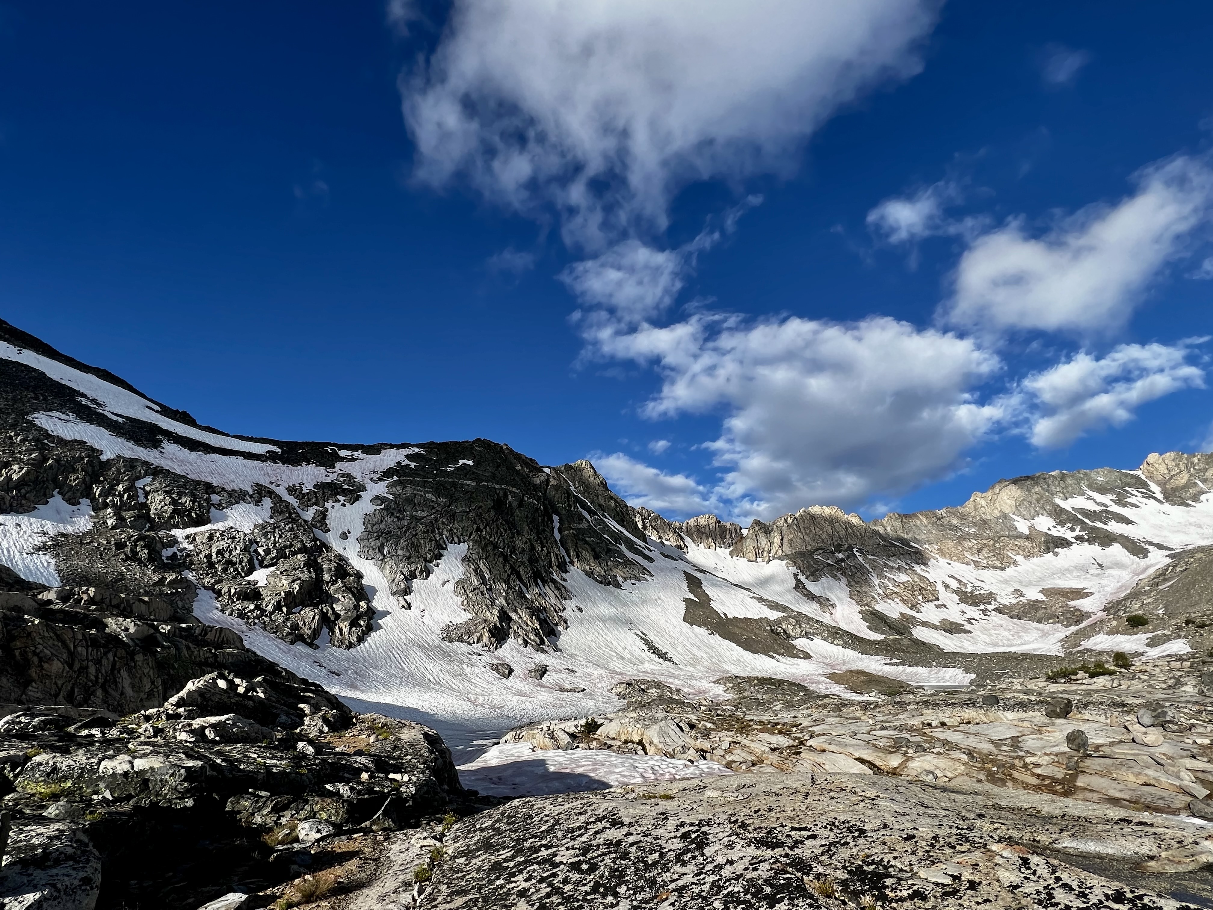
My plan for today was to try heading over Rae Col to visit Sixty Lakes. Being too uncertain about my plan (and the weather) to commit to a simple day hike, I packed up and headed out. My camp had been between the JMT and the northeast-most of the tarns located just west of it, so I got a quick start toward the col. I made easy-enough progress going above/around snow for the first 1/3 mile or so. Then the boulder-scrambling became too difficult and (not being equipped with crampons or ice axe), I felt uncomfortable committing to a snow walk up the remaining 300’ or so of elevation to Rae Col -
video: deciding NOT to proceed further up Rae Col
https://flic.kr/p/2pmUo1y
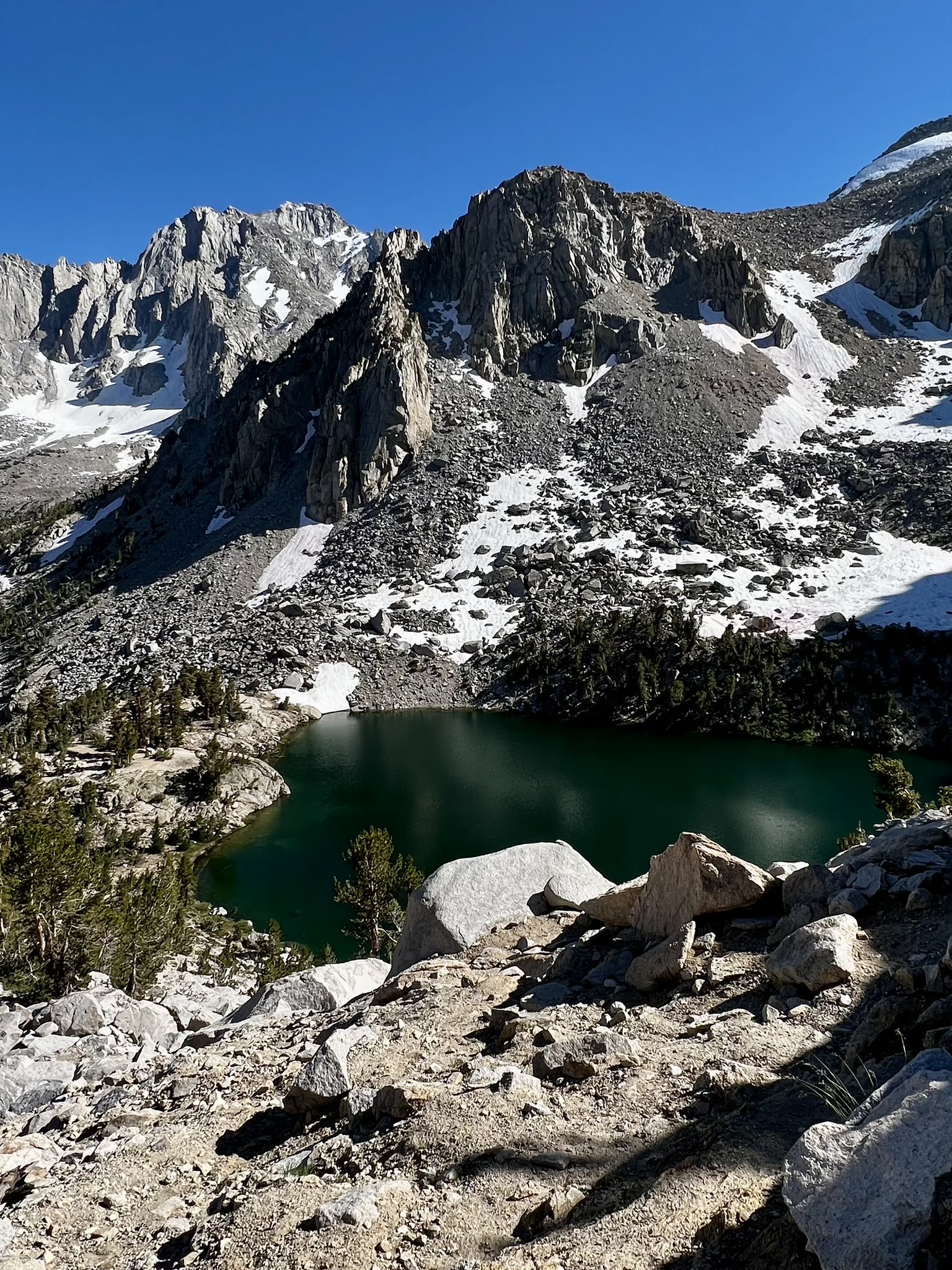
I retreated back down to the trail, dropping down to Upper Rae to access the Sixty Lakes trail, and started heading up. Getting to the first lake, I took a break and got photos
 first lake along the Sixty Lakes Trail
I had enough time left in the day to continue further up the basin, but the weather looked pretty dismal and I just wasn’t feeling up for it, and decided to head back to Upper Rae -
 Upper Rae Lake
 I had thought about finding a tent site at Middle Rae for the night; when I got to the trail crossing (at the outlet from Upper Rae), it looked deep enough for me (if I slipped) to get an unpleasant dunking -
 JMT crossing at the Upper Rae outlet
So, I headed instead back to my “granite rib” of the previous night, and found a better spot that was at least mostly on soil.
 my (modestly) better site for night 3
Day 4 -
This morning dawned with unusual weather; clear and beautiful to my west, and concerning-looking clouds blowing in from the east and north. I wasn’t sure about the outlook for storms, so I decided to head back over Glen Pass rather than risk getting stuck where I was if rain decided to dump.
Conditions for photography (or “picture-taking”, as I can’t honestly call myself a photographer) were so perfect that pointing my phone in any random direction likely would have yielded something pretty, so I was in a pretty good mood and felt okay about starting back.
Here’s a few shots (yes, the “Brewer and North Guard” shot is terrible due to zooming way in, but it looked nice in-person) -
 beautiful sky - 7:30 AM on day 4
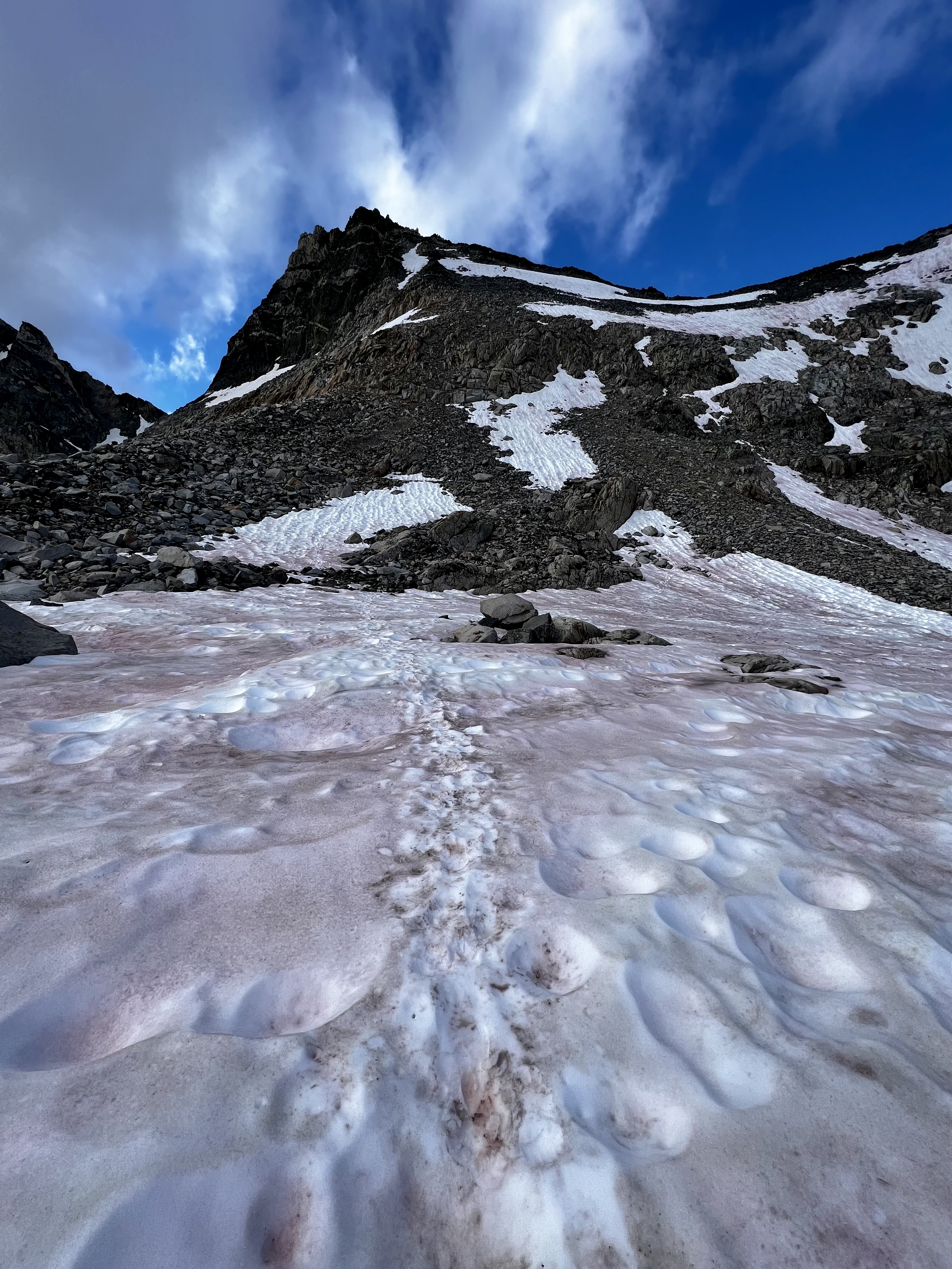 the JMT, on a not-so-busy morning
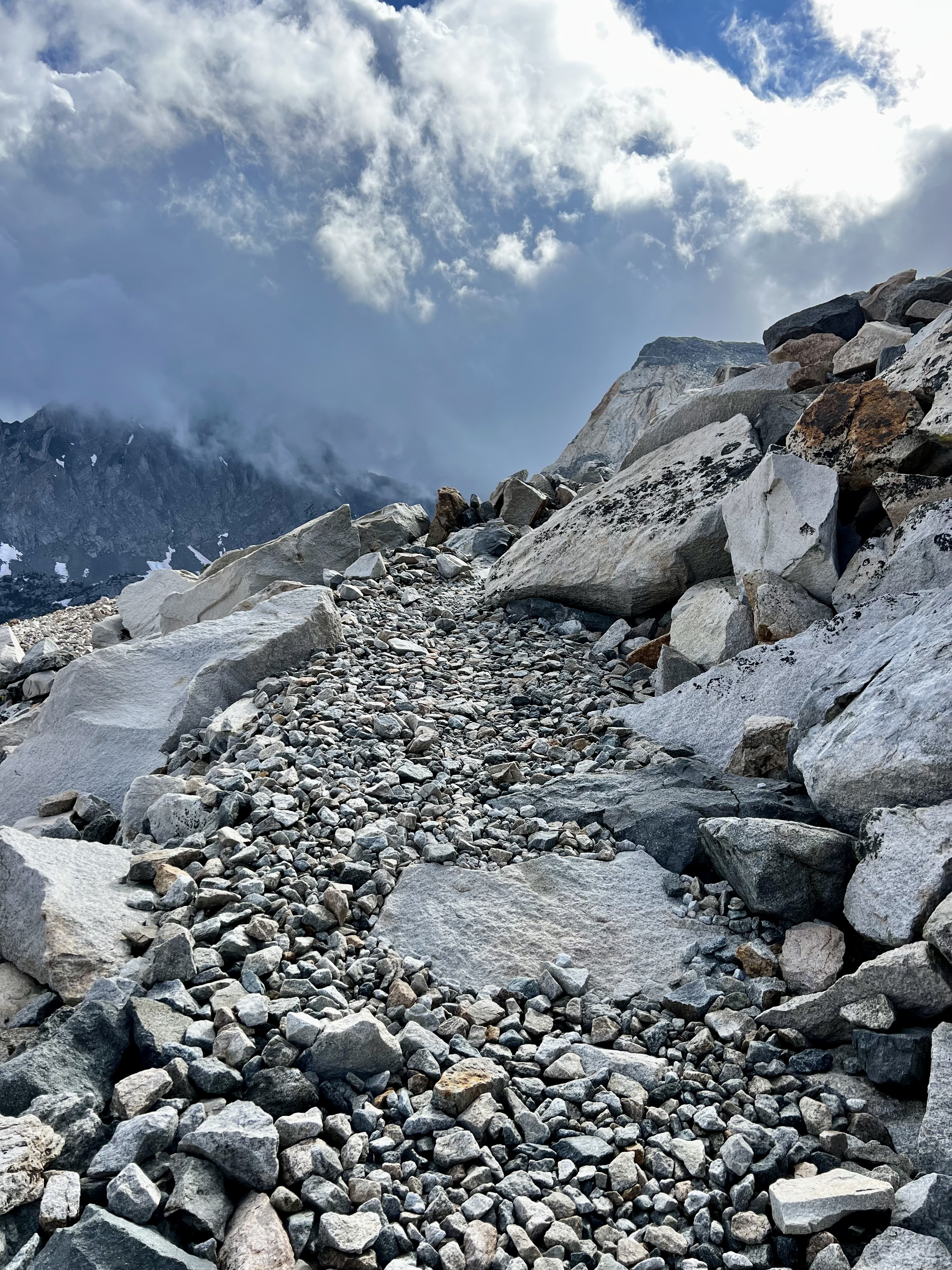 clouds rolling in from the east
 can I get some MORE clouds please? Thanks !
 nice view back down the basin, a bit before reaching the pass
 view southwest from Glen Pass - Brewer and North Guard (??)
Getting back down the south side of Glen was uneventful; I’ll try to shorten my narrative from here on. I’ll mention here that I encountered a couple of hiker groups heading to Glen Pass as a dayhike from Kearsarge Lakes, and one group heading to Rae Lakes for an overnight (they had started that morning from Onion Valley). Some of the “day hikers” seemed like they were looking strictly at mileage from the map and not the overall difficulty, but I said nothing other than to wish them a nice day.
I continued south on the JMT, and took the Kearsarge Pass (“high” trail) turnoff rather than heading back via Bullfrog Lake. I was very impressed with the condition of this trail; here is one place the trail crews display their skill -
 nicely-constructed bit of the Kearsarge trail
I did, at least, manage to get a halfway-decent shot of Bullfrog Lake on this return leg of my trip -
 Bullfrog Lake, viewed from the K.P. trail
I reached the turnoff to Kearsarge Lakes, but wasn’t thrilled about losing 450’ or so of elevation (that I would need to regain the next morning). The weather had been changeable all day, and it was raining a bit as I was getting set up. I was able to jump in my tent right as it started hailing. The hail let up after a few minutes, long enough for me to cook dinner - which I ate in my tent after the rain started up again.
Day 5 -
The climb back up to Kearsarge Pass was strenuous, but uneventful. Heading down the east side, I had thought to do the side-trip to Matlock Lake (to check it out for a future trip). However, laziness (and a strong post-hike food impulse) overrode this plan, so I hurried down the remaining trail to get back to my car and satisfy my hunger in Lone Pine.
 last look at Kearsarge Lakes - 9:30 on day 5
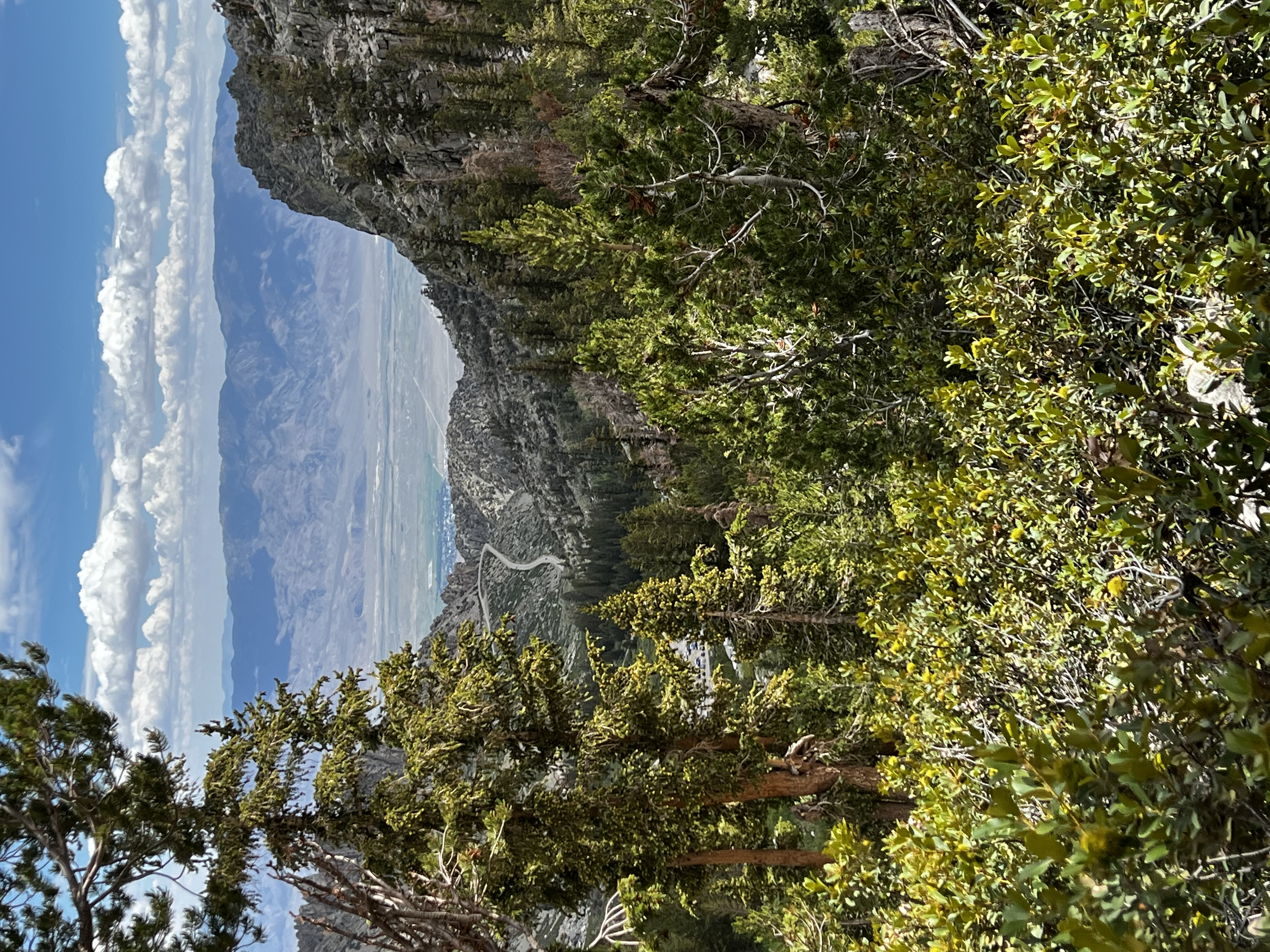 beer and a burger - somewhere on the horizon
In conclusion, I have to say I was not completely satisfied in my ability to meet my objectives on this trip, but ended it with a lot of hope that my next trip (over Pine Creek Pass to Merriam Lake and beyond) would go better (it didn’t, but that’s another story). Perhaps my real objective should be to take a little more satisfaction from what I am able to do, and just keep at it as long as I can.


