
I just got back this past Sunday from a 5-day trip over Lamarck Col into the Evolution Basin area. I felt this sense of wonder at several points during the trip, for all of the above reasons. Despite the calendar showing that we're already in mid-August, it certainly felt more like June up above 11,000 feet. As a head's up -- I took a lot of photos, so this report will be mostly images with some commentary.
---
On Tuesday evening, the day before our trip started, we packed up the car and left Oakland in the evening, driving east across Sonora Pass and finally pulling into a spot along the McGee Creek road to car camp just before midnight. Our dispersed campsite was at about 7,500 feet, and we hoped that this would help acclimate ourselves more to the elevation than if we had driven up from sea level on the morning of the first day.

Day 1, Aug. 9: Drive to North Lake TH, hike over Lamarck Col to Darwin Canyon
Having driven through the Sierra at night, sunrise over McGee Creek the next morning was our first glimpse of the range that would be our home for the next five days.
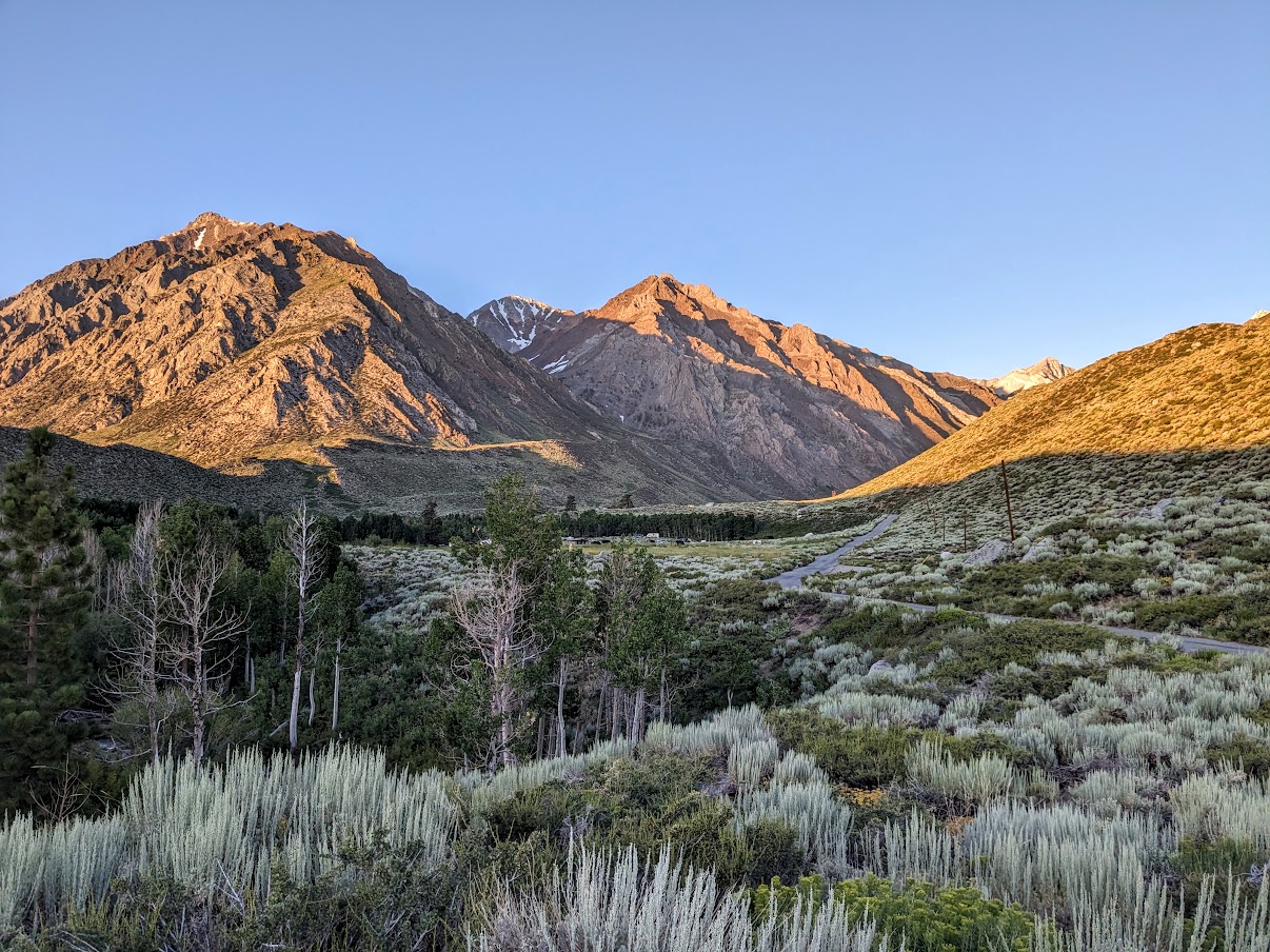
After tossing the tent back in the car and drinking some cold brew that my wife had made the day before, we drove the remaining 50 minutes to the North Lake trailhead parking and geared up. Mosquitos were present, but not horrible at all. We were pleasantly surprised. But still, not wanting to let them build up any confidence, we preemptively sprayed all of our clothing with picaridin before we started walking the dirt road to the actual trailhead.
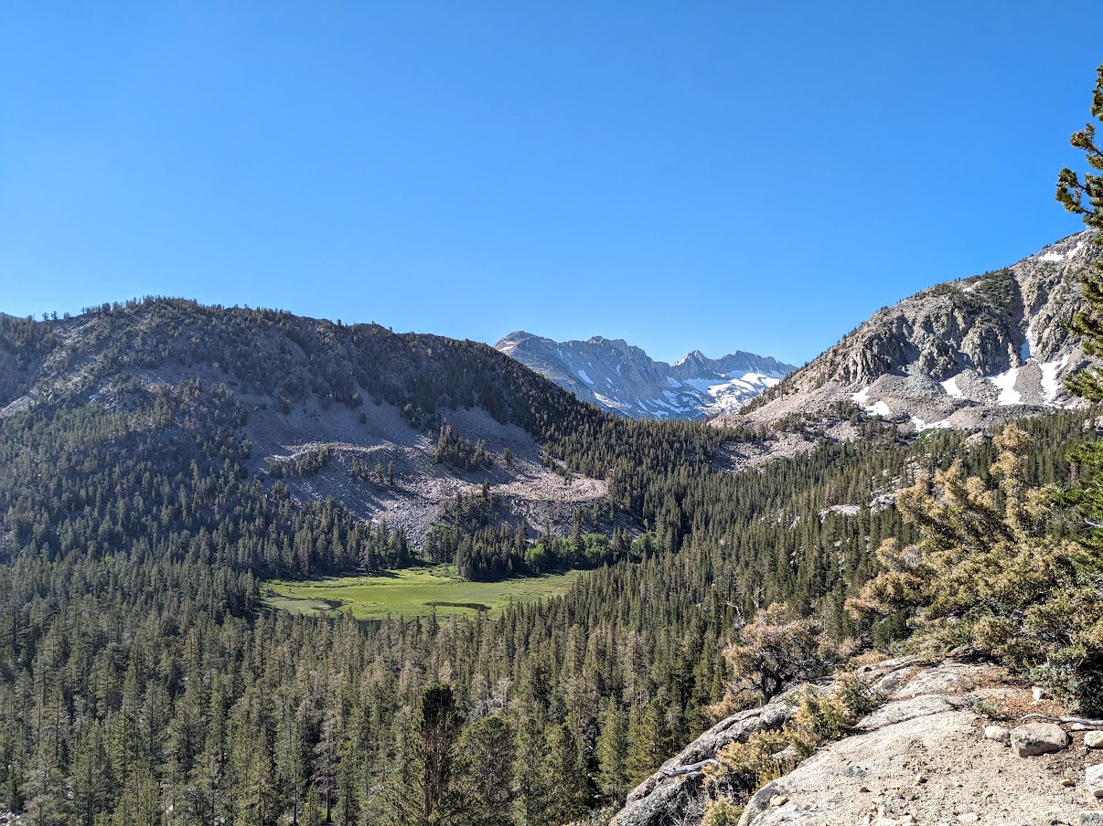
Eventually the road transitioned to trail, and we followed the signs for the Lamarck Lakes. Soon we had climbed high enough to get a view of Grassy Lake (well, technically, a view of the meadow adjacent to Grassy Lake). It was at this point that I realized to my dismay that I had left my phone charging cable back at the car. I don't bring a dedicated camera backpacking and use only my Pixel 6a phone to take photos, view topographic maps, and take hiking/fishing notes. Without being able to charge my phone with my external battery pack, I'd have to use my phone very sparingly if I wanted to have a chance of it lasting for the full 5 days of the trip.
We took off our boots to cross the outlet stream of Lower Lamarck Lake. (When we returned 5 days later, a helpful local called down to us from the rocks on the other side that there are logs you can walk across at the actual lake outlet so we enjoyed a dry crossing that day.) We continued on, doing a bit of class 2 offtrail to circumvent the two additional creek crossings below Upper Lamarck Lake, and then joined the use trail on the south side of the creek. There the real fun began.

This is probably as good a time as any to mention that this was my first backpacking trip of the year. I had done a few day hikes earlier in the season but it'd been a month since the last one, and a conditioning trip I had planned for late July ended up being canceled due to some car issues. My wife had done a 3-day backpack in Olympic National Park in Washington a few weeks prior, but it was a mellow trip at significantly lower elevation and she didn't feel suitably conditioned for a high altitude backpack. So we were both aware that this first day would be rougher than usual. We had previously gone from North Lake over Lamarck Col to Darwin Canyon in 6 hours in 2020, so we figured this day would take a bit longer but hoped that after the tough first day the rest of the trip would go off as planned.
Well, not having done any conditioning trips prior, with heavy first day packs, the hike up went about how you'd expect: very slowly. We labored up each of the switchbacks, and then once past the switchbacks we continued laboring up each of the wide, sandy shelves that comprise the ascent up to Lamarck Col.

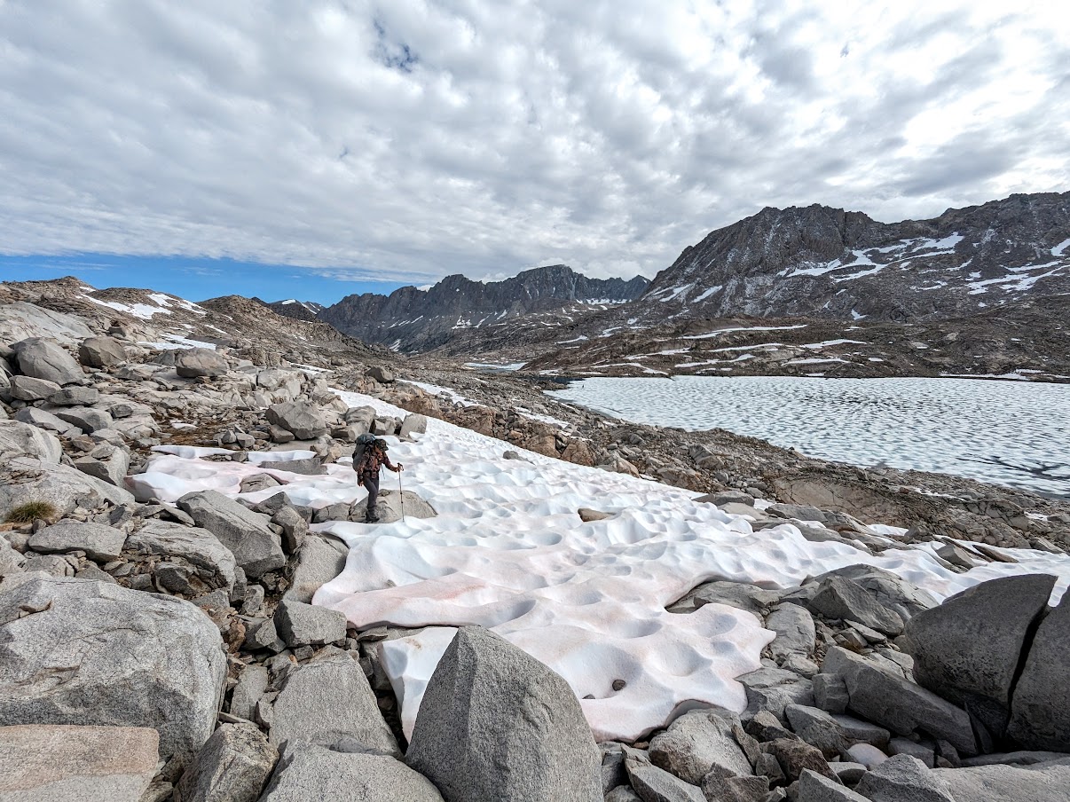
Once we got up to around 11,600 feet the snow fields began. They weren't bad as snow fields go -- relatively low angle and firm enough to hold our weight, but soft enough to kick steps in. But they still required more attention than simply trudging up a trail, and seemed to make for more strenuous hiking too.
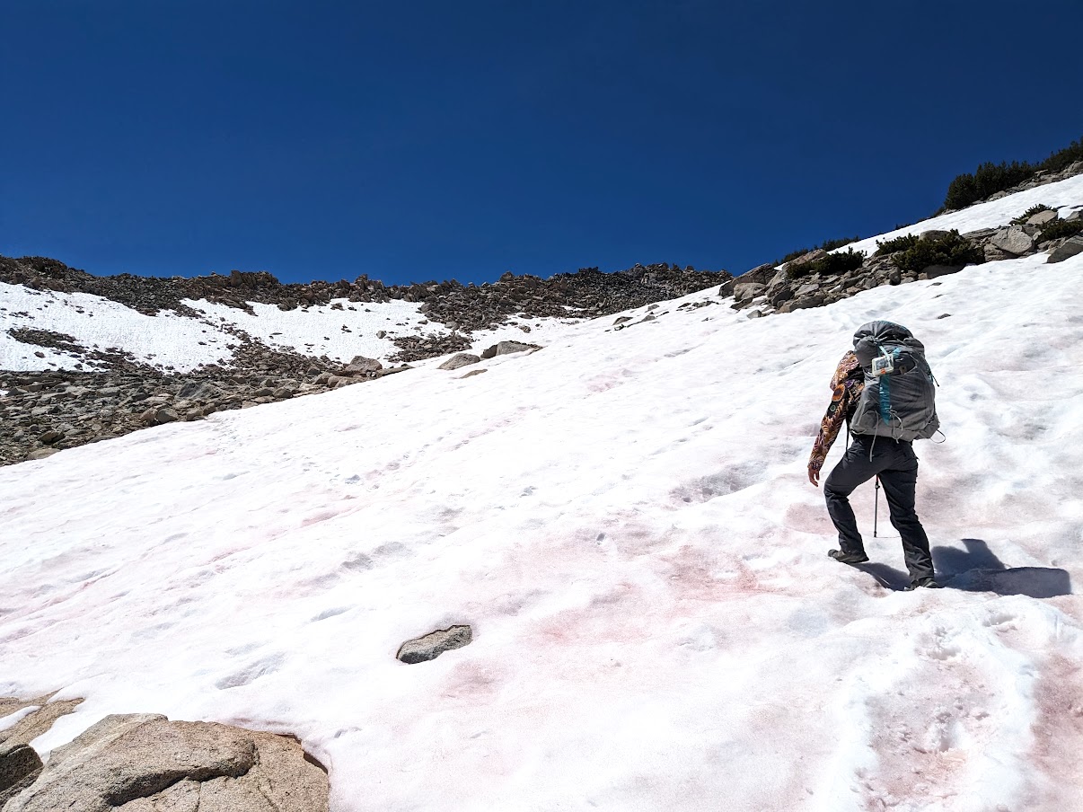
Finally we pulled ourselves up onto the penultimate shelf below Lamarck Col. The permanent snowfield (glacier? can we call it a glacier?) stretched much wider and higher than the last time we'd crossed it. Back in July 2020 we could almost avoid the snow entirely by clambering up an easy class 2 route to the south. Not so this year.
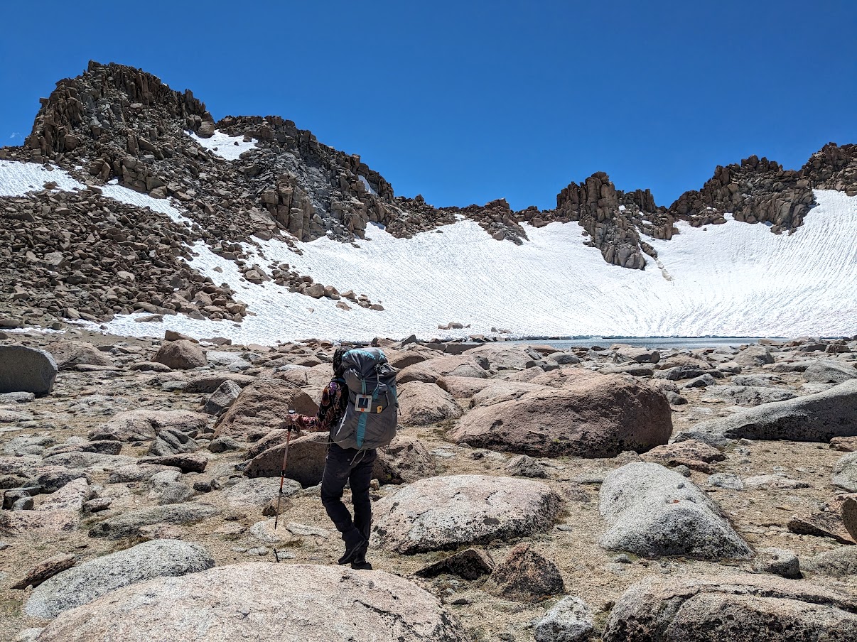
We moved carefully up the snow, following in the boot tread of many hikers that had gone before us, and eventually topped out at the col.

The sign welcoming us to Kings Canyon National Park was a sight for sore eyes, not least because it meant that we wouldn't have to gain any more elevation that day.

Another welcome and familiar sight: Darwin Canyon, with its string of lakes laid out before us. Even though we were well into August, there was a significant amount of snow still clinging to the south canyon wall, and remnants of ice floating on the edges of the lakes.
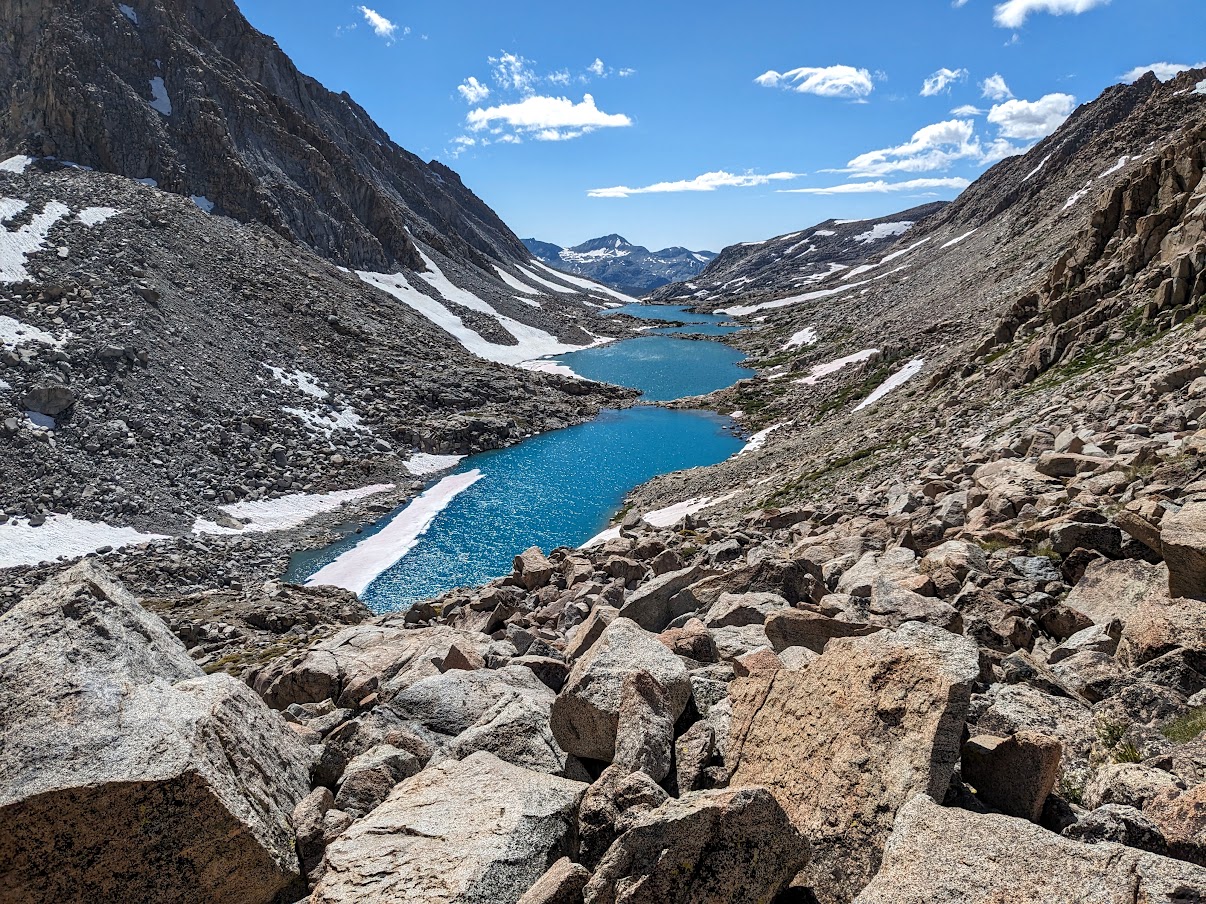
The hike down the south side of Lamarck Col was tedious but efficient, and eventually all that was left to tackle was the classic boulder hop along the north shore of the Darwin Canyon Lakes. Eventually, 8 hours after we left the trailhead, we staggered into the campsite nestled amidst the rocks at the inlet of Lake 11,623. (NB: I've seen trail mileage estimates of anywhere from 6.5 miles to 8.5 miles from the North Lake parking lot to Darwin Canyon. My wife's phone informed us that she had hiked 9.5 miles that day. Does anyone know the real hiking distance from the parking lot to one of the middle lakes in Darwin Canyon?) It took us significantly more time to make it there than we had expected, but at least make it we did. We set up camp and spent the rest of the evening fishing and enjoying the view over the lake. Little did we know that this would be the first and only evening of our trip that would be rain-free.

Dinner time rolled around, but we weren't hungry. Speaking of dinner -- I'm not the kind of person who cares much what he eats while backpacking. I'm a big fan of food back at sea level, but once on the trail it's simply fuel for ensuring that I can continue to function. My wife, on the other hand, places a much higher emotional value on a good, filling, and varied backcountry menu. So before this year's trip, she decided to experiment with planning, prepping, and dehydrating each ingredient for a full complement of home-made dehydrated dinners:
- shepherd's pie (ground beef, mashed potatoes, peas, carrots, spices)
- vegan dirty mac and cheese (macaroni, flour, nutritional yeast, turmeric, spices, black bean soup mix)
- fiesta bowls (parboiled rice, ground beef, zucchini from the garden, corn, black beans, salsa, hot sauce)
- ramen (instant noodles, dehydrated mushrooms, zucchini, additional spices -- okay, so this was the one "cheat" meal we'd typically do on a backpacking trip)

Day 2: Hike down past Darwin Bench to JMT, south on JMT through Evolution Basin and over Davis Lakes Pass to Davis Lakes
On Thursday morning we decided to get a leisurely start to our day, naively trusting the weather forecast we'd received before we left that rain wouldn't arrive until Friday. We had planned to eat the ramen on the first night, as this was the bulkiest of the meals. But because we skipped dinner we were hungrier than usual, so we cooked the ramen for breakfast this morning instead. This would turn out to be a poor decision on my part.
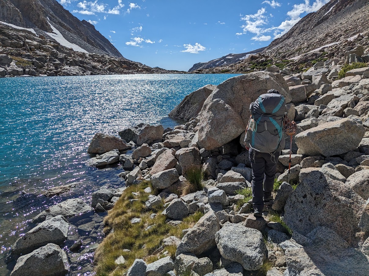
We started hiking at 9am, picking our way along the use trail winding around the lower two lakes. Halfway around the lowest Darwin Canyon lake (11,592), we were confronted with a steep snowfield on the north side of the lake that was right on the edge of what we felt comfortable traversing with only trekking poles. Unbuckling our packs, we tentatively scuttled across, and once safely on the other side we breathed a sigh of relief before we descended into the gorgeous Darwin Bench.


There was a ton of snow still, and it made for some interesting routefinding decisions as we lost the use trail, regained it, left it on purpose to circumnavigate a snowfield, regained it, and accidentally found ourselves on a higher variant of the trail lower down on the Bench which required a brief section of class 2 scrambling to rejoin the main use trail just above the descent to the JMT.

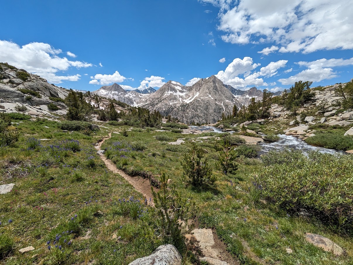
Once on the JMT, clouds started to crowd the sky, but we were too busy gawking at the superb scenery to notice.


Evolution Lake was supremely inviting, and looked like a wonderful place to hang out. The mosquitos apparently thought so too, as we got swarmed with the bugs when we stopped briefly for a snack break. The crossing of the inlet to Evolution Lake was just high enough to force us to remove our boots for the wet stone hop. During the few seconds it took me to roll my pant legs back down and put my socks back on, I got 3 bites on my briefly exposed shins and calves.

It was at this point that I started experiencing digestive issues that slowed my hiking considerably. I get acid reflux when hiking on a full stomach, and earlier in the morning I had made the ill-fated decision to eat ramen for breakfast along with my coffee. So we took a half-hour break along the trail above Sapphire Lake so I could recline and try to force the acid back down where it belonged.


Continuing on into upper Evolution Basin, the skies began to darken and the landscape became decidedly more stark, with much more snow blanketing the area.

As we approached Wanda Lake, we had to make a decision: stop short of our planned itinerary for the day and set up camp here, or take a chance and try to head up and over the low pass to the southwest to reach the Davis Lake Basin before the rain arrived. The smart decision would have been to stop there. But we haven't often been accused of being wise, and we decided to continue on and headed up toward the pass.
Davis Lake Pass only requires a few hundred feet of elevation gain to ascend on the east side, and is said to be pretty simple to cross under normal conditions. Just a lot of talus hopping. However, with the huge winter we've had, these weren't normal conditions. Although we easily gained the elevation needed, there were some tricky snow fields to contend with on this east side of the pass. One of them stretched far enough up a long and steep gully that it effectively forced us to try to cross it rather than go around. However, once we reached the other side of the snowfield, we found to our dismay that the other side abutted a steep rock wall and a deep crevasse had formed along that wall. There was a snow bridge across the most likely section where we could cross over to solid rock, and we tentatively explored the stability along the edge. It seemed like it might work. We held our breaths as I minced across first sans pack (figuring since I was heavier that if it were to cave in, it'd cave in on me). Seeing that this worked, my wife then heaved my pack over to me, then her pack, and finally she launched herself over to the solid rock on my side while I waited with hiking pole outstretched as an emergency handhold.
Success! We were out of the woods, we thought. Then it started raining.
We donned rain shells and continued across the top of the pass. It was slow going, not only because the pass is very wide, but also because it's full of boulders. On a good day, it'd be relatively tedious to hop across the talus. In the rain, the rocks got slippery and we slowed to a crawl. It started raining harder, and after some frantic discussion of our options we switched tactics from soldering on to setting up an emergency bivy atop the pass and waiting it out. Problem was, despite the lack of topographic lines on the map, we were in the middle of a decidedly un-flat boulder field.
We eventually found a tiny patch of gravel in between some boulders, rushed to set up the tent, and dove in. This was perhaps the most awkward place I've ever set up a tent, but at least we weren't getting wetter. An hour and a half later, the rain let up and the sun reappeared for a moment. We took off the rain fly to help it dry faster, and surveyed the scene.

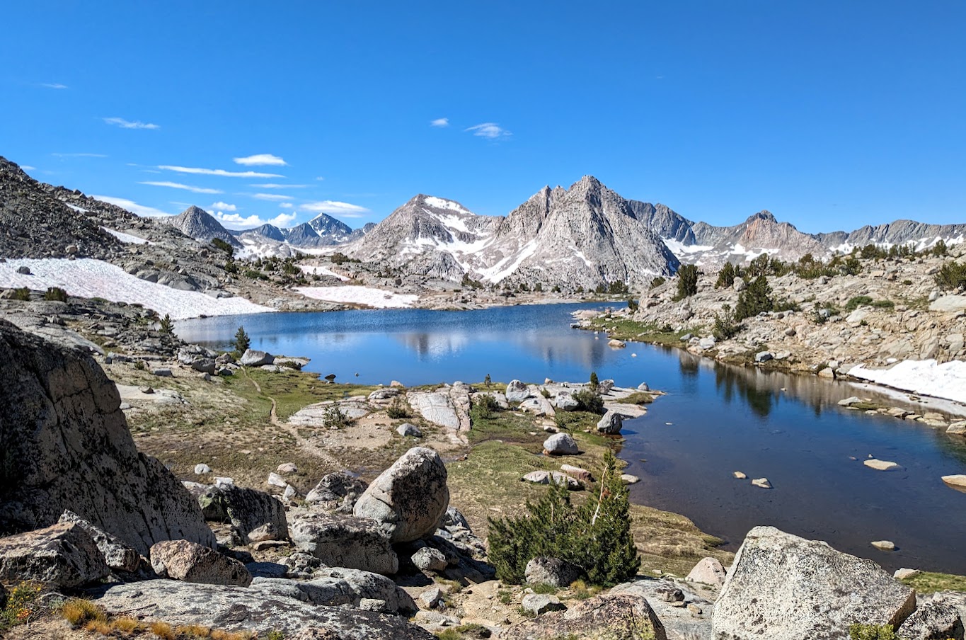
Davis Lakes Basin spread out invitingly before us. It was so close, but the boulders were still wet from the rain and within minutes dark clouds returned.

We hurried down the west side of the pass as quickly as we could, which was not at all that quickly given the high risk of slipping on slick rock, and barely made it to the highest Davis Lake (11,196) before it began raining again. There was at least a much larger flat area here, so we decided to cut our losses and set up camp for the night short of our ultimate destination.
After waiting out the rain for another hour, we poked our heads back out of the tent and salvaged the last remaining daylight to eat dinner (the vegan dirty mac and cheese -- tasted like the real thing!) and enjoy the mosquito-free cool mountain air.


Day 3: Move camp to peninsula in between Lower Davis and Upper Davis Lakes
Friday was intended to be a layover in the middle of the huge Davis Lake (technically two lakes, separated by 6 feet of elevation and a short 15-foot creek). Instead, we were awoken early at Lake 11,196 to the sound of more rain. It rained steadily for two hours until 6am, at which point we decided to break camp right away and hike over to our original planned campsite on the peninsula between the two Davis Lakes.


It took an hour to walk down to Upper Davis Lake and around the southern shore to the peninsula at its outlet. Traversing some of the snowfields here likely made our travel easier than if we had to do more boulder hopping. Upon arriving at our campsite, we immediately set up the tent just in case the rain returned later in the morning. Camp chores done and gear set out to dry, I had the rest of the day to fish and explore the two lakes.


By the late afternoon, dark thunder clouds had rolled in again. The lake was so big that I was a good half-hour hike away from our campsite -- if it rained now, I'd get real wet before I could make it back to the tent.

I tempted fate by fishing just a little longer, then raced back to camp. I got there just in time, as the sky to the east had turned from dark to nearly black. Fifteen minutes later, thunder started booming and it began raining again.
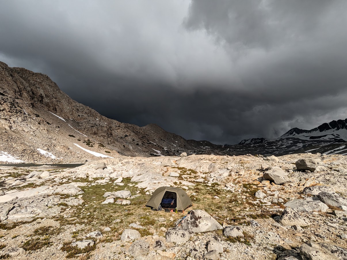
The rain and thunder continued all through the evening, so we cooked dinner under the vestibule (shepherd's pie -- delicious) and ate inside the tent.

An hour in, the rain turned to hail. Our REI Quarter Dome SL 2 was certainly being put to the stress test, and so far it was holding up. Half an hour later the hail turned back into rain, and eventually the rain stopped. I emerged from the tent again like a bedraggled butterfly and utilized the quickly fading light to wrap up some camp chores and admire another stunning sunset.


Day 4: Hike back over Davis Lake Pass, head north on JMT to Darwin Canyon
We knew today would be long, so we packed up before the sun rose above the basin wall and headed out. We retraced our steps back to Davis Lake Pass, the going much quicker now with fresh legs and dry granite, and picked a safer route down the snowfield on the other side.


Wanda Lake on the other side of the pass was showing more signs of thawing, but was still mostly covered in ice. We navigated a few more snowfields before we reached the JMT.

Once back on the JMT, the travel became much quicker. As we cruised down Evolution Basin the sun came out again, and it was as if the season changed from winter to summer in just a few miles.

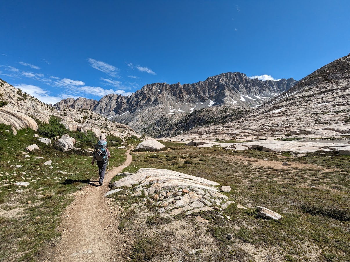

A couple of hours later, we turned back onto the use trail leading into Darwin Bench and began threading our way up the switchbacks. It was a slow but mercilessly efficient slog, and soon we were up on the bench overlooking the valley.

After a final push, we arrived back in Darwin Canyon at 1:30pm.


We were beat, so we spent half an hour just lounging around like lizards before begrudgingly getting back up to set up camp. On our first night we had camped in the same exposed site overlooking the inlet of Darwin Canyon Lake #3 that we used during our July 2020 trip, and knew that it flooded when it rained. Now that we were expecting rain, we instead chose to camp in a very protected site tucked against rock cliffs and hidden from the trail by a small copse between Lake #1 and Lake #2. This site (which actually has space for three tent pads, although the middle one is small and the lowest one looks like it floods) ended up working out perfectly. When a thunderstorm did indeed roll in later that evening, our tent experienced minimal disturbance despite the winds howling through the canyon. Dinner this night was the fiesta bowls, and my wife declared it to be her favorite of the three dehydrated meals she had prepared.


Day 5: Back out over Lamarck Col to North Lake TH
It had only rained for a few hours the evening prior, and our tent was mostly dry by 6:30am Sunday morning when we woke up and began packing camp for the last time. Unfortunately, almost as soon as we started hiking, it began raining again. And there was nothing we could do this time except hike on in the rain.
We navigated around the upper two lakes and then trudged slowly but steadily up toward Lamarck Col. A group of three that was camped at Lake #3 packed up and headed out soon after us, but never caught up. Eventually they veered off toward the gap southeast of Lamarck Col overlooking Schober Holes and the Sabrina Basin, and we didn't see them again until we had come down from the snowfield on the other side. Halfway up the south side, we spotted a single backpacker camped at the base of a snowfield. It didn't look like a fun place to camp. But then again, it also wasn't fun to be hiking up above 12,000 feet in the rain. He at least looked dry, while we were soaked and cold and feeling pretty miserable.
Then about 500 feet below Lamarck Col the rain turned to snow. We couldn't help but laugh -- as if our morning couldn't get any worse. We willed ourselves to continue doggedly making our way toward the top, connecting various use trails. Finally after what seemed like an eternity but in reality was only 1.5 hours since leaving camp, we arrived at the Col and carefully followed the well-worn boot track down the steep snowfield on the other side.

From here on out the rest of the hike was uneventful. We just retraced our steps from Day 1, moving as quickly as we could on the downhill so we could stay warm. By the time we got down to the Lamarck Lakes, the temperature had risen significantly and the sun was even making an appearance again. Once we got back to the parking lot, it was warm and a squadron of mosquitos maneuvered somewhat successfully to try to infiltrate our car.
---
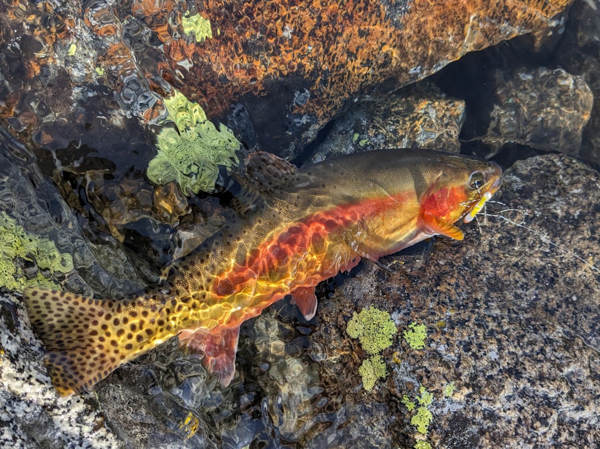
The fishing in a few of the lakes we visited was excellent. Fishing shortly after ice-out is generally considered to be a prime time to target backcountry trout hungry after a long winter, and the lakes I fished on this trip were no exception. Several had robust populations of golden trout, and a few of them had some pretty big goldens that were willing to take flies and lures.
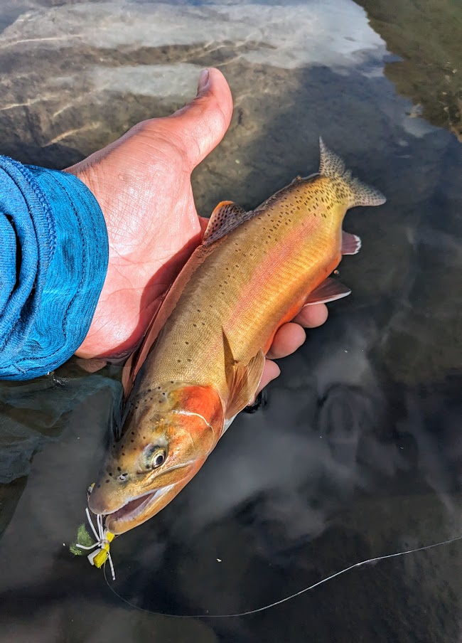


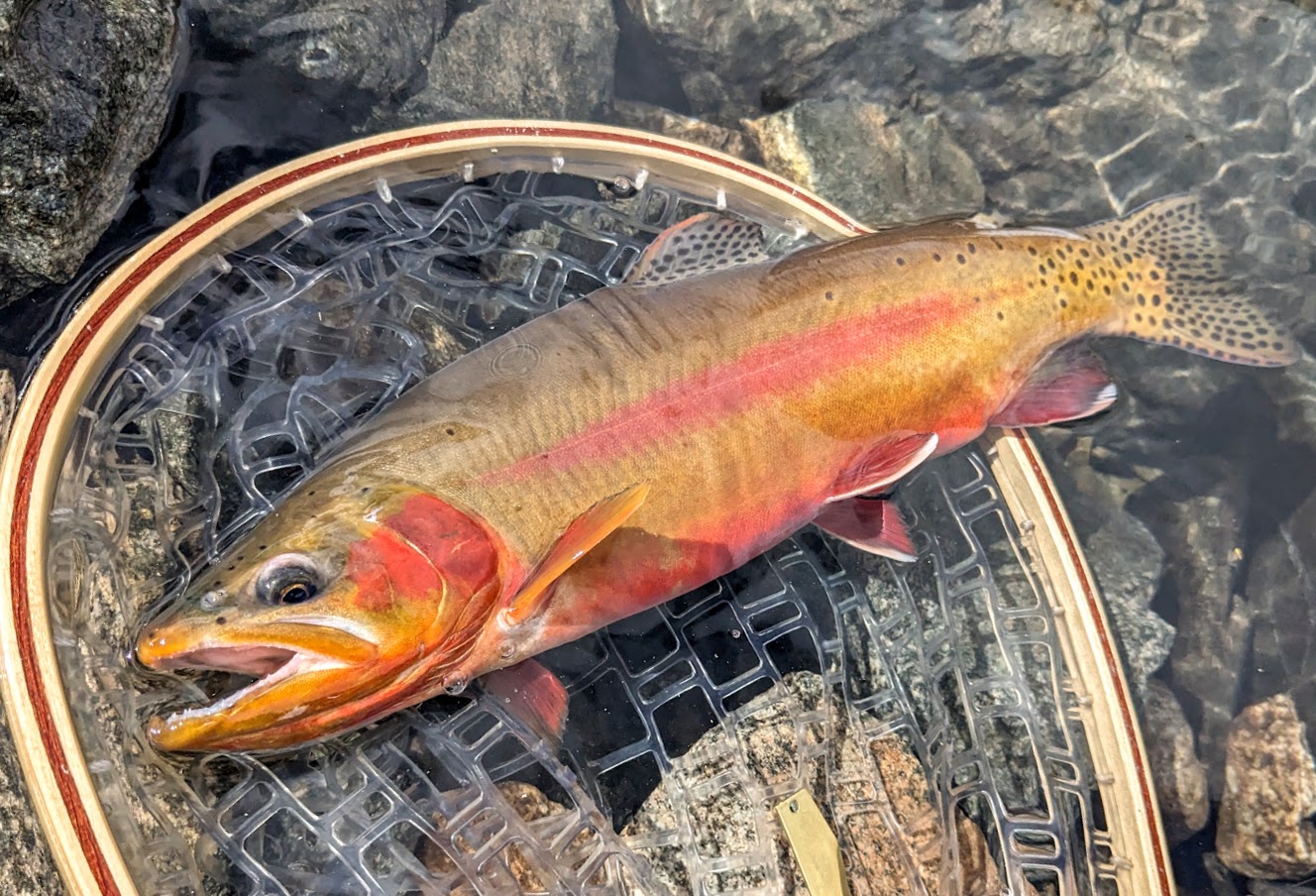
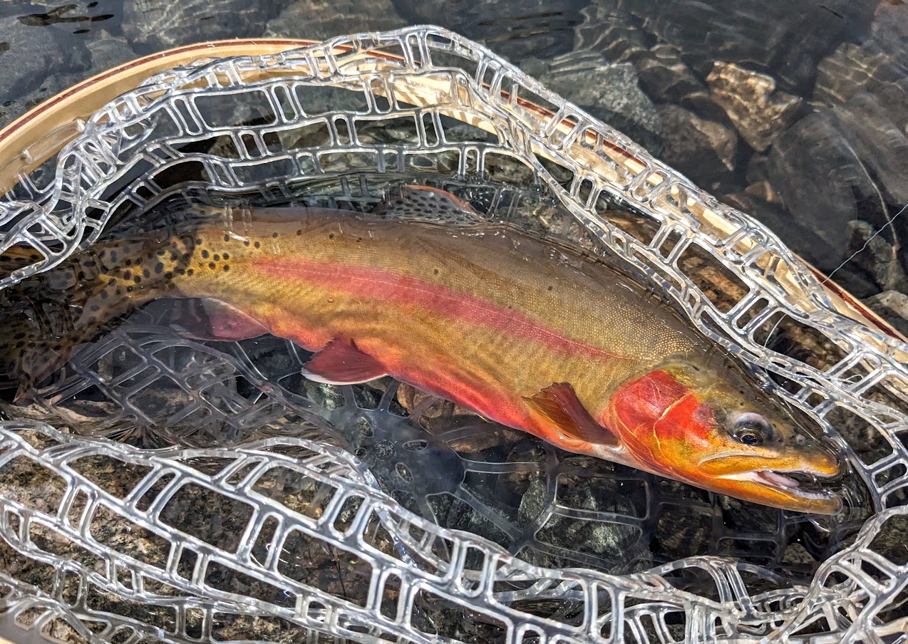


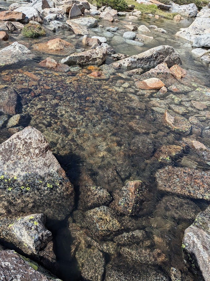
At one lake, goldens were stacked up in the shallow outlet area preparing to move into the outlet creek to spawn. I left the fish that were already spawning alone so they could do their thing, but there were dozens of other goldens that were not yet spawning and they were voracious, racing each other to smash the beadhead nymph dropper I had tied beneath an indicator hopper.


---
Postscript: We got lunch at Salsa's Tacqueria in Bishop (I had really good carne asada fries), got gas at the Paiute Casino, and then headed out on the long drive back home. On the way, we successfully killed all 3 mosquitos that had managed to follow us in when we threw our gear into the car back at the trailhead.


