Tom, I have not been up there but I've had my eye on the area for a long time and was mulling it over, perhaps for later in the year. But the map shows the trail crossing the W Fork of Green Greek back and forth in the 8200 to 8400 vicinity. Are you saying it is possible to avoid these crossings, or the trail has been rerouted?Tom Perkins wrote: ↑Sun Apr 16, 2023 6:21 am Green Lake does not require a creek crossing, and you can walk to the North to West Lake and Par Value lakes without a crossing; I would expect a lot of snow up there in May this year, but no scary crossing. You do have to cross Green Creek to get to East Lake and the Hoover Lakes to the South of Green Lake, although it may be possible to make your way up there off trail on the West side of the creek. I would avoid it in May.
End of May trip advice
-
kpeter

- Topix Fanatic
- Posts: 1450
- Joined: Mon Jan 04, 2010 1:11 pm
- Experience: Level 3 Backpacker
Re: End of May trip advice
-
wildhiker

- Topix Fanatic
- Posts: 1114
- Joined: Tue Jul 26, 2011 4:44 pm
- Experience: Level 4 Explorer
- Location: Palo Alto, CA
- Contact:
Re: End of May trip advice
I hiked up the trail from Green Creek trailhead to Green Lake in 2020. My inReach track shows that I crossed the West Fork Green Creek twice just within the wilderness boundary, as shown on the topo. Perhaps you could avoid the crossings by going cross-country along the north side of the creek. I don't remember what that area looked like.kpeter wrote: ↑Sun Apr 16, 2023 2:53 pmTom, I have not been up there but I've had my eye on the area for a long time and was mulling it over, perhaps for later in the year. But the map shows the trail crossing the W Fork of Green Greek back and forth in the 8200 to 8400 vicinity. Are you saying it is possible to avoid these crossings, or the trail has been rerouted?Tom Perkins wrote: ↑Sun Apr 16, 2023 6:21 am Green Lake does not require a creek crossing, and you can walk to the North to West Lake and Par Value lakes without a crossing; I would expect a lot of snow up there in May this year, but no scary crossing. You do have to cross Green Creek to get to East Lake and the Hoover Lakes to the South of Green Lake, although it may be possible to make your way up there off trail on the West side of the creek. I would avoid it in May.
-Phil
-
Tom Perkins

- Topix Novice
- Posts: 7
- Joined: Tue Jan 31, 2023 5:41 pm
- Experience: Level 3 Backpacker
Re: End of May trip advice
I’m pretty sure the trail doesn’t cross there; I just checked the USGS layer and it confirms my memory. It will be somewhat limited this Spring, however, as the roads may not get much attention, and Green Lake is only a couple of miles in.
-
SSSdave
- Topix Addict
- Posts: 3524
- Joined: Thu Nov 17, 2005 11:18 pm
- Experience: N/A
- Location: Silicon Valley
- Contact:
Re: End of May trip advice
Look at Sentinel Hub (SH) and Caltopo. Set your dates forward another month.
That is Mono Lake top left and Bishop bottom a bit right of center. Snow level along the Eastern Sierra on US395 was still at about 6000 feet.
SH shows Cherry Valley Reservoir at 4.7k was still surrounded with snow on April 9. Will all that snow melt in 6 weeks? I'll bet it will still be multi feet deep above 7k.
Now change the date to April 10, 2017. Not quite as much snow but similar thus a good resource for comparisons looking into the future this year. Now change the SH date to May 30, 2017. Note even Kibbie Lake at 6.6k was still mostly covered in ice and snow. To reach Cherry Creek the Kibbie Ridge Trail climbs to 8.0k. If you don't know what you are looking at with the Sentinel Hub satellite images, Caltopo can easily show you. Note some of the white may be clouds. Changing Rendering from Natural Color to Color Infrared helps separate that.
You do not have the required permissions to view the files attached to this post.
-
kpeter
- Topix Fanatic
- Posts: 1450
- Joined: Mon Jan 04, 2010 1:11 pm
- Experience: Level 3 Backpacker
Re: End of May trip advice
I need to correct my information. WD was right. The KIB station seems to have stopped functioning on March 30 after the last big storm moved through. Unless it starts working again, we won't be getting good information on the speed of the melt from it. Time to look for some second-best stations that might still be functioning.kpeter wrote: ↑Sat Apr 15, 2023 7:29 pmThere are three Kibbie-related stations, and 2 of the 3 are obsolete stations that have no data. Lower Kibbie Ridge (KIB) is the automated station that is showing data. Currently, it is at 105 inches of snow. It is at 6700 feet.Wandering Daisy wrote: ↑Sat Apr 15, 2023 6:33 pm Last I looked the Kibbie Ridge snow sensor has no data this year.
https://cdec.water.ca.gov/jspplot/jspPl ... ies=cdec01
-
Love the Sierra

- Topix Expert
- Posts: 424
- Joined: Sat Jun 11, 2016 6:32 pm
- Experience: Level 3 Backpacker
Re: End of May trip advice
Paul and WD, thank you. I have solid intermediate ski skills but, with anything heavier than a day pack, just cannot keep my balance. I am proficient with snow shoes and crampons and do not mind snow travel. I have the gear for camping comfortably as well.I just plan for much less mileage over the trip.
WD, I am with you, I worry about high creek crossings too!
Ken Peter and others, thank you for the comments on Kibbie. Sounds like that is one I had better tackle when dry.
C9. Interesting that you mentioned Levitt meadow, I was thinking about it. If I hit it with snow, maybe it will not be the mosquito nightmare it is purported to be? Lassen would be great, but isn’t all of it totally destroyed by the recent fires in the past 5 years?
WD, Tom Perkins and Ken Peter, I have also been thinking about West Lake out in Hoover. In my Jasmine Rose’s first backpack and, sadly, my Sunshine’s last, we went to East Lake, up to Summit Lake and then to West Lake. Anyway, we did it in 2019 when there had been a ton of late, March snow. I would not venture the crossings to East Lake and would only go to West. However, I wonder if, in all of that snow, West will be a dead end and a one night in and out.
Okay, now for the dumb questions… please be patient with my ignorance. Where is Kennedy Lake? I did a wonderful backpack in 2017 out of Kennedy Meadow up Relief Creek to Emmigrant Lake so I am pretty familiar with the area, but do not remember Kennedy Lake.
Many thanks to all of you!!
-
c9h13no3

- Topix Fanatic
- Posts: 1326
- Joined: Tue Sep 18, 2018 1:19 pm
- Experience: Level 1 Hiker
- Location: San Mateo, CA
Re: End of May trip advice
There will be no mosquitoes almost anywhere in May in the Sierra this year (or most years in May).Love the Sierra wrote: ↑Mon Apr 17, 2023 9:36 pm C9. Interesting that you mentioned Levitt meadow, I was thinking about it. If I hit it with snow, maybe it will not be the mosquito nightmare it is purported to be? Lassen would be great, but isn’t all of it totally destroyed by the recent fires in the past 5 years?
Yeah, Lassen burned. But the volcanic landscapes there are often desolate anyways. Look at some pictures and decide for yourself if you‘d find the landscape compelling.
Kennedy Lake is at 7800’ near Kennedy Meadows in the Emigrant. Hang a left before you get to Relief Reservoir. There will still be snow in May, but all the creek crossings are bridged and you should have dry ground to camp on if you hunt around.Love the Sierra wrote: ↑Mon Apr 17, 2023 9:36 pm Okay, now for the dumb questions… please be patient with my ignorance. Where is Kennedy Lake? I did a wonderful backpack in 2017 out of Kennedy Meadow up Relief Creek to Emmigrant Lake so I am pretty familiar with the area, but do not remember Kennedy Lake.
Many thanks to all of you!!
"Adventure is just bad planning." - Roald Amundsen
Also, I have a blog no one reads. Please do not click here.
Also, I have a blog no one reads. Please do not click here.
-
Love the Sierra
- Topix Expert
- Posts: 424
- Joined: Sat Jun 11, 2016 6:32 pm
- Experience: Level 3 Backpacker
Re: End of May trip advice
Thanks c9, I see it now.
Also, thanks for the Levitt Meadow idea. I have never hiked out of there since there have always been prettier places to go. But maybe this is the year.
WD, I forgot to mention that I am familiar with that early trip report in which you walked the road to Agnew Meadow. That is where I go the idea.
Also, thanks for the Levitt Meadow idea. I have never hiked out of there since there have always been prettier places to go. But maybe this is the year.
WD, I forgot to mention that I am familiar with that early trip report in which you walked the road to Agnew Meadow. That is where I go the idea.
-
Love the Sierra
- Topix Expert
- Posts: 424
- Joined: Sat Jun 11, 2016 6:32 pm
- Experience: Level 3 Backpacker
Re: End of May trip advice
C9, I have been to Lassen a few times and loved it. I also enjoy the volcanic landscapes. However, a trip in a burn is just not worth taking for me.
-
SSSdave
- Topix Addict
- Posts: 3524
- Joined: Thu Nov 17, 2005 11:18 pm
- Experience: N/A
- Location: Silicon Valley
- Contact:
Re: End of May trip advice
The funny thing from the perspective of this old photographer, beyond the OP, for those determined to do some mountain stuff along the Eastern Sierra between mid May and late June, this epic snow pack 2023 spring will be a fabulous May and June to disperse camp along dirt roads in amazing sagebrush zone environments with aesthetic wild flowery green areas. Recently saw a tv news site report with a picture of lots of poppies in Sand Canyon west of Ridgecrest. Ton's of places in that zone to waterless disperse camp at.
Learn to carry water jugs with enough water to over several days even take a pail shower each day. Even buy a quality insulated ice chest. Yes, we earth monkeys need liquid nurishments. Especially nice to find dirt road locations beside permanent streams that ought be booming with snowmelt this spring. Large patchy expanses of showy flowers with creatures one misses during summers because much like the Mojave Desert just south, their spring is soon after winter storms end and later hide from the mostly brown dry hot sun fried sagebrush landscapes. Well except at night to go out and pee. Ok for the naturalist enthusiasts like this earth monkey:
https://www.fs.usda.gov/Internet/FSE_DO ... 335777.pdf
Very easily armchair planned at home in this era with Caltopo and Google Earth. Alabama Hills is one obvious choice. Other's are Red Rock State Park, Jawbone Canyon. Key for doing such is to drive about looking out along roads to see what elevations and or exposures are green and flowery. Of course riparian areas are always more fun, more green, more birds, more creatures, more places to take afternoon refreshing quick jack-in-the-box dips after whatever day's hiking effort. Then flexibly make a plan on your maps. Even without tools or web, in this era one can copy readable jpg screen grabbed maps from Caltopo into any smartphone that can be easily viewed kicking back in your vehicle during evenings. Else for paper maps before a trip, visit a FedEx Office with a USB memory with screen captured, properly sized, map files.
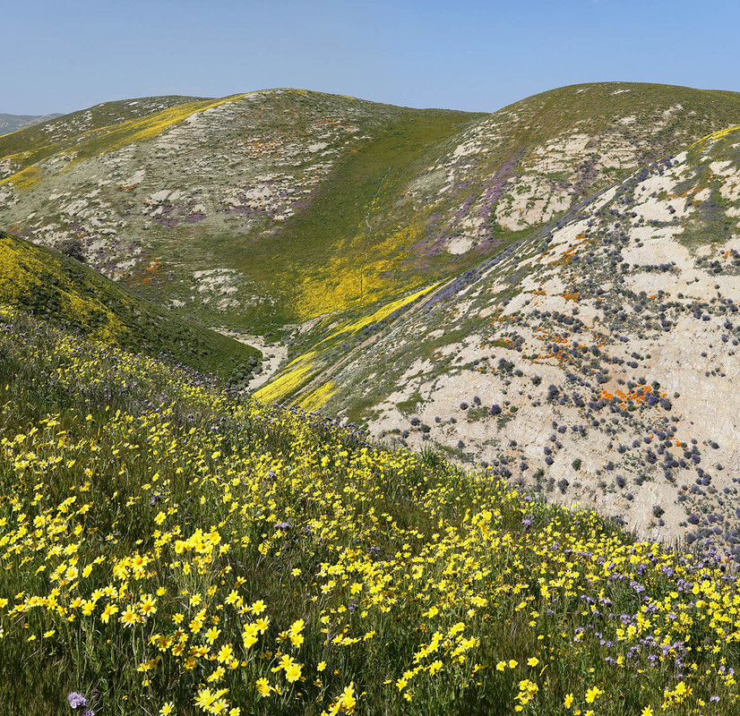
Ok so what am I doing now? No, haven't skied for several weeks though my pass resorts are all still open. Definitely would be otherwise haha. Visited blue oak savanna grassland landscapes 6 times at Pacheco Pass and now southern areas of Carrizo Plain and 3 days last week at the lushly green this wet year SR166 Cuyama River at Cottonwood Creek Canyon. Epic of a lifetime wildflowers in places. Tenting? Well not usually. On road trips, little old me at 5'6" 138#, sleeps comfortably in the back bed of my old Forester. Here's a link to just one web downsized bee heaven photo taken last week. Driving back south later this week for round dos.
Learn to carry water jugs with enough water to over several days even take a pail shower each day. Even buy a quality insulated ice chest. Yes, we earth monkeys need liquid nurishments. Especially nice to find dirt road locations beside permanent streams that ought be booming with snowmelt this spring. Large patchy expanses of showy flowers with creatures one misses during summers because much like the Mojave Desert just south, their spring is soon after winter storms end and later hide from the mostly brown dry hot sun fried sagebrush landscapes. Well except at night to go out and pee. Ok for the naturalist enthusiasts like this earth monkey:
https://www.fs.usda.gov/Internet/FSE_DO ... 335777.pdf
Very easily armchair planned at home in this era with Caltopo and Google Earth. Alabama Hills is one obvious choice. Other's are Red Rock State Park, Jawbone Canyon. Key for doing such is to drive about looking out along roads to see what elevations and or exposures are green and flowery. Of course riparian areas are always more fun, more green, more birds, more creatures, more places to take afternoon refreshing quick jack-in-the-box dips after whatever day's hiking effort. Then flexibly make a plan on your maps. Even without tools or web, in this era one can copy readable jpg screen grabbed maps from Caltopo into any smartphone that can be easily viewed kicking back in your vehicle during evenings. Else for paper maps before a trip, visit a FedEx Office with a USB memory with screen captured, properly sized, map files.
Ok so what am I doing now? No, haven't skied for several weeks though my pass resorts are all still open. Definitely would be otherwise haha. Visited blue oak savanna grassland landscapes 6 times at Pacheco Pass and now southern areas of Carrizo Plain and 3 days last week at the lushly green this wet year SR166 Cuyama River at Cottonwood Creek Canyon. Epic of a lifetime wildflowers in places. Tenting? Well not usually. On road trips, little old me at 5'6" 138#, sleeps comfortably in the back bed of my old Forester. Here's a link to just one web downsized bee heaven photo taken last week. Driving back south later this week for round dos.
Who is online
Users browsing this forum: aetherspear, Alw, Google Adsense [Bot] and 119 guests