Name: Earhart Ridge
Overview: The ridge that extends from the summit of Amelia Earhart Peak trends southwesterly and is punctuated in two places that enable backpacker access between upper Lyell Canyon and Ireland Lake. This is the more northerly gap.
Class: 2 (the Ireland side is harder).
Location Yosemite wilderness
Elevation: Almost 11,600 ft.
HST Map:HST Map
Description: A quartet of un-named lakes sits on a plateau a bit northeast of Simmons Peak. They are separated from Ireland Lake by a ridge extending southwesterly from Amelia Earhart Peak. The ascent of this ridge from the quartet of lakes is easy class 2. Once you reach the ridgeline, it's an appreciably steeper descent on the Ireland side. A sand-gravel chute will take you about a third of the way down, but then it is best to traverse on a southwesterly trending ramp until you run into a chute filled with crushed rock/boulders which extends down to Ireland basin. I've tried to draw a rough set of lines on one of the photos, but when I try to save the image, the lines get distorted. I'll keep trying.Here are the images:
Earhart Ridge (unofficial)
-
cgundersen

- Topix Fanatic
- Posts: 1338
- Joined: Sun Jul 16, 2006 1:07 pm
- Experience: N/A
Earhart Ridge (unofficial)
You do not have the required permissions to view the files attached to this post.
-
wildhiker

- Topix Fanatic
- Posts: 1114
- Joined: Tue Jul 26, 2011 4:44 pm
- Experience: Level 4 Explorer
- Location: Palo Alto, CA
- Contact:
Re: Earhart Ridge (unofficial)
I've been over this ridge 5 times between Ireland Lake and Maclure Creek, some in each direction, and it is MUCH easier to head over the slightly higher part of the ridge south of the pass you describe, over the point labelled 10641 on the USGS topo. I took a bunch of photos of the route on my trip last year and have been meaning to write up the route description. I'll try to write it up and add it to this topic. By the way, I always refer to this as "Amelia Earhart Pass" - sounds more exciting than "Earhart Ridge".
-Phil
-Phil
-
cgundersen
- Topix Fanatic
- Posts: 1338
- Joined: Sun Jul 16, 2006 1:07 pm
- Experience: N/A
Re: Earhart Ridge (unofficial)
Phil,
I'm with you all the way on your assessment. The route I described is easier when you're approaching from the Maclure-Lyell side, but all that is lost on the Ireland side, unless it's early season and there is ample snow for glissading. Obviously, there was no snow left on this trip, and that may be increasingly common. I'll look forward to your write up of the alternative route; maybe it can be Amelia Earhart Pass to distinguish the two?
Cameron
-
erutan

- Topix Expert
- Posts: 492
- Joined: Tue Aug 25, 2015 4:46 pm
- Experience: Level 4 Explorer
Re: Earhart Ridge (unofficial)
I've done it twice I think from Vogelsang to Lyell. I've always just followed the drainage up from Ireland, then cut up a little north of the southern low point of the pass to where there's a use trail down to those quartet of lakes. I refer to it as "Amelia Earhart Pass" as well and I feel like I might have heard it referred to that somewhere. It probably seems worth splitting this into it's own entry at some point to disambiguate the two.
There's some discussion on it here: viewtopic.php?f=9&t=22124&start=60#p174138
There's some discussion on it here: viewtopic.php?f=9&t=22124&start=60#p174138
You do not have the required permissions to view the files attached to this post.
admin @ Sierra Nevada Current Conditions group.
-
frozenintime
- Topix Regular
- Posts: 299
- Joined: Tue Aug 18, 2015 8:06 pm
- Experience: N/A
Re: Earhart Ridge (unofficial)
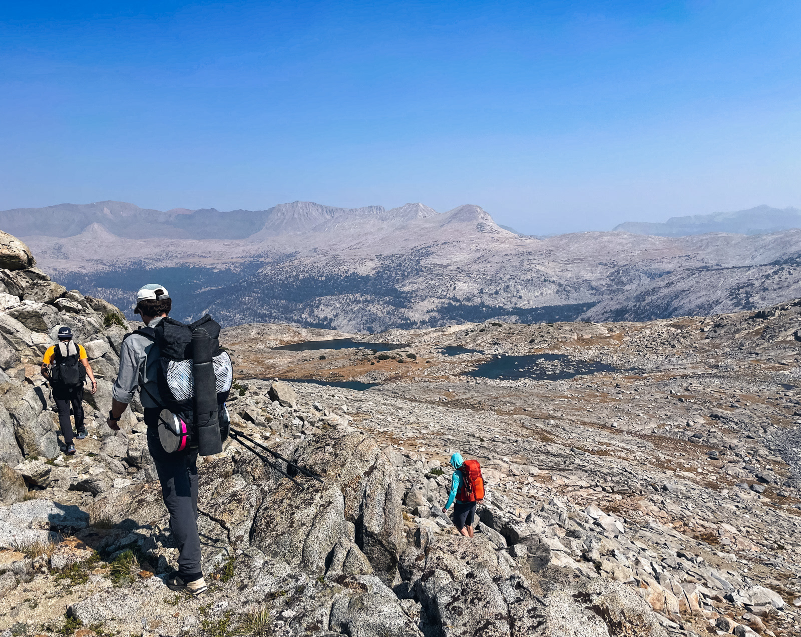
i crossed this pass last fall from parsons peak to maclure creek, but crossed south of 11641 (same as erutan, i believe), which made much more sense from our routing.
from the parsons side, it barely registers as a pass (you're only climbing 100 feet or so over modestly slanted terrain).
the east side involved simple enough route finding around some ledges:
after the lakes, it's worth finding the brilliant grassy seam running south most of the way to upper maclure creek lakes:
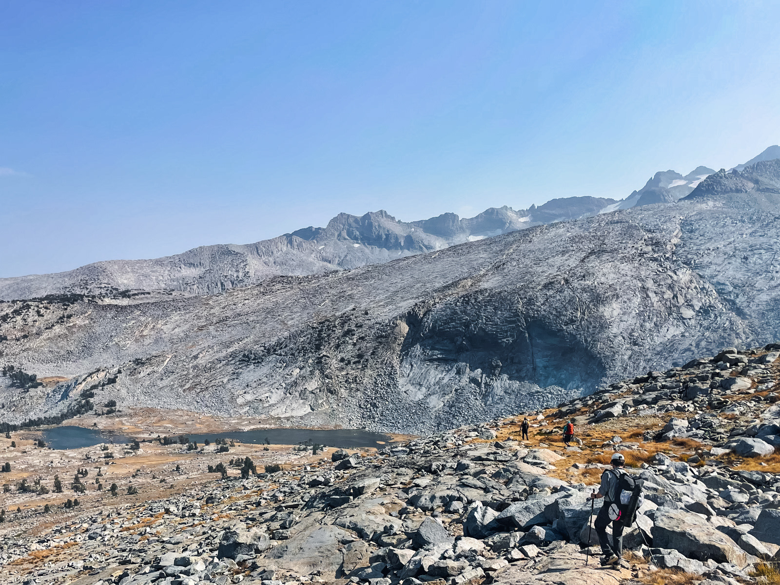
(photos are from this report: https://badmountain.org/tuolumne-zone-traverse)
from the parsons side, it barely registers as a pass (you're only climbing 100 feet or so over modestly slanted terrain).
the east side involved simple enough route finding around some ledges:
after the lakes, it's worth finding the brilliant grassy seam running south most of the way to upper maclure creek lakes:
(photos are from this report: https://badmountain.org/tuolumne-zone-traverse)
-
wildhiker
- Topix Fanatic
- Posts: 1114
- Joined: Tue Jul 26, 2011 4:44 pm
- Experience: Level 4 Explorer
- Location: Palo Alto, CA
- Contact:
Re: Earhart Ridge (unofficial)
I just posted my complete description of this pass, crossing over the point 11,641, which I believe is easiest after doing this pass five times. See: viewtopic.php?f=31&t=22775
-Phil
-Phil
Who is online
Users browsing this forum: No registered users and 28 guests