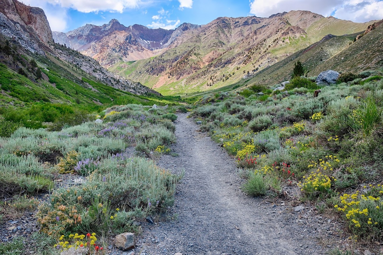
It felt good to reconnect with my favorite Eastern Sierra shuttle friend and she was happy to meet me at the Onion Valley parking lot and deposit me and my pack full of food at the McGee Pass trailhead. It's always a little strange to be dropped off at a remote trailhead with only one way home (the long way home was about 160 miles south). By 1:00 pm I was heading up to McGee Lakes for a chill half day of hiking. . . and after an hour the 30% forecasted chance of rain was 100% dumping on my poncho. By the time I made it to the tarn above Big McGee Lake it was dry and I found a nice sheltered spot away from the crowds.
Early season wildflowers would mean early season mosquitos later. . .

Storm approaching:

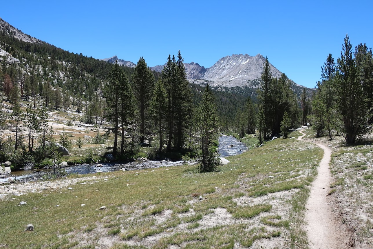
Day 2: McGee Pass & Squaw Lake:
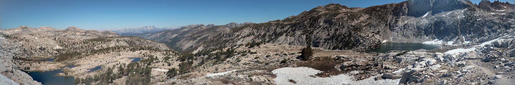
The next day I started the climb to McGee Pass. I had read mixed info on the condition of the snow, and I was happy to have micro's for the short section of steep snow near the top. The altitude and my lack of acclimatization made for a slow first pass of the trip, but before long I was over the top and cruising down toward Tully Hole. These first two days were low mileage to help with acclimatizing so I got to Squaw Lake with plenty of time to make camp, clean up, chat with PCT hikers and enjoy the alpenglow.
Looking back at Little McGee Lake on the climb to McGee Pass:

Wonderland on the west side of McGee Pass:


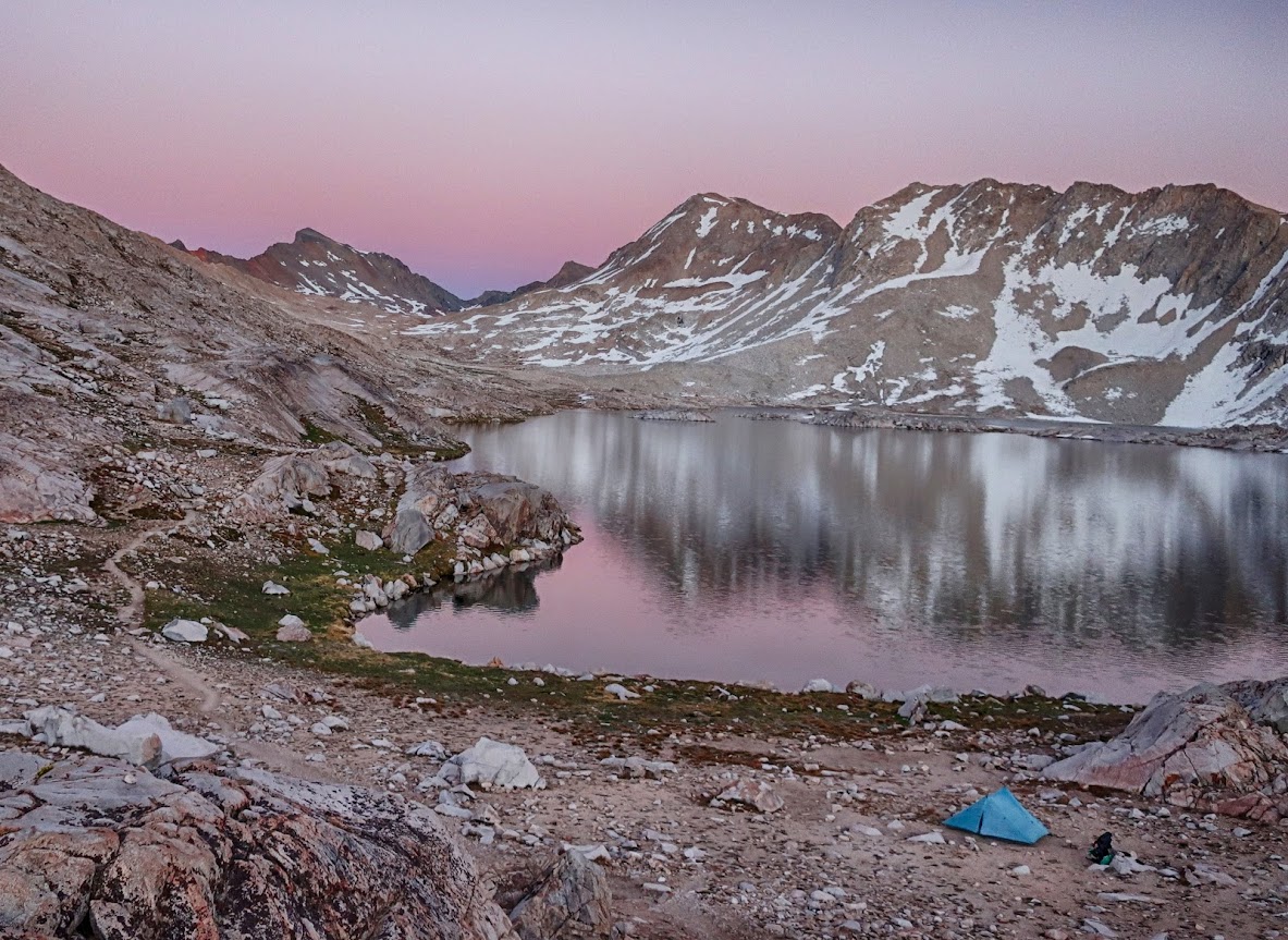
Alpenglow at Squaw Lake camp:

Day 3: Silver Pass & Bear Creek:
Without my hiking buddy Hobbes to "encourage" me get an early start I was a little slow in the morning, and finally got hiking by about 9:00 am. Even hiking through familiar terrain the beauty of the JMT passes never gets old. It was a crystal clear day with pano views all the way back to the Minarets. I made it to Bear Creek by late afternoon and battled the mosquitos until finally escaping into the tent. This is the only time of year that I bring an actual tent, and it was worth every extra ounce to have complete serenity away from the hoards of mosquitos that night. Not many photos from today as I was focused on keeping sane while under constant attack from the dreaded mozis.
The view north from the top of Silver Pass:
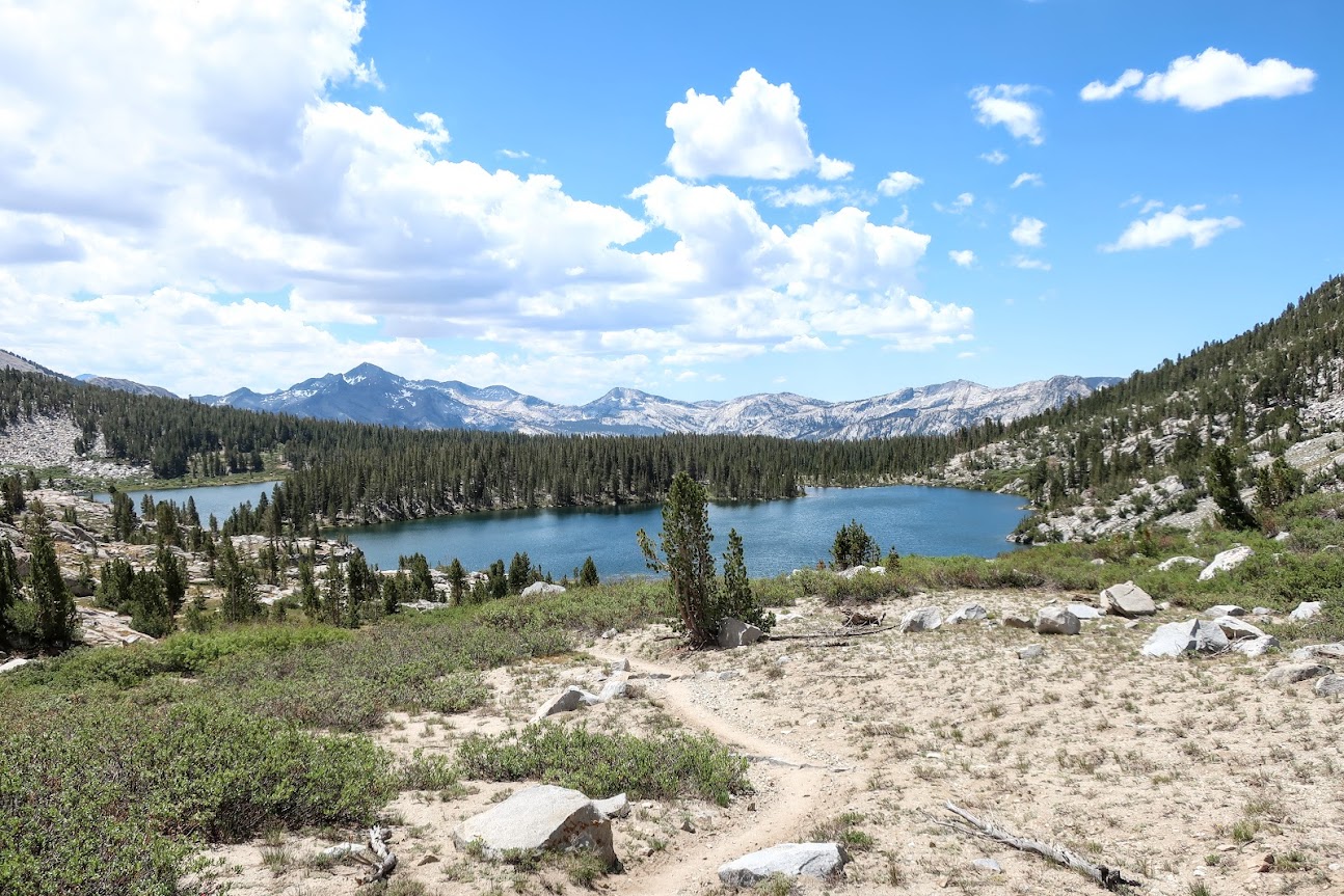
Day 4: Seldon Pass:
I woke early unable to sleep while scratching bug bites on my legs. It was barely light, but fortunately cold enough that the bugs weren't awake yet. I cleaned off the multitude of bites in the freezing cold creek (instant relief!), had a quick breakfast and got hiking. Hiking in the early morning while it was still cold felt good. After taking a pleasant break at Marie Lake (in the wind the bugs were not a problem) I strolled over the pass and down to Sallie Keyes Lakes. Unfortunately I forgot to refill water at the lake and had to endure some seriously dry miles until the Piute Pass Trail Jct.
Marie Lake from Seldon Pass:

Sallie Keyes Lakes:
Day 5: Evolution:
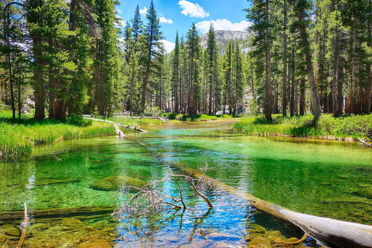
Finally the good stuff. After first hiking through Evolution on my first JMT thru hike in 2011 I've been back many times, mostly to access cross country routes in the area. It felt good to return to some of my favorite sections of the Sierra. Morning sauntering along Evolution Creek and afternoon up to Wanda Lake. I arrived early with plenty of time for dinner on a bluff overlooking the Goddard Divide to the south and back at the alpenglow on the giant faces of Darwin and Mendel.
Evo Creek:
Evo Lake & Darwin/Mendel:

Blufftop camp overlooking Wanda:
Day 6: Muir Pass & Palisades Lakes:
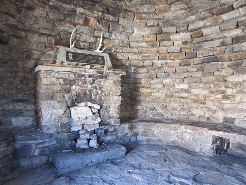
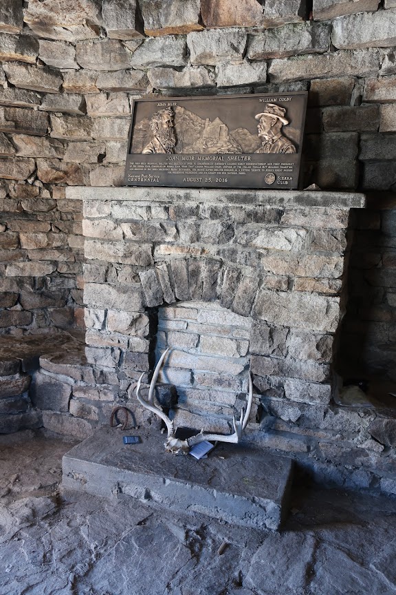
There was plenty of snow on the east side of the pass, and plenty of PCT thru hikers trudging along trying to figure out how to best get through it. With a late start (10:00 am) I made it to Palisades Lake after dark and setup at a familiar spot. It usually takes a few days to fully acclimate and by now I was starting to get into a groove of hiking all day and actually enjoying it. BTW, I noticed that the fireplace in Muir Hut had been completely closed up with bricks. When I was there 11 years ago it was only partially done.

Muir Hut fireplace 2011:
Muir Hut fireplace 2022:


Day 7: Mather and Pinchot:
I woke with the first light and headed up to Mather Pass. After chatting with a friendly family that was thru hiking the PCT together, I cruised down the pass, through Upper Basin and finally turned on my old iPod Nano. There is nothing like strolling downhill for miles while listening to music and enjoying a large homemade ice coffee. Over the years I've 'perfected' a mixture of Via and various sweeteners and powdered creamers that makes a tasty ice coffee after 'brewing' all night in ice cold water.
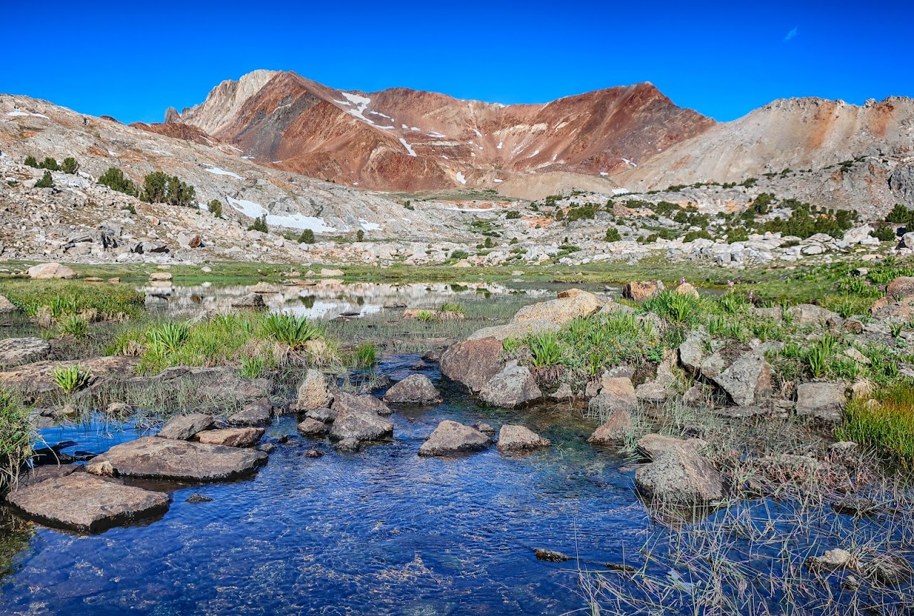
After making it over Pinchot in the afternoon there was still plenty of time to explore the bright green grassy meadows on the south side. I've had my eye on this area for years and finally had the opportunity to explore it for a few hours. It's a beautiful spot, with the green meadows and wildflowers contrasting against the bright read peaks nearby.
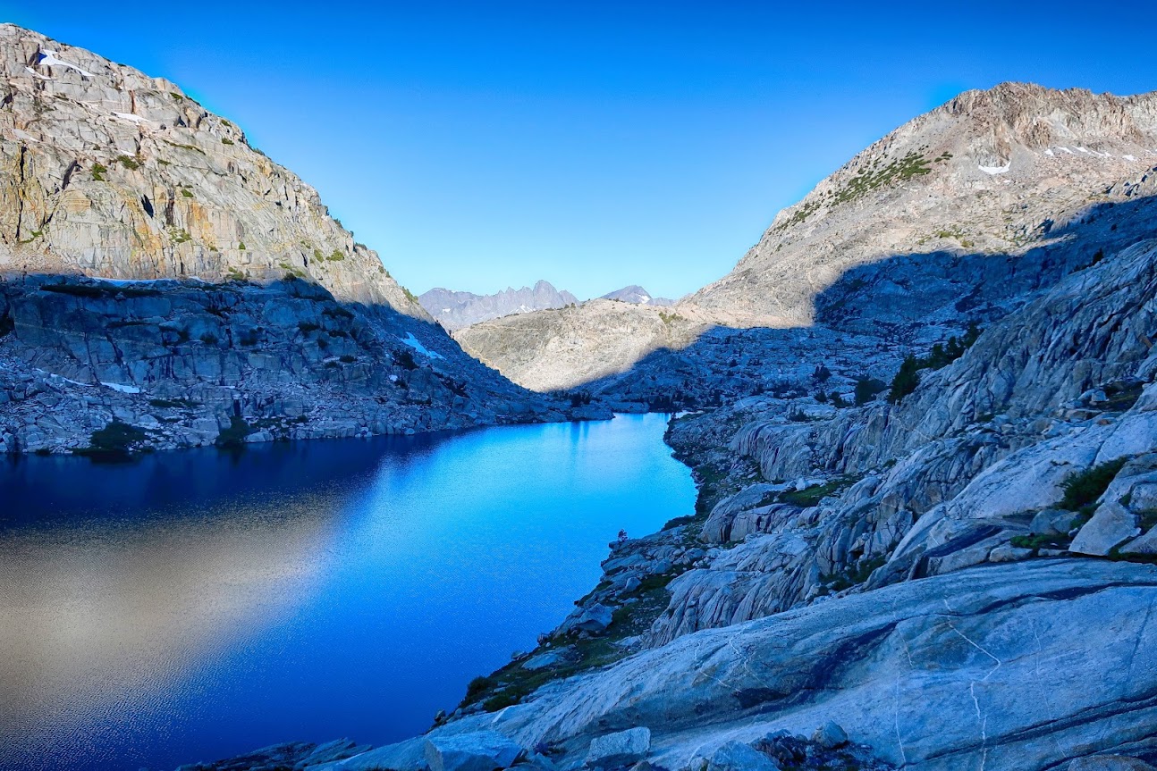
Morning on Palisades Lake:
Mather Pass Pano:

Miles of easy terrain through Upper Basin:
Meadows below the south side of Pinchot Pass:


Day 8: Rae Lakes:
I rejoined the JMT and strolled down to the Woods Creek Bridge by mid morning. I tried exploring a potential cross country route into the the far north end of 60 Lakes Basin, but got turned around by steep waterfalls and cliffs. After a few hours of exploring I decided to just take the JMT to a special camp spot on a bluff that overlooks the Painted Lady just in time for sunset.
Familiar ground around Rae Lakes:


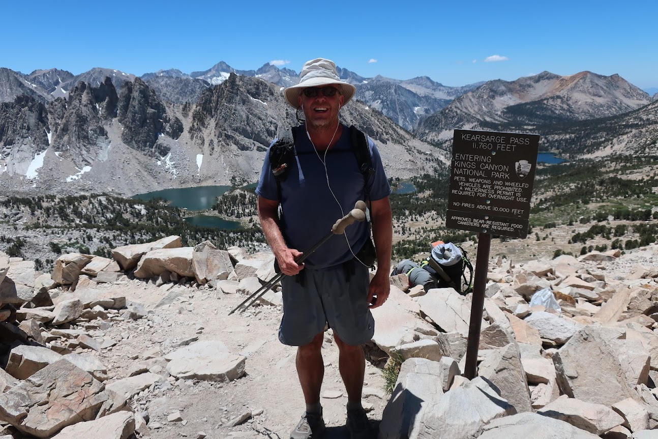
Day 9: Glenn & Kearsarge:
After dreaming of a cheeseburger and a shower all night I was up early and over Glenn pass in time to enjoy another amazing ice coffee and some tunes while strolling down toward Charlotte Lake. By the time I reached Kearsarge Pass it was almost easier to jog down the steep stairs toward the parking lot. I felt completely at home in the Sierra again.
Happy camper:
I have done a lot of solo cross country exploring in the Sierra and spent weeks at a time solo on the SHR, XSL and XST, but there is something nice about just tuning out and doing easy trail miles while chatting with other hikers and just taking time to swim and take pictures all day. I might even start fishing soon. Maybe it's just part of getting more 'mature'
Many thanks to all who have posted so many amazing trip reports over the years. I have a backlog of trips that I'm just now getting the time to put together. More later.
Andy.
(BTW: This trip is from 07/09 - 07/17/2022)