Trip advice: Hopkins Pass / Laurel Lake / McGee Pass Lollipop

If you've been searching for the best source of information and stimulating discussion related to Spring/Summer/Fall backpacking, hiking and camping in the Sierra Nevada...look no further!
User avatar
janeway
Topix Novice
Posts: 7
Joined: Mon Jun 28, 2021 4:42 pm
Experience: Level 3 Backpacker

Trip advice: Hopkins Pass / Laurel Lake / McGee Pass Lollipop

Post by janeway »

Last year I got a taste of off-trail travel for the first time, heading from Purple Lake up to Ram Lakes and down to Lake Virginia. It was awesome and I'm eager to get more cross-country experience. Thus this trip plan that tags a bit of the SHR - let me know if I've missed anything!

Skill: Level 2.5 - 400 on-trail miles in the past 18 months but only ~5 miles' cross-country travel
Terrain: Class 1/2
Main interest: views! Especially big views of big peaks.
Distance: 8-12 miles on trail, 5-8 off trail
Past experience: Rae Lakes Loop x2, PCT CA Sec A-C, Thousand Island & Ediza, Duck Lake/Purple Lake/Lake Virginia

July 4th - 7th, 2021

Day 0
Drive up to Mammoth Lakes, short day hike for acclimatization (Little Lakes Valley), stay in town

Day 1, 7.3mi, +3100'
McGee Trailhead to Big McGee Lake (camp on southwest peninsula, or at tarn above outlet if crowded)

Day 2, 7.7mi, +2100', -2900'
Hopkins Pass to Mono Creek Trail to Laurel Creek meadows (for big views)

Day 3, 6.7mi, +2700', -1800'
Laurel Creek / Laurel Lake / Grinnell Lake / Bighorn Pass / Shout-of-Relief Pass / meadow north of Tully Lake

Day 4, 11.2mi, +2000', -4700'
McGee Pass back to McGee Trailhead

CalTopo: https://caltopo.com/m/KBRD

I'd appreciate any advice on where to camp for good views (if I've missed any such opportunities) plus of course any tips about the route. I'm not excited about the steep, exposed climb up Laurel Creek but I decided I'd enjoy the supposedly-beautiful descent down Hopkins Creek and some time below the treeline versus attempting to navigate the Hopkins-Grinnell saddle during my first real x-country experience.

Lastly, bear can or no bear can? They're not required in this area... what would you do?

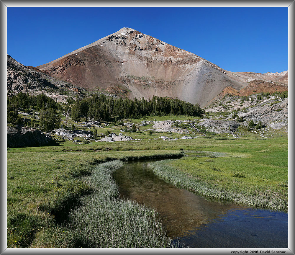
Unrelated pic as a thank you!

Bullfrog Lake from Kearsarge Pass-Glen Pass trail
Image
User avatar
cgundersen
Topix Fanatic
Posts: 1338
Joined: Sun Jul 16, 2006 1:07 pm
Experience: N/A

Re: Trip advice: Hopkins Pass / Laurel Lake / McGee Pass Lollipop

Post by cgundersen »

Hi Jane,
That's a fabulous loop, but if you are most keen on big views, I'd stretch it by one day and stay in the upper reaches of Hopkins basin on day 2 (giving you plenty of time to explore sans pack). Then, rather than camp at Laurel lake, I'd head all the way up to Grinnell. There are fantastic campsites along the western shore of the upper limb of the lake. And the distant views are marvelous. Even from Grinnell's elevation, it'll be a long day picking your way over both Bighorn and Shout-of-relief. If you stick with the ambitious plan you have, there will be little room for error if the weather acts up, or you find yourself a bit more gassed than expected. Not saying it cannot be done, but some of the xc travel you're looking at will be slower than you expect. I always carry a bear can, but lots of folk get by fine without (or with surrogates like ursacks). Good luck! Cameron
User avatar
Flamingo
Topix Regular
Posts: 347
Joined: Tue Mar 29, 2011 12:18 pm
Experience: Level 4 Explorer
Location: West Oakland, California
Contact:

Re: Trip advice: Hopkins Pass / Laurel Lake / McGee Pass Lollipop

Post by Flamingo »

Ahoy Jane, your route is awesome. I did it in reverse last year (TR link). Here's a few suggestions; take them with a grain of salt:
  • My favorite campsite along this route was the unnamed tarn above Ross Finch Lake.
  • Laurel Lake is a slice of heaven, and it's a crime against humanity to rush through this area. I suggest allowing extra time to savor it. :D
  • The "trail" over Hopkins Pass was quite deteriorated on the north near the top, which may take extra time to cross if you were expecting engineered switchbacks.
  • If you get ahead of schedule, and/or if you want to challenge yourself, I highly recommend Red Slate Mountain as a side trip. It's a total walk-up summit, and it would be a nice capstone to your journey.
Enjoy, and be safe!
Last edited by Flamingo on Tue Jun 29, 2021 12:16 pm, edited 1 time in total.
User avatar
SSSdave
Topix Addict
Posts: 3524
Joined: Thu Nov 17, 2005 11:18 pm
Experience: N/A
Location: Silicon Valley
Contact:

Re: Trip advice: Hopkins Pass / Laurel Lake / McGee Pass Lollipop

Post by SSSdave »

Ahh that great spot above Bullfrog Lake, well done! Welcome to High Sierra Topix.

The west side of Big McGee is indeed a good location to site looking eastward across the certain to be breeze wavy lake in the afternoon. In the morning were you to linger it is however on the wrong side of the lake for morning reflections that don't tend to calm up till mid morning when sumping cool night breezes from McGee Pass have balanced. If you start up to Hopkins Pass in the morning, you'll be at the top when the best scenery north northeast is unfortunately mostly backlit drab. Additionally there is a better place down canyon to view the big peaks to the south than at the pass itself that is rather far back. Thus some wisdom in not immediately descending per Cameron's input but then that may put you behind on your aggressive itinerary. Your second and last days are rather long so that loop route is better with 5 or 6 days if someone actually wants to enjoy scenery this area deserves instead of rushing through just to enable the loop itinerary. Practically the only reasonable 4 day trip from the McGee trailhead would be an out and back over McGee Pass to the Tully area with a layover then back.

So here is how you could better sync the first couple days of your trip given 5 days to better photographic light as well as make your first day a wee easier when your pack is heaviest. Look at my locations noted below on Google Earth, GE. The trail crosses a large meadow at 10240+ that has delightful areas of wildflowers 5.5 miles in up a decent 2.4k. Camp in the trees near the two ponds. There are good late afternoon views down canyon towards Mt Morgan from the broad dome just north.

In the morning on your second day you could spend some time looking up canyon towards impressively colorful Red and White Mountain in best morning sunlight front lit. Then after mid morning likewise the colorful metamorphic rocks up towards Hopkins Pass will be most saturated. Note GE does show the actual trail near the top of the pass.
So maybe you'll be at the pass up 1.5k on the day late morning to noon and then will descend the easy basin. At 10320 in the meadows about 4.5 miles into your day, instead of continuing, maybe take a break making lunch and relaxing that will also allow afternoon light southeastward to better illuminate the grand scene southward. It is there at the canyon bend you can see peaks south. Optionally leave your pack and climb up 280 feet to the knob northeast of Lower Hopkins Lake for a superb view then return to your pack and continue down the canyon. Instead of hiking up Laurel Creek, for day 2 camp down along wonderful flowery Mono Creek at the open avalanche meadow at 9000 feet that would be about 8 miles for the day.

So on day 3, you would just drop 200 feet to 8800 before making the steep ascent up the Laurel Creek trail. Once you top out at the hanging valley lip at 9700 the trail tends to disappear in most areas due to frequent avalanche debris, however the route walking anywhere along the east slopes of the stream is simple. Although per Cameron, you could go up to Grinnel, the better light there is mid morning while the sun is shining from the east south east, not afternoon. So Laurel Lake or the meadow below at 10200 might be camped at however you are only 4.5 miles into your day with hours more. So you might instead make lunch at Laurel and then in the afternoon continue towards Bighorn Pass since you need to catch up on your itinerary that really would be better with another day. So if weather isn't an issue you could camp right near the pass that has fine afternoon views towards Grinnel Lake and peaks down canyon to the southeast like Gabb. In any case even from Laurel, the next day anywhere west of McGee Pass is not a long day.

Then on day 4 while you would be fresh to continuing to Shout of Relief Pass. View the info on our Cross Country Passes page. The best area to camp at northeast of Tully is at 10800 in the trees above the meadow. However that is only maybe 3.5 miles for the day. You might just stop at Tully for lunch and a nap. Late afternoon views of colorful Red Slate from the meadow are among the best in range. The last reasonable spot to camp would be at 11.0k at the foot of the pass and switchbacks. Above there up across the pass and then way down to 10800, there really isn't anywhere to camp atop the shattered jagged metamorphic boulders or scree for a long 3 miles.

From 11k it is about 10 miles back to the trailhead though most beyond the pass is downhill. More realistic would be to go over McGee Pass all the way to Big McGee Lake. However between Laurel Lake, McGee Pass, and back to Big McGee would be lots of strenuous mileage just passing through quickly even with 5 days.

The view from your Meadow near Tully.


Image
User avatar
littlebear
Topix Newbie
Posts: 1
Joined: Tue Jun 29, 2021 6:08 am
Experience: Level 3 Backpacker

Re: Trip advice: Hopkins Pass / Laurel Lake / McGee Pass Lollipop

Post by littlebear »

It seems like most folks cross Hopkins Pass from the McGee Creek side. My reservations are starting from Rock Creek, so I was planning taking Hopkins trail towards the pass. What's it like to cross the pass from Hopkins Trail north to McGee Creek? Would the descent be too sketchy with a pack? Thanks team!
User avatar
cgundersen
Topix Fanatic
Posts: 1338
Joined: Sun Jul 16, 2006 1:07 pm
Experience: N/A

Re: Trip advice: Hopkins Pass / Laurel Lake / McGee Pass Lollipop

Post by cgundersen »

Littlebear,
Hopkins will only be dicey if you have never done anything like it before. And, that entire Hopkins ridgeline is deceptive, so make sure you locate the right place to start the descent or it could get scary quickly. Generally, there has been a big stone pile designating the start of the descent, but for how some folk object to such clues, one never knows whether it might be dismantled. Cameron
User avatar
janeway
Topix Novice
Posts: 7
Joined: Mon Jun 28, 2021 4:42 pm
Experience: Level 3 Backpacker

Re: Trip advice: Hopkins Pass / Laurel Lake / McGee Pass Lollipop

Post by janeway »

@cgundersen - Cameron, I would love to stay a fifth day but alas the world of non-wilderness calls! From everything I've read about the area, I'm going to fall in love and come back someday so I shall not despair too much about my limited time. I just finished my second tour of Rae Lakes Loop this past Sunday and even the longer days (14 mi, +3100' net; 12 mi, +1400'/-4500' net) felt pretty good. Of course those were on-trail but hopefully 6.5-7 miles off trail Day 3 hitting both passes is still well within my wheelhouse. Good point on the weather, though - luckily there seem to be many options (ex: holding at the meadows in Hopkins Basin) should challenges arise. Outside of the Sierra I'm a sleep-with-my-food kind of backpacker, but for this trip I decided to bring my bear can for ease and peace of mind (and to ensure LNT).

@Flamingo - yes, your TR inspired this trip! Your writing style conveys both the beauty and the emotion of your trip - thanks for sharing. It's neat that I'll be departing just one day after your year mark. I noted your Day 1 campsite on my map (might be a great option to avoid July 4th crowds) and will definitely consider the Red Slate Mountain side trip if time and fitness allow (you saw the coastal range - that's awesome!). Your Day 2 campsite by the tarn above Rosy Finch Lake will be a great lunch spot for me, I think. For hiking up the shadeless Laurel Creek climb ("relentless" was a good word!), I'll have my trusty chrome dome.

@SSSdave - Thank you for the welcome! You too have been inspiring! I saw both the picture you included here (thus my planned Day 3 campsite) and your photo in Flamingo's thread looking north from the meadow south of Laurel Lake. In that post, you mention loss of fishing interests - have the trout been removed from Laurel and Grinnell Lakes? I know such eradication projects are underway in SEKI. Your detailed familiarity with the terrain and its lighting consequences is impressive, as is your beautifully descriptive language. Unfortunately I can't add a day this time, but I added all the viewpoints you mention to my map - many of which will work out nicely for lunch or a snack break. I also added notes from the Cross Country Passes pages. Thank you!
User avatar
SSSdave
Topix Addict
Posts: 3524
Joined: Thu Nov 17, 2005 11:18 pm
Experience: N/A
Location: Silicon Valley
Contact:

Re: Trip advice: Hopkins Pass / Laurel Lake / McGee Pass Lollipop

Post by SSSdave »

Image

Meadow stream inlet to Laurel 8/7/17. With lots of snow melting below the headwall behind the lake, that is also where I filled up my Nalgene bottle with cold crystal clear water after taking the photo with my little ELPH190. Notice the fish shadows.
User avatar
Tamarack
Topix Novice
Posts: 13
Joined: Fri Aug 11, 2017 2:06 pm
Experience: Level 4 Explorer

Re: Trip advice: Hopkins Pass / Laurel Lake / McGee Pass Lollipop

Post by Tamarack »

Hi Jane,

You have already been given great suggestions by others, but here are a few more comments based on the two times I have done this same “lollipop” route. It is very high up on my list of favorite areas.

• Your day 2 lunch spot does indeed offer a superb view south over the canyon of Mono Creek, as SSSDave mentions (knob northeast of Lower Hopkins Lake). On my first trip, I actually took a good use trail (unintentionally) directly to Lower Hopkins Lake that branched off from the Hopkins Pass trail north of that lake and went over the minor ridge. I had planned on continuing further from there that day, but found the views from that knob to be so wonderful that I sat there for hours watching the changing light on the peaks on the other side of Mono canyon past sunset. So I ended up camping by Lower Hopkins Lake.

• Because I stopped early, I started a couple hours before dawn the next day, descended to Mono Creek, and was up (very steeply) to the lip of the valley containing Laurel Creek just past sunrise. Walking slowly up that valley along the creek to Laurel Lake is very memorable. I then camped early by Grinnell Lake (my third night). Sunrise on Red and White Mountain and the turreted peak directly west of Grinnell Lake is spectacular. If I had to pick one place to camp on this entire route, it would be there.

• The pond-dotted granite bench south of and above Tully Lake is where I camped the next (4th) night, and it is fascinating to explore and photograph the myriad views reflected in the many little ponds there. It might be a better area to camp in than the meadow north of Tully Lake, which may be mosquito hell at this time.

I think it would be a mistake to try to cram this route into only a three night, four day trip. It is doable, but it would be a shame to have to push yourself through such beautiful but challenging terrain. As others have said, you will have little room for error. You will be very happy if you add a day, despite non-wilderness demands. Giving yourself the luxury of sauntering around the creeks aimlessly, sitting quietly by the lakes, etc., takes the experience to another level in many ways. And you would then not have to rush the cross country sections, some of which are going to be much more difficult than anything you have done yet.

Do you have a personal locator beacon? I highly recommend one for solo travel, especially cross country where a misstep can be very serious, as I can attest.

Moon phase is approaching new moon, so stargazing should be great!

Ara
User avatar
janeway
Topix Novice
Posts: 7
Joined: Mon Jun 28, 2021 4:42 pm
Experience: Level 3 Backpacker

Re: Trip advice: Hopkins Pass / Laurel Lake / McGee Pass Lollipop

Post by janeway »

Hi Ara - thanks for the recommendations! I have flexibility on the route but not the # of days this time, unfortunately. So perhaps if I find myself camping at Lower Hopkins Lake on Day 2 as you mention, I'll go back over Hopkins Pass and visit Steelhead Lake or go up into Pioneer Basin or one of the Recesses for Day 3 - lots of options in the area! If I find myself doing any sort of "cramming", I'll definitely back off and come up with a better plan. Stress is not the point of this (nor any) trip for me. Thanks for the reminder to grant myself flexibility. :)

I've also noted the pond-spotted bench as an option; the west side of Cotton Lake sounds quite nice.

And yes, I do have a PLB (Garmin InReach) - thank you for checking!
Post Reply

Who is online

Users browsing this forum: Bing [Bot] and 95 guests