
This trip was years in the planning, and I finally decided it was time to hike it. I got my trail reservation for Cottonwood Pass Pre-Covid, and then sweated out the forest closures until they got the online permit system working, which was quite a relief. Social Distancing works great out in the backcountry, after all.
Now, my wife is a very wimpy hiker, so the planning took some extra attention. What the hike needed most was shorter miles/day and lesser elevation/day. Since the total distance was about 70 miles, that necessitated an ELEVEN DAY trek! Which meant that we'd be carrying a LOT of food. And just forget about summiting Whitney! She flatly refused to even try; she swore that her lungs would never allow it. Luckily for us, the High Sierra Trail technically ends when it intersects the John Muir Trail, so we could avoid Whitney and at least claim to have hiked the entire thing (49 miles total). In other words, the JMT summits Whitney, but not the HST. Hooray!
Prep Days:
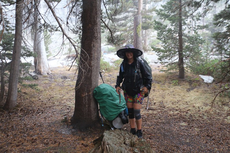
In 2020, there were no reliable shuttles between SEKI and Lone Pine, and hitchhiking was out of the question, thanks to Covid. So we took two cars, and drove both cars six hours to SEKI from San Diego (dropping one off at the trailhead), then drove the other car another six hours to Horseshoe Meadows. We had plenty of extra time, so we spent two days at the trailhead, camping and day-hiking at 10k feet in order to get Vicki's lungs well on the path to acclimation. This trip was never planned to be a Suffer-Fest, after all.

Vicki poses with the Parker Group of Giant Sequoias after dropping off her car

We spent two nights at the Cottonwood Pass Trailhead, acclimating to elevation
Day 1: Cottonwood Pass Trail to Chicken Spring Lake
We left the parking lot at dawn, hiking 4.7 miles and climbing 1400 feet to the lake. I've hiked this trail before, but Vicki hadn't, and we enjoyed it quite a bit. There was no snow at all at Cottonwood Pass in August in the dry year of 2020. After lunch at the pass, we hiked another mile to Chicken Spring Lake and set up camp. Vicki had a bit of a headache up there at 11,300 feet, but her lungs seemed to be doing well, and that's what really mattered. There weren't many people camping that night, either, which was nice, as most of the (greatly reduced numbers of) PCT thru-hikers were far north of California by that time.
Weather-wise, that afternoon a thunderhead built up over Whitney, but we only received a couple of drops and heard some distant thunder, so all was well.
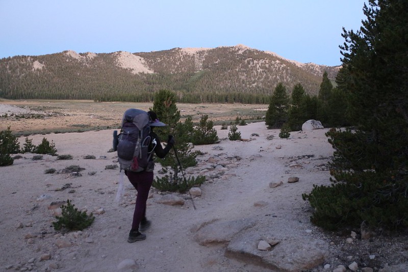
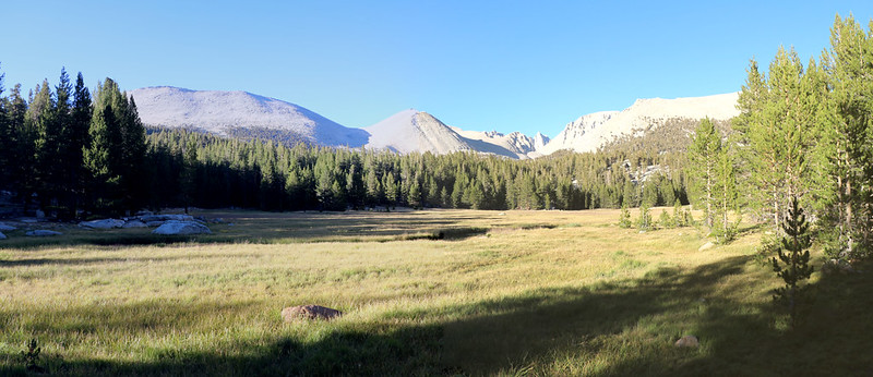
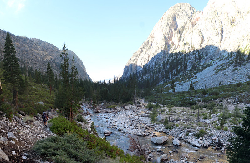
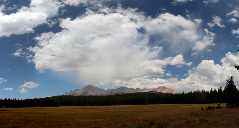
Peak 11620 across Horseshoe Meadows as we hiked west on the Cottonwood Pass Trail

Me and my big vintage backpack at the intersection of the Cottonwood Pass Trail and the Pacific Crest Trail

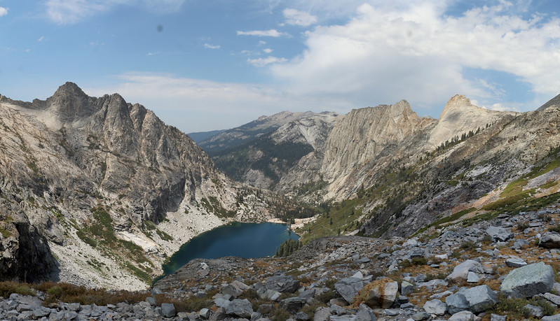
Panorama view of Chicken Spring Lake
Day 2: Chicken Spring Lake to Rock Creek
We hiked 9 miles and dropped 1900 feet, down to 9600 feet elevation, and this made Vicki happy, even though it was one of our longest days on the trail. We were pretty whupped by the time we reached the creek, and we camped a half mile short of the main camp, closer to the ranger station than the creek crossing. After dinner we went and visited the backcountry ranger, who was in residence at the time. He'd spent the last day or two in the Miter Basin checking hiking permits. We all agreed that 2020 was a very strange year to be out in the wilderness, and he gave us advice about the water supply on the following day's hike. He was a nice guy, and very friendly.
There was a smattering of puffy clouds that day, but no thunderstorms happened at the Sierra Crest, which was fine by us. Fine hiking weather.
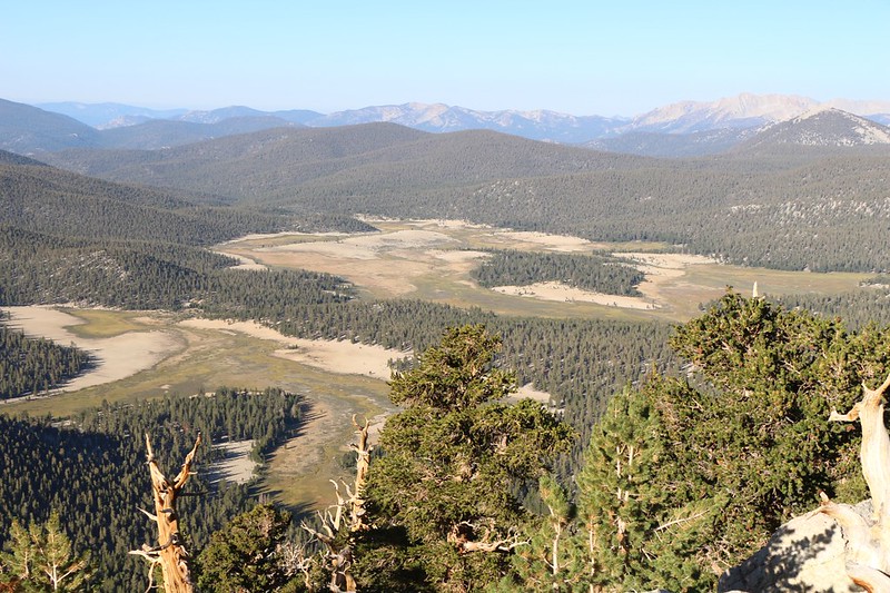
Big Whitney Meadow from the Pacific Crest Trail north of Chicken Spring Lake
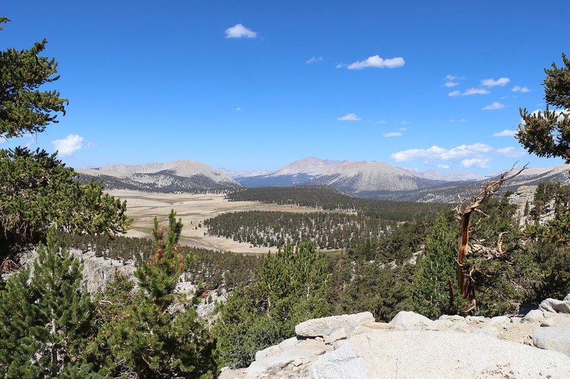
Looking west over the Siberian Outpost toward Mount Anna Mills, Mount Kaweah, and Mount Guyot
Joe Devel Peak, the Miter Basin area, and Mount Langley

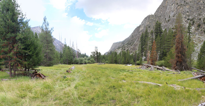
Grassy meadow near Rock Creek where we found a great campsite under some trees
Day 3: Rock Creek to Crabtree Meadow
We hiked six miles total, climbing 1400 feet to Guyot Pass and descending 600 feet, and arrived at lower Crabtree Meadow where the PCT crosses Whitney Creek. We knew the day's ascent was going to be tough for Vicki, so we left camp at dawn and hiked in the cool of the morning. We're morning people, I guess. We got there just after noon, and hung out watching several deer out in the meadow. As we had extra time, we even did a bit of laundry, hoping to rid ourselves of the stink of our hiking clothes. We also had a view of Mount Whitney itself, and Vicki rejoiced that she wouldn't be climbing it. Ever. She's stubborn that way.
It was a cloudless day, and the threat of afternoon thunderstorms had diminished for now. I like puffy cumulus clouds for photos, but not for getting wet. I also like them for shade, but we hadn't gotten any that day.

As we climbed higher, north of Rock Creek on the PCT, we could see Mount Anna Mills to the southwest

Mount Guyot from Guyot Flat, north of Guyot Pass
Late afternoon panorama view east over Crabtree Meadow toward Mount Whitney and neighboring peaks
Day 4: Crabtree Meadow to Wallace Creek
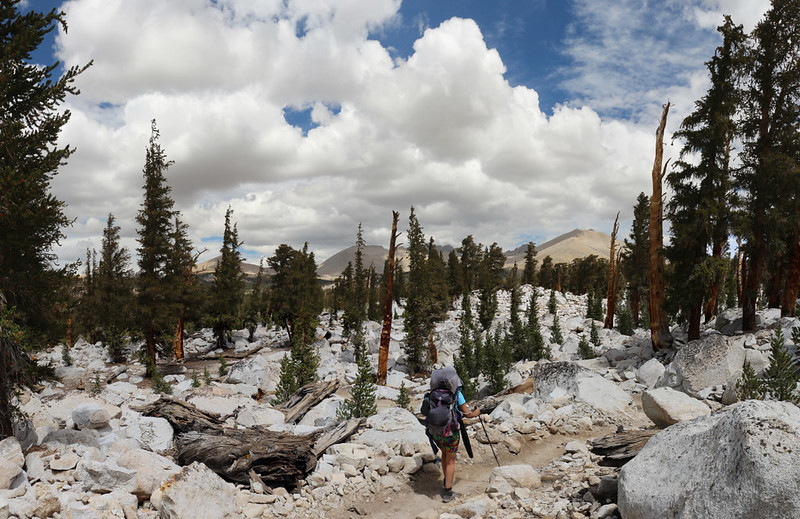
We hiked a whopping four miles and ascended/descended about 900 feet, making this the easiest day of the entire 11-day trek. I had originally planned the hike for ten days, skipping this stop entirely, but Vicki intervened and insisted on staying here. Ten days of food is heavy enough, I argued, and nearing the limits of what can be stuffed into bear cannisters, but it didn't matter to her. In fact, it turned out that I had been carrying BOTH large bear cans (to alleviate her suffering) ever since Chicken Spring Lake! Believe me when I say that you don't want to know how heavy my big external frame pack (circa 1972) was, but it weighed in at well over sixty pounds! I still feel that it was worth it in order to get my wife to come backpacking with me, but it surely took a toll on the skin over my hip bones. My only consolation was that it would be getting lighter every day.
The weather was changing. There had been clouds in the sky from the very beginning, and by the end of the day there were dark clouds massing, and we heard the rumbling sounds of thunder off to the east. Whitney was making its own weather, as usual. But we stayed dry in camp. It appeared that the weather pattern was entering a new phase, but there wasn't much we could do about it, being four days away from the car.

Panorama view west over Sandy Meadow. What a beautiful spot!
Mounts Tyndall, Versteeg, Williamson, and Barnard in the distance to the northwest

We found a nice spot to camp on the north side of Wallace Creek, as the south side was very crowded with JMT hikers.
Day 5: Wallace Creek to Kern Canyon near Whitney Creek
This day was one of the best days of the trip, and it was also the beginning (or ending) of the official High Sierra Trail. We ended up hiking seven miles, and dropped 2600 feet in elevation, descending into Kern Canyon, otherwise known as the Kern Trench. It isn't as deep as the Grand Canyon of the Tuolumne, but it's impressive just the same. I was expecting that the trail along Wallace Creek would be relatively boring, hidden down in a steep canyon, but no. The trail stayed up high along the canyon wall, and the views were excellent the entire way down! We were seriously stoked. At first we could see the entire Kaweah Range to the west, and as we got lower the view shifted to look all the way down (and up) the canyon with its shear and glaciated granite walls. Very impressive!
The temperature rose as we dropped down below 8000 feet elevation, but at least the clouds were building so that we might hope for a bit of shade. And we found plenty down at the wide, flat bottom of the canyon, where there were huge pines. We took a break at Junction Meadow, where I had planned to camp, but Vicki was feeling good and asked if we could continue onward a few more miles to the spot where Whitney Creek entered the Kern River. It would make tomorrow's long hike that much shorter. Vicki? Asking for more mileage? I agreed instantly. This was too good to pass up. It took us another hour or two, but we found a nice camping spot near the creek.
Naturally, it started to rain as soon as we were ready to set up camp. It was mainly just a sun shower, but we still had to put on some raingear and wait it out. We didn't see any rainbows, but that was OK, and soon we had the tent set up and all was well.
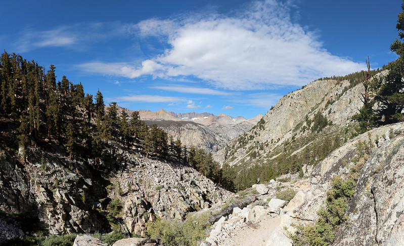
View down Wallace Creek on the High Sierra Trail with the Kaweah Peaks Ridge in the distance to the west
Panorama view across Kern Canyon from the High Sierra Trail above Wallace Creek

We finally reached the tall trees in the bottom of Kern Canyon on the High Sierra Trail

Our tent and campsite down in Kern Canyon near Whitney Creek
Day 6: Kern Canyon descent to Funston Meadow via Kern Hot Spring
Thanks to Vicki's extra energy yesterday, we only had to hike eight miles and descend another 1200 feet. Easy. Just the same, we woke up extra early and started hiking a bit before dawn. We knew that it would be hot that day, down there below 7000 feet elevation, and we wanted to set up camp before the rain this time. We also wanted to spend some time at Kern Hot Spring. And it all worked out perfectly.
Kern Canyon runs north-south, so we had plenty of shade for several hours, hiking in the shadow of the towering cliffs. But eventually it got hot and sunny. And it was plenty toasty at noon when we arrived at the Hot Spring. Just the same, we ate our lunch and enjoyed the area thoroughly. It was too hot for a full bath in the cement tub (very hot water) but there was a cooler pool down in the riverbed where the temperature was perfect for a relaxing bath. And boy, did we need one! We didn't use soap in the river, of course, but we still felt (and smelt) a whole lot better.
After that we hiked down to Upper Funston Meadow and set up camp in what normally would be a "Stock" camp for horse packers, but 2020 had almost completely stopped the use of horses in the wilderness, so we had the place to ourselves. I'm not going to say we were sorry. I often wish that there were no horses in the wilderness, but that topic is not a part of this trip report.
We did our laundry (to match our clean bodies) while the sun was shining, and it dried rapidly on the line. Soon the puffy clouds that were drifting up from the south began to join forces and become dark, menacing thunderheads. We felt a raindrop and heard some thunder, then hustled to take in our laundry and put everything under the vestibules of the tent. We hunkered down inside and enjoyed the storm, which had plenty of flashes of lightning. The rain turned into pea-sized hailstones and pounded our tent incessantly for almost thirty minutes. It was impressive! But we stayed warm and dry and that was what mattered.
View down Kern Canyon toward the narrows with the Kern River down below

We arrived at Kern Hot Springs on the Kern River in Kern Canyon

Vicki in the warm rocky pool at Kern Hot Springs
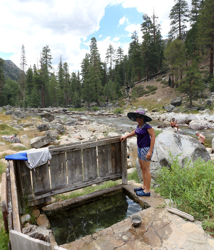
The cement bathub at Kern Hot Springs, with the Kern River flowing by down below
The view looking south over Upper Funston Meadow near our campsite
Day 7: Funston Meadow to Moraine Lake
This day was the toughest day of all, where we had to make up for our insane folly of having descended into the Kern Trench. "What hikes down must climb back up," as the saying goes, and this was the big day. Six miles and over 2600 feet of climbing! Yes, this was Vicki's day of dread and doom. I even volunteered to carry every last bit of food to make her pack lighter. And it worked!
We woke up at 3am and started hiking at 5am, in the pitch black night, using our headlamps. It was nice and cool at that hour, and Vicki got almost all the way up the switchbacks before the sun hit us. We continued onward while it was still cool, but eventually had to slow down for extra breaks on the Chagoopa Plateau as the day progressed.
After a couple more miles we made it to the Moraine Lake Trail and left the HST. This trail is known as the "High Sierra Bypass Trail" and I highly recommend that it be taken if you have a chance. It's only a tiny bit longer and you get to visit a High Sierra lake! It's a No-Brainer. We also got to stop at Sky Parlor Meadow and see Mount Kaweah across the way.
More and more clouds continued drifting north as we hiked. We even got a sprinkle of rain at the meadow, which made us hike even faster. We wanted to get our tent set up before what was obviously going to be a thunderstorm. It was inevitable. In fact, it was already storming constantly to the west, out over the Great Western Divide. No thanks! We made it to the lake as it began lightly raining, and we found a spot for the tent. We put it up as fast as possible during a short break in the clouds and got everything inside it right away. Including ourselves. Just in time! Once again, all heck broke loose, with lightning and thunder and hailstones. The air got freezing cold during the hail, and we had to put on our extra layers. It was an impressive storm, which subsequently broke up in typical Sierra Style as sunset approached.
This happened on August 16th, 2020, which turned out to be the dreadful day that started the terrible California Wildfires of 2020. But we didn't know anything about that, of course. We were just happy to be dry and warm.
By the time the sun rose, just after 6am, we were already high above the floor of Kern Canyon

Mount Guyot to the east as we climbed onto the Chagoopa Plateau
Panorama view north toward Mount Kaweah over Sky Parlor Meadow from the High Sierra Bypass Trail

Hailstones covered the ground in our campsite at Moraine Lake

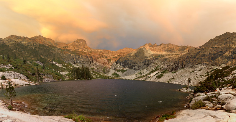
By 6pm the thunderheads had mostly broken up, leaving pretty clouds over the surface of Moraine Lake
Day 8: Moraine Lake to Big Arroyo Camp
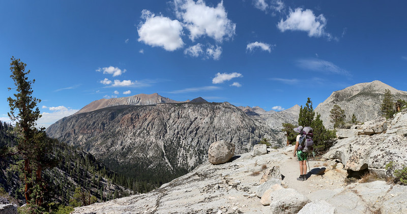
We hiked 7.5 miles along the southeast side of Big Arroyo, climbing 1300 feet and descending 1100, which was a fairly average day of hiking. The views along the trail were anything but average, however. Big Arroyo was nearly as deep as the Kern Trench. After a great viewpoint, the Bypass Trail rejoined the main HST near some expansive meadows, then headed back for more views along the rim of the canyon. As Big Arroyo Creek climbed upward, the trail eventually headed downward, and the Big Arroyo Camp was located at the intersection.
Once again, we almost made it there in time to beat the day's round of thunderstorms. It didn't rain on us all that much while hiking, and we noticed that most of the action was out to the west once again, over the Great Western Divide. We knew that we would be crossing the divide tomorrow, but we'd worry about that later. Meanwhile, after hiking into camp under our ponchos, we got the tent set up and enjoyed the rest of the day. It was odd that the storms were heading north once again. Normally, they head east or northeast toward the Sierra Crest, and don't behave like this. It turned out that they were the remains of Tropical Storm Fausto, and this became the second deadly day for California, which logged nearly 11000 lightning strikes and started 367 separate wildfires!

Panorama view west over Big Arroyo from the viewpoint north of Moraine Lake on the High Sierra Bypass Trail

Panorama view of Mount Kaweah from the High Sierra Trail on the Chagoopa Plateau

North Black Rock Pass Peak, Mount Eisen, and Lippincott Mountain over Big Arroyo

It was only 2pm but the afternoon thunderstorms had already started as we neared Big Arroyo Camp
Day 9: Big Arroyo Camp to Upper Hamilton Lake
This day was, without a doubt, both the best and the worst day of the entire trek! We hiked eight miles, climbing 1100 feet up to the Kaweah Gap, and descending 2500 feet down to Upper Hamilton Lake.
Once again, we packed up in the dark and started hiking at dawn. We wanted to climb while it was cool, and also make it into camp before the thunderheads (if any) developed. The sun hit us by the time we made it to the gap, but there was enough overcast that we didn't suffer much from the heat. After a rest, we continued onward, heading downhill on what can only be called the most beautiful section of the High Sierra Trail.
First stop: Precipice Lake. There are thousands of photos of this lake in the internet, and none of them truly do it justice. Maybe there's simply too much to take in. And even though we just had a break at the Gap we decided to take another one right there. Vicki even took a dip in the lake! I thought she was nuts, but she said it wasn't too cold.
Then we continued downhill and came upon one of the most jaw-droppingly awesome views I have ever seen: The Hamilton Lakes Basin. Upper Hamilton Lake was a deep blue gem in the basin's bottom, while towering walls of glaciated granite were all around us. And across the way was the legendary Valhalla, the granite monolith known for both Angel Wings and Cherubim Dome. White puffy cumulus clouds made it utterly picturesque. I must've taken hundreds of photos as we continued hiking down toward the lake, following the amazing trail, which must've been blasted by dynamite into the side of the bowl. Continuous, non-stop views! It was excellent. We even got to hike through the famous tunnel, which I hadn't realized was along this section.
The clouds began growing and drawing closer together. We saw virga below the dark cloud bases high above us at Precipice Lake, and we hoped the folks we met heading up there were doing OK. We hiked faster, trying to beat the rain and get our tent set up, but the trail had hidden switchbacks and was much longer than we thought. We put on our raingear and plodded onward as it rained heavily. Soon, everything was wet. The wind gusted erratically and my cheap poncho was rendered almost useless, so that I felt like Marilyn Monroe above the air vent. Still we marched on. We crossed the creek below the lake and found a stand of trees to hunker down beneath. The temperature dropped as it commenced to hail, and the thunder was impressive. Some of the people that were hiding in their tents had to jump out and relocate them, as deep puddles began forming underneath, threatening to soak all of their gear. Take this advice: NEVER pitch your tent on a perfectly flat spot unless you know it won't rain. Those perfect spots were formed by sand being washed down by the rain! We waited for nearly a half hour and finally the rain got light enough that we decided to set up our tent. By then we were getting a bit hypothermic, but there was only one cure: Dry clothing and getting ourselves out of that freezing wind. And that's what we did. Soon we were happy and warm.
After that, the clouds began breaking up, but the strong east wind remained. It was so strong that there were whitecaps on the lake! Pretty soon everybody in camp was hanging their stuff out to dry, and that wind was a true marvel. Everything we owned was dry within an hour. And to top it off, a long-lasting rainbow formed up above near Mount Stewart, and soon everyone was outside taking selfies and having a great old time.
What a day! It was the best, the worst, and everything in between. I wouldn't trade it for anything.

Looking north from Big Arroyo toward the Nine Lake Basin with Kaweah Gap (far left)

Panorama view north from the trail just below Kaweah Gap

Panorama view of Precipice Lake and Eagle Scout Peak

Panorama west from the High Sierra Trail over the small lake below Precipice Lake, toward Valhalla
Upper Hamilton Lake, our destination for the day, was far below us

View from the cleft, of the stone tunnel

Heavy rain, hail, and wind wet the boulders and created misty spray as we finally neared Upper Hamilton Lake
We took shelter from the hailstones under some trees in the campground
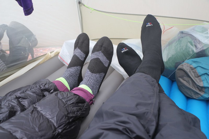
We put on our SealSkinz waterproof socks because our shoes were also completely drenched - Happy Feet!
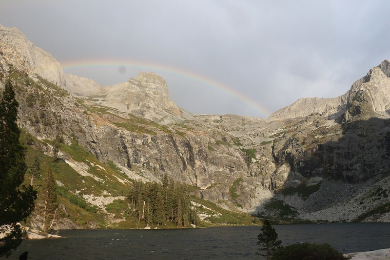
Shot of the rainbow over Mount Stewart and the whitecaps on Upper Hamilton Lake after the thunderstorm
Wide-angle panorama view of Upper Hamilton Lake, Mount Stewart, and Eagle Scout Peak as the storms broke up
Day 10: Upper Hamilton Lake to Nine Mile Creek
This was our second-to-last day of the trek. We hiked about seven miles and did a lot of up and down as we crossed several drainages, with a net descent of 800 feet. Once again, the heat was a factor as we dropped in elevation, but we didn't wake up early this time. We ate a normal meal, wished our neighbors good luck on the big climb to Kaweah Gap (we were one of the few people hiking east to west) and headed out in search of more spectacular views. And we found them!
For the most part, the trail was blasted into the sheer granite side of the Middle Fork Kaweah River valley, and we had a great time. We crossed a waterfall, a couple of wooden and steel bridges, and visited the Bearpaw Meadow High Sierra Camp, which was closed in 2020 for Covid. We ate lunch in the empty campground, then hiked onward.
As the afternoon grew late, we noticed that the cumulus clouds were once again building up to the east, over Kaweah Gap, and we were quite thankful to be hiking due west. We got a bit of shade once in awhile, but we were finally rid of the monsoonal moisture. Hooray! We set up our tent at Nine Mile Creek and went to sleep early, intending to head out before dawn.

Lower Hamilton Lake lies beneath Angel Wings, with Cherubim Dome on the far right
Panorama shot from the trail below the Hamilton Lakes looking down at the Middle Fork Kaweah River

The builders of the High Sierra Trail really had to blast away at the granite walls - quite impressive!
Wide-angle shot with the Middle Fork Kaweah River Valley (left) and Elizabeth Pass (right)

Hiking west above the Middle Fork Kaweah River Valley
The Bearpaw Meadow High Sierra Camp was not occupied in 2020 so we ate our lunch in peace

Buck Creek and the footbridge on the High Sierra Trail
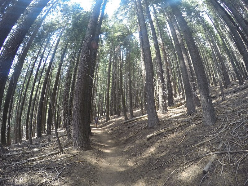
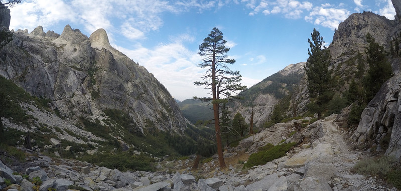
The HST entered another section of tall pine forest - it was quiet and shady and peaceful in there
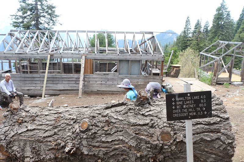
Day 11: Nine Mile Creek to Crescent Meadow
Once again, we woke up at 3am and started hiking in the dark, on this, our final day. Nine Mile Creek was aptly named, as we had about nine miles to get to our car, and mostly it was downhill, but not enough for Vicki. And we knew that it was going to be hot.
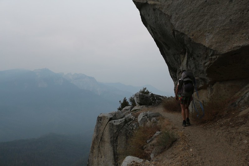
When we woke up in the dark we could smell smoke in the air, which didn't make us feel very confident. Had yesterday's lightning started a nearby forest fire? We didn't know. There was no one to ask. But we also realized that we had no choice but to continue hiking west. We didn't have enough food to head east! I checked out the map and there were a couple of alternate routes ahead of us, so we decided to play it by ear. Of course, it turned out that there were no fires nearby. Most of this smoke was from the CZU Lightning Complex near Santa Cruz, but there was no shortage of smoke from nearly every other wildfire. In fact, the entire state of California was inundated with smoke. But we didn't know that. The only thing we knew was that we wanted to get the heck out of there!
And thus we missed all the great views along this final section of trail, which I had hiked back in 1997 after descending via Elizabeth Pass. I still had my memories, but Vicki missed out on a beautiful section of the High Sierra Trail. Sorry, Vicki!
Our feet were hiking fast that day and we made the nine miles in record time, arriving at the car before noon. Like horses to the stable. We loaded our gear into the car and took a quick visit to see the General Sherman Tree, then headed down into town, where I had reserved a motel room for the night. Showers! Food! Civilization! It was great, and we enjoyed it as much as we could with all that smoke in the air.

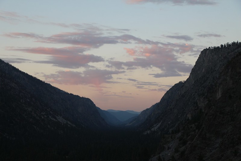
An hour after leaving, we were still hiking in the early light of dawn, with a smokey haze over the area
Wildfire smoke ruined our views on the final hike out to Crescent Meadow

Moro Rock appeared through the haze as we turned the final corner on the HST at Eagle View
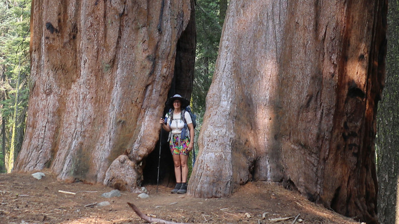
We arrived in the Giant Forest, with Vicki posing between two mighty Giant Sequoia Trees

We had a motel room reserved in Three Rivers, and we headed directly there for a shower and some normal food - Yay!
The following day we grabbed some breakfast in town, and headed south, east, and north, all the way around the Sierra Nevada. 250 miles versus 70 on the trail. It was a boring, hazy, six hour ride back to Horseshoe Meadows. Up at 10k feet elevation, there was a lot less smoke, but it was still present, ruining the views. In fact, the entire Owens Valley was full of smoke. We arrived at lunchtime, and decided that we'd rather drive another six hours to San Diego than stay an extra night up there in that lousy air. And that's what we did. It was a long day of driving but worth it, as there wasn't much smoke back home. And there's nothing like your own bed after a long trip.
So that ended our Big Trek of the Summer of 2020. Was it worth it? Oh, yes! We had a great time, and all of our gear came through with flying colors. We overcame a number of challenges, and turned what could have been a series of miserably stormy days into an epic and awesome experience.
GPS tracks can be viewed and exported from my CalTopo Page
LOTS more photos and videos can be found on my Flickr Page
Happy Hiking!
.


