
Day 1 (7/3) – My boyfriend and I took off after work with the plan to hike only a mile or two. We got to Lower Lamarck Lake and decided that was more than enough. Nothing much to report back from this short hike. The trail is clear to Lower Lamarck Lake, and the lake outlet is easily crossed (didn’t even get our feet wet) on a log jam right next to the lake. As was common for the entire trip, it was difficult to find a dry place to camp because the ground is so saturated. Bugs were semi-active. They would land on you if you stopped moving, but they didn’t seem motivated to bite.
Day 2 (7/4) – We lazed around camp in the morning for a while because I didn’t want to hit Lamarck Col too early when the snow was too firm. We ended up rolling out around 8 am, and that was great timing. The snow was perfect, crunchy styrofoam all the way up and provided a great bite for our microspikes. (Side note: I was fine for the entire trip in microspikes. No need for crampons.) The trail to the col was clear until the end of the steep switchbacks leading away from Upper Lamarck Lake. Then there was pretty continuous snow coverage all the way up. In addition to the final snow field up to the col, I think that there were about 3 or 4 snow fields that were steep enough to make me slow down and think carefully about my foot placements. But all had pretty mild runouts should you fall and none motivated me to switch from trekking poles to an ice axe. I found the final snow field up to the col to be surprisingly easy. It’s steep, and if you fall, you end up in a lake. However, there is an extremely deep and well-defined boot path leading up to the col. It’s like climbing a staircase. While a fall would be bad, you would have to work really, really hard to fall given the great boot path. I did use my ice axe for this final portion because, no matter how unlikely a fall was, I knew that stopping myself was a must if I were to fall.
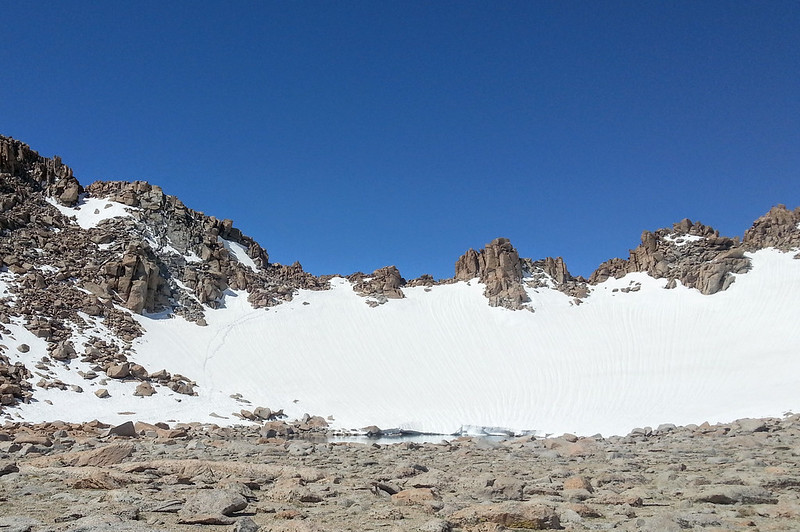
The final climb up to Lamarck Col. You can see the bootpath on the far left of the snowfield.
**Pausing here to provide a different perspective on the climb to the col** My boyfriend joined me for this first day of the trip, and he has pretty minimal snow travel experience. He said that he found the final climb to the col to be intimidating but doable. He also reported that some of the snowfield before the col that required a lateral traverse, rather than climbing straight up, to be pretty scary. He had his ice axe out almost every time we hit snow. I realize that I’ve been at this whole “walk around on snow in the mountains” thing for a long time, so hopefully this alternative perspective helps others gauge their comfort level.
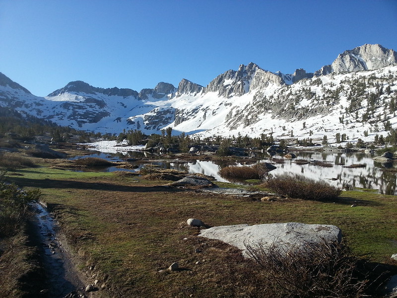
Now back to our regularly scheduled programming. From the top of Lamarck Col, I was shocked at how little snow I saw, and the first 1000 feet or so of the descent was snow-free! The snow became patchy one I hit the lakes in Darwin Canyon, which vary from almost completely melted out to almost completely frozen.
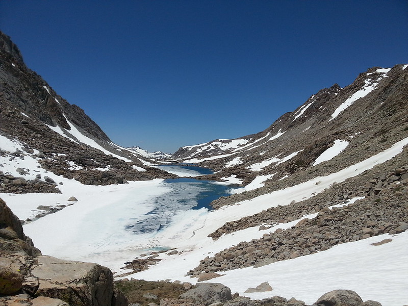
Looking down Darwin Canyon.
I was able to more or less follow the path of the summer trail along the lakes. When I hit a snow field near a lake, I would veer uphill to avoid the potential for the snow to calve off into the water. The snow fields around the lakes were shallow and easy to traverse until I hit the last lake. That lake had an all but vertical snowfield on its northern bank. I was not willing to traverse that, but thankfully, there is an easy way around. Just hike up the side of the snowfield until you’re almost at the top. You’ll then see a flat section of snow that allows you to walk across the top of the vertical part with very little danger (the flat part is easily 5 feet wide). That flat walkway deposits you on to a plateau that allows you to walk above the rest of the vertical snow field. I wish I got a picture of this, but you can’t miss it. It took me 5 seconds to look uphill and figure out the way around.
Once I left the lakes and started dropping into Darwin Bench, things got more interesting (read: miserable). The snow coverage was 100%, and it was awful, slushy, suncupped snow. There is zero sign of a boot pack (or any footprints, for that matter), so it was up to me to plow through slushy suncups for hours on end. The creek draining the lakes was also covered in rotten snow bridges and calving snowbanks, so I had to make sure to choose my path with care. After I passed the lake at Darwin Bench, the snow started to disappear, but I really struggled to follow the trail down to the PCT. I’d find it, lose it in brush or snow, check the GPS to figure out where I went wrong, thrash through brush and rocks to get back to the trail, and then repeat this pattern all over again. I finally made it to the PCT, where I immediately ran in to a ton of people headed north. Everyone advised that I should camp ASAP because the snow started again in about half a mile. I was more than happy to oblige given how exhausted I was after Darwin Canyon.
Day 3 (7/5) – The PCT hikers I talked to the night before told me that I could expect snow from Evolution Lake until about 3 miles south of Muir Pass. I got a very early start knowing that firm morning snow would make this long stretch of snow much more pleasant. Thankfully, there is a very well-defined boot path through Evolution Basin, over Muir Pass, and through the top part of Le Conte Canyon. Without this boot path, I’d probably still be somewhere in Evolution Basin stumbling over suncups.

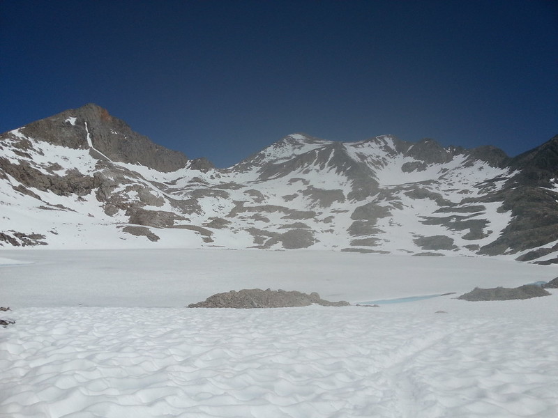
A very frozen Evolution Basin, complete with the incredible boot path.
One important note is that the boot path goes on the west side of Evolution Lake (the summer trail goes on the east side), presumably so that you can avoid crossing the Evolution Lake inlet stream. I didn’t realize this until I was about halfway along the east side of Evolution Lake. It wasn’t a huge mistake because the inlet stream was easily crossable at the standard summer crossing, but it was annoying because the boot path on the east side was much better defined than the boot path on the west side. If you’re traveling north on the PCT, it’s very easy to see that you should continue on the west side, but if you’re traveling south, it’s easy to make the same mistake that I did.
As far as the rest of Evolution Basin is concerned, there's nothing to do but follow the boot path and slog your way up Muir Pass. The descent into Le Conte Canyon was a bit more interesting. The winter route bears very little resemblance to the summer trail, and you have to have blind faith in the fact that it’s going to take you where you need to go. Occasionally, it looks like it’s going to take you to some pretty crazy places, but don’t question it! There are a few sections of the route through Le Conte Canyon that were similar to Lamarck Col in that there was a lot of exposure but a very secure and deep boot path.
Upper Le Conte Canyon. Just as frozen as Evolution Basin.
As I was headed down Le Conte Canyon, I met a guy who was doing my exact trip in reverse. We spent a while exchanging information, and to my great dismay and surprise, he informed me that the bridge across the upper crossing of Dusy Creek was washed out! This sent my anxiety level to about 1,000% because that upper crossing of Dusy Creek would for sure be impassible without the footbridge. The creek is a full-on waterfall at that point. If I couldn’t cross that, I wasn’t getting home. He told me that he had made it through by scrambling down the rocks next to Dusy Creek and reported that it was a horrible bushwack and sketchy scramble. I thanked him for this info, but also questioned its accuracy. I hadn’t heard anything online or from the rangers about that footbridge being out, and given how popular the route over Bishop Pass is, I figured that I would have heard something.
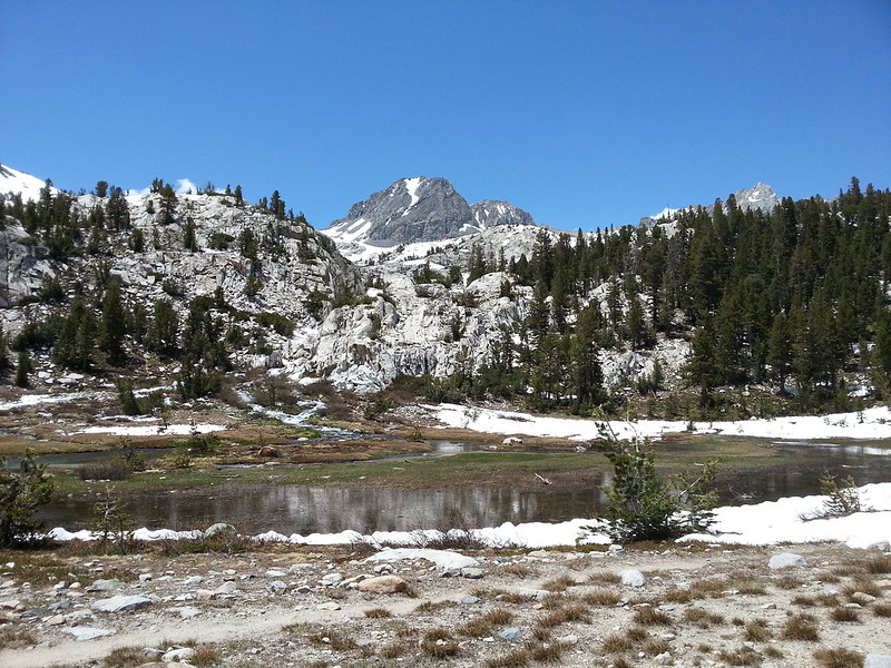
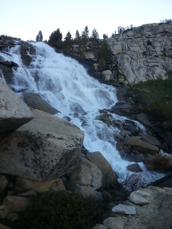
You rejoin the summer trail in Le Conte Canyon where the trail crosses over to the north side of the Kings River just below 11,000 feet. This crossing is easy, and you finally start to see some trail! This is also the first place where it would be feasible to camp since Evolution Lake, assuming that you don’t want to camp on snow. Around 10,000 feet, I finally got truly clear trail and enjoyed the cruise down to the junction with the trail to Dusy Basin. Le Conte Canyon is absolutely beautiful this time of year. The waterfalls were roaring and I saw tons of deer in the meadows.
The views were pretty great in lower Le Conte Canyon.

And just got better.
I hit the junction with the trail to Dusy Basin and Bishop Pass around 3:45. I was planning to take a long break there before starting the climb up the switchbacks, but the mosquitos were horrible so I continued on. I tried to stop in at the ranger station to see if there was any intel on the supposedly washed out bridge, but the ranger was out on patrol. I headed up the hot, dry switchbacks and made camp in the woods after the first set of switchbacks. Needless to say, after being told that the footbridge was washed out, I did not have a particularly relaxed evening in camp. All I could think about is what I would do if I couldn’t get across that upper crossing.
Day 4 (7/6) – I woke up super early, too wired about the footbridge issue to sleep anymore. I was on the trail around 5:30 am. The lower crossing of Dusy Creek was waist deep and very swift at the trail, so I bushwacked about 100 feet upstream, where I was able to chain together a series of about 5 crossings, none of which caused me to get wet past my ankles. It was just a lot of scrambling and bushwacking. If you’re coming down the Dusy Basin trail, there are two carins marking where you should leave the trail for this upstream crossing. If you’re going up the trail like I was, just start scrambling upstream once you hit the trail crossing.
I then started marching uphill to see what lay in store for me at this footbridge. To my immense relief, the bridge was not washed out!!! I repeat: THE BRIDGE OVER THE UPPER CROSSING OF DUSY CREEK IS STILL THERE AND AS SOLID AS EVER. I have no idea how on earth this other hiker missed the bridge. He seemed like a nice guy, and I have no reason to believe that he would purposefully pass on incorrect information. But how do you mistake something like that? It was all very odd, but thankfully, I was able to relax for the first time in about 16 hours.
Dusy Creek right after the upper crossing. You can see a tiny corner of the most definitely not washed out footbridge in lower right hand corner.
The trail through Dusy Basin was clear but very wet until about 11,000 feet, when the snow became so continuous that I gave up on trying to follow the trail and started navigating my own way to Bishop Pass. Like Darwin Canyon, the snow was extremely suncupped with no footprints or boot path to speak of. The last bit of the climb to Bishop Pass was melted out and I was able to rejoin the summer trail for about the last 500 feet of the ascent.
Dusy Basin is starting to melt out...sort of.
The descent down Bishop Pass was the most technical part of the trip. It started out easy enough, but then I hit those steep switchbacks just below the pass. The top part of the switchbacks were completely snow covered and required a steep descent that had me plunging my ice axe before each step and gripping it very hard. The lower part of the switchbacks were melted out enough that you could see the outer edge of each switchback but not so much that you could walk on them. This semi-melted state also meant that you had an unpleasant combination of exposed scrambling with occasional patches of rotten snow. I opted to stick with as much rock as possible for this lower part, and I would rate the descent as stiff class 2.
After that scramble, it was an easy hike out to South Lake. Being the Saturday of a holiday weekend, the trail was a zoo and provided endless “what on earth are these people thinking” entertainment. In no particular order, I observed:
- A girl with an overnight pack wearing red pleather boots with lots of decorative buckles, faux fur sticking out the top, and a 2 inch heel. I can only assume that someone advised her that she needed boots for backpacking, and those were the boots in her closet.
- A couple with a baby in a Kelty carrier that was asking me for info on the best way to climb the pass. When I described my experience, they grumpily told me that I had just ruined their trip with that news. Gee, so sorry that I can’t melt the snow for you.
- A man wearing crampons and carrying his ice axe in his hand about .5 miles from the parking lot. You know, just in case a sheet of ice pops up out of nowhere on absolutely dry trail.


