
You can read the whole thing over on my blog as well. This early-season training trip ended up being just 10 miles +4,900ft/-1,650ft due to me bailing because of the conditions.
I had a good 9 days between the last day of instruction and when my final exams were scheduled, so even with a few days for review sessions and extra office hours, I still had plenty of time to head off to the woods to shake the winter off and train for more involved trips later in the summer. Typically, I head up to the Trinity Alps (1, 2) during this time, but with the big winter we've had here in 2019, there aren't many great options up there around this time, so instead I headed to Yosemite. I usually try to avoid Yosemite Valley, especially in the spring, since it's so full of people, but wow, this trip has shifted my perspective. Dare I say that I may even have become an early-season valley enthusiast? Indeed, I have, though the conditions definitely made me change my plans and provided copious amounts of both adventure and solitude---being the only person at Taft Point in the middle of the day when the waterfalls are raging? Yes, please!
Day 0
Oakland to Yosemite Valley
Did you know you can hop on a train in Oakland with your pack and get all the way to one of the most beautiful mountain ranges in the world, without driving yourself at all? I've done this a couple of times before, and with my planned route requiring hitchhiking and with it being Yosemite Valley's peak visitor season, I decided to forego my own car and take Amtrak and YARTS. I arrived in the valley around 1:30pm on Saturday, May 11 and headed straight for the Wilderness Permit Office. I had a permit to start hiking on Monday, May 13, but hoped I could swap it out for a Sunday start. Indeed, no other idiots wanted to hike three thousand vertical feet straight out of the valley only to meet snow-covered trails, so I was good to go!
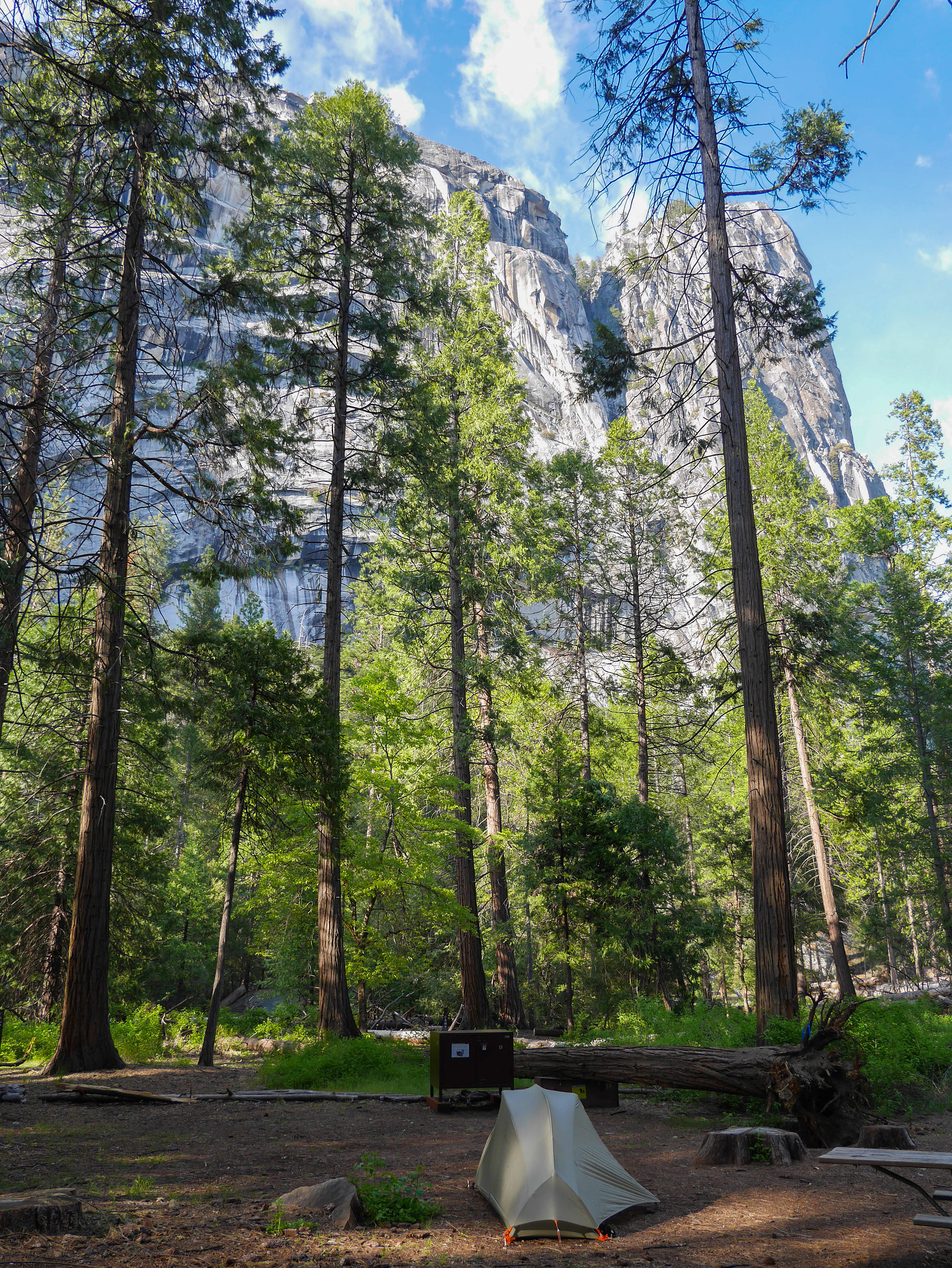
After securing my permit, I bought a can of sparkling wine (which is a thing humans managed to make exist now, bless), and walked from the Visitor Center are over to the Backpacker's Campground. With your backcountry permit you get to stay at the Backpacker's Campground for $6 per night, one night directly before and one night directly after your trip. The campground is located north of the North Pines campground, which floods in the early season, so be prepared to walk a bit if this is your planned accommodation. (We're here to walk anyway, right? Hiking is walking. Yep. Hiking is walking. Sex and the City taught me that.)
I set up my tent and cracked a can of sparkling wine. I read for a bit and then decided to head out to Mirror Lake a few hours or so before sunset. The lake (which completely disappears after peak snowmelt) lived up to its name.

There were a few people out and about around Mirror Lake, and one **** impossible woman asked "You look like you know what you're doing---what's the fastest way back to the Majestic Hotel from here?" You and I know that the Ahwahnee only got renamed that after a concessioner trademarked the names of a bunch of Yosemite landmarks in an abominable act of extortion. And only an ******* would use the names we were forced to adopt after that vindictive act of capitalism occurred. But anyway, I pointed her along a path and before taking off she said "This place isn't worth it. This lake, it's whatever. It took us forever to get here! I think the mileage signs are wrong. We're fast walkers and it took us 2 hours to walk here!" l m f a o
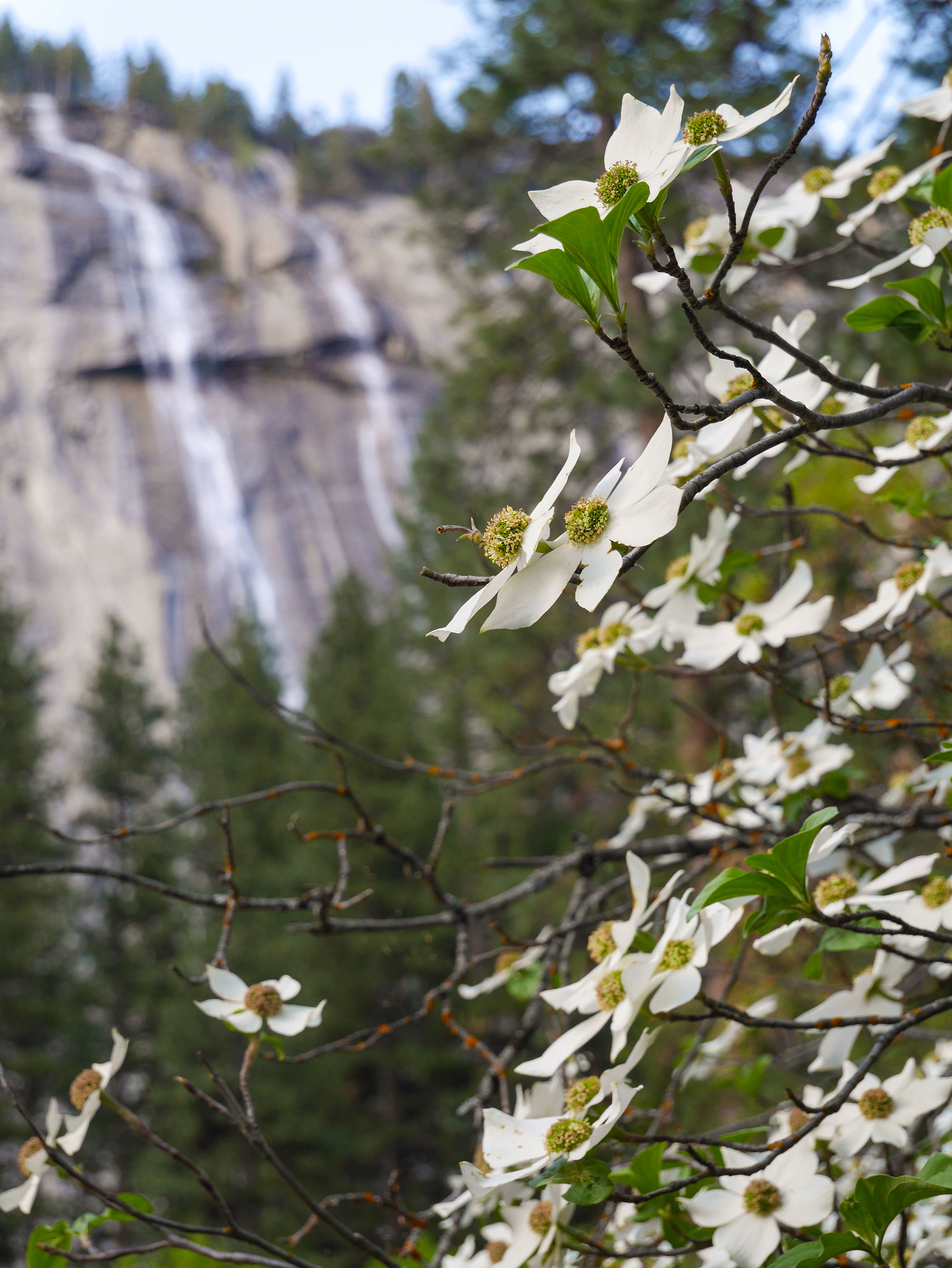
Anyway, I walked back on my own, just freakin marveling at the Valley in its spring splendor. I walked past the backpacker campground where my tent waited and headed to the nearest spot for dinner, which when North Pines is closed happens to be the Ahwahnee. I grabbed a table in the bar to have a salad and a glass of bubbly. The dogwoods near the hotel were in full bloom, and seasonal waterfalls tumbled down the smooth granite walls just north of the hotel. It was divine.
I walked the half mile back to camp and found the Saturday night scene at the Backpacker's Campground to be pretty bustling! I wanted to hang out by a fire, but felt bad about making one just for myself, so I invited myself to a nearby fire ring and was luckily not politely asked to leave. In fact, Nate and Eve (hi if you ever happen to read this!) were so super friendly and welcoming, and gave me some beta on the trail up the Merced! Thanks new friends xoxo
Day 1
Yosemite Valley to Tunnel View to Crocker Point
4mi, +2,900ft/-300ft
I woke up, packed up, and walked to the free valley shuttle stop at the Ahwahnee. My plan was to take it as far west as I could and then to hitchhike to Tunnel View.
 [/url]
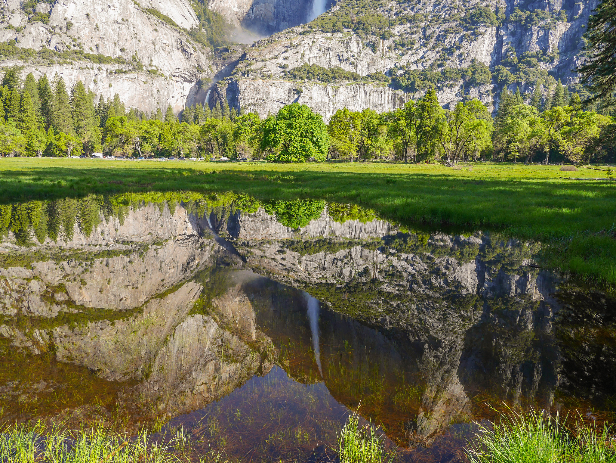
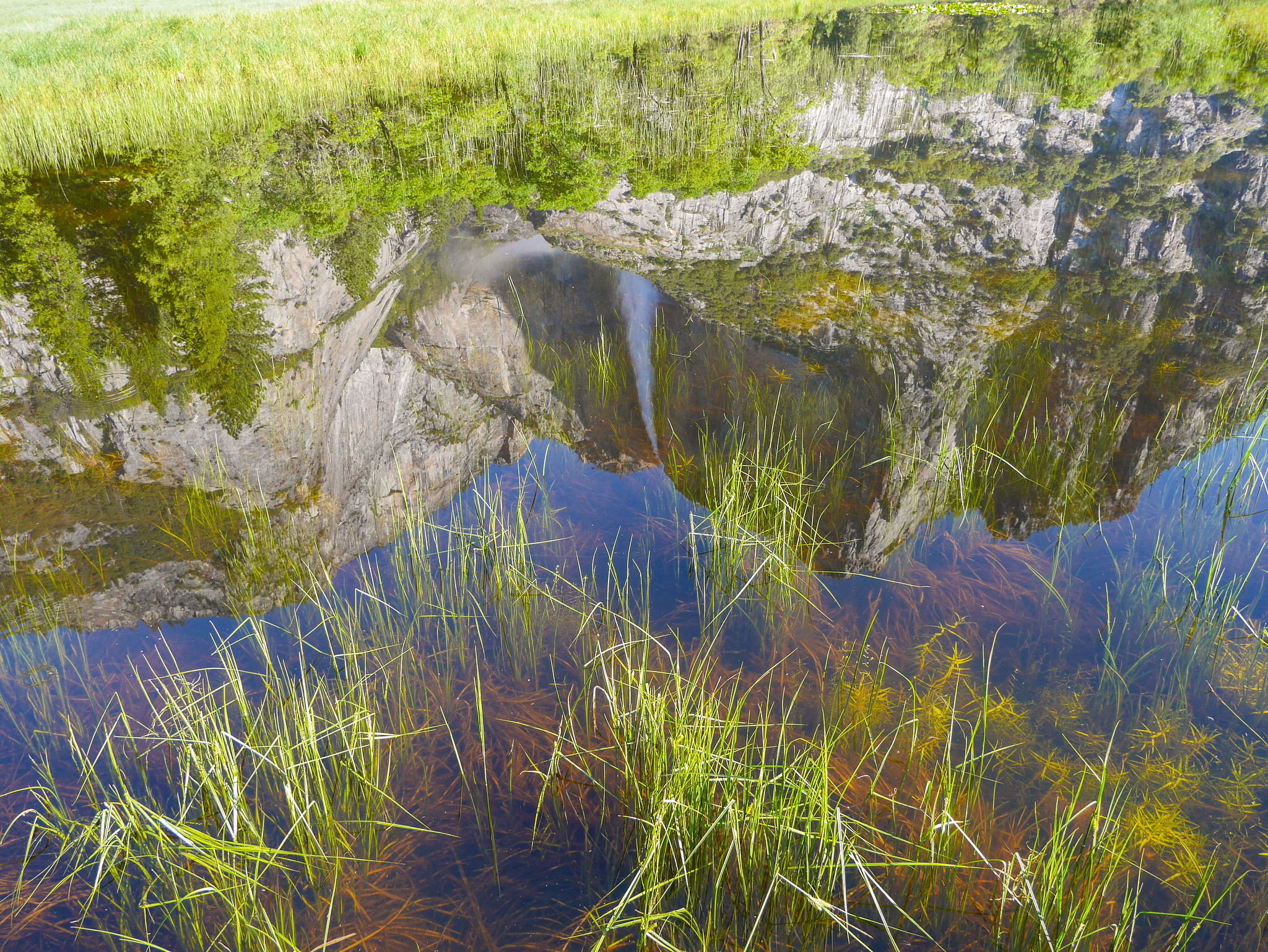
I hopped on the shuttle, planning to ride it over to the Chapel stop. But when I got off near that stop, I realized that the road is one-way there and I in fact needed to be on the northern of the two roads in the valley. Oops! This provided me a serendipitous viewing of Yosemite Falls and its reflection in the marshy swamps of the valley.

I stuck my thumb out for about 5 minutes near the Yosemite Falls parking lot before getting picked up by a friendly 60's-ish guy and his brother in a sedan. They took me as far as a meadow near El Cap where they wanted to stop to watch climbers. I thought that for sure at this junction the road on the south side of the valley was two-way, so I walked over there only to find that it wasn't! I walked back again to the meadow and stuck my thumb out for a few more minutes. Eventually a friendly young 20's dude named Jake (iirc?) pulled over in his pickup. I threw my pack in the back and hopped in. He was headed back out to Fresno to pick up the rest of his church group, who would be spending the summer in the valley hosting free services in the campgrounds. Bless? I guess?
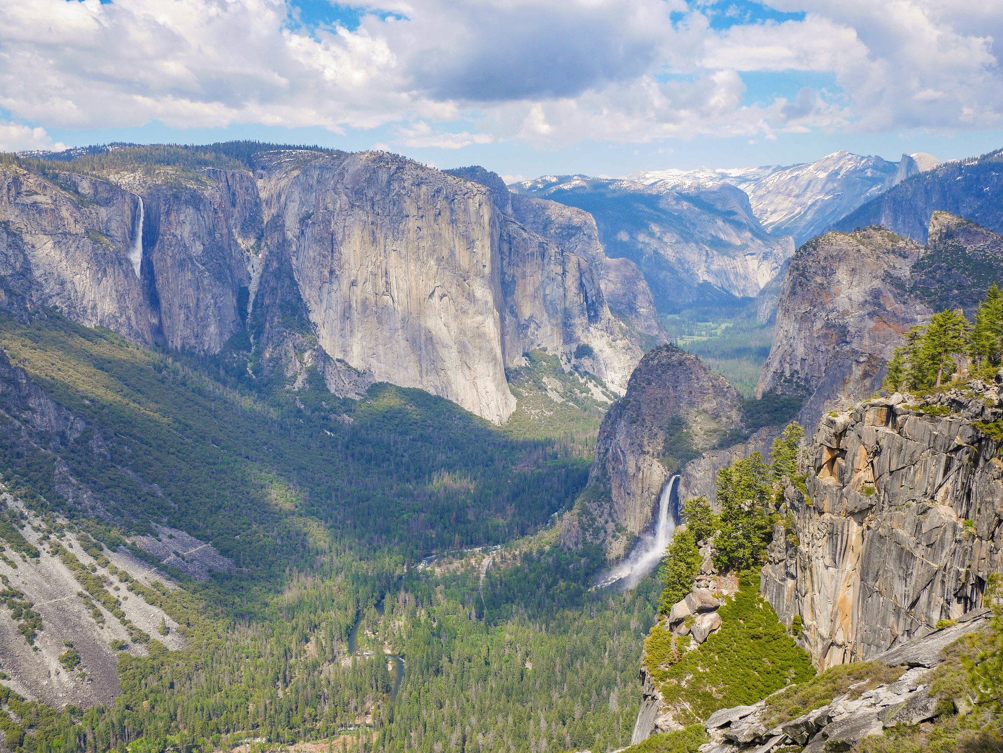
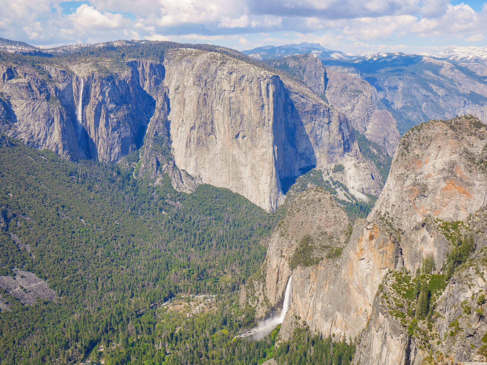
By 10am I was headed up the Pohono Trail from Tunnel View. The trail just goes basically straight up, gaining about 1,000 ft per mile.

It is frequently in the woods, but offers better and better views of a vista similar to Tunnel View as it ascends to the South Rim.
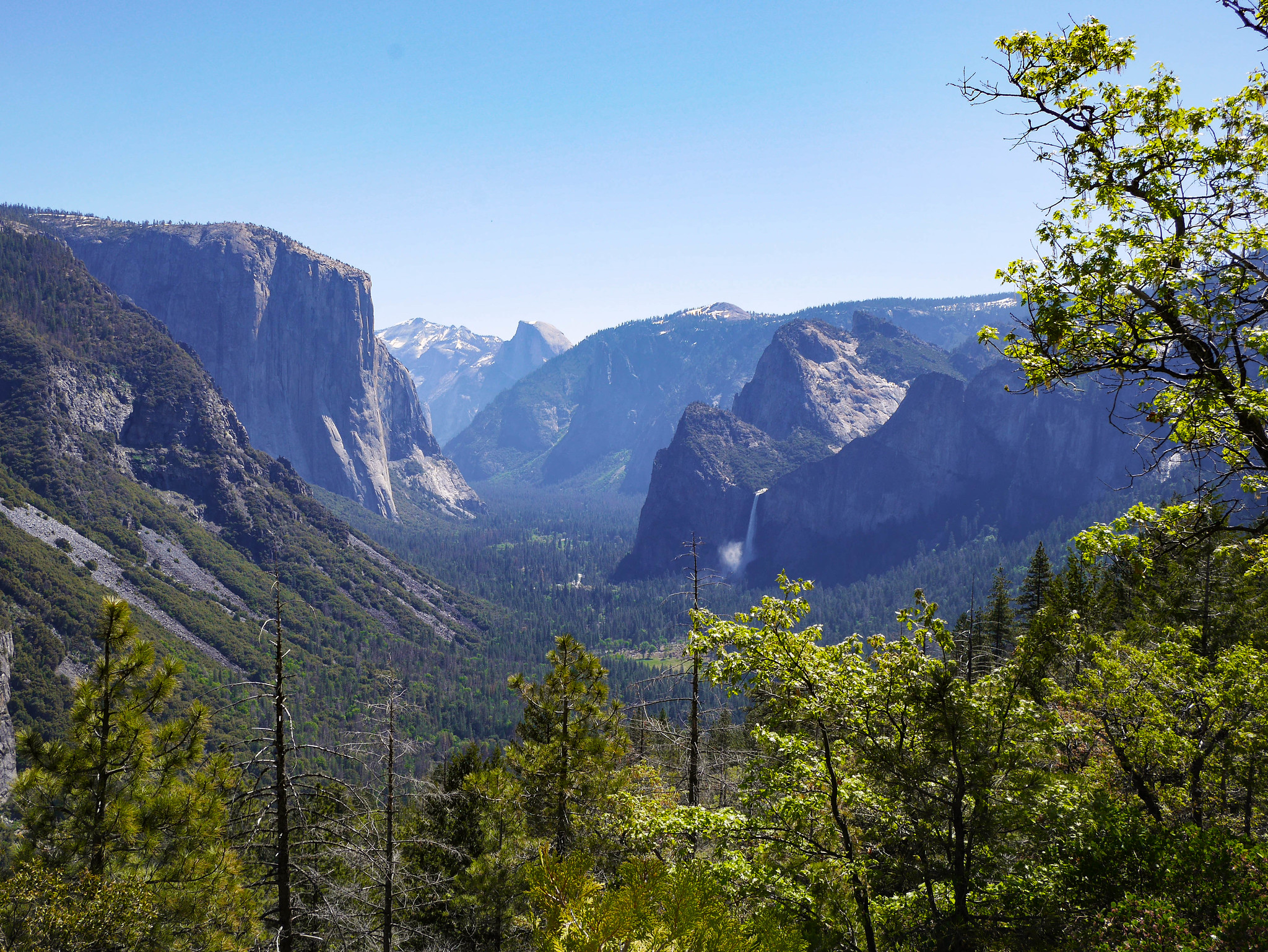
There are peek-a-boo views here and there, too, including this one of Ribbon Falls.

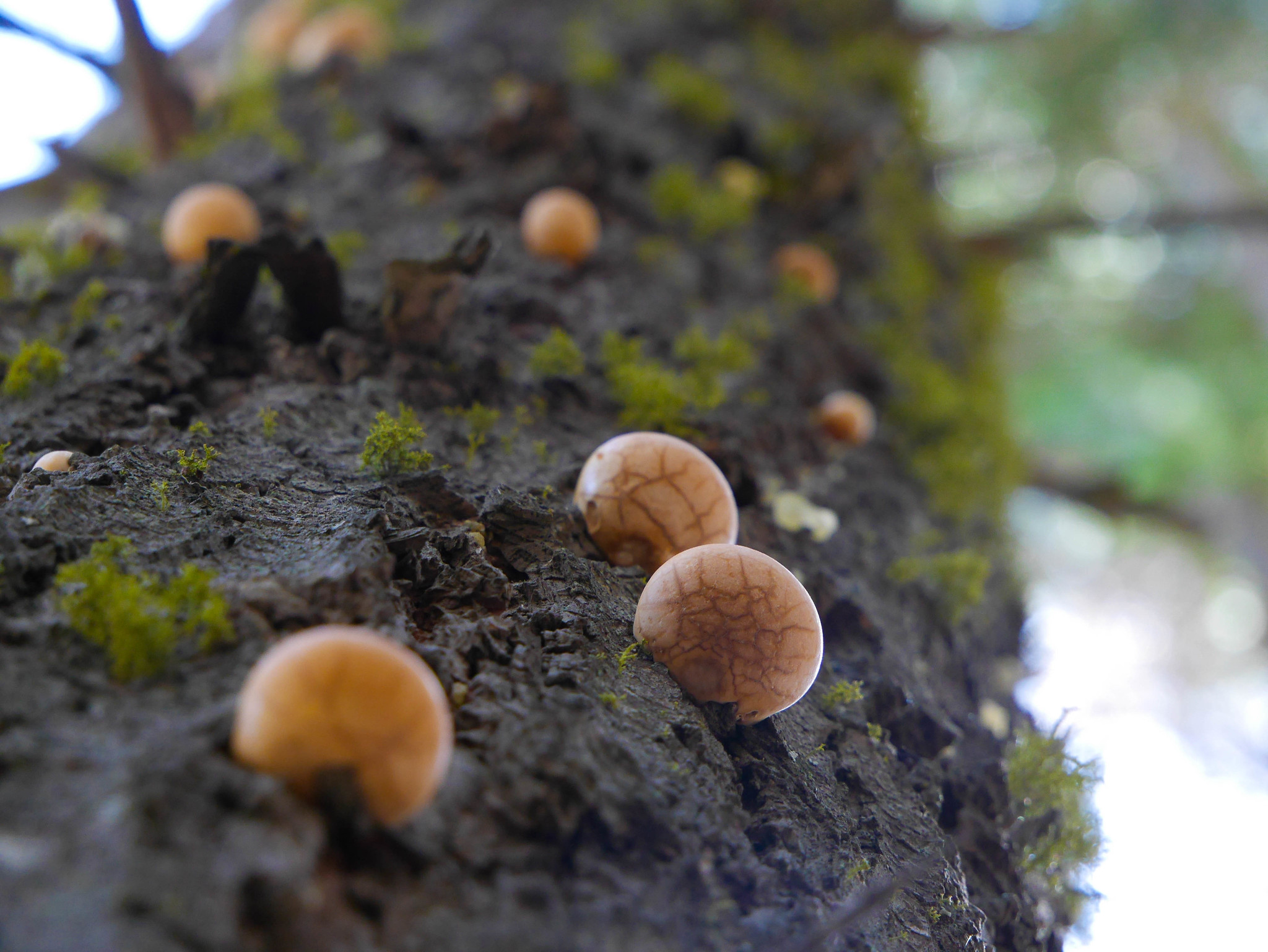
And some puffball mushrooms of some sort were taking over a tree by the trail.
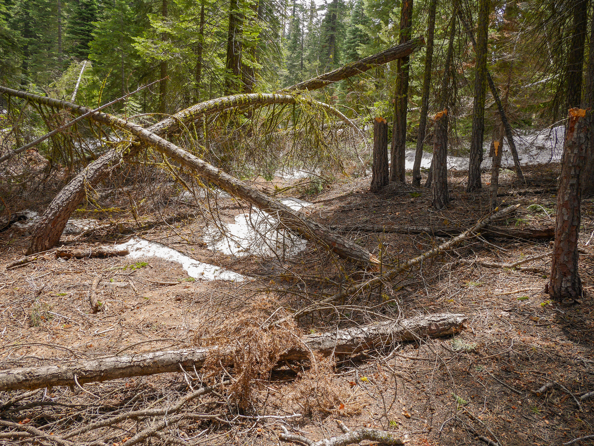
The snow started in earnest around 6,700 ft, just past Artist Creek. In this area a couple of day hikers were following me, and I thought about advice for people who are new to finding a trail beneath a consolidated snowpack. One major thing to look for, especially in wooded or partially wooded areas, is cut logs. Looking straight ahead in the photo below, it's obvious where the trail goes---trail crews don't saw tree logs unless they have to to clear trail, so if you see a clearly sawn tree, you know you're on trail.

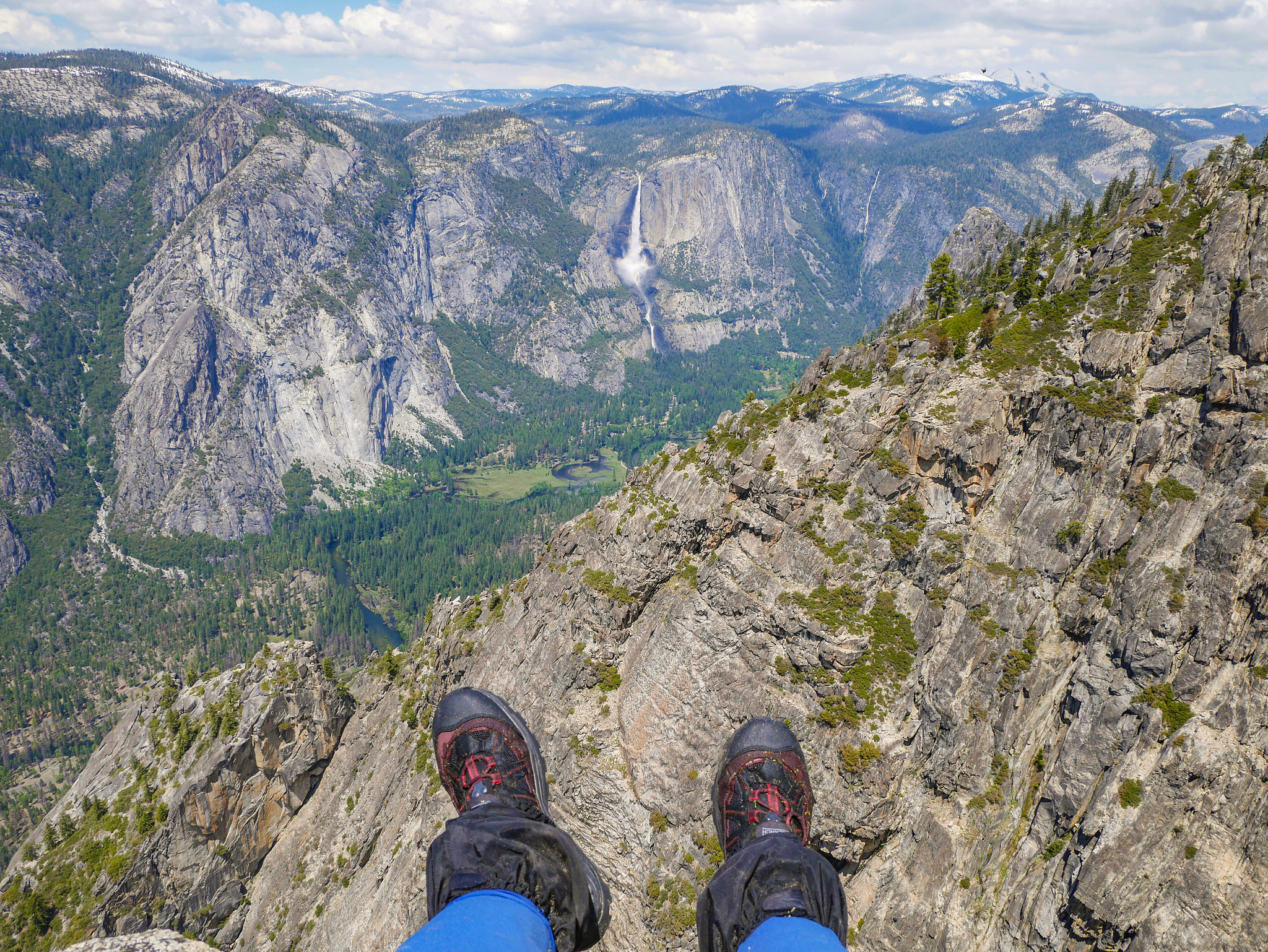
I was getting a bit hungry at this point, so I decided to stop and look for a spot to have a snack. I ended up finding a perfect rocky outcropping to sit on. I even had cell service, so I could send my parents unnerving photos of my feet dangling over the edge of a cliff! I'm certain they appreciated that "I'm ok!" check-in message.


After hanging out for an hour or so, I pushed on. The trail was getting more and more annoying with consolidated snow and routefinding tasks, but before long I was at Stanford Point.


I took a little break there as well, and also spotted a pair of dayhikers who had been following me, but they didn't go all the way out to the rim where you can see Bridalveil Fall! Instead, they were just lounging by a log right by the trail. To come all that way and then not even go to where the best view is... welp.
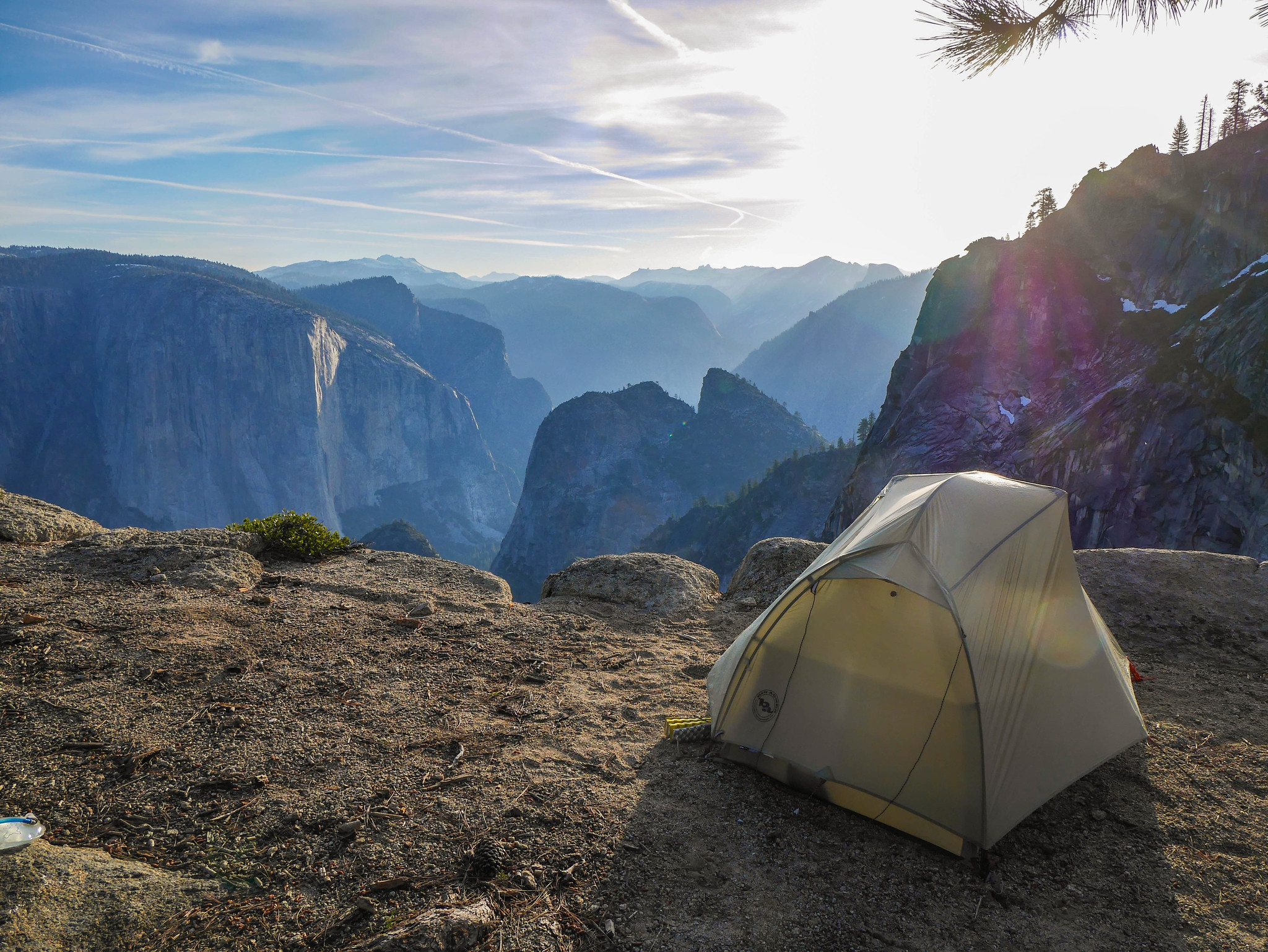
I headed on and by 3pm I was at Crocker Point. I debated what to do. I wanted to camp somewhere with a nice view and I knew that beyond Dewey Point the route took me back into the woods. I also thought, looking at my maps, that from Dewey Point you couldn't see Bridalveil Fall. So when I poked around Crocker and found a spectacular site directly on a cliff with the most amazing view, I had to just stop and set up camp.
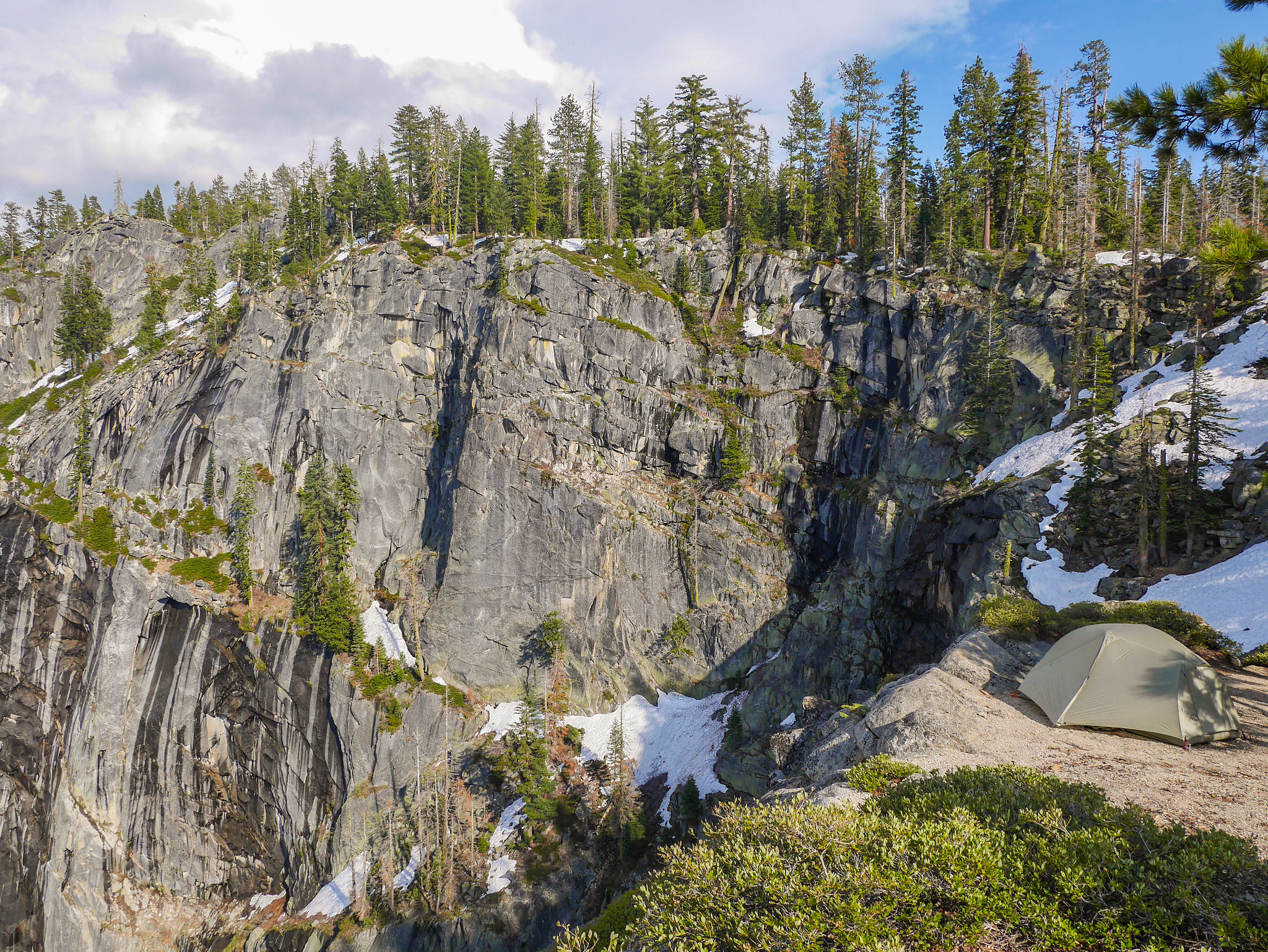
The only issue was finding water. Yosemite's south rim can be very dry depending on the season. I saw enough snow around Crocker Point to know that I could at least melt snow if necessary, but after dropping my stuff and setting up my camp, I headed off to see if I could find a legit stream. I could hear snowmelt trickles cascading down the cliff near my site, so I headed in that general direction, hoping that there would also be runoff on the non-cliff side. I scrambled down off trail about a quarter mile and found a legit runoff stream. I filled up 3 liters of water and chugged a liter while there before heading back to camp. On my way back, I scurried out to get a view of my campsite. Can you spot my tent? (Sorry mom)


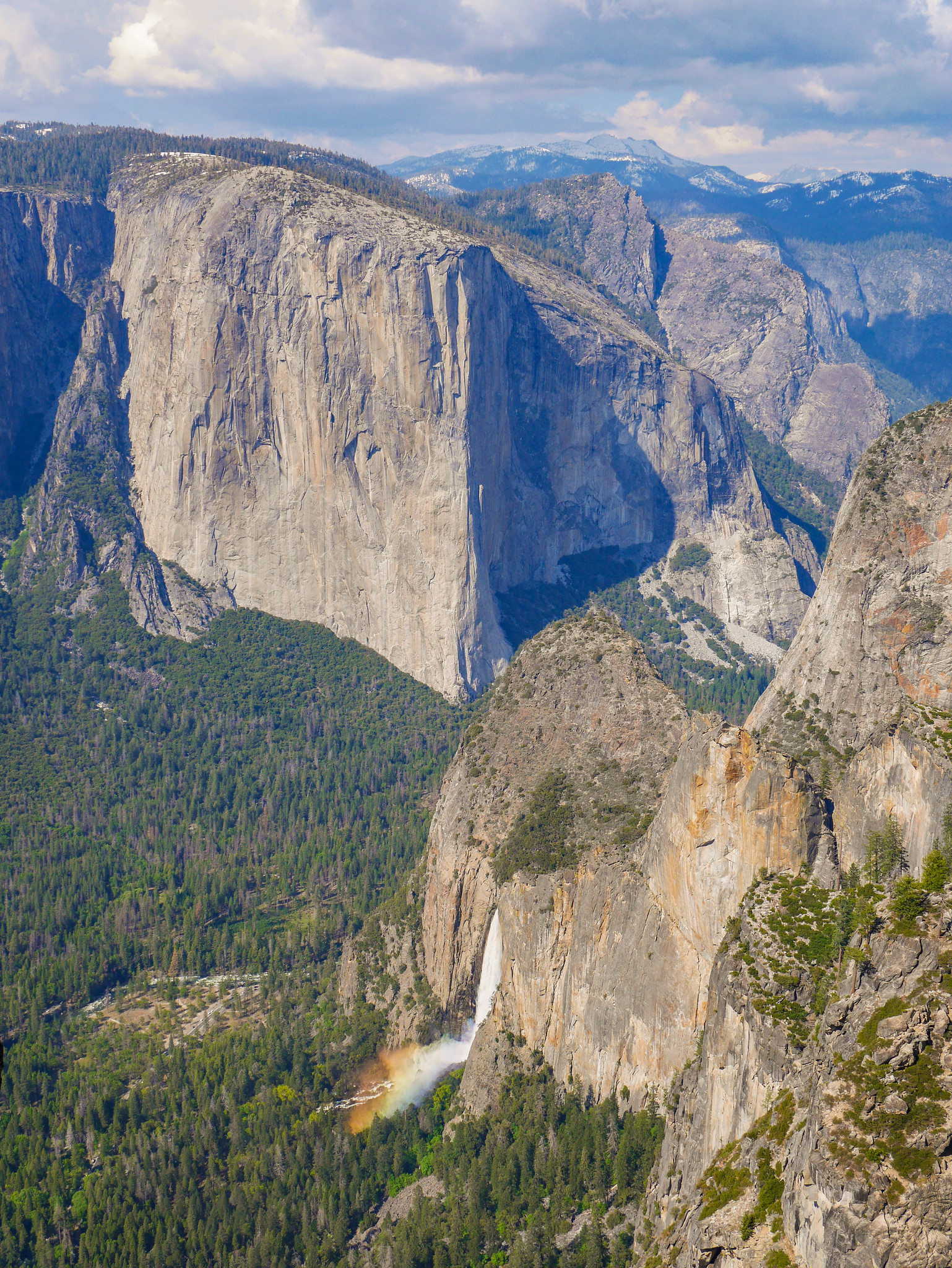
When I arrived back at my site, I peeked over the cliff only to see that Bridalveil's mist was making A **** RAINBOW in its mist T_T I died, a lot, of how beautiful it was.
Back at camp with copious water in hand, I still had some time to kill. I puttered around taking photos and then set up my hammock in some trees and read for a while.


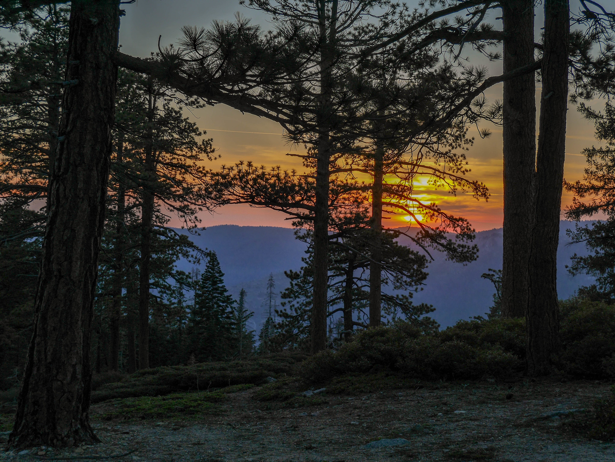
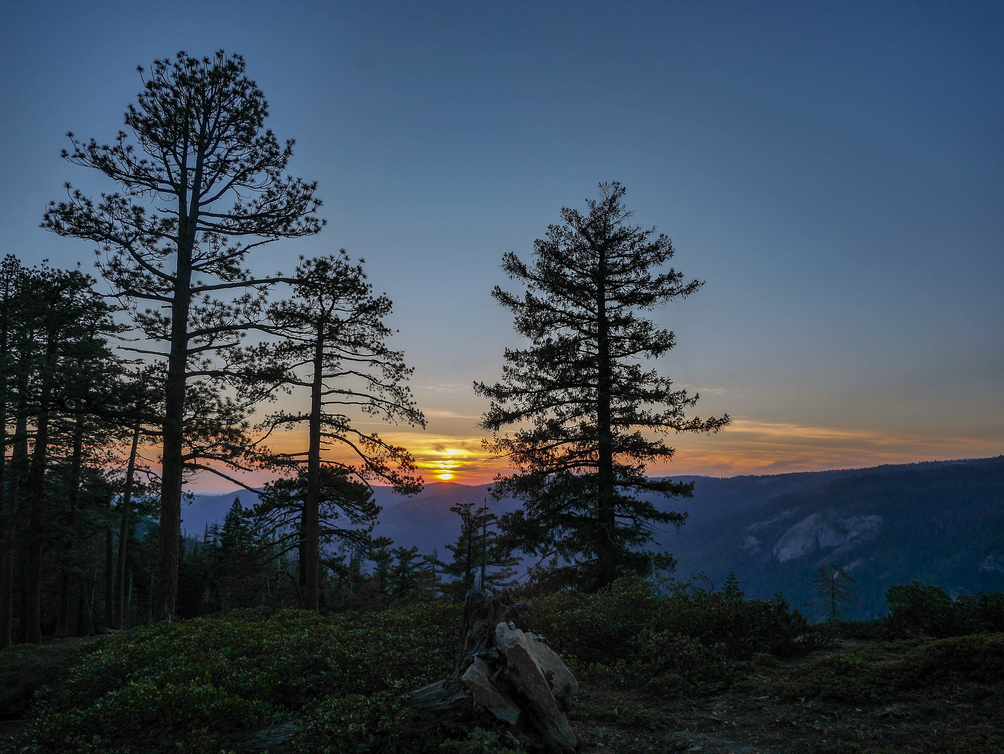
But soon enough it was dusk and I cooked up some food with this freakin unbelievable dinner vista.

After dinner I read some more, watched the sun set, and then crawled in my tent and passed out. What a day!
Day 2
Crocker Point to Taft Point TH
6 mi, +2,100ft/-1,500ft
I was lazy this morning and didn't stir until the sun began to warm my tent. To be fair, this was around 6:45am so it wasn't like I was suuuuuuper slacking, but I had a difficult day planned and needed every moment of daylight I could get. (I didn't yet know that I'd bail at Taft.)
The vista from camp was different but no less beautiful in the morning.


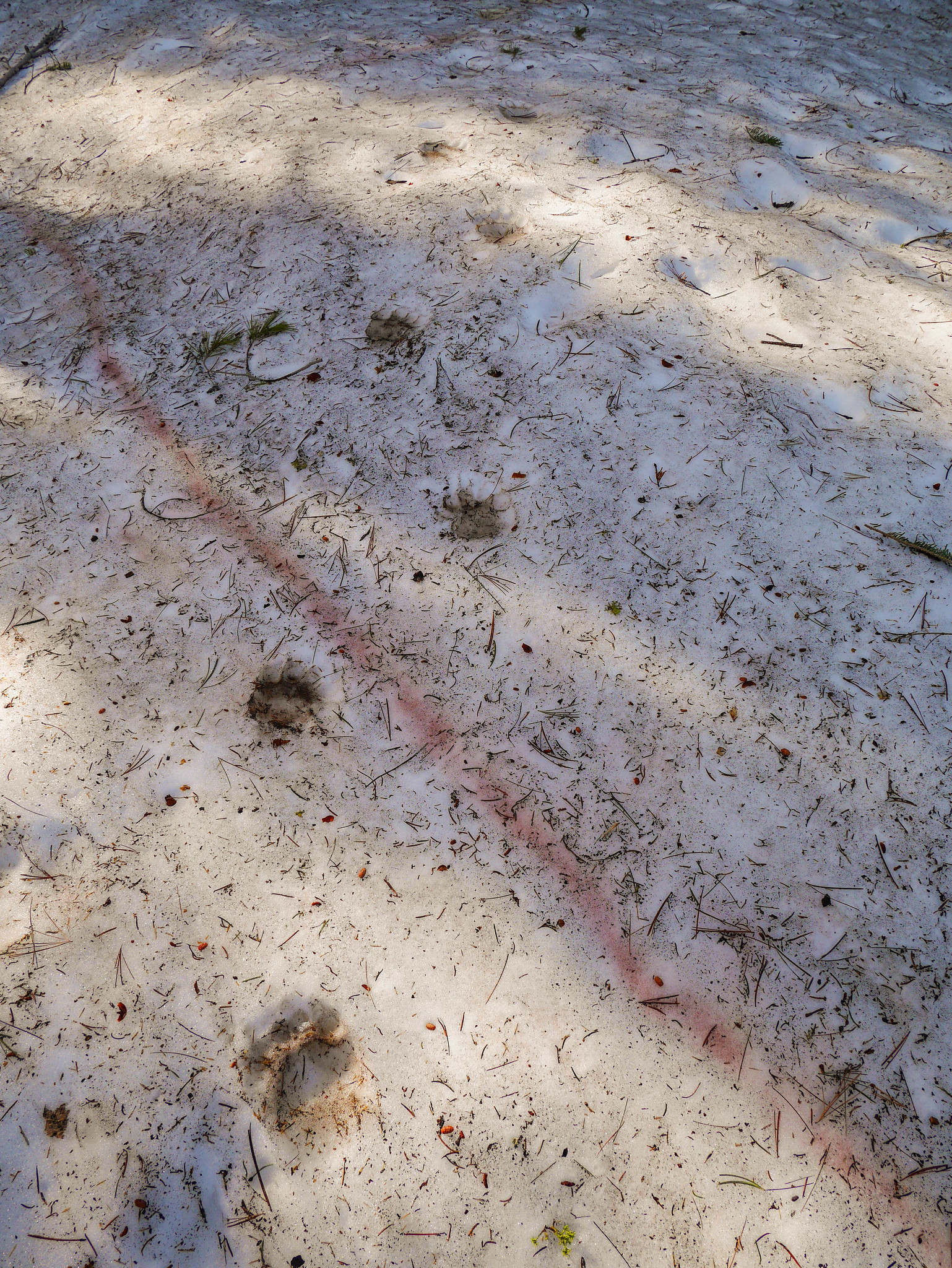
I packed up and was on the "trail" (lol) by 8:15am. Soon I came across some pretty large, pretty fresh bear tracks. So cool!

The view from Dewey Point confirmed my expectations and validated my decision to stay at Crocker. It's nice and all but lacking any waterfalls at all! Pff, why am I even in Yosemite in the spring if not to soak up all the waterfall views I can?


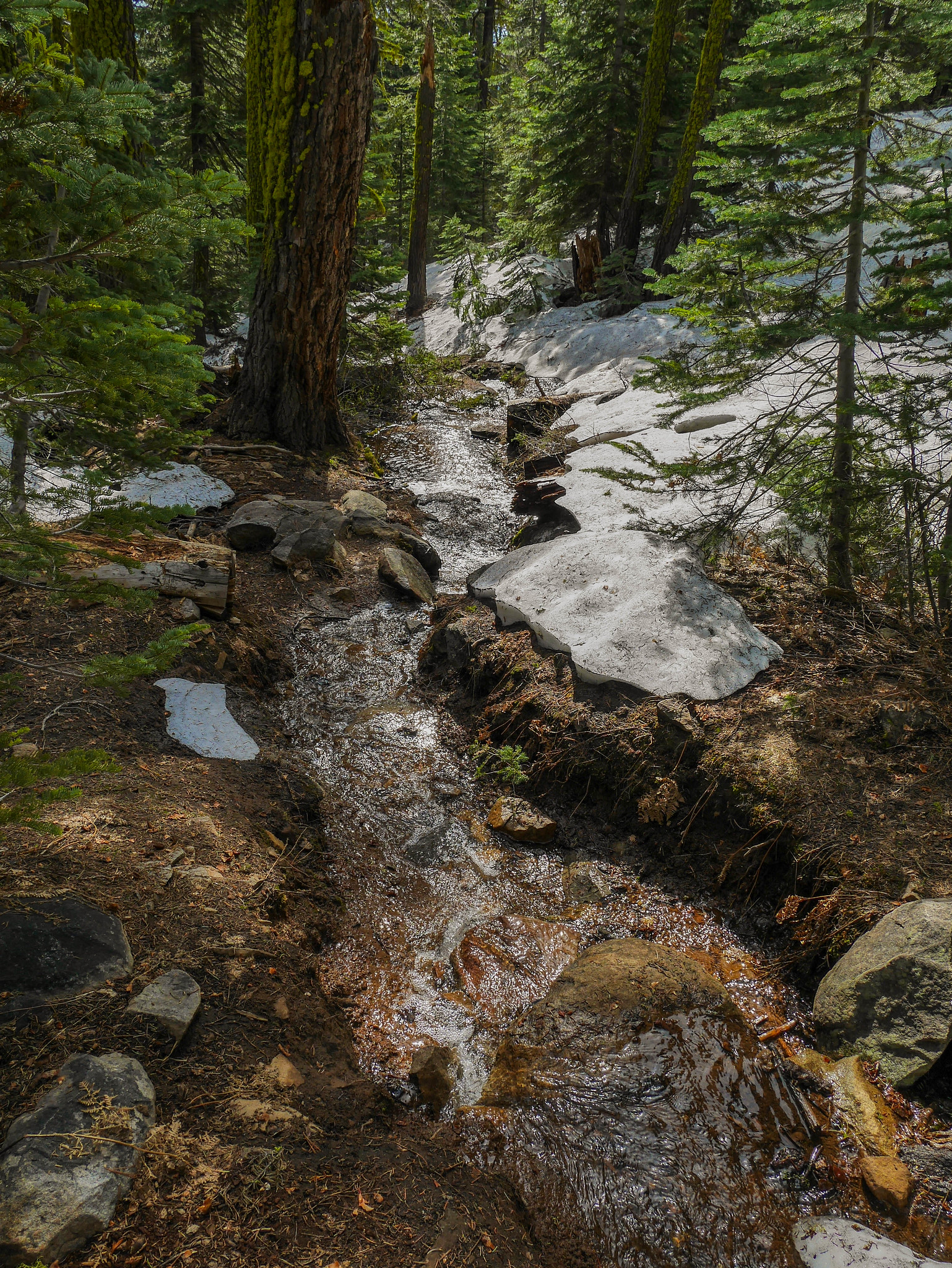
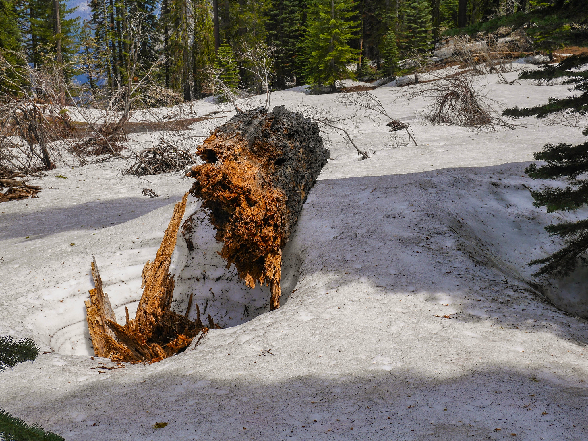
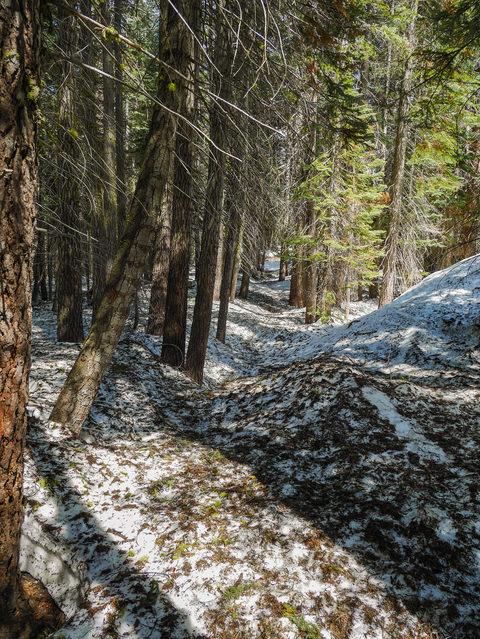
There had been snow on the trail ever since Artist Creek, and it was coming and going, mostly patchy and just slowing me down a bit but not offering too many serious obstacles. But after Dewey Point that changed for the worse. There were way more downed trees and lots and lots of snow.


It doesn't look like much in photos, but snow and downed trees can slow your pace considerably. On this stretch I was making only 0.75 miles per hour instead of my usual 2 or 2.5. I had to constantly stop to look for signs of trail, and often when I found the trail it looked like this:

Finally, I made it to Bridalveil Creek and crossed its bridge. I was super jazzed on the opposite side to see clear trail, but sadly that only lasted a few hundred yards and then I was again greeted with downed trees and annoying snow.


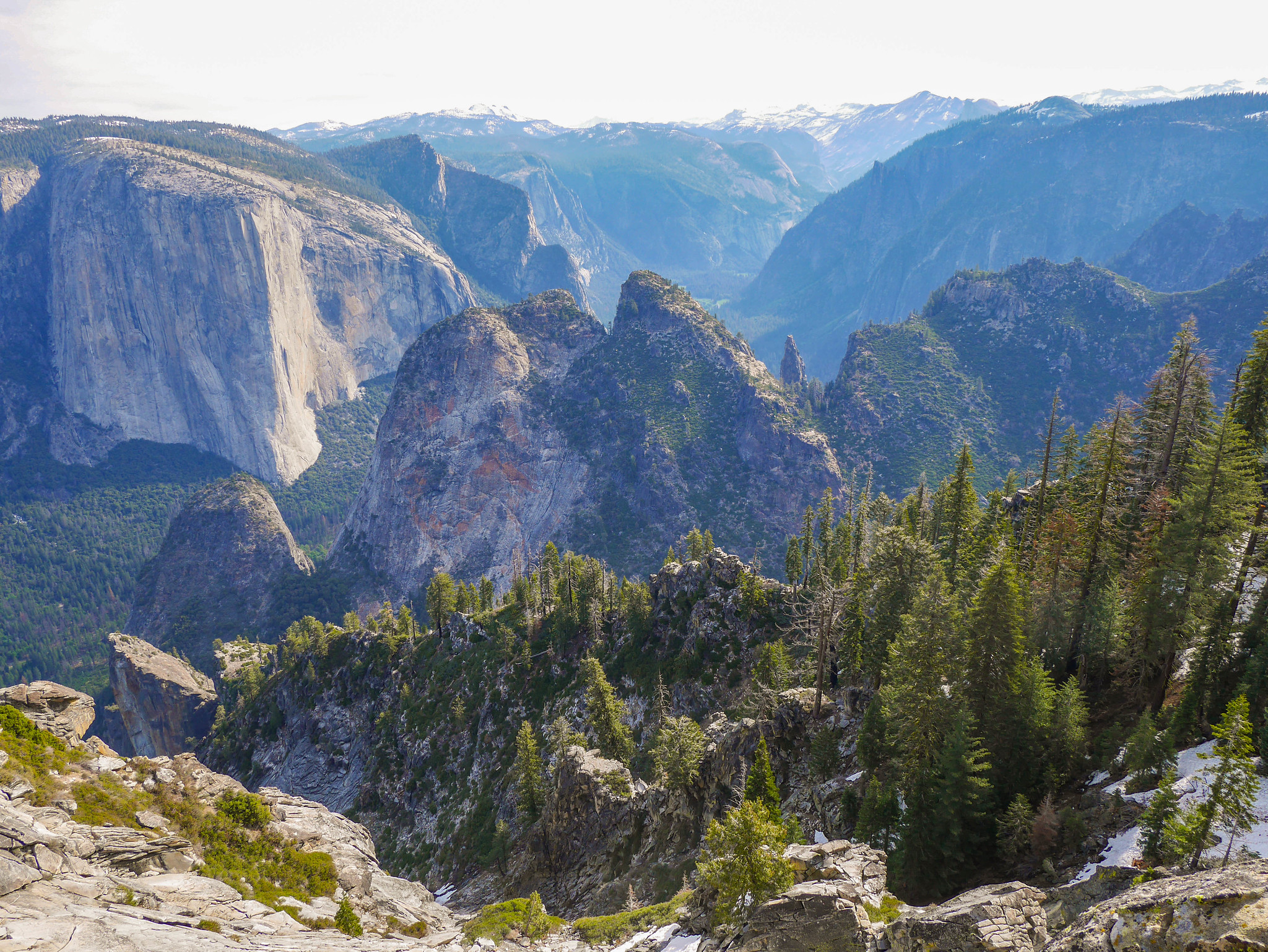
Soon enough the trail cut back north towards the valley rim and I got magnificent views down into the valley.

I was near, but not at, Taft Point here and had a spectacular view of Yosemite Fall.

The next section had a snowy trail with a decent angle and a runoff that was dangerously steep and culminated in a 1k cliff, so I threw on my microspikes.


I arrived at Taft Point around 1:15pm and had it entirely to myself. I still hadn't seen a human since back around Artist's Creek, and I wouldn't see one until I got back to the Taft Point trailhead parking lot. It'd been about 15 years since I'd been to Taft Point, and I was not at all prepared for the incredible vista that I got to enjoy all on my own. Usually I avoid places that are both this incredibly spectacular and also less than 1.5 miles from a road, but this early in the season I was the only idiot out here. What a joy!


Now here's where I hemmed and hawed about what to do. It was coming on 3pm and I still had a couple of miles of snowy route to go just to get to Glacier Point. From there, I could either hike 7 miles to Little Yosemite Valley, or I could bail and hitch somewhere. If the road wasn't open (btw I had terrible luck with this---the road opened 2 days before my trip started and closed due to storms 1 day after!!), I could have camped anywhere, but with Glacier Point road open, there were no legal spots to camp between 3 miles back at Bridalveil Creek and 9 miles ahead at Little Yosemite Valley. I decided to hike to the next junction before deciding what to do. Just getting there was an ordeal of snow, so I was full on ready to bail when I reached the junction.

I decided that I'd bail at the Taft Point TH and hopefully would be able to hitch a ride back down to the valley. (Another worry was that by the time I reached Glacier Point, it would be too late to hitch and also too late to continue on to LYV.) So I kept on keepin' on through the snow, routefinding my way back towards the trailhead.

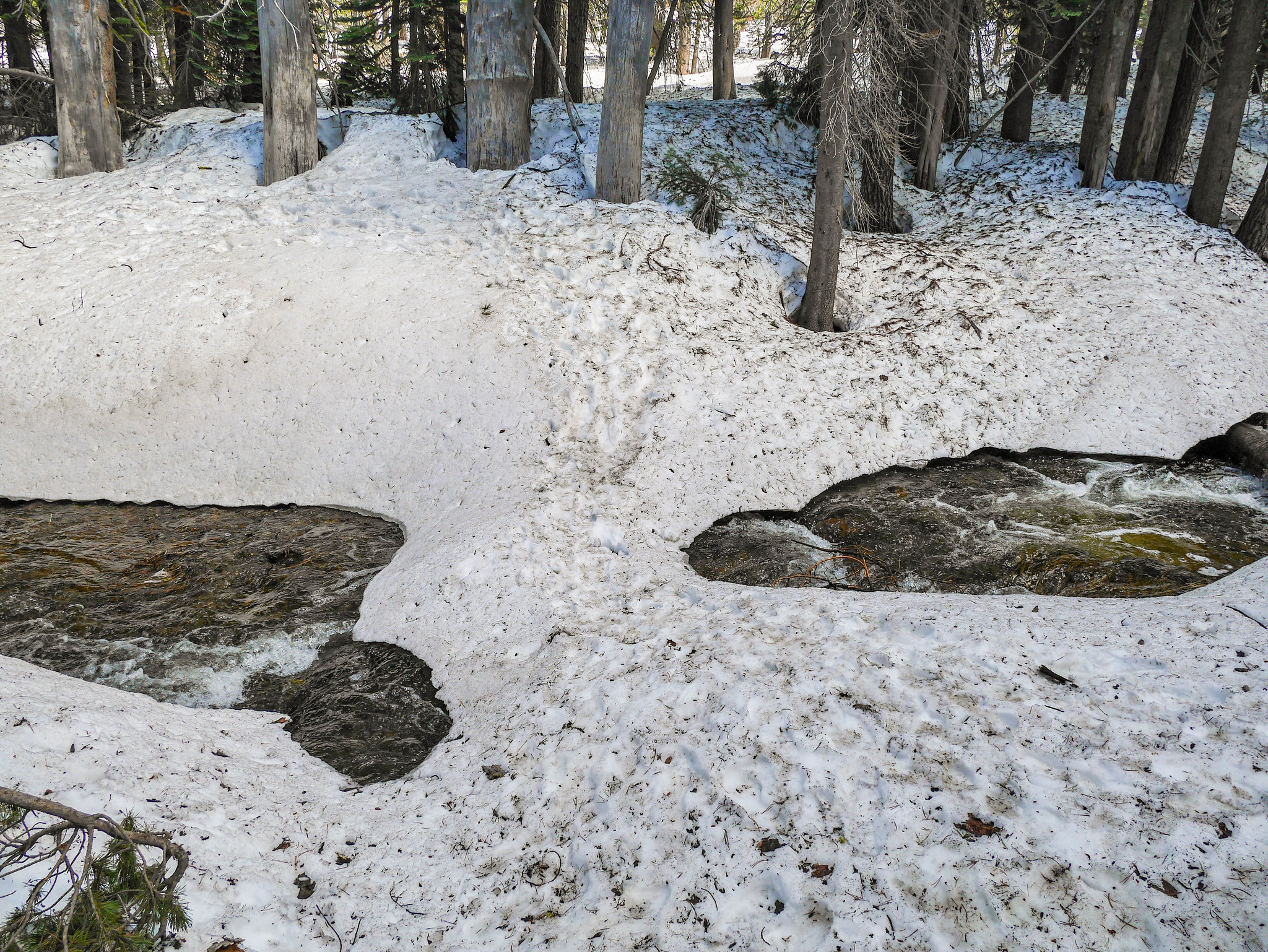
Around 2:30pm I could hear the cars on Glacier Point road, so I knew I was nearly there. But right then I encountered a raging snowmelt stream that is usually a trickle outside of spring. I was shocked (but really also, not shocked) to see that plenty of idiots had crossed on this freakin' snow bridge! My god, talk about a death wish. It's hard to tell in the photos, but the stream was easily thigh to waist deep. If the bridge collapsed, good **** luck. You'e probably dead. I found a log that was infinitely safer a bit downstream.

By 2;45pm I was cruising back down to the valley in a rented sedan driven by a nice Chinese man who'd just graduated college and his 60's-ish dad. I managed to get to the permit office by 4:15pm and snag a permit to hike out again the next morning! More details on that coming soon.
Want to do this trip yourself? You'll need a Pohono Trail (Tunnel View) [url=https://www.nps.gov/yose/planyourvisit/wildpermits.htm]permit from Yosemite. If you're there early season like me, you'll need good navigational skills, especially micro-routefinding in the woods.

