Just back from a very good solo trip to the Boundary Lake area…will take a little time to post a trail report properly, where I will also thank the several of you who gave me excellent advice on that trip.
Right now I have been asked to choose a destination to take a friend backpacking from June 14-17. This will be his second trip but he is much younger and more fit than I am and has more than kept up with anything I can do.
My principle concerns:
1) Must be able to drive, pick up permit, and start the hike, starting from the Bay Area, on day 1, similar to my recent Cherry Creek hike. My friend can't get as much time off as I can so this must be a compressed four day trip. So that unfortunately rules out Cottonwood, Big Pine, etc.
2) Given the fact that mosquitoes are beginning in the 6500 range and expected to progress upwards, I want to aim for approximately the 8000-8500 foot zone. Higher and we’ll probably run into snow, much lower and we will probably risk thick mosquitoes.
3) Can’t risk impassable streams, although we’ll both wade knee high or slightly higher if necessary and safe.
So far, my ideas include:
A. Fontanillis Lake from Tahoe, at 8200. I have been just as far as Fontanillis and have fond memories of this place, above the long granite water slide below.
B. Deer lake from Crabtree, at 8460. I’ve done this before early season, but crossing W Fork Cherry Creek is always an issue until you get to it. Don't want to go much south of this in Emigrant because the elevations decline.
C. Lillian Lakes Loop. Lillian Lake 8868. The attraction is I’ve never been. The road sounds tricky but usually doable for a passenger car. Is this too high/too soon?
D. Green Lake at 8944 from out of Bridgeport. I've never been. Worries: must cross Green Creek twice. Since I've never been, I'm not sure about what the crossing might be like.
Advice would be welcome! I'm probably edging toward option A simply because it is less risky, but some of you with particular experiences with these destinations could easily sway me.
Which of these 4 destinations for June 14?
-
kpeter

- Topix Fanatic
- Posts: 1450
- Joined: Mon Jan 04, 2010 1:11 pm
- Experience: Level 3 Backpacker
-
SSSdave

- Topix Addict
- Posts: 3524
- Joined: Thu Nov 17, 2005 11:18 pm
- Experience: N/A
- Location: Silicon Valley
- Contact:
Re: Which of these 4 destinations for June 14?
After May weeks of cloudy often stormy weather, this next week will be sunny warm. Mosquitoes late afternoon will rise up from their damp forest areas lower down and fly up to higher areas just be snow lines where all the water is draining over bedrock landscapes in order to lay eggs. Thus I would not bet that 8000-8500 won't have mosquitoes but rather the opposite.
Fontanillis Lake didn't appeal to me.
Instead of overused down in a hole Green Lake, use the same trailhead and go to much more scenic East Lake, only about 4 miles 1700 feet of vertical. Much colorful metamorphic geology. Camp on east side mid lake. From there on a layover day can dayhike up the trail to Gilman, Hoover, and Summit Lake or move camp to one of those lakes.
http://mapper.acme.com/?ll=38.07138,-119.29985&z=15&t=T
-
kpeter
- Topix Fanatic
- Posts: 1450
- Joined: Mon Jan 04, 2010 1:11 pm
- Experience: Level 3 Backpacker
Re: Which of these 4 destinations for June 14?
Thanks Dave,SSSdave wrote:After May weeks of cloudy often stormy weather, this next week will be sunny warm. Mosquitoes late afternoon will rise up from their damp forest areas lower down and fly up to higher areas just be snow lines where all the water is draining over bedrock landscapes in order to lay eggs. Thus I would not bet that 8000-8500 won't have mosquitoes but rather the opposite.
Fontanillis Lake didn't appeal to me.
Instead of overused down in a hole Green Lake, use the same trailhead and go to much more scenic East Lake, only about 4 miles 1700 feet of vertical. Much colorful metamorphic geology. Camp on east side mid lake. From there on a layover day can dayhike up the trail to Gilman, Hoover, and Summit Lake or move camp to one of those lakes.
http://mapper.acme.com/?ll=38.07138,-119.29985&z=15&t=T
As for East Lake, I was worried that there might be too much snow to get higher than Green, but if we go in that direction then I would prefer to do East lake or West lake. East Lake is at 9400. Do you have memories of the crossings of West fork Green Creek?
-
maverick

- Forums Moderator

- Posts: 11846
- Joined: Thu Apr 06, 2006 5:54 pm
- Experience: Level 4 Explorer
Re: Which of these 4 destinations for June 14?
Professional Sierra Landscape Photographer
I don't give out specific route information, my belief is that it takes away from the whole adventure spirit of a trip, if you need every inch planned out, you'll have to get that from someone else.
Have a safer backcountry experience by using the HST ReConn Form 2.0, named after Larry Conn, a HST member: http://reconn.org
-
kpeter
- Topix Fanatic
- Posts: 1450
- Joined: Mon Jan 04, 2010 1:11 pm
- Experience: Level 3 Backpacker
Re: Which of these 4 destinations for June 14?
Thanks Mav. Great report from WD from a July 1 trip in 2011. 2011 was a high snow year just about like 2017, so going two weeks earlier than she did probably would not be a problem.maverick wrote:http://www.highsierratopix.com/communit ... ake#p45071
-
maiathebee

- Topix Expert
- Posts: 470
- Joined: Tue Jun 18, 2013 11:59 am
- Experience: Level 4 Explorer
- Location: Alpine Meadows, CA
- Contact:
Re: Which of these 4 destinations for June 14?
I was in Desolation this weekend. Echo Lake --> Lake Aloha and back for a quick overnight. Solid snow on the top forested flat part of the trail between Triangle lake junction and Lake Aloha, but around PCT along Aloha is melted out. Aloha itself is about 40% frozen. There were few bugs but seemed ready to explode in a week or two. I would not want to be around that elevation in Desolation in two weeks.
This was taken at Fontanillis on 6/22/2014, a similar snow year to this year.
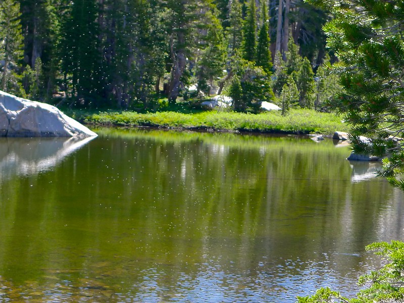 SO MANY MOSQUITOS!!! by Maia Averett, on Flickr
For reference, here's what Lake Aloha looks like right now:
This was taken at Fontanillis on 6/22/2014, a similar snow year to this year.
SO MANY MOSQUITOS!!! by Maia Averett, on FlickrFor reference, here's what Lake Aloha looks like right now:
You do not have the required permissions to view the files attached to this post.
oh hey! you're reading my signature.
that's nice. want to check out my blog?
here it is: plutoniclove.com
ig: @plutonic_love
that's nice. want to check out my blog?
here it is: plutoniclove.com
ig: @plutonic_love
-
wildhiker

- Topix Fanatic
- Posts: 1114
- Joined: Tue Jul 26, 2011 4:44 pm
- Experience: Level 4 Explorer
- Location: Palo Alto, CA
- Contact:
Re: Which of these 4 destinations for June 14?
As for Lilian Lake loop...
The road is in poor condition and a long drive from the Bay Area - at least 5 hours, maybe more.
The lakes here are very attractive, but the trail spends a lot of time in forest, which means snow and mosquitoes both stick around longer.
-Phil
The road is in poor condition and a long drive from the Bay Area - at least 5 hours, maybe more.
The lakes here are very attractive, but the trail spends a lot of time in forest, which means snow and mosquitoes both stick around longer.
-Phil
-
AlmostThere
- Topix Addict
- Posts: 2724
- Joined: Wed Jun 24, 2009 4:38 pm
- Experience: Level 4 Explorer
Re: Which of these 4 destinations for June 14?
The spur roads to the trailheads along the routes in the Bass Lake/North Fork district of Sierra NF are the roughest part of going out to Fernandez, Norris, etc. trailheads. You can get out there on Beasore ok in any vehicle, the going gets pothole-y and rough. But turning and heading up to Fernandez in a Prius is an adventure and a half. Always call the FS before attempting those roads, or similar in other forests. At best you wasted an hour, at worst you get stuck and no one else up there has a tow kit or satellite phone.
-
wildhiker
- Topix Fanatic
- Posts: 1114
- Joined: Tue Jul 26, 2011 4:44 pm
- Experience: Level 4 Explorer
- Location: Palo Alto, CA
- Contact:
Re: Which of these 4 destinations for June 14?
Have you considered Ostrander Lake in Yosemite (south of Glacier Point road) and a mix of cross-country and trail over to Buena Vista Lake and Crest? You could even make a loop returning via Mono Meadows trailhead and walking/hitching the road for a couple of miles. Maverick just reposted a trip report to Ostrander from another forum in the conditions section - looks pretty nice, and at your desired elevation:
http://highsierratopix.com/community/vi ... ead#unread
Jeff Schaffer's Yosemite guide describes the cross-country route east from Ostrander Lake.
-Phil
http://highsierratopix.com/community/vi ... ead#unread
Jeff Schaffer's Yosemite guide describes the cross-country route east from Ostrander Lake.
-Phil
Who is online
Users browsing this forum: Bing [Bot] and 27 guests