Coyote Pass?
-
Cross Country
- Topix Fanatic
- Posts: 1328
- Joined: Thu Dec 24, 2009 11:16 am
- Experience: Level 4 Explorer
Re: Coyote Pass?
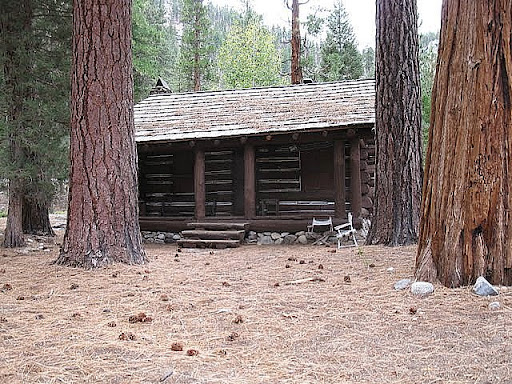
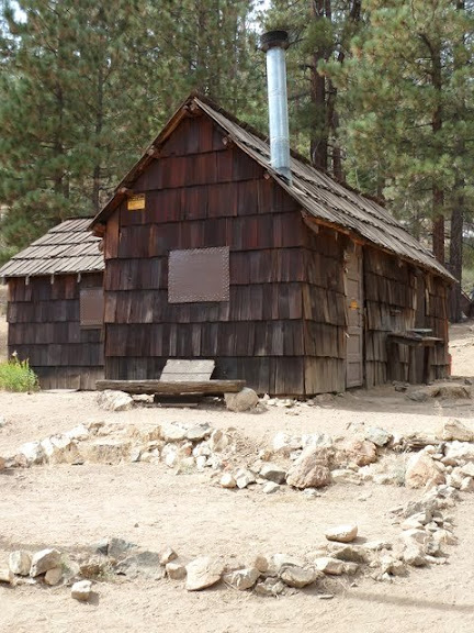
This is "Saint" Diane in our camp-site South of the ranger station on the Kern.
You do not have the required permissions to view the files attached to this post.
-
DoyleWDonehoo

- Founding Member
- Posts: 480
- Joined: Wed Dec 14, 2005 2:06 pm
- Experience: N/A
- Location: San Jose, CA
- Contact:
Re: Coyote Pass?
You have to be logged in. Not my rules.jdunne wrote:I don't have permission to look at the pictures.
Doyle W. Donehoo
Sierra Trails:
http://www.doylewdonehoo.com" onclick="window.open(this.href);return false;
Sierra Trails:
http://www.doylewdonehoo.com" onclick="window.open(this.href);return false;
-
richlong8
- Topix Expert
- Posts: 841
- Joined: Tue Nov 25, 2008 6:02 pm
- Experience: Level 4 Explorer
Re: Coyote Pass?
Coyote Pass- I have a friend who has been up to Coyote Lakes 3 times in the last 5 years. He comes up the Deep Creek drainage, and says that is the best access point now to the Coyote area, to his knowlege.
I spent a 5 day backpacking/fishing trip( October 2010) going from Lloyd Meadows as far as the Ranger Station area. Here are a few photos that should look familiar:
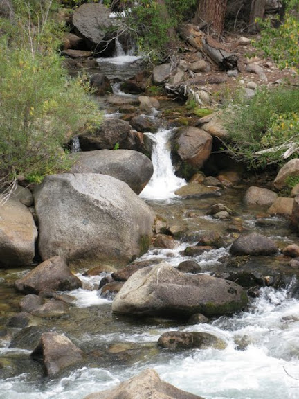
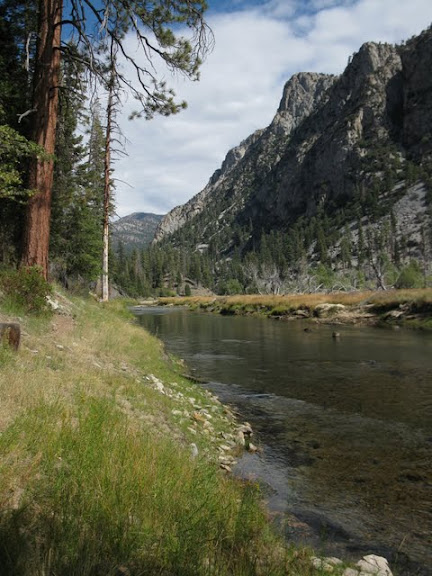
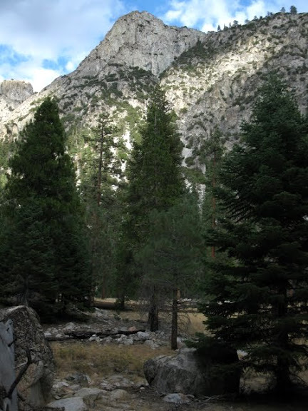
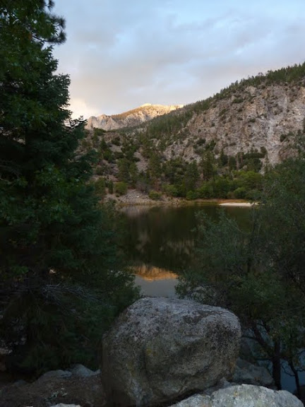
Regards, Richard
I spent a 5 day backpacking/fishing trip( October 2010) going from Lloyd Meadows as far as the Ranger Station area. Here are a few photos that should look familiar:
Regards, Richard
-
East Side Hiker
- Topix Regular
- Posts: 391
- Joined: Tue Oct 19, 2010 8:10 am
- Experience: N/A
Re: Coyote Pass?
Great pics Richard, they do bring back memories of the Kern. If I can shake the East Side, I want to get back there.
-
richlong8
- Topix Expert
- Posts: 841
- Joined: Tue Nov 25, 2008 6:02 pm
- Experience: Level 4 Explorer
Re: Coyote Pass?
I prefer the east side as well. I would like to access the ranger station on the river via Trail Pass/Golden Trout Creek, then go north up river, and exit eventually over Shepherd Pass.
I found the trail from Lloyd Meadows to Little Kern Lake much more trashy than it should have been. The Kern River itself was very slow for fishing until getting about 3 miles from the ranger station. Little Kern Lake was also very slow. I almost got the impression that the very active packers in this area are allowing their clients to run totally amuck, not catch and release fishing, and not picking up after themselves. I probably will never return by this route again. It was still a great trip, but it could have been so much more if people treated it like the wilderness that it is.
I found the trail from Lloyd Meadows to Little Kern Lake much more trashy than it should have been. The Kern River itself was very slow for fishing until getting about 3 miles from the ranger station. Little Kern Lake was also very slow. I almost got the impression that the very active packers in this area are allowing their clients to run totally amuck, not catch and release fishing, and not picking up after themselves. I probably will never return by this route again. It was still a great trip, but it could have been so much more if people treated it like the wilderness that it is.
-
East Side Hiker
- Topix Regular
- Posts: 391
- Joined: Tue Oct 19, 2010 8:10 am
- Experience: N/A
Re: Coyote Pass?
Seeing the pictures of Trout Mdw/Henry Brown's place makes me long to see more. If anyone has more pictures of that area, or especially of the Coyote Lakes or Coyote Pass area, please post them if you want or can. I'd love to see them. All my pictures of the region from that period of my life are way-pre-digital, and for me aren't easily available.
-
DoyleWDonehoo
- Founding Member
- Posts: 480
- Joined: Wed Dec 14, 2005 2:06 pm
- Experience: N/A
- Location: San Jose, CA
- Contact:
Re: Coyote Pass?
I am attaching below an altered/updated map of the Lloyd and Lewis TH. Most maps have trails missing and omit the extent of the Lloyd trailhead. Hopefully you can make out the details. Too bad this BBS does not have the feature where you mouse over a picture and it springs up to full size. Click on the map to enlarge.
Lloyn Meadows TH is one of the best early season trailheads in the sierra. While most other trails are blocked with snow, you can do the trip into the Kern Rivers in May (maybe even April), which I did many times (yeah yeah, I should do a TR). From near snow free Jerky Meadows (the high point on the way to the Kern) you can see snow on Farewell Gap.
The Lloyd trailhead has lots of horsepacker parking and a fair sized waterless camp-ground. There are various free and organized CG's nearby as well as a pack station.
The Lloyd TH is near the entrance of the trailhead parking area (ample paved parking). The trail is fairly level until just after the unmaintained trail junction. It is a nice trail.
The unmaintained trail is usable, and is used by horsepackers, and backpackers will only want to do this trail in the downward direction. It is steep and exposed and sometimes faint and overgrown a bit. The footing is good throughout, at least the one time I tried it.
At the junction with the Lewis trail there is a trail that goes north into the Little Kern, and if you go down it a ways you get a picture perfect view of the Little Kern River basin and Farewell gap. Early season this north trail might not be too desirable due to high water in the Little Kern River. Other routes into this basin are available without dangerous wet crossings.
It is a real good idea to have 7.5 map of this area because the area from Jerky to the Little Kern bridge is threaded with many use trails. Best advice is to take rights at all trail junctions except the faint use trail to Castle Rock (keep going straight). Once you reach the bridge, everything is pretty obvious, though there are narrower horsepacker use trails here and there. The main trails are obvious.
More later if there is any interest.
You do not have the required permissions to view the files attached to this post.
Doyle W. Donehoo
Sierra Trails:
http://www.doylewdonehoo.com" onclick="window.open(this.href);return false;
Sierra Trails:
http://www.doylewdonehoo.com" onclick="window.open(this.href);return false;
-
East Side Hiker
- Topix Regular
- Posts: 391
- Joined: Tue Oct 19, 2010 8:10 am
- Experience: N/A
Re: Coyote Pass?
For whatever reason, I still don't get how to "get permission" to view photos. I guess I'm dumb.
-
oldranger

- Topix Addict
- Posts: 2861
- Joined: Fri Jan 19, 2007 9:18 pm
- Experience: N/A
- Location: Bend, Oregon
Re: Coyote Pass?
ESH
Just log on and it should work.
mike
Just log on and it should work.
mike
Mike
Who can't do everything he used to and what he can do takes a hell of a lot longer!
Who can't do everything he used to and what he can do takes a hell of a lot longer!
-
ERIC

- Your Humble Host & Forums Administrator

- Posts: 3254
- Joined: Fri Oct 28, 2005 9:13 am
- Experience: Level 4 Explorer
- Location: between the 916 and 661
Re: Coyote Pass?
East Side Hiker:
I sent you a PM. Check your Inbox.
I sent you a PM. Check your Inbox.
The primary reason for that setting is to limit heavy broadband use and site slow down from direct hotlinking and indexing by photo search engines like Google Images.DoyleWDonehoo wrote:You have to be logged in. Not my rules.jdunne wrote:I don't have permission to look at the pictures.
New members, please consider giving us an intro!
Follow us on Twitter @HighSierraTopix. Use hashtags #SIERRAPHILE #GotSierra? #GotMountains?
Follow us on Facebook: https://www.facebook.com/HighSierraTopix
Follow us on Twitter @HighSierraTopix. Use hashtags #SIERRAPHILE #GotSierra? #GotMountains?
Follow us on Facebook: https://www.facebook.com/HighSierraTopix