Questions and reports related to Sierra Nevada current and forecast conditions, as well as general precautions and safety information. Trail conditions, fire/smoke reports, mosquito reports, weather and snow conditions, stream crossing information, and more.
This fire almost prevented my first Half Dome trip yesterday. Family coming from the bay area had to divert to 140 causing a very late start. The smoke looked ominous on the way in but wasnt too bad at the trail. It obscured the views from Half Dome but wasnt enough to ruin it.
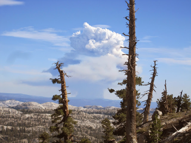
From Wawona Rd
From the Dome
Sent from my SAMSUNG-SGH-I747 using Tapatalk
Last edited by sheperd80 on Tue Jul 29, 2014 12:09 pm, edited 1 time in total.
2000 Acres, south of Mammoth Pool Reservoir, near tail end of Minarets Road
on western side of Sierra. http://inciweb.nwcg.gov/incident/4013/" onclick="window.open(this.href);return false;
Here we go, fire season in the higher season has begun.
Please make sure to title your posts according to the fires that you are reporting
on to ensure confusions. Thanks
I don't give out specific route information, my belief is that it takes away from the whole adventure spirit of a trip, if you need every inch planned out, you'll have to get that from someone else.
Have a safer backcountry experience by using the HST ReConn Form 2.0, named after Larry Conn, a HST member:http://reconn.org
Just called the High Sierra Visitor Information Station On Kaiser Pass Road. Ranger's not sure about Bear Lakes but says its "pretty smoky" where he's at, FWIW.
Last edited by maverick on Wed Jul 30, 2014 9:43 am, edited 2 times in total.
Reason:Subject changed
Buford wrote:
Mineral King valley was filled with smoke this morning. Don't know where the fire is.
There have been a couple of fires, now 100% contained, in the the Lake Isabella area
from which the smoke could impact the MK area with the right wind conditions.
Professional Sierra Landscape Photographer
I don't give out specific route information, my belief is that it takes away from the whole adventure spirit of a trip, if you need every inch planned out, you'll have to get that from someone else.
Have a safer backcountry experience by using the HST ReConn Form 2.0, named after Larry Conn, a HST member:http://reconn.org