July 1-3, 2011
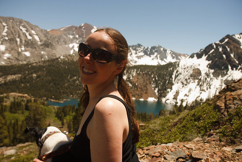
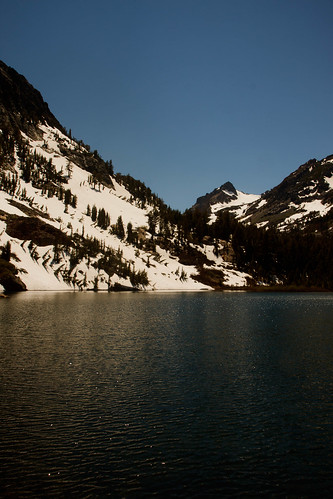
We were all packed up for a 4-day trip without knowing until the last minute where we were going. Would it be Black Buttes, Rubicon River out of Loon Lake, Kennedy Lake, Walker River out of Levitt Meadows or Green Lake? We loaded all the maps and headed to Bridgeport ready to go for wherever we could get a permit on the holiday weekend. At noon we got the permit for Green Lake. My original plan of a loop trip to Soldier Lake was voted down by my husband who hates to walk on snow. We settled on a base camp at Green Lake, little over 2 miles in, where he could fish and I could day-hike. With reports of mosquitoes, I was apprehensive. I hate mosquitoes as much as he hates snow. It was hot but a gentle breeze cooled us off and kept bugs down. I chose to wade a few shallow side-creeks whereas my husband, with longer legs, hopped rocks or walked logs. He had trekking poles; I had forgotten to pack mine! We found a nice dry albeit over-used campsite on the east shore south of the outlet creek. The wind really picked up; great for bug abatement, but not for fly fishing. My husband fished using a spinner the rest of the afternoon with no luck.

Fishing at Green Lake
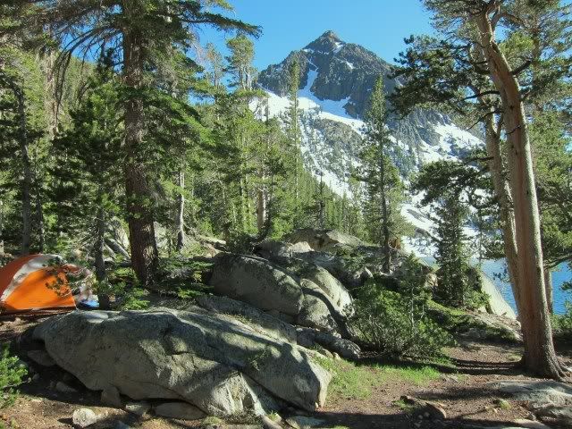
Camp at Green Lake
We got up at dawn and headed up to East Lake. Shortly up the switchbacks the trail crosses the creek from East Lake. I again waded and my husband with his high top leather boots splashed through on top of rocks. Soon we were basically on snow to the outlet. About half way along the east shore we found a nice dry bench for fishing where I bid farewell and continued to hike up to Summit Lake. The snow was solid although steep at times. There seemed to either be thick drifts of snow or bare ground. The rock in this drainage is dark so the trail was open where it went through rocks, and deep under snow in the trees and on north-facing slopes. I found the trail off and on all the way to the pass at the west end of Summit Lake where there surprisingly was a dry campsite. East Lake, Gilman Lake and Hoover Lakes were mostly thawed and Summit Lake was just beginning to thaw. I crossed all streams on sturdy snow bridges.

Morning at Green Lake

East Lake from outlet
 Upper Hoover Lake
Summit Lake

Snowy north facing slope by Lower Hoover Lake
The good thing about day-hiking is a light pack; the bad thing is that once at your destination, you have to hike all the way back to camp! On the return I ran into a few people. At Gilman Lake I was careless and happy to be on a trail, headed down canyon. Shortly I realized I had made a stupid mistake- I was not lost (knew very well where I was and it was not where I intended to be!). Ugh- back uphill and over the cliffy rocky buttress east of East Lake. That cost me nearly a mile and 300 feet elevation. Since I had forgotten my trekking poles my knees began to get stressed the final descent back to Green Lake. I was already soaked, so simply walked through the creek shoes and all. I was hot and sweaty so immediately took a quick bath; it felt great! The day’s hike was 10 miles with 1,800 feet gain. Soon my husband came walking back with two nice fish for dinner. The breeze continued to keep bugs down, however we seemed to be invaded by ants, throwing many out the tent door before we called it a day. It was so warm that night that we did not even get inside our sleeping bags.

Sunrise at Green Lake
The third day I hiked up to West Lake while my husband preferred to fish. Well, soon I was wading again. I was getting really fast at this taking off shoes and walking through water. The trail up to West Lake was dry except for the upper 300 feet of the 1,000-foot gain in 1.1 miles. There were a few dry camp spots up here, in spite of the snow. The lake was spectacular and I wished we had camped up here, but a mostly frozen lake is not what my husband had in mind for fishing! When I returned he had caught two more fish that we cooked up for lunch. We had planned on staying another day, but I had hiked about all I wanted to see and the fishing was not that great, so we returned, reaching the trailhead by 1:30. We drove home, the beautiful route via 395, then over Monitor Pass, Luther Pass and Echo Summit, dropping down to 100+ degree heat! The view at the top of Monitor Pass looked out onto a still very snow Sierra. All rivers were bank-full and flowing fast full of standing waves. Horsetail Falls was spectacular. The big melt is on!

Green Lake from trail to West Lake

Outlet pond at West Lake

West Lake

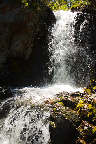
View of Green Lake from rocky point near falls from West Lake