This was a mellow backpack with a mix of on- and off-trail hiking. My friend Mike and I had been backpacking with a couple of other friends in New Mexico’s Pecos Wilderness a few weeks earlier, where the mornings were good but the afternoons brought lots of hail, thunder and lightning. So we decided to go on this last minute Sierra trip to try and make up for that wet weather. And that worked out: on this trip the sky was clear except for two distant clouds one day. And we saw three grouse, but only two people.
Monday, August 30. Picked up our permit in Prather and started hiking from the Maxson Trailhead around noon. Fortunately for us, we started the backpack the day before the national forests closed. No one said anything to us when we were at Prather, but the Forest Service issued the press release announcing the closure later that same day and left a copy of the release and the closure order on our windshield at the Maxson parking lot at some point after we started hiking.
We also avoided an unexpected problem the day before when, after flying into Fresno, we couldn’t find fuel canisters. REI and Walmart didn’t have any, and Sportsman’s Warehouse had these large ones, probably 24 ounces, which would have been inconvenient at best even if we shared. Finally found normal-sized ones at Big Five.
The hike in along the trails was good. We arrived and camped at Hobler Lake around 3:00 pm. We used the big established campsite between the lake and the trail. This was the warmest night of the trip, down to about 40 degrees or so.
Tuesday, August 31. We started northeast along the Hobler Lake Trail and then continued a mile or so north along the Burnt Corral Trail, which doesn’t appear to be maintained. We then went off trail to follow the right branch of Burnt Corral Creek to Lake 9280. Unfortunately, the right branch itself forks, which the USGS quad doesn’t show, and we took the larger left fork, which does not lead to that lake. But based on elevation readings, we knew we needed to head east, and reached the lake. As you might expect, it was much lower and smaller than normal, although six or so waterfowl were still paddling about.
Our next goal was Lake 9880, a little less than a mile to the north. As throughout the trip, we pulled a little to the right as we navigated toward the lake, but corrected and then climbed the ramp about ¼ mile west of the lake. According to a sign nailed on a tree on the west side of the lake, the lake has a name: Hosses Lake.
After lunch at Hosses Lake, we set out for our campsite destination, Lake 10040, about a mile northwest. Here was the main navigation glitch of the day, although it ended up making no difference. The original idea was to head northeast, maintaining elevation on the west side of the Post Corral Creek canyon, then climb up that canyon to the meadow at around 10000 ft, and head southeast to the west side of the lake. But I somehow decided that we needed to circle around the Post Corral Creek canyon. We then we climbed the east shoulder of that canyon and hiked north along the west side of the next canyon to the east. And that brought us to the south side of the lake, where the smaller ponds are, rather to than the west side. This was a little confusing at first, but all’s well that ends well. Camped on the north side.
Wednesday, September 1. Our goal today was to climb Ward Mountain and then camp at Lake 10200, about 3/4s of a mile south of the mountain. The plan was to start by climbing the gradual slope northnortheast of the lake to the col at 10600 ft., but again we pulled right – this time far right – and ended up in the next small recess/cirque to the east. No big problem, other than a steeper climb than we’d expected as we crossed the shoulder to get back to the more gradual route. Nice view from the col toward Piute Canyon.
After reaching the col, we traversed up a bit to the west and followed the ridge down to the col by Ward Mountain, where we had a nice view back toward the ridge.
The class 2 route to the summit of Ward Mountain wasn’t as apparent as we thought it would be, and we weren’t really in the mood at that point to do a lot of searching for the route, so we bailed on climbing the last 300 or so feet of Ward Mountain and had lunch. Then we headed down to the tarn and to Lake 10200, which has mountain hemlock and mountain heather. I slept on the small ridge to the east of the lake with its great views looking toward Piute Canyon.
Thursday, September 2. I’ve had a minor obsession with climbing Mosquito Pass, so that was this day’s objective. We’d hoped that we could get over to Heather Lake by maintaining elevation and contouring around the base of the ridge running to Zingheim Heights, but that only worked for the first small drainage south of the lake – the succeeding terrain along the north side of the ridge was too steep. So we descended across some pinemat manzanita into the next small basin, which was lush with lots of young trees and other low growth. We then headed southeast along the base of the ridge through open woods, past the twin ponds, and down to a grassy meadow along the creek that starts northwest of Zingheim Heights. Some alpine gentian were hiding among the grasses in the meadow.
After a little reconnoitering, we found the Heather Lake outlet stream and climbed. Again, we pulled a little to the right, but corrected and made it to the lake, which, true to name, was surrounded by mountain heather.
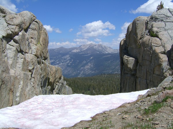
On the way up, we saw some bear sign – a relatively recent footprint in the mud. And then we climbed Mosquito Pass – the chute, not the Secor bypass route.
A little steeper than I’d expected but not bad. After that, we hiked south to Lower Indian Lake, where we camped along the long meadow running parallel to the narrow part of the lake. The previous two nights had been in the mid-thirties, and this night got down to around freezing, as the condensation on the tents froze.
Friday, September 3. Started the day with a climb up Fleming Mountain. Nice views in all directions, including toward the Reddy’s Hole and Red Rocks Basin area to the west.
An osprey flew along the ridge as we were up there, and we saw an American kestrel as we hiked down. Then we packed up camp, and hiked down the Hell for Sure Trail to Post Corral Meadow. The Hell for Sure Trail, which basically runs parallel to the Meadow Brook Trail a little to the east, seemed very different than the Meadow Brook Trail to me – much dryer and sandier.
When we got to the meadow, a couple from San Diego was camped on the slabs. Talking with them was the first time we heard that the forest had been closed – the couple had started backpacking a day before us, but had heard about the closure from some people at a pack camp. The creek wasn’t flowing, but there were a number of pools where trapped fingerlings were dashing about. A few Sierra gentian were near the pools. A couple of mule deer came down to the pools while we were there.
Saturday, September 4. A good, uneventful hike out to the trail head. We apparently were so engrossed in whatever we were discussing – I don’t know what – that we missed both trail junctions. But instinct carried us in the right direction. Got back to the car around 11:30 a.m. and drove back to Fresno for our flights home the next day.
As a bonus on the flight back home, I passed more or less above Mount Shinn and Ward Mountain, so I could see Florence Lake, Lake Edison and some of the surrounding terrain north of where we hiked.
Thanks to sekihiker and TehipiteTom for useful information in trip reports on this site and elsewhere.
TR: Red Rock Basin to Red Mountain Basin via Mosquito Pass, August 30-September 4, 2021
-
agfhst

- Topix Acquainted
- Posts: 31
- Joined: Wed Feb 01, 2017 4:54 am
- Experience: Level 3 Backpacker
TR: Red Rock Basin to Red Mountain Basin via Mosquito Pass, August 30-September 4, 2021
You do not have the required permissions to view the files attached to this post.
-
balzaccom
- Topix Addict
- Posts: 2970
- Joined: Wed Dec 17, 2008 9:22 pm
- Experience: N/A
Re: TR: Red Rock Basin to Red Mountain Basin via Mosquito Pass, August 30-September 4, 2021
Nice report! That's an area I'd like to explore some day. We've done Lower Indian from the other side, but as part of a Red Mt. Basin trip. Thanks for posting.
Last edited by balzaccom on Wed Oct 20, 2021 3:26 pm, edited 1 time in total.
Check our our website: http://www.backpackthesierra.com/
Or just read a good mystery novel set in the Sierra; https://www.amazon.com/Danger-Falling-R ... 0984884963
Or just read a good mystery novel set in the Sierra; https://www.amazon.com/Danger-Falling-R ... 0984884963
-
kpeter

- Topix Fanatic
- Posts: 1450
- Joined: Mon Jan 04, 2010 1:11 pm
- Experience: Level 3 Backpacker
Re: TR: Red Rock Basin to Red Mountain Basin via Mosquito Pass, August 30-September 4, 2021
I enjoyed your write up. Another area to explore.
-
sekihiker

- Founding Member
- Posts: 959
- Joined: Sun Dec 18, 2005 2:47 pm
- Experience: Level 4 Explorer
- Location: Fresno
- Contact:
Re: TR: Red Rock Basin to Red Mountain Basin via Mosquito Pass, August 30-September 4, 2021
Thanks for the report and photos.
Nice to see your photo of Mosquito Pass from the other side. In heavier snow years, the pass has a cornice at the top that blocks the way.
Nice to see your photo of Mosquito Pass from the other side. In heavier snow years, the pass has a cornice at the top that blocks the way.
Who is online
Users browsing this forum: Bing [Bot], jmherrell and 119 guests