Over the holiday weekend I completed a 40-mile circuit starting and ending at the Pine Creek trailhead. I call this route The Great Mono Loop; it connects Italy Pass, Gabbot Pass, Mono Pass, and Morgan Pass. The circuit mixes on-trail and off-trail hiking; it includes a short section of the Sierra High Route. It's likely that other HST members have hiked variations of this route. Please feel free to post URLs to previous trip reports in the comments section of this thread.
ROUTE: I planned to complete the trip in five days, but I was feeling strong and I finished in four days.
PHOTOS:
I posted photos below in the post. You can also view my entire photo album here: https://flic.kr/s/aHskDPYLU8
REPORT:
I departed the SF bay area at 4am and drove across the central valley, over Tioga Pass, and then south along Highway 395 to the Pine Creek trailhead. Along the way, I picked up two PCT thru-hikers hitchhiking from Tuolumne Meadows to Mammoth Lakes. They needed new shoes. We mostly talked about the evolution of the PCT over the past decade since my thru-hike in 2005.
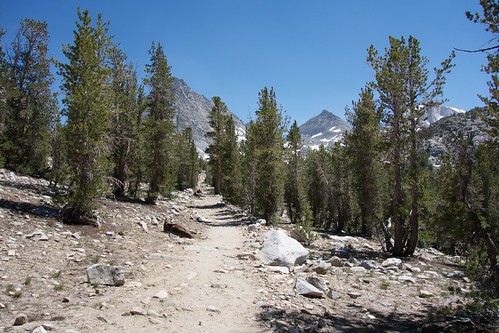
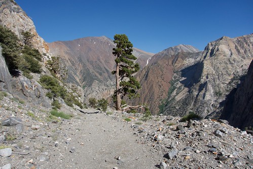
The parking lot at Pine Creek trailhead was nearly full, perhaps not surprising because it was Saturday on a holiday weekend. I ate lunch and started hiking at 1pm. Following advice from previous HST posts, I found the actual Pine Creek trail by walking through the pack station; otherwise, this trailhead is not obvious from the parking lot. I climbed the switchbacks slowly under the hot afternoon sun. I was elated to be returning to the backcountry, but I also felt miserable in the heat with a full pack, and coming from sea-level.
As I climbed higher, I passed several dozen hikers returning from day trips to Pine Lakes. I eventually arrived at Upper Pine Lake (10,200’) and setup camp. I considered climbing higher to Honeymoon Lake, but I chose to rest because I felt fatigued from the heat and the altitude.
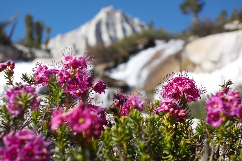
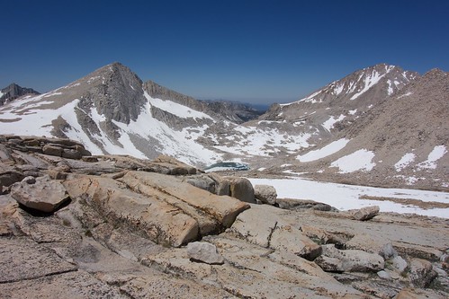
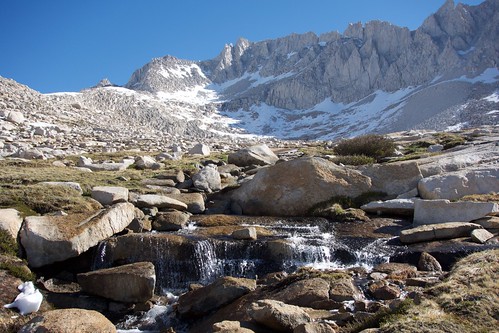
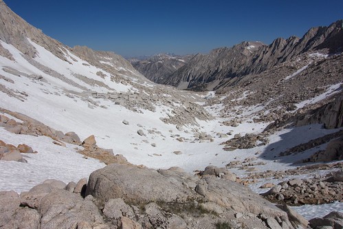
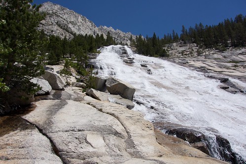
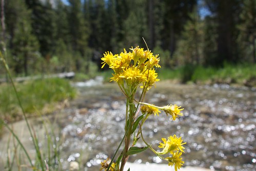
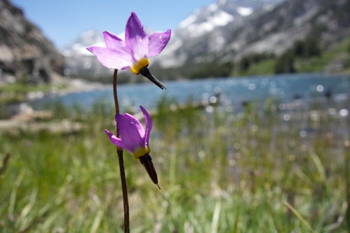
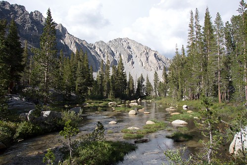
On the second day, I continued along the Pine Creek trail to Honeymoon Lake, and then followed the Italy Pass trail into Granite Basin. This section is fantastic; it passes through a seemingly endless chain of alpine meadows, waterfalls, and delicate tarns. A light breeze kept the mosquitos away, and the wildflowers were brilliant in the morning sunlight. The trail disappeared near the head of Granite Basin, but I found cross-country walking to be easy here. The route to Italy Pass was obvious. I arrived on Italy Pass at noon. I ate lunch and watched a party of climbers scramble up the western ridge of Mount Julius Caesar.
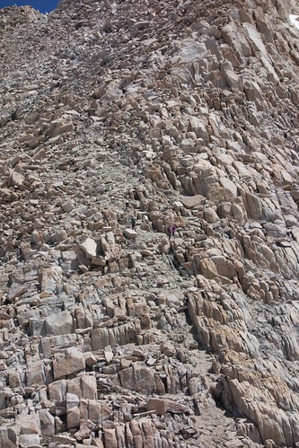
My descent from Italy Pass was relatively straightforward. Crossing the talus slowed me down, but I found a use trail above Jumble Lake and the walking became easy. The use trail ended at the shore of Lake Italy, and I returned to talus-hopping along the southern shore of the lake. [EDIT: I later learned that I should have gone clockwise around the lake and followed the northern shore]. This section around the south shore of Lake Italy was frustrating and my progress was slow. The talus here is large and unstable, and I frequently scrambled over car-sized boulders.
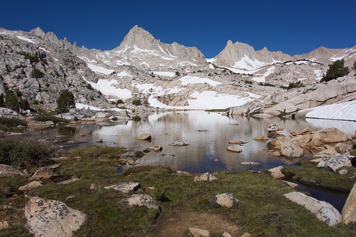
By mid-afternoon, I reached the sandy meadow between Lake Italy and Toe Lake. I setup camp in the shade of a large boulder. I was exhausted from all my talus scrambling, and it felt nice to splash around in the shallow water of Toe Lake. I took a nap in my tent. Later, I enjoyed the evening light dance in colorful patterns across Mount Dade and the Sierra Crest. Lake Italy is an amazing place to camp-–-it's a huge cathedral in the sky---and I felt lucky to have it all to myself for one night.
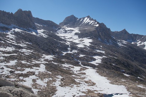
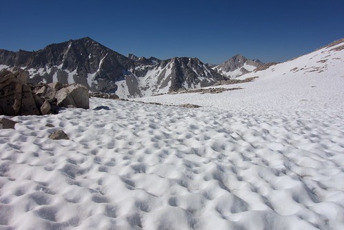
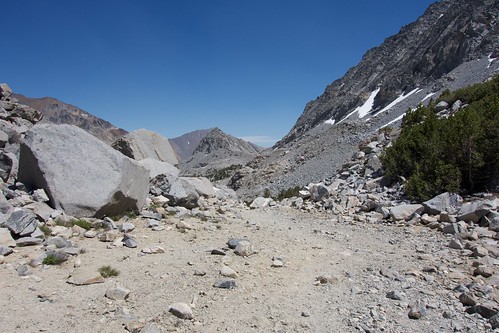
On day three, I climbed Gabbot Pass in the morning. Several feet of snow remained on the pass, but it had consolidated into the proverbial “Sierra cement” that made for easy crossing. Previous HST posts mentioned the talus was annoying on the north side of Gabbot Pass, but the snow cover worked to my advantage and I rapidly descended into the Mills Creek canyon.
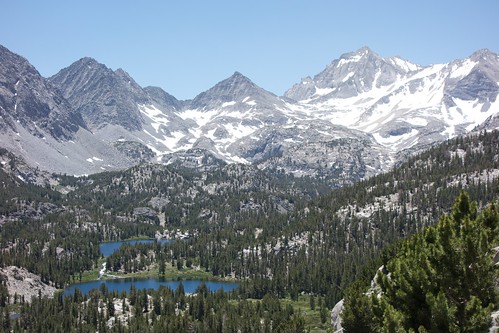
The Mills Creek area is very scenic, with open pine forests under towering granite spires. I rested at Lower Mills Creek Lake, swam in the cold water, and sunbathed to dry. A light breeze kept mosquitos away and the conditions were practically perfect. It was challenging to find willpower to leave this beautiful spot.
My descent from Mills Creek into the Second Mono Recess was frustrating as I bushwhacked through thickets of aspen and cottonwood. [EDIT: see the comments for discussion of a better route]. Whereas the cross-country walking along upper Mills Creek was easy, here the canyon pours into a waterfall and I could not find an optimal route down into the Second Recess. I thought I was following a use trail, but it frequently disappeared and I had to fight through dense foliage. This passage seemed to take forever.
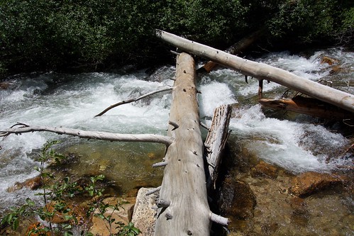
Near the bottom of the Mills Creek waterfall, I met HST members RoguePhotonic and AlpineMike. It’s nice to meet HST members in real life. We chatted about our trips and snow conditions. They shared with me useful advice about the Mono Creek ford. Rogue said the water was above his waist and the crossing was challenging. Mike, fortunately, found a log crossing fifty meters upstream. Rogue and Mike were climbing Gabbot Pass, so we said goodbye and I continued downstream.
The trail through the Second Recess is lovely and easy to follow; I soon arrived at the Mono Creek crossing. Rogue and Mike were correct: the ford appeared too dangerous. I followed Mike’s advice and found the log upstream. The log was somewhat hidden in bushes, though, and I doubt I would have found it without Mike's suggestion.
[Edit: see cgundersen's 2011 photo on Flickr of the log crossing: https://www.flickr.com/photos/10845599@ ... 392180095/]
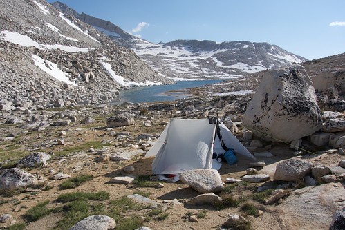
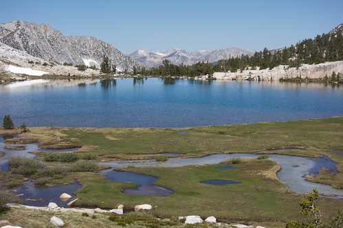
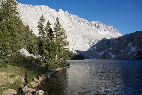
Across Mono creek, I boiled a pot of soup and refueled at Fish Camp. I then enjoyed the afternoon following the well-maintained trail up the Mono Recess. After walking cross-country for the past few days, it felt luxurious to return to an engineered trail. I was able to silence my brain and simply cruise through the forest. I saw no one else all day. I camped at Fourth Recess Lake in a lovely site on the northeast shore. The alpenglow was incredible on the peaks above Fourth Recess Lake.
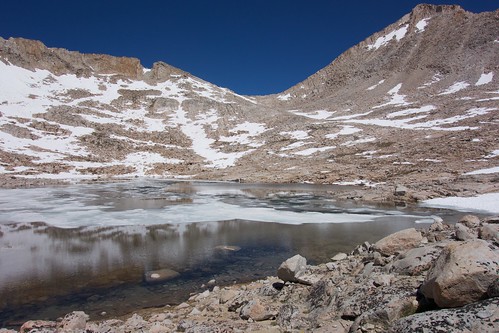
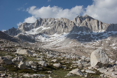
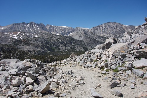
On the fourth day, I continued up the Mono Creek trail and reached Mono Pass at noon. I love the stark landscape at Mono Pass; it’s just rock, ice, and blue sky. Two backpacking groups passed me headed the opposite direction, presumably they were hiking from Mosquito Flat trailhead into the Mono Recesses.
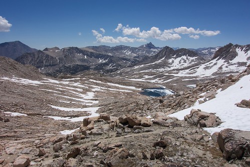
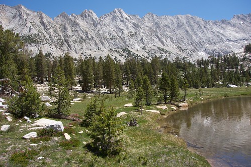
The rest of the afternoon was a blur. I descended Mono Pass and hiked up the Little Lakes Valley and then over Morgan Pass. The Little Lakes Valley is outrageously beautiful, but also I think crowded because Mosquito Flat trailhead is nearby. The crowds didn’t bother me. After several days of solo travel, I found it oddly charming to see all these families, fishermen, and climbers enjoying themselves.
Over Morgan Pass, the crowds disappeared and I seemed to have the mountains to myself once again. I really connected with the Morgan Lakes area: deep blue lakes, huge vistas, and colorful geology. I’m surprised I haven’t seen more trip reports from these lakes. This area has a long history of mining, and the “trail” here is an abandoned jeep track. I followed the track down the canyon, and enjoyed the afternoon sun casting long shadows across the rusted mineral landscape. I returned to Pine Creek trailhead as sunset peaked, just in time to watch Mount Tom glow in the evening light.
Overall, I feel this trip was a fantastic success.
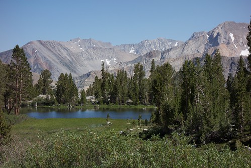
Photos from Day One. . .
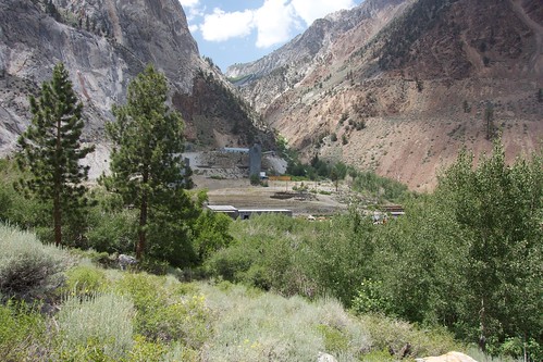
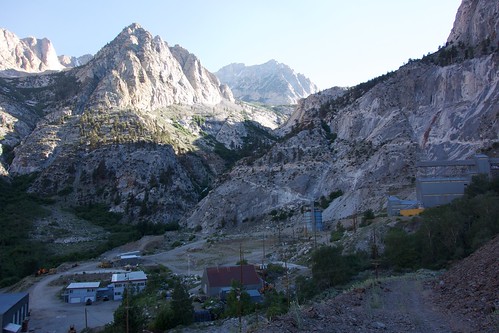
The Pine Creek Tungsten Mine, seen from the switchbacks ascending Pine Creek.
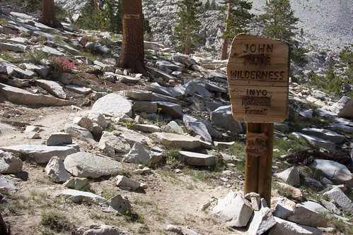
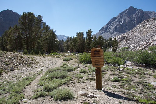
Entering the John Muir Wilderness along Pine Creek
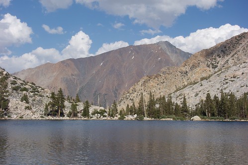
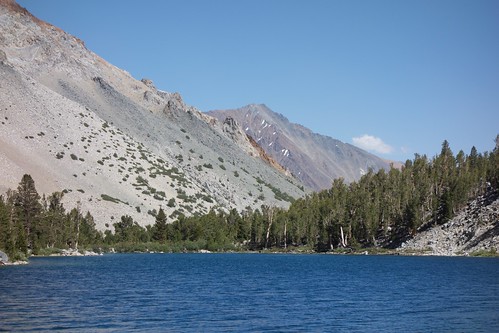
Lower Pine Lake with a view of Mount Tom.
The outlet of Upper Pine Lake
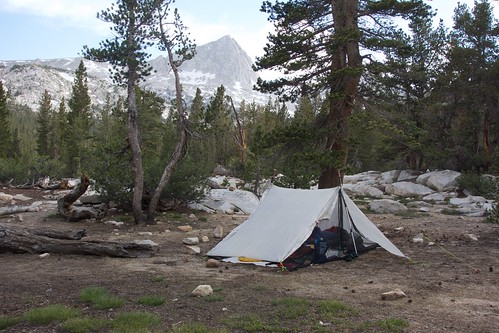
My camp near Upper Pine Lake