TR: JMT Spring Traverse 2016

If you've been searching for the best source of information and stimulating discussion related to Spring/Summer/Fall backpacking, hiking and camping in the Sierra Nevada...look no further!
User avatar
Hobbes
Topix Fanatic
Posts: 1120
Joined: Wed Apr 27, 2011 8:09 am
Experience: N/A
Location: The OC

TR: JMT Spring Traverse 2016

Post by Hobbes »

Lamarck Col -> JMT -> Kearsarge Pass
5/31/2106 - 6/5/2106

Special equipment: ice axes, trail runners/micro-spikes, GTX socks, tights, knee gaiters, gloves, 5+ r-value pads, 10 degree bags; optional boots/crampons

Approach to Lamarck Col 6/1/2016 7:00am
Image

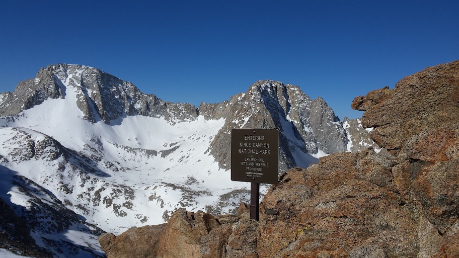
Rather than wait to pull together a complete trip report, I figured it would be more interesting to post up a couple of initial tidbits and allow a more detailed story to develop from there. Andy has hundreds of photos to sift through and organize, as well as his own perspective that should help provide better context to what we jointly experienced. Suffice it to say, over time as the stories are told and re-told again about the perfect conditions, incredible weather and endured hardships, legends will continue to grow about this amazing hike that Lead Dog, Tenacious D and myself took along the JMT in the spring of 2016.

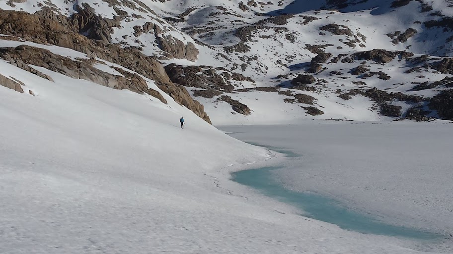
Lead Dog @ at the shore of Helen lake 6/2/2106 7:30am
Image

Day 1 - 5/31/2106
N Lake TH - upper Lamarck plateau
3.1 miles

Where to start? Well, Lead Dog (aka BlueWater) and I drove up from OC on 5/31, met & picked up our permit in Lone Pine before noon, and then proceeded to drive up to Onion valley to rendezvous with our shuttle driver. [Kurt, our low-key, very $ reasonable & gregarious driver, has his own host of interesting stories to tell (AF academy, Viet Nam, 37 years airline captain), so if you need a ride along the east side, give him a call at 616.972.9476.]

Leaving our cars behind, Kurt drove us up to the N Lake trailhead for the start of our adventure. We were both a little anxious due to both known challenges of heavy snow, but also the expectation of unknown surprises that awaited us. To add a higher pitch, there were tales of recent trailhead 'rescues' Kurt had performed for whipped & stranded PCT hikers looking to escape at various exit points, primarily Horseshoe meadows. (In anticipation of potential problems, both LD and myself had credit cards & cash in case we decided/had to bail at Bishop, Taboose, etc.) After a couple of perfunctory pictures, and a word of assurance that we looked like we knew what we were getting ourselves into, Kurt took off. We were left with nothing else to do but hike, so off we started.

The first challenge we were going to encounter was the state of the dangerous and exposed trail below the initial switchbacks above upper Lamarck lake. Just getting to that point was a little bit difficult because snow coverage was close to 100% beyond lower Lamarck lake. (Throughout the hike, 10.7k became the baseline. Below that, patchy, sometimes almost continuous snow; above, 100%+ coverage.) Because of our afternoon start, we of course had to deal with our first series of post-holing fun in the deep snow drifts that covered the entire trail.

[Note: The entire trail plan was to hike very early each day in order to have perfect, hard packed snow/ice conditions in which to simply walk across. Day 1 was a late start due to the basic logistics of merely getting there, shuttling cars, etc.]

Getting to the base of the switchbacks, we could just make out small traces of trail snaking up the shoulder, along with boot tracks/crampons in the snow both linking the trail, as well as heading straight up the chute. I don't have any photos looking up, but I'm sure Andy has some that will provide a better perspective. What I do have is looking down the steep chute - oddly, everything appears flat, when it was actually around a 60-70+ degree fall off.

It may look flat, but it is actually very steep
Image

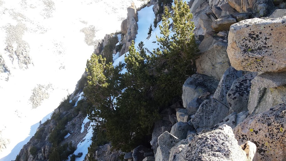
After finally making it to the top of the switchbacks, Lead Dog took a few steps to the left to gain a better perspective on the other side. This is what he saw:

Are you feeling lucky?
Image

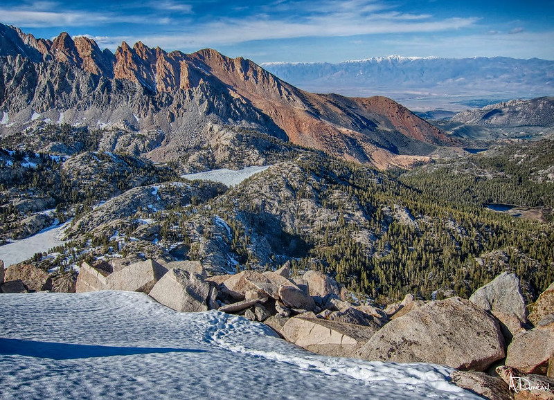
This had death written all over it, so we just sort of whistled to ourselves, and went to plan B that we had devised while ascending. To the right of the switchbacks are a series of boulders that lead to the top of the 11.6k ridge line above upper Lamarck lake. We knew that the south side had a mellow grade, so all we had to do was engage in a little class 3 hand-over-hand climbing straight up the boulders in order to bypass the cliffed-out drop-off section laying in wait below the snow/ice choked trail.

Just a little higher
Image

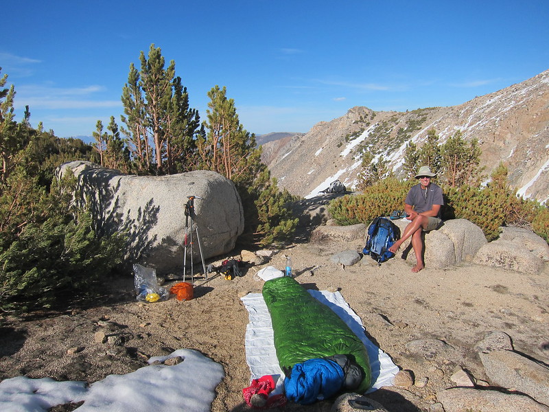
After not too much time, we finally reached the top of the ridge. To our collective great relief, we saw both impromptu bivy spots along the top, as well as a nice, mellow plateau @ 11.5k further down with plenty of camp spots. So, as the day was edging to evening, we headed on down, set up camp, cooked dinner, and crawled into bed. Spoiler alert: neither of us set up any kind of shelter the entire trip; the weather was so perfect everyday, we simply threw down our gear and cowboy camped each & every night.

With an agreed start time of 6:30am early next morning to get over Lamarck Col, we both fell sound asleep after an adventurous day one.
Last edited by Hobbes on Tue Jun 14, 2016 10:19 am, edited 25 times in total.
User avatar
Hobbes
Topix Fanatic
Posts: 1120
Joined: Wed Apr 27, 2011 8:09 am
Experience: N/A
Location: The OC

Re: JMT Spring Traverse 2016

Post by Hobbes »

Day 2 - 6/1/2106
upper Lamarck plateau - Lamarck col - Darwin canyon - JMT - Wanda lake
10.4 miles

Lamarck Col 6/1/2016 7:45am
Image
Last edited by Hobbes on Tue Jun 14, 2016 10:19 am, edited 3 times in total.
User avatar
Snowtrout
Topix Regular
Posts: 305
Joined: Mon Feb 18, 2013 10:06 pm
Experience: Level 3 Backpacker
Location: Fresno, CA

Re: JMT Spring Traverse 2016

Post by Snowtrout »

Thank you for the valuable info and pics. My wife and I are starting the JMT on June 19 going sobo from TM and information of the trail has been difficult to get so far. From what I have read, lots of PCT'ers skipped this area and jumped to Tahoe but those who have gone for it, have stories and pics of nothing but snow from Whitney to Evolution Valley. According to snow depth stations and river flows gauges, the heat over the past week has melted a lot of snow with the peak melt happening maybe this weekend [-o<

Either way, I hope you post some more.....your information is very much appreciated at this time :D
User avatar
Hobbes
Topix Fanatic
Posts: 1120
Joined: Wed Apr 27, 2011 8:09 am
Experience: N/A
Location: The OC

Re: JMT Spring Traverse 2016

Post by Hobbes »

We didn't see anyone anywhere until the afternoon of day 2 on 6/1/2016. Along the shore of Evolution lake, we met our first PCT hikers: two brothers heading north. Figuring they probably didn't get many photos together, I offered to take their picture. They were so sick of snow that rather than respond with a "thank you", one said "What's there to take a picture of? It's just snow." This is the exact place & time (around 4pm) where I took their photo:

Image

Does this fantastic vista look like it's "just snow", or was his reply more indicative of a state of mind exhausted from conditions? Anyway, they mentioned that something like 90% of PCT hikers had elected to skip ahead from Kennedy meadows. The 6-10 trekkers we met each day would therefore represent the very small percentage of those willing to take on the challenge. We would soon enough begin to share an inkling of their feelings, yet still yearn for the high country to be as completely snow covered as possible to enhance the alpine experience. Thankfully, we had our wishes delivered - in spades:

Nearing camp spot by Wanda lake 6:30pm
Image

Note: We started between 5:30-6:30am, but other than a few small breaks, we didn't stop until 6:30-7:30pm each day, with an overall avg speed of 1.43mph:

Complete actual record
https://docs.google.com/spreadsheets/d/ ... edit#gid=0

I would expect you will get a mix - maybe clear, exposed trail above 11k, but still some good snow holding at the very tops.

PS Tenacious D(avid) is a Czech hiker who was the first southbound JMT trekker (starting from Happy Isles) of the year. His stories of trying to get through Yosemite the week before are truly hair raising. Andy and I had heard from various NOBO PCTers that someone was ahead of us; we came across him wasted, sunburned and resting just below Monster Rock. He joined in with us there, and the rest is, well, history ... (Hint: I have never met anyone with his level of mental fortitude and physical endurance - just incredible. After a particularly hard day, he showed up late after we were already in bed. That's when Andy named him "Tenacious D".)
User avatar
Bluewater
Topix Expert
Posts: 584
Joined: Sun Oct 23, 2011 3:33 pm
Experience: Level 4 Explorer
Location: Laguna Beach
Contact:

Re: JMT Spring Traverse 2016

Post by Bluewater »

"Tenacious D" was incredibly tenacious. After missing our camp the last night he ended up setting up a bivy in the snow and boulders at the base of Glen Pass so we wouldn't miss him. . . he arrived at 11:00 pm that night.

David (Tenancious D) started from Happy Isles on May 19th and endured four days of constant snow storms and finally hiked out over Mono Pass to replace his shoes. We watched him remove his new(er) boots, pants etc to ford some very high water crossings barefoot. After one of these crossings in Upper Basin he post holed in the snow barefoot and cut his ankle on a hidden boulder. He seemed unaffected by the huge gash on his ankle (I could see it was through the skin and into the muscle) while he discovered that he was out of the antiseptic in his first aid supplies.

A few days later he showed us the large deep scraped sections of skin missing from both ankles and it was then that we insisted that he hike out with us via Kearsarge Pass and get some medical attention in Lone Pine.

Many thanks to Hobbes for making sure that he got what he needed in Lone Pine. I understand the doctor was very concerned when he first saw David's ankles, but fortunately he was ok.

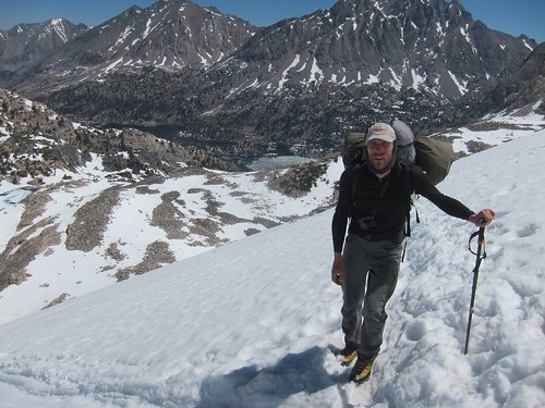
Here is a picture of Tenacious D at the top of Glen Pass. Since he was out of fuel and only had spaghetti and oatmeal he had gone without breakfast that morning. . .

Image

This one is right before the post-holing injury in Upper Basin:

Image

Hobbes mentioned many times that with the right gear Tenacious D could be unstoppable.
User avatar
Bluewater
Topix Expert
Posts: 584
Joined: Sun Oct 23, 2011 3:33 pm
Experience: Level 4 Explorer
Location: Laguna Beach
Contact:

Re: JMT Spring Traverse 2016

Post by Bluewater »

A few more from Day 1:

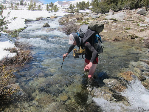
Hobbes checking out the outlet of Upper Lamarck Lake:

Image

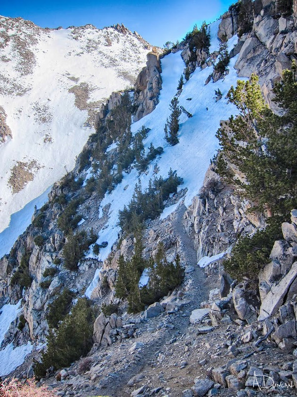
At the top of the switchbacks above Upper Lamarck Lake the trail became an ice wall along the normal route:

Image

So Hobbes led the way through the boulders and snow to find a class III route along the ridge to the top. The view from the top:

Image

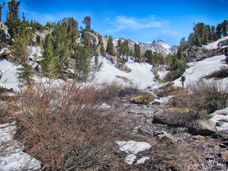
This was a difficult section, but to our surprise there was a large dry area to camp on the first plateau:

Image
User avatar
ERIC
Your Humble Host & Forums Administrator
Posts: 3254
Joined: Fri Oct 28, 2005 9:13 am
Experience: Level 4 Explorer
Location: between the 916 and 661

Re: JMT Spring Traverse 2016

Post by ERIC »

Really enjoying following this thread. As always, great photos too. Thanks for posting.
New members, please consider giving us an intro!
Follow us on Twitter @HighSierraTopix. Use hashtags #SIERRAPHILE #GotSierra? #GotMountains?
Follow us on Facebook: https://www.facebook.com/HighSierraTopix
User avatar
paul
Topix Expert
Posts: 865
Joined: Thu Mar 15, 2007 3:35 pm
Experience: N/A

Re: JMT Spring Traverse 2016

Post by paul »

Looks like a great trip!
Just a little suggestion – if anyone else is heading up to Lamarck – I would suggest taking the “winter route” instead of the trail. It’s basically the next drainage over to the southeast from the Lamarck Lakes valley. You go to Grass Lake and the follow its southernmost inlet stream up the valley. I came down this way when I came out over Lamarck at the end of a ski tour, and it was a piece of cake. Route finding on the lower part in the trees will be a little trickier on the way up than it was for me on the way down but should be not a big deal, and there’s no exposed terrain on any of it.
User avatar
Hobbes
Topix Fanatic
Posts: 1120
Joined: Wed Apr 27, 2011 8:09 am
Experience: N/A
Location: The OC

Re: JMT Spring Traverse 2016

Post by Hobbes »

paul wrote:If anyone else is heading up to Lamarck I would suggest taking the “winter route” instead of the trail.
LeadDog aka BlueWater has been over to Darwin basin so many times he could rightly be called "Mr Lamarck". He & Alpine Mike took the Grass lake drainage (winter route) back in February:

http://highsierratopix.com/community/vi ... =5&t=14048

That was our big question mark - the snow had melted sufficiently to make the winter route a tedious slog, but it was still a bit early for the use trail to be completely open past the switchbacks. So, we improvised along the way, and as we discovered from some boot tracks & bivy spots, it's a pretty common work around.
User avatar
Hobbes
Topix Fanatic
Posts: 1120
Joined: Wed Apr 27, 2011 8:09 am
Experience: N/A
Location: The OC

Re: JMT Spring Traverse 2016

Post by Hobbes »

Day 2 - 6/1/2106
Part I - Lamarck col, Darwin canyon

Andy & I were stoked to have gotten past the switchbacks/death zone on our first day. This was a really big question - one we had discussed (and quietly feared - not so much the route, but the cascade effect any delay would have on the overall hike) for months leading up to the hike. Because each day had fairly ambitious milestones, we really didn't have any margin for error. Day 2 was no exception - we needed to get over Larmarck col and make it to the Muir hut. Per this spreadsheet:

https://docs.google.com/spreadsheets/d/ ... edit#gid=0

You can see it took us 2.5 hrs to get from lower Lamarck to our bivy location. Day 2 records 9.5 hrs (of actual hiking), but doesn't provide the details of actually being on trail from 6:30am to 7:00pm. Those extra 2.5 hours would have really put us behind schedule if we had waited to tackle it on D2, so you can probably imagine how exalted we were to prep camp, eat dinner and hit the hay on our nice flat bivy plateau after the first day.

We woke up the next morning around 5:30am and got going by 6:30am. The sun was already up - while we could have gotten started earlier, I think we both needed a little bit of recovery time from all the driving, shuttling and hiking to 11.5k after coming directly from sea level. Anyway, with the skies perfectly clear and the sun bouncing off the snow, we de-layered right away, and then made great time quickly hiking up & over the solid surface. Per the chart, we matched our projected time of 1mph, and covered the 1.8 miles in 105 minutes. Reaching the top, we had a great view of Mt Mendel, Mt Darwin and the canyon:

Image

It didn't take us long to get down to the first (last?) of the Darwin lakes - a mix of snow, scree and boulder hopping from the col soon had us down on the canyon floor:

Image

When LeadDog had been through this area back in Feb, he & Mike were able to snowshoe directly across the frozen lakes. In our case, we had a bit of the worst of both worlds: too melted out to cross, but still lots of snow drifts around the lake edges to make travel difficult. So, we had a combo platter: traveling through the snow, then going up and over the boulders blocking the way. If you refer to the spreadsheet, you can see it took almost 4.5 hrs to travel 3.5 miles - one of our slowest sections.

Thankfully, our mysterious guardian angel had preceded us by a day. He left a single line of boot tracks invariably taking, as it turned out, the most optimal path. That is, we'd get up to a clearing, search out a route, then see his faint tracks in the distance and conclude that was the way to go. (Turns out he was a climber who was tackling Mt Mendel; we came across his tent at the base of the bench ie the standard route, with his boot tracks visibly leading up the couloir.)

After passing his tent, we made our way down the Darwin bench drainage leading to Evolution valley & creek. This is the beginning of the descent:

Image

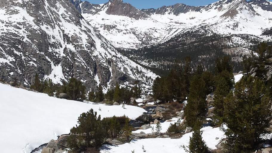
It didn't take us too long to finally reach the sunny, green & clear PCT at mile marker 845 at around 10.7k. As it turns out, this would be become the benchmark snowline for the remainder of our trip. Below 10.7 - warm & sunny, above 100% snow coverage. After spending the last 24 hrs hiking, climbing & sleeping in/on snow, we were happy for the chance to take off our shoes, dry off our gear, and generally laze around a little bit in the shade before tackling our next section for the day: Evolution basin.
Last edited by Hobbes on Fri Jun 10, 2016 11:54 am, edited 1 time in total.
Post Reply

Who is online

Users browsing this forum: Google [Bot] and 30 guests