Mike
Conway Summit Webcam
-
oldranger

- Topix Addict
- Posts: 2861
- Joined: Fri Jan 19, 2007 9:18 pm
- Experience: N/A
- Location: Bend, Oregon
Re: Conway Summit Webcam
What Rogue says, besides Russ doesn't understand technical terms like cfs. 
Mike
Mike
Mike
Who can't do everything he used to and what he can do takes a hell of a lot longer!
Who can't do everything he used to and what he can do takes a hell of a lot longer!
-
rlown

- Topix Docent
- Posts: 8225
- Joined: Thu Oct 25, 2007 5:00 pm
- Experience: Level 4 Explorer
- Location: Wilton, CA
Re: Conway Summit Webcam
because I thought modern day science uses the metric system!!
-
Shawn
- Topix Fanatic
- Posts: 1061
- Joined: Sat Nov 12, 2005 9:56 pm
- Experience: Level 4 Explorer
Re: Conway Summit Webcam
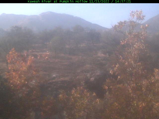
The Kaweah "River". Sigh.
-
rlown
- Topix Docent
- Posts: 8225
- Joined: Thu Oct 25, 2007 5:00 pm
- Experience: Level 4 Explorer
- Location: Wilton, CA
Re: Conway Summit Webcam
better start the rain dances.. The ducks in the cam are a great touch, maybe, unless Markskor happens by..
-
Shawn
- Topix Fanatic
- Posts: 1061
- Joined: Sat Nov 12, 2005 9:56 pm
- Experience: Level 4 Explorer
Re: Conway Summit Webcam
I looked up "ducks" in the dictionary; "providing a false sense of security - always leading the wrong direction".
There's an interesting story behind the three webcams at Mineral King (one of which is shown below). They were designed and built by a former JPL engineer (RIP). Each is on solar/battery power and the update frequency depends on the amount of sunshine. They use an old land line feed from MK, which has proven amazingly consistent over the years. Too bad they can't figure this out for the Tioga cam.
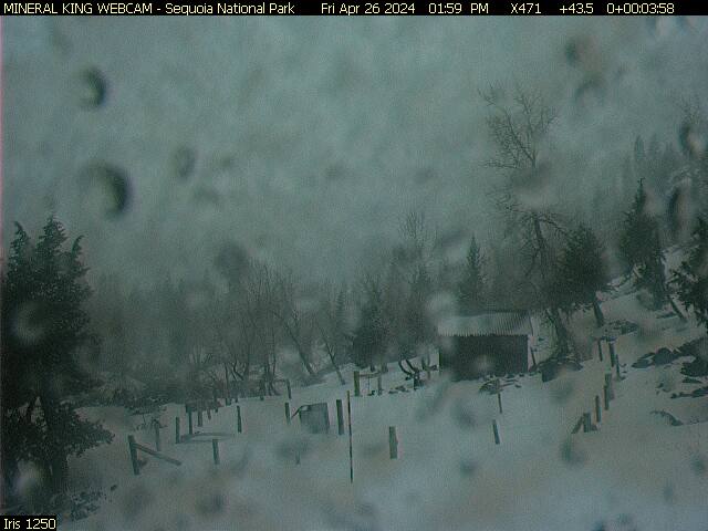
There's an interesting story behind the three webcams at Mineral King (one of which is shown below). They were designed and built by a former JPL engineer (RIP). Each is on solar/battery power and the update frequency depends on the amount of sunshine. They use an old land line feed from MK, which has proven amazingly consistent over the years. Too bad they can't figure this out for the Tioga cam.
-
rlown
- Topix Docent
- Posts: 8225
- Joined: Thu Oct 25, 2007 5:00 pm
- Experience: Level 4 Explorer
- Location: Wilton, CA
Re: Conway Summit Webcam
tioga had a land line. more reliable than the cam. then the park "said" they went satellite phone. ok, hook them up.. The PC is in their support cabin on the north side of the entrance. I know that because i was emailing with their Support person. there was work one summer in the cabin and they filled the PC with sawdust shavings.
I recommended the CDEC uplink hook-up. They are sister orgs. nothing. kind of frustrating after what, 4 years.
I recommended the CDEC uplink hook-up. They are sister orgs. nothing. kind of frustrating after what, 4 years.
-
KathyW

- Founding Member
- Posts: 414
- Joined: Thu Aug 26, 2010 6:19 pm
- Experience: N/A
Re: Conway Summit Webcam
I decided against Virginia Lakes/Dunderberg; so no report on conditions. Not much snow means icy conditions and the days are pretty short right now for a slowpoke like me. I did get out, but to lower and warmer areas.
-
SSSdave
- Topix Addict
- Posts: 3524
- Joined: Thu Nov 17, 2005 11:18 pm
- Experience: N/A
- Location: Silicon Valley
- Contact:
Re: Conway Summit Webcam
Conway Summit one of my favorite areas during the fall! View at the US395 scenic pullout for Mono Lake just south of the summit is one of the best in the state, especially at dawn between October and February when the sun rises over Mono allowing wonderful dawn skiers.
Interesting comment on remote sites being damaged by lightning. Not something I had heard about. Turned up this page with a search.
http://www.ospmag.com/issue/article/web ... mote-sites" onclick="window.open(this.href);return false;
The last 5 years I have been repairing business phone system media gateway switches that run across Ethernet LANs. Most models have multiple connections for older POTS analog phones that connect up to all manner of telephone lines. And of course lightning often hits telephone lines, especially those connecting for miles sticking up high atop telephone poles. Thus I see lots of switches that have had lightning damage which sometimes causes rather spectacular visible damage with gnarly black charred remains though more often the overvoltages by time they reach our equipment merely destroys semiconductor integrated circuits internally. So lots of interesting electronic troubleshooting for this old electronic tech.
Thus within the telecommunications industry there has been a long term battle against lightning damage with lots of engineering continually coming up with better system designs and protection devices to survive strikes. Would expect the current issues with remote sites, particular all the recent CDEC sites will if they are being zapped, be solved in near future. I'm guessing solutions will include hauling up some lengths of heavy guage wire by packer horses to encircle remote equipment boxes thus allowing lightning strike ground currents to dissipate into the ground nearby. They already have usual wires atop the boxes going down to the ground for lightning that directly strikes at the top from the sky just like buildings anywhere. Trouble is if they just stick some metal stake in the ground right at the equipment shed, that may still have high resistance to the rest of the nearby terrain.
-
KathyW
- Founding Member
- Posts: 414
- Joined: Thu Aug 26, 2010 6:19 pm
- Experience: N/A
Re: Conway Summit Webcam
The road to Virginia Lakes was open to about 9,600' this past weekend - about 1/2 mile or so from the end of the road. You still need skis or snowshoes for efficient travel past that point, but the snow was consolidating and melting fast.
-
Wandering Daisy
- Topix Docent
- Posts: 6696
- Joined: Sun Jan 24, 2010 8:19 pm
- Experience: N/A
- Location: Fair Oaks CA (Sacramento area)
- Contact:
Re: Conway Summit Webcam
Most CDEC river data sites are below dams, so not that useful for backpackers. One exception is the data on the Merced River at Happy Isles. Reservoir data has inflow data which would show natural flows IF there were no upstream dams. The data is not intended for the public in general, but for water resource managers, particularly flood management. The reservoir data is particularly difficult to use. I believe you can get a graph but it is a bit of a chore. You could download the data and make your own graph in Excel.
The only data that would be of interest to backpackers isr "unimpaired" runoff data - that means it is not influenced by dams or other upstream man-made structures. I watch the spring melt using CDEC sites - primarily to get a feel for when the peak flow is happening. CDEC rainfall and snow pack data is much more user-friendly. The USGS monitors some rivers independent of the CA Department of Water Resources and this data is presented on the USGS websites.
I find the trail journals of the PCT hikers the most useful information on back country stream crossing conditions.
Who is online
Users browsing this forum: No registered users and 3 guests