esrice wrote: ↑Sat May 18, 2019 11:29 pm
Thanks for all the info. I'm aiming for Ansel Adams, south of the Minarets. Slope aspects mostly southish and planning on staying out of canyons except to get over the San Joaquin. So I guess I'll keep my fingers crossed and my eye on the various snowpack websites.
keep an eye on the Mammoth Mountain summit webcam - it'll give you an idea of what is happening in that area, as you can easily turn it to look at the area you plan to visit.
I'd say you have a ton of snow above 9,000 feet We travelled through there in 2017 in mid July, and after a complete white-out at Donohue and Island Pass on the JMT with only some solid ground on the south facing slopes below 10,000, we headed across to the PCT, which is on a much dryer slope and usually hot and dusty. It was super green there, with tons of running water, but at least we made it to Agnew Meadows without any major snow fields. The road to Reds Meadow was still closed, so walked the pavement to get past the rest of that area. Once we headed up to Silver Pass, the same thing again, solid white above 9,500 feet. Again, this was mid July after a very similar snow pack
top of Island Pass July 12, 2017
 Frozen tarns on top of Island Pass
and just below Island Pass, showing south exposure in the foreground (it hides the huge snow drifts we had to navigate on the way down), and how heavy the snow cover still was facing north
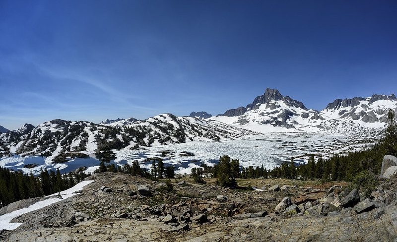 Wide view of 1000 Island Lake
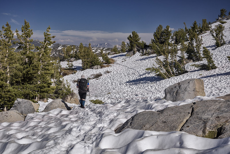
typical travel in the transition zone - this is about 9500 facing south, below Donohue Pass. Down there, water becomes a problem. Any small stream can become an obstacle, and even areas that are usually dry can transform into a waterfall
 Wild country below Donohue
 John Muir "Creek" rather than trail
It's beautiful up there at that time of year, plus you likely have most areas off the PCT/JMT all to yourself. June this summer will be a lot more snow than what we had in July, so some of these conditions will actually resemble 9,500 feet south facing slopes
 Water with no way out
I'm going in August this year - it'll be more like a normal below average snow year in July, all with bugs and flowers, but at least I don't have to fear the next creek crossing.
if you want to see more images of conditions browse through my albums from the 2017 hike on Flickr, they are about half way down this album list page and dated in the title
https://www.flickr.com/photos/speedcent ... 4158688673

