
Day 1:
Agnew Meadows to Thousand Island Lake via the High Trail (PCT)
About 8.5 miles, 1700 ft gain
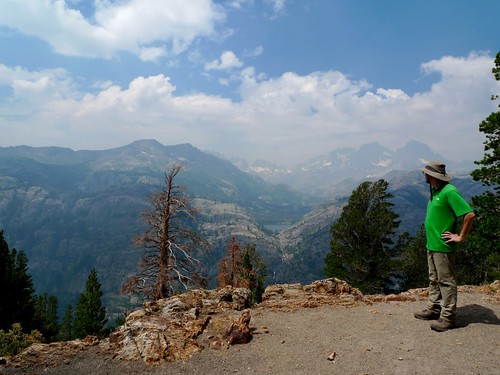
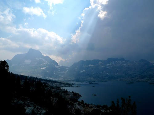
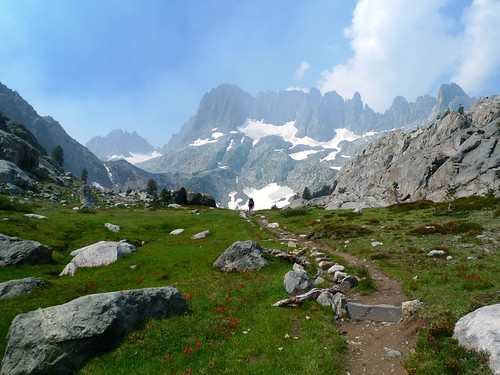
The smoke from the Aspen Fire filled the valley below the High Trail and obscured our views of lakes and mountains across. We can only imagine how amazing this view would have been on a clear day! We didn't find the trail too hot nor too dry even though we didn't get on the trail until 10:30am due to picking up permits and taking the shuttle from the Mammoth Adventure Center.
Shadow Lake from the HIgh Trail / PCT by snackronym, on Flickr
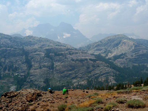
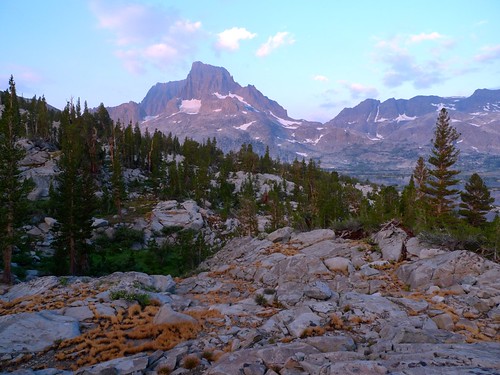
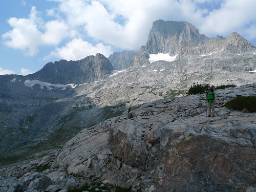
Lunch with Banner & Ritter by snackronym, on Flickr
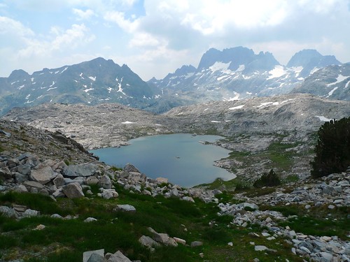
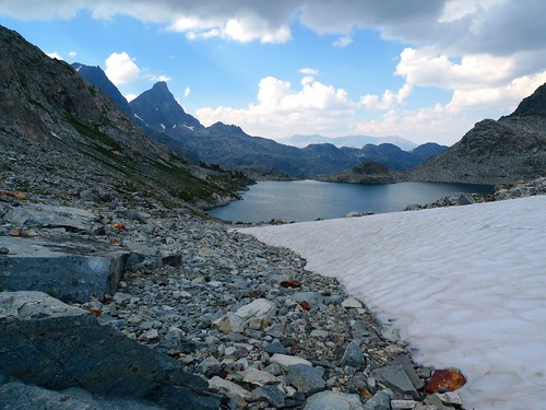
Granite valley east of Thousand Island Lake by snackronym, on Flickr
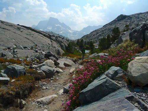
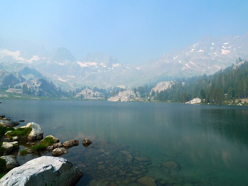
We took our time and took two 45 minute breaks to soak in the (hazy) views, but still we crossed the outlet stream of Thousand Island Lake around 3:30pm.
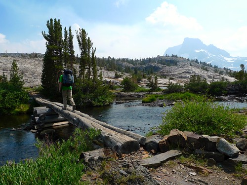
Crossing Thousand Island Lake's outlet stream on the JMT by snackronym, on Flickr
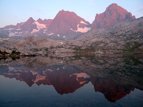
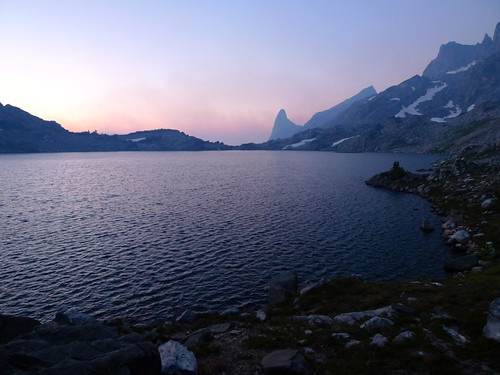
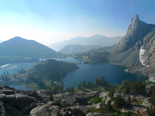
Storm clouds on the north side of Thousand Island made for some dramatic lighting and inspired us to move quickly off-trail on the south side to find a place to set up camp.
Dramatic lighting from a storm by snackronym, on Flickr
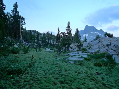
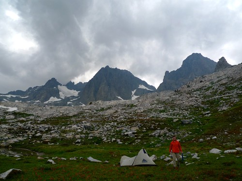
We found a cozy spot and set up camp just as a storm rolled in.
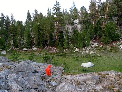
Camp 1 - Thousand Island Lake by snackronym, on Flickr
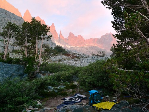
After the rain stopped and the clouds cleared around 5pm, we had a chance to poke around near camp.
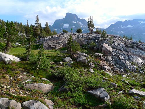
Camp 1 and Banner by snackronym, on Flickr
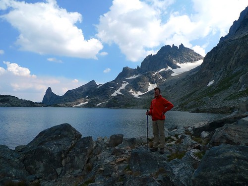
And have dinner on the rocks above our camp with a view of Banner. (This is me, by the way.)
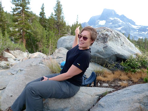
Look, we can see Banner! by snackronym, on Flickr
We went to bed early so I could be up before dawn to snap some photos from near camp.
Dawn on Day 2 by snackronym, on Flickr
Sunrise glow on Banner and Thousand Island Lake by snackronym, on Flickr
Day 2:
Thousand Island Lake to Nydiver Lakes via Whitebark Pass
About 6 miles off trail, 1400 feet elevation gain
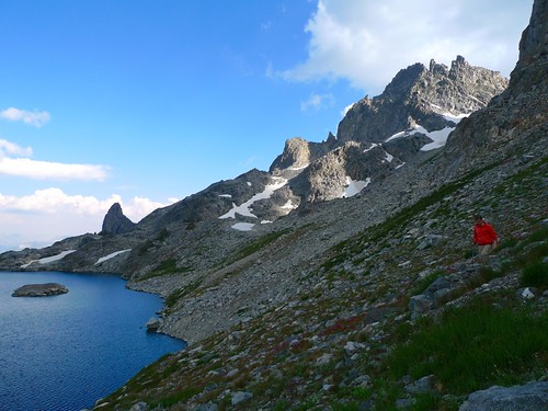
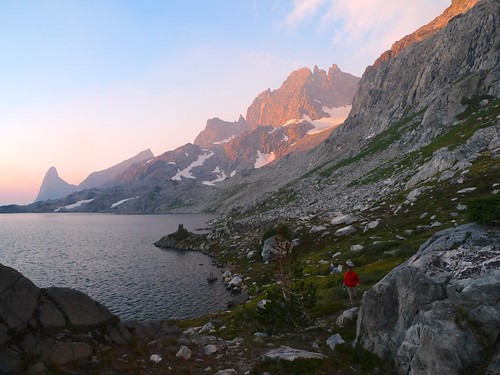
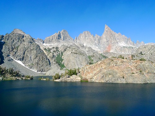
We broke camp around 7:30am without eating breakfast and made our way along the south shore of Thousand Island towards the low saddle between Thousand Island and Garnet at the base of Banner.
Banner and Thousand Island Lake by snackronym, on Flickr
We were fairly high up the hill, so we decided to head up to the ridge for a view of Garnet for breakfast at around 8:45am.
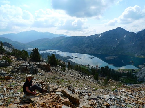
Breakfast view of Garnet Lake by snackronym, on Flickr
We found our own way down higher than the true saddle / pass between Thousand Island and Garnet.
On our way down to the wash above Garnet Lake by snackronym, on Flickr
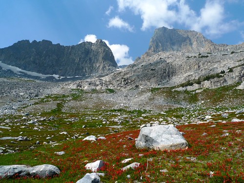
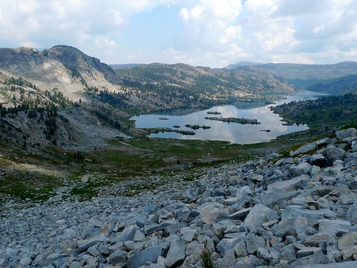
And we were greeted with the most amazing valley drainage below Ritter and Banner and above the small ponds above Garnet Lake. The whole area was red with Indian Paintbrush.
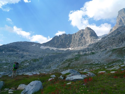
Gorgeous meadow of Indian Paintbush below Banner & Ritter, above Garnet Lake by snackronym, on Flickr
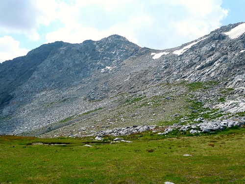
Glacial valley above Garnet Lake by snackronym, on Flickr
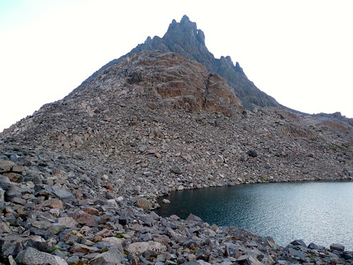
We were headed for Whitebark Pass. Secor describes the route across and up loose talus and scree to the notch just to the left of the low point in this photo. We found the talus to be very loose and unstable and we were quite happy to finally reach the notch at the top. Climbing that part was the easiest bit of the entire ascent.
Whitebark Pass. by snackronym, on Flickr
Garnet Lake from mid-way up to Whitebark Pass by snackronym, on Flickr
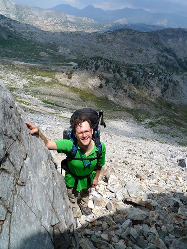
Happy to be finally at the base of the notch. by snackronym, on Flickr
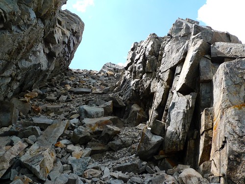
The notch at Whitebark Pass. by snackronym, on Flickr
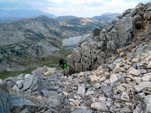
Ascending Whitebark Pass with Garnet in the background by snackronym, on Flickr
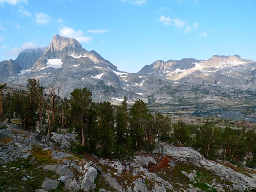
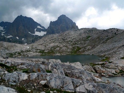
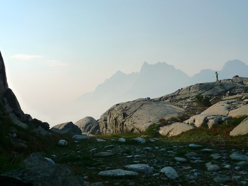
Awesome views of Nydiver, Minarets, and Iceberg Lake from the pass, which we achieved around noon. But whoops, a storm is brewing over Ritter and Banner! We basically ran down the south side of the pass to upper Nydiver and hastily threw up the tent as it started to hail.
Upper Nydiver Lake and MInarets. by snackronym, on Flickr
A break in the hail allows us to get water by snackronym, on Flickr
The storm lasted about three hours, sadly. But afterwards we were able to do some exploring.
Ritter & Banner from Nydiver Lakes by snackronym, on Flickr
Day 3:
Nydiver Lakes to Cecile Lake via Nydiver outlet stream, Shadow Creek, Ediza, and Iceberg.
We rose before dawn again to catch some of the beautiful Eastern Sierra sunrise.
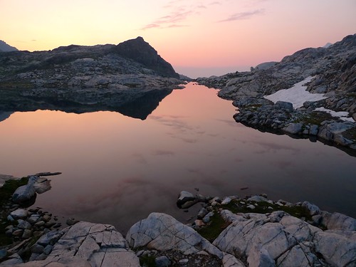
Sunrise over middle Nydiver Lake by snackronym, on Flickr
Ritter & Banner glow in the sunrise above upper Nydiver Lake by snackronym, on Flickr
Then we headed down to Lower Nydiver so we could follow the use trail from its outlet down to Shadow Creek. The smoke from the Aspen Fire was especially heavy in the valley below. We took a quick morning dip in Lower Nydiver, swimming to its cute little island.
Surveying the smoke situation in the valley below Nydiver Lakes by snackronym, on Flickr
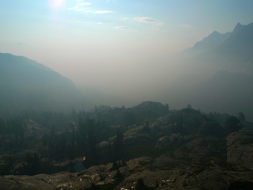
So much smoke! by snackronym, on Flickr
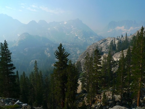
Hazy view of the Minarets and Volcanic Ridge from the trail down Nydiver's outlet stream by snackronym, on Flickr
Once at Shadow Creek we turned towards Ediza and Iceberg. We were happy to see a trail again! Less happy to see lots of people---we hadn't seen a soul since we crossed the outlet stream for Thousand Island on our first day (about 40 hours prior). It was about 9:30am and three groups were headed down from having camped at Ediza the night before.
Lake Ediza. Imagine it'd be beautiful without the smoke! by snackronym, on Flickr
Minarets seen from the valley just below Iceberg Lake by snackronym, on Flickr
We crossed the snow-free talus slope of Iceberg and climbed up to Cecile. My hiking partner is less than enthused about talus and we don't yet know that there is about a mile of it to cross to get around Cecile.
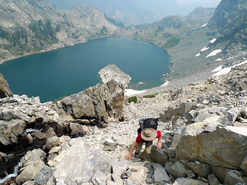
Climbing to Cecile Lake by snackronym, on Flickr
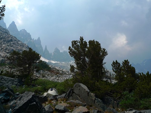
It was smokey and a storm threatened, so we set up camp in some trees to the west of Cecile's outlet.
Camp 3 as a storm threatened… again. by snackronym, on Flickr
We spent some time in the tent listening to thunder and expecting rain that never came. We would have welcomed rain to wash away from the smoke. It was really windy and when we emerged from the tent we were happy to find that the smoke was gone even though it hadn't rained. We did a bit of exploring of Cecile to plan our route out the following morning and ended up circumnavigating the lake.
Very high winds cleared out the smoke. Yay! by snackronym, on Flickr
Cecile from the southwest side below the Minarets. by snackronym, on Flickr
Picking our way along the western slopes of Cecile by snackronym, on Flickr
We're almost back at Camp 3 in the trees in the middle there. by snackronym, on Flickr
Day 4:
Cecile to Devil's Postpile via Minaret Lake
10 miles, negligable elevation gain.
We "overslept" and only rose at 5:30am. I'd been hoping to get up early enough to be around the eastern talus field of Cecile to photograph the sunrise glow on the Minarets. I had to settle for some quick snaps from camp.
Sunrise over Cecile Lake by snackronym, on Flickr
Sunrise glow on the Minarets above Camp 3 by snackronym, on Flickr
Getting water from the snowmelt stream by Camp 3 by snackronym, on Flickr
We headed around Cecile (again, this time with packs) and then down to Minaret Lake and out. We were at Devil's Postpile waiting for the shuttle by noon.
The use trail around the east side of Cecile. Please talus there's another way! by snackronym, on Flickr
Minaret Lake from the use trail that connects it to Cecile by snackronym, on Flickr
Hard to say goodbye to those Minarets. by snackronym, on Flickr


