
Day 1: Backpacking to First Lake

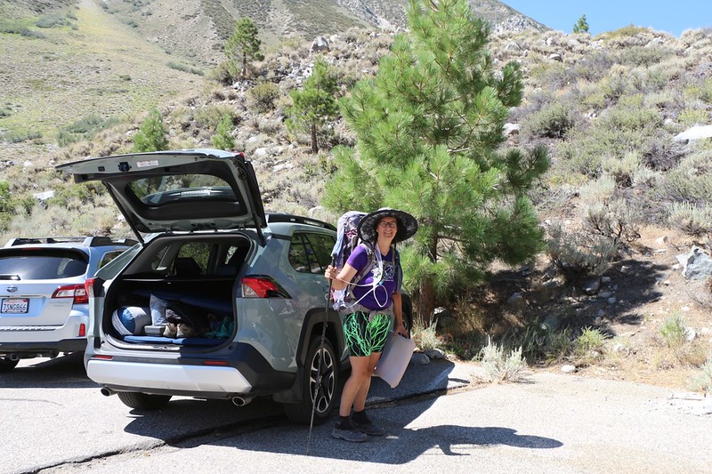
Vicki starting the hike at the "other" Big Pine Creek Trailhead near First Falls - because it was shorter and started higher

Panorama shot from the trail with Second Falls on the left

Me, as we entered the John Muir Wilderness
I was saddened to discover that one of the "Cancel Culture" fools had defaced the wooden sign, crudely scratching out John Muir's name. This happened just after the Sierra Club walked back the awesomeness of their founder. See the article and read the well-written replies Much like babies playing peek-a-boo, these folks simply cover their eyes and history ceases to exist. Or they vandalize it with a rock.

The trail continued up the valley until we were treated to a panorama view of Temple Crag, North Palisade, Thunderbolt, Winchell, and Robinson

After 5 miles and 2500 feet of climbing we made it to a campsite at First Lake
Getting ourselves into the main basin was the toughest day of the trip, but we were sure glad we made the effort, as the scenery was superb.
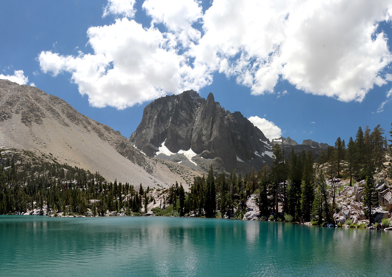
Temple Crag and First Lake as the afternoon cumulus clouds built up
Day 2: Basecamp at Fourth Lake
This was a fairly easy day, with only 800 feet of climbing over three miles of trail. Exactly what we had in mind after yesterday's long hike.

Looking back at First Lake as we climbed up the trail toward Second Lake

Vicki posing like an "Instagram Girl" with Temple Crag and Second Lake

Me posing in in the same spot, but nobody cares about "Instagram Guys"
And, before you ask, neither one of us posts to Instagram, just High Sierra Topix. This is as it should be.

Vicki taking a break above Third Lake with Temple Crag on the left
After Third Lake, the trail climbs another 500 feet or so, and almost all of the countless day-hikers and Instagram Girls were left behind. Only the true backpackers are left. This is also as it should be.

The trail climbs high above Third Lake and the views improve

Panoramic view from the granite cliffs on the northern shore of Fourth Lake

Zoomed-in panorama of tha Palisade Glacier, with Mount Gayley, Mount Sill, Polemonium, North Palisade, Starlight, and Thunderbolt

Setting up our tent at our base camp above Fourth Lake - we would stay here three nights
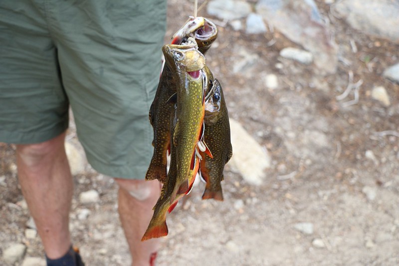
One of our neighbors happened by and showed us his catch of trout from Fourth Lake - fly fishing really works!
As the days went by, it was apparent that the fly fishermen were getting a "hit on every cast" while the bobber fishermen were getting nothing. Words to the wise...

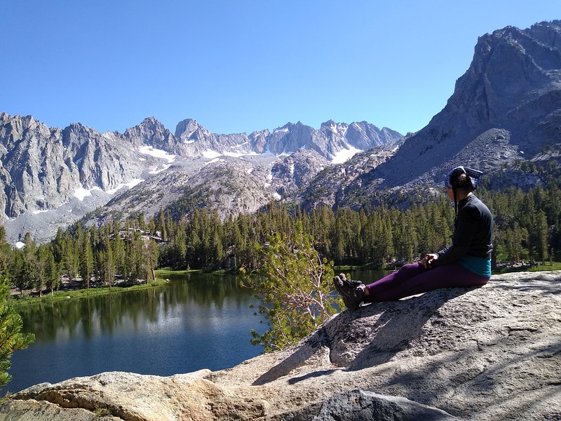
Afternoon panorama shot from our campsite at Fourth Lake. Yes, we just sat around the rest of the afternoon and gazed out at this view. Wow!
Day 3: More Lakes
This was our first day-hiking day. Our plan was to hike out and visit all of the other major lakes in the basin. Summit Lake, Sixth Lake (not Seventh), Fifth Lake, and Black Lake. Not too much climbing and just a few miles. Easy hiking, because we were On Vacation.

The morning light over Fourth Lake, with the Sierra Crest
We took our sweet time getting ready that morning, and then started hiking uphill toward Summit Lake.

One of the most stunning views in the High Sierra - looking at the Palisade Glacier from Summit Lake
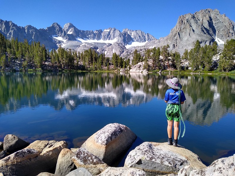
Cell phone camera photo of Vicki posing at Summit Lake
I took way too many photos at Summit Lake. After that, we wanted to head to Sixth Lake, but Vicki disliked the idea of heading downhill on the Summit Lake Trail to the main NF Big Pine Creek Trail, then back up again to get to Sixth Lake. Cross-country travel was called for. So we got out the GPS and maintained elevation at about 11,000 feet, heading west, and intersected the main trail just below Sky Haven Peak. It worked great, and we got in some fine views.

Temple Crag, Gayley, Sill, Polemonium, North Palisade, Thunderbolt, Robinson, Agassiz, Aperture, and Two Eagle from our cross-country route

Panorama view of Sixth Lake from the high perch to its north, with Two Eagle Peak right of center
We saw Seventh Lake not far away, but I'd been there before and I knew that the trail basically disappeared before it ever arrived. Plus it went downhill to get there, and Vicki nixed that idea. So we took a break, then headed downhill on the main trail to Fifth Lake.

Panorama view over Fifth Lake with Temple Crag, Gayley, Sill, Robinson, Agassiz, Aperture, and Two Eagle Peak
After taking yet another break at Fifth Lake, we moseyed on over to Black Lake, the last lake on our Itinerary. There was nobody there, except a whole bunch of trout swimming along the shore.

Panorama view of Black Lake, with Sky Haven (12,896 ft) across the way
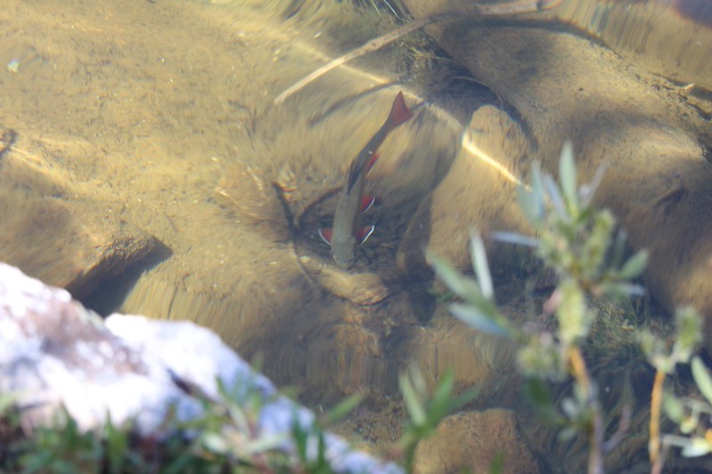
Close-up of a trout swimming along the southern shore of Black Lake
Then it was time to head back to base camp for a nice, relaxing nap. We were really beginning to appreciate this no-pressure "Base Camp" lifestyle.
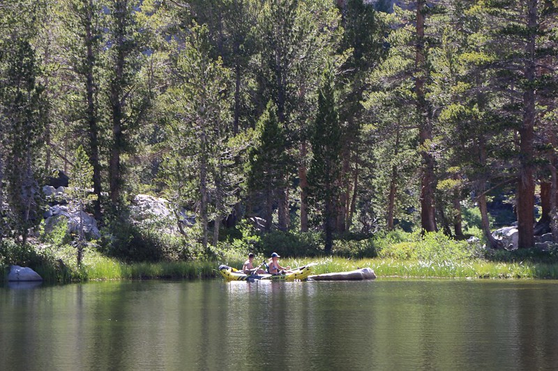
One of our neighbors had an inflatable kayak brought in on muleback, and they paddled around on Fourth Lake
We hung out and watched the lake, with all the fish jumping and feeding as evening came on. And then we went to bed early. Why? Because we felt like it. That's why.
Day 4: Sam Mack Meadow
Vicki was truly feeling acclimated to elevation by this time, so today's easy plan was to day-hike over to Sam Mack Meadow, and maybe even climb up toward the Palisade Glacier.
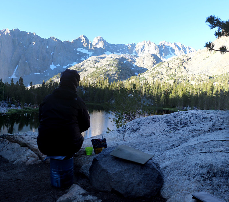
Eating breakfast in the early morning as the light hits our day's destination - Sam Mack Meadow is that shadowed cleft across the way

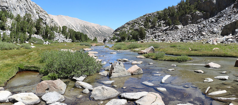
Crossing Big Pine Creek on a log bridge as we head toward the meadow

We made it to the flat part of Sam Mack Meadow, and there was plenty of green grass and flowers

Vicki crossing the creek at Sam Mack Meadow as we headed up the Glacier Trail

Panorama view looking back down at Sam Mack Meadow

The first three lakes in the Big Pine Lakes Basin
When we saw this awesome view we stopped hiking and decided to take a major break and eat lunch. The vistas from up there were superb, looking down on everything. We even saw what we thought was our tent in the distance above Fourth Lake. Nice!
When I told Vicki about the next section of trail to the glacier, she decided to quit while she was ahead. It was too mch work and too much climbing. I'd been there before, so I was cool with her decision. We decided to go back and explore the meadow instead.
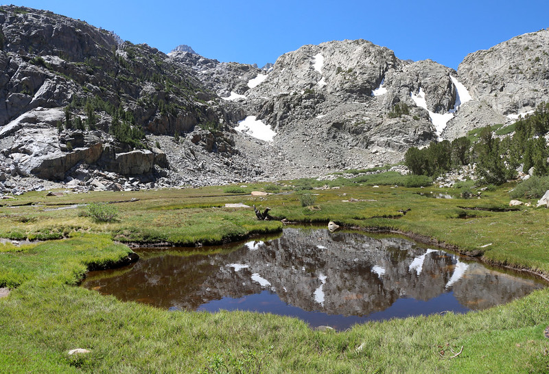
Reflections in a small pond in Sam Mack Meadow.
The marshy ponds along there were full of Sierra Yellow Bellied Frogs, and they were lazily sunning themselves on the grass until we showed up, and then they started jumping into the water like crazy.
Looking back down at the creek from the upper end of the meadow while we took another long break
Then we hiked back to camp, and arrived in the early afternoon.
Vicki hanging out on a boulder at our campsite on Fourth Lake - it was easy to just sit there for hours
This was our final full day in the basin, and we were feeling pretty mellow.
Day 5: Hiking Out
We woke up super-early, at 3am. We packed up our gear and started hiking by 5am. We wanted to get a jump on all the day-hikers who would be swarming up the trail. My wife has had lung trouble in the past, so we really take the Covid-19 social distancing rules to heart. We found that most people were great, but there were still too many other hikers who didn't seem to care at all. They wouldn't give us enough time to get off the trail when passing. So we decided that the best defence was to avoid them entirely, by hiking when they were still asleep.
Besides, we had a long drive home ahead of us (six hours to San Diego), so getting to the car early was a great idea.
And the best part is that hiking in the dark, by headlamp, is actually a lot of fun! Quiet, cool, and peaceful.
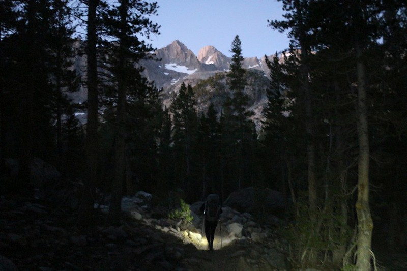
Mount Gayley and Mount Sill shining with alpenglow as we hiked in the darkness before dawn

Alpenglow on Temple Crag up above Third Lake, and Vicki still has her headlamp on
The sun rose as we neared Second Lake. It was shining directly at us, so we had to get out our wide-brimmed hats and keep our heads down.

Vicki and her backpack in front of Temple Crag and Second Lake.

We took a short break at Lon Chaney's Cabin
The early day-hikers began to pass us as we headed down toward Second Falls, but our strategy seemed to have paid off. The people that get up early appear to be the more considerate hikers. Which isn't surprising to me, as I'm a morning person, too! Ha ha

View up the South Fork of Big Pine Creek at the Clyde Glacier, Middle Palisade, and Norman Clyde Peak from the trail near First Falls

The view east down the Big Pine Creek Valley as we headed down the exposed final mile to the trailhead parking lot.
It was 10am by this time, and the sun was already getting hot! We were relieved that we weren't heading uphill at that hour.
We were glad we woke up so early because it was still morning when we arrived back at the parking lot
All told, it took us about 5 hours to hike the 7 miles and 3000 feet down to the car, which wasn't record time by any means. But we had fun, and that was the whole purpose of this trip.
We explored a large part of the Big Pine Lakes Basin, and enjoyed every minute of it. It was a backpacking trek with a bit less planning, and a very forgiving timetable. It's no surprise that we managed to have a wonderfully relaxing time in the mountains. And I have to admit that it was so much better than suffering through yet another week of quarantine at home!
Lots more pictures and videos on my Flickr Album Page
GPS tracks can be exported from my CalTopo Map Page
P.S. I'd like to apologize to the forum folks for the lateness of this Trip Report. My only excuse is that I had two more trips to take in the Sierra last Summer in August and September, and I'm still trying to get caught up. Don't worry, I'll get to those TR's before too long, and certainly before this Summer. I hope...
.


