weird geology on Google Earth
- SSSdave
- Topix Addict
- Posts: 3597
- Joined: Thu Nov 17, 2005 11:18 pm
- Experience: N/A
- Location: Silicon Valley
- Contact:
weird geology on Google Earth
I was exploring around with Google Earth 3D south of Pinchot Pass and came across some weird geology I am wondering what the heck this mystery is???
Some others here into our rock sciences will no doubt be amused too and maybe have an explanation. This is at 36d 55m 23.58s N 118d 24m 71 W at elevation 11822 feet in metamorphic rock. At first I thought it was just some vegetation, maybe moss pattern or erosion layers, however it shows up in all the historical dates thus must be rock. Then noticed the slope above seemed to be glacial polished so wonder if it might be a thin layer of some type of mineral deposition the glacial went over? Or maybe glacially polished limestone?
Since I've queued up a trip over Taboose for this August, there is a good chance I am going to find out.
- dapperdave
- Topix Acquainted
- Posts: 73
- Joined: Tue Aug 28, 2012 2:07 am
- Experience: Level 4 Explorer
Re: weird geology on Google Earth
Dave
Looks like vegetation, on sediment in a dry seasonal pond to me.
Topographically, it's not likely to be bedrock.
You might find this interesting
http://geomaps.geosci.unc.edu/quads/ful ... inchot.jpg
My bet is on Pzch Calc-Hornfels as the source of the Emerald pools. Maybe finely divided Alumino-silicates and Talc?
Dave
- SSSdave
- Topix Addict
- Posts: 3597
- Joined: Thu Nov 17, 2005 11:18 pm
- Experience: N/A
- Location: Silicon Valley
- Contact:
Re: weird geology on Google Earth
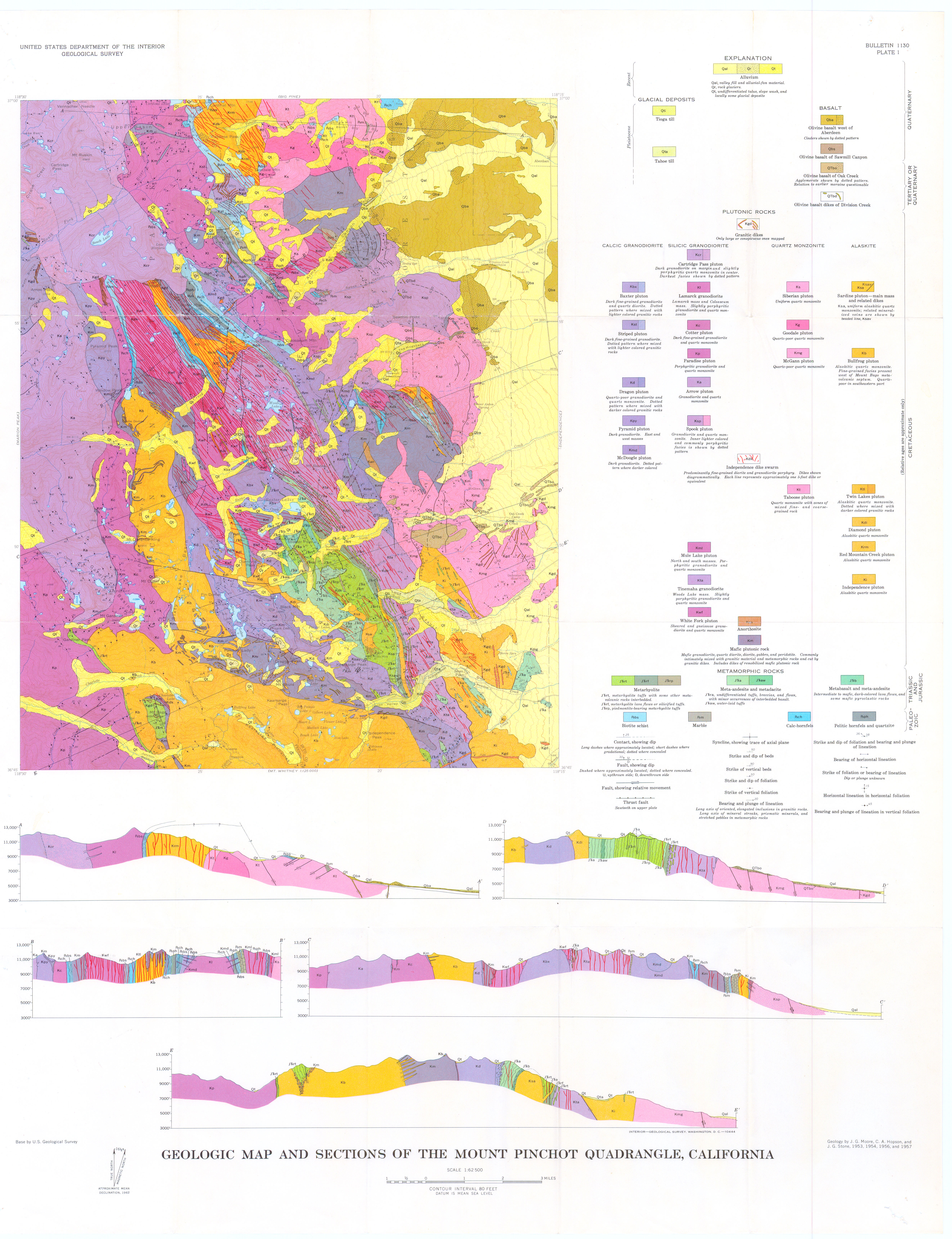
Thanks dave for your educated input. On closer map examination this is at 11790 feet or 3590 meters. On GE it is right at the boundary seam of brown and white and strata that I've circled in magenta. The same structure does not show low down anywhere on that seasonal stream ravine. The geology map shows the white strata to probably be Paleozoic Pzch and the brown strata Pzbs. However not far away is Pzm, marble, so this might be a small chunk of that since it is down lower in the ravine.
Pzch = Calc-hornfels
Pzbs = Biotite schist
Pzm = Marble
Will be interesting to actually check this out. The reason I didn't think it was vegetation was it is identical on all the historical GE maps before the current one that might be odd if it were organic. And if it was sediment then why has it stayed the same for over a decade?
And you added in a hunch about the emerald pools presumably those over near east Arrow Peak basin. That is another place I plan to camp near for a day. Map shows Kgd, Goodale pluton though not identified on the map labels.
- dapperdave
- Topix Acquainted
- Posts: 73
- Joined: Tue Aug 28, 2012 2:07 am
- Experience: Level 4 Explorer
Re: weird geology on Google Earth
Hi Dave, did you manage a field visit?
Dave
Dave
- SSSdave
- Topix Addict
- Posts: 3597
- Joined: Thu Nov 17, 2005 11:18 pm
- Experience: N/A
- Location: Silicon Valley
- Contact:
Re: weird geology on Google Earth
Not this summer, as all the smoky fires had me cancelling trips during the August period I might have gone up there.
- tomba
- Topix Expert
- Posts: 497
- Joined: Sat Jun 18, 2011 12:50 pm
- Experience: Level 4 Explorer
- Location: Bay Area
Re: weird geology on Google Earth
It looks similar to this:
- dapperdave
- Topix Acquainted
- Posts: 73
- Joined: Tue Aug 28, 2012 2:07 am
- Experience: Level 4 Explorer
Re: weird geology on Google Earth
Nice piece of "ground-proofing" Tomba
Dave
Dave
- mokelumnekid
- Topix Expert
- Posts: 475
- Joined: Mon Sep 22, 2008 4:45 pm
- Experience: N/A
- Location: Seattle
- Contact:
Re: weird geology on Google Earth
I've looked at a lot of metamorphic rock in the Sierra and elsewhere and haven't seen anything like this. I'm guessing that it is a surface feature, not a bedrock feature (I'm a practicing geologist). When you have so many contacts in a complex structural arrangement, groundwater flow and seeps can pop out about anywhere and be quite persistent. Ping Giant Brookie and ask him what he thinks.
- tomba
- Topix Expert
- Posts: 497
- Joined: Sat Jun 18, 2011 12:50 pm
- Experience: Level 4 Explorer
- Location: Bay Area
Re: weird geology on Google Earth
Here is another one. A surface feature made of grass and ponds. Click to enlarge.
Who is online
Users browsing this forum: No registered users and 9 guests