Page 3 of 4
Re: Interesting strava heat map showing gps routes
Posted: Thu Feb 01, 2018 8:49 pm
by freestone
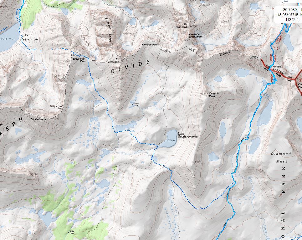
Thank you all posting and refining this thread but I still have some questions. Below is a series of views centered on the Kings-Kern Divide and Lake SA is the obvious landmark most of us will recognize. I noticed the Caltopo map with the heat layer shows less tracks even though the information came from Strava. It shows an interesting route over Lucy's Foot Pass, but no activity over Harrison.
I changed the map layer to the Satellite view with the heat at 100% and had an easier time of seeing all the tracks, including several tracks over Harrison.
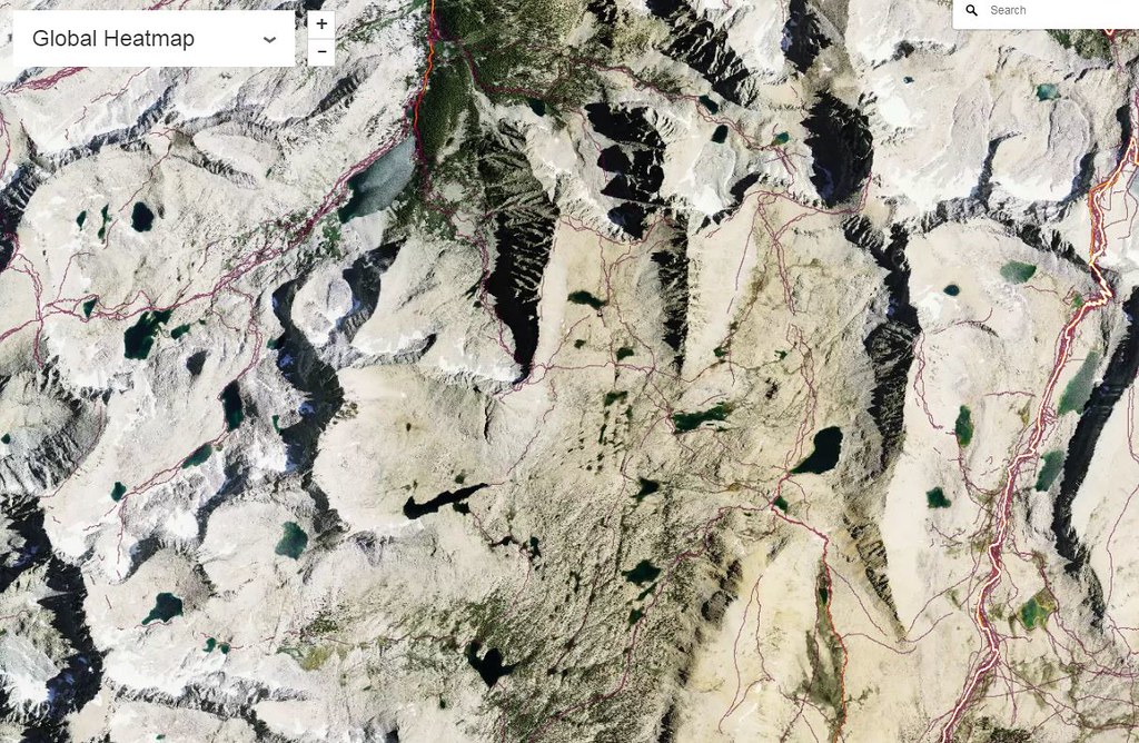
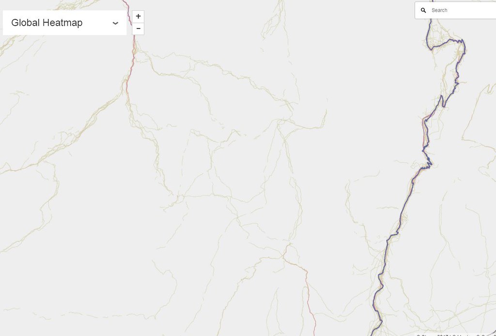
You can also remove the map entirely to get a feel for just how many people have been into a specific area.
I like the Caltopo layer best of all, but for some reason only certain tracks seem to appear? Again, a big thanks to Dbogey for posting and SirBC and Limpingcrab, for refining the views.
Re: Interesting strava heat map showing gps routes
Posted: Thu Feb 01, 2018 9:16 pm
by SirBC
Yes, I've noticed that the Strava heatmap layer overlay for the CalTopo maps isn't as complete as other Strava heatmaps.
This one has far more detail and specifies that it is using Strava data from 2017. But it doesn't have all of the goodies that I love on CalTopo...
Re: Interesting strava heat map showing gps routes
Posted: Thu Feb 01, 2018 10:01 pm
by tomba
After some investigation of Strava Global Heatmap web page I found that you can use the following URL template in Caltopo custom later to see more data:
"
http://heatmap-external-c.strava.com/ti ... X}/{Y}.png"
You can use "-a", "-b" or "-c", to load balance their servers, I think.
Use "all", "ride", "run", "water", or "winter" to see different activities.
Use "hot", "blue", "gray", or "bluered" to select color of the tracks.
For the rest of the instructions see SirBC post at
http://www.highsierratopix.com/communit ... 10#p131460.
The tracks look faint.
Re: Interesting strava heat map showing gps routes
Posted: Fri Feb 02, 2018 9:07 am
by Wandering Daisy
Thanks SirBC for the link to the 2017 map. This is all making more sense now. If the data were truly representative of all hiking activity, it would be a good tool for the FS or NPS to manage the trails.
I took a good look at the Wind RIver Mtns. in Wyoming. It is interesting that the two "high routes" , Skurka's and Dixon's, both which give out GPS tracks on the internet, have distinct lines, although not nearly the number as on popular trails. I suspect that those who use published GPS tracks for navigation, are also more likely to use the app for the "heat map". CDT thru-hikers also fall into this category.
Similar thing going on with Sierra with published GPS tracks and "on-line route guides". Interesting to note that Roper was purposefully a bit vague for his route in fear of the general route becoming a use-trail. I did the SHR in 2010 and since then, have been on parts and noticed the faint trails and way too many cairns that were not previously there. PCT and JMT hikers also are very likely to use published GPS tracks, as well as the heat map app.
Am I the only one a bit freaked out by this? Personally, if I used a GPS, I would never use that app; it seems a bit contrary to the wilderness experience.
Re: Interesting strava heat map showing gps routes
Posted: Fri Feb 02, 2018 2:47 pm
by oldranger
Interesting that at least 3 of my favorite places have no tracks!
Re: Interesting strava heat map showing gps routes
Posted: Fri Feb 02, 2018 5:50 pm
by schmalz
I hope everyone realizes that the data you are seeing is just a small subset of actual usage. I believe this data is only from people who are using strava gps and are allowing for their data to uploaded into the cloud. I suspect that is a very small subset of offtrail hikers in the sierra.
Re: Interesting strava heat map showing gps routes
Posted: Sun Feb 04, 2018 3:54 pm
by dbogey
Anyone can upload GPS data from devices like Garmin, Suunto.... to Strava
Re: Interesting strava heat map showing gps routes
Posted: Sun Feb 04, 2018 4:31 pm
by SirBC
dbogey wrote:Anyone can upload GPS data from devices like Garmin, Suunto.... to Strava
Yeah, I record my GPS tracks with my Suunto watch and when I sync with my Suunto account it automatically uploads the tracks to my Strava account in the background.
Re: Interesting strava heat map showing gps routes
Posted: Sun Feb 04, 2018 6:38 pm
by dave54
I use MyFitness instead of Strava. My account is linked to my health insurance, and as long as I maintain activity levels and other health markers I get a rebate on my premiums.
Re: Interesting strava heat map showing gps routes
Posted: Sun Feb 04, 2018 9:42 pm
by SirBC
dave54 wrote:I use MyFitness instead of Strava. My account is linked to my health insurance, and as long as I maintain activity levels and other health markers I get a rebate on my premiums.
Wow, that's a pretty cool concept. I'm a little shocked that we have something as forward thinking as that in the healthcare space here in the US.