
This is officially my first Trip Report here for HST and I think I should share it now as I have to go back to work tomorrow, we all know how that can delay sharing, am I right?
Anyways, my dad and I, on our annual two nighter decided to do something that we both haven't really done in an extensive amount, cross country travel. I've done very basic cross country travel before, and he has had a little more experience over the years. Anyway, we (mostly me) decided Moose Lake would be a doable hike for us for our trip. We left Visalia/Exeter the morning of Wednesday to see if we can snag a campsite at Lodgepole (shutter) and get the permit for the Lakes Trail by 1:00. After getting Lunch on the way up, we were able to snag a campsite (last tent one for the night) and get our permit. We did Little Baldy that afternoon then went to Wuksachi for dinner that night.
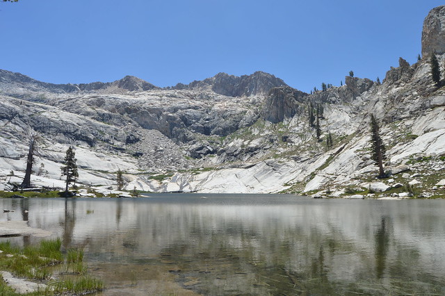
July 16: We left Wolverton about 7:30 heading to Pear Lake, the trail portion was a little slow moving, as we were just pacing ourselves up Watchtower and not really trying to exert too much energy. We were keeping up with day hikers, so we couldn't be moving too slowly. My dad has been in this area many times, this is my first time past Heather Lake, so I was taking in the views as we moved into the Lakes region. Being a Thursday, it wasn't too crowded but there were about a dozen people total going up and down, so not bad at all. We arrive at Pear around 12:15 and perch up on the rocks to eat lunch and refill the water bottles, beautiful area!
 DSC_0671 by Charles Slaght, on Flickr
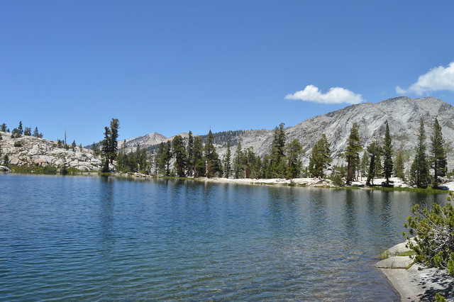 DSC_0684 by Charles Slaght, on Flickr
After lunch we headed due east attempting to shoot the gap between the "Matterhorn" and the ridges of Winter Alta (success!). After the initial nervousness of doing my first legitimate scramble with a pack, the movements and routefinding became much easier and comfortable, and we were at the gap in no time.
 DSC_0692 by Charles Slaght, on Flickr
This was just below the gap, our last glimpses of Pear.
Once we crested, we aimed for the single dead tree as the beacon to the next climb to the top of the ridge. We ended up skirting to the north of this area, and went south of the tarns to the gap just under 11,000 feet on the ridge. Moving over this area was incredibly easier than I thought and it wasn't too hot, but we missed the shade. At just after 4:00 we hit the gap and caught our first views of the glorious lake.
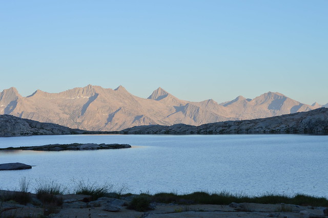
 DSC_0717 by Charles Slaght, on Flickr
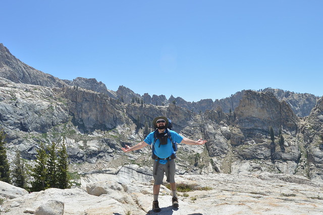
With my dad in the frame, overlooking Moose and the Great Western Divide.
We could see our destination! From here we skirted down the ridge and mucked up the descent a little bit. We got in a little hairy place where it was a little difficult to move down (about 50-70') at the edge of our comfort zone. Luckily, and thankfully, we were able to calmly find the holds we needed and make our way down with five points of contact at all times. Once we passed this, it was a short talus hop and to the shore! We set up camp on the north shore looking to the south east, had dinner and relaxed after a long day of hiking.
 DSC_0727 by Charles Slaght, on Flickr
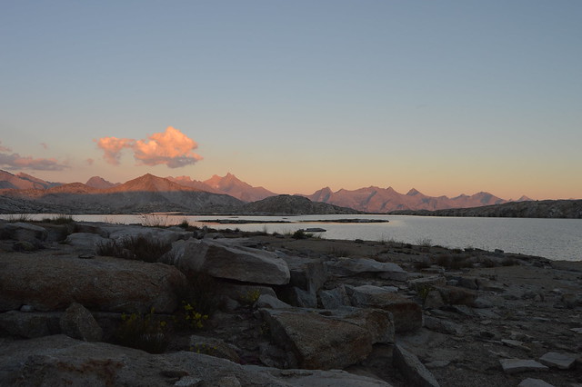 DSC_0754 by Charles Slaght, on Flickr
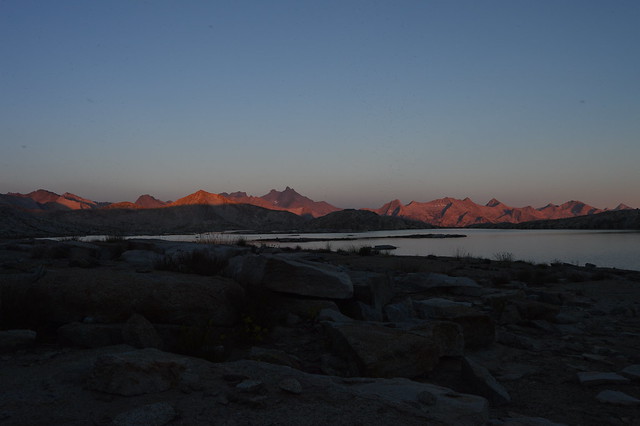
View from our site at dusk.
July 17: This was an off day for us as we were planning on hiking the Tablelands and micro explore the area. We shot to the east end of the lake and came around to scout the way to Alta Meadow. From this end, it was awesome seeing across Buck Canyon and the area where the High Sierra Trail goes, it was such a beautiful area!
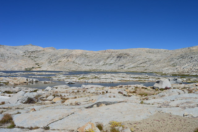 DSC_0782 by Charles Slaght, on Flickr
Looking west across the lake.
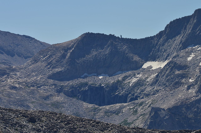 DSC_0794 by Charles Slaght, on Flickr
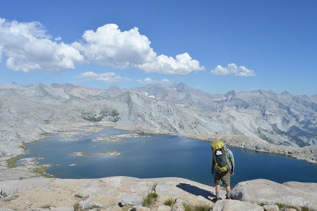
Looking across Buck Canyon to Precipice Lake and Kaweah Gap. We were really intrigued by the rock formation on the ridge-line of Eagle Scout Peak.
After we scouted, we headed up back to the north and back to the ridge dividing Tokopah Valley and Moose Lake. Here is were we saw a much better route down to the lake and perched ourselves on the high point of the northern section to look down to Table Meadows and Lake 10559 (I think). After this jaunt, we returned to camp and I dipped in the lake before having some afternoon naps. That evening, I figured out how to finally get the night shots I've wanted to get with the new DSLR camera I purchased last year, I think with more practice I can get them down, but not too bad for a first time, yeah?
 DSC_0807 by Charles Slaght, on Flickr
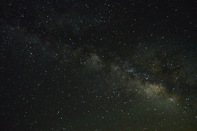 DSC_0830 by Charles Slaght, on Flickr
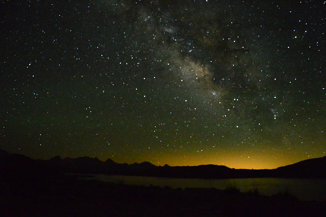 DSC_0833 by Charles Slaght, on Flickr
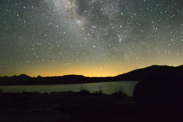 DSC_0837 by Charles Slaght, on Flickr
July 18: After a restful night sleep, despite my sleeping pad having a leak (patched one, couldn't find the other), we set off around 7:30 on the way home via Alta Meadow. This was largely uneventful, though very tiring. We met a couple of guys from Visalia that was camped opposite the lake from us, heading to Table Meadows that day. We decided to leave Moose from the eastern saddle (not the lowest, mistake) and make our way to the use trail. This was slow moving but nothing too difficult, though I think it would have been easier just to stay high. Once we hit the use trail on the Buck Canyon side, we had no problems until we hit the talus ridge to cross over to the first views of Alta Meadow, we kept to the east too long and had to move down then up too much, it was tiring. We crested about a quarter mile from the rock formation on the southern end of the ridge and gameplanned our way to Alta Meadow. We decided to stay high and cut through the brush and rocky slopes thinking we'd intersect the trail again, this didn't happen as we realized we were way above (better than below!) the old trail. We dipped altitude and crossed the drainage and small cliffbands at around 9,600. Once we came to the last ridge with the trail in view, we were still probably a good 300 feet above where the trail was. We skirted through the ferns and got to the meadow pretty quickly, though it felt like forever. We refilled our water on the creek just west of the meadow around 1:30 and hightailed it back to Wolverton. It felt like we were running once we were on maintained trail again. We could see the storm coming in from the south the whole time and we were wanting to get at least to Panther Gap before it rained. We made fantastic time back to Wolverton, as it started raining and pea sized hailing on us with about 15 minutes to go in the hike, back at the trailhead at 4:15.
All in all this was a fantastic trip. I was in better shape than I had been on the past couple of trips (thankfully) and I experienced something that I have been wanting to for a long time. It was not always an easy time, but this trip was one where the challenges were there and we were able to successfully confront them competently and calmly. If this was just a few years ago, I don't think I'd be able to handle it. I've been thinking about Moose Lake for years and to finally make my way too it has been an endearing accomplishment. Though I think I'd be more comfortable to be with someone with much more extensive cross country travel from now on, I feel that my dad and I did a good job doing this route ourselves. I hope you guys enjoy this and I look forward to my next trip!


