
July 24, 2014
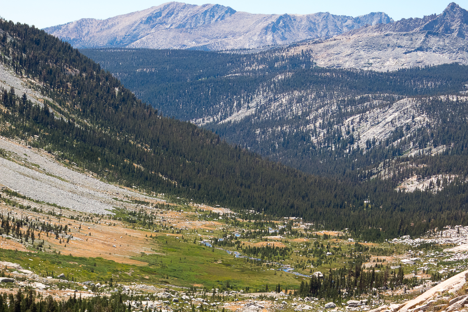
There was plenty of light by 5:30, but I didn't get started till around 5:50am. It was already getting warm, but fortunately there is a lot of morning shade on the first part of the trail. From Crescent Meadow up to Bearpaw Meadow (11.1 miles) the trail is very runnable, with some small rolling hills. The views across the canyon to the right are decent but not unbelievable, so you don't have to stop. My legs were quite sore, from long runs at Mt Rainier and Mt Tamalpais last week and over the weekend, but they loosened up nicely. A couple of streams were only a trickle, but most had enough water to fill up if you needed it. I carried 2L from the start and only refilled at the meadow camp when I arrived, about 8am.
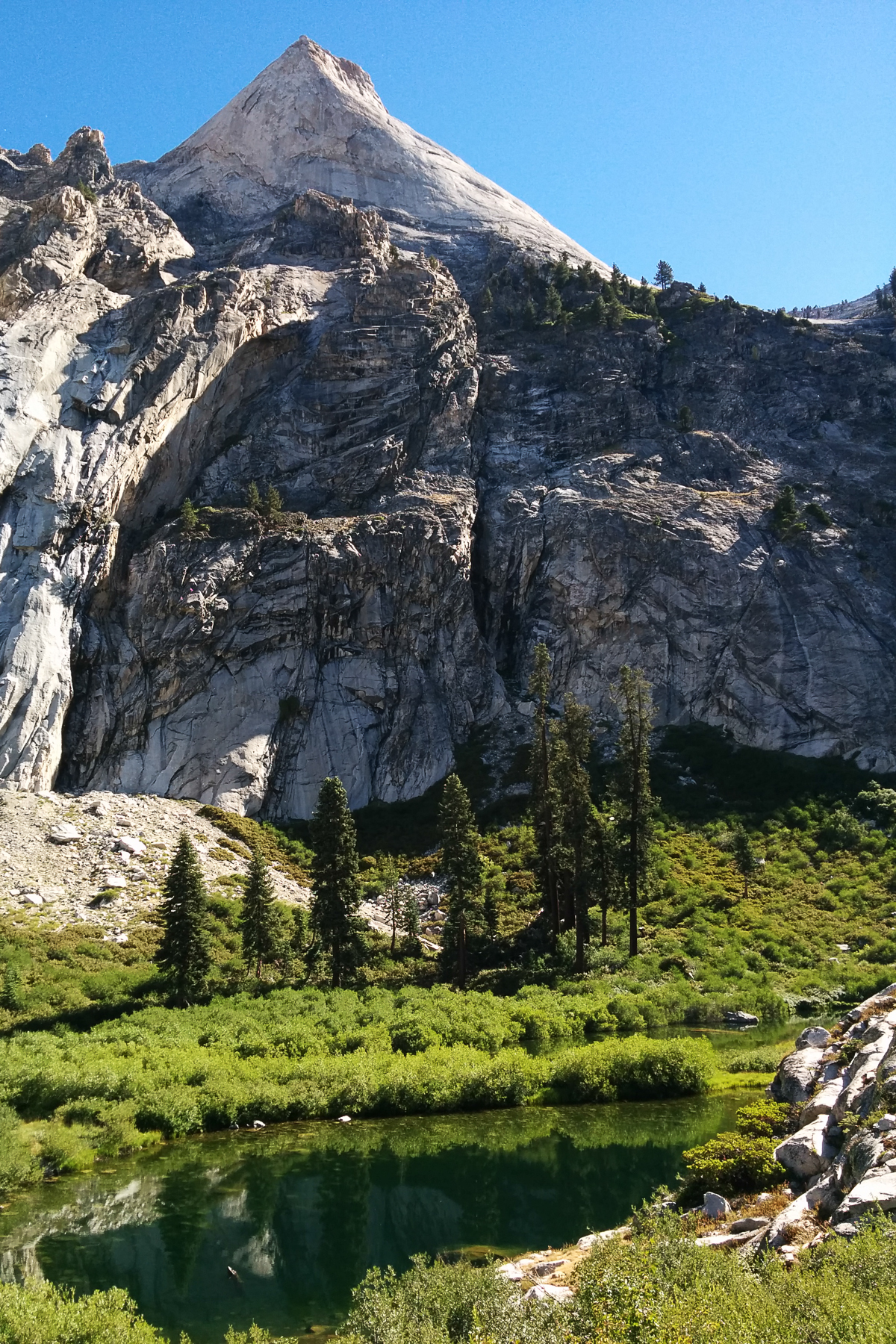
Bearpaw Meadow fancy camp:


Looking up from just past Bearpaw Meadow:


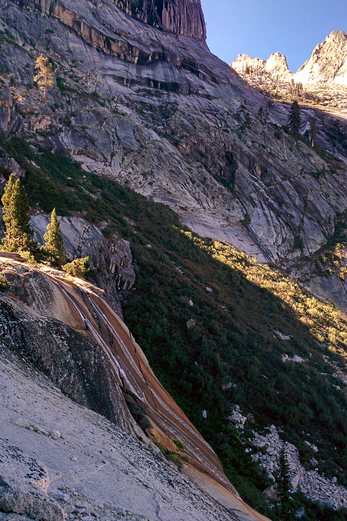
The next 1.7 miles down to Lone Pine Creek had some muddy sections, but nothing sloppy. The roughest section of trail all day was the switchbacks steeply ascending from Lone Pine Creek, and I hiked quite a lot there.
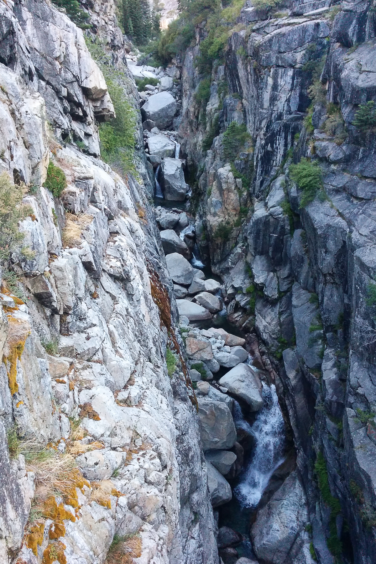
Lone Pine Creek:
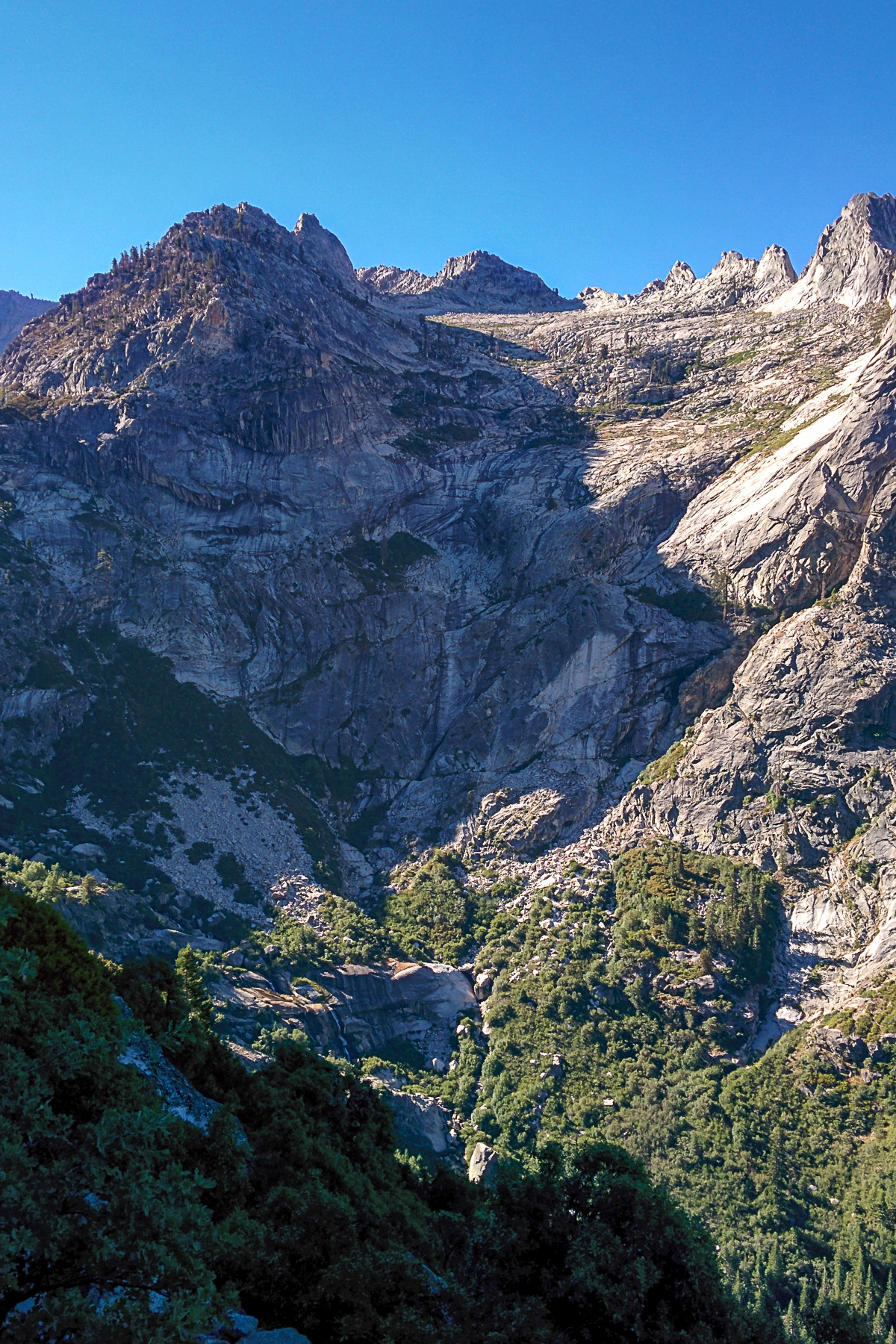
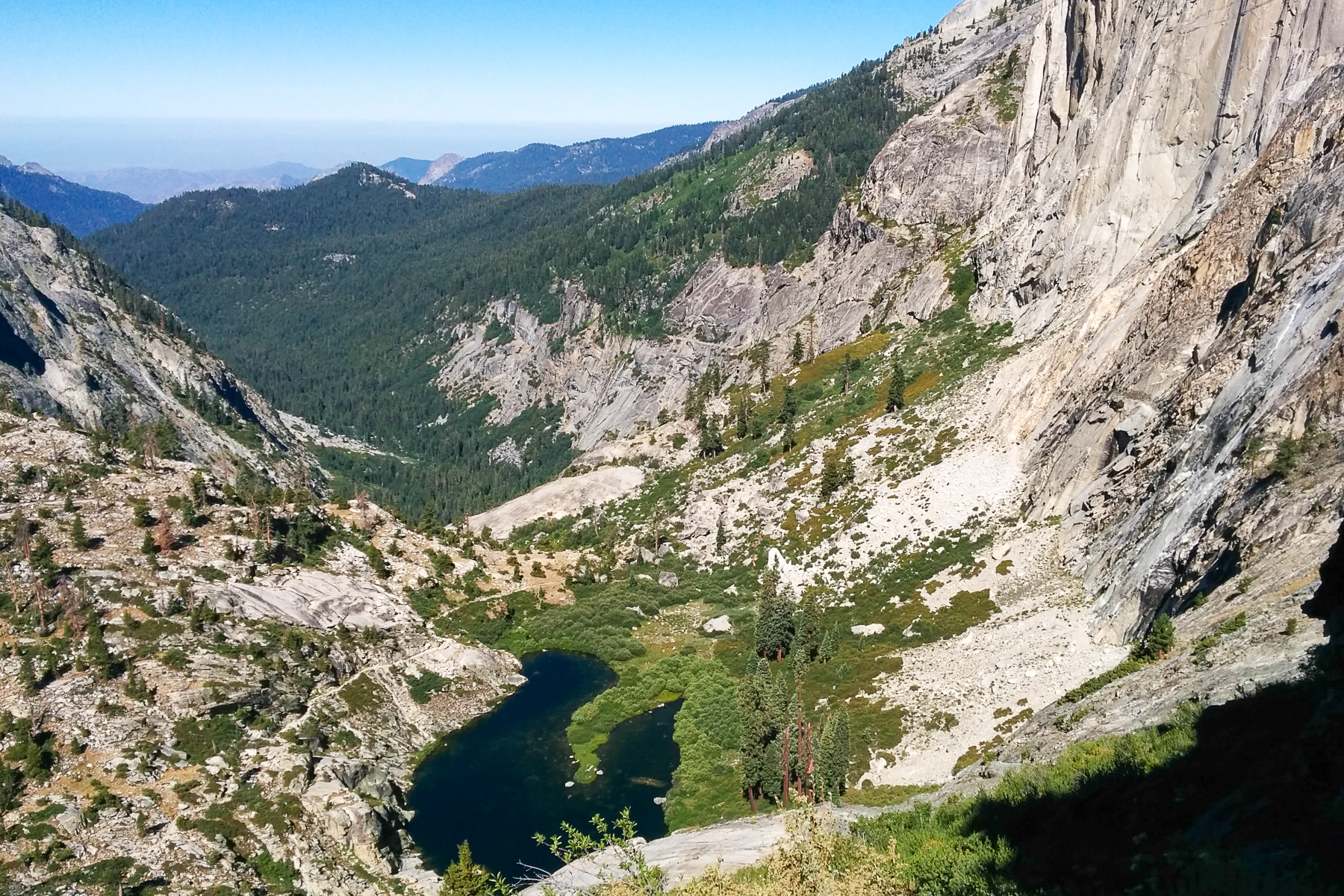
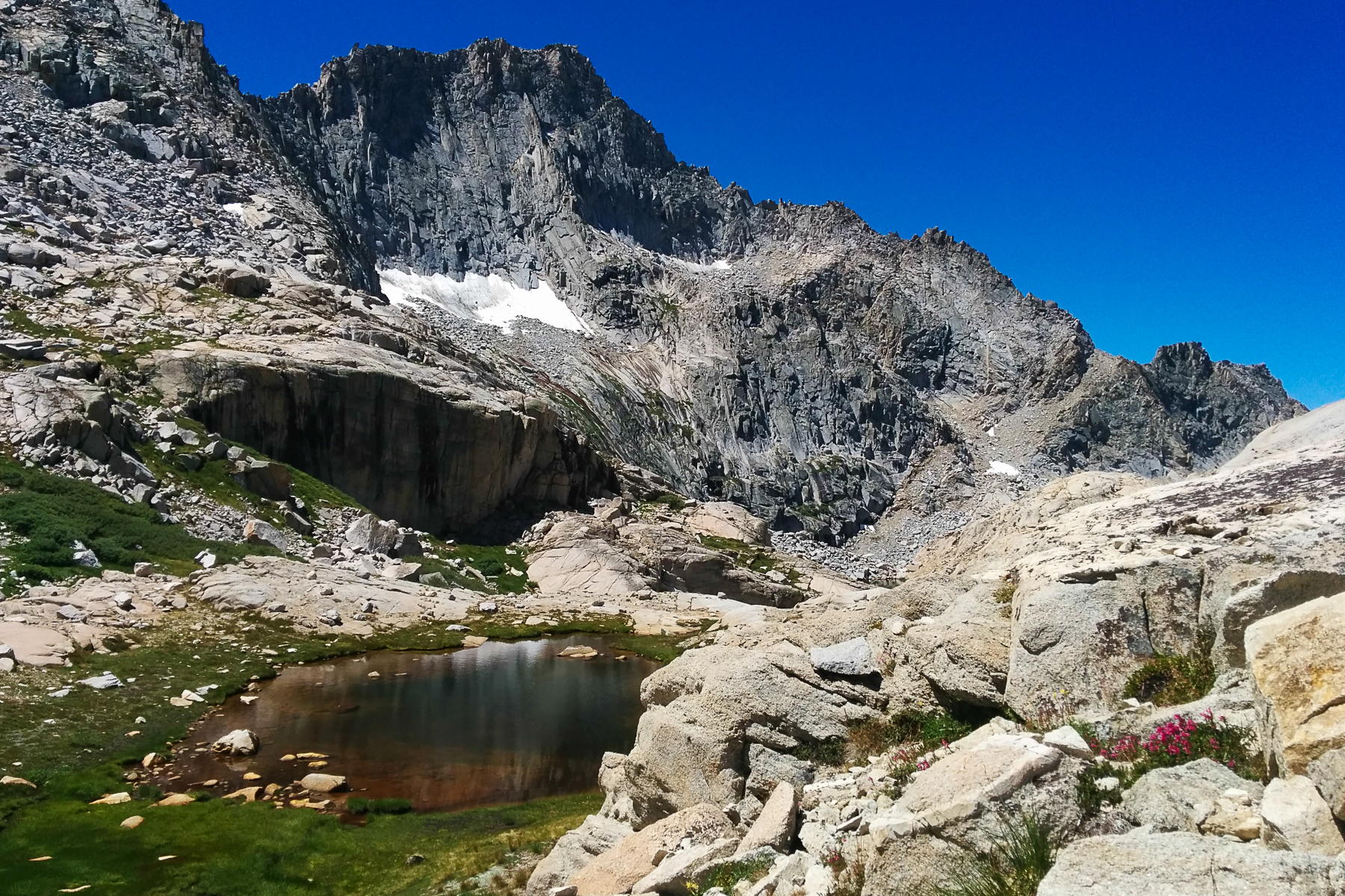
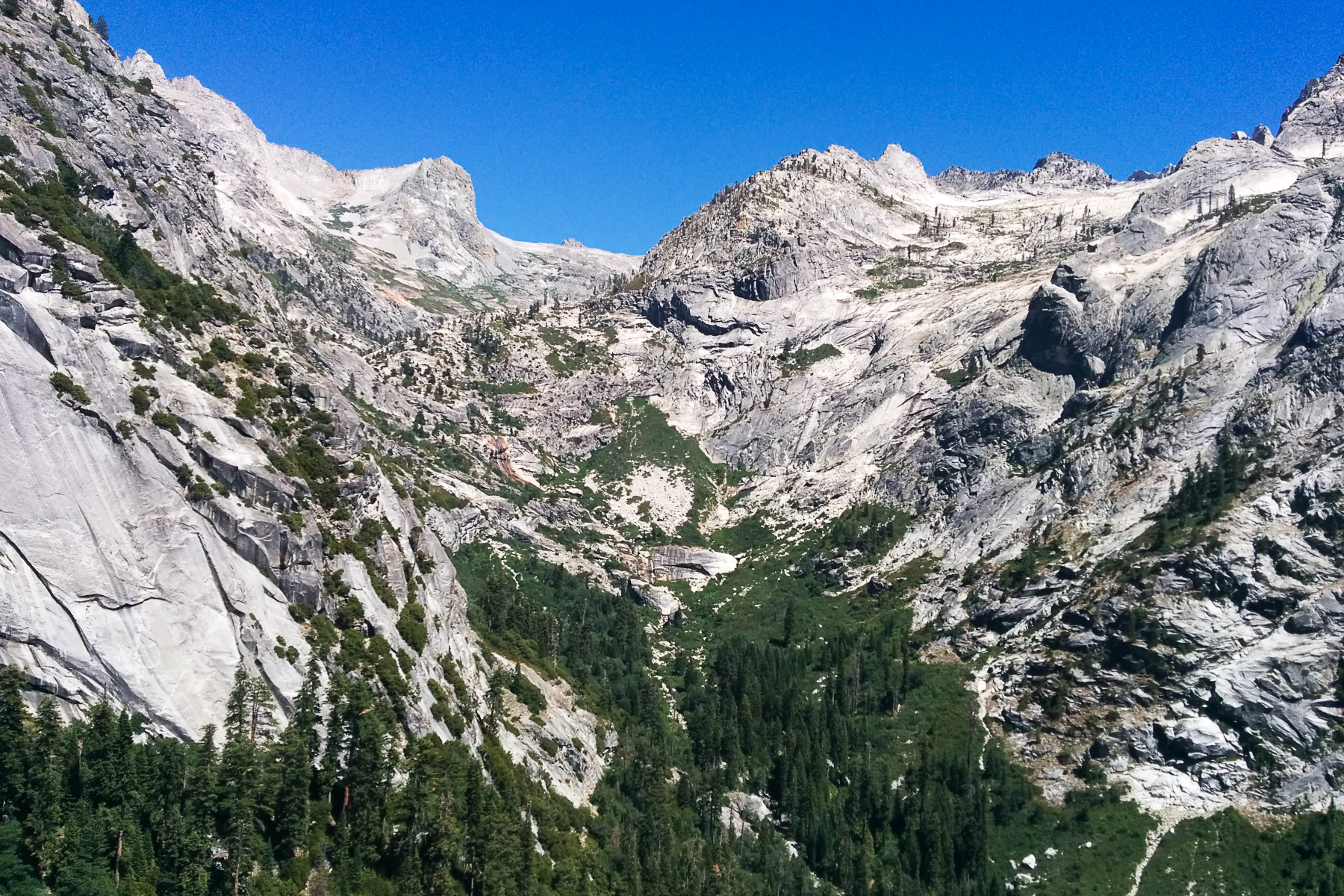
Trail views en route to Hamilton Lake :


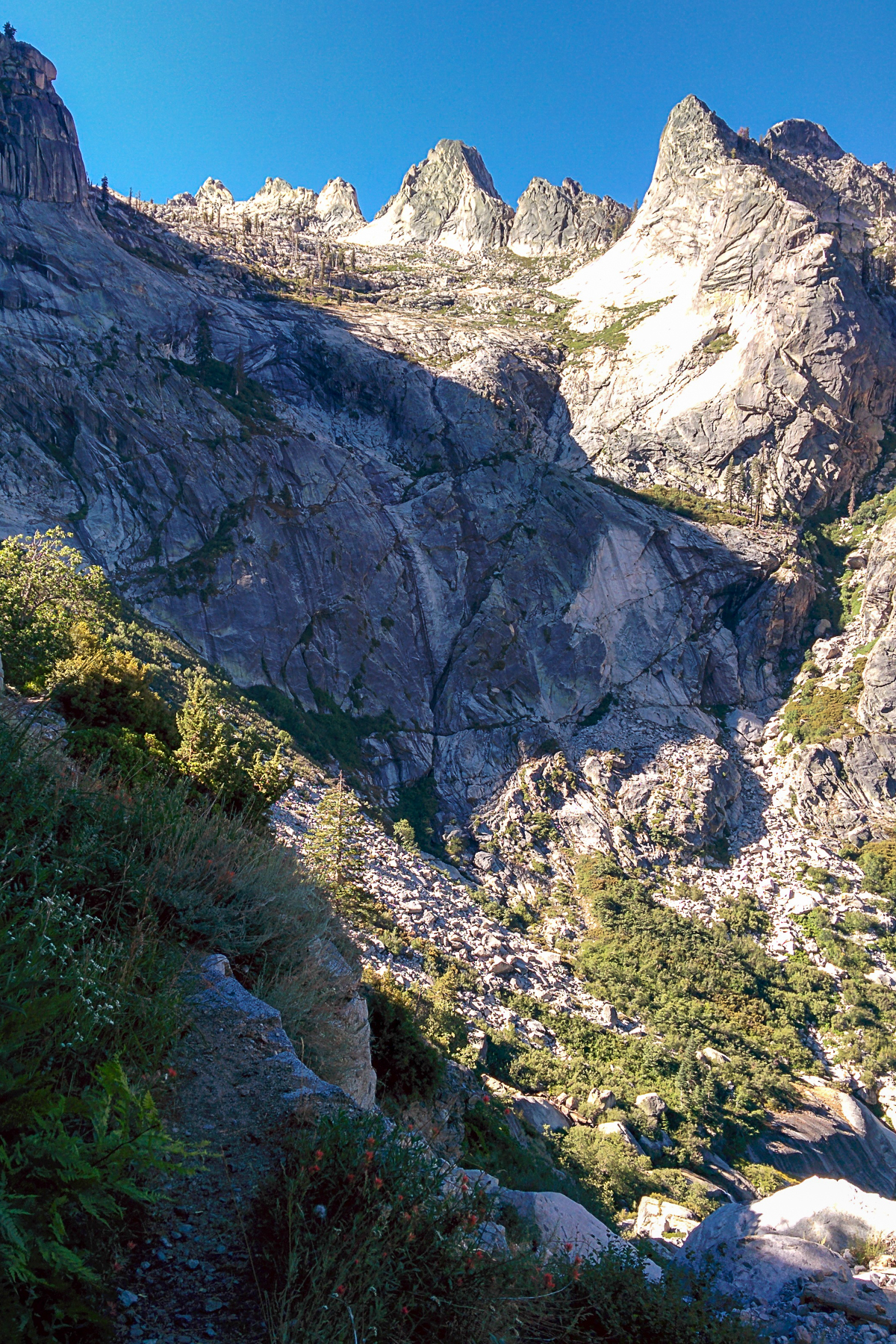


Hamilton Lake:

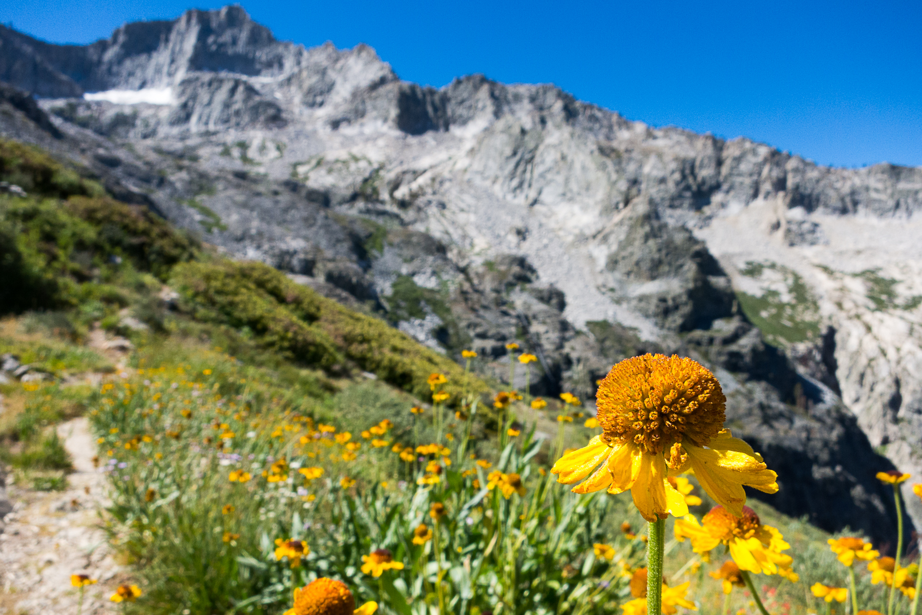
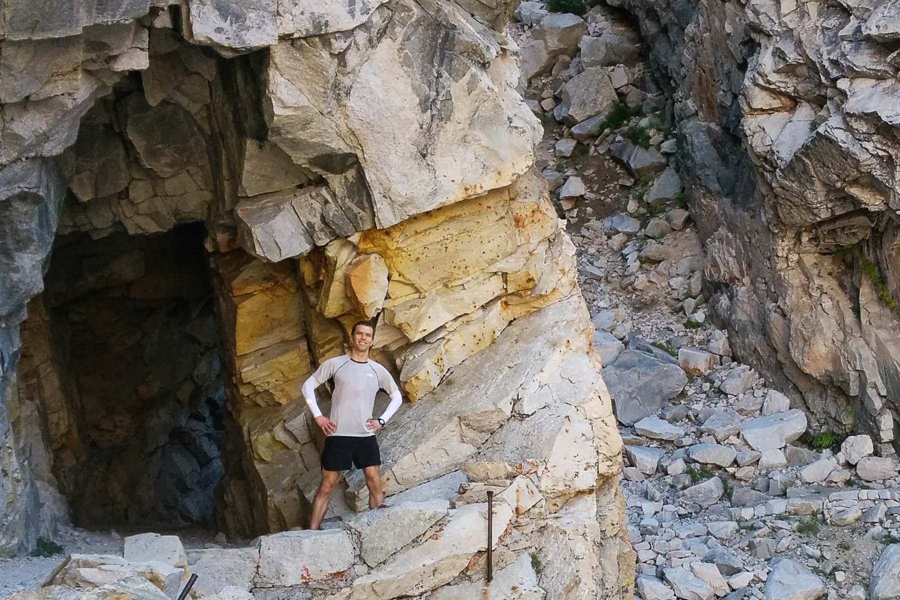
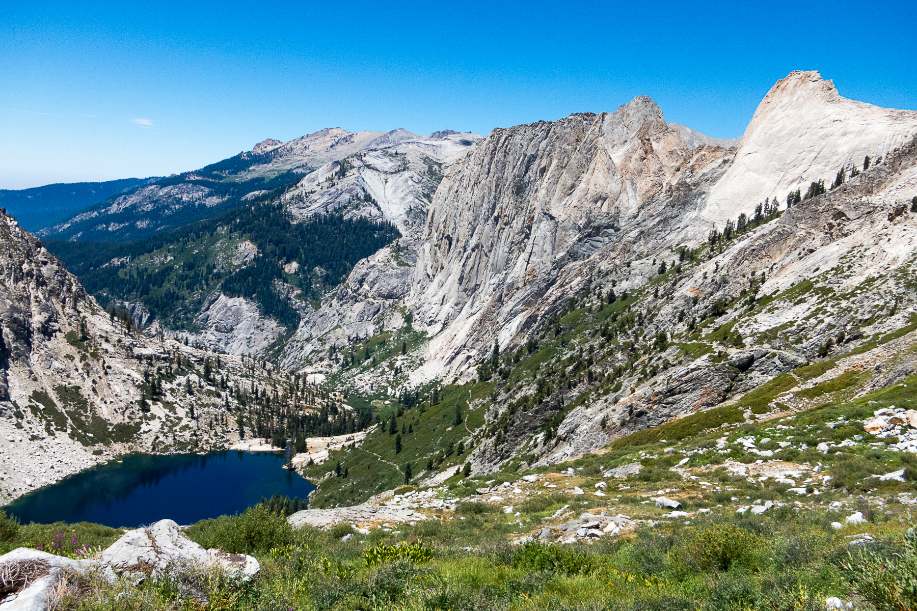
I left Hamilton Lake (15.1 miles) by 9:30. The trail from to Precipice Lake (18.4 miles) has some steady climbs and plenty of switchbacks. But there were wildflowers at small creek crossings and of course the impressive trail tunnel (16.7 miles).
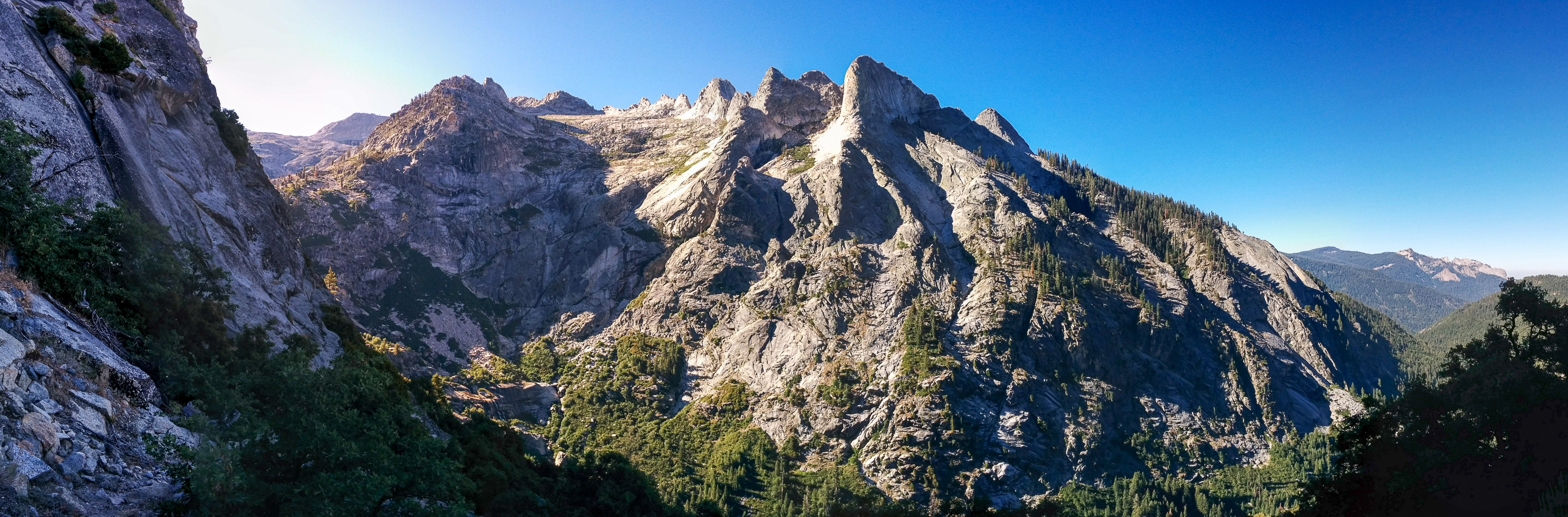
Hamilton Lake to Precipice Lake:


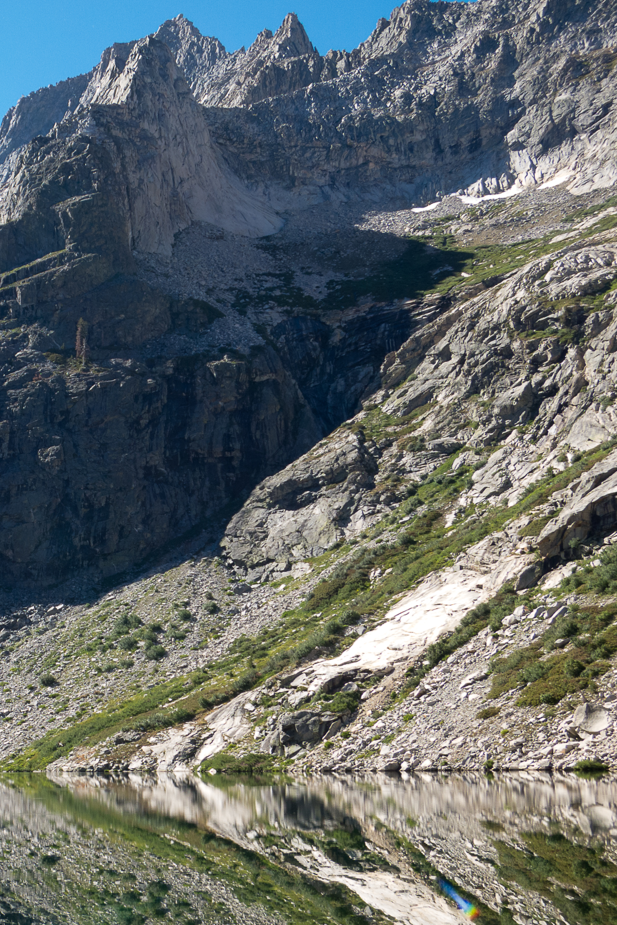
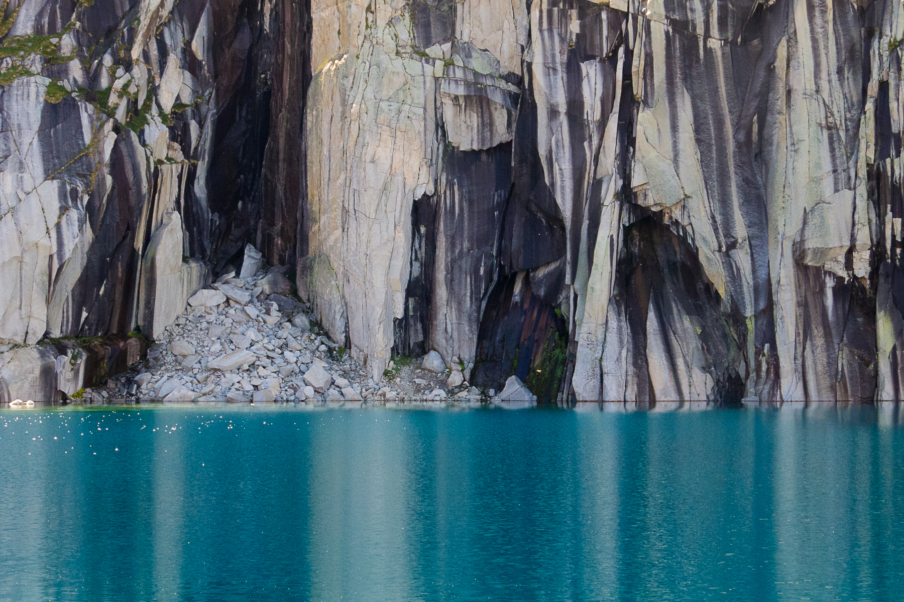
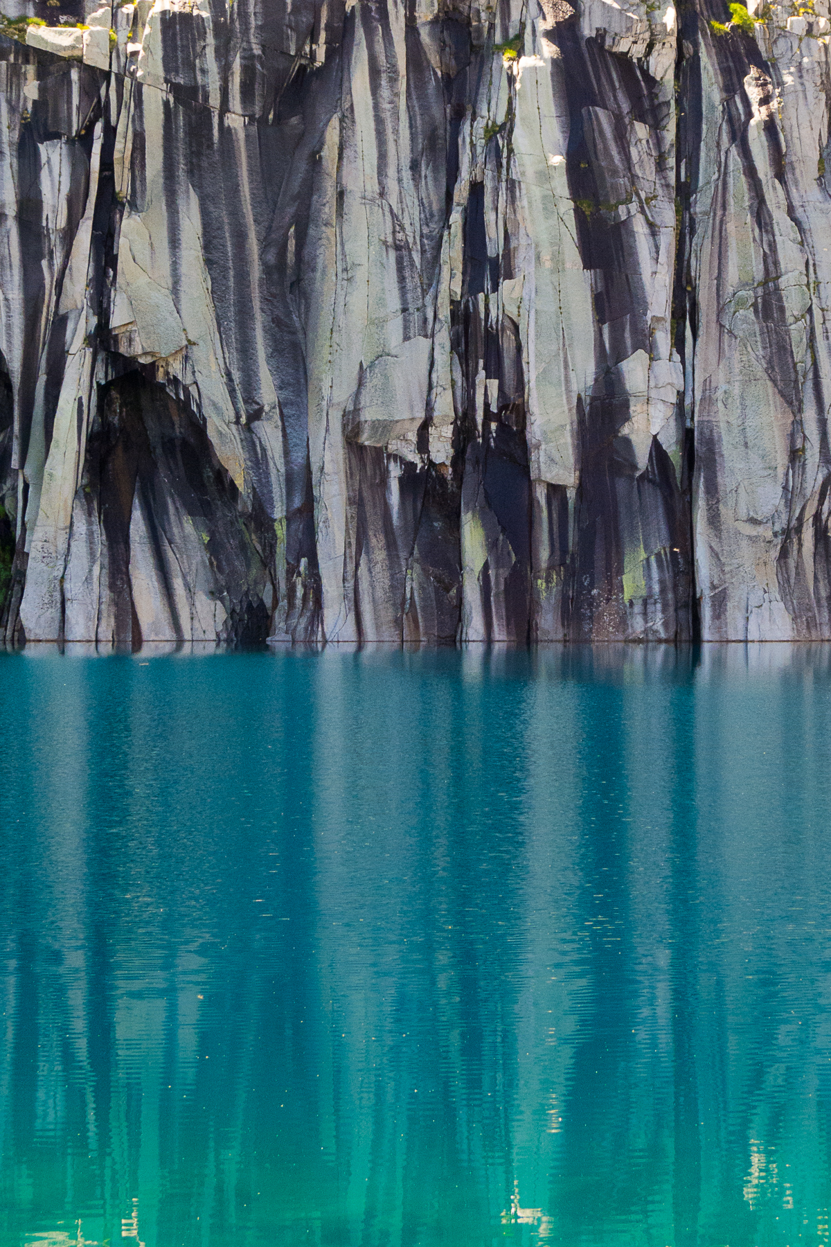
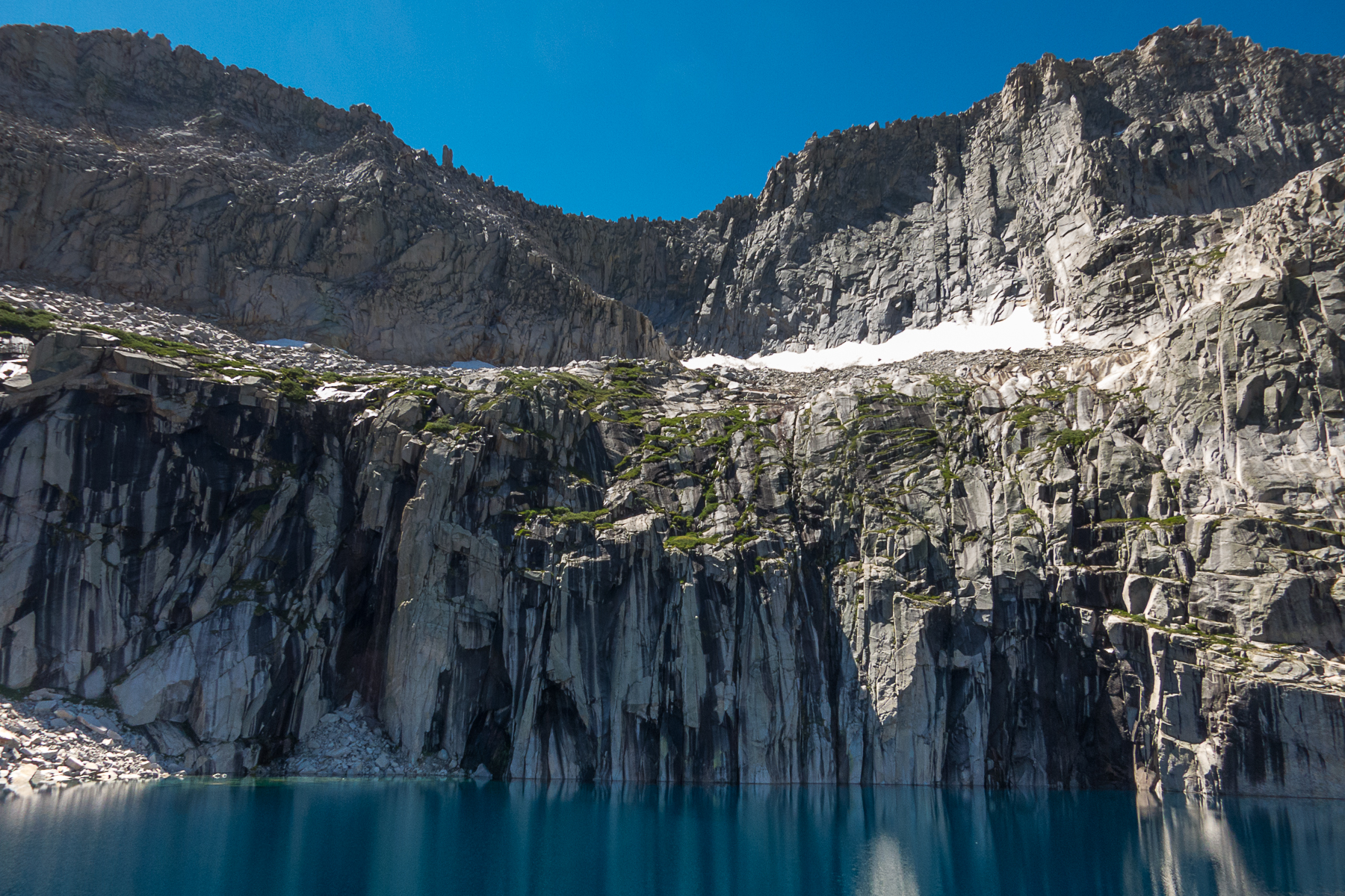
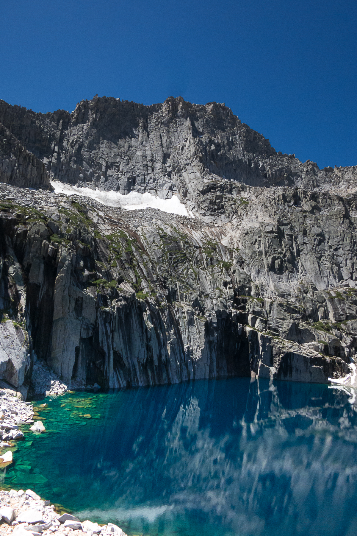
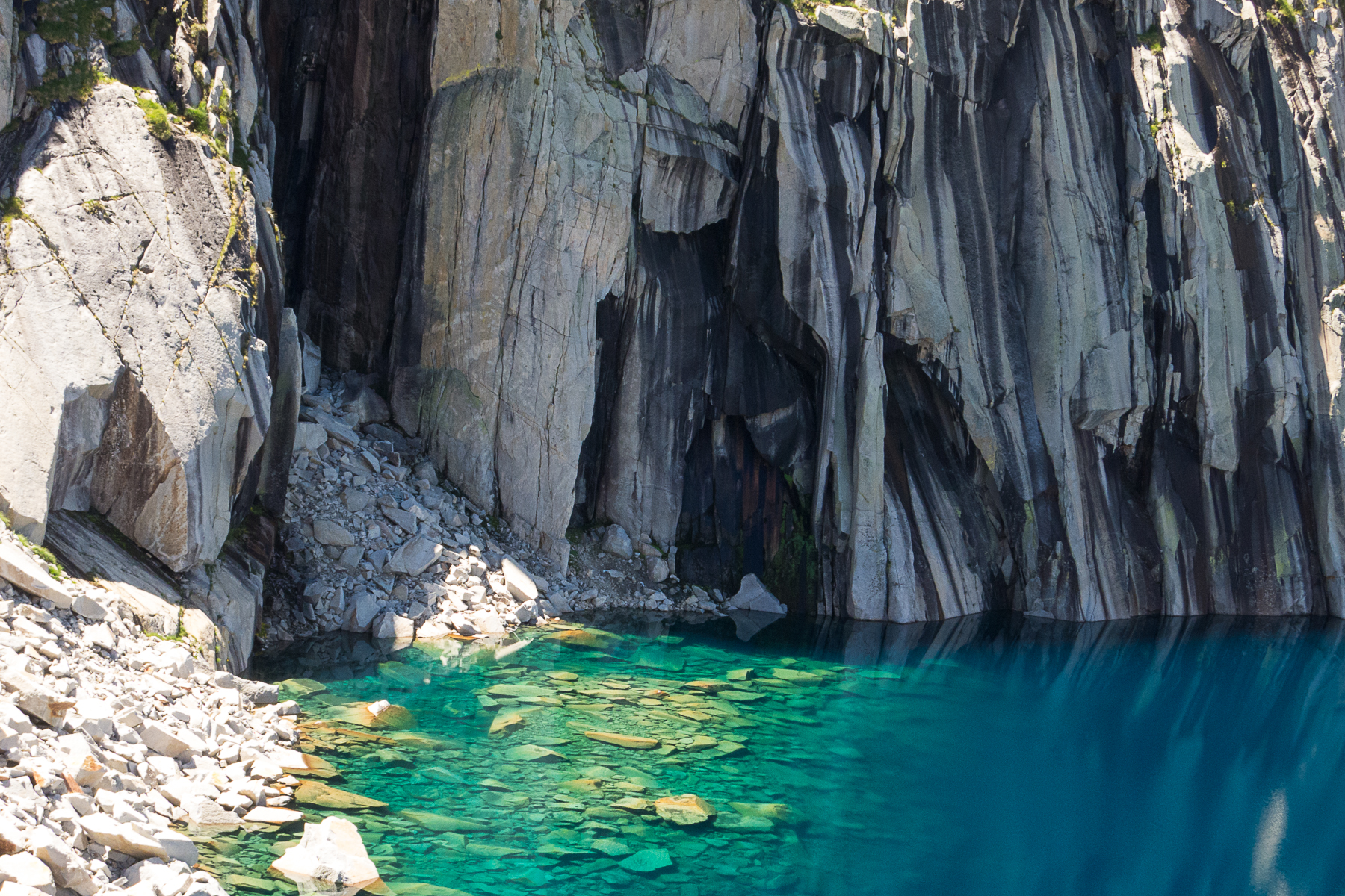
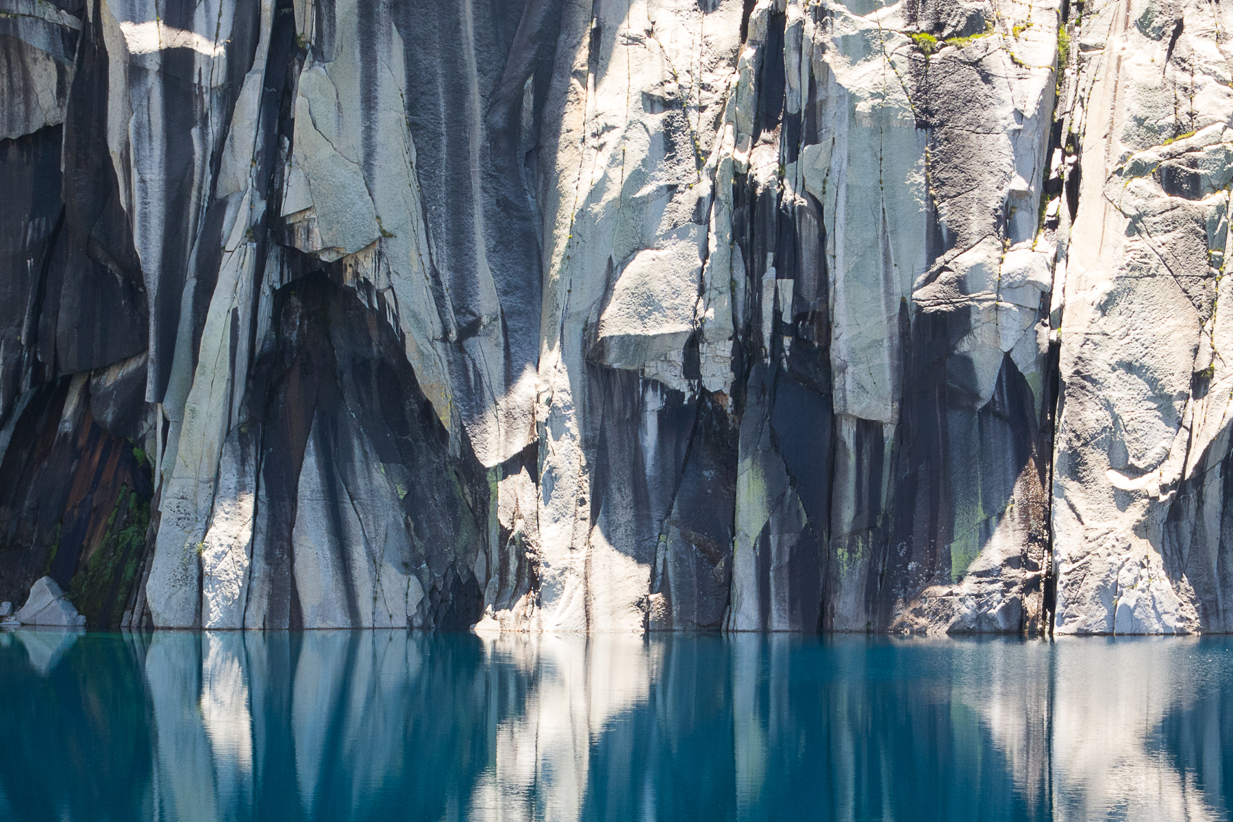
I arrived at Precipice Lake by 11am. Actually, the whole point of the trip was to see this lake. At the Getty Center's exhibit this spring, I'd really liked Ansel Adams's photo "Frozen Lake and Cliffs." (Here's one version online:
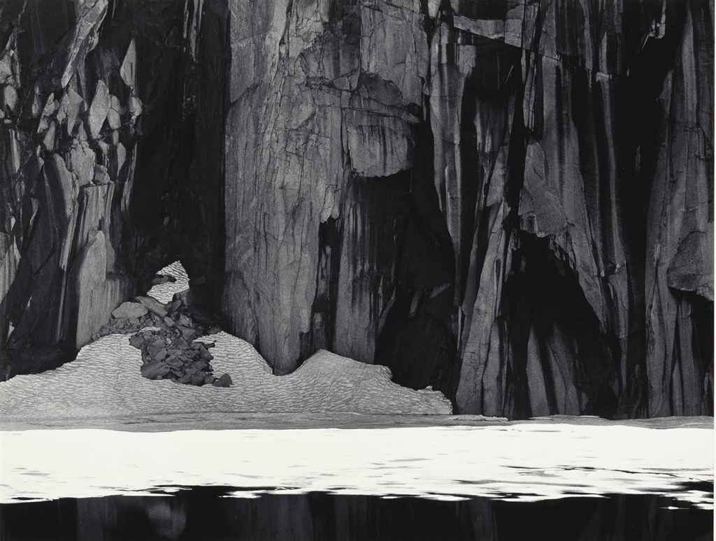 .) When I learned that the lake in his photo was fairly easily accessible, I had to go see it!
Of course, my trip was too late for there to be any ice. And worse, I arrived probably 10-15 minutes too late to see the cliffs in full shade. That's okay, I still spent half an hour photographing the lake and cliffs (and I'd spend more time on the way down!).
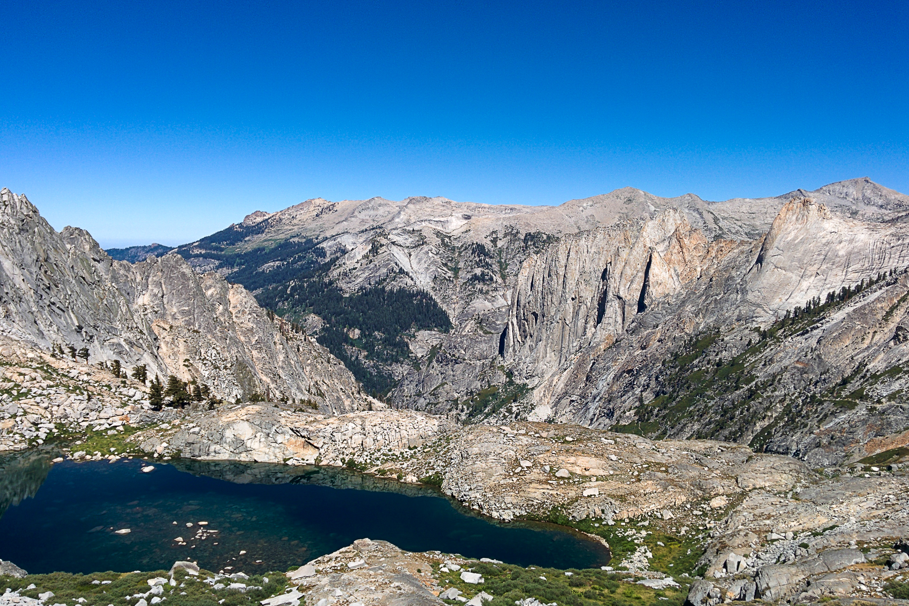
Precipice Lake:


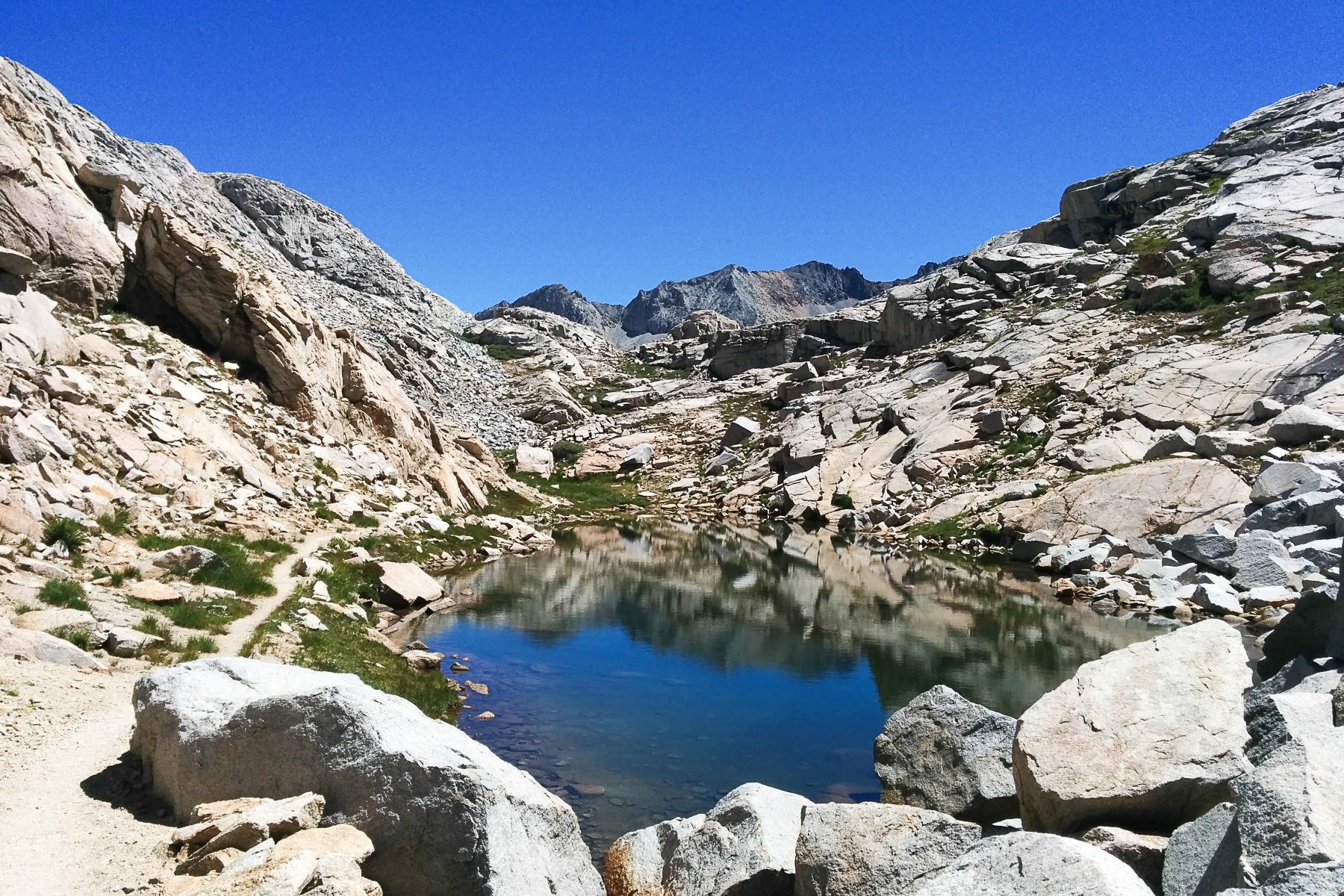
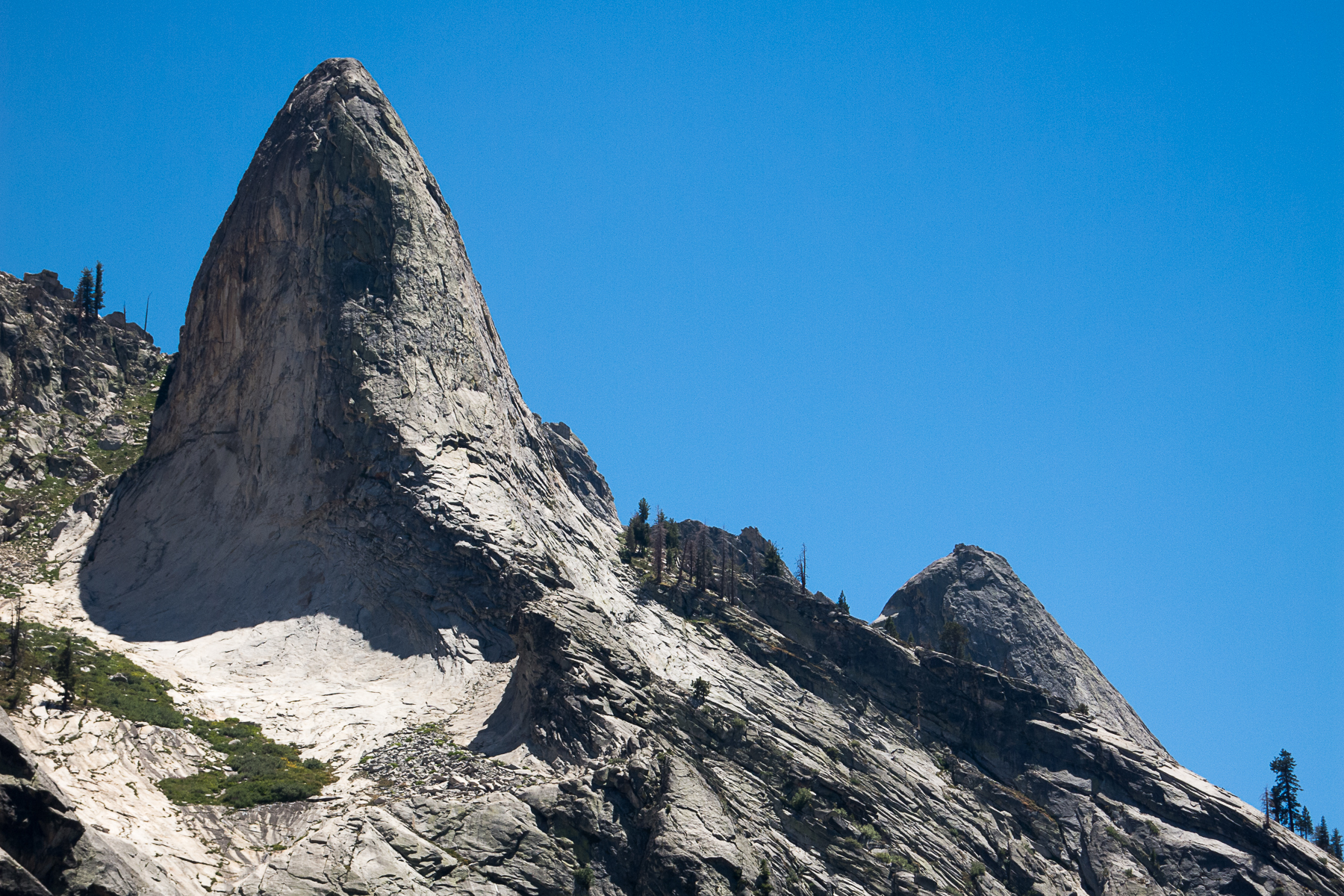
Finally, the trail from Precipice Lake to Kaweah Gap (19.2 miles) felt very easy. It is not very far, and flattens out a bit after the first climb, meandering past a couple small alpine lakes. Arriving at the gap at about 11:40am (5:50 after starting, 3:56 time moving), I scouted the traverse to the south ridge of Eagle Scout Peak, but didn't go far. Maybe another day.
The last two lakes before Kaweah Gap:


Looking over Kaweah Gap:


I started down at ~12:10pm, and got to Crescent Meadow by 5:50 (5:40 elapsed, 3:40 moving). The descent was actually much more runnable than I had expected coming up. Even though I wasn't carrying trekking poles, the stairs were not a big problem. But I was slowed down because the light had changed since the morning, so I had to keep taking photos! I also chatted with several groups hiking the High Sierra Trail to Mt Whitney. Wow! All day after about mile 9 there were lots of hikers on the trail, and everyone was very friendly.
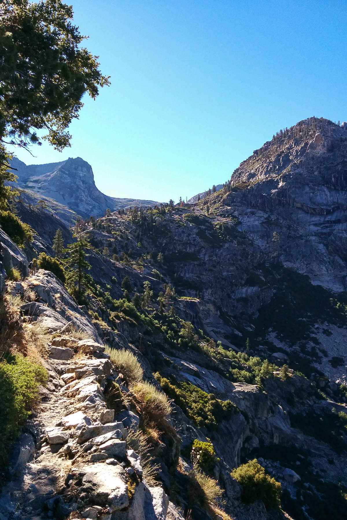
Trail descending to Hamilton Lake:

Trail tunnel in the sun:


Below Hamilton Lake:


Looking back up the canyon:

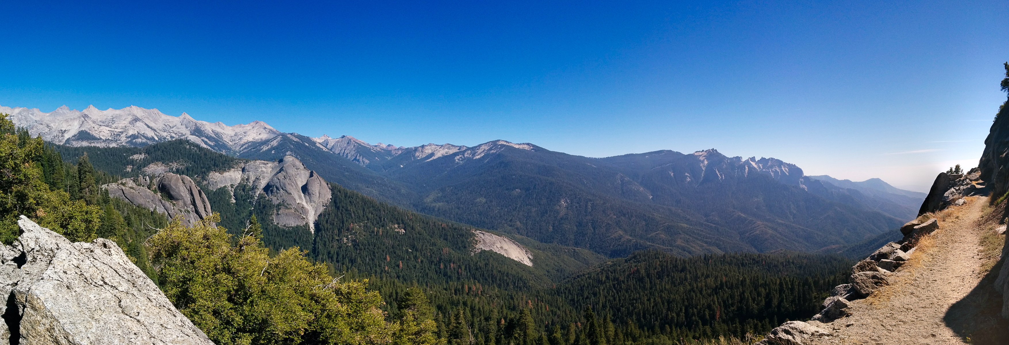
Sunny trail panorama (~9 miles from Crescent Meadow):

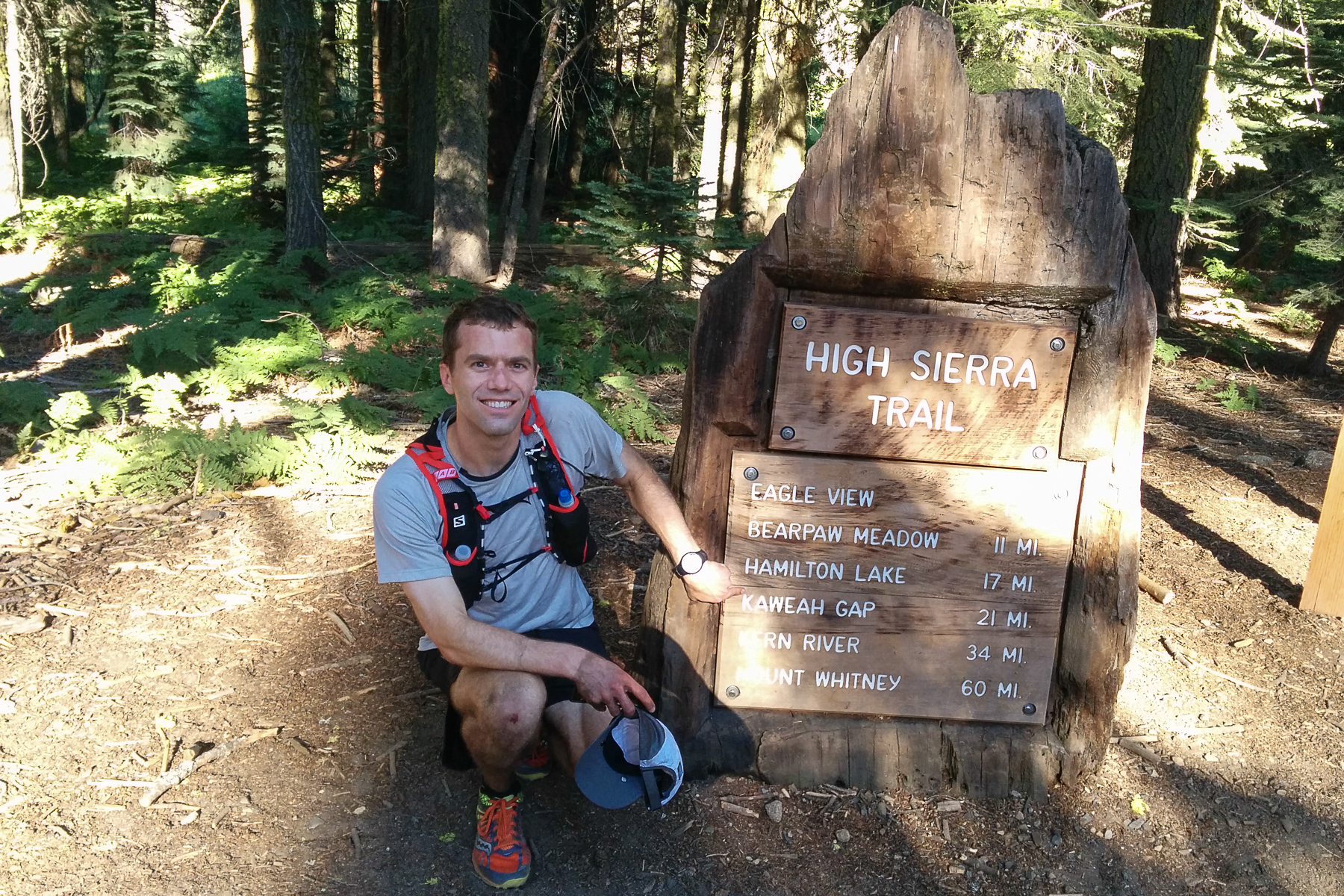
What mostly slowed me down, though, was the heat. Without a cloud all day, I fortunately didn't have to worry about thunderstorms. But the heat was bad. The sunny sections of trail below Bearpaw Meadow, which were frequent in the afternoon, especially sapped my energy. Averaging ~10 minute miles, it took me as long to descend from Bearpaw Meadow as it had to ascend to it in the morning! (To be fair, there are hills along the way.) I was tired; my attention wandering at Eagle's View, 0.7 miles from the end, I tripped on nothing on some perfectly smooth trail. It just got me dirty. Back at the parking lot, I got my photo taken in front of the trail sign. I didn't tell them that it is really only 19 miles to the gap.
Hyperbolical sign:
Route details:
Strava route ascent:
Strava route descent:
Nutrition: 3200 calories (5 Clif bars, 9 Gus, energy drink mix) --- way more than I carried at Rae Lakes a few weeks ago!
Runnability:
I ran the Rae Lakes loop trail counterclockwise a few weeks ago. That trail was amazingly well groomed! Far nicer than what I am used to running at home, coming down there were more than a few spots where I could open it up to a 6-minute/mile pace, and the only non-runnable sections were descending from Glen Pass through the snowfields and descending the stairs from Mist Falls.
This trail was also quite runnable, but with worse footing than the Rae Lakes trail. Also muddier and more overgrown, though that could be because of the later date. The worst part was ascending east from Lone Pine Creek. Surprisingly to me, all of the stair sections were runnable on the descent. Maybe the stairs are slightly shallower than on the Rae Lakes loop? Or, maybe it is just because the stair sections are toward the middle instead of toward the end, so you aren't tired yet.


