
I planned to visit the popular Canyon Creek drainage, hoping that the early dates would cut down on the crowds of people who swarm this area in the summer. On my way in on Friday morning, the only people I saw was a large trail crew, but on Saturday it'd be a different story! I started at 10:30am on Friday and didn't see anyone until around noon when I neared the spot where the trail crosses Canyon Creek. Then Saturday afternoon into Sunday, I had the entire Boulder Creek drainage to myself---bliss!
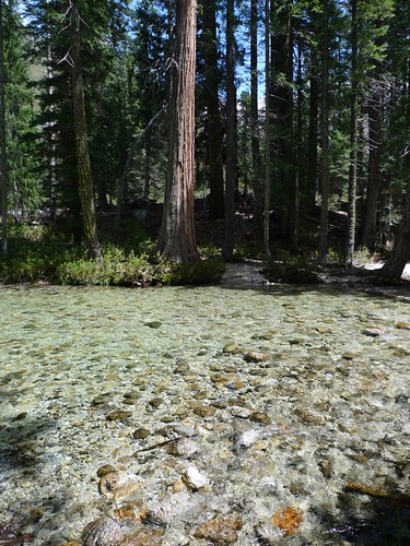
The first few miles of the Canyon Creek Trail are through deciduous forest with mossy rocks strewn about.
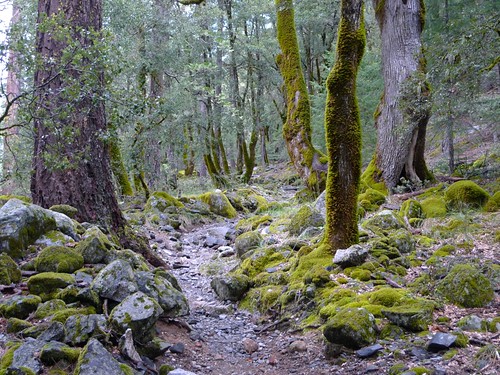
Canyon Creek Trail by snackronym, on Flickr
The weather was cloudy across the west side of the canyon, while the trail follows the east side of the canyon.
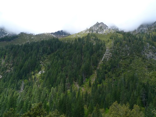
Western slopes of Canyon Creek by snackronym, on Flickr
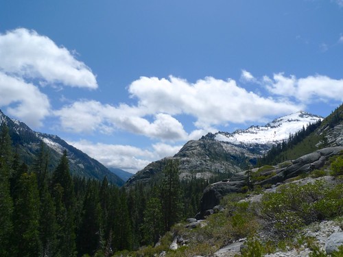
As the trail gains elevation, the forest transitions to more evergreens and the views start to open up to the granite walls of the canyon. At one point, you look out to the junction of the Boulder Creek (behind the sloping granite in the foreground) drainage with Canyon Creek's drainage.
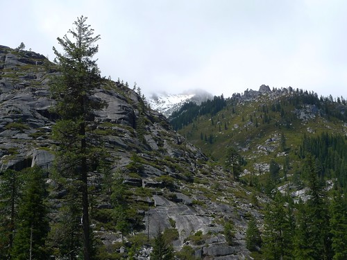
Looking out to the west by snackronym, on Flickr
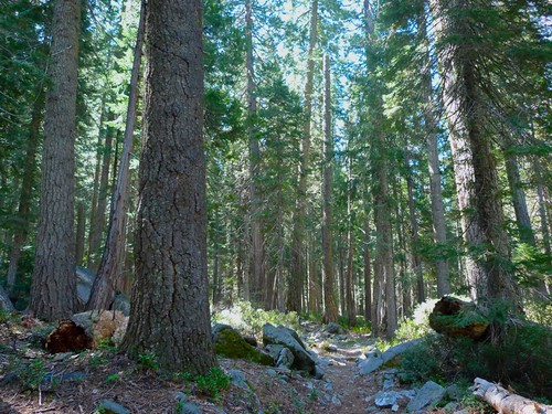
After a brief stretch of exposed trail with views, it's back to the woods again. The forest is pretty and you get peeks at the walls of the canyon, but for me this type of trail is a bit boring. At least it makes for pleasant hiking, though!
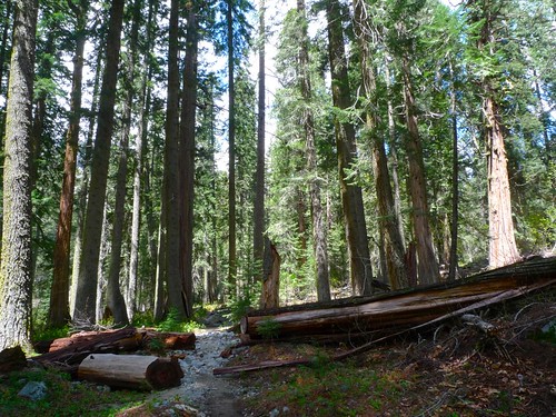
Walking through the forest by snackronym, on Flickr
Ah, finally I get a view back down the canyon I've been hiking up!
Fist look back by snackronym, on Flickr
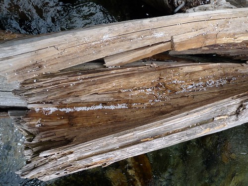
And at this point Canyon Creek cascades nicely over wide slabs of granite. Soon after these falls, I'd encounter the first people of the day (a trail crew of about 8 people rolling big boulders around).
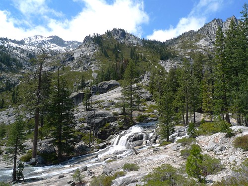
Canyon Creek by snackronym, on Flickr
After 2.5 hours of hiking, I had lunch at 1pm at Upper Canyon Creek falls.
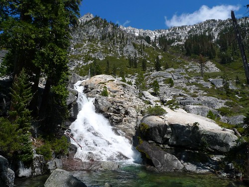
Upper Canyon Creek Falls by snackronym, on Flickr
My pace would slow a lot now since I kept wanting to turn around and take photos and admire the grander and grander views of the canyon!
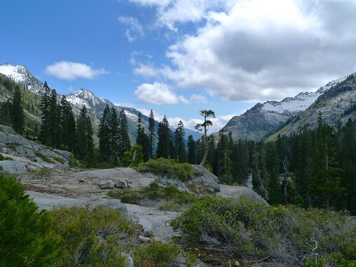
The best tree by snackronym, on Flickr
I reached Upper Canyon Creek Lake at 3pm and set up camp. Pretty much all of the established campsites are within 100 feet of water due to the steeply sloping sides of the basin.

Upper Canyon Creek Lake Camp by snackronym, on Flickr
I had a nice view over to the little basin where L Lake lives and I planned to dayhike there the next day. Mother nature had other plans, however. I spent the night listening to sleet fall on my tent and winds whip by. I woke up to a thick whiteout with strong winds and a mix of frozen precipitation that didn't stick to much besides my tent.
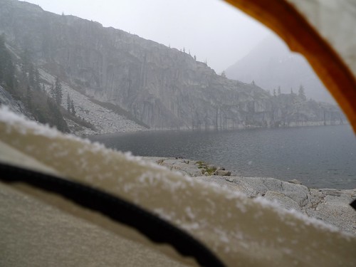
Wintery Mix by snackronym, on Flickr
So I spent most of the morning huddled inside my bag, napping on and off.
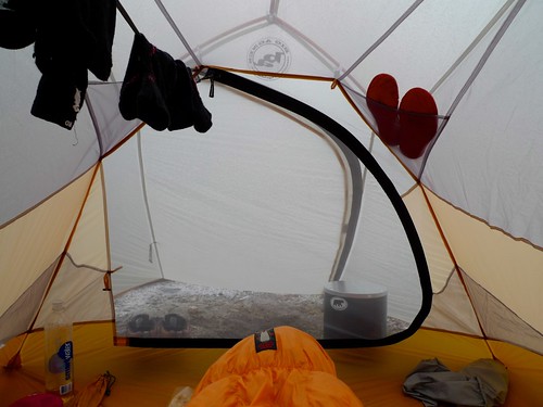 Tent Life by snackronym, on Flickr
As I thought the storm was clearing, I packed up my gear inside the tent ready to make a break for it if it cleared enough. Finally, around 11am, I got my chance.
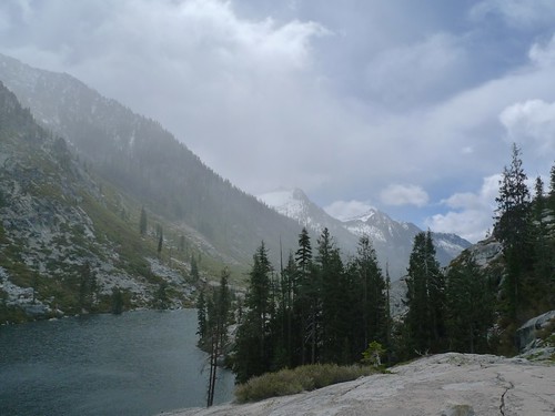
Lower Canyon Creek Lake by snackronym, on Flickr
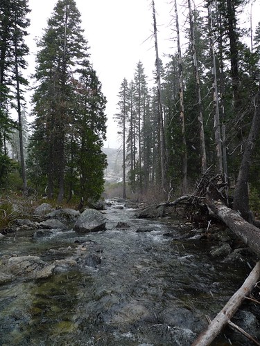
I headed back down the trail, thinking I'd either leave or visit Boulder Creek if the weather was nice when I got to the junction. It looked promising at first!
Canyon Creek by snackronym, on Flickr
And then it started to hail (?).
Looks like styrofoam by snackronym, on Flickr
Creek crossing in the hail by snackronym, on Flickr
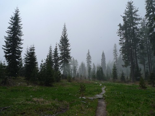
This meadow was nicer yesterday by snackronym, on Flickr
And then suddenly, five minutes later, it was completely clear and sunny again. I guess I'll be heading to Boulder Creek after all!
Wait what? Is this the same day? by snackronym, on Flickr
I forded Canyon Creek. The water was about shin to knee deep.
Crossing Canyon Creek again by snackronym, on Flickr
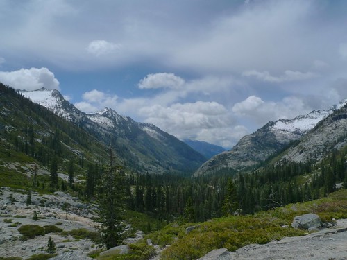
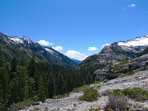
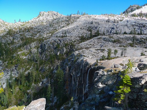
As I headed up the steeper sections of the Boulder Creek Trail, the views began to open up.

Boulder Creek drainage by snackronym, on Flickr
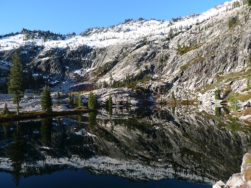
And soon I arrived at the surreal, Tolkien-esque basin in which Boulder Creek Lake lives. The basin is chock full of waterfalls and little ponds. So beautiful!
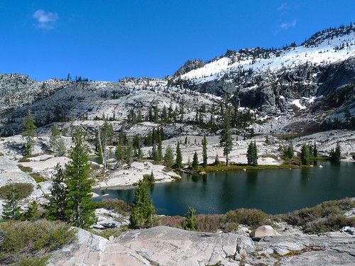
Boulder Creek Lake by snackronym, on Flickr
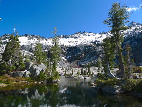
Surreal ponds in the Boulder Creek Lake basin by snackronym, on Flickr
Boulder Creek Lake outlet waterfall by snackronym, on Flickr
I got up early the next morning for some beautiful sunrise alpenglow reflections on the pools around the basin.
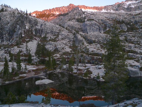
Alpenglow above Boulder Creek Lake basin by snackronym, on Flickr
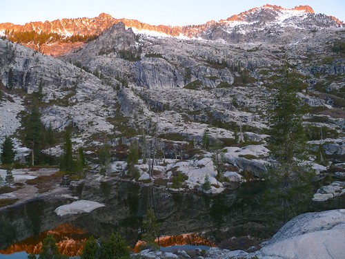
Alpenglow on Boulder Creek Lake basin by snackronym, on Flickr
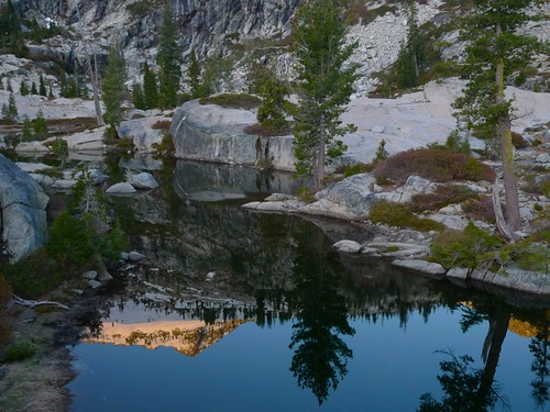
Surreal ponds and reflections by snackronym, on Flickr
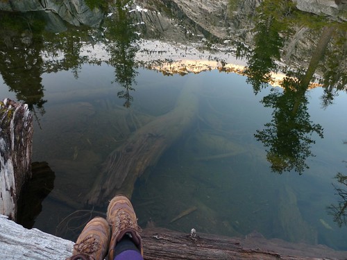
Reflections by snackronym, on Flickr
I said goodbye to the basin around 8:30am and headed back down to my car.
Boulder Creek Lake by snackronym, on Flickr
 Headed back down through the forest by snackronym, on Flickr
I didn't die! by snackronym, on Flickr


