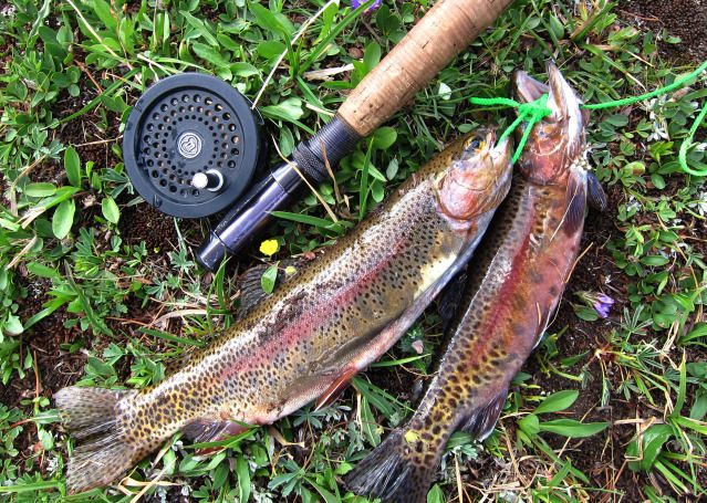
I spent most of the summer in Wyoming in the Wind River Mountains. This year’s up-side-down summer weather ended up with “Sierra” weather in the Wind Rivers and “Rocky Mountain” weather in the Sierra! But little did I know this when I started. It only froze one night out of forty; rain threatened, sprinkled but a real storm with lightning, hail and downpours on materialized twice. I over-packed, expecting the “real Rockies” weather to return any day. The “drought” in the Rockies may have provided me with fine backpack weather, but it also caused many forest fires filling the air with smoke making photography very challenging. Two thing remained constant in the Wind Rivers; the lack of people once away from popular day-use trails and the abundance of game- elk, deer, moose, mountain sheep, rabbits, birds, rodents = hundreds, people=tens .
I spent a ridiculous amount of time this winter planning the route, developed too many options and left Sacramento yet undecided on the exact route! Because of my guidebook, I never seem to simply do a trip for recreation; my pack was not only loaded with too much cold weather gear, it contained several “agendas”. I wanted to try out a through-hike along the crest of the Wind River Mountains, similar to Roper’s High Route for the Sierra, gather on-ground information for a few areas that I have failed to get to in the past and obtain better photographs for the northeast part of the mountain range. I did not 100% succeed on any of these. I was pleasantly surprised that my old body could still do this kind of trip. In fact, my body did better than some of my equipment.
One could straight-line through hike in about 180 miles if one could afford two commercial packer resupplies. Add all my nooks and crannies and it expands to 220 miles. Replacing packer resupplies with two walk-out resupplies and I ended up doing 266 miles (66% off trail) in 36 days plus two full and two half days in town to resupply. I averaged 7.4 miles a day. Elevation gains were moderate, averaging 1,800 feet per day. I chose to travel south-to-north, mainly to give streams in the north, which are harder to cross, time to go down. My start was from one of the trailheads very close to Lander, Wyo. and the end was at a trailhead very close to Dubois, Wyo. The three sections were:
SECTION 1: SOUTH, 13 days, 85.3 miles (plus 1.5 town days)
SECTION 2: MID SECTION, 13 days, 101.3 miles (plus 1.5 town days)
SECTION 3: NORTH, 11 days, 79.1 miles
The trip was challenging and a bit anxiety generating since I was specifically testing some passes and routes of questionable feasibility. In addition, I was trying to find routes that did not require special equipment and experience, such as crampons or mountaineering skills, so only carried my trekking poles and a 30-foot cord for lowering and lifting my pack. I would have enjoyed the trip more if I had not so many “must do” items on my agenda that made it feel a lot like work! The 13-day ration periods bumped my pack’s starting weight over my comfort limit, making the first few days of each section grueling. And lastly, the notion of going solo in grizzly bear country was anxiety provoking. I took my Bearikade canister the entire trip even though it was not officially “required” and bear spray on the last two sections. I enjoyed the last section the most after I pretty much abandoned the “pure” through-route idea. Although I thoroughly enjoyed being in the mountains for nearly 40 days, I realized I do not have a pure “through-hiker” mentality.
7/10 Day 1 Worthen TH to Stough Creek Lakes. 11.1 miles including 3.8 day hike/+2840 ft./8.7 hrs.
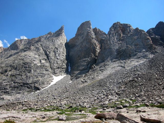
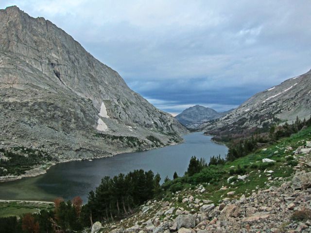
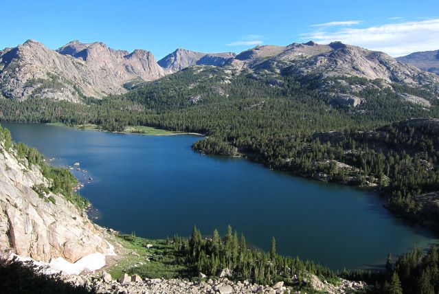
I planned on starting at Fiddlers Lake but forecasts for unsettled weather along with lifting my pack squelched the idea of starting up Silas Canyon with the rigorous over-the-top required on the second day. I failed to meet my through-hike goal and I had not even started! But practicality won over purity and as we left Lander, Wyo., I decided my friend would drop me off at the Worthen Meadows trailhead to take advantage of its shorter all-trail route to Stough Creek Lakes. We said our good-byes at 7:45AM. It was thankfully cool and other than having a bit of difficulty finding the best place to cross Roaring Fork Creek, it was an easy start. I took my first rest at 9AM just as the trail started climbing up to the unnamed pass between Roaring Fork and Stough Creek drainages. When I picked up my pack I swore little “gremlins” placed rocks inside! I was even feeling the altitude. On top by 10:30 I took another rest, ate a snack, enjoyed the view towards Wind River Peak and met a family returning from my destination.

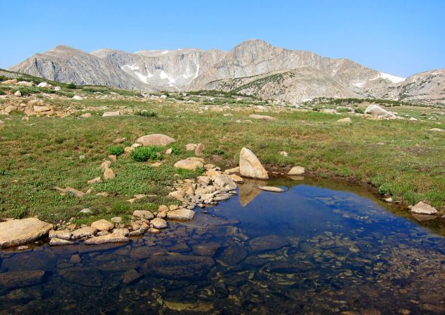
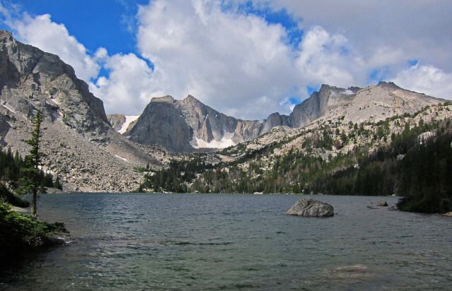
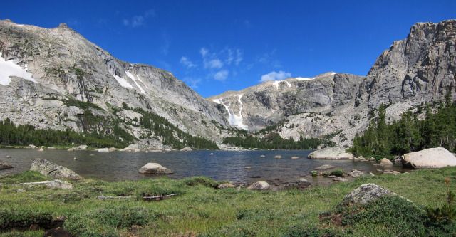
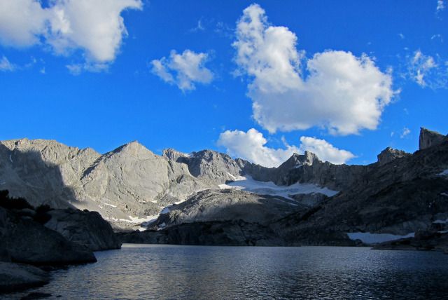
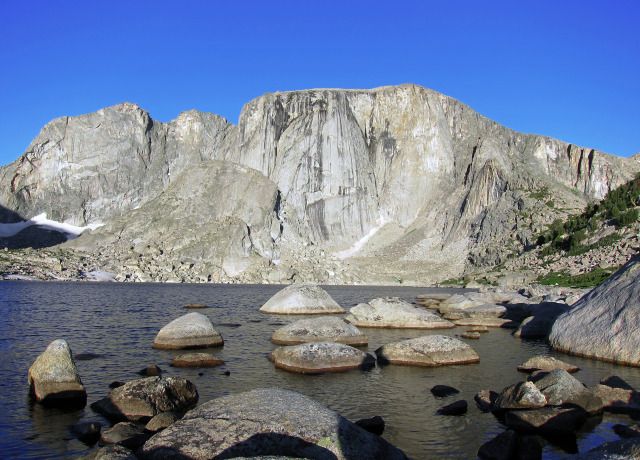
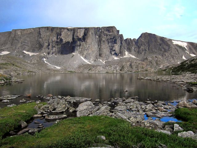
View from Pass to Sough Creek Lakes
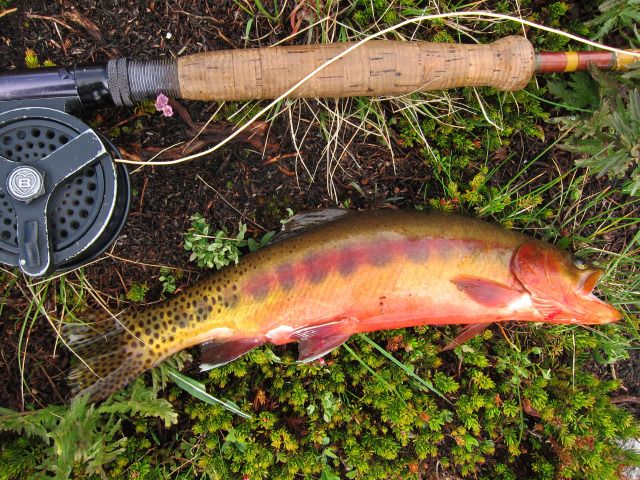
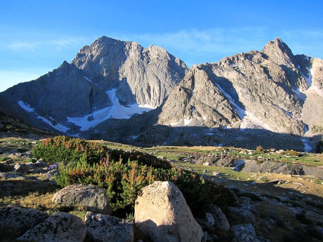
I dropped to the trail junction where mosquitoes added to the misery. My back was killing me. My poor pack was loaded beyond its recommended weight and suffering would be the norm for a few days. Having not planned on using the Worthen trailhead I was not yet on the maps I carried and to my horror the sign said 3 miles to Stough Creek Lake when I was thinking more of a mile. Climbing uphill to add to the misery as big clouds built overhead. At the second lake in the basin I rested while watching several fishermen across the lake and I realized I would not make it to my intended destination. I found an established campsite in trees at the third unnamed lake just as rain started to dribble out of the big black clouds. It was 1:30. Six hours of walking and I was dead on my feet. How out of shape I was! I took a quick nap in the tent while it lightly rained.

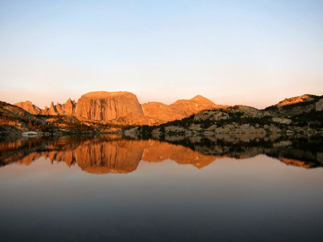
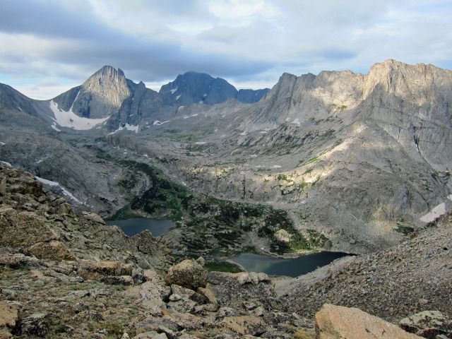
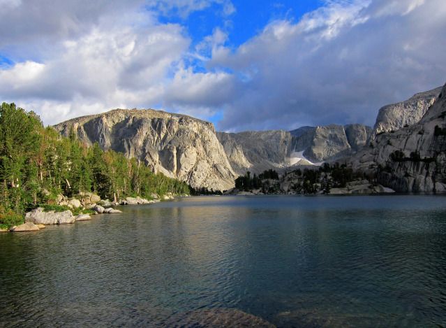
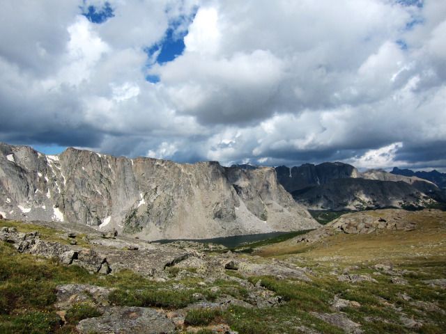
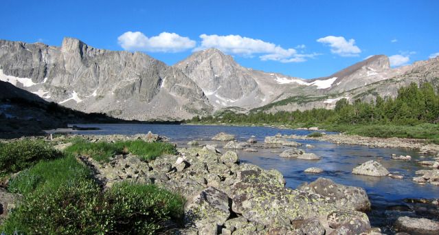
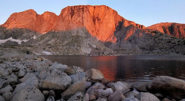
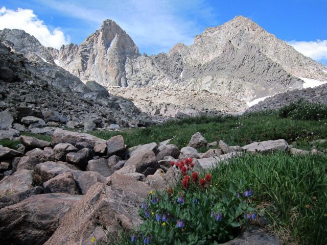
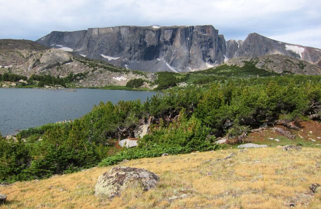
View from my Campsite
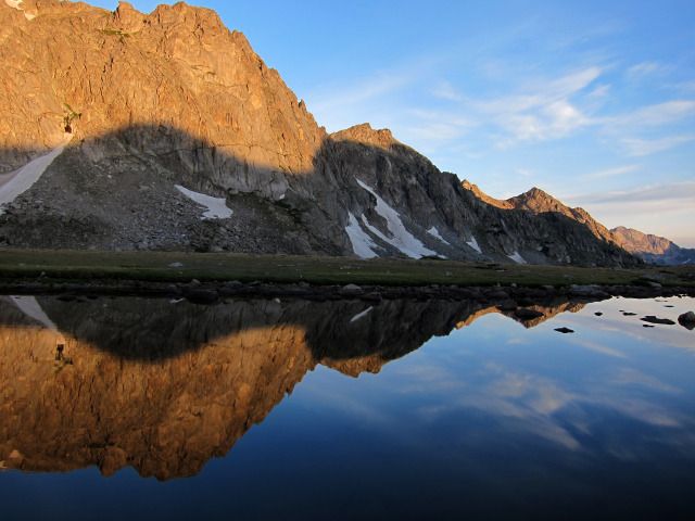
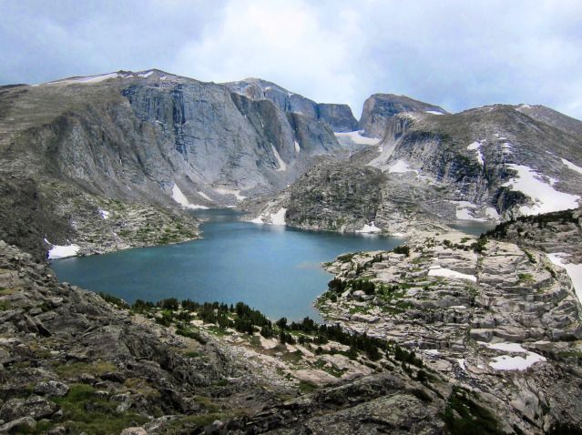
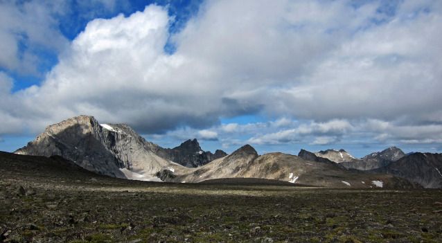
When I no longer heard raindrops on the tent, I crawled out and gathered camera, rain jacket and water bottle and set out for a 2-hour hike to the upper lakes, where I had intended on camping. Although weather threatened, no more rain fell but the gray skies made the beautiful area look a bit dismal in photographs. The upper lakes had more scenic but exposed campsites and along the creek was a large bug-filled wetland, so my lower campsite probably was better given the weather. Every bone in my body said “go home” but I managed to haul my weary self to Lake 10,902 and take a few pictures. Back at camp I cooked an early dinner but it was too early to go to bed so I also checked out the next day’s route to Toadstool Lake. Back at camp a buck deer was right next to my campsite and making all sorts of disapproving noises. I ran him off and crawled into my sleeping bag as thunder rumbled in the distance. It definitely was a “two-Advil” night. In fact by midnight, I needed more pain killers.

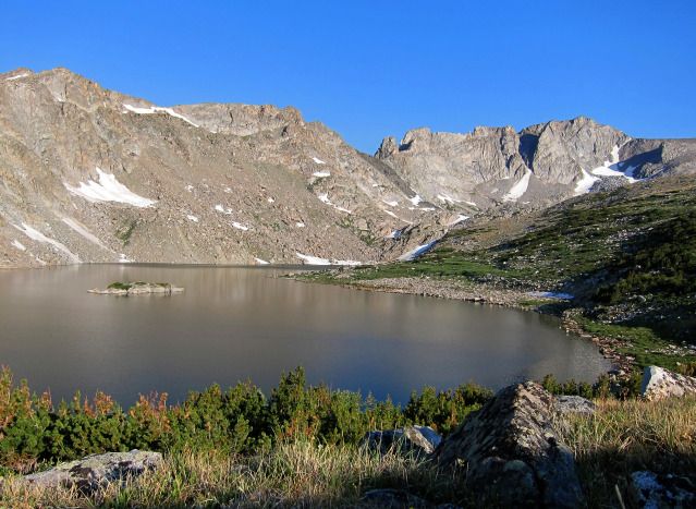
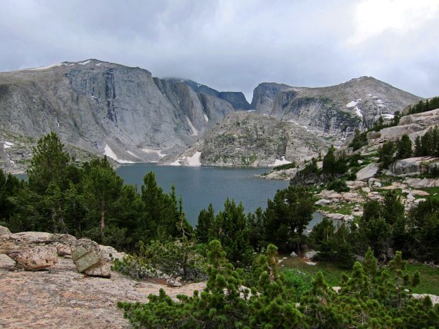
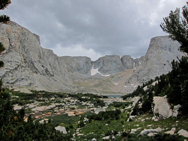
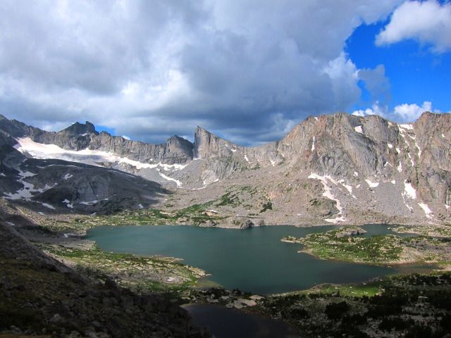
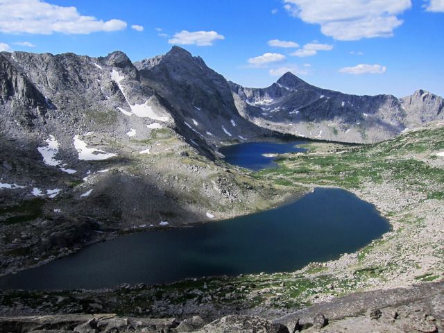
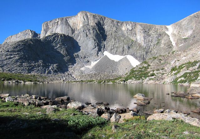
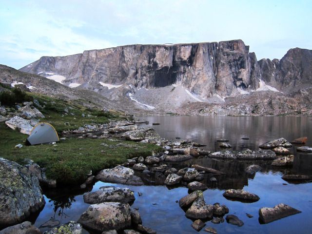
View from one of the upper Stough Creek Lakes