Member descriptions, photos, and map locations of Cross Country Passes in the High Sierra. This forum is for information only - discussions should be kept in the appropriate categories. This forum is a component of the HST Map. We need your help to complete the database, so please contribute!
GENERAL OVERVIEW: Pace Col (Grinnell Pass) is located in the Mono Divide
within Sierra NF, and is a direct route between Laurel Creek and the Fish Creek.
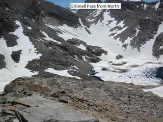
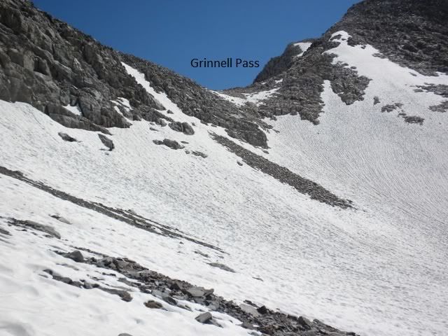
ROUTE DESCRIPTION: Hike north of past both Grinnell Lakes toward the Col.
There is loose shale mixed with patches of snow on the northern side of the Col.
Circle around Red & White Lakes eastern side.
PHOTOS: Courtesy of Cgundersen
Professional Sierra Landscape Photographer
I don't give out specific route information, my belief is that it takes away from the whole adventure spirit of a trip, if you need every inch planned out, you'll have to get that from someone else.
Have a safer backcountry experience by using the HST ReConn Form 2.0, named after Larry Conn, a HST member:http://reconn.org
Here are some photos of Pace Col without snow in early September 2008. We crossed Pace Col from south to north. This was the first backpacking trip by my friend in the photos. He ran many marathons, but talus travel was new to him and a bit disconcerting.
From below Laurel Lake.
Looking north from Little Grinnell Lake.
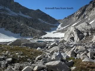
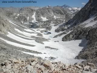
Looking south from the top of Pace Col.
Looking north from the top of Pace Col.
Looking south from Red and White Lake. The most technical part of the crossing was at the cliffs just above my friend's tired body.
Looking south from the north side of Red and White Lake.
Before mid season or in big years until late season going around the east side of the Red and White Lake via a short shadowed talus chute through the usual steep rock band may be snowy icy steep. Note from my position I could not see what was in that chute and why two northward bound backpackers that came over the pass looked at that chute for a half hour before deciding to not try it. That will force one to climb high up and around through steep loose areas easily class 3. Last year of 2017 end of July watched two backpackers spend a couple hours wandering about there while two of us were fishing until finally getting through. On the below image the chute is above where I marked a red X. The red line is where they went while the yellow line is the standard later season route they expected to use via the chute. Also note one cannot simply stay low by the rocky shoreline due to the same bedrock band that is a cliff into the water plus a steep snowfield, lower down.