I'm going to be up fishing the Cottonwood Lakes this coming weekend doing an overnight trip and am planning on also bagging Mt. Langley provided the weather stays as clear as it says it will be. I'm just debating whether to go up Old Army (preferred) or New Army. I know I can get up New Army no problem right now but am not quite so sure of the conditions of Old Army. So any current info on Old Army Pass, trail/snow conditions?????
Thanks,
Mike
Langley via Old Army
-
Rockstar fisherman

- Topix Acquainted
- Posts: 56
- Joined: Wed Sep 10, 2008 2:11 am
- Experience: N/A
- Location: Bakersfield, CA
-
rayfound

- Topix Expert
- Posts: 477
- Joined: Thu Apr 24, 2008 4:44 pm
- Experience: Level 3 Backpacker
- Contact:
Re: Langley via Old Army
Mikey, don't forget to post a report in the Skeeter Updates.... I would love to have an idea of skeet-skeet conditions before I get there on the 21st.
Cheers Bro.
FWIW, I believe that Army Pass (Old) is still fairly routinely traveled... in fact, one of the things we're considering is hiking up Army pass and down New-Army, traversing the ridge between as an interesting way to get from the Main cottonwoods to the S-fork lakes... much harder than it needs, but I would love to see the views from the pass. If you go up, let me know if you think the cross-country between the passes looks sane.
Thanks,
-
Rockstar fisherman
- Topix Acquainted
- Posts: 56
- Joined: Wed Sep 10, 2008 2:11 am
- Experience: N/A
- Location: Bakersfield, CA
Re: Langley via Old Army
You know I'll have a report Ray!
I'm just trying to get up there the shortest distance without getting to Lake 4 only to find out I should go to New Army due to snow on Old Army. The cornice is my only concern at Old Army.
Your plan definately looks sane so long as you stick to the pass routes, provided I do make this hike up I'll let you know. I've been dying to bag a peak, which I've never quite done.
-
Rockstar fisherman
- Topix Acquainted
- Posts: 56
- Joined: Wed Sep 10, 2008 2:11 am
- Experience: N/A
- Location: Bakersfield, CA
Re: Langley via Old Army
Well I did it!! My brother David and I backpacked to Lake No.1 on Sunday where we set up camp for the night and fished for the day. Sunday we hiked up to where we could get a look at Old Army Pass and found it clear of snow so we decided that would be our route instead of New Army Pass which would take longer and have a bit more elevation changes. Sunday I went to bed early and I awoke Monday morning feeling great and ready to conquer the peak that stood beyond our campsite.
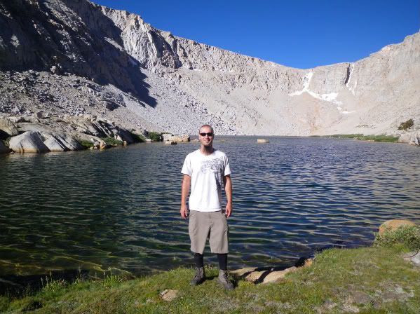
At Lake No.4 with the pass behind me.
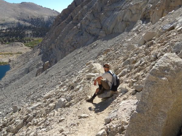
Here I am taking a break and enjoying the morning scenery.
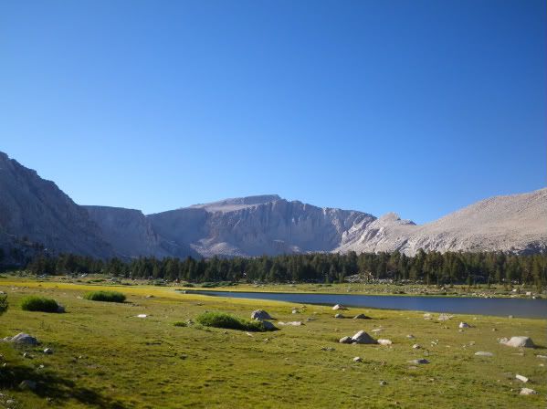
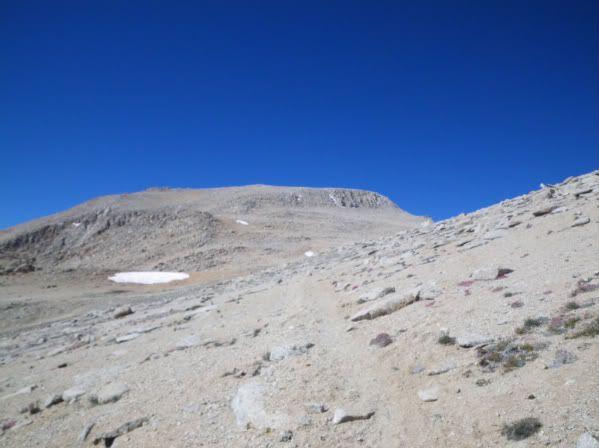
Dave and I half way up Old Army Pass with Lakes 4 and 5 in the background.

Me on top of Old Army Pass and at the entrance to Sequoia National Park.

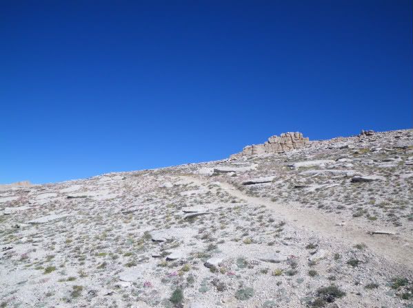
The trail to Langley was very defined and easy to follow.
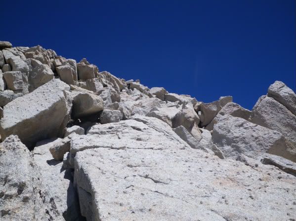
Now just beyond here I'd say around the 12,500ft elevation range I started to get nausea really bad, and could only do 4-15 steps between breaks or I'd nearly throw up. So I had a LONG SLOW SLOG up towards the summit of Mt. Langley, the trail was excellent and if it hadn't been for the damn altitude sickness this hike would've been pretty darn easy for me, except for a little boulder scramble, but it wasn't very difficult or scary.
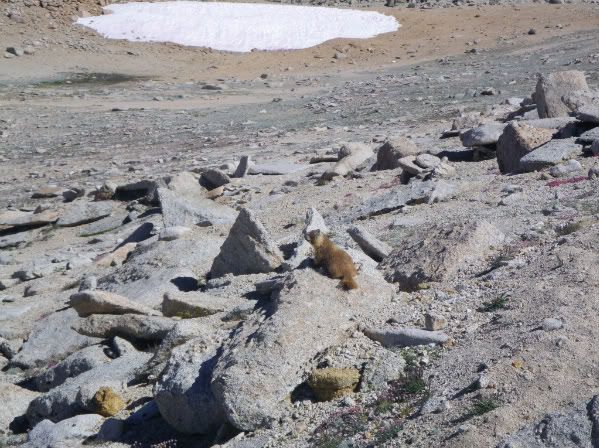
I could not believe how many marmots were around, I've never seen so many in my life and also was surprised to see them so high up 13,000ft. +
Near the summit looking West.
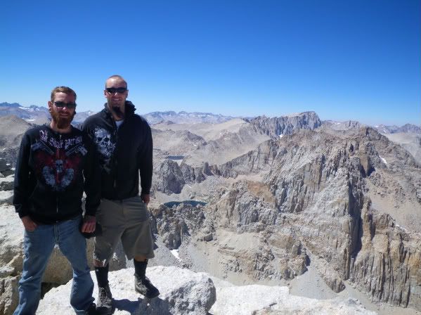
FINALLY 7 hours later (very embarrassed to say that) I made it to the summit of Mt. Langley, 14,042ft. elevation. Here is Dave and I with Mt. Whitney in the background.
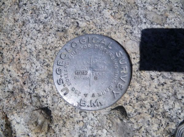
We found the geological marker very quickly and signed the registry as well.
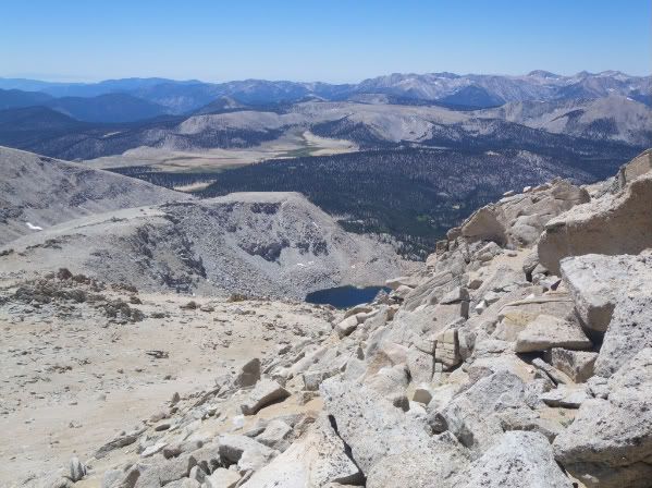
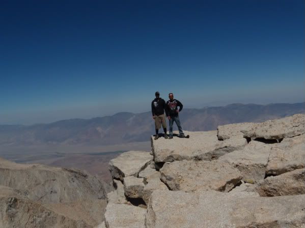
Out on a ledge with the Owen's valley in the background.
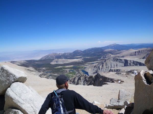
Looking into Miter Basin, I want to fish this Lake sooooo bad!!

Since it took me forever to get up there and we had to go all the way back to the truck this day my time on the summit was limited to about 20-25 mins. Crazy thing is I was also able to make 3 phone calls from the summit, I have Verizon.
Here is David on our way back down, you can see Lake No.1 where we stared way in the background.
I think my biggest mistake was that I did not eat a thing till we got to Lone Pine around 9pm. I know not smart but hey, I wasn't hungry then when I got hungry I was too sick to eat my sandwhich that I had packed up with me due to the elevation. I never felt better until I got at least half way down the stairs to about the 10,800 ft level. Had it not been for the AMS I'm sure I could've easily made the summit in 4 hours, my brother who lives in Scottsdale had no problem with the altitude what so ever. All I care about is I finally accomplished my first peak and a Fourteener as well.
Mike
At Lake No.4 with the pass behind me.
Here I am taking a break and enjoying the morning scenery.
Dave and I half way up Old Army Pass with Lakes 4 and 5 in the background.
Me on top of Old Army Pass and at the entrance to Sequoia National Park.
The trail to Langley was very defined and easy to follow.
Now just beyond here I'd say around the 12,500ft elevation range I started to get nausea really bad, and could only do 4-15 steps between breaks or I'd nearly throw up. So I had a LONG SLOW SLOG up towards the summit of Mt. Langley, the trail was excellent and if it hadn't been for the damn altitude sickness this hike would've been pretty darn easy for me, except for a little boulder scramble, but it wasn't very difficult or scary.
I could not believe how many marmots were around, I've never seen so many in my life and also was surprised to see them so high up 13,000ft. +
Near the summit looking West.
FINALLY 7 hours later (very embarrassed to say that) I made it to the summit of Mt. Langley, 14,042ft. elevation. Here is Dave and I with Mt. Whitney in the background.
We found the geological marker very quickly and signed the registry as well.
Out on a ledge with the Owen's valley in the background.
Looking into Miter Basin, I want to fish this Lake sooooo bad!!
Since it took me forever to get up there and we had to go all the way back to the truck this day my time on the summit was limited to about 20-25 mins. Crazy thing is I was also able to make 3 phone calls from the summit, I have Verizon.
Here is David on our way back down, you can see Lake No.1 where we stared way in the background.
I think my biggest mistake was that I did not eat a thing till we got to Lone Pine around 9pm. I know not smart but hey, I wasn't hungry then when I got hungry I was too sick to eat my sandwhich that I had packed up with me due to the elevation. I never felt better until I got at least half way down the stairs to about the 10,800 ft level. Had it not been for the AMS I'm sure I could've easily made the summit in 4 hours, my brother who lives in Scottsdale had no problem with the altitude what so ever. All I care about is I finally accomplished my first peak and a Fourteener as well.
Mike
-
East Side Hiker
- Topix Regular
- Posts: 391
- Joined: Tue Oct 19, 2010 8:10 am
- Experience: N/A
Re: Langley via Old Army
Mike's last picture is amazing. Its so high, so far south, so dry most of the year... That part of the Sierra is so special - Mt. Langley, the Army Passes, Cottonwood Pass, Mulkey, Horseshoe Mdw...
-
Packtofish
- Topix Acquainted
- Posts: 54
- Joined: Thu Jul 27, 2006 4:44 pm
- Experience: N/A
- Location: San Luis Obispo, CA
Re: Langley via Old Army
Any updates on the condition of Army Pass in the last week or so? I'm heading up to hike Langely this weekend with my wife. She is not comfortable with crampons and an ice axe, so hopefully there is a dry line exposed by now.
Thanks.
~D
Thanks.
~D
-
quentinc
- Topix Expert
- Posts: 890
- Joined: Tue Nov 01, 2005 10:28 pm
- Experience: N/A
- Location: Los Angeles
Re: Langley via Old Army
Unlikely. There's usually icy snow on a steep stretch just below Old Army well into July. This year probably into August.
-
Packtofish
- Topix Acquainted
- Posts: 54
- Joined: Thu Jul 27, 2006 4:44 pm
- Experience: N/A
- Location: San Luis Obispo, CA
Re: Langley via Old Army
Yeah, I want her to enjoy this(first 14er) so I'm going to take New Army and see how that goes. Should have plenty of traffic to have a good boot track by now.quentinc wrote:Unlikely. There's usually icy snow on a steep stretch just below Old Army well into July. This year probably into August.
Thanks,
~D
-
DoyleWDonehoo
- Founding Member
- Posts: 480
- Joined: Wed Dec 14, 2005 2:06 pm
- Experience: N/A
- Location: San Jose, CA
- Contact:
Re: Langley via Old Army
Truth.quentinc wrote:Unlikely. There's usually icy snow on a steep stretch just below Old Army well into July. This year probably into August.
See my comments about Old Army Pass when snow is present early season:
http://www.doylewdonehoo.com/whitney/whitney58.htm" onclick="window.open(this.href);return false;
Doyle W. Donehoo
Sierra Trails:
http://www.doylewdonehoo.com" onclick="window.open(this.href);return false;
Sierra Trails:
http://www.doylewdonehoo.com" onclick="window.open(this.href);return false;
Who is online
Users browsing this forum: No registered users and 1 guest