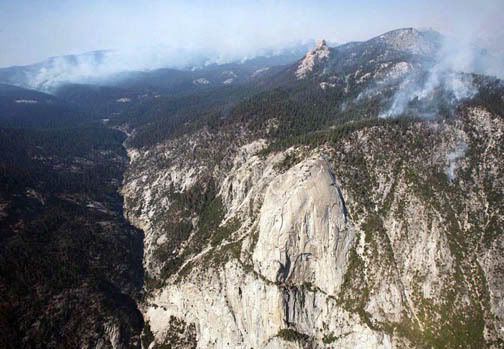
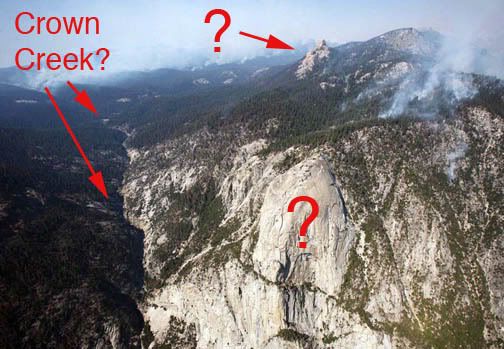
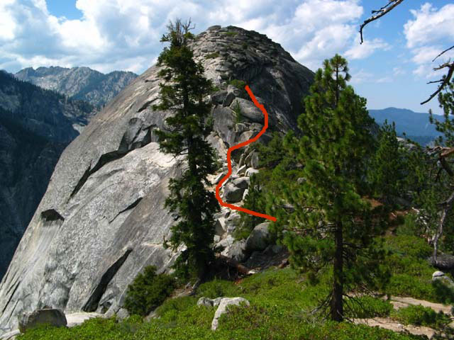
The foreground "?" dome is certainly Tehipite Dome. As I mentioned I haven't seen it from this perspective/angle, but when you're on the rim of Tehipite Valley right before the big descent, Tehipte Dome does not appear dome-like at all. It just looks like a big granite cliff. It's an odd optical illusion that the dome appears so different from eye-level or above vs. from the valley floor. From the valley floor Tehipite Dome is very domed looking, from eye-leve it appears nearly level with the rim... which is almost is... looking at photos from the backside (this photo, if it shows up, is from climber.org and shows the backside of Tehipite Dome from the rim)
http://www.climber.org/TripReports/imag ... -route.jpg it doesn't appear very domey. From the valley floor it looks like this
http://gallery.photo.net/photo/837322-lg.jpg I have a few shots from the rim but I'm not exactly sure where I have them online, too many photo folders, ha!
And that's definitely the Crown Creek drainage. Silver Spray Falls is just to the left of Tehipite Dome... you had to have been flying pretty much over Tehipite Valley to get this perspective. It probably just looked like a wide space along the M.F. Kings River, because Tehipite Valley is just this side of your pic of Tehipite Dome.
In the background "?" I can almost say for certain that is Kettle Dome, 99% sure... in fact check out Google Earth and type in "Tehipite Dome" and follow the direction of the pic and there lies Kettle Dome.
Next time you fly over this place, let me know, ha!


