
I'll post a couple highlights, but there are a ton more photos/details on my blog. No ads or anything, just easier vs posting lots of photos here.
https://backpackandbeer.blogspot.com/20 ... -2022.html
Since someone usually asks, these photos are all with my Sony a7ii and the 24-105 lens. There are also cell phone photos on the blog.
Background: I had spent all winter thinking about the Sierra and decided that I wanted to try one of the other hard east-side passes after doing Shepherd Pass in 2021 (https://backpackandbeer.blogspot.com/20 ... -2021.html). I also wanted to try some easy cross-country passes after making the climb to Pickett Lake. Taboose Pass sound like it would put me in the middle of a lot of possibilities. And it looked like I might be able to meet some people at Maverick's Ladder Lake meetup.
So, here is what I planned for 11 nights
Taboose -> Upper Basin -> Mather Pass -> Cirque Pass -> Potluck Pass -> Knapsack Pass -> Dusy Basin -> JMT -> Ladder Lake -> JMT -> Amphitheater Lake -> Cataract Creek Pass -> Dumbell Lakes -> Dumbell Pass -> Lakes Basin -> Cartridge Pass -> Bench Lake -> Taboose Pass
Things did not go according to plans because it turns out the weather gets a vote
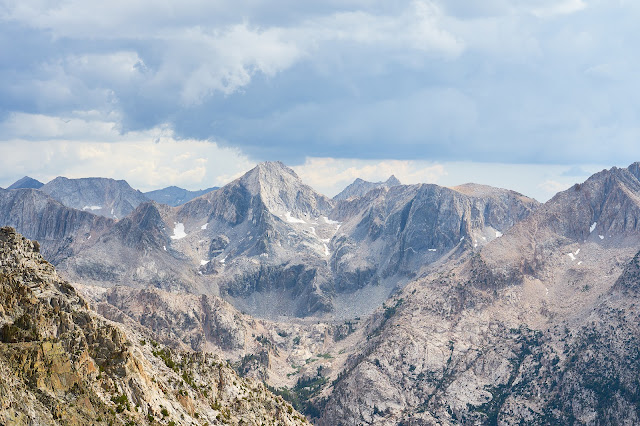
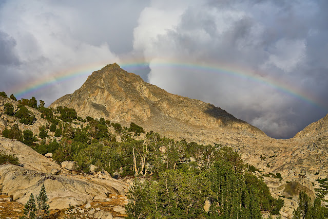
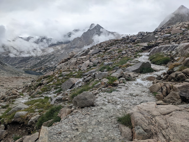
A preview of the trip

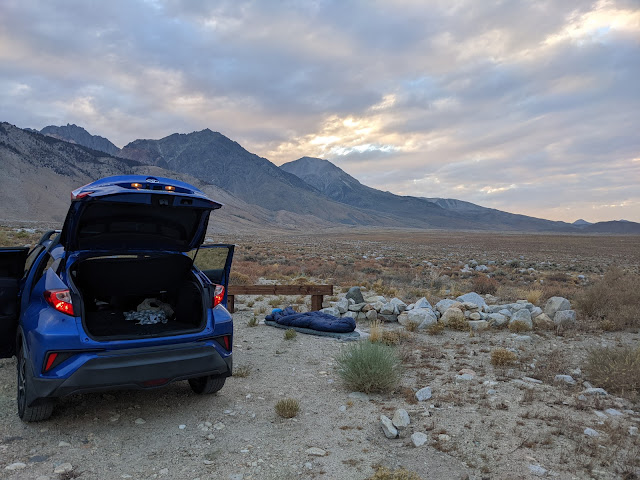
I flew into Reno, got a car, and drove south to tacos in Big Pine, and some beer and then drove to Taboose Road. God, what a terrible road. I gave up about a mile short of the trailhead when I found a small pulloff near the old corrals, figured I'd rather walk the last mile in the morning.
Weather did not look great, planning on cowboy camping by the car, hope I don't get wet.
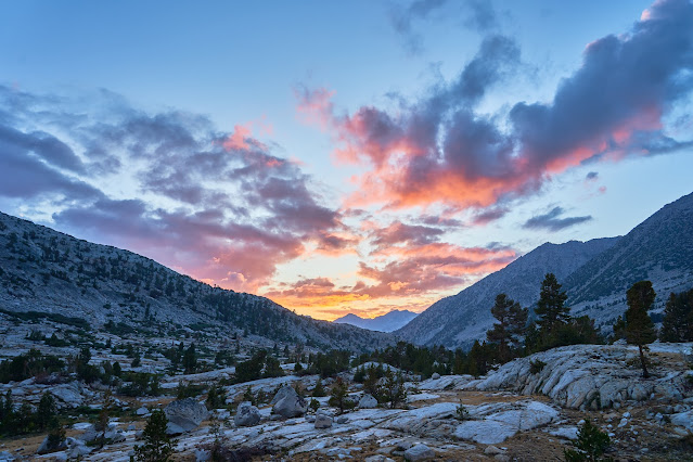
Day 1 (Taboose Pass)
Woke to a beautiful sunset

And started hiking early, clouds were building over the pass
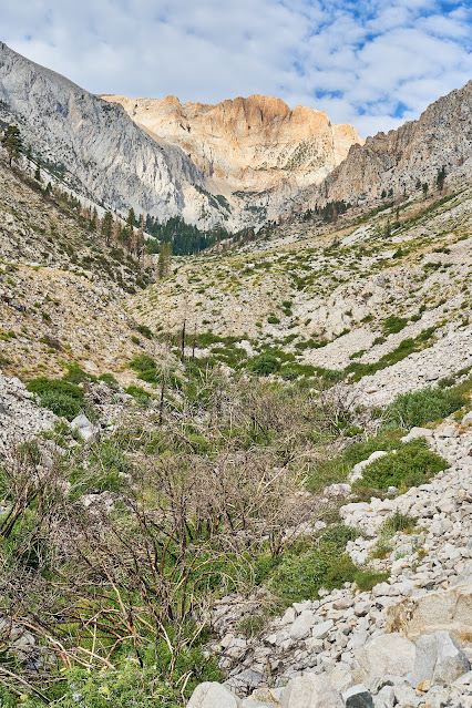
I got to the top of the pass in about 9 hours and quickly set up camp since rain was on the way
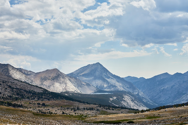
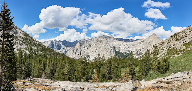
Day 2 (Upper Basin)
JMT through Upper Basin

Nice storm (rain, hail, graupel) came through not long after I set up camp below Mather Pass, thankfully did not last long and I was able to wander a bit.

Day 3 (Mather Pass, Cirque Pass)

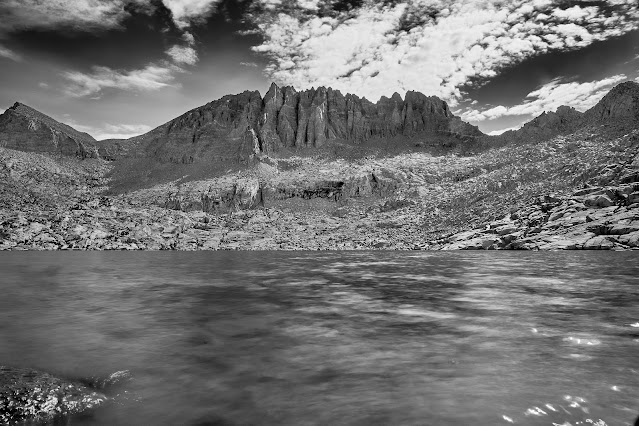
Palisade Lakes
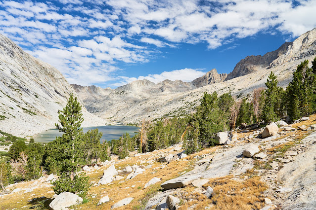
Climbing towards Cirque Pass with Lower Palisade Lake below

A little bit of route finding and I made it over Cirque Pass (I really appreciate the info on the cross-country passes here on HST, thanks everybody)
Set up camp at the outlet of the lake that drains into Glacier Creek.
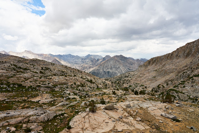
Amazing views to the west, clouds building
And to the east, clouds building

Day 4 (Potluck and Knapsack Passes)
Clouds already
I'd really like to spend a couple nights in the Barrett Lakes Basin
Looks like Dusy Basin is going to get hit
Day 5 (Dusy Basin layover)
After a ton of rain the previous afternoon, I woke up to lots of low clouds

Because of all the rain, when I went wandering I only took my cell phone
Day 6 (moving to lower Dusy basin)
Looks like better weather

I set up camp at the end of the lower basin and dodged more rain, when it wasn't raining, it was beautiful

More rain, talked to some other people who were sort of nearby, everyone was happy with this view
Finally, a nice sunset
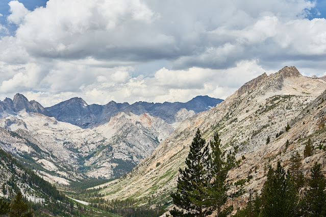
Day 7 (down to the JMT)
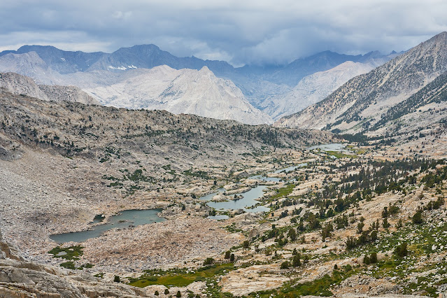
Great views from the Dusy Basin trail looking west
Skipped Ladder Lake, didn't seem to make sense to make that climb just to hang out in my tent, set up camp on the edge of Grouse Meadow

Day 8 (South on the JMT)

I got to the decision point for Amphitheater Lake and decided to skip given the weather, so up the Golden Staircase to the Palisade Lakes and a swim
No swim, I barely got my tent set up before the sky opened up. After a couple hours, the rain stopped and I crawled out to find four guys had set up right next to me. They said they were in a hurry to get of the trail once the lightning was right on top of them. I didn't mind a little company for dinner and then the rain came back with a vengeance.
Ominous sky right before the storm

Day 9 (Mather Pass)
Rained all night, still raining in the morning. I said goodbye to the guys and headed south
Every little trickle was raging, the trail was a small creek below Mather (cell pic)
Upper Basin under the clouds (cell pic)

The South Fork of the Kings was raging at the JMT crossing. I was very glad I had crossed to the east side high in the basin. I decided that aiming for Bench Lake just looked wet so I went over Taboose with the hope of less rain lower down. I set up camp in a small site I had noticed on the way up.
Day 10 (trailhead)
Looking down on the Owens Valley

Back towards Taboose

Got to the car and the battery is dead, I had a cell signal so I was going to die, but a crappy way to finish the trip

Got a hotel in Bishop for the last two nights and did a short dayhike near Lake Sabrina and then back to Reno (with a stop at Mono Lake) and then home.
Not exactly the trip I had planned but still a pretty good experience. It turns out the storm that hit me in the Palisade Lakes also creamed Death Valley https://www.nps.gov/deva/learn/nature/d ... e-2022.htm


