
The full report, with a trillion photos and too many words, is here:
https://badmountain.org/a-long-walk-to-a-nameless-lake
A brief summary is below.
Our route was, in my estimation, one of the easier loop options in/out of the area as it avoided the bushwacky part of Goddard Creek and the talus monsters of Ionian Basin:
Courtright > Hell For Sure Pass > Martha Lake > Reinstein Pass > Lake 10,232 > Finger Col > North Fork Kings > Courtright
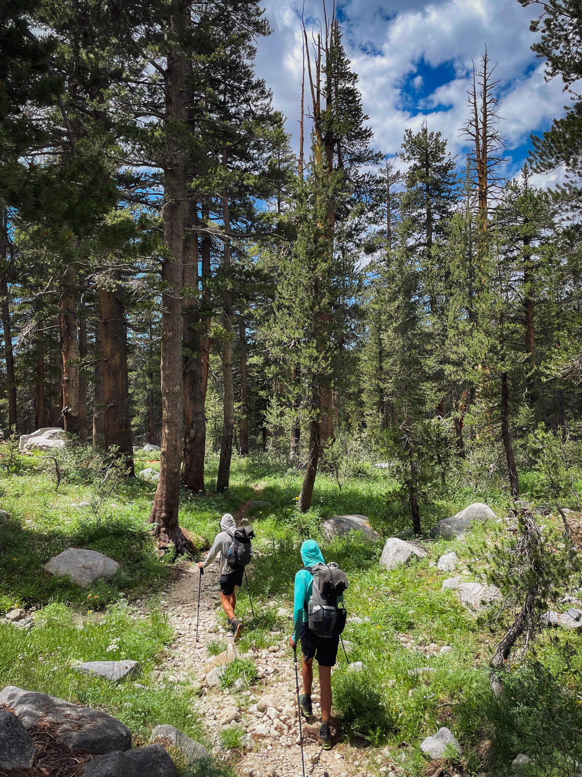
Still, it took 27 miles and 7k of gain to get there from Courtright, with the first 10ish miles all forested.
We started from Courtright Reservoir.
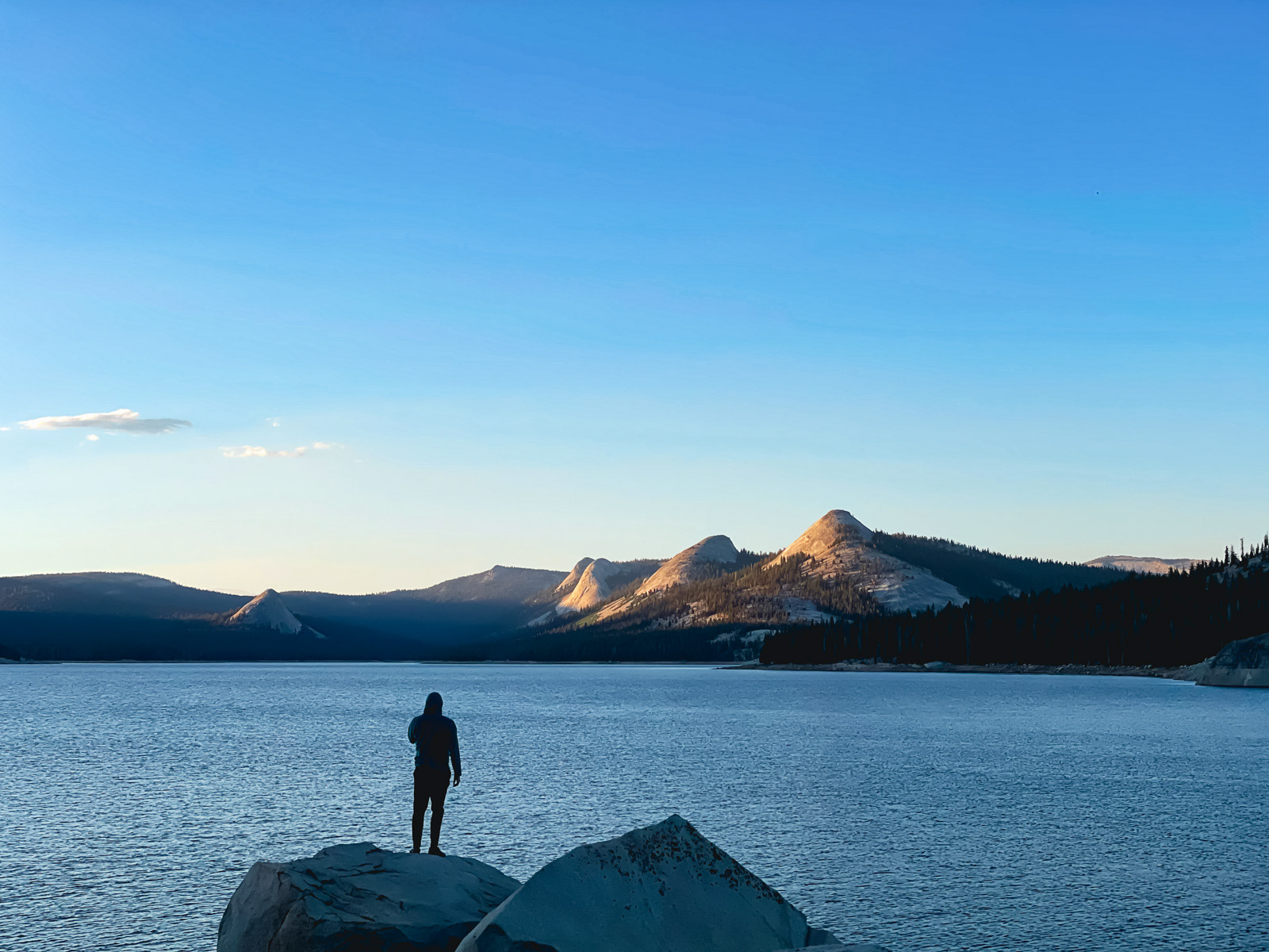
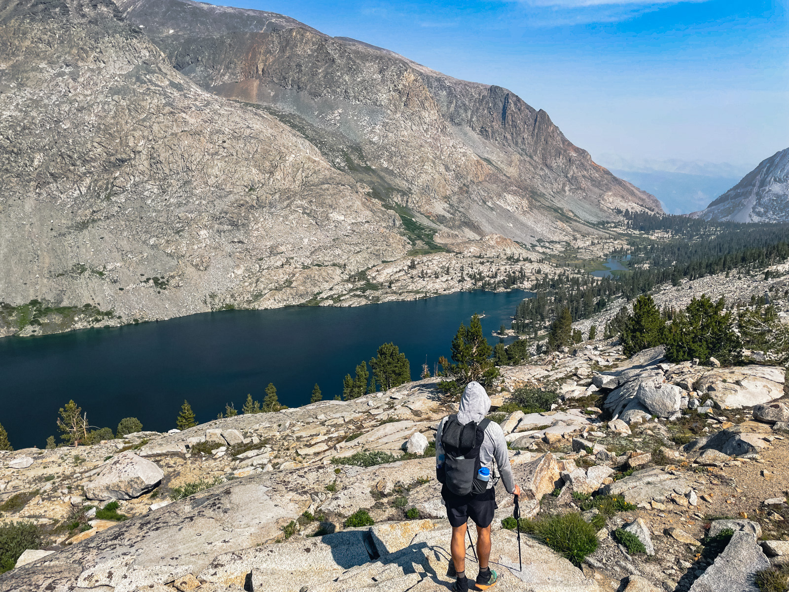
After 15 miles and 4000 feet of gain, we made it to Hell For Sure Lake.
Acceptable evening light!
I woke in the middle of the night to the smell of smoke, and in the morning the lake was draped in a thin haze. A few texts via InReach told us that this was the Oak Fire, and had started the afternoon prior. I was very frustrated. Many of my recent trips had been marred by smoke: that's why I was out here in July to begin with, when the heat of summer had hopefully not dried the drought-stricken earth to a tinder box just yet. To have seemingly missed this narrowing window between ice and fire even on July 22 was supremely discouraging.
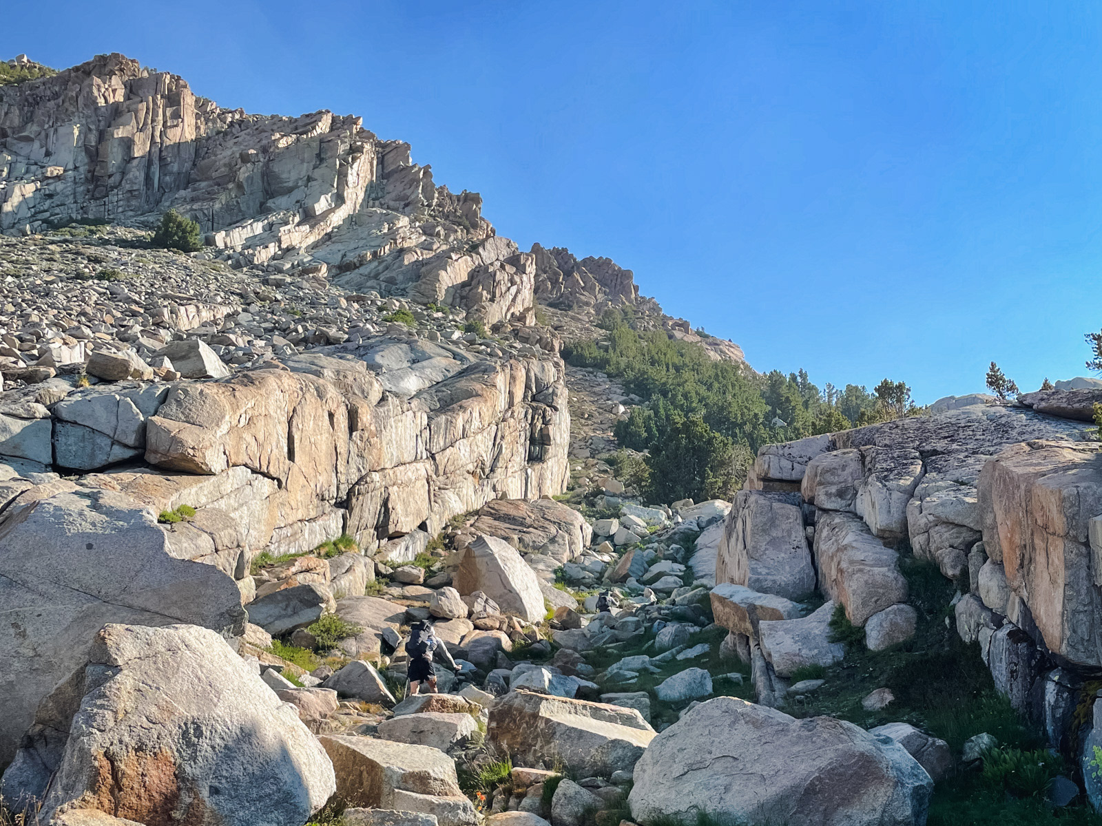
Soon we were climbing Hell For Sure Pass.
A brilliant lake at the edge of the kingdom.
The east side of Hell For Sure is absolutely gorgeous, with wide open views down Goddard Canyon and beyond. I had hoped that the interior of the Sierra would be less impacted by this new fire, but the opposite was true. I found this hugely dispiriting and was having a hard time rolling with the punches (which might be the most important ingredient for a successful encounter with wilderness). This is something I have to work on in our persistently smoky era.
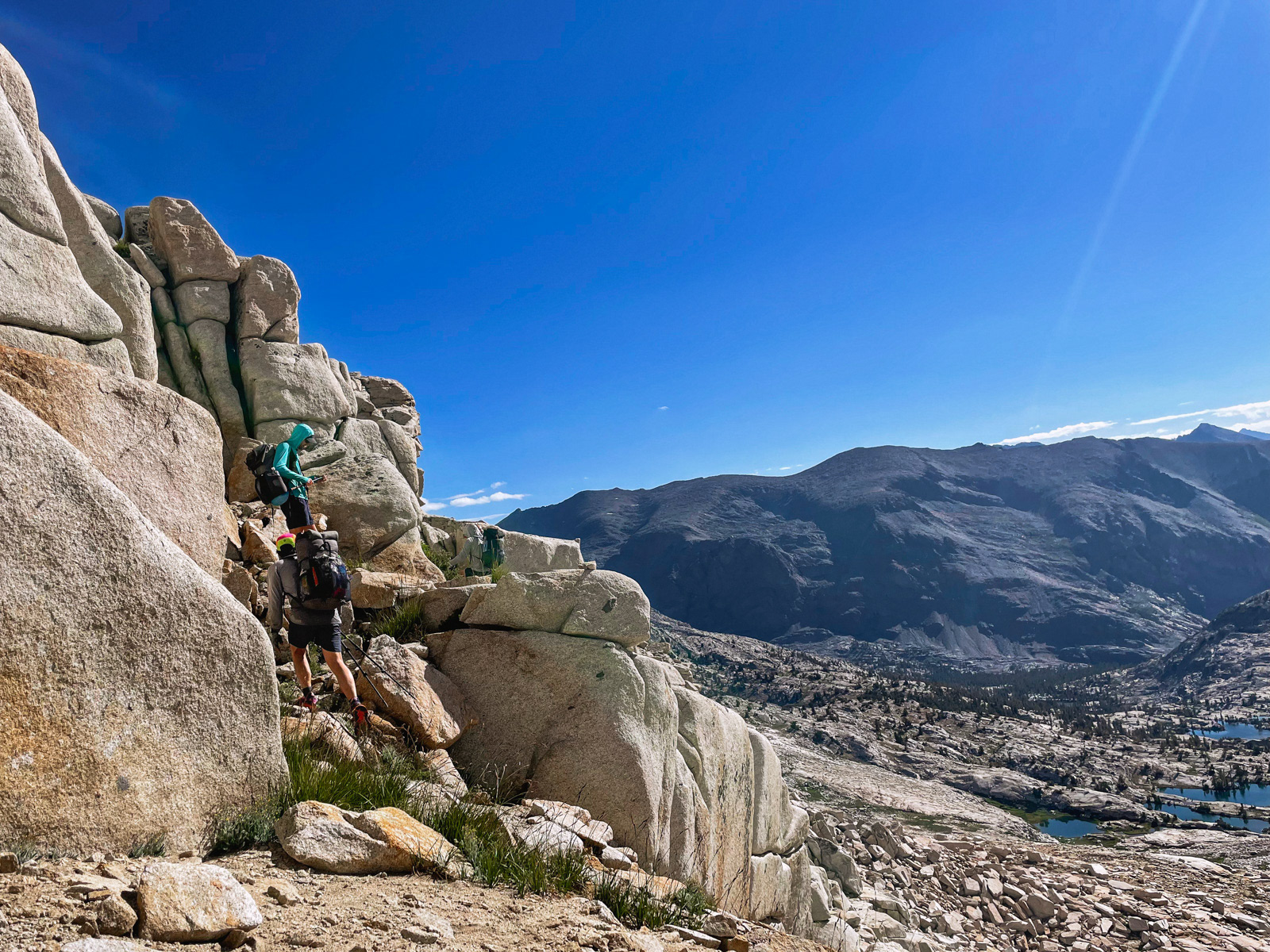
The east side is a surprisingly brutal trail, even as a descent. The trail is sparse and easy to lose in places, but cliffy enough that you wouldn’t want to freelance your way down the hillside: you kinda need to stay with the iffy trail.
On top of that, there is somehow 500 feet of climbing on this “descent,” which traverses above the canyon for a surprisingly long time. In fact, it’s almost 4 miles from the pass to the canyon floor!
Upper Goddard Canyon.
Martha Lake.
We wrapped around Martha and started up Reinstein Pass, which was easy on this side, at least by the standards of an off trail, high country slog.
The south side of Reinstein was a different story. HST and elsewhere advise that there are a few drop offs to avoid near the top, but we found the descent to be far more arduous than that modest description.
Instead, we found ourselves in one of the range’s occasional dark portals, a perverse sub-kingdom where everything was harder, steeper and weirder than usual. We scooted our butts down too-steep slabs, swung our bodies around spicy, 15 foot drops and broke at least one trekking pole.
The high basin below Mount Reinstein had a chaotic aura.
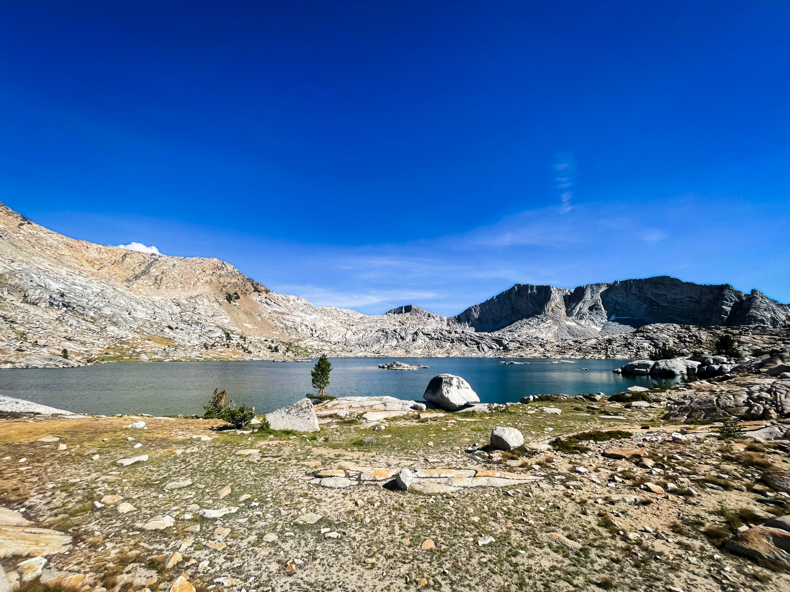
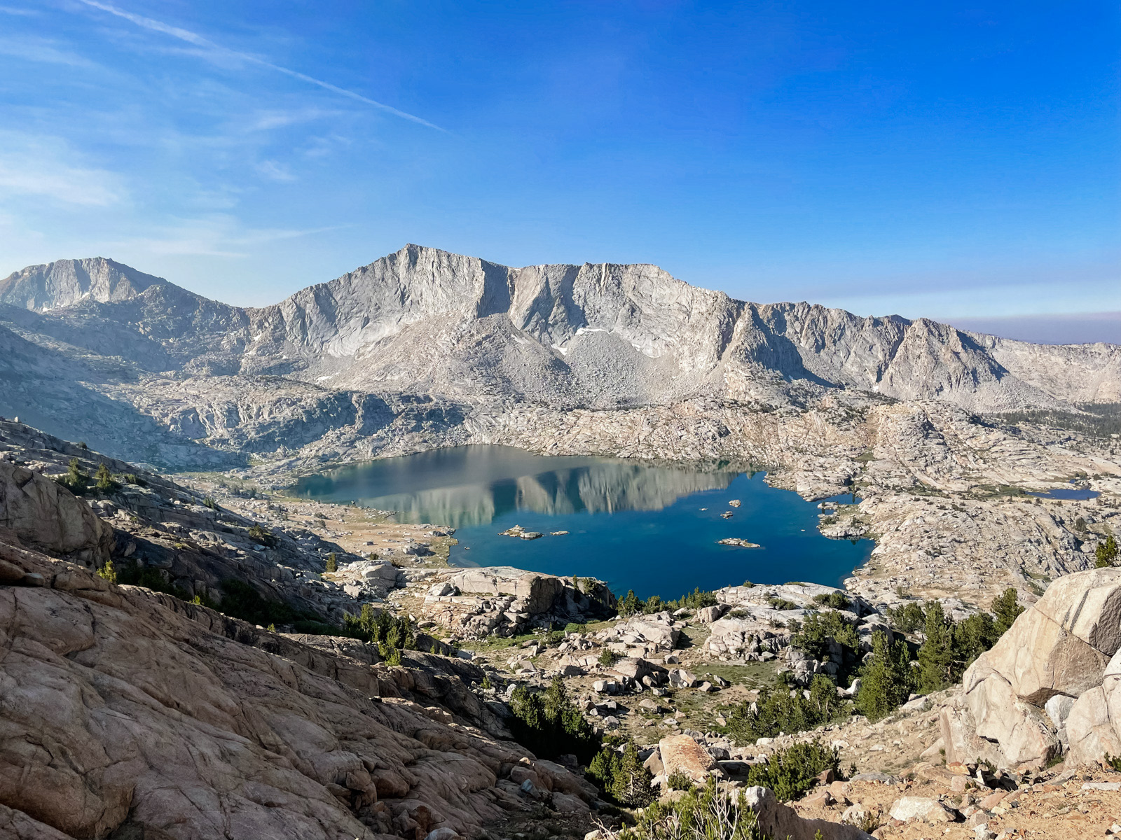
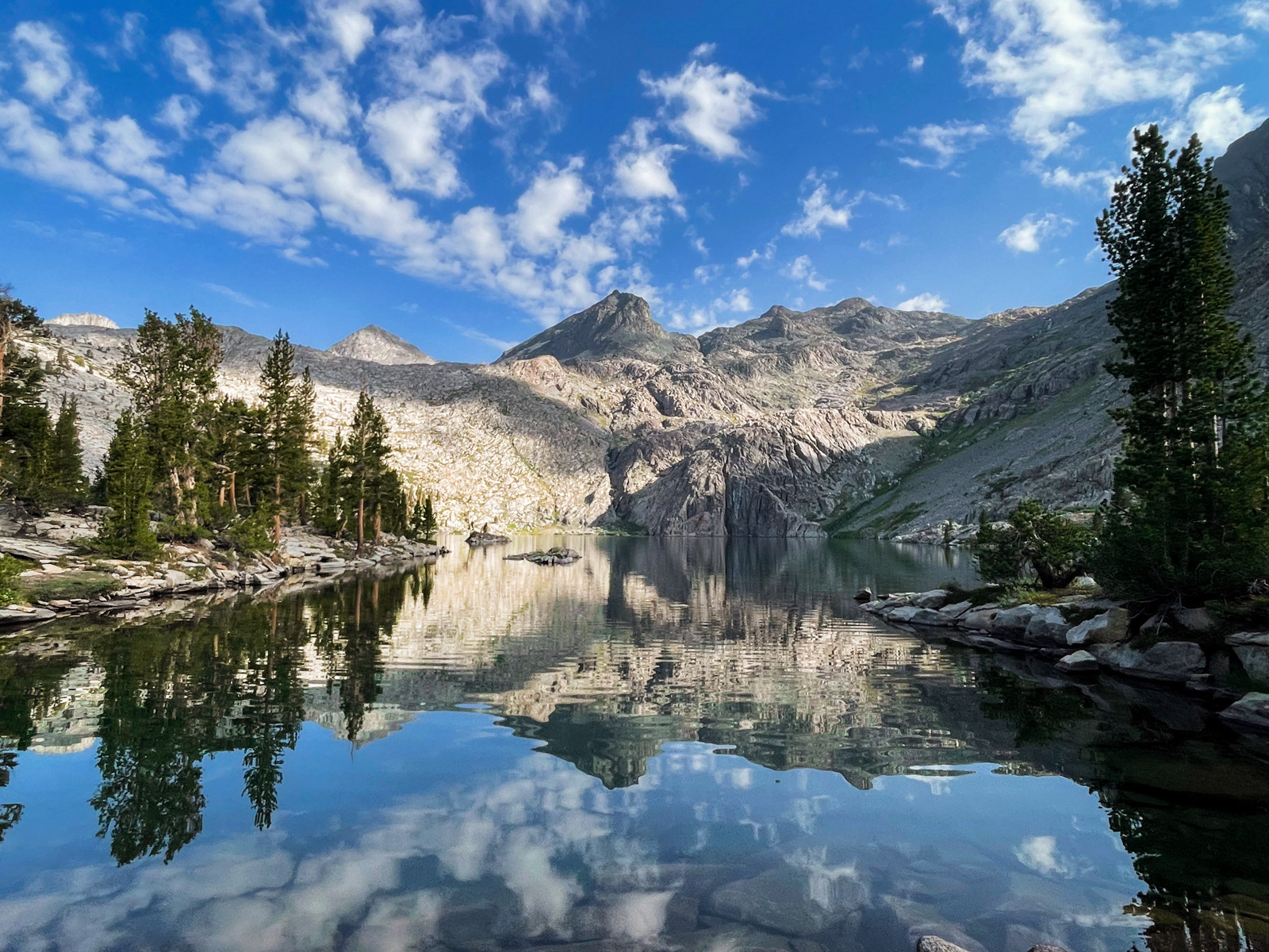
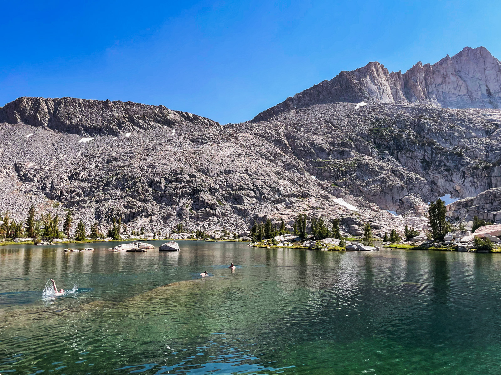
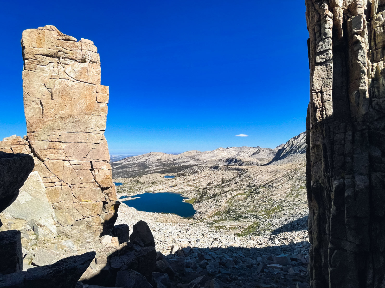
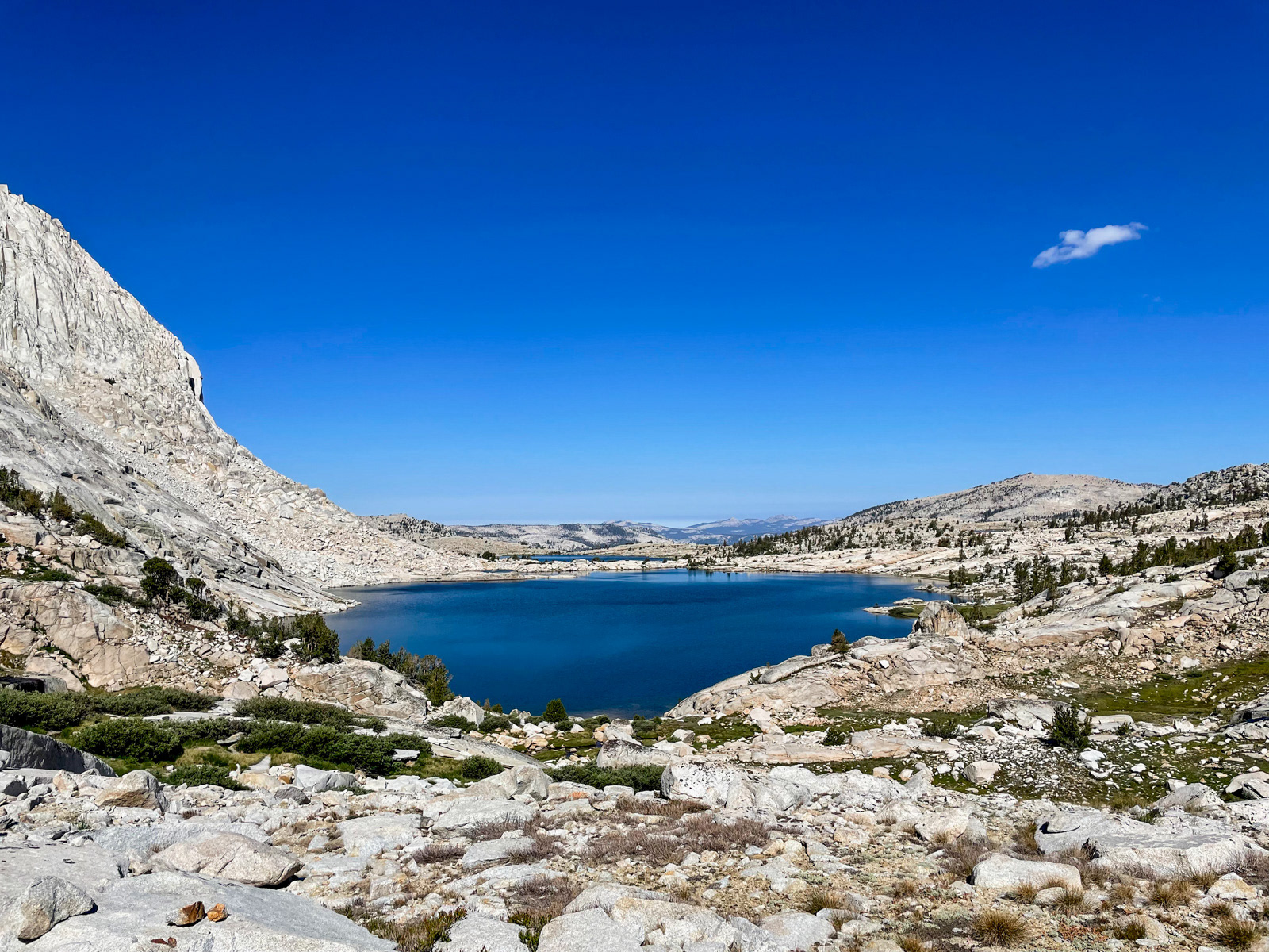
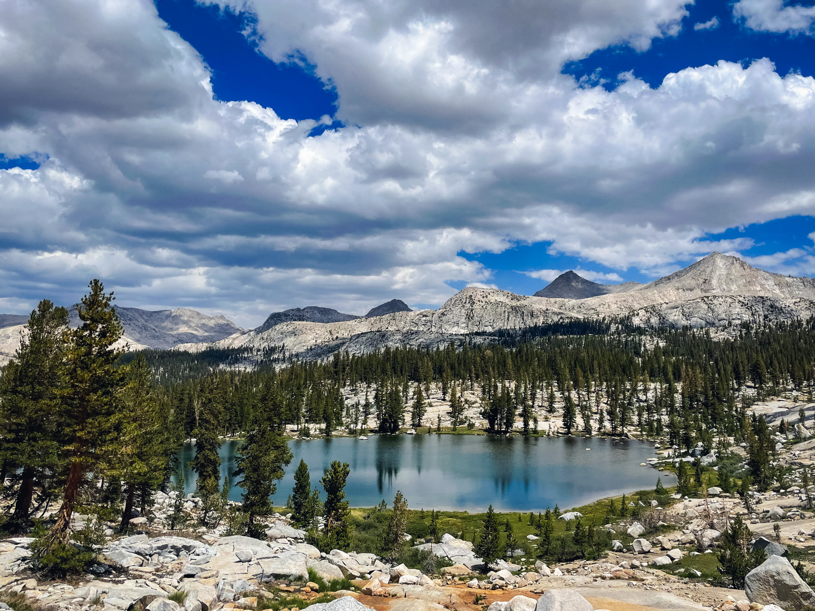
Eventually, the terrain eased off and we descended a series of small granite-bound lakes and tarns. Soon we were looking down at 10232.
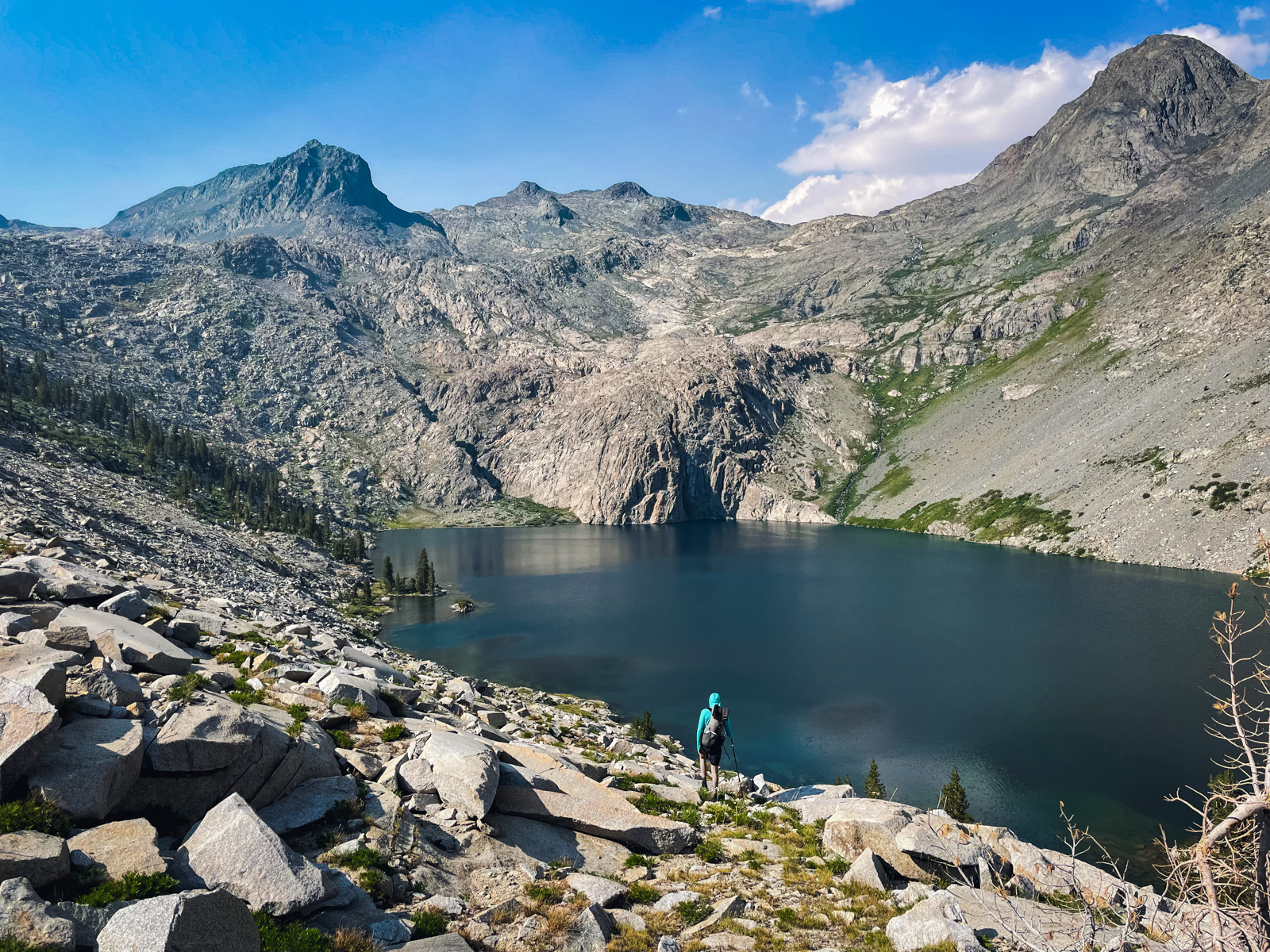
It's almost half a mile long!
The nominal point of this trip was to see this lake, and it somehow lived up to its reputation. The setting is exquisite. It’s not a trick of the camera.
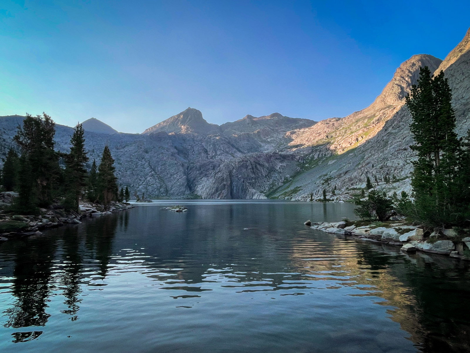
The northern wall behind the lake climbs straight off the water, a glorious cacophony in all the colors, shapes and stratifications of the geologic rainbow. A series of cascades come screaming down the northern headwall, draining the highest lakes beneath Mount Goddard before tumbling into the lake with a roar. It’s glorious.
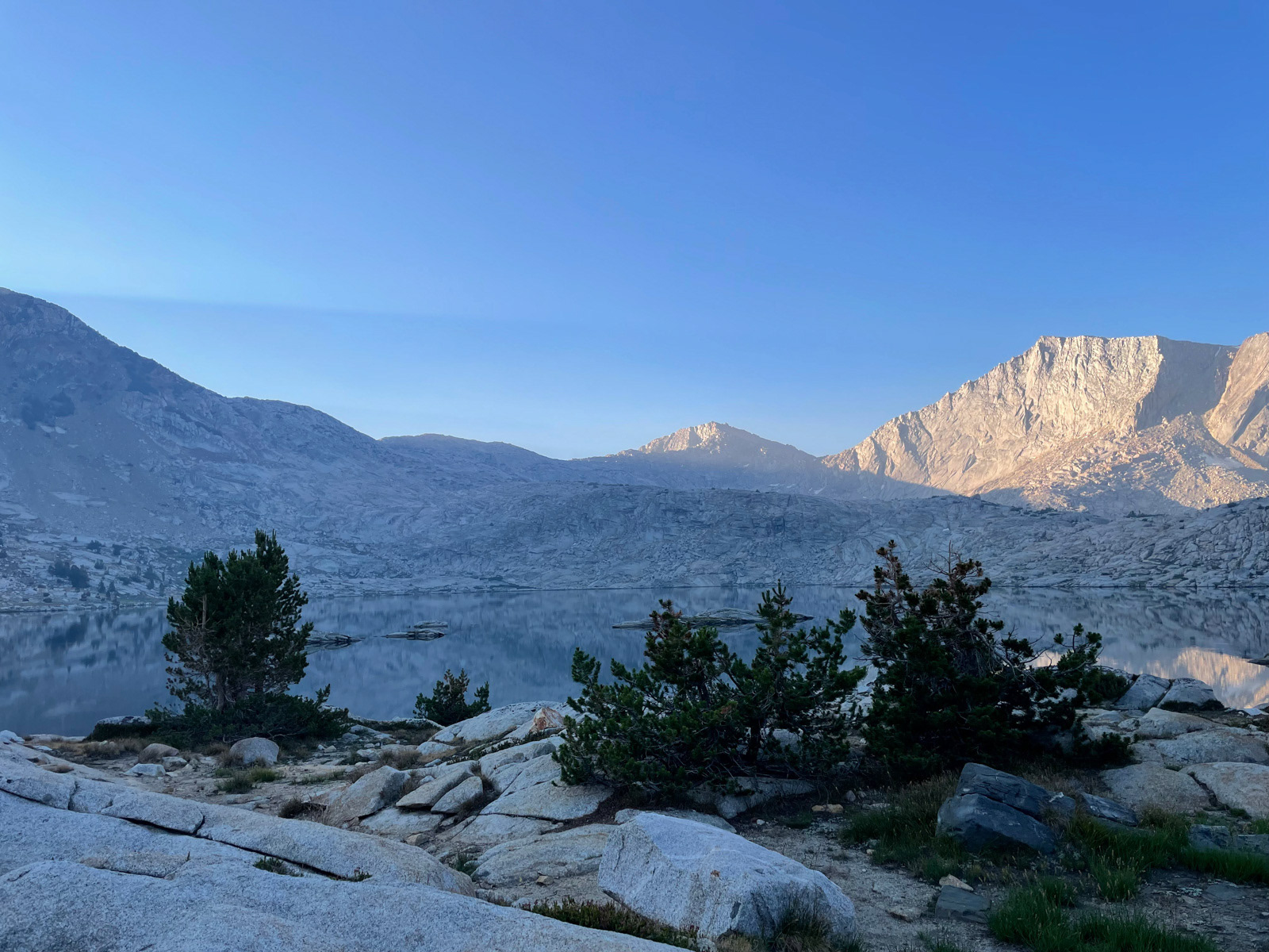
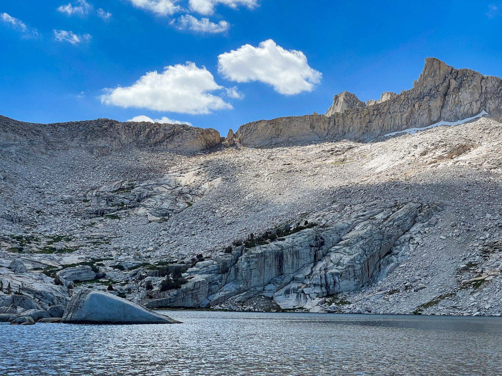
There is indeed a greater sense of solitude here than at many other off trail locations in the Sierra. Not a use trail in sight. Minimal campsites scratched out in the few places that one might even fit. A single old fire ring. We settled in for the night.
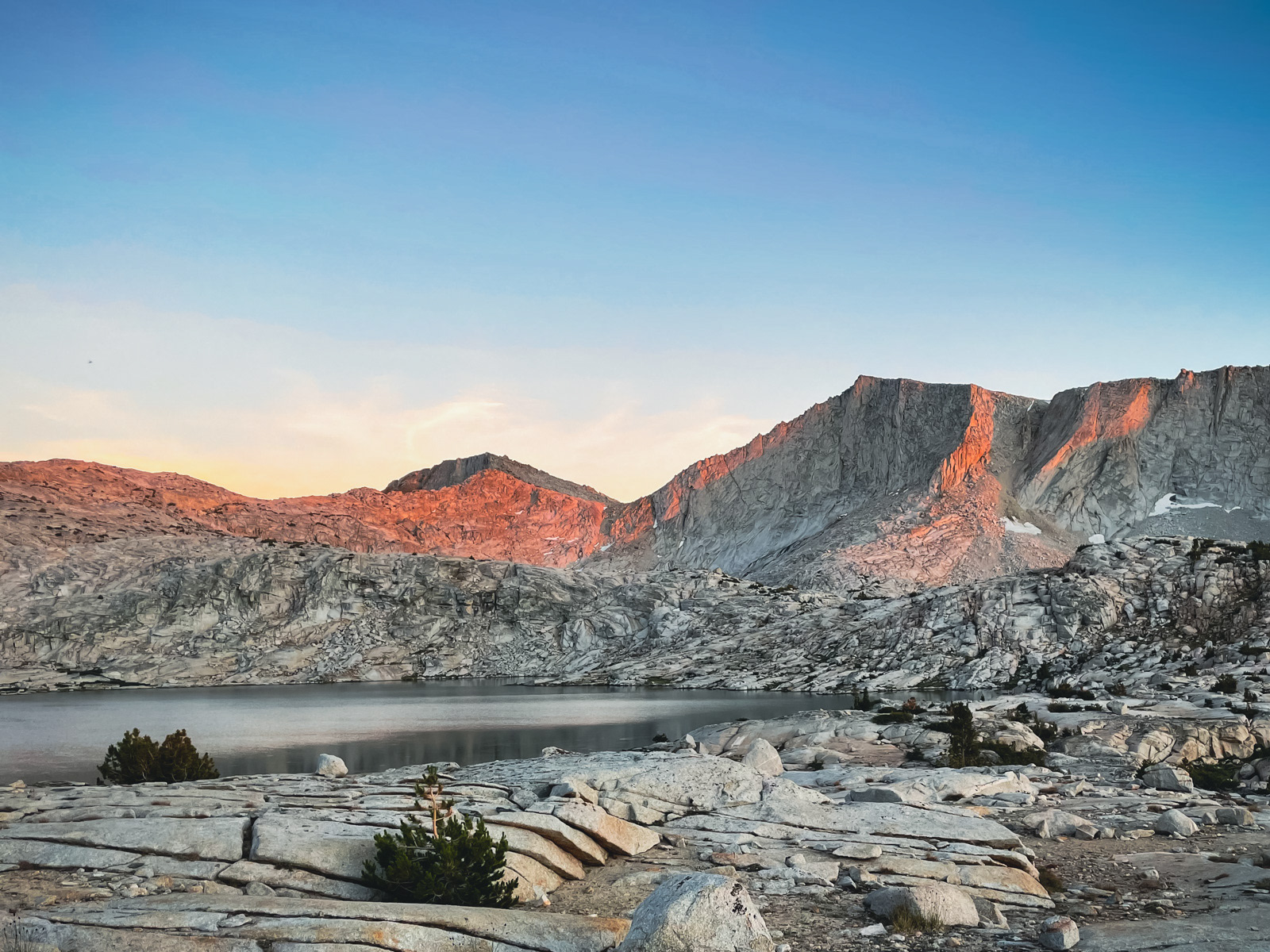
Rock walls rise precipitously off of the lake on the north, west and east sides, over 2000 feet up in each direction. This is not uncommon in the classic U-shaped basins of the glacial Sierra, but the effect is exaggerated here. I’m not claustrophobic, but being squeezed between such steep walls imbued a subtle sense of dread to our time at the lake.
On a more prosaic note, the steep canyon walls meant that even at the height of summer, we lost the sun an hour and a half before sunset and gained it a full two hours after sunrise.
Was it all worth it? At least for me, yes. Are there similarly beautiful lakes that aren’t 27 miles from the nearest trailhead? There absolutely are. But the bizarre, niche appetite to make it to these especially empty spaces is part of their irrational pleasure.
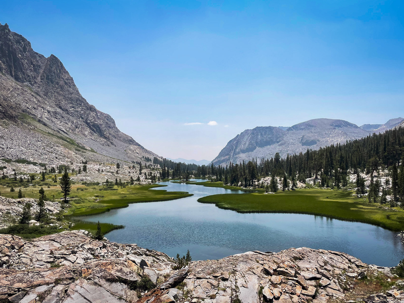
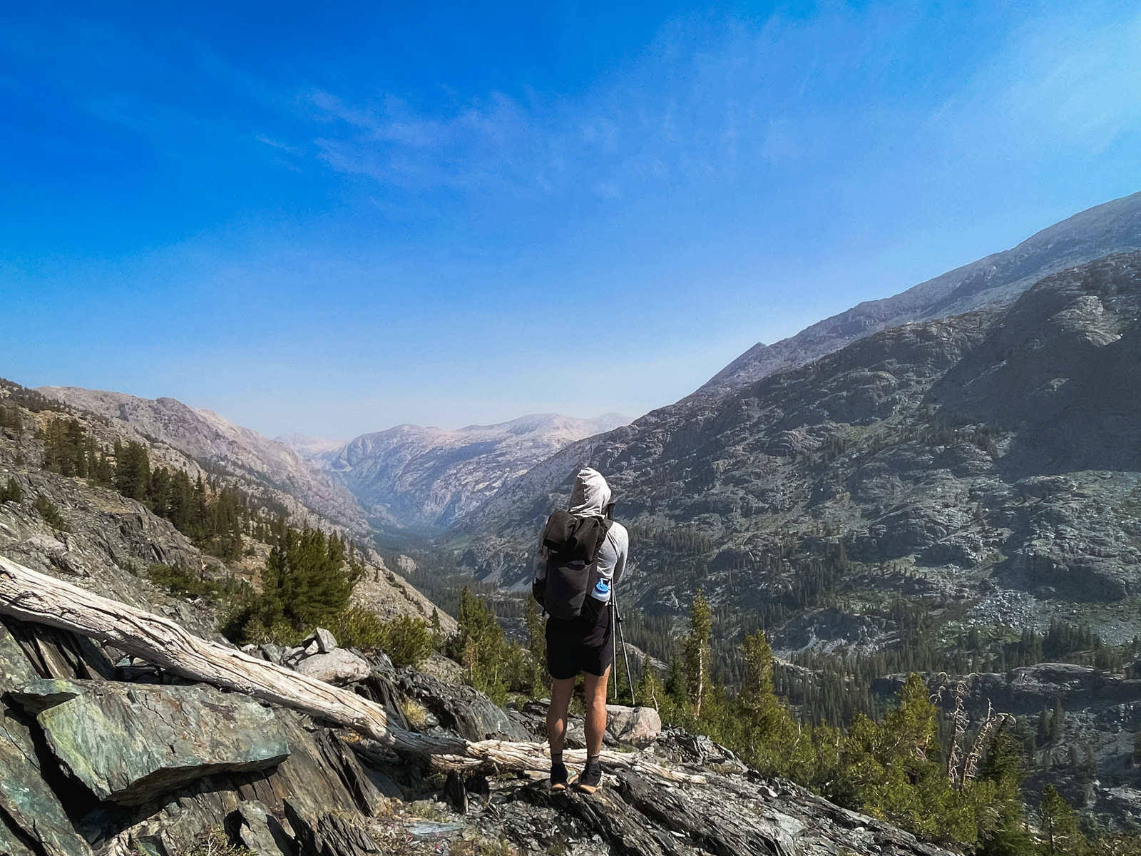
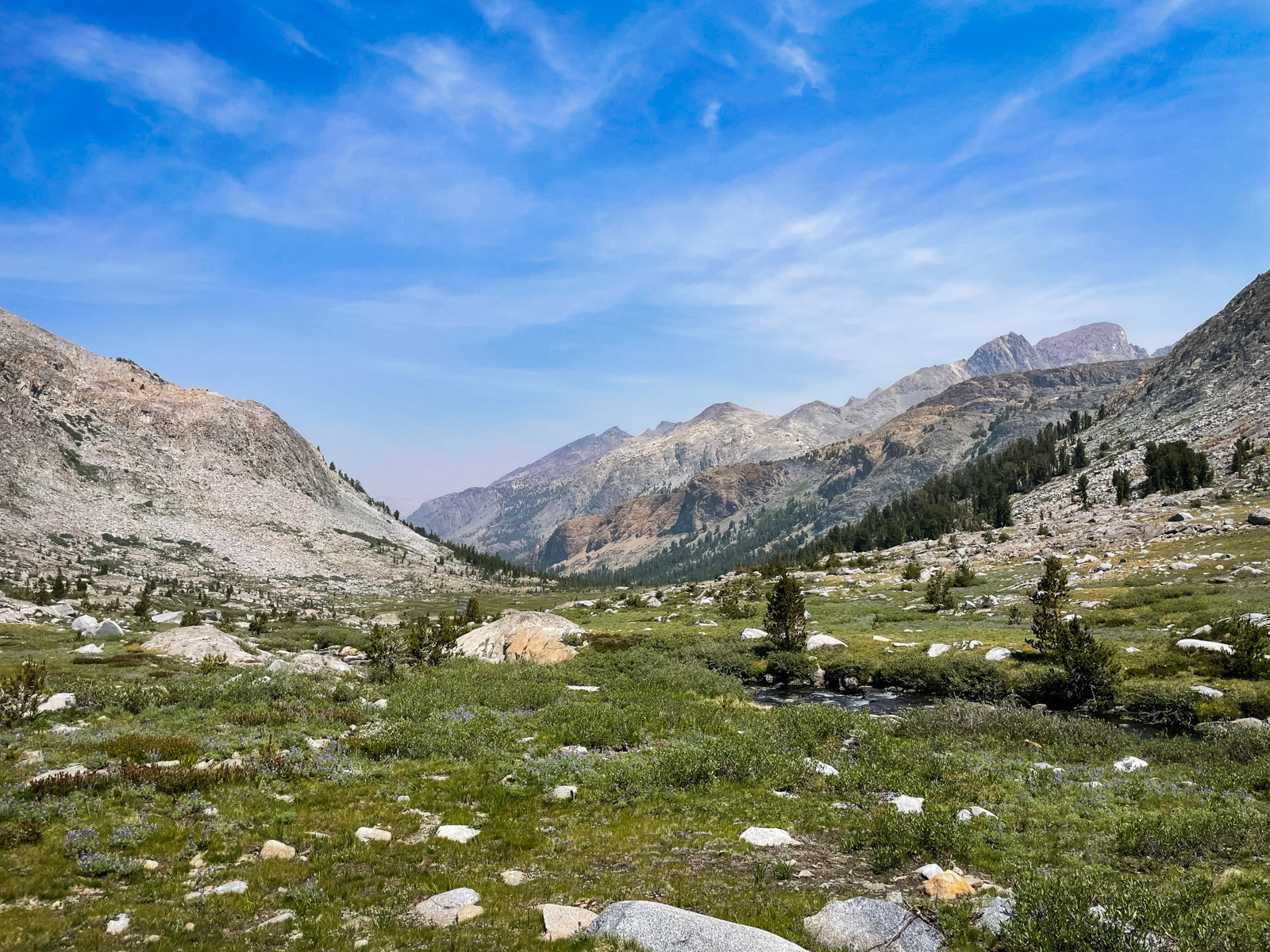
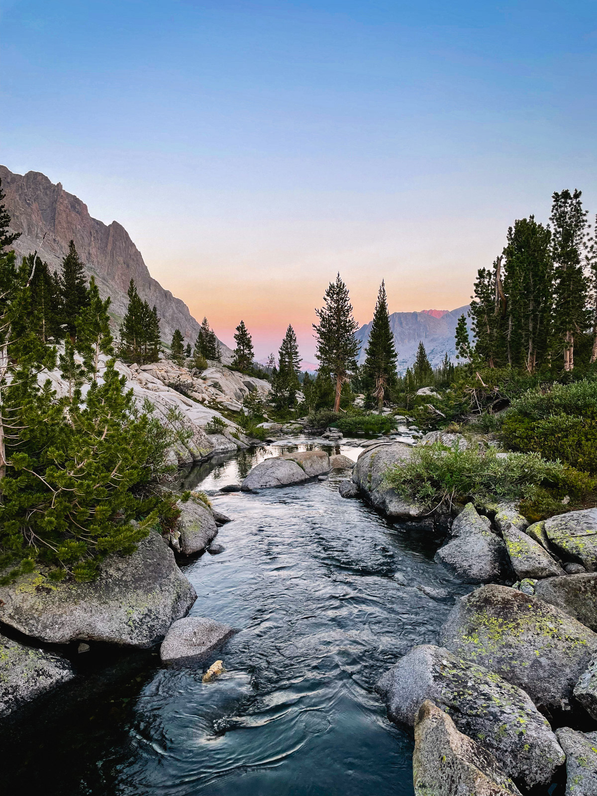
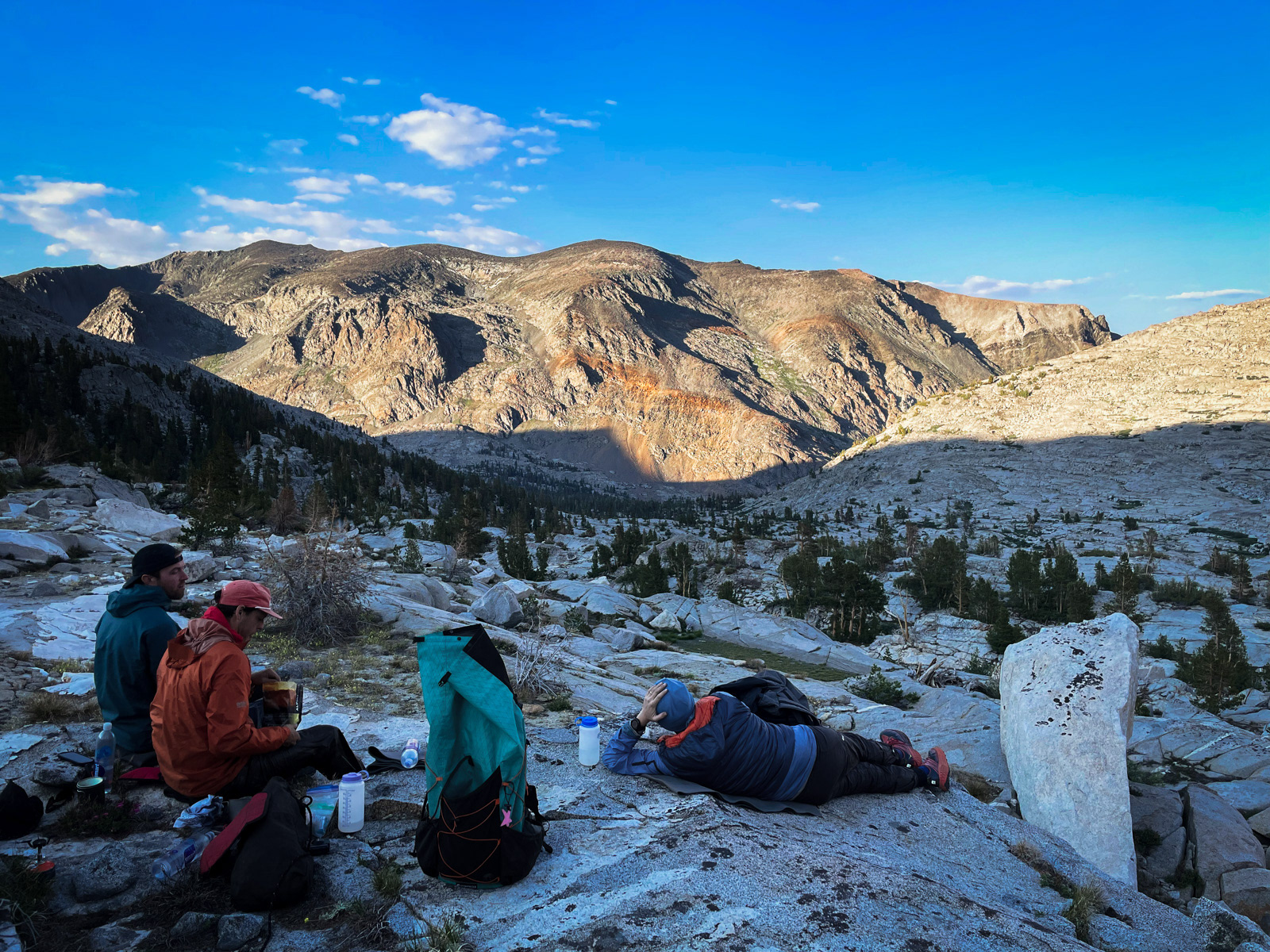
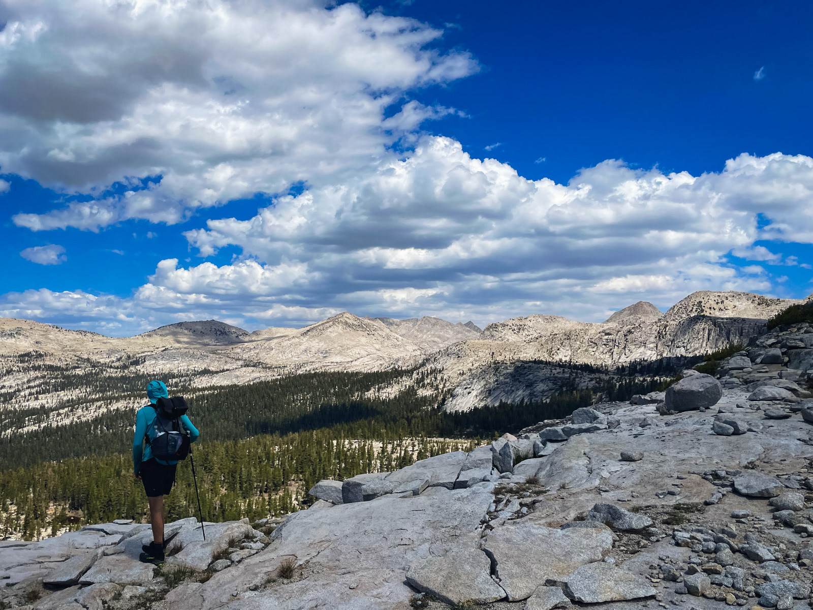
We had considered a full layover day at the lake, but the next morning we wandered the west side of the lake and eventually decided to pack up and slowly move our way down the valley and up into the Finger Peak drainage. Within a few hundred feet, the trees gave way to this amazing view.
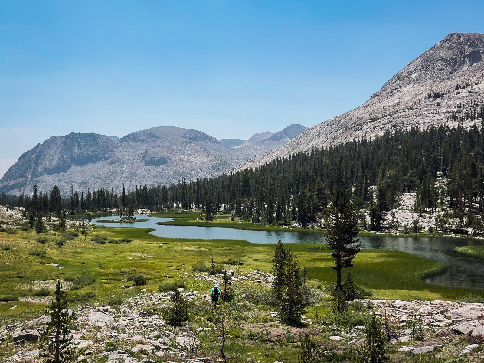
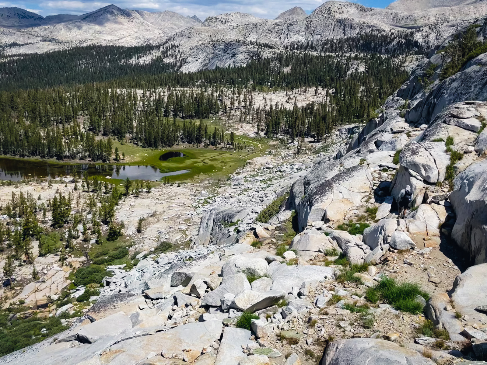
We followed the stream on the east side, which is more open. This meadow is glorious.
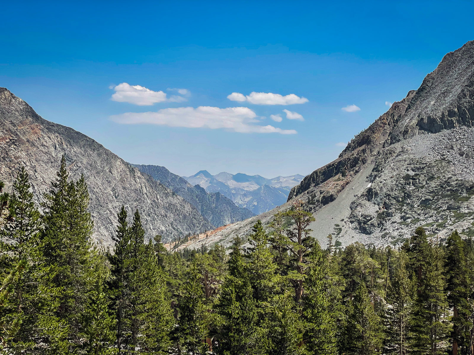
After lunch, we started wrapping our way southwest up the Finger Peak drainage. Here is a last look across the gap created by Goddard Creek to the peaks at the heart of the Kings Canyon high country.
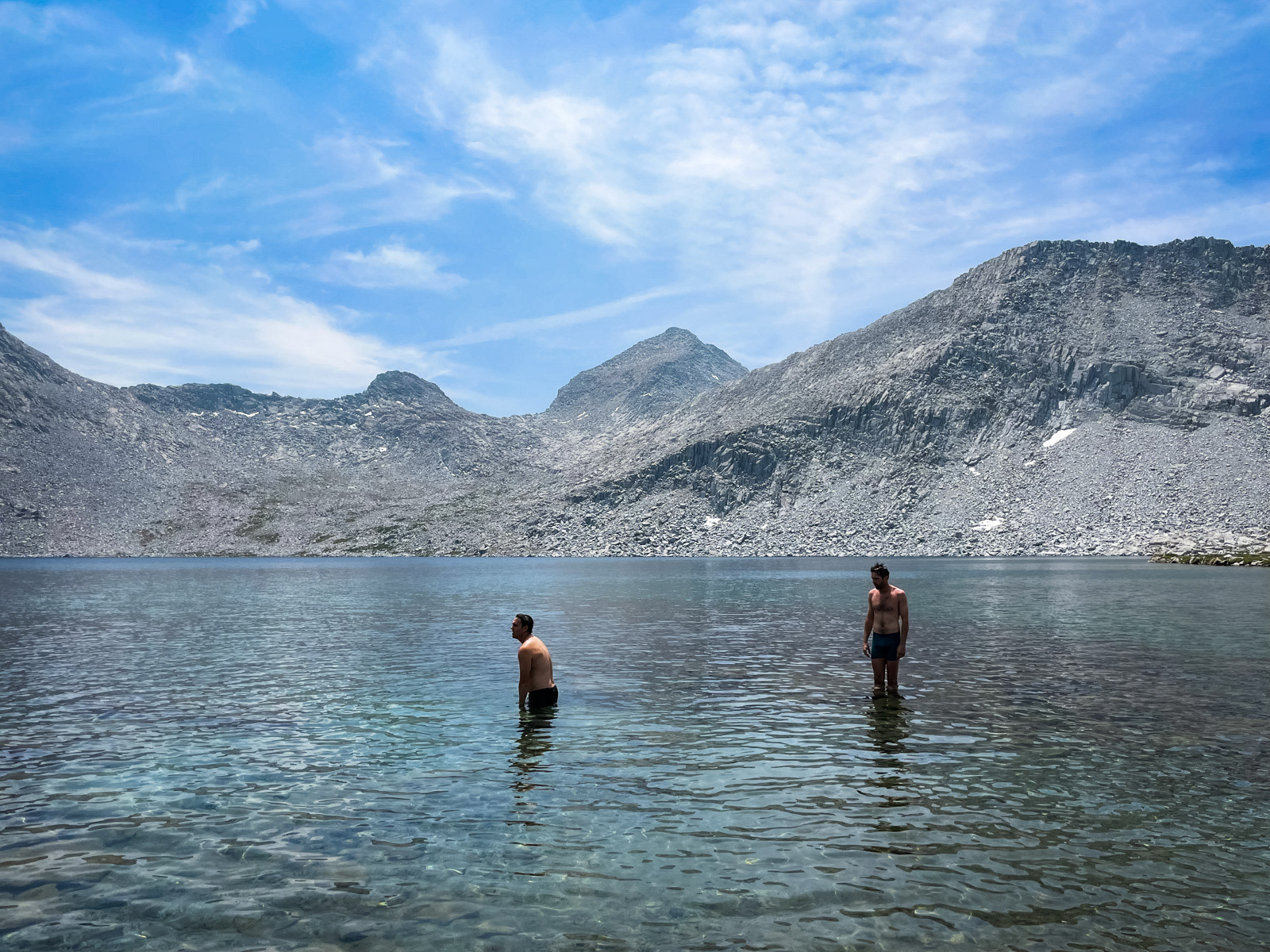
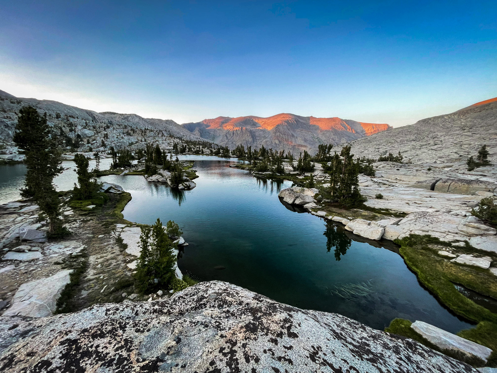
We stopped early at the unnamed lake around 10,600.
We ate dinner and watched the light change across Ragged Spur: as prehistoric, raw and gnarly a landform as you are likely to come across up here.
Evening.
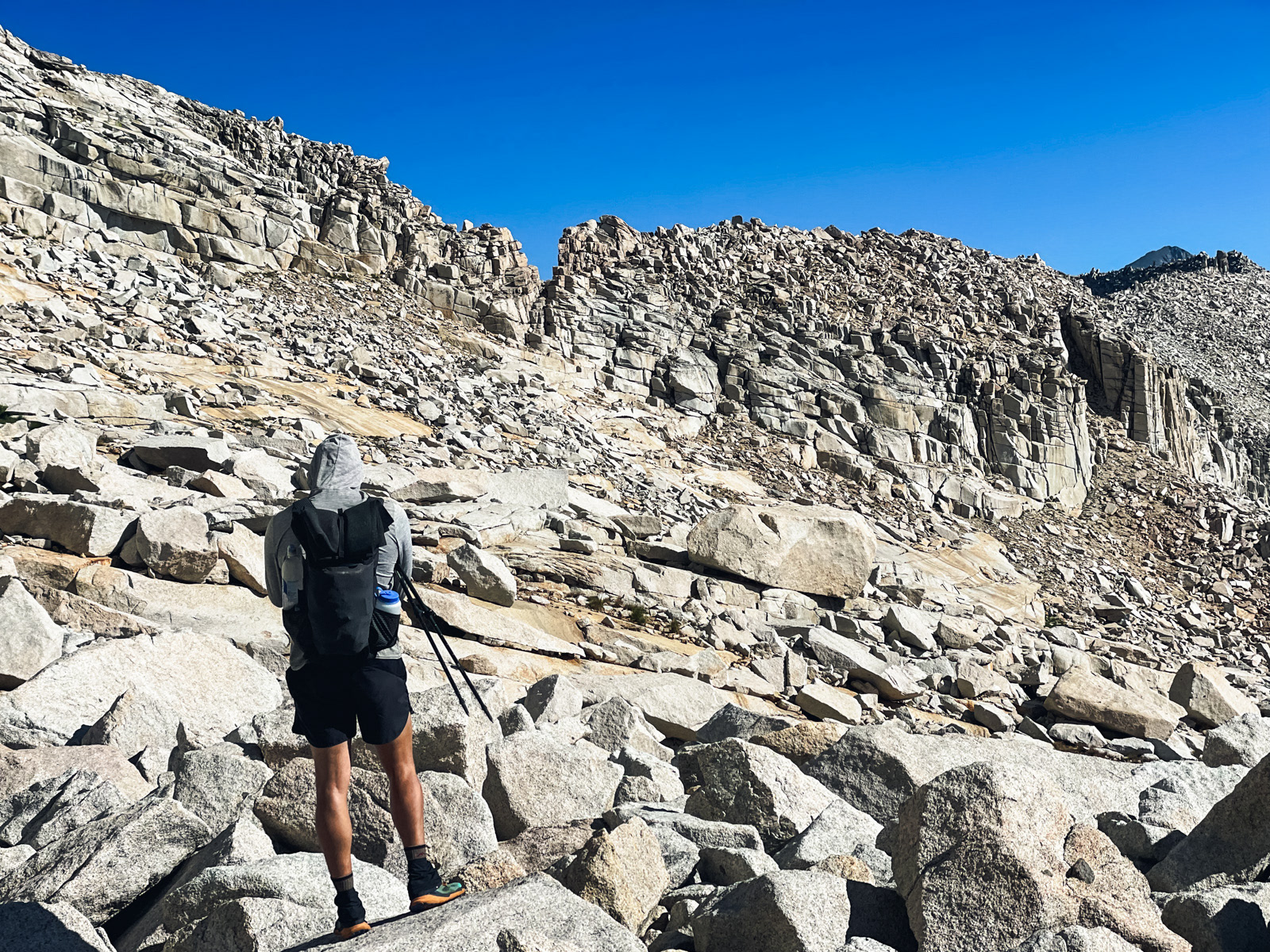
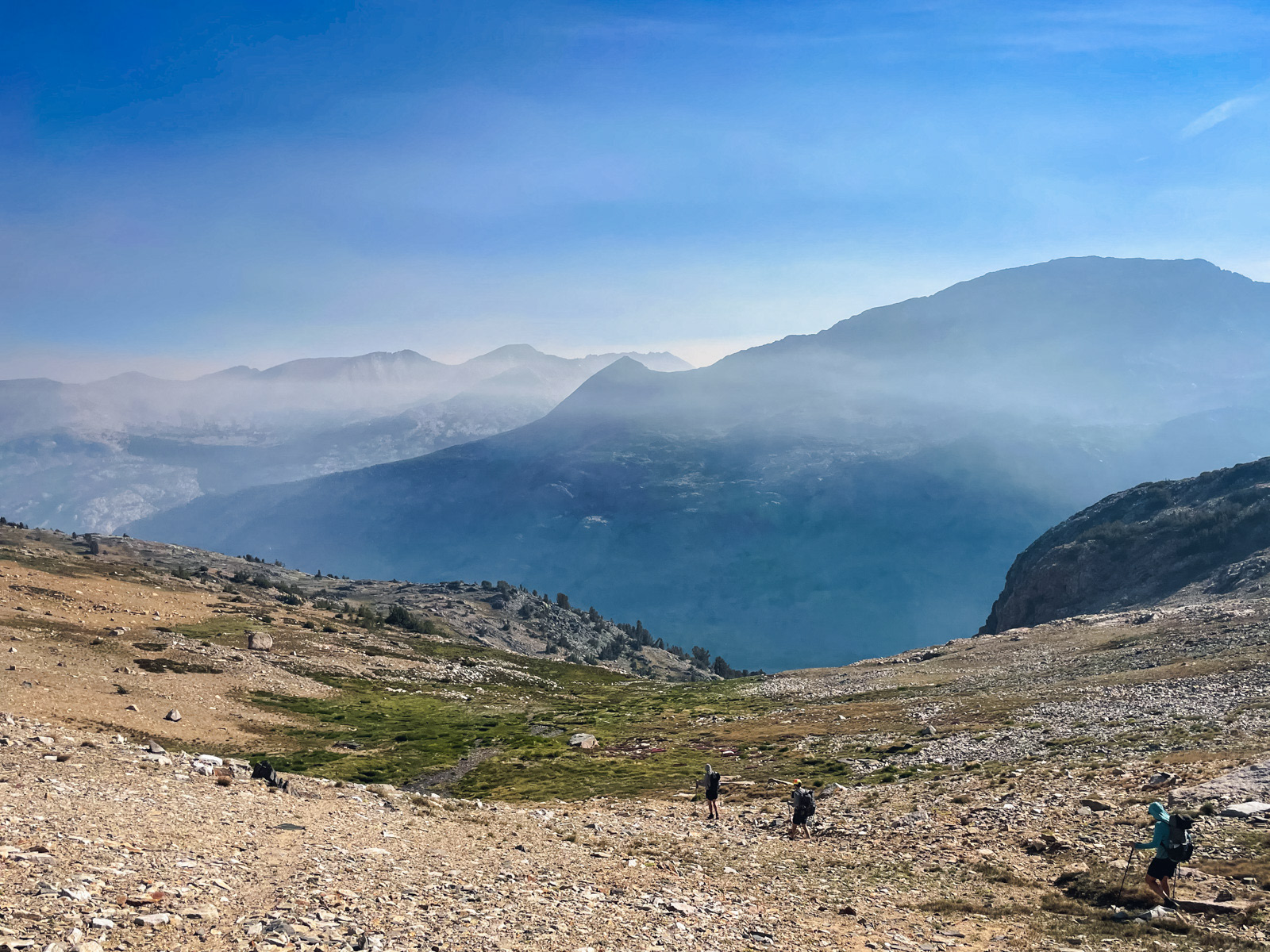
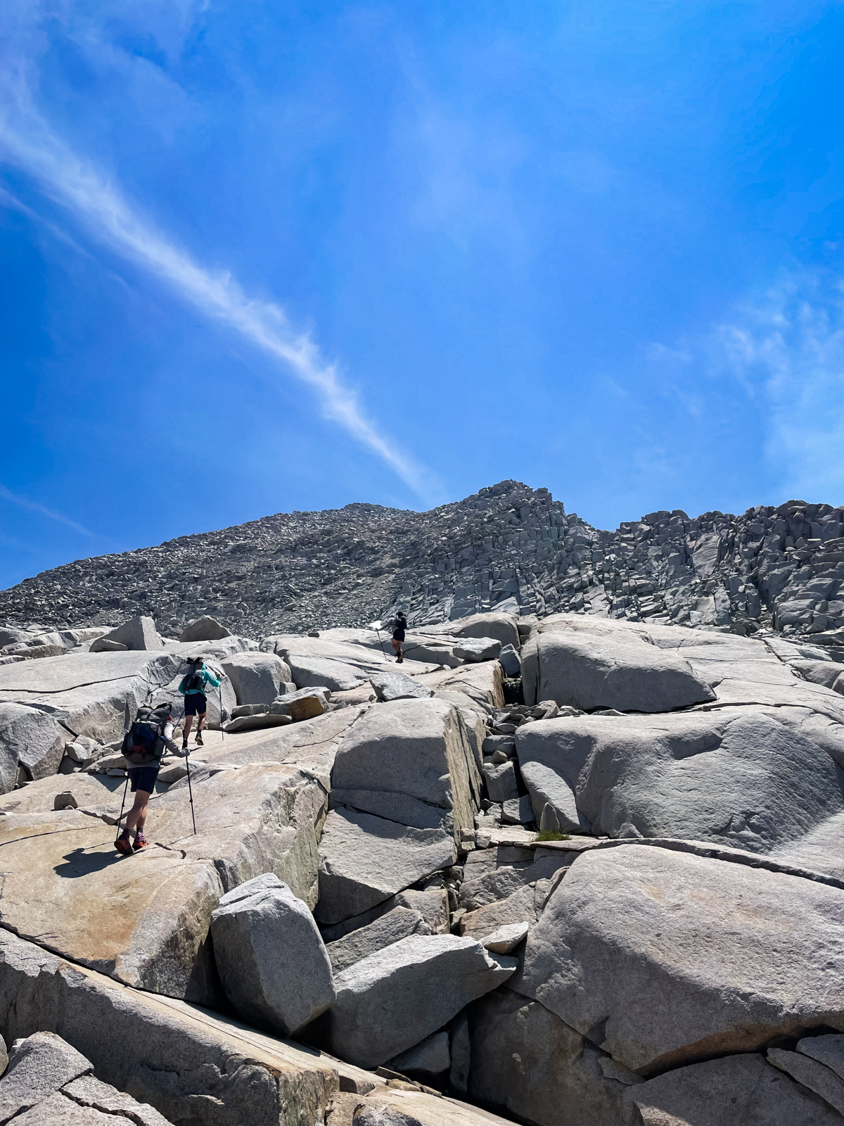
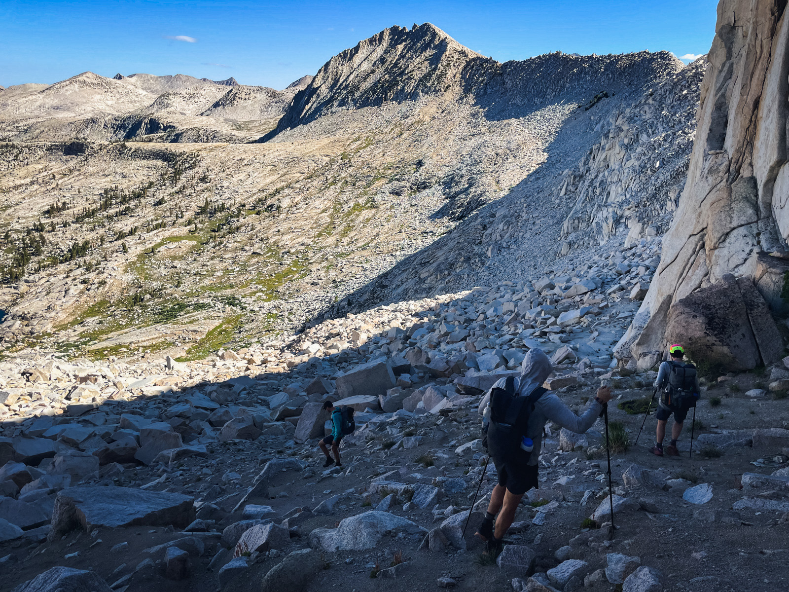
We woke to Finger Col Day – a pass that the internet told us was easy if you took the proper ledge and possibly treacherous if you didn't. We worked around the lake and were almost immediately climbing steep slabs and jagged talus. It was a windless morning and sweat was soon dripping into my eyes.
We slogged up the talus on a good line that nonetheless deposited us surprisingly far south of the Col itself, almost directly under Finger Peak. There is a more direct line, though this one was perfectly workable.
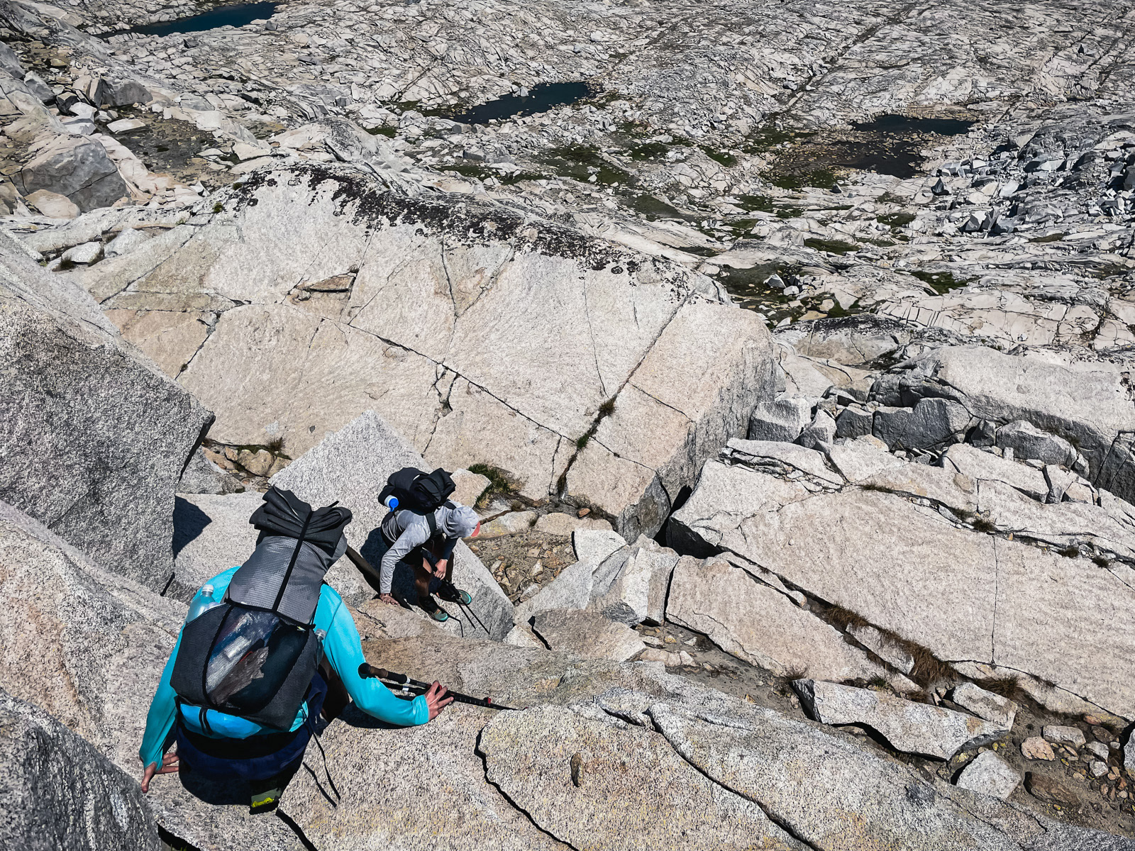
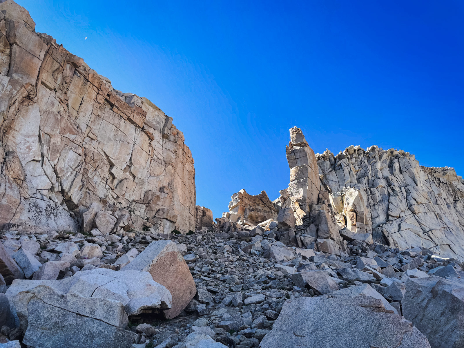
We made our way onto the ledge that is the subject of some internet consternation and… it was a wide, easy boulevard. There is one spot where you must swing around a boulder that blocks much of the ledge, but it was one quick move and the rock had good handholds. As an exposure wuss, I can tell you that this pass is nothing to worry about. I wish I’d taken more photos, but the whole ledge was over in a few seconds.
The titular finger is only visible on the far side, a thin rectangle of striated rock. It somehow manages to support a tree growing out of it near the top despite sitting at 11,600 feet.
It’s a very cool pass, architectural and a bit mysterious. In my modest experience, it’s the winner of the “Best Personality” Award in the Sierra Cross Country Pass Yearbook.
The far side is steep but easy sand at the top.
Looking back at the Finger.
Cathedral Lake!
The route from the Col to the lake looks a whole lot harder from here.
The view from the cliffs above Portal Lake was amazing.
The topo looks doable on the right (north) side of Midway’s outlet stream, but in person it was pretty chunky and we were not particularly excited to attempt it. One of us went scouting and found a route that would work but required jumping 5 or 6 feet onto a narrow ledge.

With a minimal amount of map reading, an easy and beautiful alternative presented itself, wrapping south and then northwest around the head of Crown Basin.
This improvised route went perfectly: glorious slabs with pine trees and a generous, mild grade. It probably added ¾ of a mile, but we got to stare at the profound peaks of Blackcap Basin the whole way. I’d recommend this route to anyone wandering this area.
And finally: Portal Lake.
Eventually it was time to go, and unfortunately that meant the end of the high country. From Portal, we plunged immediately down into the trees, and with it the vibe shifted into trudge mode.
This is the pain and pleasure of starting from Courtright: many miles of forest leading to some brilliant and rarely visited high country. We still had over 18 miles left.
We were all ready to stop for the night by Big Maxson Meadow, but it was pretty uninspiring. Hot forest, mediocre water, and some old cabins. So we pushed on, and ultimately found a great spot hidden away behind a granite pool on the North Fork Kings River. We were down at 8300 feet, and in another world: trees, ants, allergies, bats in the night.
If I were to do it again, I’d stay at Portal for the last night and resign myself to a long last day. Splitting the exit into two days was bad for morale.
But there's nothing else to complain about -- this was a great trip that I'd recommend to anyone who hasn't been to the area. 10,232 and the perfect meadow below it are special. I think the barrier to entry (and my lack of interest in some of the other access points) means that I may never make it back, but I'm very glad that I got myself there once.


