
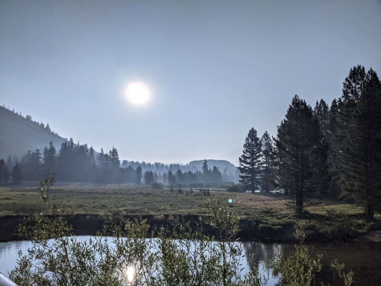
My wife had to work late on Friday, so we didn't get out of the Bay Area until 7pm and didn't arrive at the Tuolumne Meadows campground until 11:30pm. It was so smoky that we could see it through our headlights and smell it when we stepped out of the car. Not a good sign. Knowing we could use the backpacker's campground to camp the night before we began, we figured this would be more convenient than dispersed camping elsewhere. We were kind of right. Not ever having been in the Tuolumne Meadows campground and only using a map and headlamps to guide us, we stumbled around looking for the backpacker's camping area, then finding a suitable place to set up our car camping tent, then figuring out how to pay for the campsite. My apologies to everyone camped there that night for the late-night intrusion.
The next morning we awoke and realized we had pitched our tent right near some bear boxes and picnic tables. What we thought had been a relatively secluded spot ended up being right in the middle of everyone else's breakfast. Oops. I was slightly embarrassed to emerge from the tent, both because of our unfortunate choice of campsite and because we had elected to carry in my wife's car camping tent (REI Passage 2) rather than risk getting our backpacking tent wet from condensation. We probably looked ridiculous slinking out of there carrying our tent and our sleeping bags (in their cloth storage bags) all the way back out to where we had parked on the road. It was still smoky this morning, and I worried that we might have to bail if the smoke persisted.
Once back at the car, we walked to the Wilderness Permit Station to get in line for our permit. We arrived at 7:50am, behind a group of young guys with stuff strewn across the picnic tables and a friendly older woman who we chatted with for a bit. Then came the talk. This was novel for me (again -- first time starting a backpacking trip in Yosemite). I didn't realize it'd be a full 30 minutes until we were out of there with permit in hand and a fresh appreciation for what it takes to avoid (further) habituating habituated bears.
We walked back to the car again, grabbed our packs, and were finally off. The first part of our hike took us...right back through the campground, where we stashed our Powerades in a bear box and took a use trail from the backpacker's campground to the Elizabeth Lake trailhead. To my chagrin, we saw a small parking lot there at the trailhead proper. Could we have parked there and saved the multiple walks through the campground?
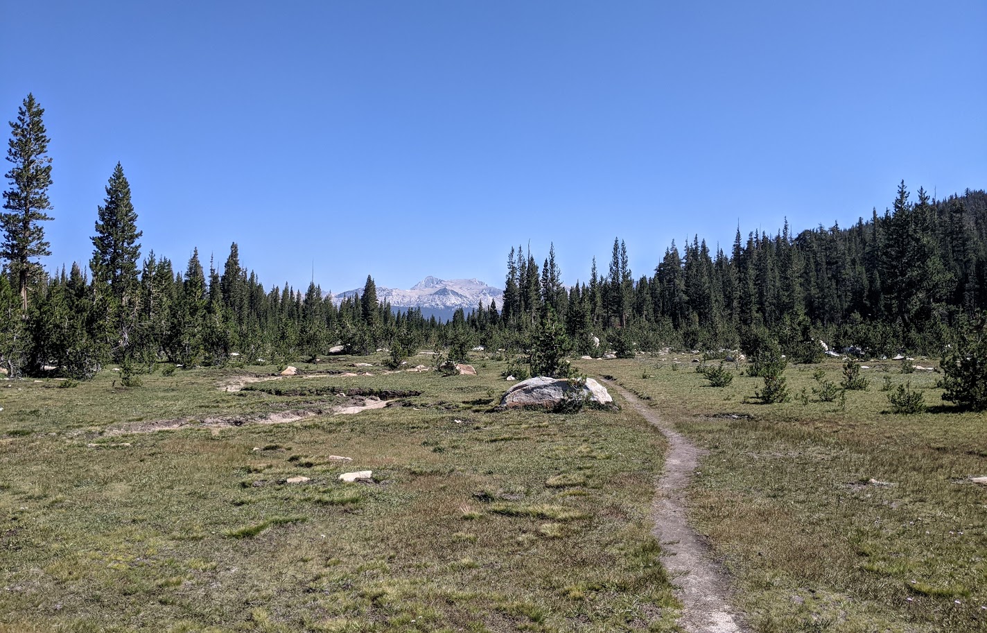
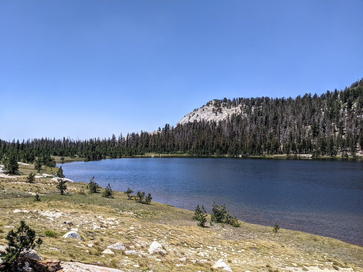
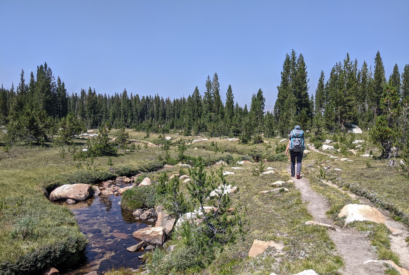
The trail to Elizabeth Lake was straightforward. A steady incline for the first half, then it leveled out for the second half. We only passed one other party, day hikers with fly fishing rods. Once we neared the lake, we veered left onto the unmaintained trail that would take us over into the Echo Creek drainage. I was surprised at how defined this trail was -- it seemed to be just about as maintained as the trail up to Elizabeth.
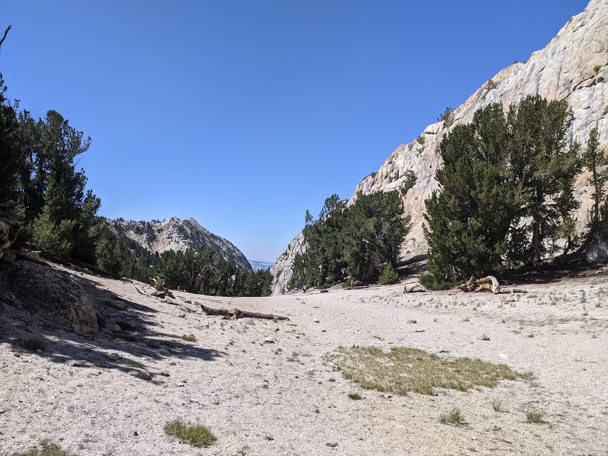
At the south end of the meadow, the "unmaintained" trail began climbing, and so we climbed with it. It was steep in parts, but pretty easily manageable and soon we had arrived at the final approach to the pass over to Echo Creek.

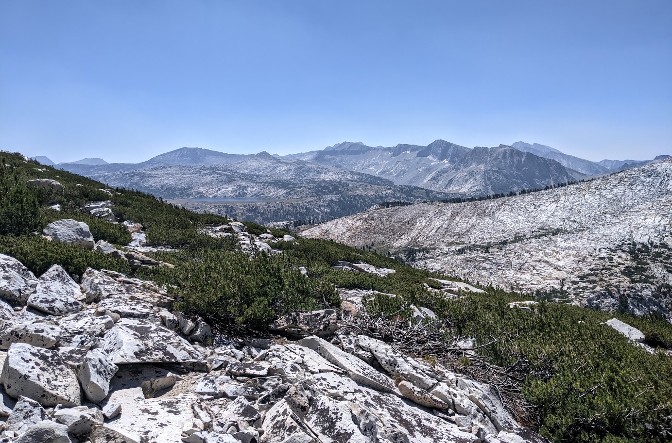
Once at the top, we enjoyed the nice views looking north. The smoke from earlier in the morning had mostly been swept away by a steady breeze.

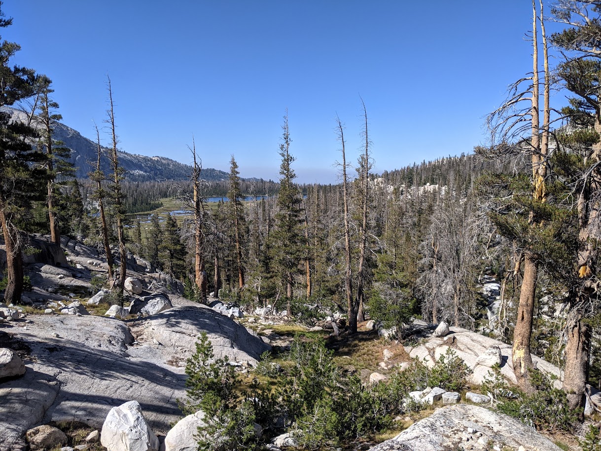
Descending the other side, we enjoyed the nice trail heading south. Still well-defined, still unmaintained. I suppose that's an understandable function of the draw of a place like Yosemite -- even the cross-country routes are easier to follow than trails elsewhere.

We took the trail down the canyon (ravine? meadow?) for a few miles until it began to veer left toward Nelson Lake. This was our cue to step off the trail and veer right, continuing to follow the creek south.

Soon we rounded a corner and spotted a steep slope above us to our right. This was our planned route up and over the ridge to Matthes Lake, our destination for the day. We began ascending, friction walking up nice granite slabs.
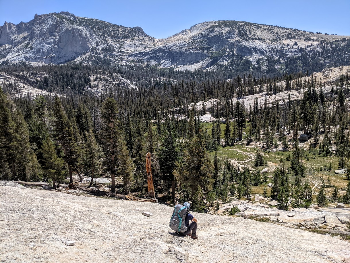
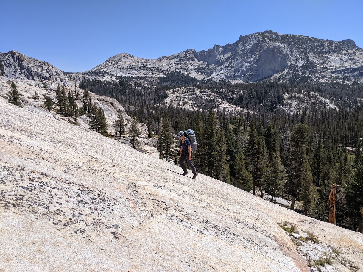
The gradient got steeper as we climbed higher.
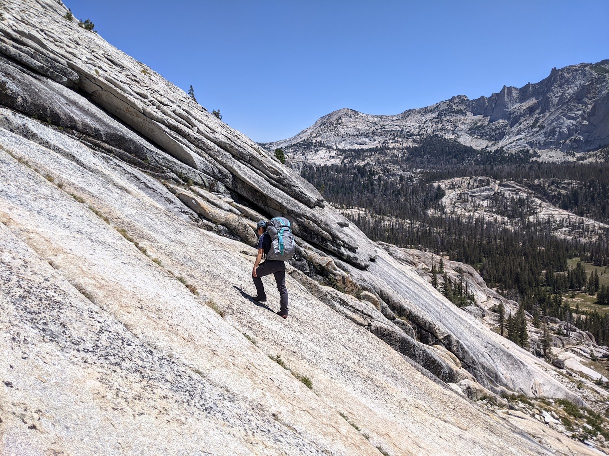
But the views (and the time saved vs. going around further south to a gentler access point) were worth it.
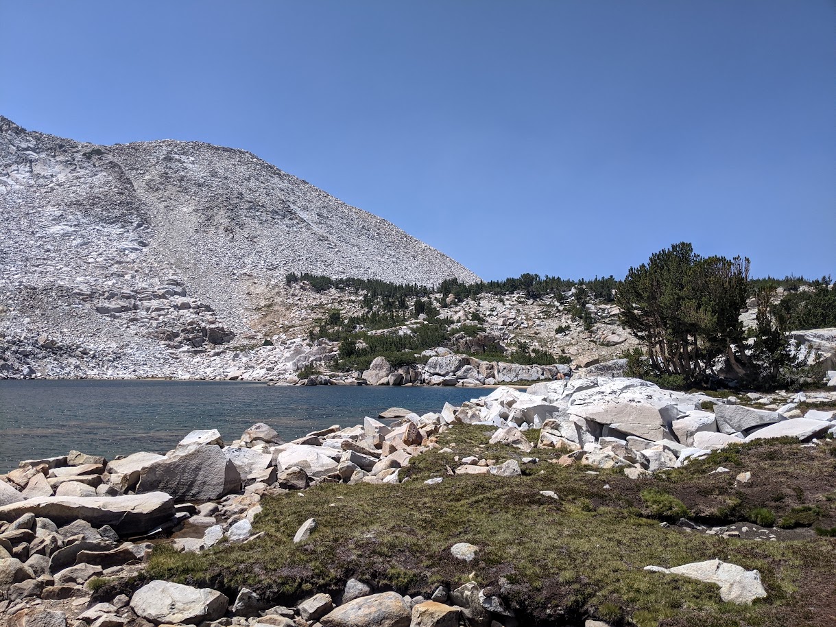
Upon reaching the top, we caught our first glimpse of Matthes Lake.
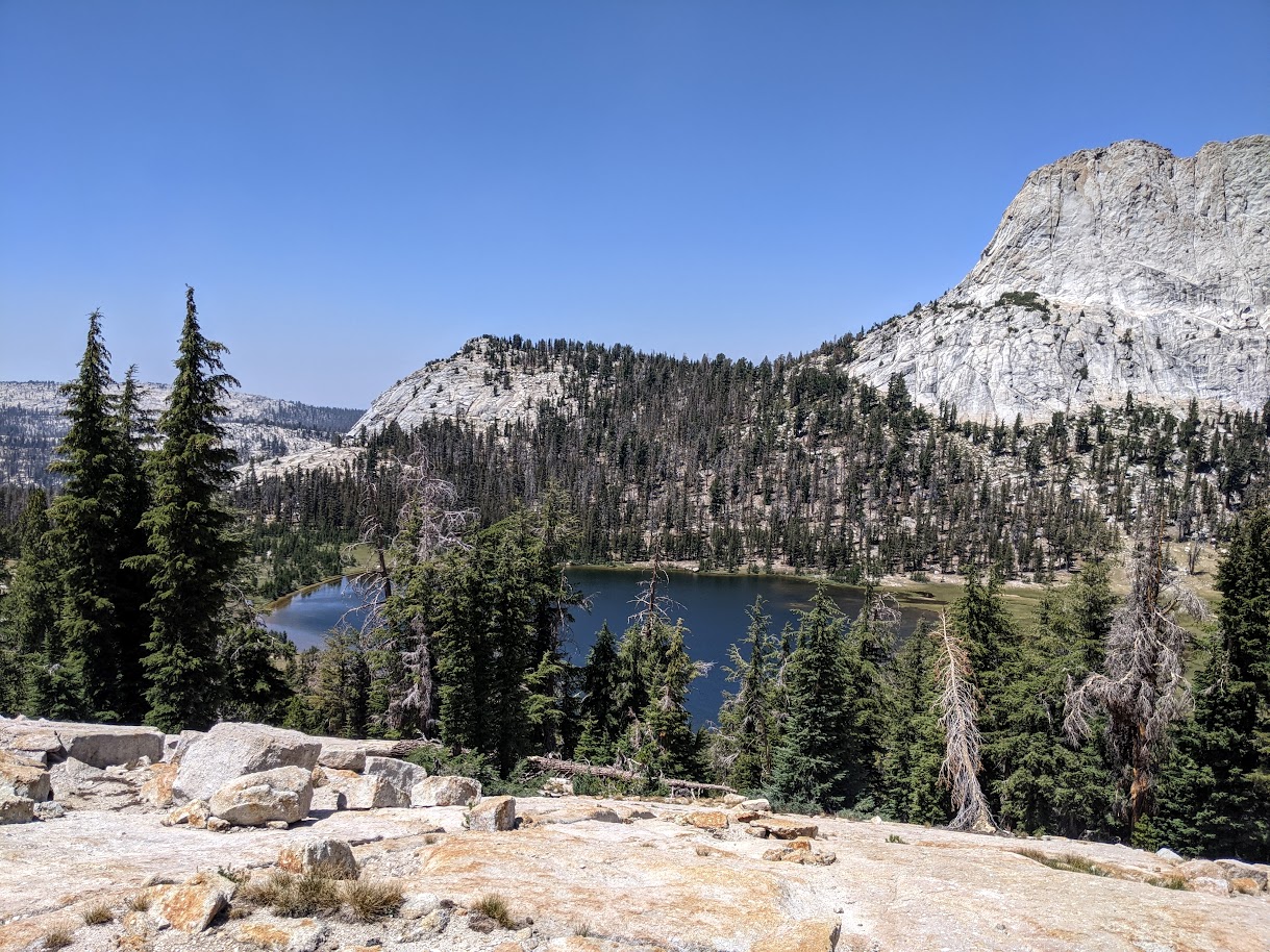
It looked beautiful, and kept getting more beautiful the further we descended down toward the lake. So this was why people were willing to jump through so many hoops to backpack in Yosemite.
It was like camping in the Valley, and having it all to yourself. Matthes Lake, with the formidable Matthes Crest towering above its west shore.

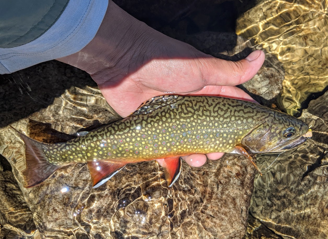
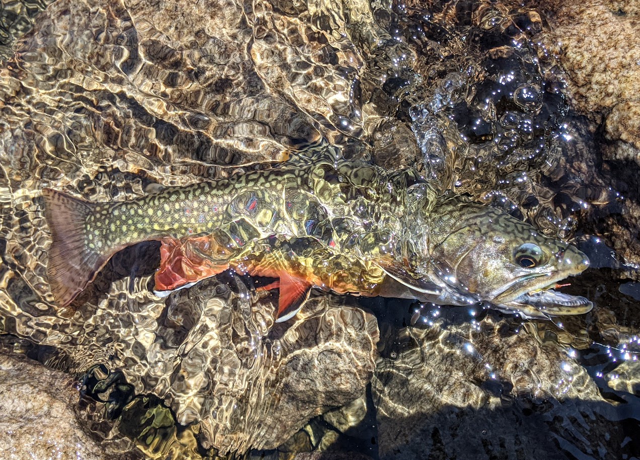
We found a campsite well away from the lake to the south in the midst of a stand of small trees, and set up camp. It was only about 1pm, so we had the entire rest of the day to enjoy the lake. I fished and took more photos. The fishing was good for brookies, but the scenery was even better.

Another couple of backpackers arrived around 4pm and passed by on their way to camp elsewhere near the lake. We waved from our lightweight camp chairs. By 5pm we were already hungry, so we decided to make an early dinner: instant rice, dehydrated black bean soup mix, bacon bits, and home-dehydrated zucchini from the garden. The food plus the happy hour cocktails (whiskey + Crystal Lite lemonade), plus not getting much sleep the night before, meant we conked out early. So no sunset photos, though I'm not sure how much of a sunset we would have seen anyway with the Crest blocking much of the setting sun to the west.
The next morning, we packed up and were off by 8:15am. I took one parting shot of the lake with Matthes Crest gleaming above it, basking in the morning sun. As we walked back around the southeast side of the lake, we spotted the other backpackers camped further away from the shore.

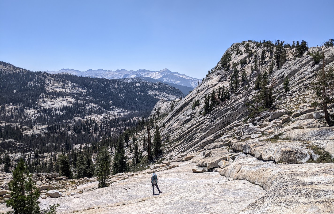
Back up the ridge to the east we went. We made quick work of this ascent, making it to the top of the pass in only 15 minutes. Going down the other side down to Echo Creek took a bit longer, but not much more time. Soon we were striding back up the meadow en route to intersect the trail to Nelson Lake.

I was looking forward to today's exit hike. Rather than a simple out-and-back, I had planned for us to turn this into a loop: from Nelson, we'd walk up the drainage to Reymann Lake, then up and over the saddle to the northeast into the drainage with the unnamed lake southwest of Johnson Peak. Then from there, we'd drop down to Elizabeth and head back out to the car.
Nelson was not quite as scenic as Matthes, but boasted an even larger meadow. This made for easy walking as we headed up the drainage. Once past the meadow, we followed the creek as it wound its way up toward Reymann.
Reymann Lake was pretty, and full of willing brookies.

From Reymann, we began climbing east/northeast toward the high saddle above, which separated the Nelson Lake drainage to the west from the Rafferty Creek drainage to the east, and also from the Unicorn Creek drainage to the north. I'm not sure if crossing this saddle counts as two passes or one, but I'm going to count it that way because the alternative was to cross over into the Rafferty Creek drainage, descend a bit, then head north so we could cross west into the Unicorn Creek drainage. Going directly up to the top of the end of the ridge east of peak 11,105 allowed us to drop straight down the other side instead.

It was at this point that I began to realize I'd made a tactical error. Not an error in routefinding -- we were still sticking exactly to the path that I had laid out for us -- but an error in expectation-setting. I had confidently assured my wife the day before that this second day's hike would only be a bit harder than the first, and casually described the pass we would cross today as being about the same elevation as the first day's pass. I had not, of course, looked closely at the map before making such assertions. As it turned out, today's pass at 10,840 feet was 700 higher than the pass we had crossed over between Unicorn Creek and Echo Creek the day before (10,160 feet). That, combined with the fact that our route today was mostly all cross-country, while our route yesterday was mostly on a defined trail, and I was forced to concede that today was in fact significantly harder than yesterday.
I enjoyed the view east across Rafferty Creek toward Evelyn Lake, and tried to ignore my wife glaring at me from the west. She's a stronger hiker than I am, so she had no problem on the offtrail ascent. She just wasn't planning to do that much work on this exit day, and we're the sorts of people who like having our expectations set in advance. I've learned (hopefully) for next time.
Once at the top of the saddle, we got our first glimpse of Johnson Peak and the unnamed lake below. Stretched out before us was a sea of white talus, and blanketing the horizon to the north was a wave of gray smoke.

I got the go-ahead to proceed down to the lake more quickly so I could have more time to fish, so I bounded down the bigger blocks of talus and then boulder-hopped my way to the lake shore.
The resident brookies were colorful and voracious. I fished around half of the lake perimeter, getting a good sample size of the fishery and finding some photo subjects.

Soon it was time to head out. We passed by the lakelets downstream of the main lake, then dropped down to a hanging valley below.


At the end of the valley, the gradient got steeper but we stayed to the right of the creek and found nicely connecting ramps weaving down through the pine forest until we reached the meadow at the bottom.
From here, we reconnected with the Elizabeth Lake trail. For the first time since leaving Matthes we began seeing other people again: day hikers on their way to and from Elizabeth. We walked briskly back down to the campground, retrieved the Powerades, and then walked out to the car. Stopping only for Hawaiian food in Oakdale and gas in Manteca, we made it back to the house in Oakland by 8pm.
Not bad for a weekend backpack without having to take any vacation days. Perhaps I'll brave the controlled chaos that is Tuolumne Meadows for subsequent trips.


