
I left Sunday morning at the cracko, encountered minimal traffic, and got to Bridgeport in under 4.5 hours. Picked up my permit at the drop box (our printer ink hadn't arrived, so I called ahead) and headed to Buckeye Campground, which had plenty of spaces open. I grabbed a space in the tent-only loop (##13-21), which was a shrewd move in retrospect, because I nearly had it to myself (one other party showed up late in the afternoon, and took a space on the opposite side of the loop).
Having situated myself, I drove up to Mono Village to get my parking pass for the next day. There was some confusion because the guy assumed I wanted it for that day, while I assumed he understood I wanted it for the next morning (because it was noon-ish at this point, and only a lunatic would start hiking in the middle of the day), but we got it sorted out.
Back at the campsite, I put on my boots for a short hike up the Buckeye trail. This is not the most appealing trail, at least in its early part; viewless forest for the first mile or so, with plenty of cow manure scattered around. But I wanted to do at least a pro forma hike, and I had the whole afternoon to kill, so I set out.
About a mile in I started hearing a flapping sound as I hiked, and had a sudden awful realization: when I grabbed my boots from the garage, I had taken the wrong pair--the ones where the sole had started to delaminate at the end of my 2017 trip (same model as my current boots). As I headed back to the campsite, and the sole delaminated further (to the point where eventually it was held on only by the toe, and flapped all over the place with every step) I contemplated my deeply unappealing options: try to hold the sole on with picture wire (which I hoped I still had in the car); do the trip in my low-top Chuck Taylors; drive home and back to pick up my boots (probably a 10-hour round trip at this point); or scrap the trip altogether.
At some point I got to thinking, if my (good) boots weren't in the garage, where are they? And the more I thought about it, the more likely it seemed that they were in the car, left there from my Death Valley trip shortly before shutdown. So when I got back to the campsite I opened up the car and...there they were, in the well behind the driver's seat.
Crisis averted.
Next morning I was up a little after 5, downed some cold instant coffee and a Kind bar, and headed up to the trailhead. Finished packing and double-checking, locked the car and stowed the key and then had to fish it out again to grab something I had left in there, locked up a second and final time, and eventually hit the trail a little after 6:30--not a super-early start, but not embarrassingly late anyway.

Once you get through the maze of Mono Village, the trail as far as Barney Lake is very cake-like, in the sense of being a piece of. Gradual steady gain that lets you get into a good rhythm and sustain it. Still early enough that I didn't run into too many people on the trail, which during the pandemic is a big plus. I got to Barney Lake a little after 9, took a break and shot some photos, then pressed on.

Immediately after Barney is one of the most annoying and demoralizing stretches of trail I know. You climb 150 feet above lake/valley level, only to lose it all again. Adding insult to injury, you hit one last set of switchbacks up--and then two minutes later switchback down again. Yes, I know why the trail is like that, but it still just pisses me off.

After the first crossing of Robinson Creek (rock-hop if you want, but shallow enough for an easy wet boot crossing) it got steeper. After the second crossing (same) it got steeper still, in an endless series of switchbacks. This whole stretch, all the way to Peeler Lake, was tough for me. Steep and hot and tedious.
By this time there were also a lot more people on the trail, passing me in both directions (I'm super-slow on the uphill). Which was kind of an enervating thing in itself. Pulling up my bandanna and stepping off the trail every time I encountered other hikers, waiting sometimes for a whole group of 8 or 10 people to pass, doing this every 5 to 10 minutes, got to be wearing after a while.
Anyway, eventually I dragged my sorry carcass to Peeler Lake (after climbing an extra 150 feet above lake level, of course, because that's how this accursed trail rolls). I took off my pack at a campsite before the outlet gully and rested while trying to decide whether to camp there or move on to better sites further along the lake shore. It wasn't a bad site in most respects, and lord knows I would have loved to quit at that point, but it had one glaring flaw that was a dealbreaker: no place to take a dump. To one side, too close to the lake; to the other, too close to the trail or to the outlet stream.

So I continued on the trail--which drops below lake level in the outlet gully before climbing back, because <i>of course</i>--to a set of campsites in forest off the north shore of the lake. (And if you have guessed by now that the trail around the lake has some spectacularly annoying ups and downs, Gentle Reader, then you are entitled to the satisfaction of knowing you are entirely correct.) There was one couple already camped there, so I set up in a site as far from them as possible and whiled away the afternoon and evening. There were, by the way, no mosquitoes.
Dinner was a collection of modular food units: a pouch of flavored tuna, a pouch of olives, and an individually wrapped piece of cheese that I hadn't eaten at lunch. (I did the same dinner every night, though sometimes I had crackers too.) I had decided to go cold this time to save a couple of pounds; I had done it before, inadvertently (stove trouble at the trailhead), and it was fine. On solo trips I've come to view the chore value of cooking as greater than the pleasure value of eating a cooked meal, so eliminating the cooking made sense from that perspective as well. At home I drink nothing but cold brew, so I figured cold coffee would be just fine in the backcountry. Turns out Medaglia d'Oro instant mixes nicely with cold water (and to be sure, I would mix it the night before), and it tastes...like cold instant, which is to say, about the same as hot instant but with a lot less trouble.
Next morning I got packed up and on my way around 6:30. At the Buckeye Pass trail junction I continued due west toward the low saddle over to Thompson.

I won't describe my route in detail because I'm not sure I found the best way (in either direction, as it happens); I'll just note that 1) the terrain is complicated and sometimes confusing, but 2) you can always maintain a sense of where the pass is. So if you muddle through like I did, you'll get there.

The other side is much clearer. Bear right along the wide grassy swale, past some rocks, and you get to a point where (facing Thompson Canyon) on your right is an open-forested slope and on your left is an unbroken mass of willow covering the slope all the way down. Apparently this saddle is known as "Willow Pass", which is an apt name because it tells you exactly where not to go.

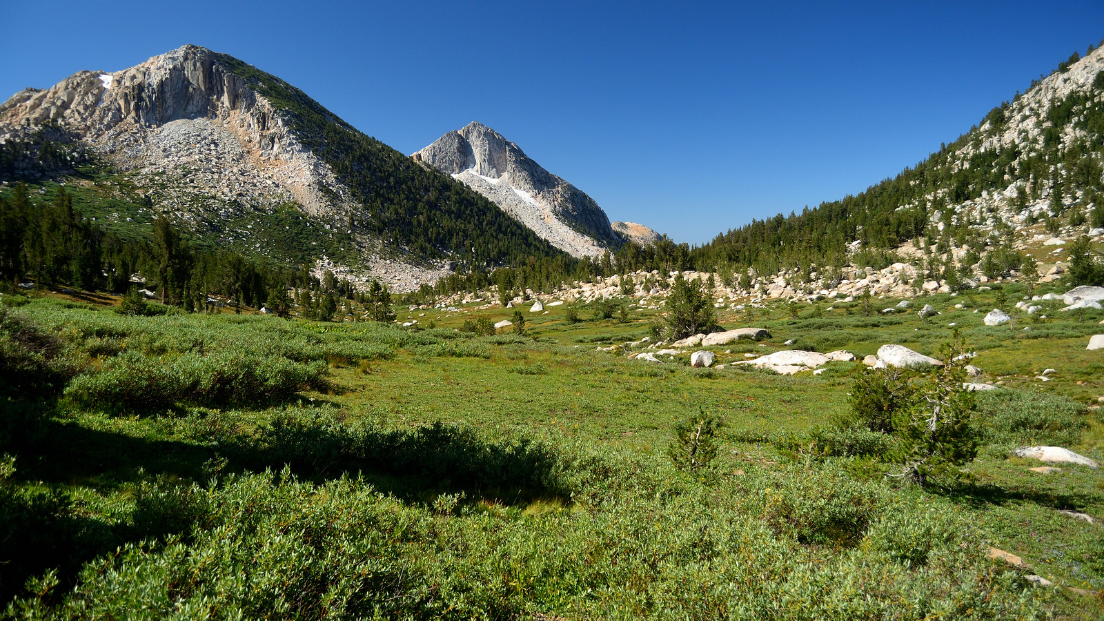
At the bottom of the descent I dropped my pack and took a stroll a little further up the delightful subalpine valley of upper Thompson Canyon. Then I saddled up again and headed down-canyon. I stayed out of the stream gully, which might well be navigable all the way but would be a tough climb out of if it isn't, and followed the gentler forested slopes to the northwest. Eventually this led into an easy parallel dry gully which dropped me off at the head of the main Thompson Canyon meadow.

Which was as beautiful as I had hoped. It was a great feeling to finally be here after looking at it on the map for all those years.

After considering a few campsites I settled on a hilltop site that I hoped would avoid mosquitoes. Yes, it's a dry year, and August, but two big shallow lakes in the meadow made me wary. Spent a lazy afternoon in camp. Had a few mosquitoes in the evening, and when I got in my tent I had to kill maybe a half dozen (I had left the zipper open).

Next morning was layover day. I stayed in my tent well past five, and spent an unhurried morning on breakfast, getting ready for my hike, and just hanging out. A little before 8 I set out for my planned destination, the lakes in the side drainage off Thompson Canyon.

Near the foot of the meadow there's a low saddle that takes you into the side drainage. Finding it and getting over it is pretty simple. On the other side you get funneled into a gully constricted by rocks and mostly avoidable willow. About halfway down I cut left onto the broad ridgelet to try to get a glimpse of the first lake, and found the going a little easier there so I took it all the way down.

(One thing to note in this section: as you'll notice if you look at satellite imagery or Google Earth, while it's white on the map there's actually a lot of forest cover here.)
Then through the meadow to the forest-fringed lakeshore.

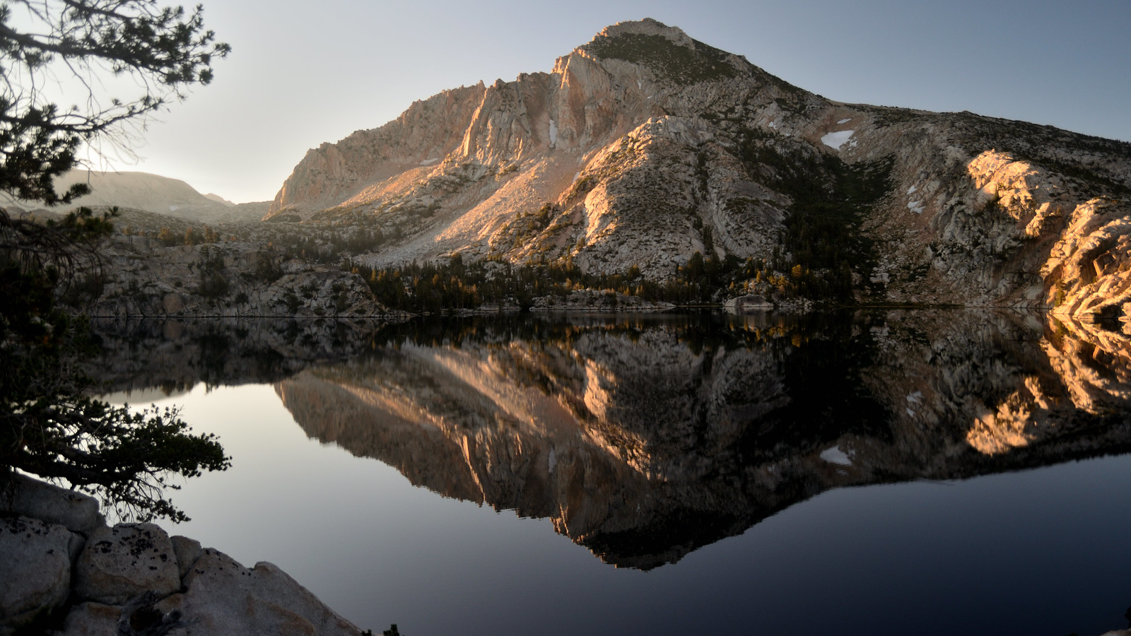
A beautiful lake, well worth the effort. I took a leisurely stroll, plenty of stopping to enjoy the views, following the southeast lakeshore around to the outlet.

Beyond the outlet the going gets a little cliffy above the stream, and swampy at stream level. It looked like the going might be better across the stream, but the stream was wider than I wanted to cross, with questionable ground all around it. So I decided to be happy with the one lake for this trip.

I hung out at the lake a while longer, then slowly made my way back around the lakeshore, again enjoying the views along the way. Then it was back up the ridgelet, over to the gully, over the saddle and down to the meadow, and back to camp.

Spent a quiet afternoon reading and playing solitaire. Around 5:00 or so, as I was enjoying a little Scotch, I heard voices and got up to look around. Coming my way were two guys I recognized from the first day (they were about the only people that day who didn't get a blank look when I said I was going to Thompson Canyon). The one who did most of the talking said they had spotted this site and thought it looked promising, then saw...could that be a tent? Alas for them, it was.

They were doing a killer cross-country trip, and had just come over from Stubblefield Canyon; next day they were going to head to Rock Island Lake and Slide Canyon, then up and across the head of Matterhorn and into Spiller then finally out Horse Creek. I said, wistfully, that I couldn't do anything as ambitious as I did when I was younger. "But you're still out here," the guy said. Perspective.
Next morning I was up at the cracko and on the road by about 6:45. My plan was to camp at Barney Lake and have a short hike out the next day. I wasn't thrilled about this, but the alternatives would have been Peeler or maybe Robinson, meaning a longer hike out (and a later departure from Twin Lakes and a rush hour return to San Francisco). It's a problem with the Robinson Creek trail: no really good campsites (by which I mean places where you might enjoy hanging out all afternoon) between Peeler and Barney. So anyway, I figured I'd head down to Barney and look for the good campsites on the rocks across the stream.
After a quarter mile or so I stumbled (almost literally) into the two guys' camp. Fortunately they were already up and about, so I didn't wake them; we chatted a bit and then I was on my way again. (They were the ones who told me the name of Willow Pass.)


Easy going back to upper Thompson Canyon. I was sort of dreading the steep climb up to Willow Pass, but it didn't take me much longer than the descent had taken. The other side, though...coming up I had stayed somewhat to the south and gotten into all kinds of willow and swampy stuff, so going down I veered northish. And wound up going cross-grained against the granite, several times having to backtrack a bit to find a way down off a rib, until I veered southish again and got back into the willow and swamp. As I said, I'm pretty sure I didn't find the best way up.
But it also doesn't matter that much. Coming out into Kerrick Meadow, I hit the trail at exactly the Peeler Lake intersection. So then it was cruise control on trail the rest of the way. At the Robinson Creek junction, there was a party of people 30 years my junior, with another couple of people just down the trail. Dropping down those switchbacks I lapped all the kids and got way out in front of them, which felt good after having everyone pass me on the way up. The older you get, the stronger gravity is; so I'm super-slow on the uphill, but on the downhill it's ride the gravity, baby.

Then that demoralizing damn stretch above Barney Lake--again, the switchbacks up followed immediately by switchbacks down--and finally, around 11:45, Barney Lake.

I was tired at this point, so I dropped my pack at the wooded campsite area (which I call "the slums of Barney Lake") and went and sat for a while in the shade looking at the lake. The kids were there, stopping on their way out, and the sound of all those voices grated on me. I sat and thought about what I was going to do. Barney is one of those gray area lakes, technically backcountry, but close enough to get a lot of dayhikers, who I knew would be arriving soon.

On the one hand, the thought of hanging out all afternoon with a lot of dayhikers at the lake made me kind of depressed. And the thought of crossing the stream and finding a campsite was suddenly very daunting, and the thought of camping where I dropped my pack depressed the hell out of me. On the other hand, if I hiked out there would be bed, bath, and beer...no wait, that's still the same hand.
So after hanging out at the lake a while I decided to just hike out. It took me about an hour and three quarters, and along the way I passed dayhikers and backpackers both who clearly hadn't set out until after noon, which is just nuts. I got a motel room in Bridgeport, cleaned up and got a Jolly Kone burger and watched trash TV, and set out for home the next morning. Which was smooth sailing until San Francisco, where Fell had two lanes blocked (one by construction, one by moving van) and when I got home there was a pickup belonging to the crew doing unpermitted renovations next door blocking our driveway. Back to reality.


