A few weeks ago Julie (my wife) and I (myself) spent a week backpacking in Sequoia National Park. We started at the Cottonwood Lakes trailhead at Horseshoe Meadow, hiked in over New Army Pass and then out over Shepherd Pass. Along the way, we visited Miter Basin, Crabtree Lakes, Milestone Basin and Thunder Basin. The full route can be seen here: https://caltopo.com/m/C4D1
Day 1 - Cottonwood Lakes TH to Soldier Lake
Since this was a point to point hike and we didn't want to bring two cars, we hired Paul at East Side Sierra Shuttle to pick us up at the Shepherd Pass trailhead and drive us to the Cottonwood Lakes trailhead. He picked us up at about 9am and had us on the trail before 11am. Friendly and interesting conversation was included at no extra charge.
The first couple miles were pretty flat and pleasant before beginning the gradual climb up to New Army Pass. We considered staying at Cottonwood Lakes the first night, but it was too early in the day when we got there so we continued to the pass. The cornice near the top of the pass wasn't an issue and I think we only need to take a step or two on the snow to get past it....I waited a little bit too long to write this report, so I don't quite remember all of the details and probably glossed over some other details in the rest of the report.
From there we hiked down through a marmot filled meadow and ended up at Soldier Lake. There appeared to be some other groups at the lake and the mosquitoes were becoming a nuisance, so we decided to camp above the meadow just before the lake where the bear locker was. This didn't help with the mosquitoes much, but it did provide a little bit of solitude. The added benefit was that it was convenient to use the bear locker to store our bag of cheez-its rather than crush it in order to fit it in one of our bear canisters.

One of the Cottonwood Lakes

View to the east from New Army Pass

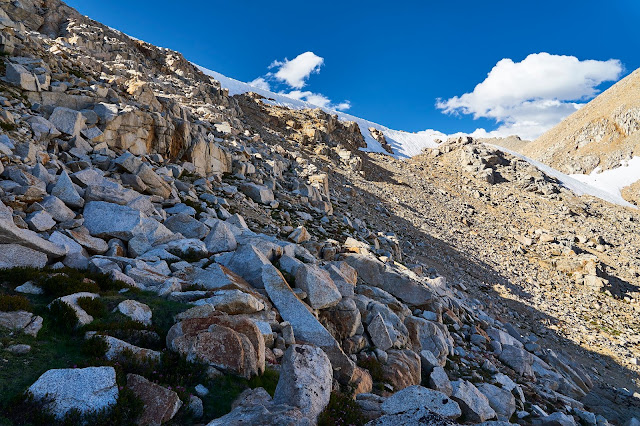
New Army Pass....obviously

Looking back up towards the way we came down from New Army Pass

Camp near Soldier Lake
Day 2 - Soldier Lake to Rock Creek Lake via Miter Basin
We had an open ended plan for the day. We were hoping to head over Crabtree pass, but the snowfield on the north side of the upper Crabtree Lake concerned us. The ranger that checked our permits the prior day mentioned that someone recently told him it was "terrifying" or something ominous like that, but we took that with a grain of salt and hoped to run into other hikers that might have some additional beta we could use to make the decision.
We started off the day by hiking around Soldier Lake and then up over the ridge to get to Miter Basin, generally following the inlet stream to the northeast of the lake. This was pretty straightforward and once we got to the top the views into Miter Basin really opened up. As we were taking a break we saw a group of hikers coming towards us. We hoped that they had come over Crabtree pass and could give us the beta we were looking for, but they were just coming from Sky Blue Lake where they had camped the night before. We then continued on to Sky Blue Lake ourselves and took a nice long break when we got there. Unfortunately, we did not see anyone else that had been over Crabtree pass and we weren't feeling adventurous enough for the Crabtree pass route without more information, so we decided to take the trail around instead.
After lunch, we headed back the way we came, but then took the trail along Rock Creek to get back to the main trail instead of going back to Soldier lake. When we got to the lake at the main trail we decided to set up camp there even though it was still somewhat early in the day. The views were pretty nice there and it seemed like we'd have to hike quite a bit further to get to a similarly nice setting. Normally, we like to spend most of the day hiking and don't usually stop to camp until around dinner time, but on this trip we were trying to keep it a little more relaxed.

Heading up to Miter Basin

Looking back towards Soldier Lake on the way up to Miter Basin

Miter Basin. We didn't realize we were wearing pretty much the same outfit until we got dressed the first morning.

Miter Basin

Sky Blue Lake

Miter Basin

Camp near Rock Creek Lake

View from the meadow near camp
Day 3 - Rock Creek Lake to Crabtree Meadow
This day was pretty uneventful and was mostly about getting closer to our next destination. We hiked over to the PCT that morning and then headed north from there. We hoped to get to Crabtree Lakes that evening, but by the time we got to Crabtree Meadow we were feeling pretty tired. After a short break, we decided to head towards the lakes knowing we probably wouldn't make it all the way there, but wanted to at least get a little closer since we still wanted to check out the lakes the next morning. We ended up camping above the meadow just northeast of Crabtree Meadow, which provided some nice views to the west.

View looking back towards Miter Basin from the other side of the lake the next morning. We camped just above the other end of the lake where the rocks start sloping up.

Views to the west from camp
Day 4 - Crabtree Meadow to Wallace Creek with a side trip to Crabtree Lakes
The trail up to Crabtree Lakes was not far from where we camped and we made it up to the first lake in about 45 minutes. That probably would have taken closer to two hours at the pace we were going at the end of the prior day. We took a short break there, stashed our bear canisters, then headed up to the middle lake, which had a beautiful stretch of beach along the north shore. After rinsing off our suncreen, we went for a swim and spent a couple hours enjoying the beachfront setting in the mountains - a perfect combination for me. We then headed back to the lower lake to retrieve our bear canisters and headed back to the JMT.
Back at the Crabtree Meadow trail junction, we took another break along with a marmot lounging on what I assume is officially called Poop Rock. When I got my camera out to take a picture, the marmot seemed to get agitated and started chirping at me and then stood up and puffed itself up while looking right at me. I had never seen that happen before and felt like it was strongly suggesting that we should move along, so we packed up and were on our way.
Our goal for the remainder of the day was to at least get to the Wallace Creek junction, which would set us up for an easy hike over to Milestone Basin the next day. When we got to the tent city at the junction, we debated whether or not we should continue a bit further, but we were tired so we ended up camping there. As usual, all it took was a short hike from there to get away from all of the other tents. It wasn't a bad place to camp, but in hindsight I was wishing we had continued on a little bit. While we had already decided to save Wright Lakes and the lakes above Wallace Creek for another trip, I regretted not at least targeting lower Wright Lakes Basin that night.

Lower Crabtree Lake

Middle Crabtree Lake

Middle Crabtree Lake

Heading back to Lower Crabtree Lake

Back at Crabtree Meadow

Marmot on Poop Rock
Day 5 - Wallace Creek to Milestone Basin
We headed north on the JMT that morning and after about a half mile there is a scenic overlook with views of the Kaweah Peaks over Wallace Creek canyon. After a couple more miles we were walking through Bighorn Plateau, which I could never get enough of. We took a break after crossing Tyndall Creek and shortly after that we left the JMT and headed west on the trail towards Milestone Basin, which had some wide open scenery that we really enjoyed. After a steep drop to get down to the Kern River we were surprised to see another person down there taking a break. Apparently he had been out for about a month and was on the final days of his trip. We chatted for a bit and he recommended a few places in the area to check out. Eventually we parted ways and then we crossed the Kern River a little bit south of the lake at the trail junction and started heading up into Milestone Basin. As we were ascending we noticed a well defined trail just below us, so we connected with that and were pretty much on a trail the whole way up to a clearing where we decided to camp. From there we had nice views towards Mount Whitney in one direction and up Milestone Creek in the other direction.

Scenic overlook just north of Wallace Creek

Hiking through Bighorn Plateau

Hiking along the connector trail between the JMT and the Kern River

Hiking along the connector trail between the JMT and the Kern River

Dinner time in Milestone Basin
Day 6 - Milestone Basin to Thunder Basin
The next morning we spent a couple hours hiking further up into Milestone Basin and the scenery was outstanding. After getting back to camp, the plan for the rest of the day was to pack up our stuff and hike just a couple miles over to Casper Lake. When we got to the lake just south of Casper Lake, we crossed at the inlet, which took a little bit of scrambling and bushwhacking. Our route was pretty direct, but I think there was probably an easier way. After crossing the inlet, we just headed in the general direction of Casper Lake and ended up at the outlet. We then walked around the lake looking for a place to set up camp, but didn't really find anything to our liking. We eventually settled on a spot on the western peninsula, which had nice views, but wasn't ideal. After setting up camp, we went out for a day hike into Thunder Basin and after about 15 minutes we came across a beautiful setting with wide open views up into Thunder Basin, a swimming hole, and a lot more space to spread out. A couple minutes later we were heading back to grab our tent and other gear and move it to this preferred location. After setting up camp for the second time that day, we decided to wait until the next morning to continue our hike up into Thunder Basin. Instead, we went for a swim and enjoyed our surroundings for the rest of the afternoon.

Hiking into Milestone Basin

Milestone Basin

Milestone Basin

View into Thunder Basin near our first camp at Casper Lake

Thunder Basin and the swimming hole near our new campsite

Camp in Thunder Basin
Day 7 - Thunder Basin to unnamed lake near the JMT
That morning Julie wasn't feeling well, so I hiked around Thunder Basin for a couple hours while she got more rest. Just like Milestone Basin, the scenery was outstanding. As much as I love alpine lakes, it is basins like these that I enjoy most.
When I got back to camp, Julie was feeling better, so we packed up and headed out. We didn't have a particular destination in mind, we just wanted to get somewhere in the vicinity of Shepherd Pass since we would be hiking out that way the following day. We started off by heading back down to Casper Lake. When we got to the northeast tip, we headed up the gully towards the three lakes along the trail to Lake South America. We ended up at the northern end of the southernmost lake and took a break there. We met back up with the trail on the other side of the lake and then hiked towards Lake South America. I heard that this was a nice stretch of trail, but I didn't realize quite how nice it was going to be. We were constantly stopping to turn around and enjoy the view.
When we got to the Lake South America junction, we took the slight detour to go check it out before heading back towards the JMT. When we got near lake WL3490, we started thinking about where we wanted to camp and we ended up at the smaller lake just east of there. It was a pretty nice setting for our final night and set us up nicely to get over Shepherd Pass the next day.

Thunder Basin

Casper Lake from Thunder Basin

Thunder Basin with the lake just above Casper Lake in the foreground

Easy walking to connect back to the main trail

One of the small lake before getting back to the main trail

Back at the main trail looking back

Tremendous view looking back on the way to Lake South America

Lake South America

Looking back up after descending down the trail from Lake South America. IIRC, we were able to bypass the snow at the top pretty easily.

The unnamed lake we camped at

Final camp for this trip
Day 8 - Unnamed lake to Shepherd Pass TH
The next morning we crossed over the JMT, crossed Tyndall Creek and eventually met up with the trail to Shepherd Pass. We knew there was a snowfield to cross on the other side of the pass and we didn't have any traction devices, so we were a little bit nervous about it, but when we arrived there at about 10:30am the snow had softened enough and we had no issues crossing. After that it was just and eleven mile hike back to the car that never seemed to end and then a five hour drive home.

Looking back on the way up to Shepherd Pass

The crux of the trip saved until the end

Heading down from Shepherd Pass

One last view up the canyon towards Shepherd Pass