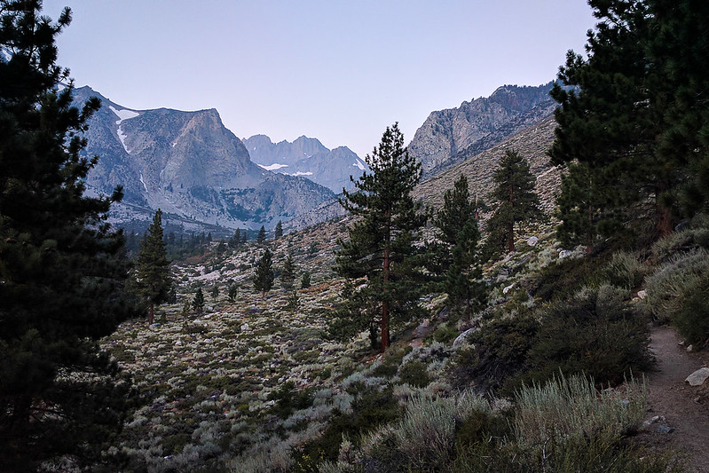
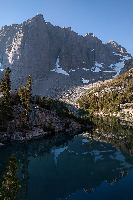
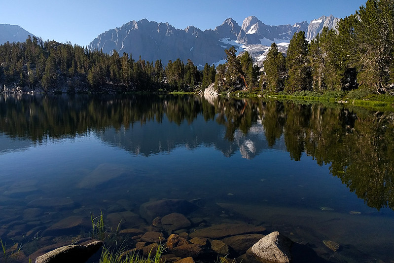
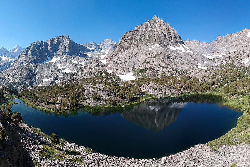
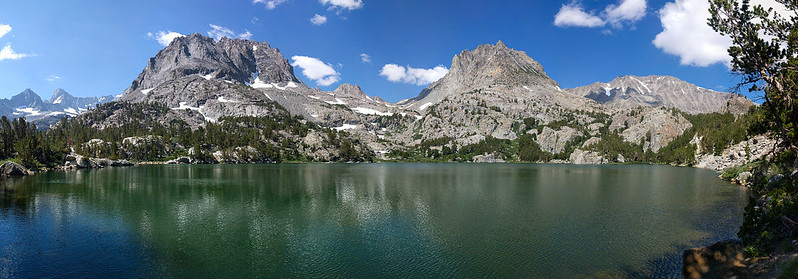
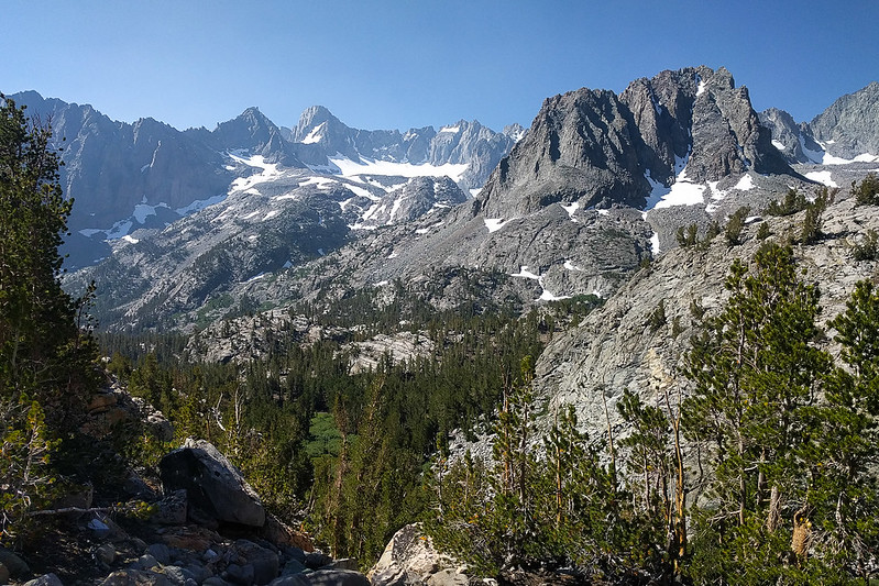
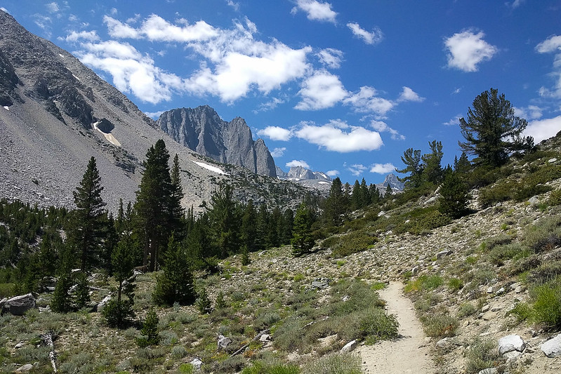
A few pics from the North Fork of Big Pine Creek, this week. (Caltopo map: https://caltopo.com/m/NQUC ) It's a lovely hike, with lots to explore. There wasn't any smoke. I saw absolutely nobody on the trail (just tents) until Sixth Lake---people like to sleep in! But coming back down there were thousands. My favorite lake was actually Sixth Lake; if you go left off the trail above the last rise you can get a nice view.
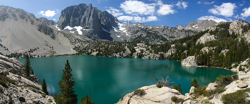
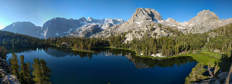
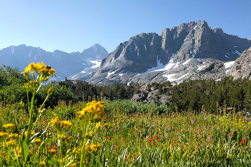
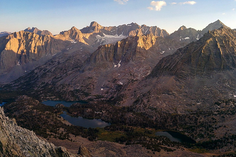
Tie, these pictures just kept getting better and better. This was a great series of pictures you took. I especially liked the one of Fourth Lake. It is very expansive and the green meadow on the right really caught my eye. I think I'll just have to walk into the picture.
What was the date of your hike? I was out the first week of August (5 days), cumulus clouds were the norm, then thunderheads by the afternoon, even at 9 am.
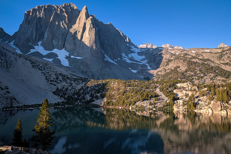
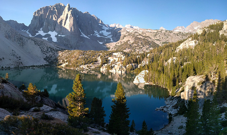
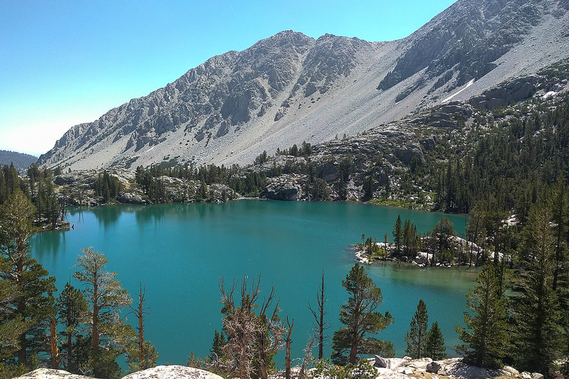
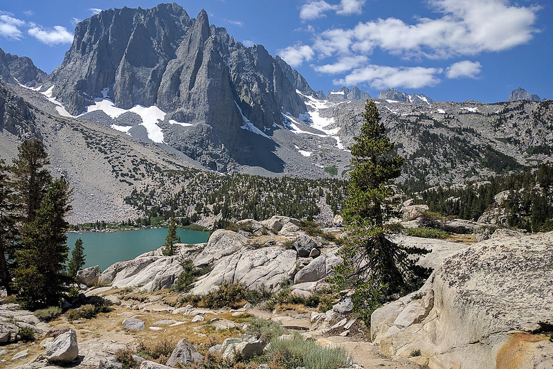
Very nice, great shots to show off the highlights of the loop, love that area. The sites at top of the cliffs above Forth Lake are quite nice, but Second Lake IMO still offers the best views, highlighting the main subjects in that area, Temple Crag and the emerald green lakes.
Professional Sierra Landscape Photographer
I don't give out specific route information, my belief is that it takes away from the whole adventure spirit of a trip, if you need every inch planned out, you'll have to get that from someone else.
Have a safer backcountry experience by using the HST ReConn Form 2.0, named after Larry Conn, a HST member:http://reconn.org
Thank you, rightstar and maverick. The date was this Tuesday, Aug. 18. I'd been planning to go out there for a while, after seeing the view from Sky Haven (day-hike from South Lake), but your Second Lake photo the other day pushed me over the edge. Still, I stand by Sixth Lake being my favorite.
Nice shot from SH , considered doing up, but east of where you took that shot from, but conditions where to volatile and not optimal the week of my trip.
but your Second Lake photo the other day pushed me over the edge.
Happy to have applied that push.
Professional Sierra Landscape Photographer
I don't give out specific route information, my belief is that it takes away from the whole adventure spirit of a trip, if you need every inch planned out, you'll have to get that from someone else.
Have a safer backcountry experience by using the HST ReConn Form 2.0, named after Larry Conn, a HST member:http://reconn.org