Questions and reports related to Sierra Nevada current and forecast conditions, as well as general precautions and safety information. Trail conditions, fire/smoke reports, mosquito reports, weather and snow conditions, stream crossing information, and more.
If you're interested is getting a great visual travelogue of current conditions in the Sierra, then you really can't do any better than follow Instagram. The hashtag I prefer is #pct2017, but there are others if you search around (eg pctig, etc).
Since there are a lot of other hikers along various stages of the route using this hashtag, it's easy to just quickly scan all the listings in order to look for those who are now in the Sierra. Once you find a poster, then you can just individually follow them along as they post current accounts.
Thanks for the info Hobbes. I don't have any social media to follow anybody but I am curious as to just how many people will actually finish the whole thing without having to skip sections and finish those sections later in the season
The more serious question is will there be a fatality this year on the PCT due to condtions. In 2011 there were a few really close calls, due to high water crossings.
The more serious question is will there be a fatality this year on the PCT due to conditions. In 2011 there were a few really close calls, due to high water crossings.
SAR has already had a busy Spring, and by the looks of the popularity boom of the PCT and JMT, it is not if, but how many.
Professional Sierra Landscape Photographer
I don't give out specific route information, my belief is that it takes away from the whole adventure spirit of a trip, if you need every inch planned out, you'll have to get that from someone else.
Have a safer backcountry experience by using the HST ReConn Form 2.0, named after Larry Conn, a HST member:http://reconn.org
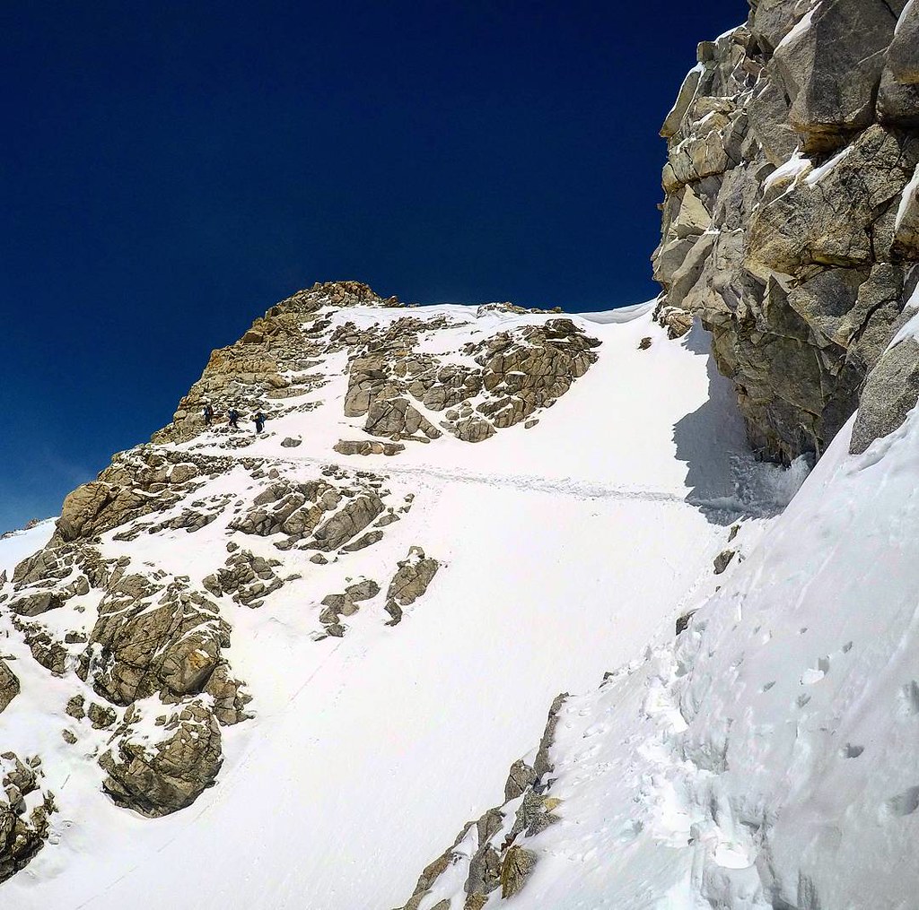
maverick wrote:Look at that cornice in that second shot.
Yep, it looks extremely sketchy. When I crossed Forester last year on 6/6, there was about an 8 foot high pile of snow on the top that needed to be scaled. The snow was too soft when I got there to be able to go up it (I'd just sink back down as I tried to climb up), so I had to scramble up about 10 feet of 4th class rock climbing to the side of the pass to get up to it. With a precarious drop beneath me and at 13k feet, it was beyond the margin of safety that I like to stay in but there was no choice.
The more serious question is will there be a fatality this year on the PCT due to conditions. In 2011 there were a few really close calls, due to high water crossings.
SAR has already had a busy Spring, and by the looks of the popularity boom of the PCT and JMT, it is not if, but how many.
Sadly, I have to agree. Lots of people are entering the PCT with no idea what they are walking towards. Callie and I just did a section hike down here in SoCal and I tried to offer some wisdom to whoever would listen to me about it.
Nice shot, next time set your timer and run up under it, so we can have a size comparison.
Professional Sierra Landscape Photographer
I don't give out specific route information, my belief is that it takes away from the whole adventure spirit of a trip, if you need every inch planned out, you'll have to get that from someone else.
Have a safer backcountry experience by using the HST ReConn Form 2.0, named after Larry Conn, a HST member:http://reconn.org