
Max & I had done a trip in the Marbles five years ago, and we both wanted to come back sometime. On top of that, the logistics made sense: he and Julie live in Portland and I'm in San Francisco, and Yreka (a little over an hour from the trailhead) is just about the halfway point. So I planned a trip out of the same trailhead (Lover's Camp) but heading south instead of west, into Red Rock Valley and the lakes around at the head of the Shackleford drainage. Julie had never backpacked before, so I figured we would play it by ear--take a more or less strenuous route depending on how she was doing.
I set out at the cracko Thursday morning. Our designated meeting point was the Black Bear Diner in Yreka. The closer I got to Yreka, the smokier it got...not a good sign. At the Raley's there a clerk told me the biggest fire was near Seiad Valley--just north of the Marble Mountain area. I got to the Black Bear early, and several tables were taken up by fire crew. At this point I was thinking we might have to bail, and I was trying to come up with likely smoke-free alternatives. The kids were running late, and it was after 1:00 before they got there.
After talking over the smoke situation with the kids, we decided to check in at the Fort Jones ranger station and see what they had to report about smoke conditions. So after lunch we convoyed over to Fort Jones, where they told us it varied depending on the wind direction. We decided, what the heck, we'd give it a try. And in fact as the road climbed up to the trailhead we did leave most of the smoke behind.
We had originally planned to hike in a couple miles Thursday afternoon, but we were already getting a later start than planned. Then there was another complication on top of that. Heading up the forest road I realized, looking at my gas gauge, that I had forgotten to buy gas in Yreka; I thought I had plenty to get me to the trailhead and back to Fort Jones, but I wasn't absolutely sure. As I was worrying about that, just a couple miles shy of the trailhead I suddenly realized I didn't see Max & Julie's car in the rearview. I pulled over and waited a minute...no car. Well, hell. The last turnoff I remembered seeing was Box Lake, and I knew they had been with me then. So I walked down the road a ways, and maybe a little more than a quarter mile back there they were, stopped. They had, in fact, run out of gas.
So I drove them to the Chevron station in Fort Jones, worrying the whole way about whether my car was going to run out of gas, where they bought a gas can and a couple gallons. We all piled back in my car and headed back to their car, then to the trailhead.
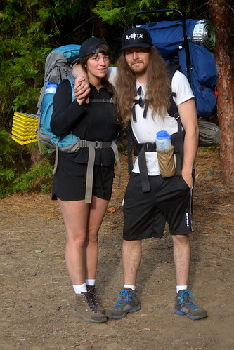
By this time it was 5:30 pm, and after some idle talk about hiking in a couple miles we decided to camp at the trailhead. I think in retrospect this was a good thing, because it gave us a lot more time to get our gear organized and packed; had we left in a hurry, trying to outrace the dusk, I know we'd have left important stuff behind.
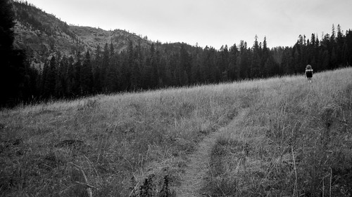
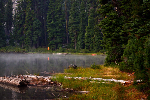
We started hiking next morning a little after 8 am. It was hazy, but still not nearly as smoky as it had been in the Scott Valley. (Still, the haze and smoke made for crappy photographic conditions. The ones I'm posting here are the best I could salvage.) We made decent time as we dropped to Long Canyon Creek and started switchbacking up the other side, then turned into Red Rock Valley. About two miles in we reached the first of several big meadows, and (hazy) views started to open up.
The meadows were beautiful, even with the haze and the drying remnants of summer wildflowers. Without the smoke, and at wildflower peak, they must be spectacular.
Red Rock Valley was a long uphill slog, and we were all glad to finally take a nice long break at a rock outcrop just above the Sky High Valley trail intersection (not marked, by the way). Refreshed, we attacked the last steep climb to the ridgeline (and the PCT) and made it a lot sooner than I expected.
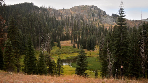
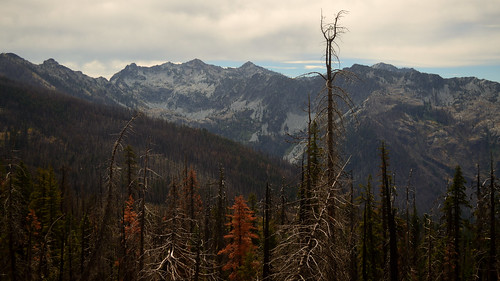
On the PCT we had spectacular views--rugged crags to the southeast, and endless forested drainages to the southwest.
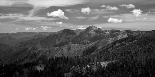
The PCT leg of our trail seemed to go on forever, but at least it was mostly fairly level. We stopped for lunch around the halfway point, soaking in the spectacular views. Then back on the trail and eventually, finally, the saddle where the Summit Lake trail branched off.
From here the trail takes a long level traverse to the north, then switchbacks down to lake level. We finally reached the lake around 2 pm, and after spending some time scouting for a decent campsite ended up setting up right where we had dropped our packs. There really aren't any good legal campsites at Summit Lake, unfortunately, but we made do with what there was.
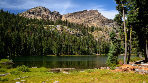
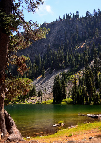
We had the lake to ourselves that night, and I suspect this was the silver lining in the smoke cloud: lots of people who might have packed into the Marbles were deterred by the smoke (as we nearly were ourselves).
Next day was a layover, so after a leisurely morning we hit the trail without packs around 10 am, heading to Campbell Lake. The smoke haze was unfortunately a little heavier this morning, though still not terrible. On the way we saw the first people we had seen since leaving the trailhead--a couple with a dog, headed for Summit Lake. At Campbell Lake we spent a long lunch break on the peninsula; this would be a great place to camp midweek, when the crowds are down.
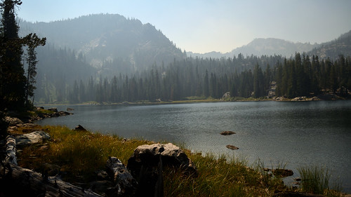
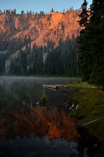
Next morning was even a little smokier. The only upside of this was deep red glow on the cliffs above the lake.
We had planned to backtrack to the PCT and head over to Sky High Lakes that day. Once again, though, plans changed: one of the kids had woken up with a health issue that needed to be checked out as soon as possible. So instead we hiked back down Red Rock Valley and out to the trailhead.
So, a less than ideal trip in several ways. Still a good trip in other ways, and Julie enjoyed it--so we'll likely do more of these.


