
Day -1
Oakland, CA to Hanford, CA
Transportation logistics for the High Sierra Trail are quite a pain—the trailheads are 214 miles (5+ hours) apart on opposite sides of the Sierra Nevada. There are essentially three options for navigating this obstacle: a ridiculously long car shuttle, arranging a key swap with people hiking the other direction, or some combination of public transit and relying on friends. Our solution was to cobble together trains, cabs, and shuttles to get to the trailhead in Crescent Meadow. For my birthday, I’d asked for my dad to come pick us up at Whitney Portal and take us back to Oakland.
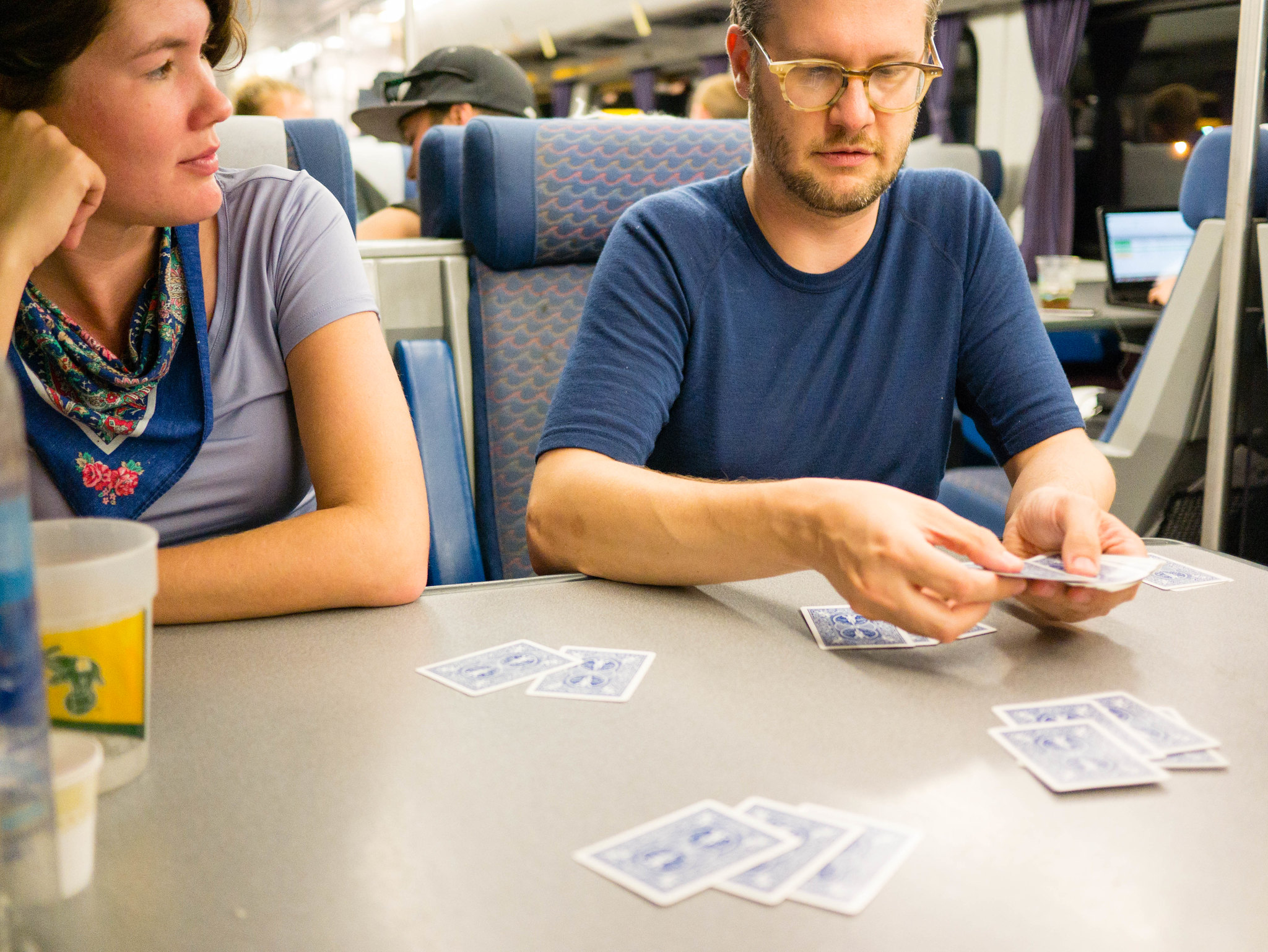 Playing euchre on the train by Maia Averett, on Flickr
In the afternoon, we took Amtrak from Jack London Square in Oakland to Hanford and then caught a cab to the Lamp Liter Inn in Visalia, where we spent the night.
Day 0
Hanford, CA to Lodgepole
We woke up early enough to gorge on pancakes and bacon at the Lamp Liter’s diner before boarding the earliest Sequoia Shuttle up to the park. The ride was a bit over two hours. It was hot, bouncy, twisty, and somewhat nauseating, but we were happy the shuttle was there to get us the long way up to the park. At the Giant Forest Museum, we hopped off and boarded an in-park shuttle to Lodgepole.
We’d planned on arriving early enough to take an acclimation hike up to Topakah Falls in the afternoon. At around 7,000ft, it’s an easy 2 miles and 500ft of elevation gain from Lodgepole up to the falls, a perfect warm-up hike to get used to the thin mountain air. This late in the summer after a dry winter, the flow over the falls was pretty wimpy, but the gorgeous (har har) granite walls made for a lovely hike in any case.
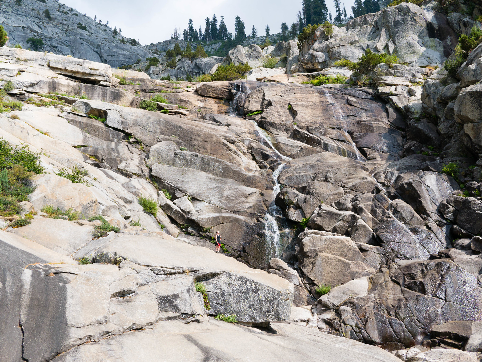 Acclimation hike to Topakah Falls by Maia Averett, on Flickr
On our way back from the falls, we saw a momma bear and two li’l cubs!
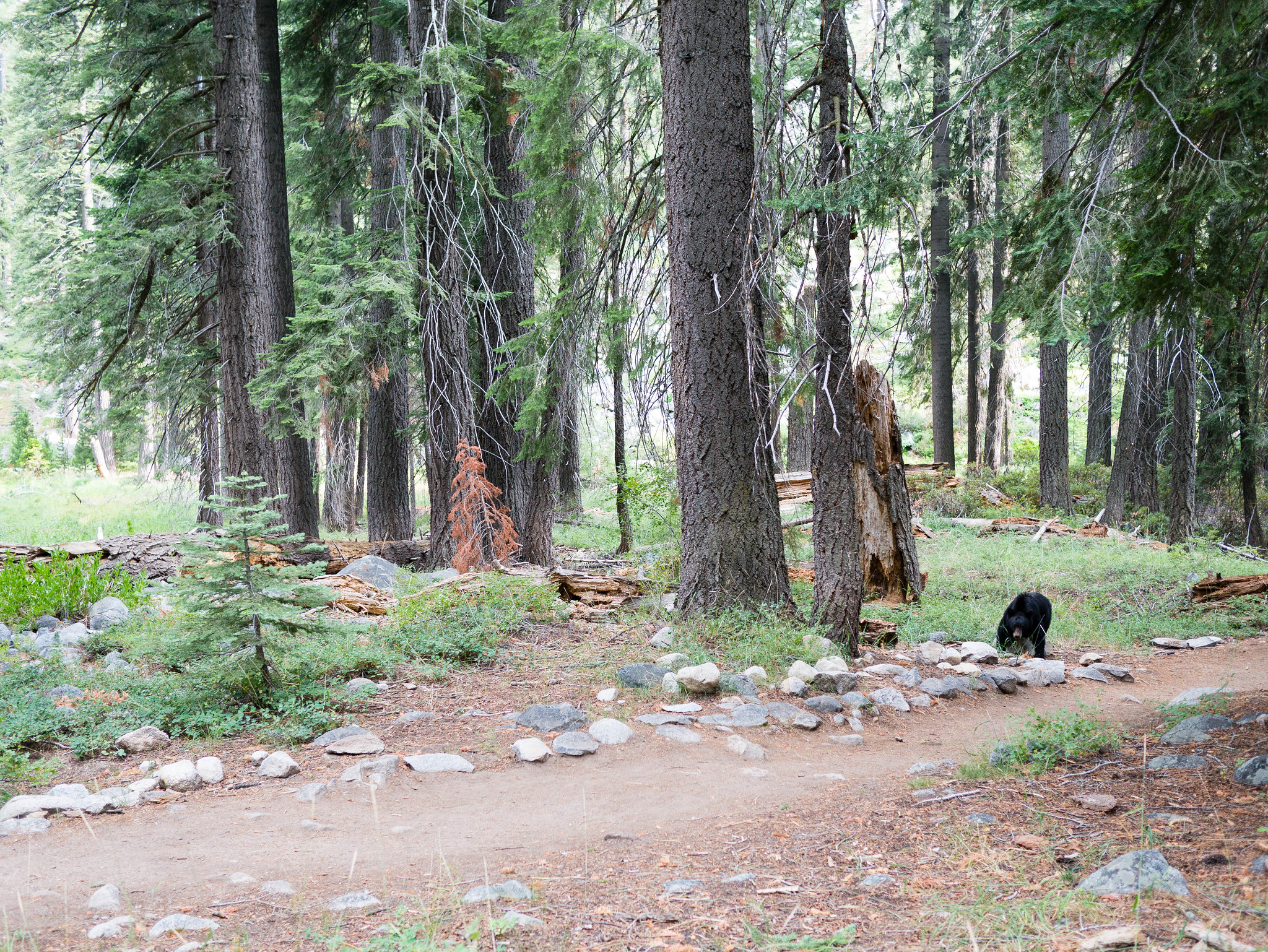 Bears! Mom and two cubs by Maia Averett, on Flickr
We spent the evening grilling and enjoying the last fresh food and beers we’d have for a long while. It was a night for filet eaten with a spoon and spooky stories from the book of Job.
Day 1
Crescent Meadow to Lone Pine Creek
13.1 miles, +3,950ft/-3,250ft
Our first real trail day started out with a bit of a rush to make the shuttle that would take us the 7 road miles over to Crescent Meadow. Bears are common along the road out to Crescent Meadow and this time was no exception. When we spotted a mom and two cubs, the shuttle driver was nice enough to slow down and let us get a good look.
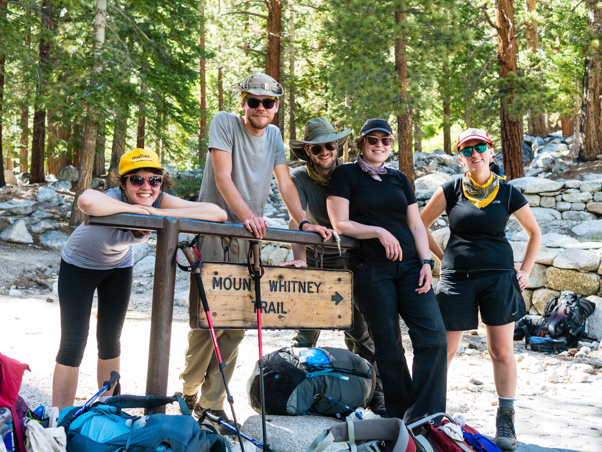
As we slathered ourselves with sunscreen at the trailhead, a group of hikers exited and we snagged one of them to document the start of our journey.
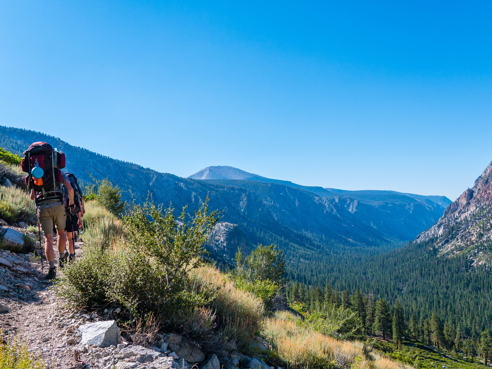
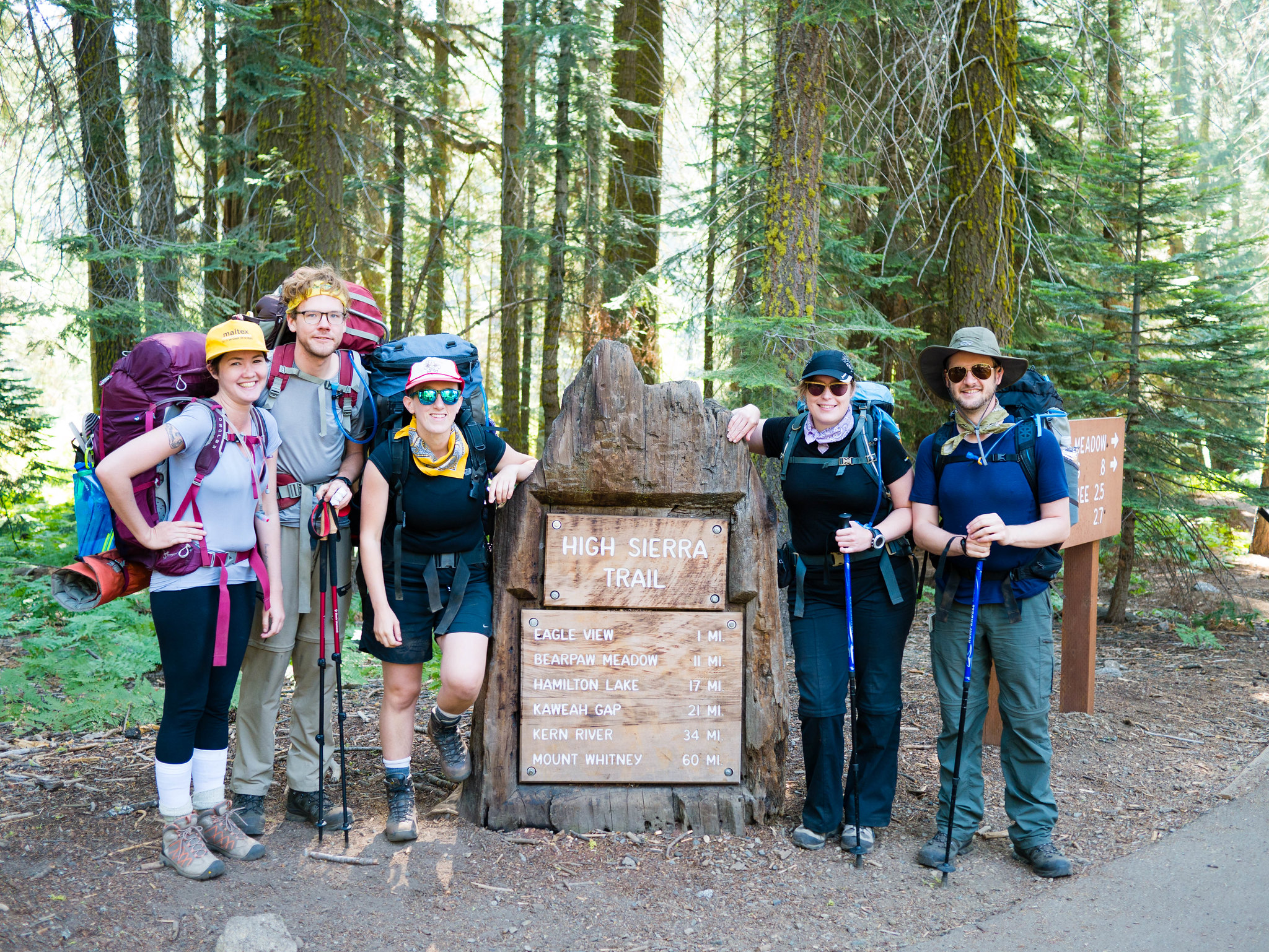 The crew, still relatively clean by Maia Averett, on Flickr
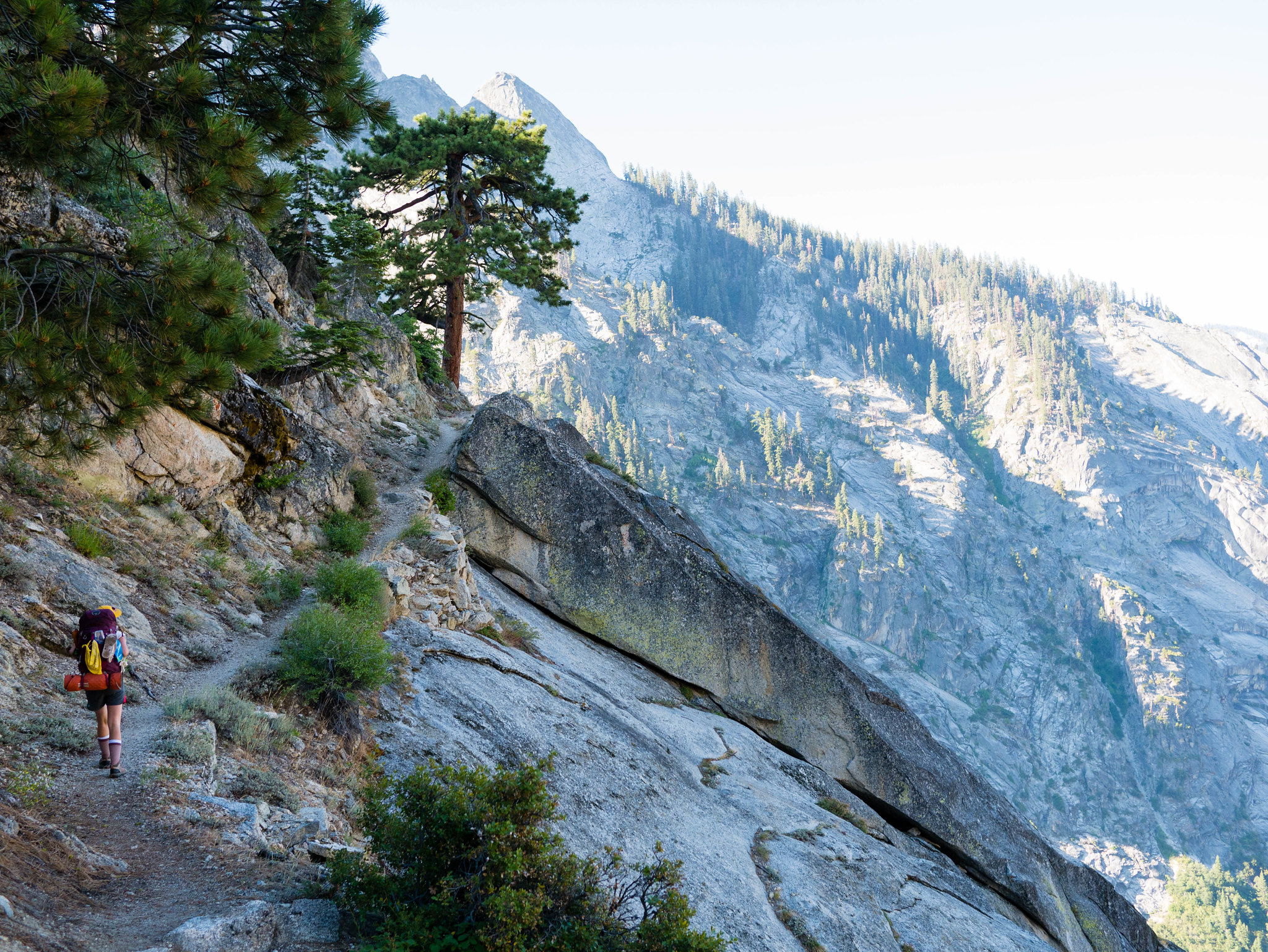
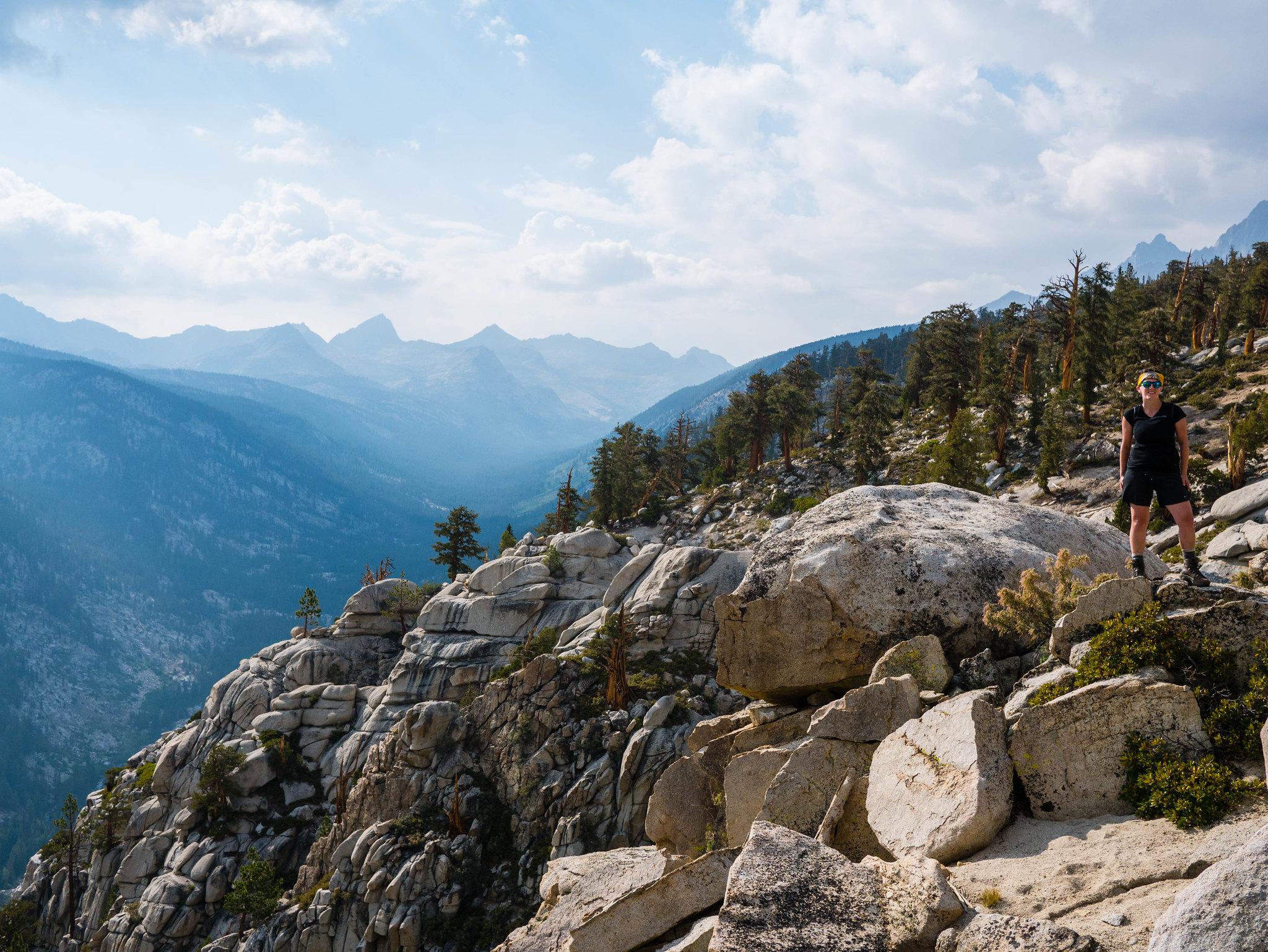
Out of Crescent Meadow, the trail climbs a few hundred feet gently through a pine and fir forest and over a crest at Eagle View, where we got our first look down at the Middle Fork of the Kaweah River that we’d be hiking along for the next 16 miles. The trail was warm and dusty with little shade for large stretches of the 5 miles to Methren Creek.
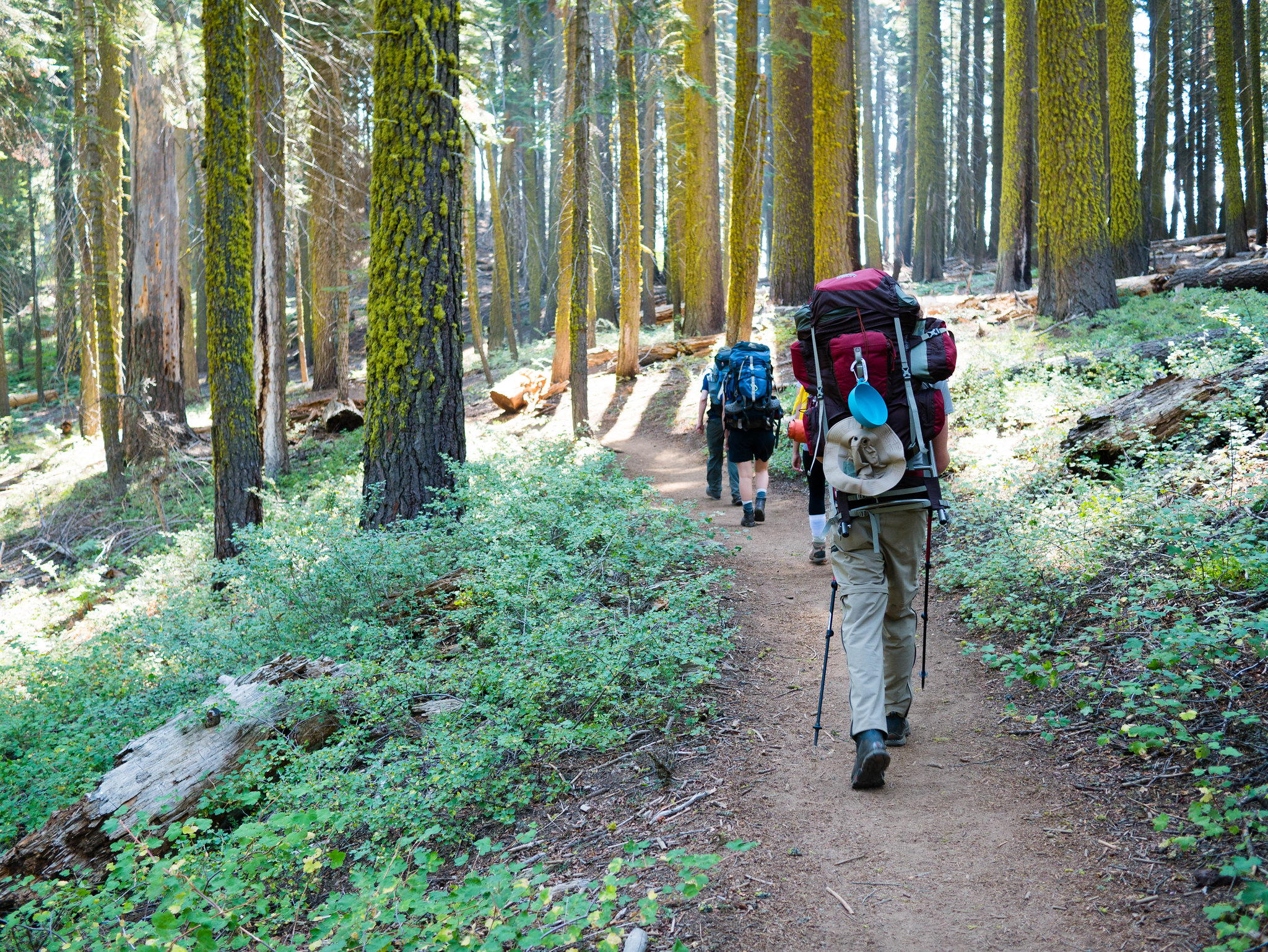 Heading up through beautiful parklike forest. by Maia Averett, on Flickr
We hiked steadily, taking a couple short snack breaks, until we reached Bearpaw. There is a quite developed High Sierra Camp at Bearpaw. Clean, comfortable-looking guests were coming and going from the main cabin as the smell of lasagna wafted from the kitchen. Must be nice to hike without a pack and enjoy a freshly prepared meal before showering and sleeping on a cot! Half of our crew was pretty beat at this point and I had to push pretty hard to get them to hike on beyond Bearpaw. I didn’t want to camp here because the backpacker’s camp is down the hill in the woods with no view. I had my sights set on the sculpted granite views of Lone Pine Creek.
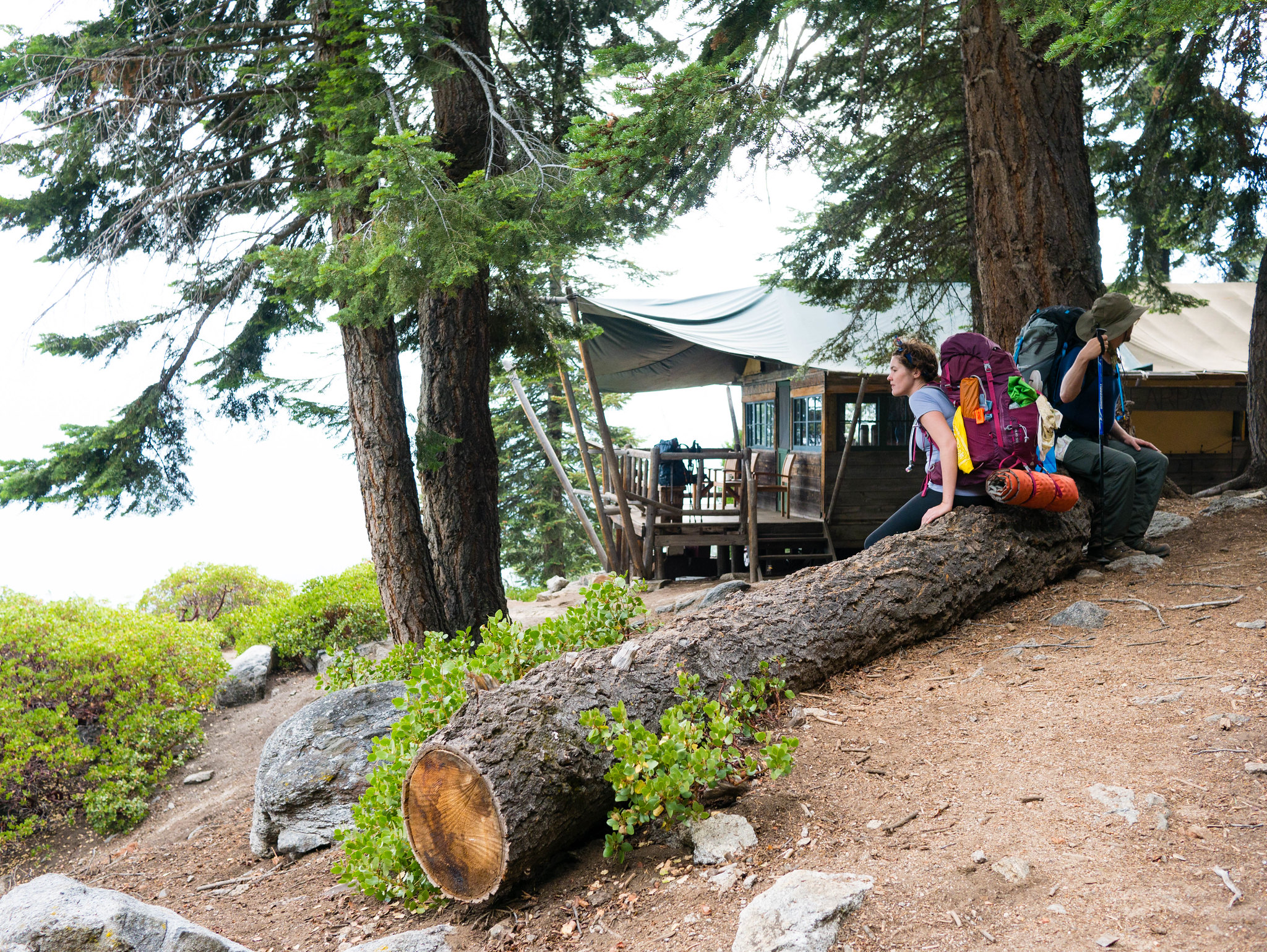 Miranda and Patrick wait and glare at the people who paid $450 a night to eat asparagus and steak packed in buy mule. by Maia Averett, on Flickr
Before setting out on our trip I’d read varying reports of whether camping at Lone Pine Creek was possible, so I was a bit worried about whether or not we’d find a legal place to camp there. About halfway to Buck Creek, we ran into a trail crew member hiking out who told us that it was indeed possible to camp at Lone Pine Creek. Beyond Bearpaw, the sculpted granite valley carved by the Middle Fork of the Kaweah River narrows and becomes more dramatic.
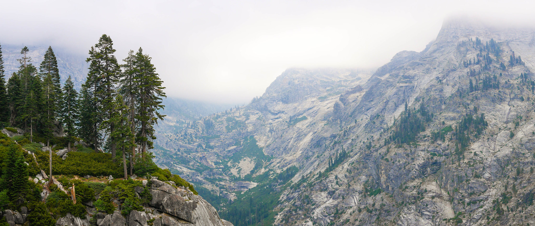 Looking up the Hamilton Creek drainage by Maia Averett, on Flickr
The trail maintenance dude had said that after the bridge over Lone Pine Creek, the trail bends to the left and that few hundred feet up beyond the bend, there’s a spot to camp to the right of the trail. We found it indeed! Here’s a satellite screen grab that shows where it is.
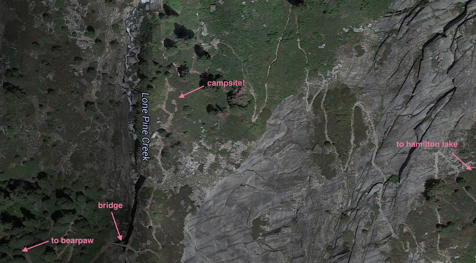 lone_pine_creek_camp by Maia Averett, on Flickr
The campsite is in the low bushes pretty close to the trail between the bridge over Lone Pine Creek and the junction with the trail that goes up to Elizabeth Pass. There is no water directly at the campsite and Lone Pine Creek isn’t accessible there, but up the valley a bit on the trail towards Elizabeth Pass, there are several streams that flow right across the trail. We had no trouble getting water here, even though it was August of a dry year.
Laurel and Nathan were using a tarp and this site provided little in the way of good anchors, but we were able to find a passable spot for them between some trees a bit farther up the trail. We went about the business of setting up camp and having dinner and then tucked in to bed at about 8:30pm, completely wiped.
Day 2
Lone Pine Creek to Precipice Lake
5.9 miles, +3,500ft/-600ft HST_2
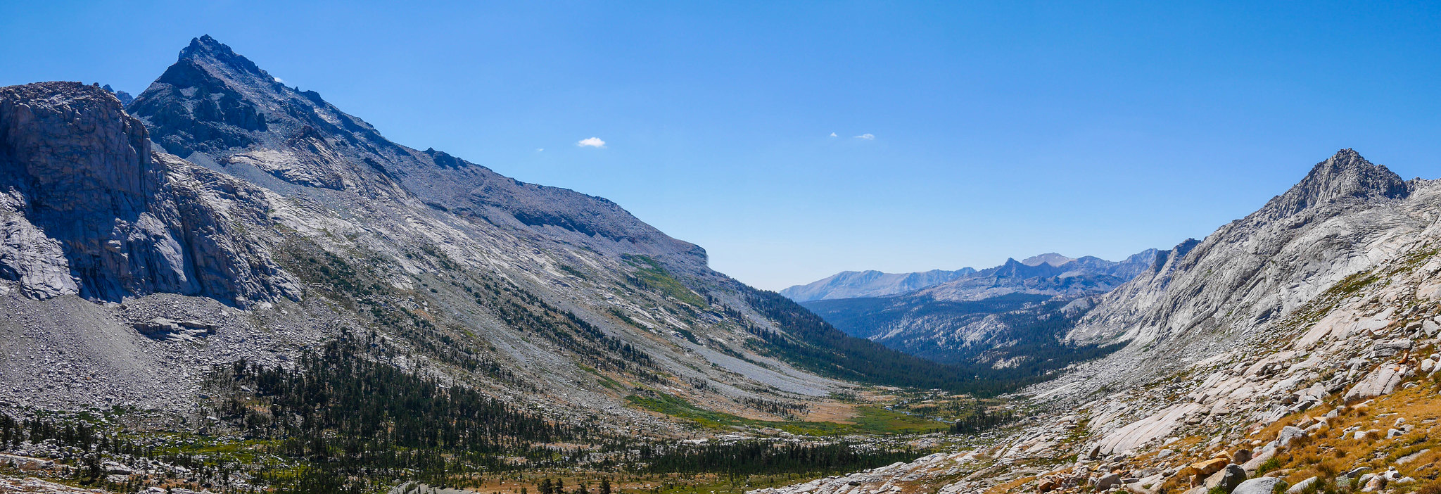
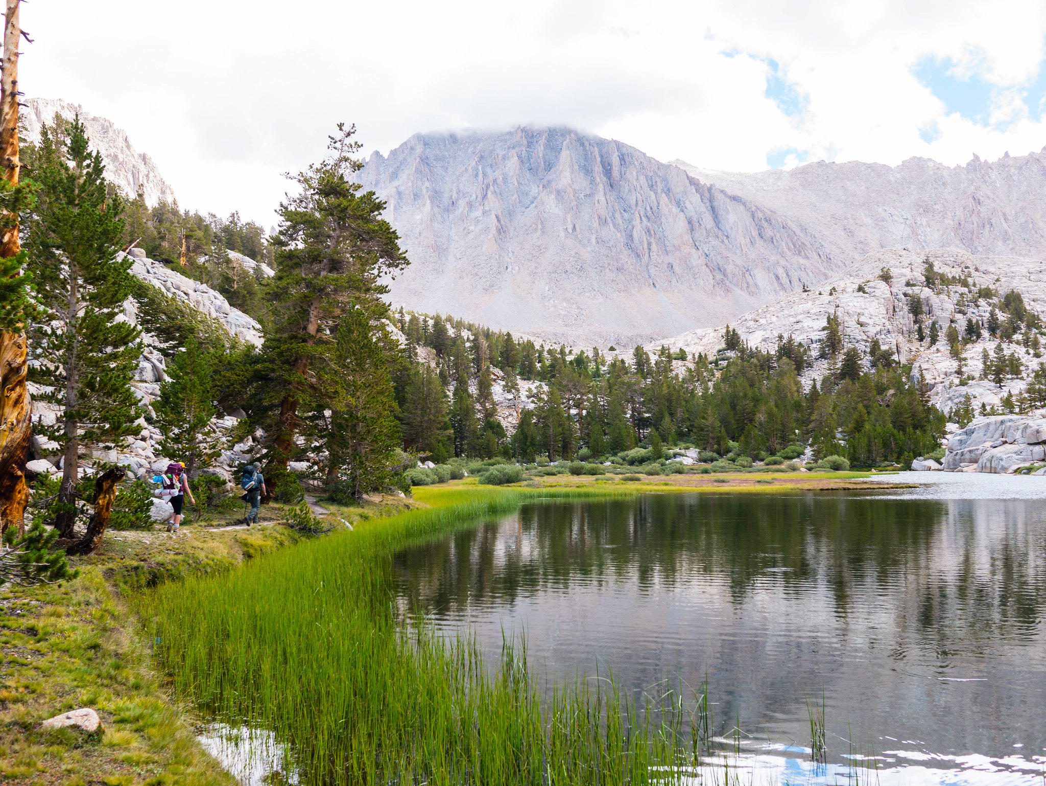
The plan for our second day on the High Sierra Trail was to head up to Precipice Lake. Though not far in terms of distance, it does entail a climb of 3,500 vertical feet. We woke not long after sunrise and started out on the trail after a quick breakfast. The trail switches back and forth the east slope above Lone Pine Creek before turning east in earnest towards Valhalla. As it turns the corner, gorgeous views of the Middle Fork open up.
 Heading up towards Hamilton Lake from Lone Pine Creek by Maia Averett, on Flickr
We crossed Hamilton Creek without trouble, knowing that only a few hundred feet remained ahead of us before we could lounge and swim at Hamilton Lake. We spent a few hours swimming and relaxing at Hamilton. The water was cool and clear and we all jumped in in our skivvies, scrubbed them out, and hopped out bare to hang our laundry and bask in the sun.
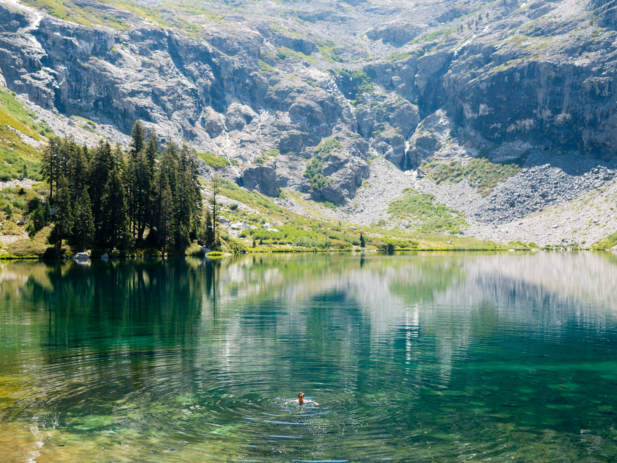 Hamilton Lake by Maia Averett, on Flickr
Since it was late morning, the view of the cliffs behind Hamilton up towards Precipice were in shadow. I’d love to come visit Hamilton again late in the day the whole bowl is glowing in the evening light. Around 1pm we packed up and crossed Hamilton’s outlet stream to begin the long slog up to Precipice Lake. I loved this part of the trail—it was just my style, open, exposed, rocky, with grand views in every direction.
 Climbing from Hamilton to Precipice by Maia Averett, on Flickr
Some of us were less enthused about the climb.
 It's how far now? by Maia Averett, on Flickr
This part of the trail is a marvel of construction. It took three seasons of construction to complete, culminating with an expensive suspension bridge that took over 200 mule loads of construction material. That bridge only lasted five seasons before being destroyed in an avalanche. The permanent replacement for the bridge was to blast an avalanche-proof tunnel out of the rock.
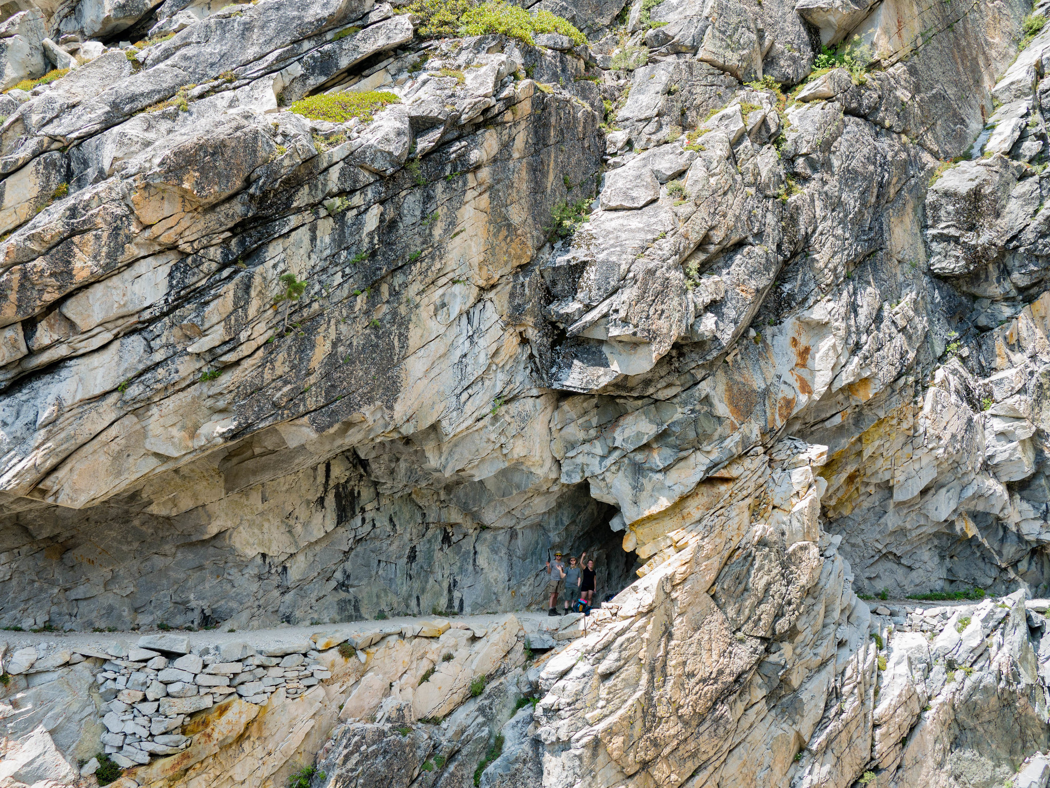 A tunnel on the trail! by Maia Averett, on Flickr
Thunderheads were gathering in the peaks above Precipice Lake and I was worried about getting caught in a storm. Precipice Lake has a few campsites, but there isn’t any protection from lightning since it’s above treeline. But where we were was no better—we had nowhere to pitch even the simplest of shelter on the cliffy climb from Hamilton to Precipice, so we pushed on.
We ended up making it to Precipice Lake, crossing its outlet stream, and snagging a couple flat areas to set up camp just before a storm rolled in. We holed up in our tent alternately napping and counting seconds between lightning and thunder and having meltdowns about the proximity of the storm. Finally, the storm cleared and we emerged to find the cloud layer just feet above our camp.
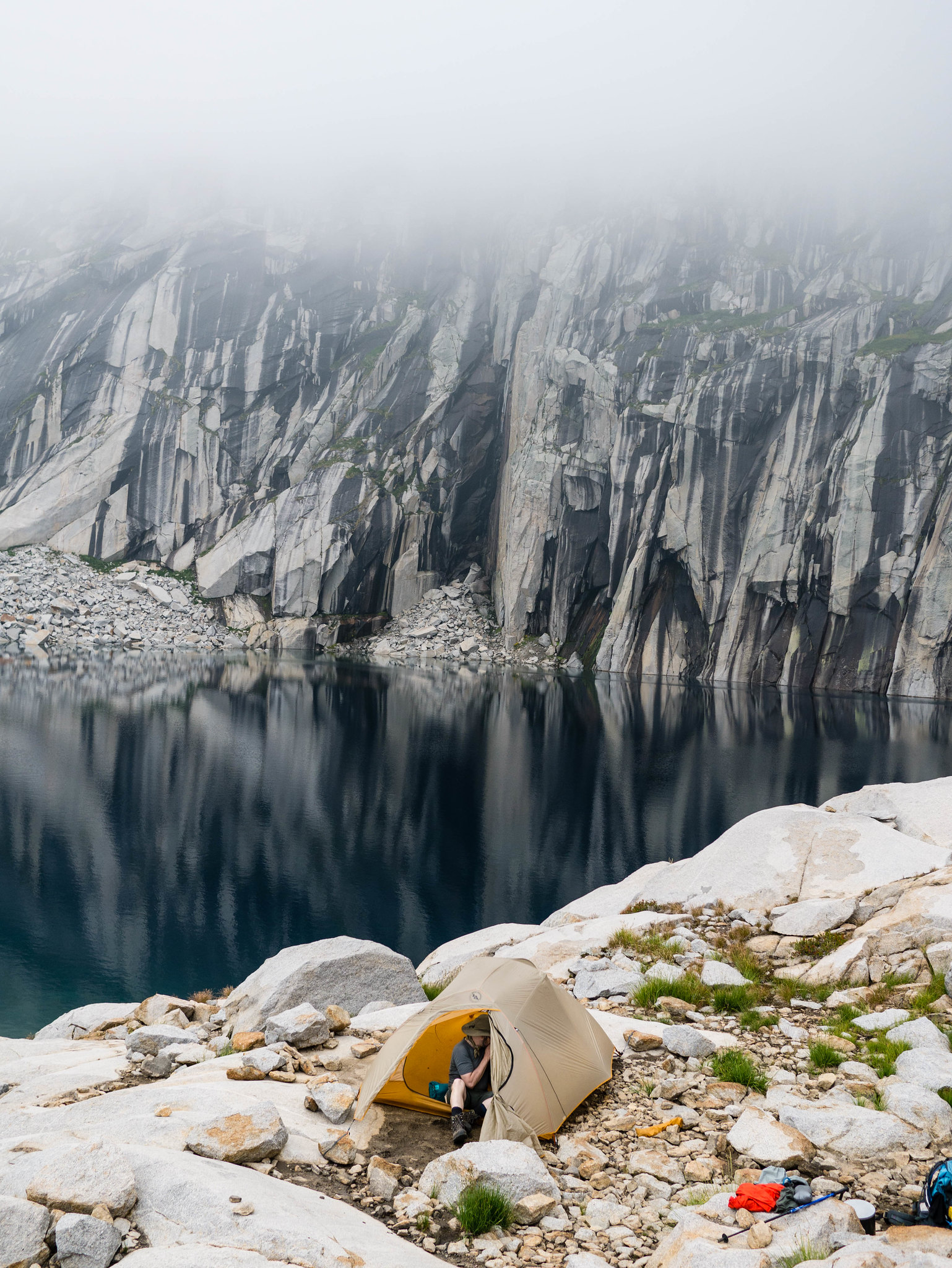 We were about twenty feet below the cloudline! by Maia Averett, on Flickr
Around 6pm the clouds broke and treated us to a gorgeous view looking down over Valhalla and the trail we traipsed in on. We did a bit of exploring, snapping photos of the classic scene that inspired Ansel Adams. Nathan had a moment with a tiny li’l salamander buddy. As the sun set, the entire rocky bowl was set afire with alpenglow. It occurred to me that I was now standing on the very rocks that I saw lit up with such neon intensity from Moose Lake earlier in the summer.
 Post-storm beams by Maia Averett, on Flickr
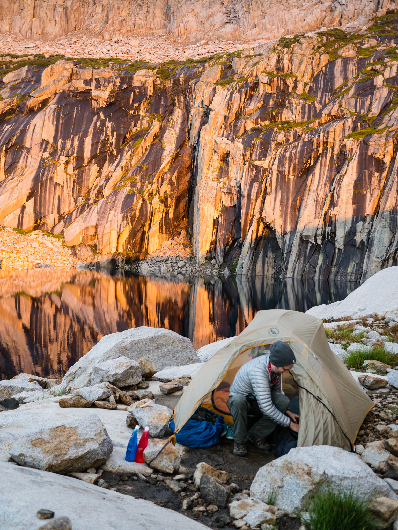 We are IN the alpenglow! by Maia Averett, on Flickr
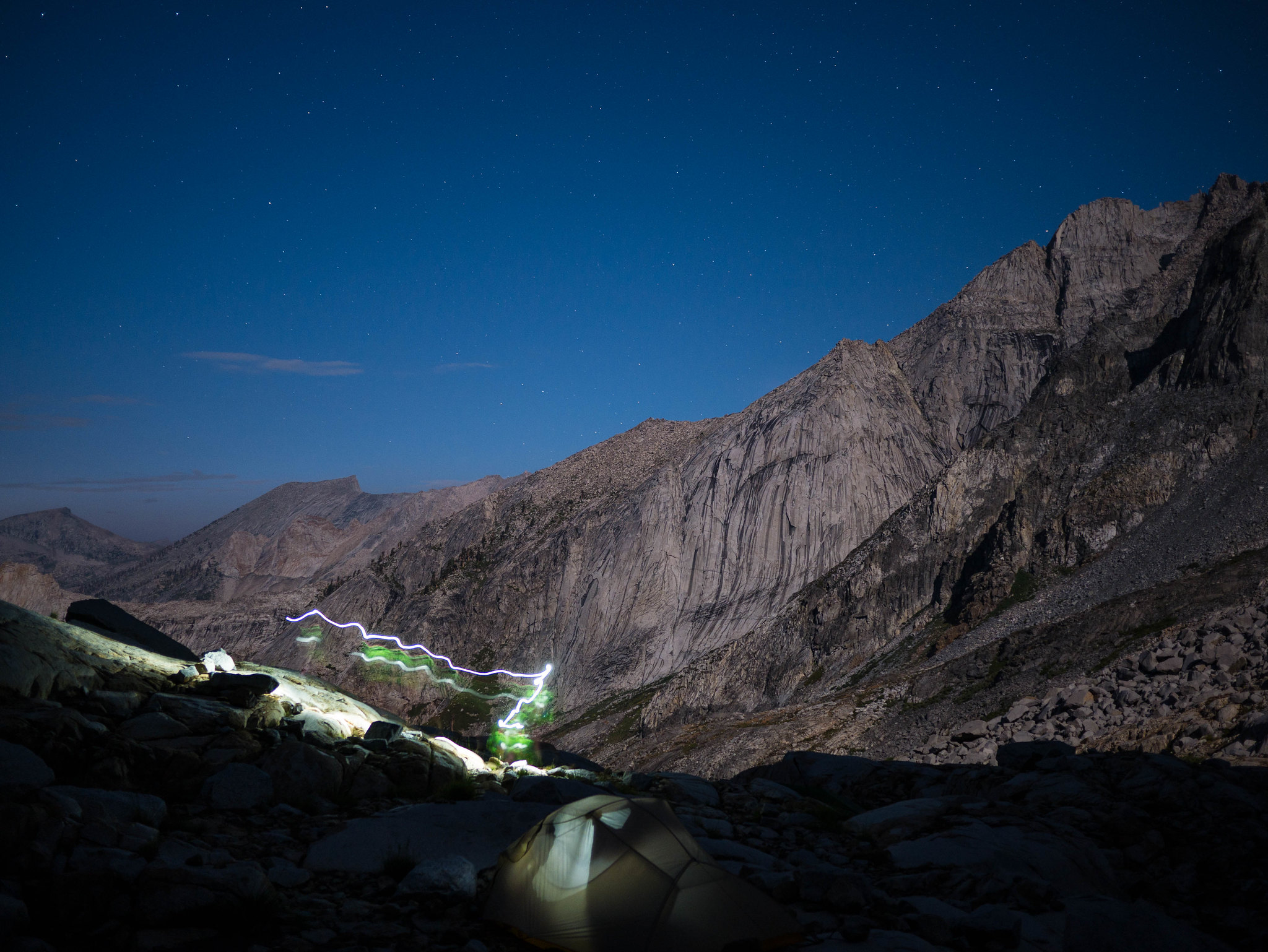 Playing with long-shutter nighttime shots lit by the moon. by Maia Averett, on Flickr
Day 3
Precipice Lake to Moraine Lake
11.8 miles, +1,850ft/-2,900ft
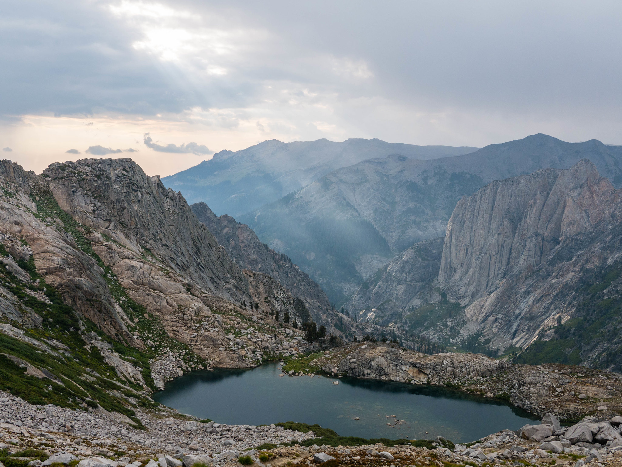
The morning was unbelievably clear. We had breakfast and got going a bit later than I’d hoped. We had a long day ahead of us. The trail heads up a bit from Precipice Lake to cross the Great Western Divide at the Kaweah Gap. As we approached the Kaweah Gap, we could see the volcanic rock of the Kaweahs peeking behind the granite of the shoulders of Mt Stewart and Eagle Scout Peak, who had been our neighbors up until now.
 Hiking up and over the Kaweah Gap by Maia Averett, on Flickr
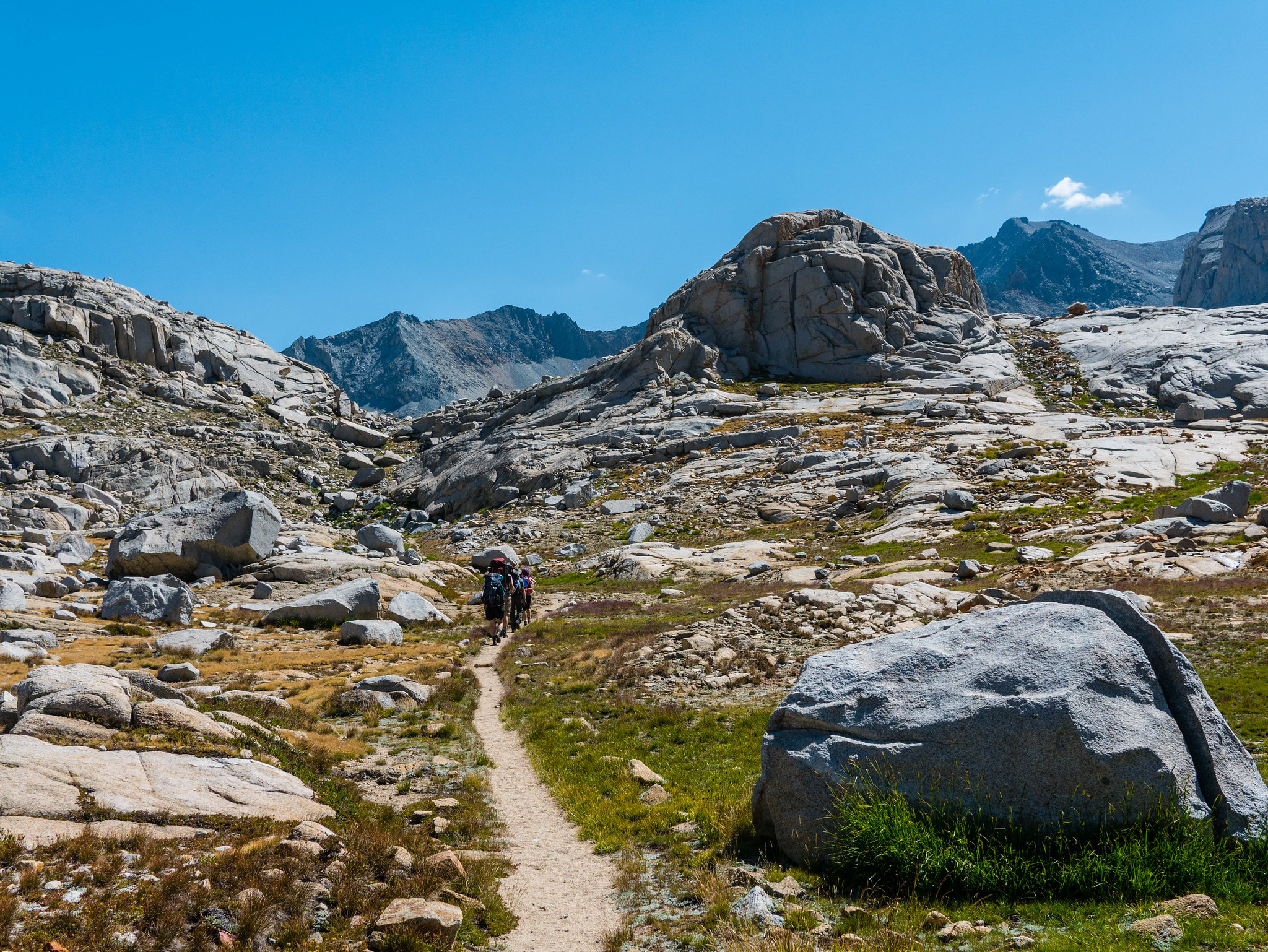 Hiking up and over the Kaweah Gap by Maia Averett, on Flickr
When we crossed and looked south down into Big Arroyo I just [heart eyes emoji x385341]. Now this.. this is my jam. Just at the curve of that slope! And to the east was the 9 Lakes Basin, a place I need to get back to explore someday.
 Our first look at Big Arroyo from the Kaweah Gap by Maia Averett, on Flickr
We started making our way down Big Arroyo and I soon fell behind. I just couldn’t stop taking photos. I was in love with this valley.
 Big Arroyo by Maia Averett, on Flickr
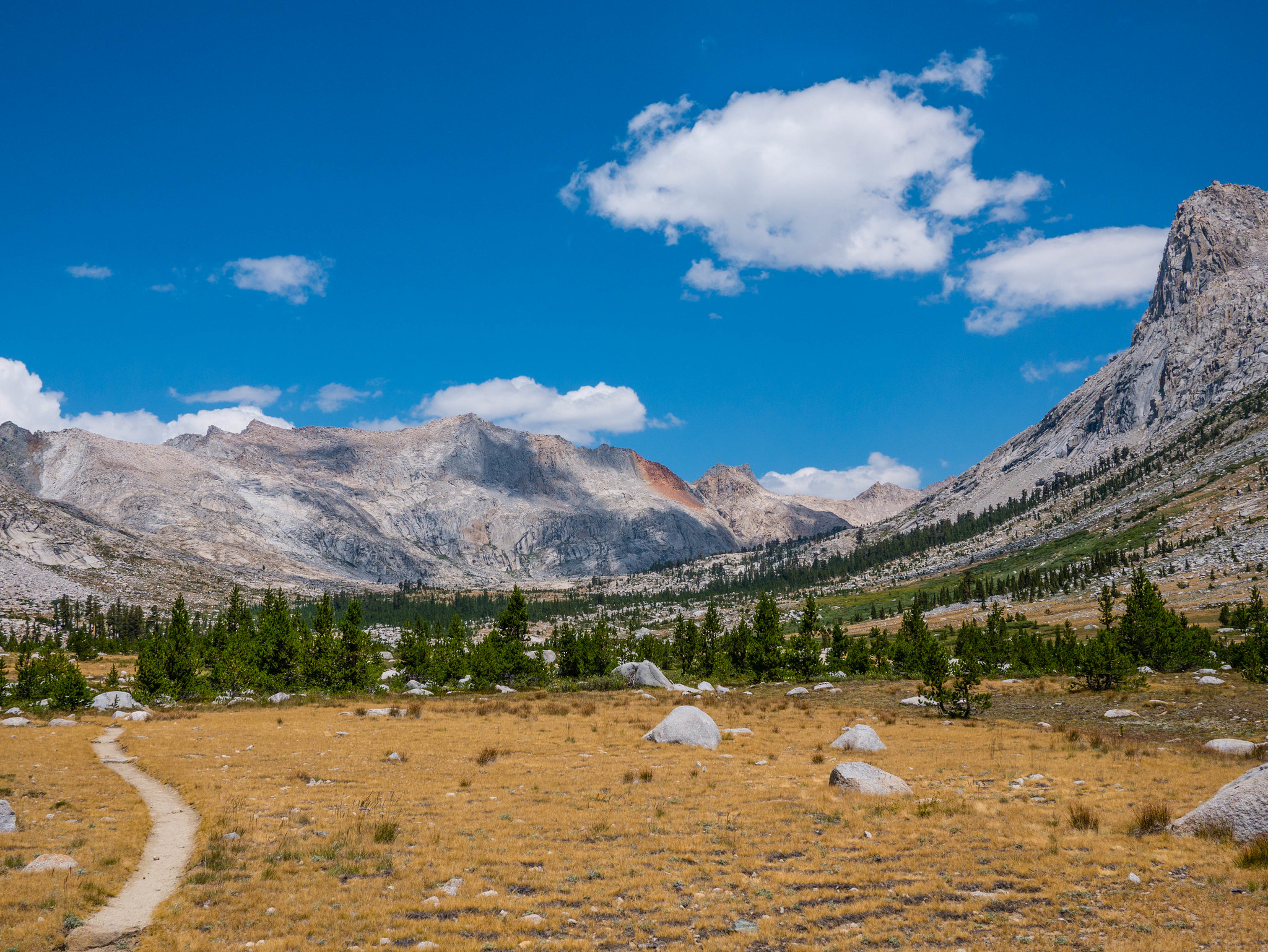 Looking back up towards the 9 Lakes Basin from the trail towards Big Arroyo by Maia Averett, on Flickr
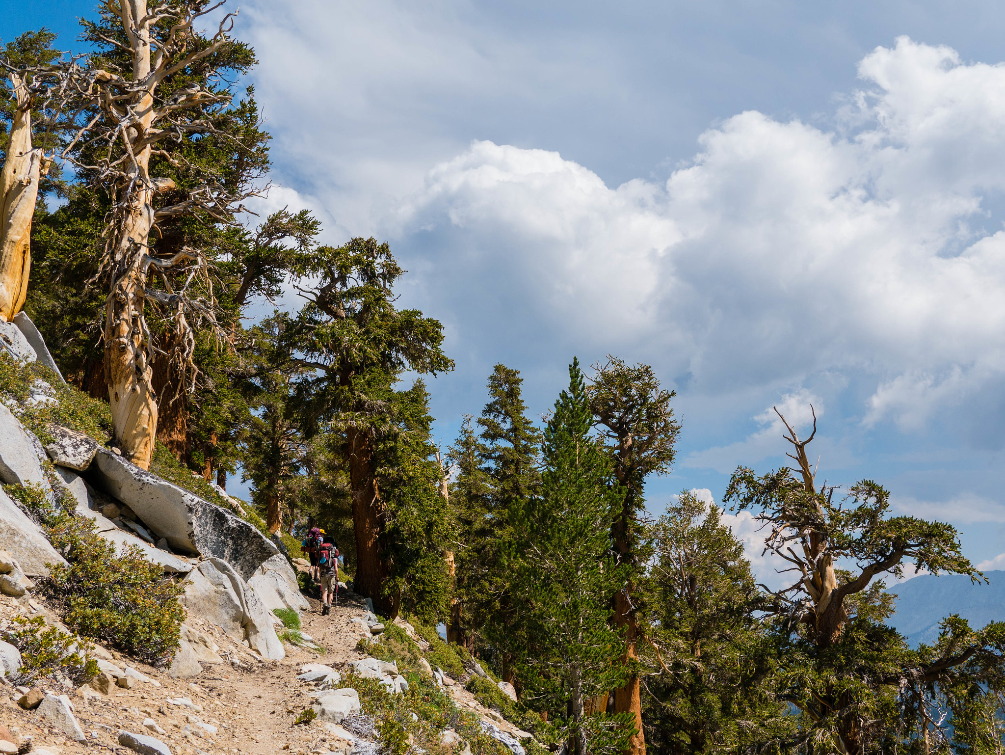
Eventually I caught up with everyone. We crossed the Big Arroyo stream and began climbing up the eastern valley wall through gnarled foxtail pines towards the Chagoopa Plateau. When we reached the top of the climb and were on the plateau proper, I was surprised by how much I adored this forest. It was so quiet, so high up, so perfectly balanced between being thick with foxtail pines and open without underbrush.
 Climbing out of Big Arroyo amidst twisted foxtail pine by Maia Averett, on Flickr
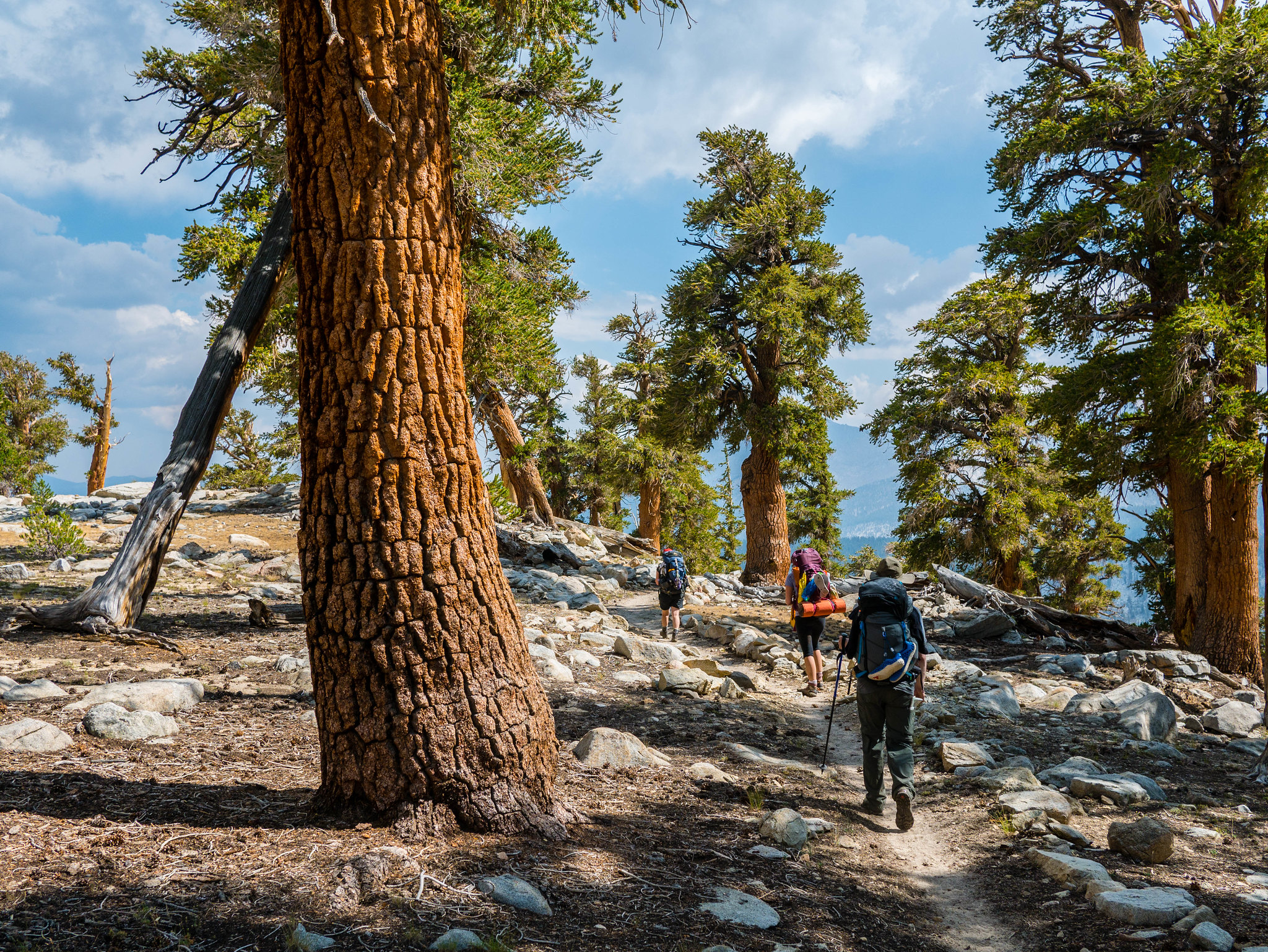 Amazing open forest on the Chagoopa Plateau by Maia Averett, on Flickr
The sun was getting low in the sky and some dark clouds were gathering to the west out towards Mineral King, so we hoofed it down towards Moraine Lake, stopping briefly to look down over Big Arroyo and admire the valley we’d hiked down all day. Moraine Lake was a disappointment. It was low from the drought, buggy, and surrounded by trees. On top of that, it was raining. We set up camp quickly and tucked in for the night.
 We had to go over to the edge and look out towards Mineral King by Maia Averett, on Flickr
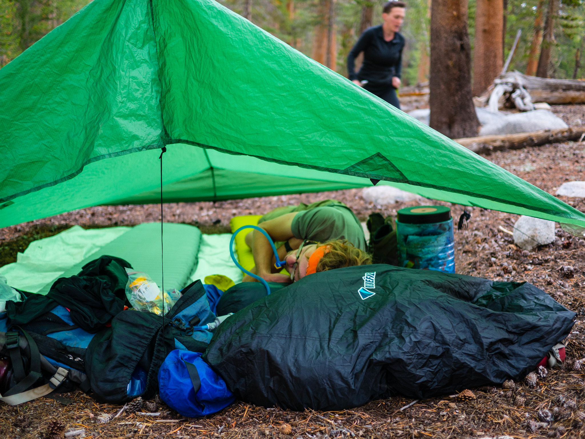 Nathan suckling on momma platypus by Maia Averett, on Flickr
Day 4
Moraine Lake to Junction Meadow
14.8 miles, +1,650ft/-2,850ft
I woke early to catch the sunrise alpenglow on the mountains peeking above the trees around Moraine Lake.
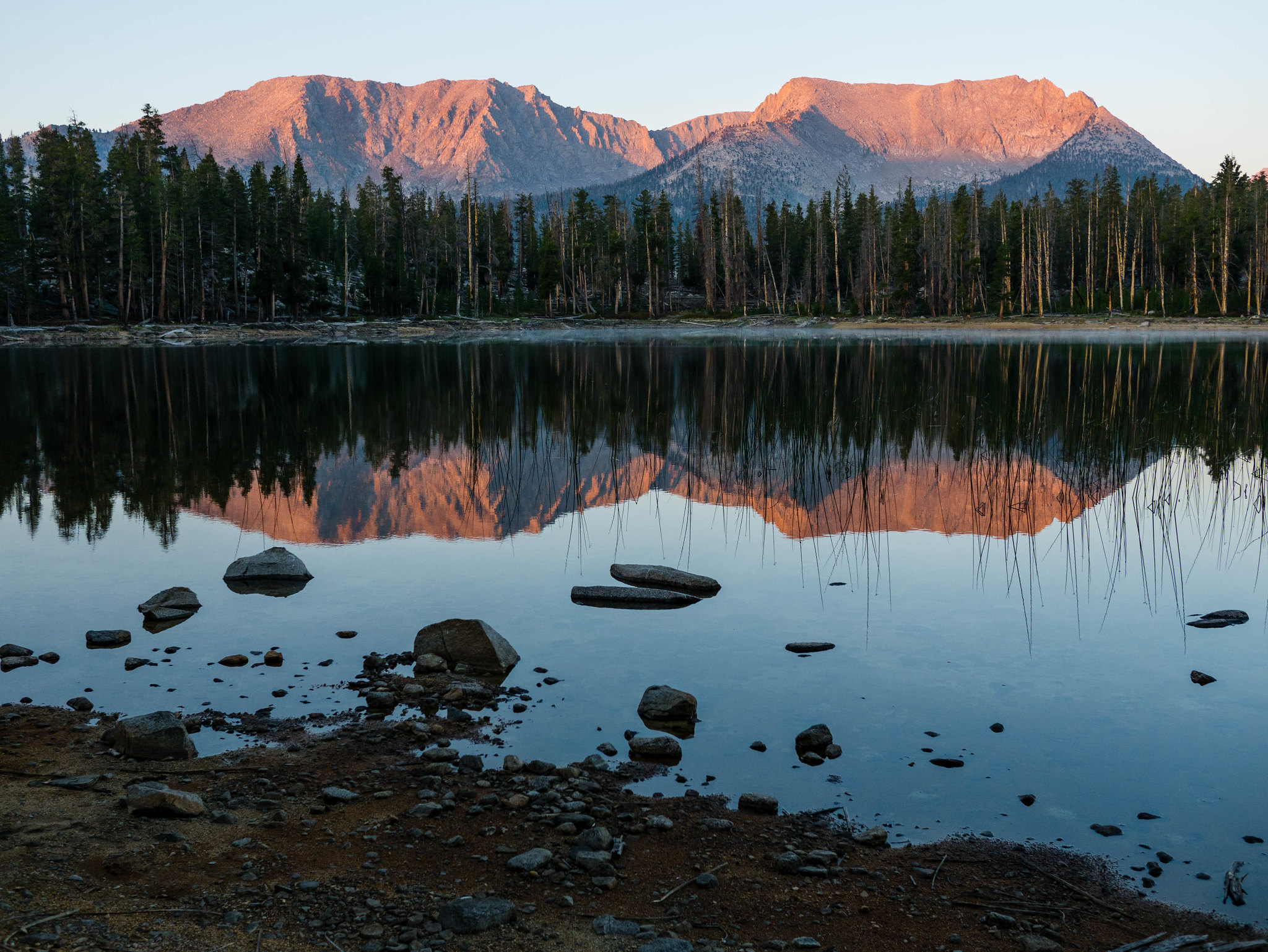 Morning alpenglow at Moraine Lake by Maia Averett, on Flickr
We breakfasted, packed up camp, and headed southeast skirting some meadows. We lost the trail for a bit in an area that had a lot of downed trees, but we picked it up again without too much difficulty. As the trail begins to descend the sandy slopes of the eastern Chagoopa Plateau, the high country across Kern Canyon becomes visible. The view down the canyon is impressive on the steep descent.
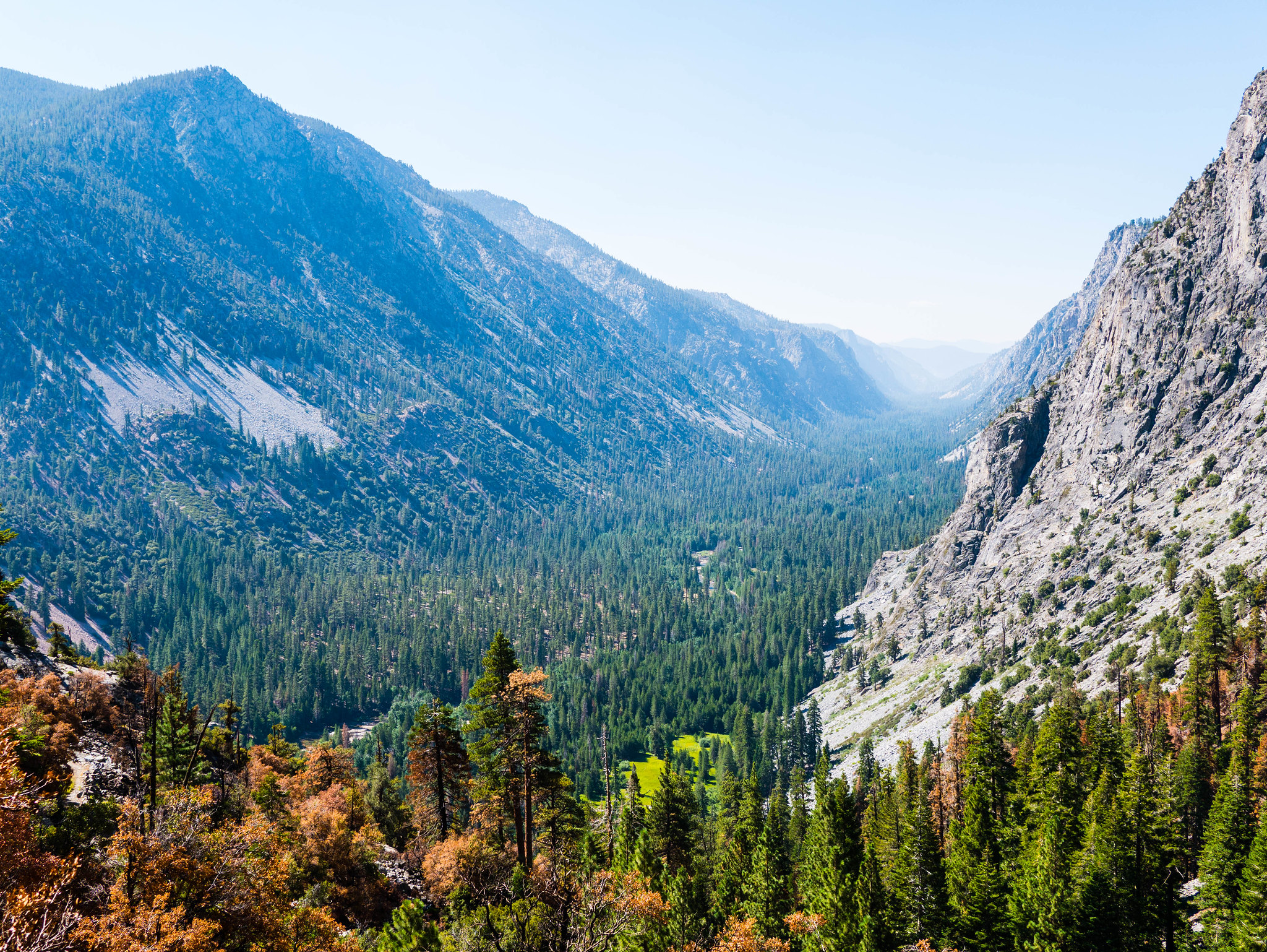 Descending into Kern Canyon by Maia Averett, on Flickr
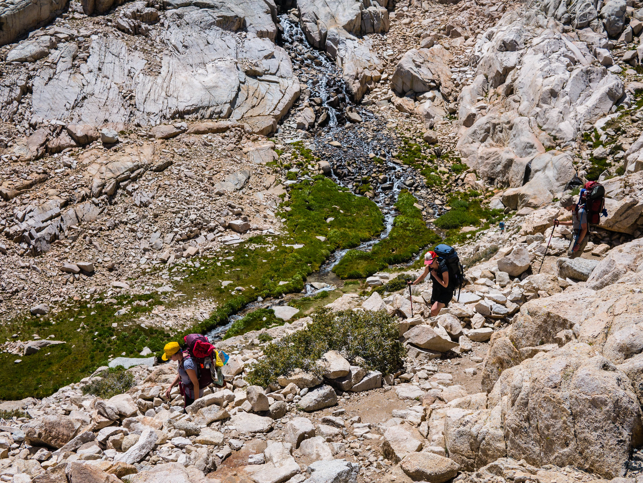
Once down at the bottom of the canyon, the trail follows the Kern River upstream. It’s quite an impressive hike with the powerful Kern River and steep canyon walls. The trail is on the east side of the river and crosses several streams as it makes its way north up the canyon. Some of these crossings would not be so fun at peak snowmelt, but they were easy for us in August.
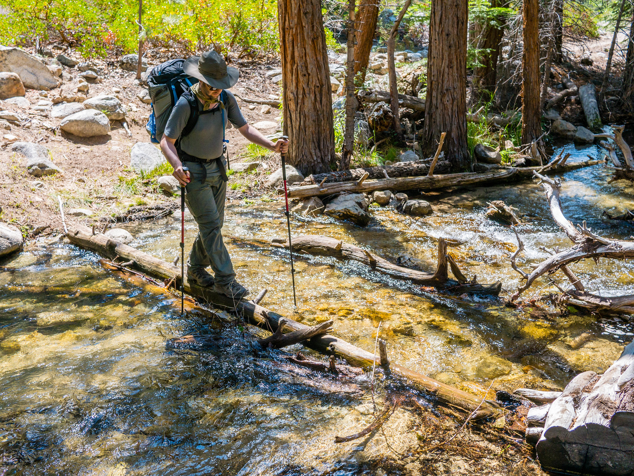 One of about a thousand stream crossings as we made our way up Kern Canyon. by Maia Averett, on Flickr
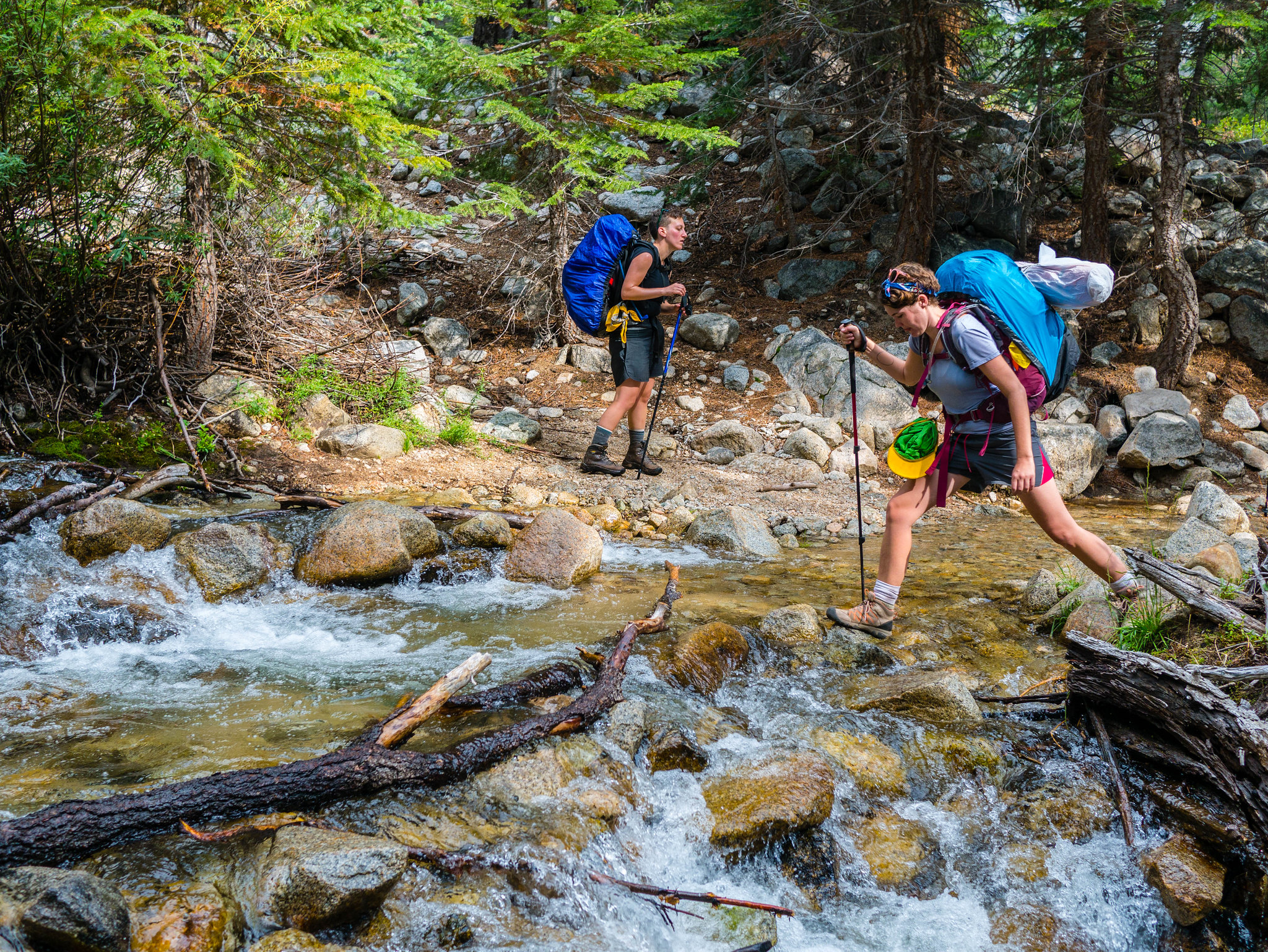 More stream crossings! by Maia Averett, on Flickr
About halfway up the canyon, there is a hot spring, complete with a tub! Oh, the joy of a hot soak after all those trail miles. We took turns soaking in the tub and scrubbing out our laundry before continuing on up the canyon.
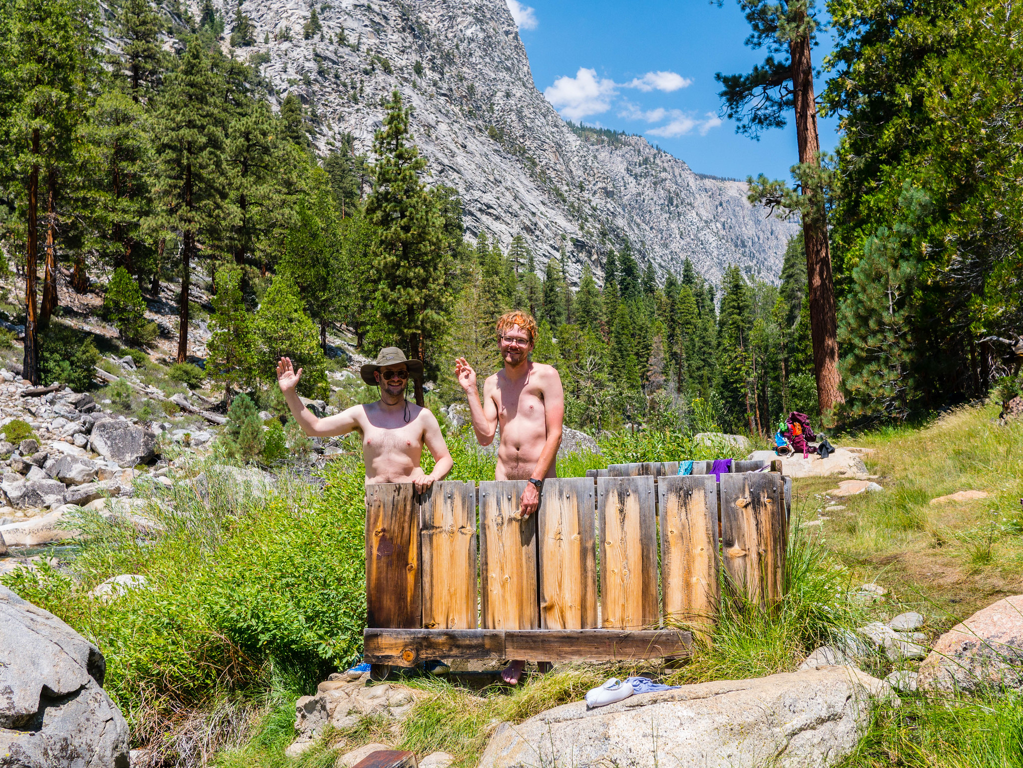 Boys of summer by Maia Averett, on Flickr
This afternoon and evening hike up the canyon was tense—some of us were tired, but we also knew that we wanted to make it to Junction Meadow before dusk. Hiking with a group can be hard when people have differing levels of stamina. I had trained a lot and had to try hard not to lose my patience with those who hadn’t prepared as well. In the end, we made it to Junction Meadow, though Miranda had some stress-related tummy troubles that made her pretty miserable.
 Open forest in Kern Canyon by Maia Averett, on Flickr
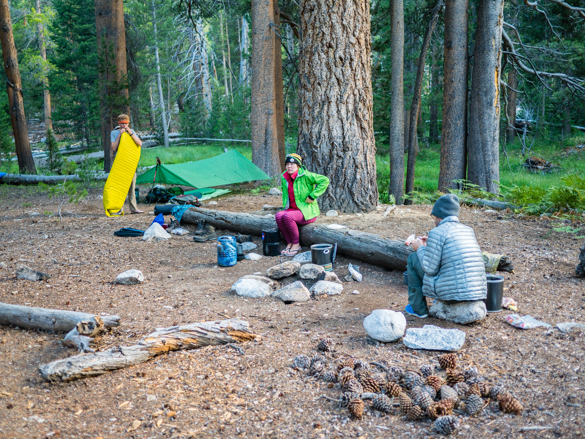 Kamp at Junction Meadow after a really long day. by Maia Averett, on Flickr
Camping at Junction Meadow was utilitarian. There were lots of other groups all around and we even ran into a ranger who checked our permit.
Day 5
Junction Meadow to Wallace Creek/JMT
4.5 miles, +2,400ft/-100ft
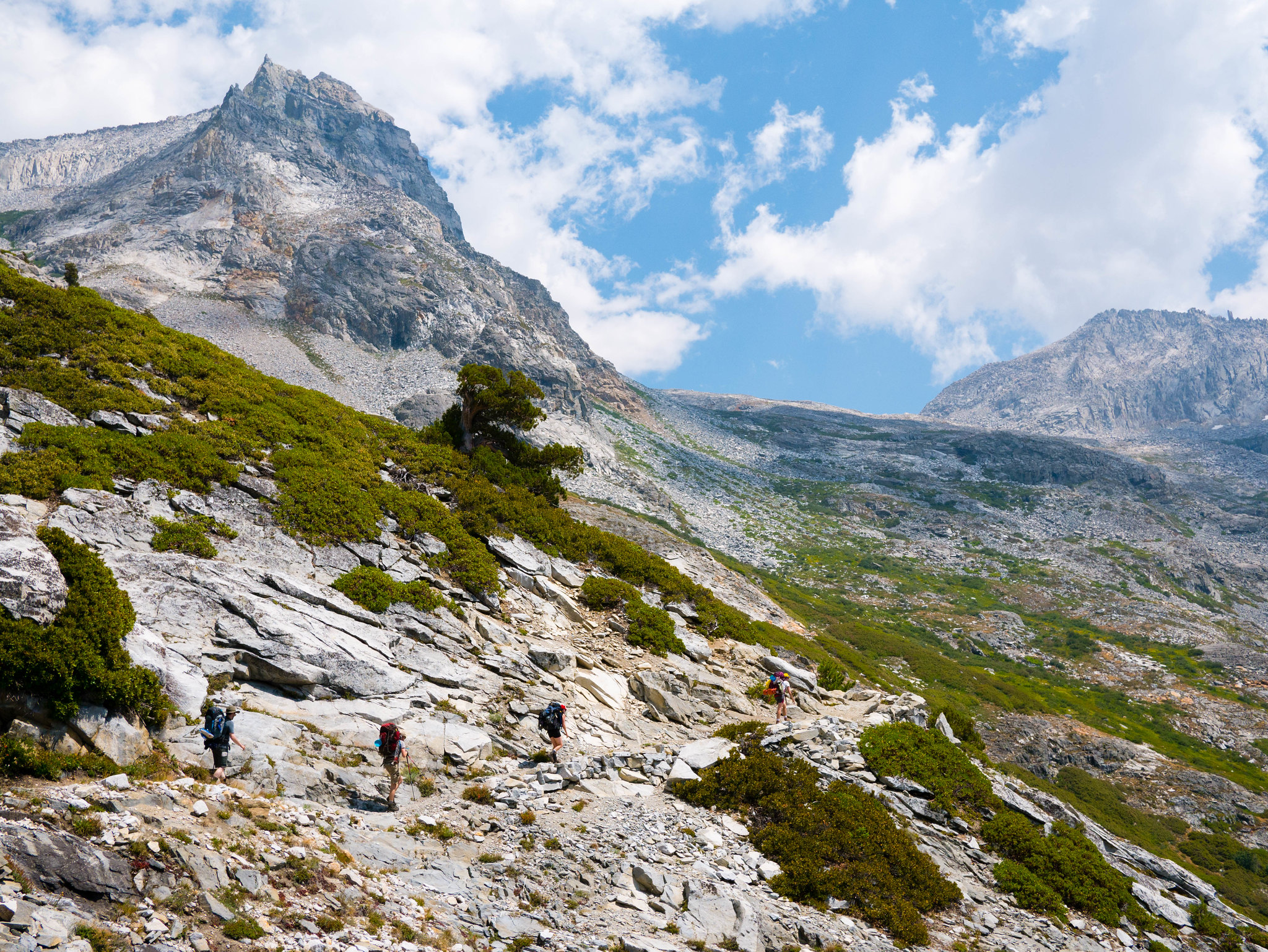
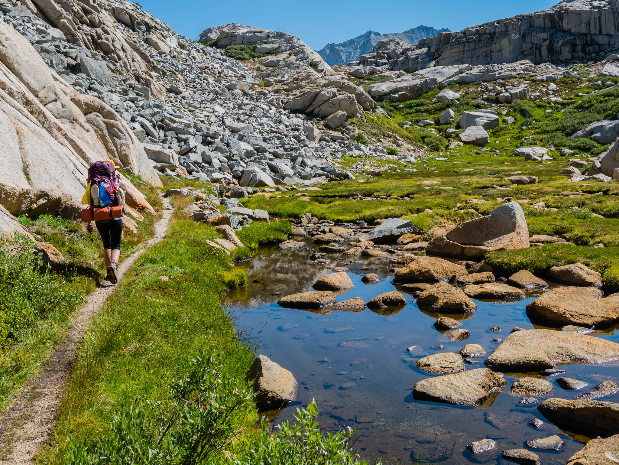
After a good night’s rest, everyone was feeling rejuvenated. Good thing, since we had a reasonably big climb today. Similar to our second day, we had a lot of vertical to gain but not so much distance to cover. I’d planned on this being a half-day to allow us some leeway in case we didn’t make it to Junction Meadow the night before. The trail climbs a bit more than moderately up above the Kern before cutting east for a more gradual ascent along Wallace Creek.
 Climbing out of Kern Canyon and up Wallace Creek by Maia Averett, on Flickr
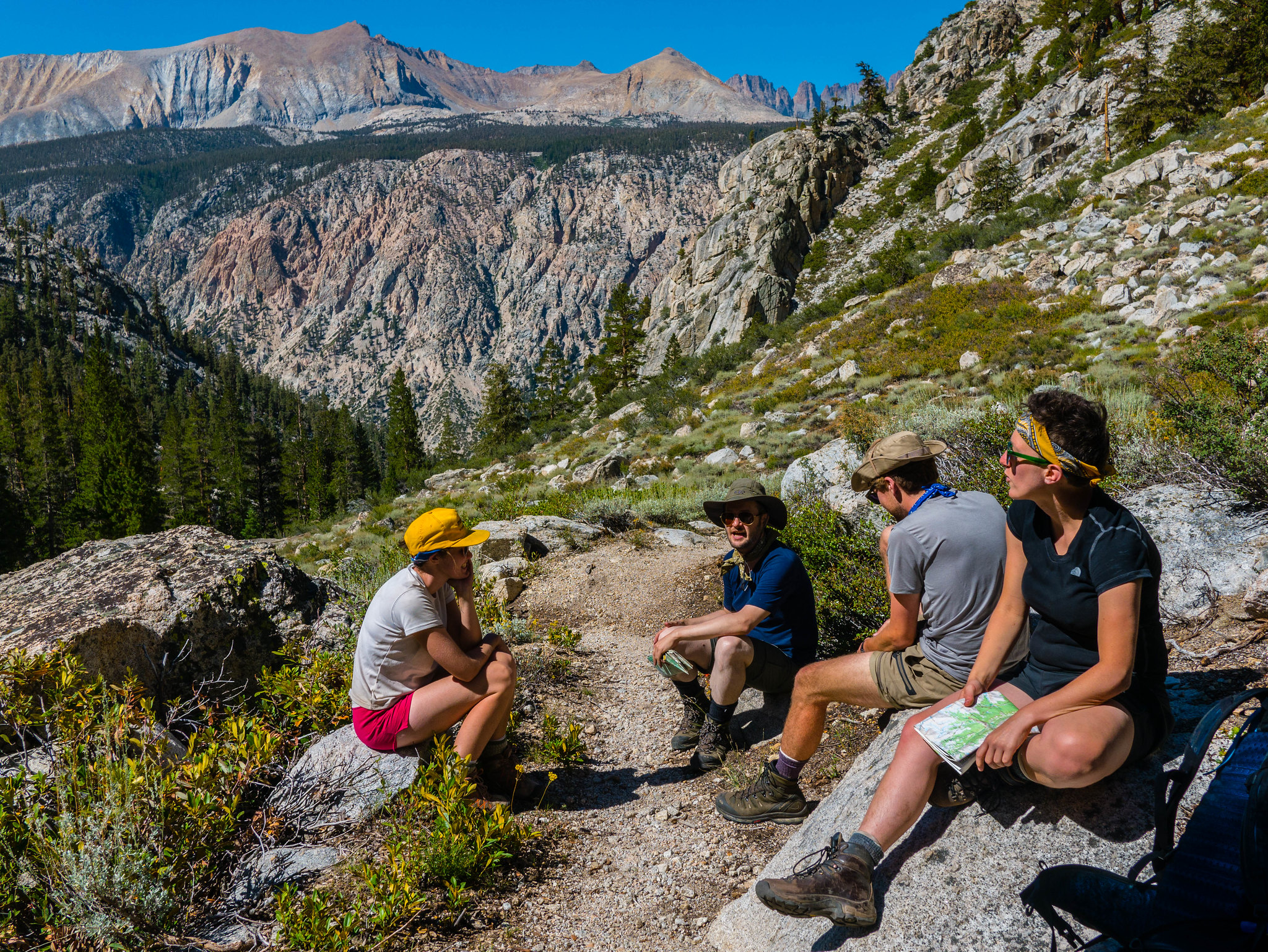 Climbing out of Kern Canyon and up Wallace Creek by Maia Averett, on Flickr
The ascent east up along Wallace Creek provides some great views across back towards the Kaweahs, which we’re now looking at from the opposite side, pretty much due east of where we were in the morning of Day 3.
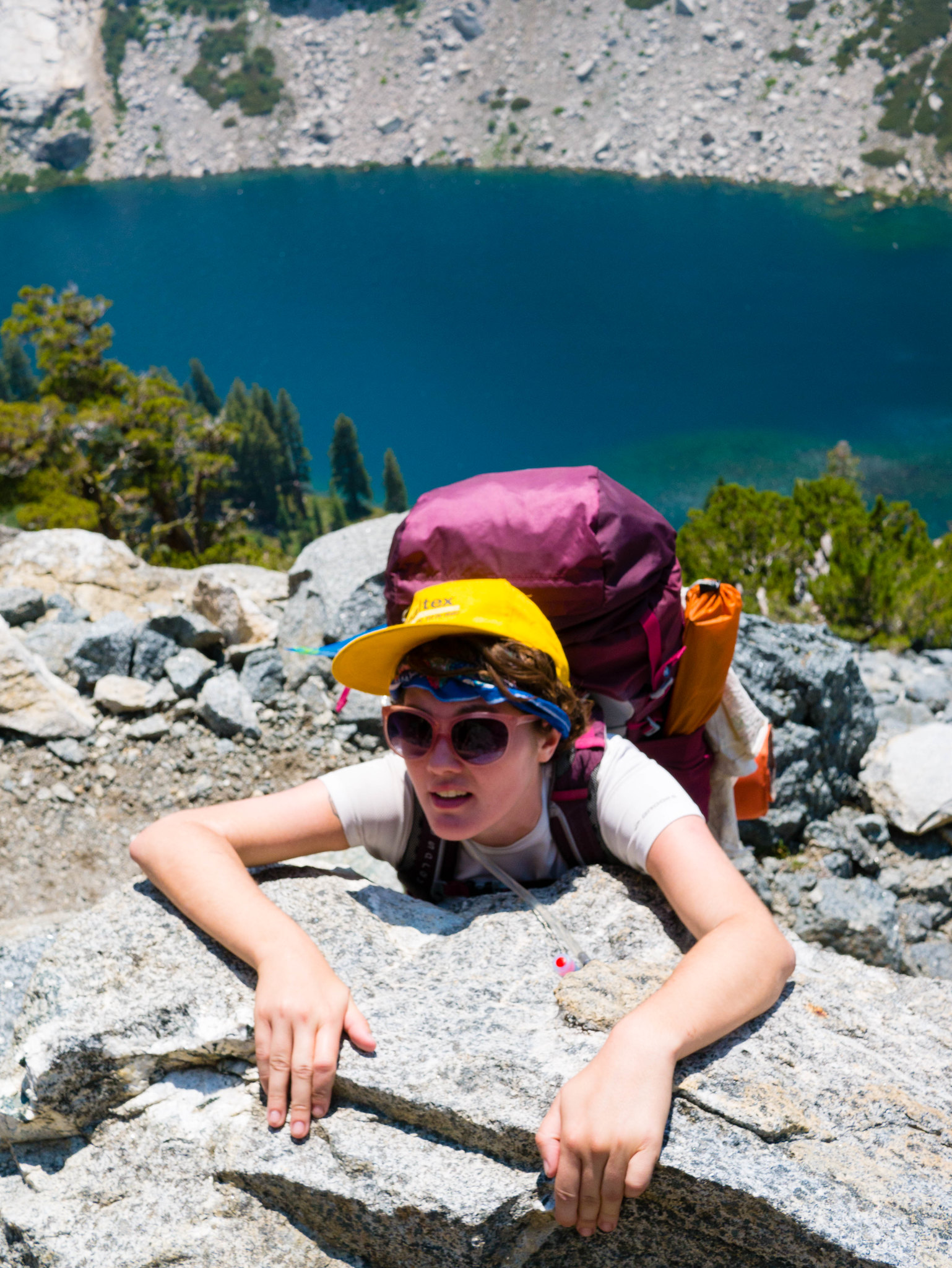
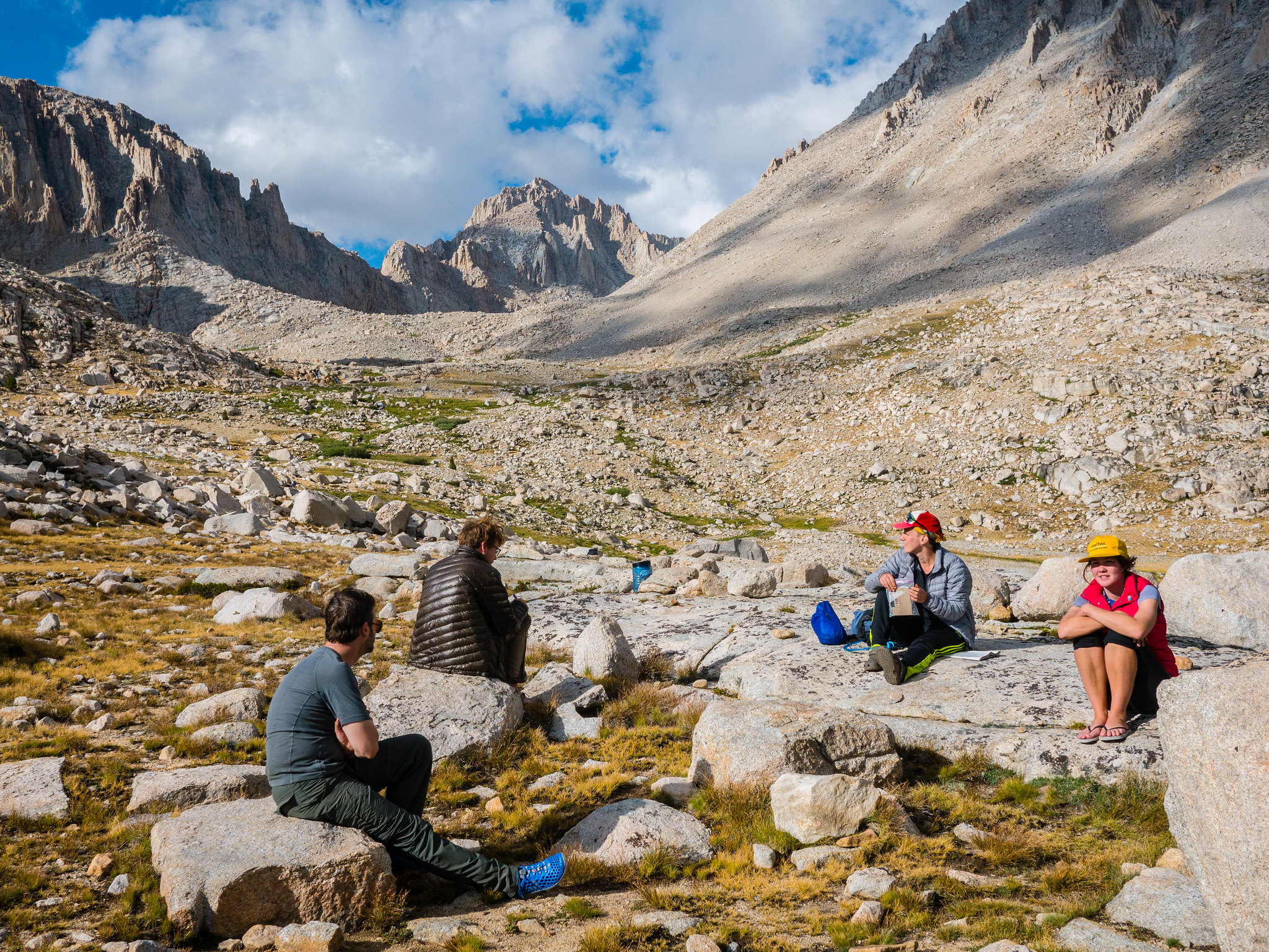
We arrived at the junction with the JMT around noon. We set up camp a few hundred feet west of the junction, south of a beautiful meadow. After doing some laundry and puttering around, both Nathan and I were a bit restless and decided to head off on our own for a bit of solitude. I headed up the JMT and then off trail to the east to check out the Bighorn Plateau while Nathan followed Wallace Creek upstream for a mile or so. The others chose to snooze and lounge at camp.
 Exploring the edge of the Bighorn Plateau from my afternoon hike exploring the PCT north of Wallace Creek by Maia Averett, on Flickr
 Exploring the edge of the Bighorn Plateau from my afternoon hike exploring the PCT north of Wallace Creek by Maia Averett, on Flickr
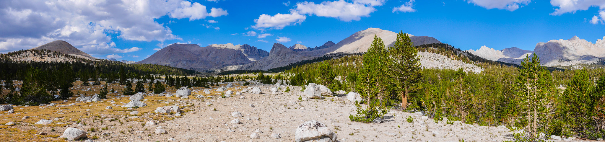
The Bighorn Plateau was incredibly impressive and it was here that I realized that I must just really love these high plateaus. There were clouds that cast shifting shadows over the expanses of brown grass, dotted with little trees doing their best to survive at treelike, all surrounded with 13k-14k peaks. Plus, I got my first view of Whitney from the west. I want to take a trip where I spend a few days just exploring this plateau. After an hour or so, I headed back to camp and found Laurel, Patrick, and Miranda having the best time just lounging in the meadow.
Day 6
Wallace Creek/JMT to Crabtree Meadow
4.2 miles, +1,050ft/-800ft
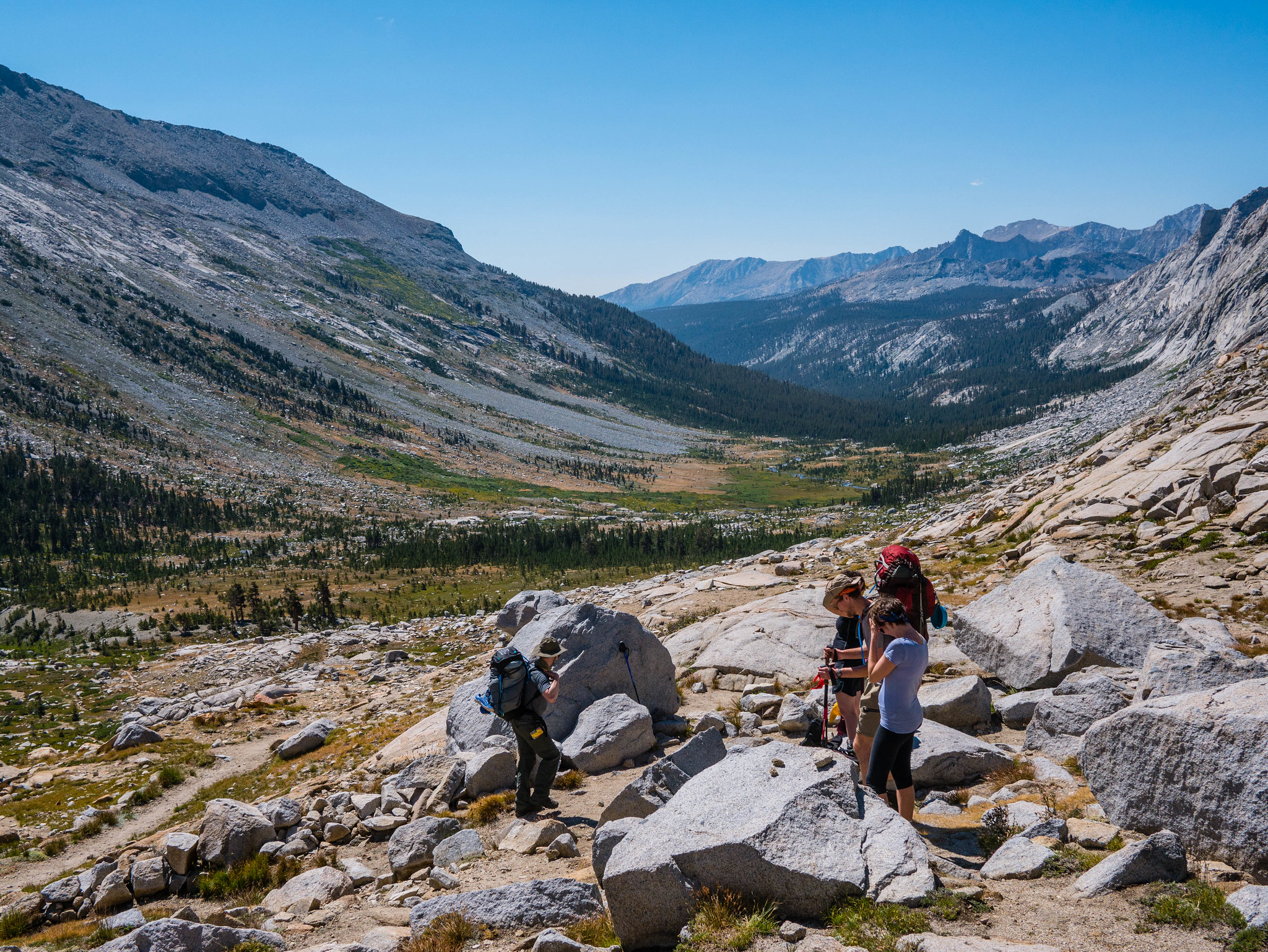
When I heard thunder and lightning at 4am I knew we were in for a bad day. Typically in the Sierra Nevada, mornings are clear and afternoons are either clear or perhaps there are thunderstorms. Rain in the morning is a sign of a storm system moving through. The rain was quite hard at times and we all elected to stay in our tents and sleep in. Around 8am, there was a bit of a break in the rain. We had some breakfast and tried to decide what to do.
The sky was dark and cloudy in every direction. When the rain started to fall again, we crawled back in our tents. Around 11am there was another break and we decided to hit the trail in hopes of making it to the Crabtree Ranger Station to get a forecast. We didn’t have a lot of distance to cover before heading up Mt Whitney and we knew we couldn’t attempt the summit in this terrible weather. For the remainder of trail until Mt Whitney, the JMT and the HST are the same. In fact, the part between Wallace Creek and Crabtree is also the PCT, in case you want to hike all the famous Sierra acronyms. The weather held and even cleared a bit as we made our way south.
 HST-1007.jpg by Maia Averett, on Flickr
The Crabtree Ranger Station is about half a mile from the junction where the JMT/HST head up towards Guitar Lake and Mt Whitney. We decided to drop our packs here and send a pair of people to see if they could get some information from the ranger while the rest of us waited with the packs. While we were waiting, the weather turned worse and worse. We were anxious to regroup and were relieved when we saw our messengers return. They had found the ranger station, but the ranger wasn’t there. Given the horrible turn in the weather, we strapped our packs and literally ran towards the ranger station as it started to hail and thunder all around us. We made it to the ranger’s cabin just as a deluge opened up—and we weren’t the only ones seeking shelter there!
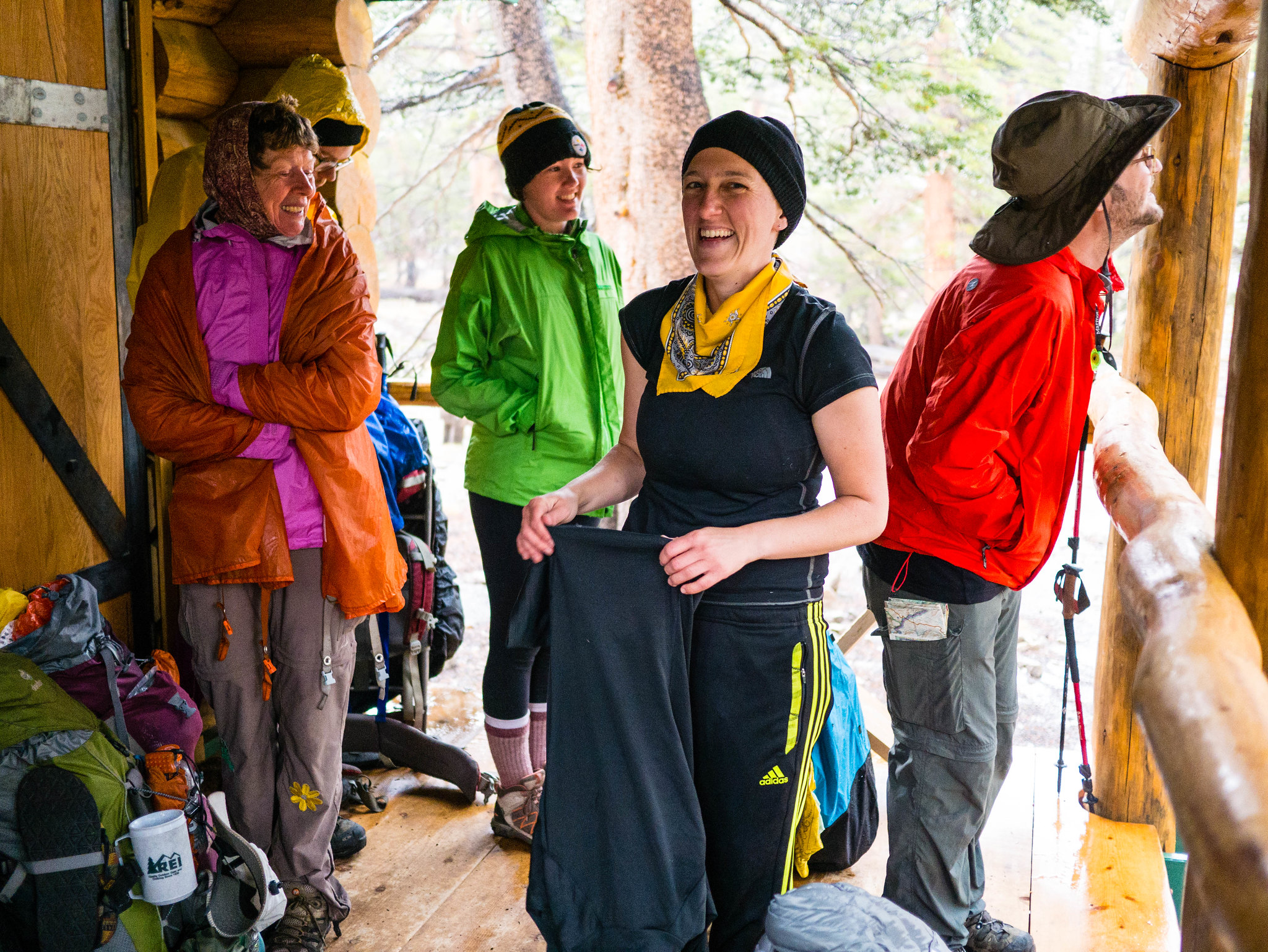 Seeking shelter on the ranger's porch by Maia Averett, on Flickr
As the afternoon wore on, more and more soggy backpackers crowded onto the porch while the sky continued to dump hail and set off cracks of lightning immediately followed by thunder we could feel in our chests. At one point we spotted a lone hiker moving swiftly, hooded, drenched, with his hands in his pockets. As he came up the steps he said “Anybody got the keys to this place?” and pulled his hood back to reveal his NPS beanie. This was our introduction to the saint who goes by the name of Ranger Rob of Crabtree. The next words from this saint were “I spent the last three hours in the lightning position.” He opened the door and invited us in (!). So incredibly hospitable of him and not at all expected. He got the wood fire going and even made tea for us. SAINTLY.
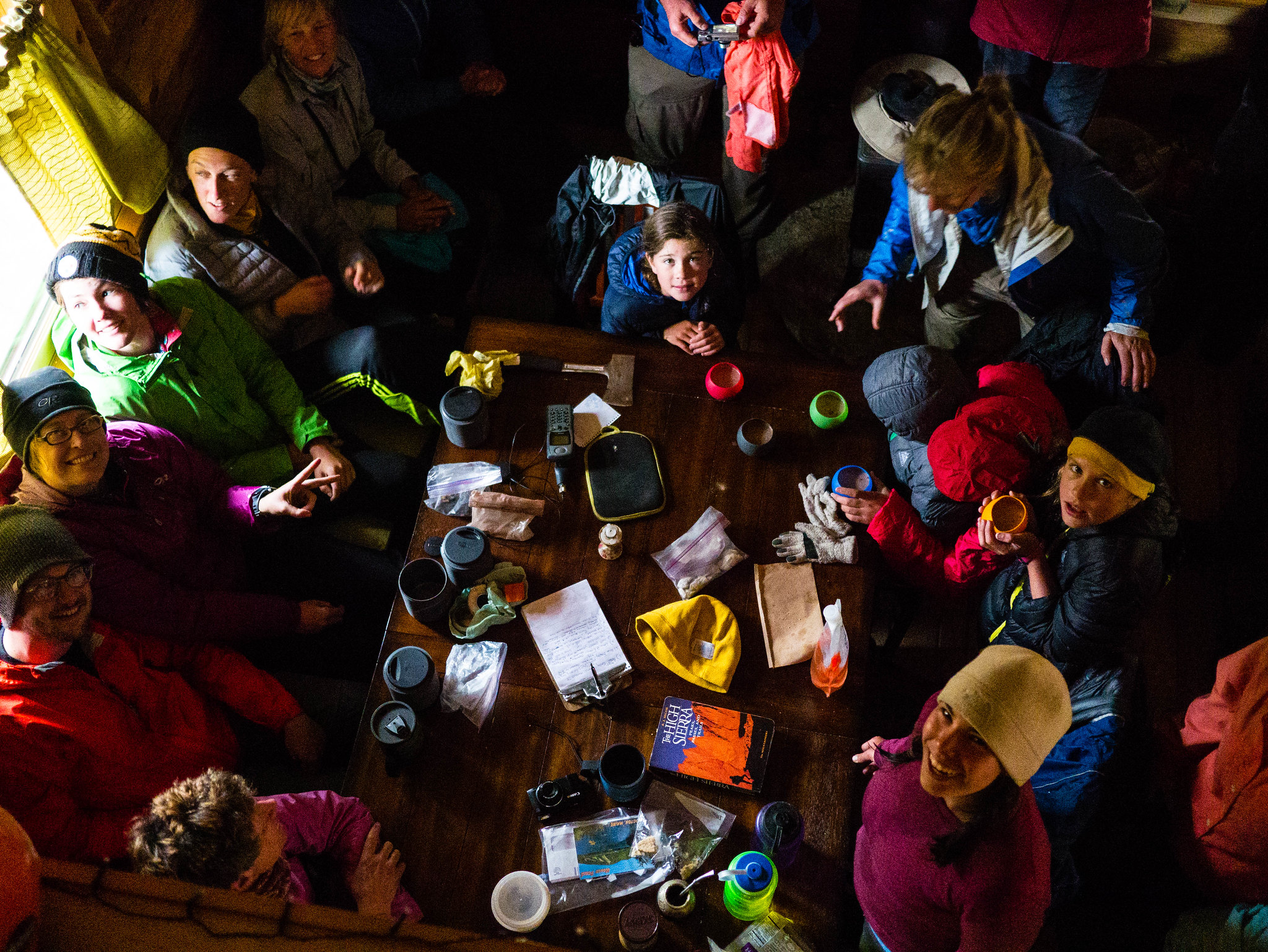 Ranger Rob invited us all in to escape the insane ligthning and hail storm by Maia Averett, on Flickr
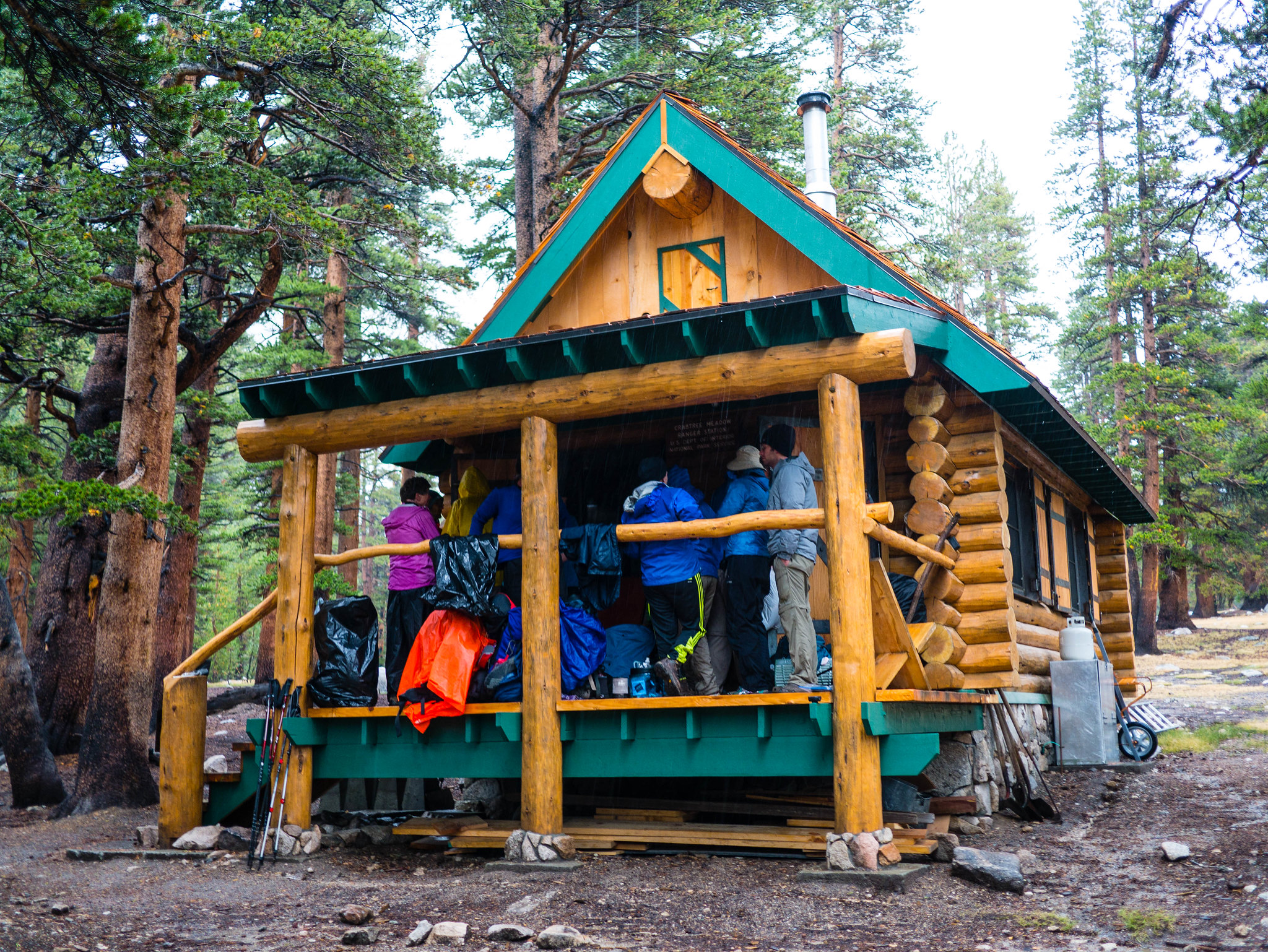 Ranger Rob invited us all in to escape the insane ligthning and hail storm by Maia Averett, on Flickr
Ranger Rob had been out on a mission to find a missing llama. Apparently some JMT hikers had rented a pair of llamas to carry their gear (pffffff) and one of the llamas had declared No Can Do about halfway down Forrester Pass. The hikers abandoned it (!!!?!) and continued on. We couldn’t help Ranger Rob with any info as we had Seen No Llama, but around 6pm the hikers and Can Do llama rolled into Crabtree (still sadly minus No Can Do). We all pretended to look the other way as Ranger Rob asked them a few questions.
I was a bit worried at this point because we were now behind schedule. Our original plan had us at Guitar Lake right now, summiting Whitney on the next morning, and spending our last night at Outpost Camp just 3 miles from Whitney Portal. My dad was coming to pick us up and was expecting us out around 10am that day. Ranger Rob checked the forecast and said that there was a warm system coming up from the Gulf that was causing all the problems. It looked like it would probably move on by tomorrow, but we couldn’t be sure. He let me use his satellite phone (SAINT) to email my dad a super short “WE’RE GONNA BE A BIT LATE BUT WE’RE OK” message. Thank you Ranger Rob!
We spent the evening in our tents hoping the weather would clear.
Day 7
Crabtree Meadow to Guitar Lake
2.8 miles, +1,050ft/-200ft
The morning was soggy. It rained until about 10am, at which point the sun came out and we tried to dry out some gear. Miranda and I were looking incredibly stylish after a week in the backcountry. Yaaaaaaaaaaaaasssss.
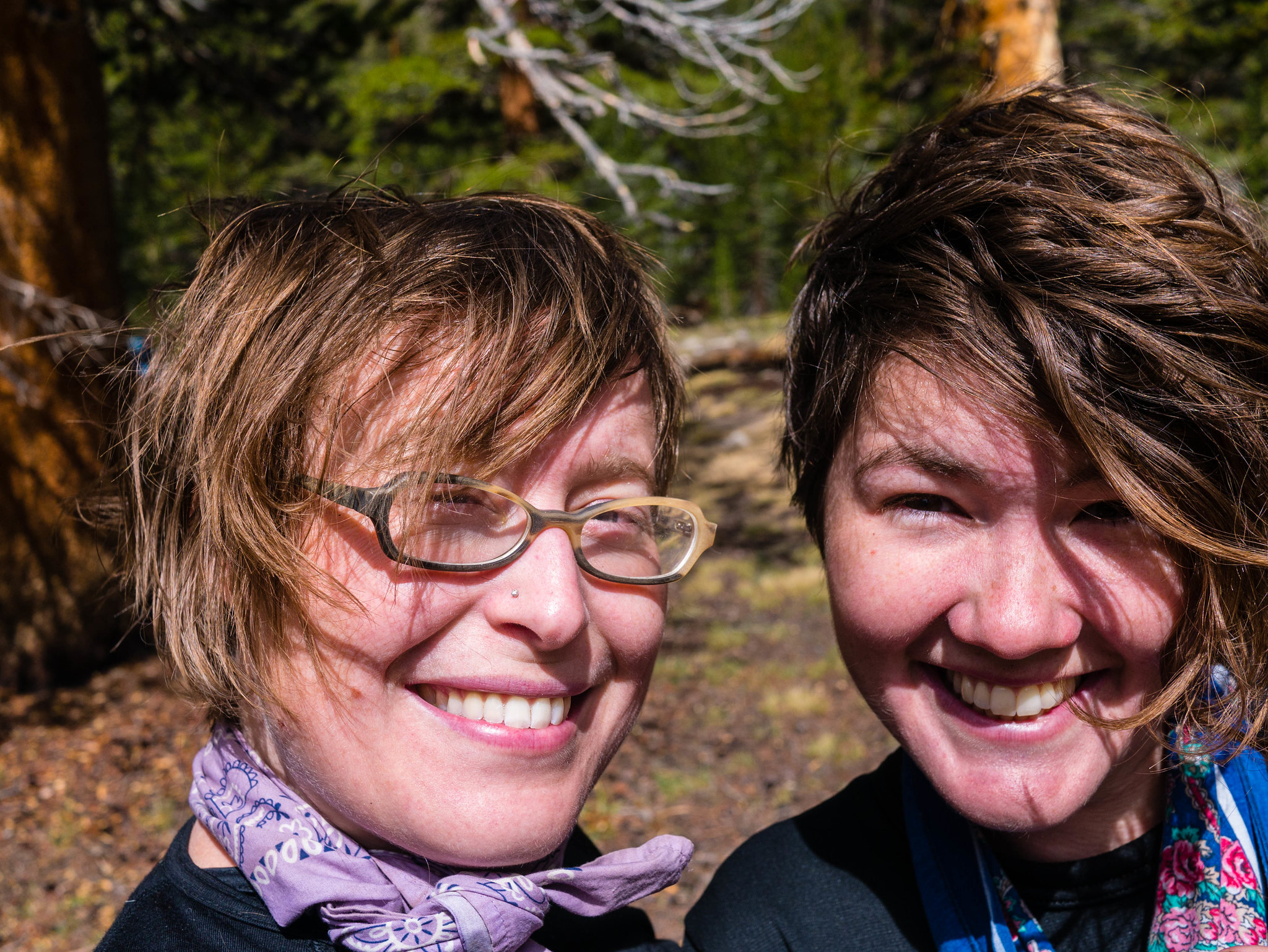 Stylish day 7 hair by Maia Averett, on Flickr
There were still some clouds hanging around the high peaks towards Whitney, but we decided to make a push for Guitar Lake, hoping that the weather would be good enough on the following morning for us to summit and hike out. It was a short few miles to Guitar Lake with nice views back towards the Kaweahs again. We arrived at the moonscape surrounding Guitar Lake at around 12:30pm. With the storm clouds all around, we didn’t want to risk summiting Whitney. Plus even after summiting, we’d have to descend quite a ways before the first possible camp. We elected to set up camp at Guitar Lake and head out at 4am if the weather permitted.
 Heading up to Guitar Lake from Crabtree Ranger Station by Maia Averett, on Flickr
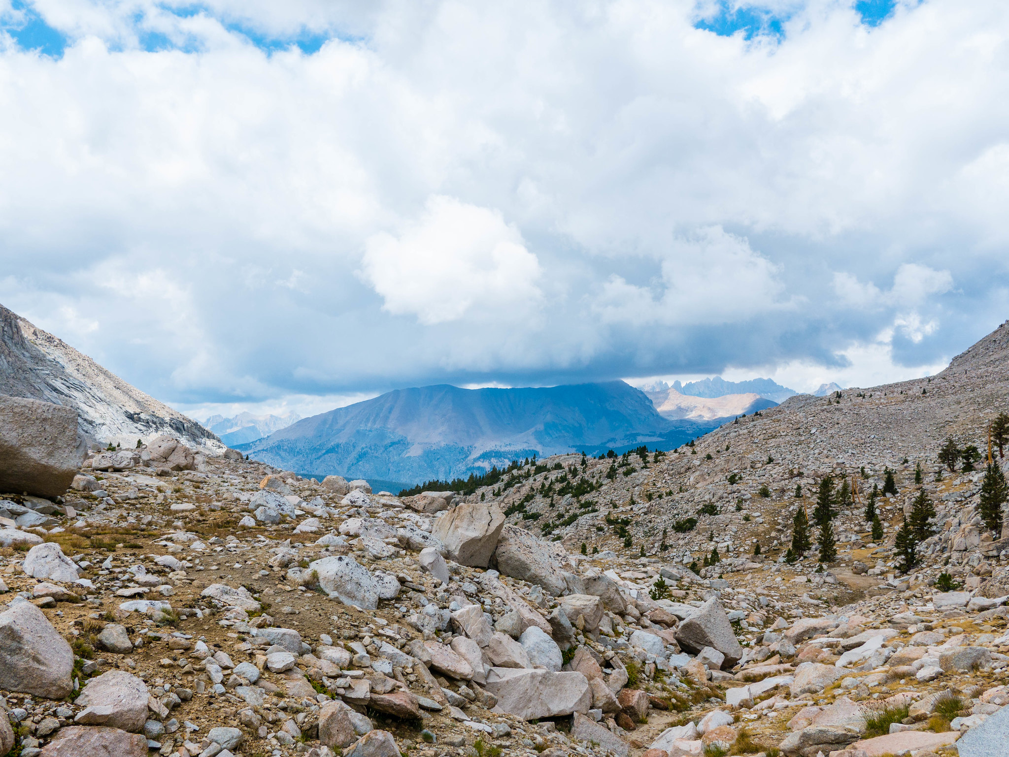 Heading up to Guitar Lake from Crabtree Ranger Station by Maia Averett, on Flickr
With this much time at camp, I was of course restless so I went off to explore. I climbed the granite slabs on the south side of Guitar Lake and ended up quite a ways up without quite realizing it! Can you spot our camp across the lake?
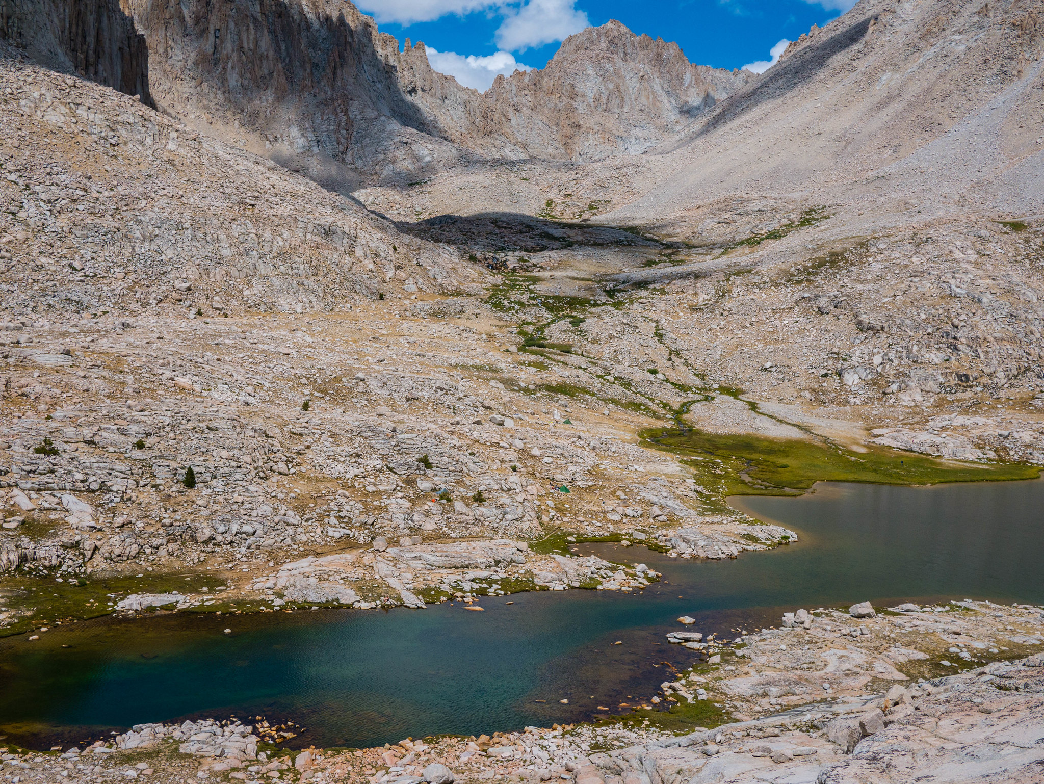 Guitar Lake by Maia Averett, on Flickr
I returned to camp for dinner and then we all climbed into our tents early in anticipation of our early morning.
 Enjoying being above treeline. Rocks! Everywhere! by Maia Averett, on Flickr
Day 8
Guitar Lake to Whitney Portal
15.6 miles, +3,450ft/-6,600ft
The weather was clear overnight—yay! I got up a bit earlier than the others to try to take some long-exposure photos. We hit the trail with our headlamps on, though we didn’t need them much except for crossing the inlet stream of Guitar Lake. The moon was bright enough to hike by. This was an amazing experience. The cold air, the stars and moon, the nothing-but-rocks, no sounds besides our own breath.
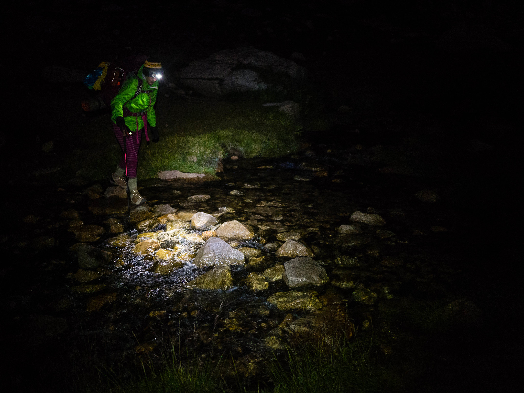 Stream crossings are more exciting at 4am! by Maia Averett, on Flickr
As we climbed higher and higher (it’s about 3,500ft from Guitar Lake to Mt Whitney!), dawn broke and began to paint the mountains in pale blues and lavenders. It was slow going on this ascent with the thin air and the gorgeous changes to document at every step.
 Hiking up towards Whitney as dawn sheds light on the Great Western Divide by Maia Averett, on Flickr
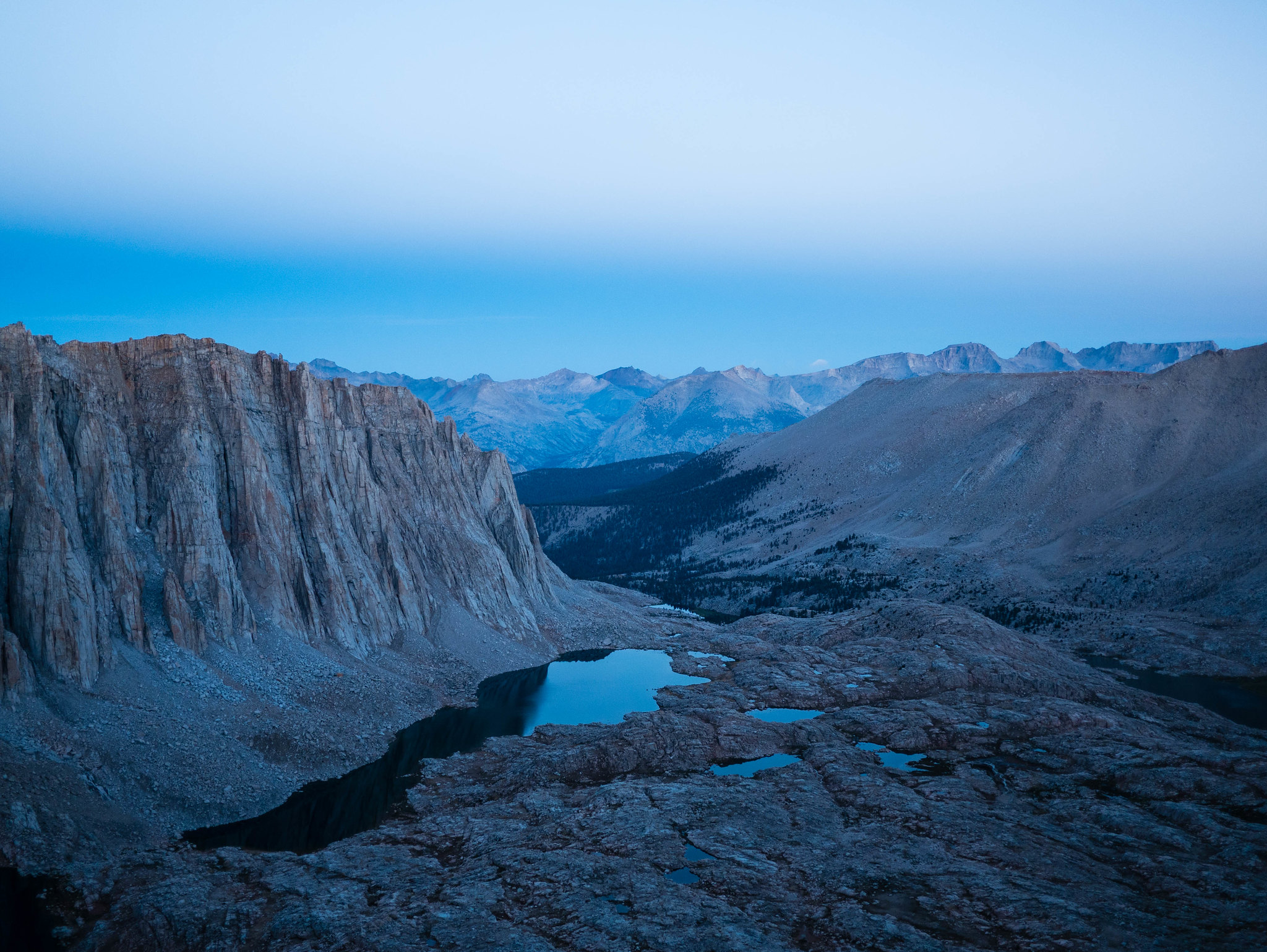 Hiking up towards Whitney as dawn sheds light on the Great Western Divide by Maia Averett, on Flickr
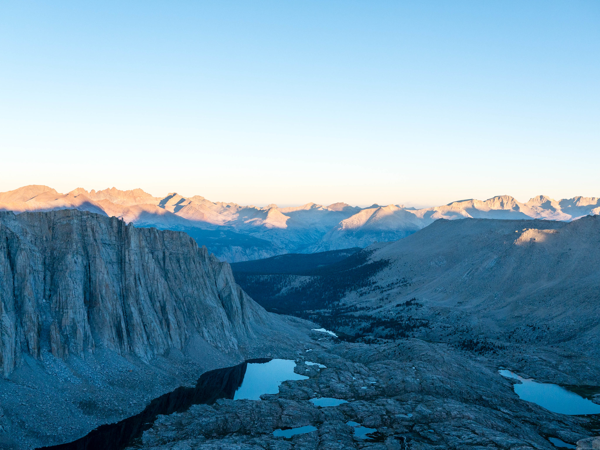 Hiking up towards Whitney as dawn sheds light on the Great Western Divide by Maia Averett, on Flickr
We made it to Trail Crest around 6:15am. We dropped our packs and just carried some water and snacks for the final push to the summit. I had some trouble with the altitude on the last few hundred feet. I felt a bit dizzy and could only proceed slowly, but I made it! The view from the summit was absolutely incredible. The high country of Sequoia to the west was lit up by the rising sun and the drop down to the immense flatness of the Owens Valley to the east seemed impossibly far.
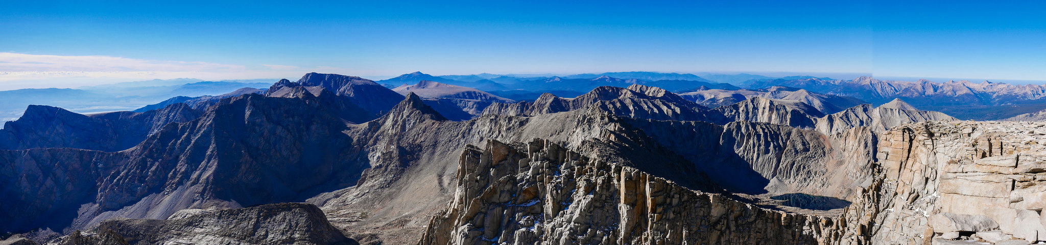 View from the summit of Mount Whitney by Maia Averett, on Flickr
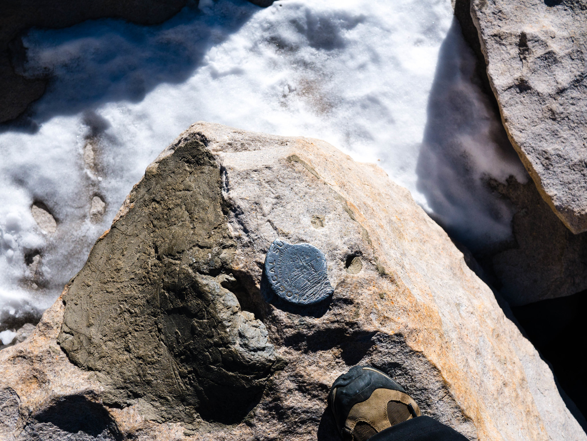 What I'm guessing is the oldest survey marker. I couldn't read the year! by Maia Averett, on Flickr
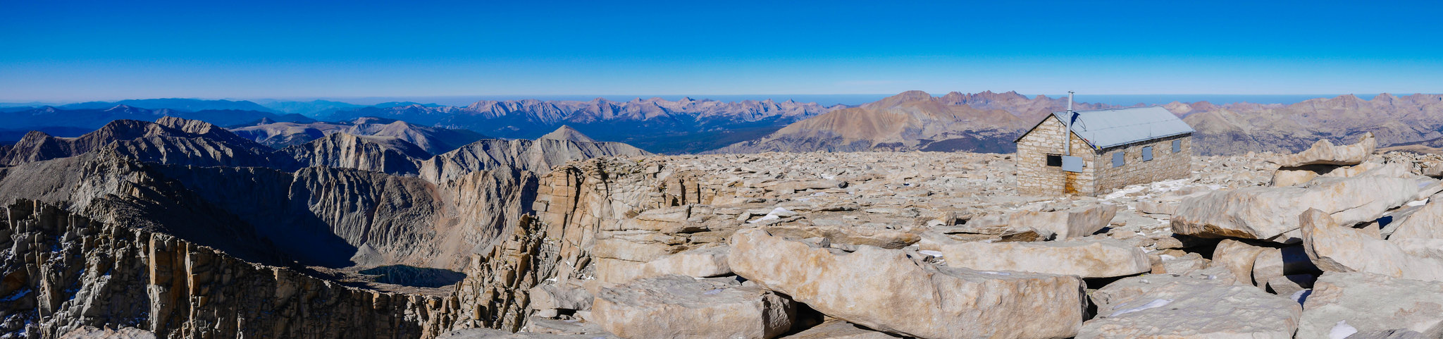 View from the summit of Mount Whitney by Maia Averett, on Flickr
Soon, though, it was time to head down. We still had 11 miles to hike. We picked up our packs at the junction and headed over Trail Crest down to the 99 switchbacks, hiking down and down and down towards the valley below.
 Down down down down… when will it ever end! by Maia Averett, on Flickr
As we neared the bottom, a few of us were tired. I was too hopped up on endorphins to be tired and I’m sure I was pretty annoying, trying to urge us on quickly because I knew my dad was waiting for us at Whitney Portal. A couple miles from Whitney Portal, we ran into him hiking up the trail! He had gotten bored with waiting and decided that there wasn’t a way he would miss us if he headed up the way we were coming down. He took our picture at the boundary of the John Muir Wilderness and was nice enough to carry Miranda’s pack the rest of the way back to the van.
Almost 12 hours after we set out hiking in the morning, we arrived at Whitney Portal and gorged on the pleasures of a greasy burger and beer. Our hair. It was exceptionally good.
 Finally at the trailhead by Maia Averett, on Flickr
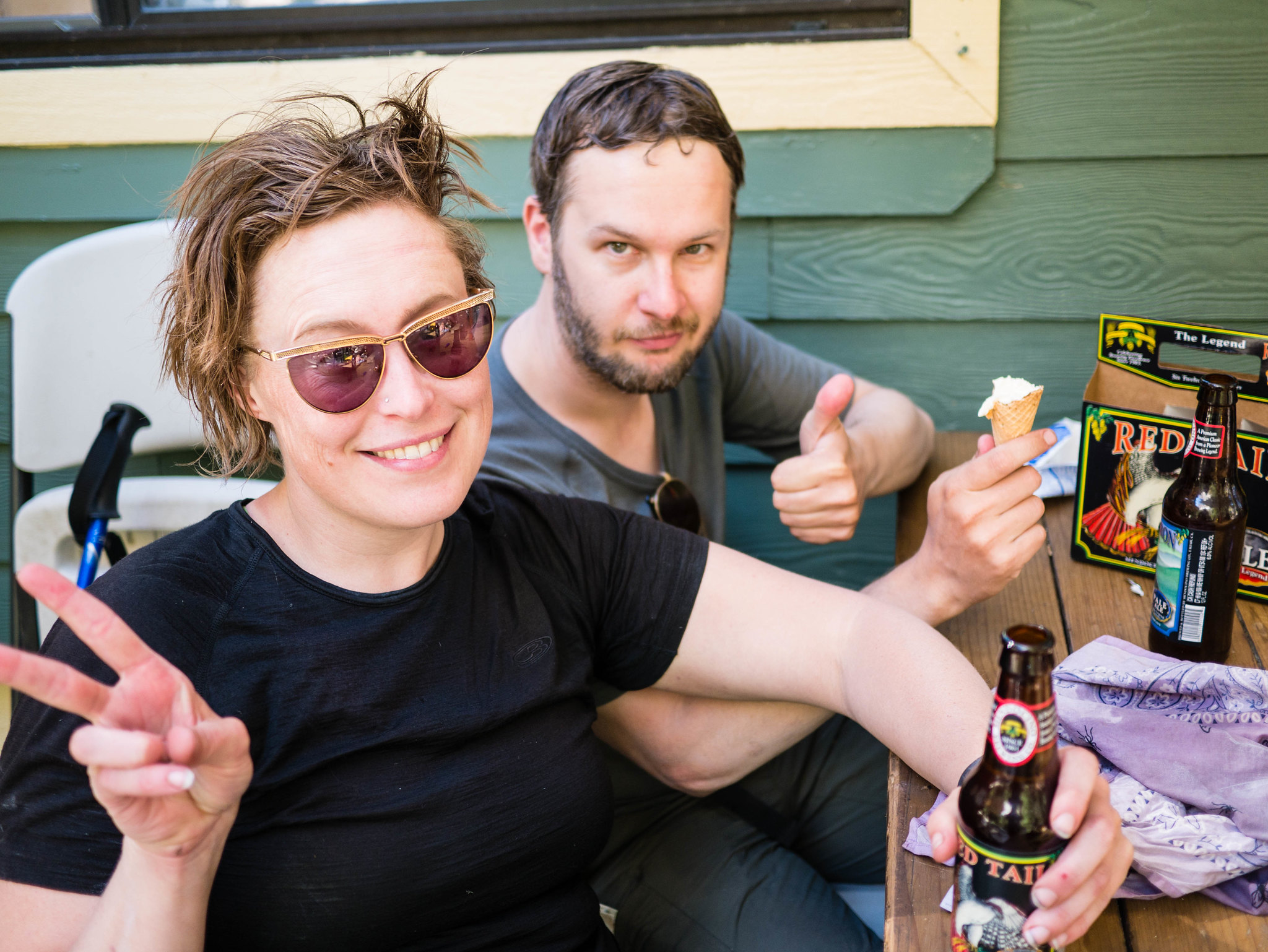 Feelin' fresh by Maia Averett, on Flickr
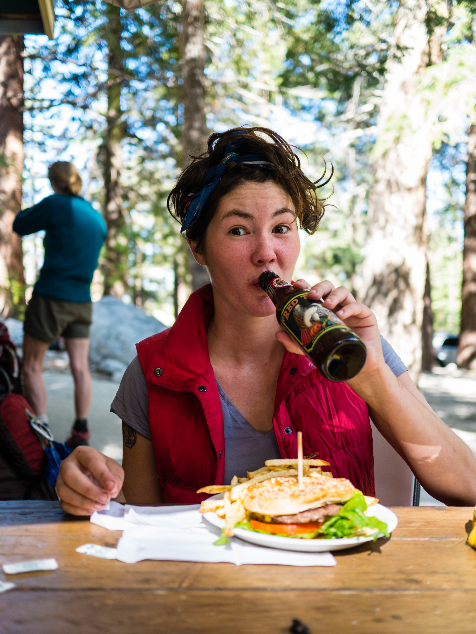 CHEESEBURGER AND BEER by Maia Averett, on Flickr
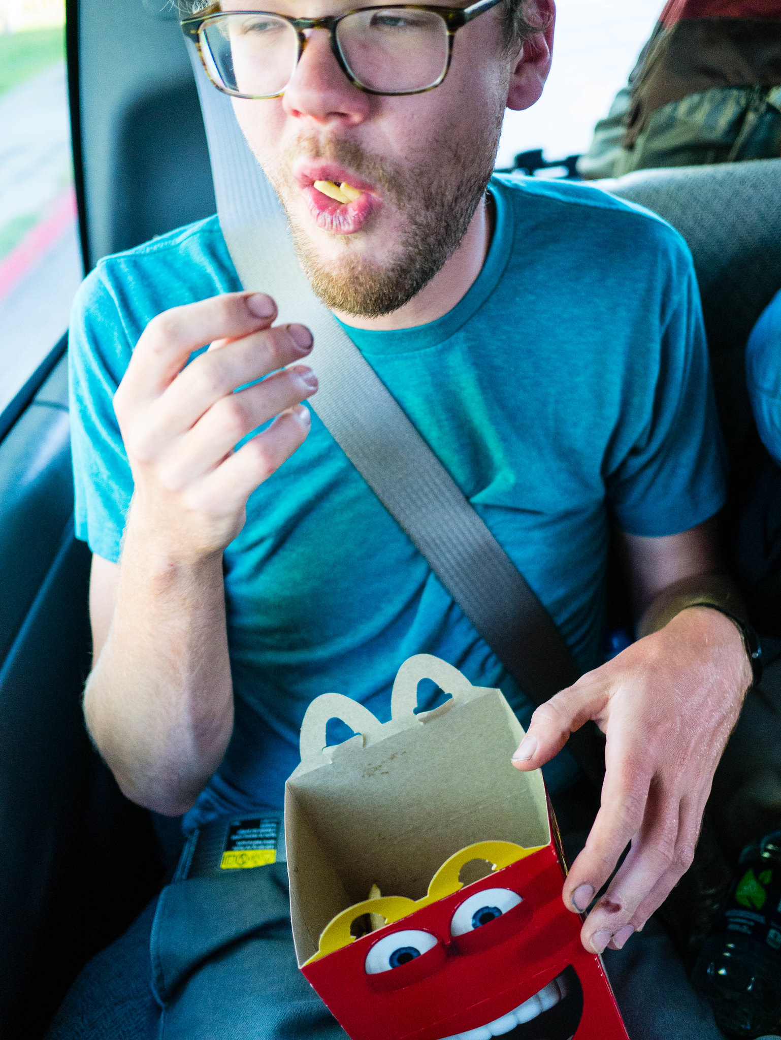
We loaded all our gear into the van my dad had rented and started the long drive back to Oakland. We may have made my dad stop for fries and McFlurries only an hour out of Whitney Portal. We deserved it.
 And more fried food about an hour later by Maia Averett, on Flickr
THE END.


