Pants Pass
Posted: Fri Oct 05, 2012 11:39 am
TITLE: Pants Pass
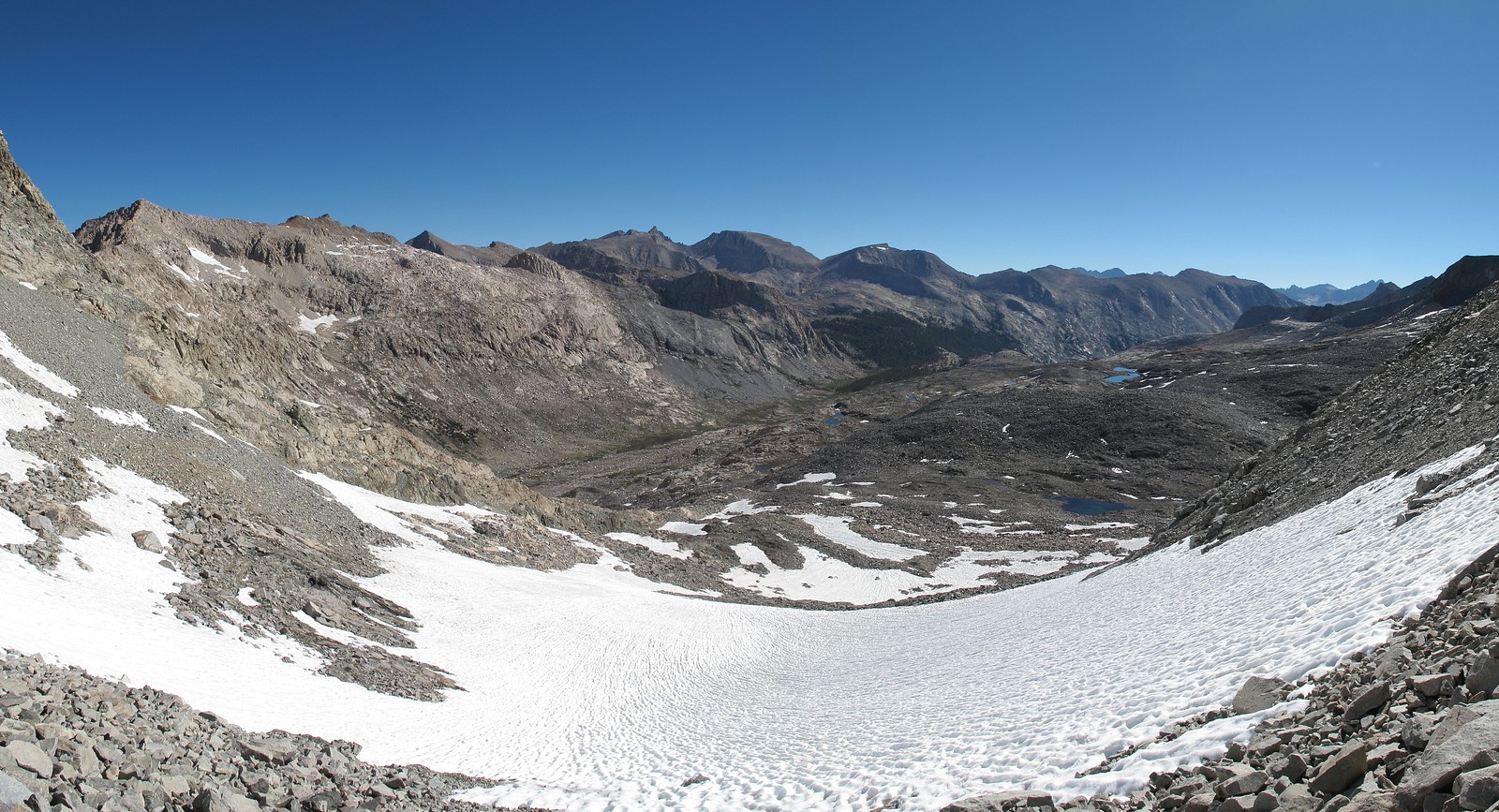
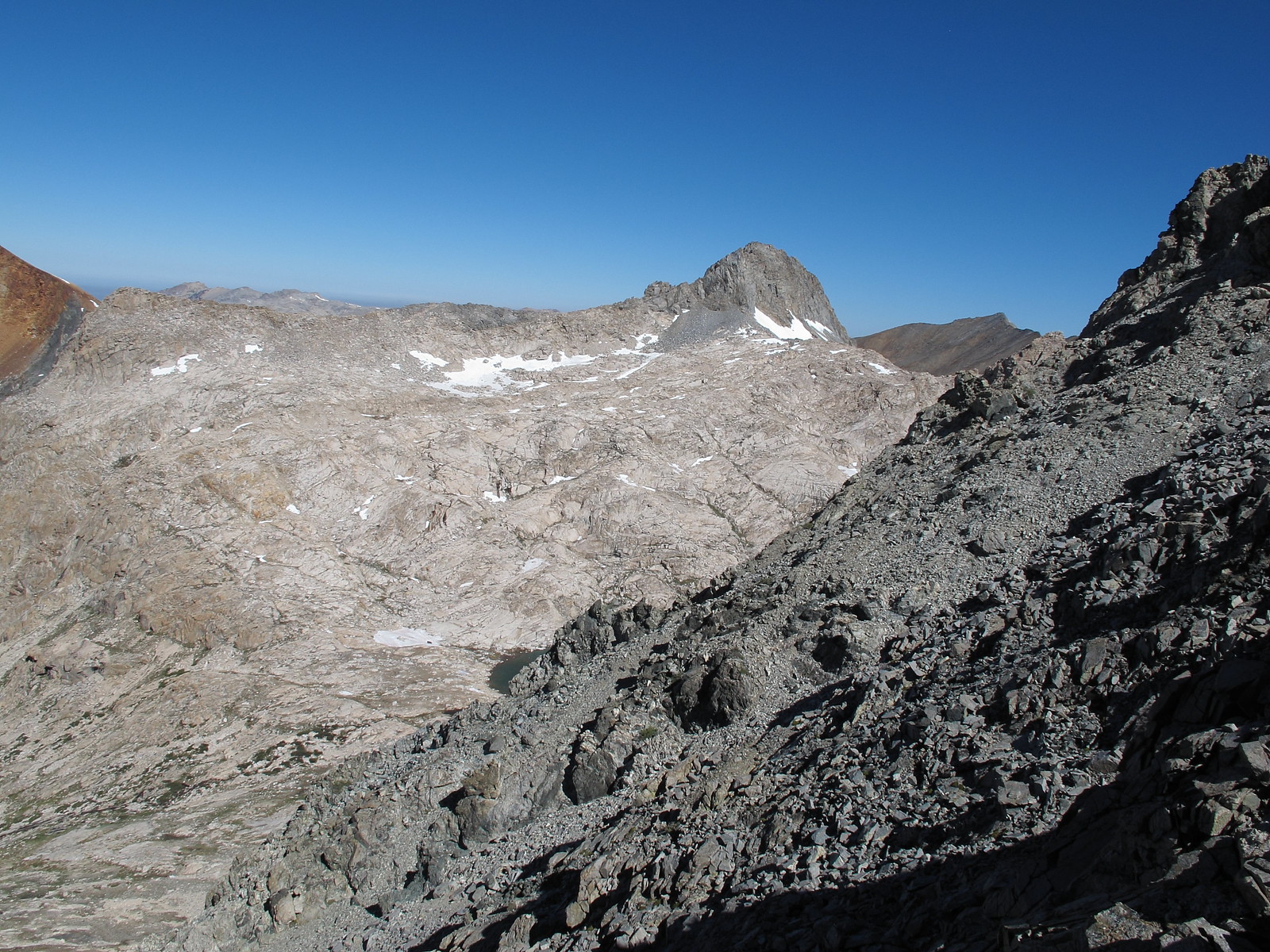
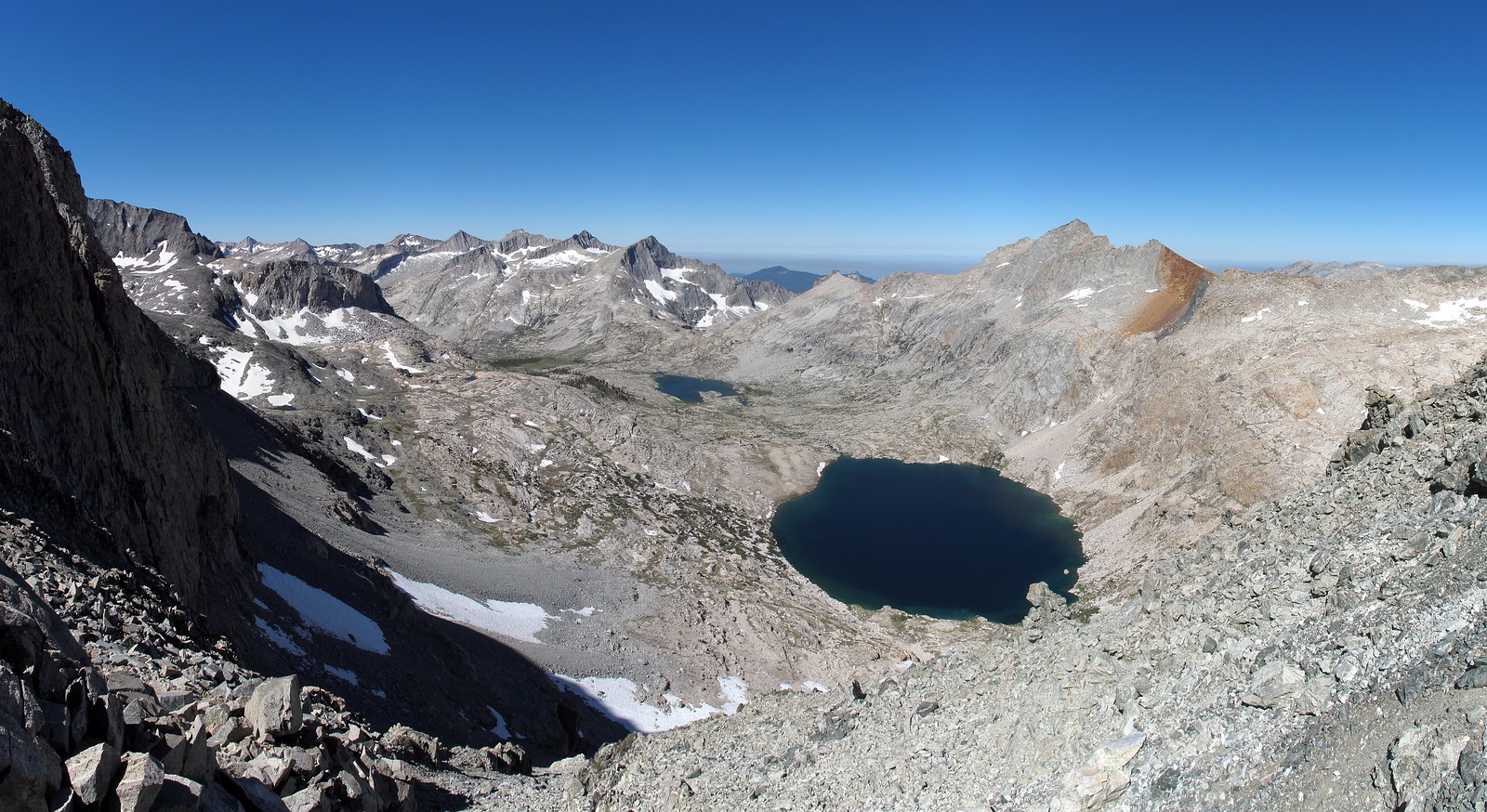
GENERAL OVERVIEW: This pass crosses between the upper Kern Kaweah River and 9 Lakes Basin
CLASS/DIFFICULTY: Class 2 - If one takes the ridge route you likely will have to pull at least one class 3 move.
LOCATION: Sequoia National Park along the North Western portion of Kaweah Peaks Ridge - HST Map
ELEVATION: 12,000
USGS TOPO MAP (7.5'): Triple Divide Peak
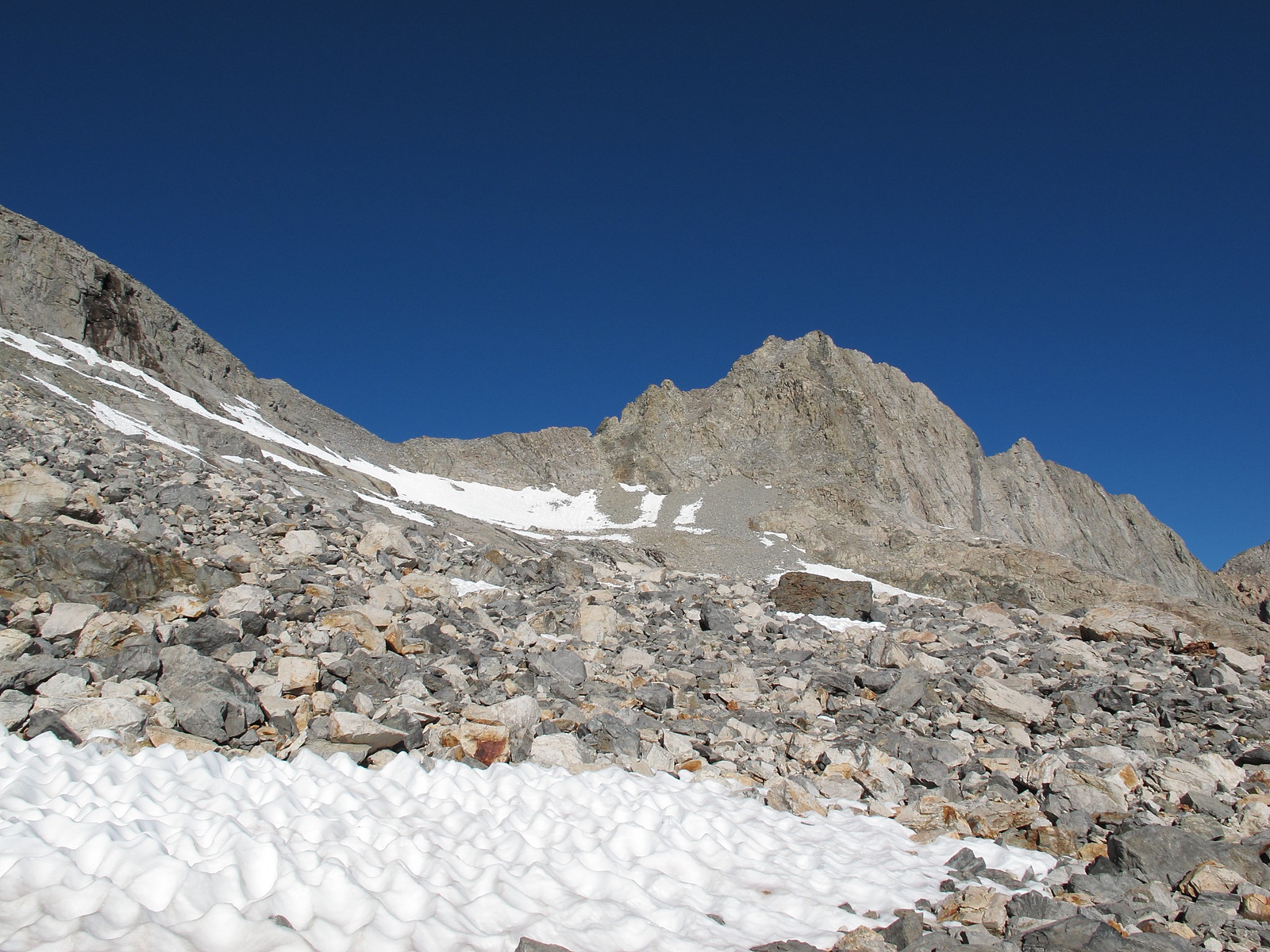
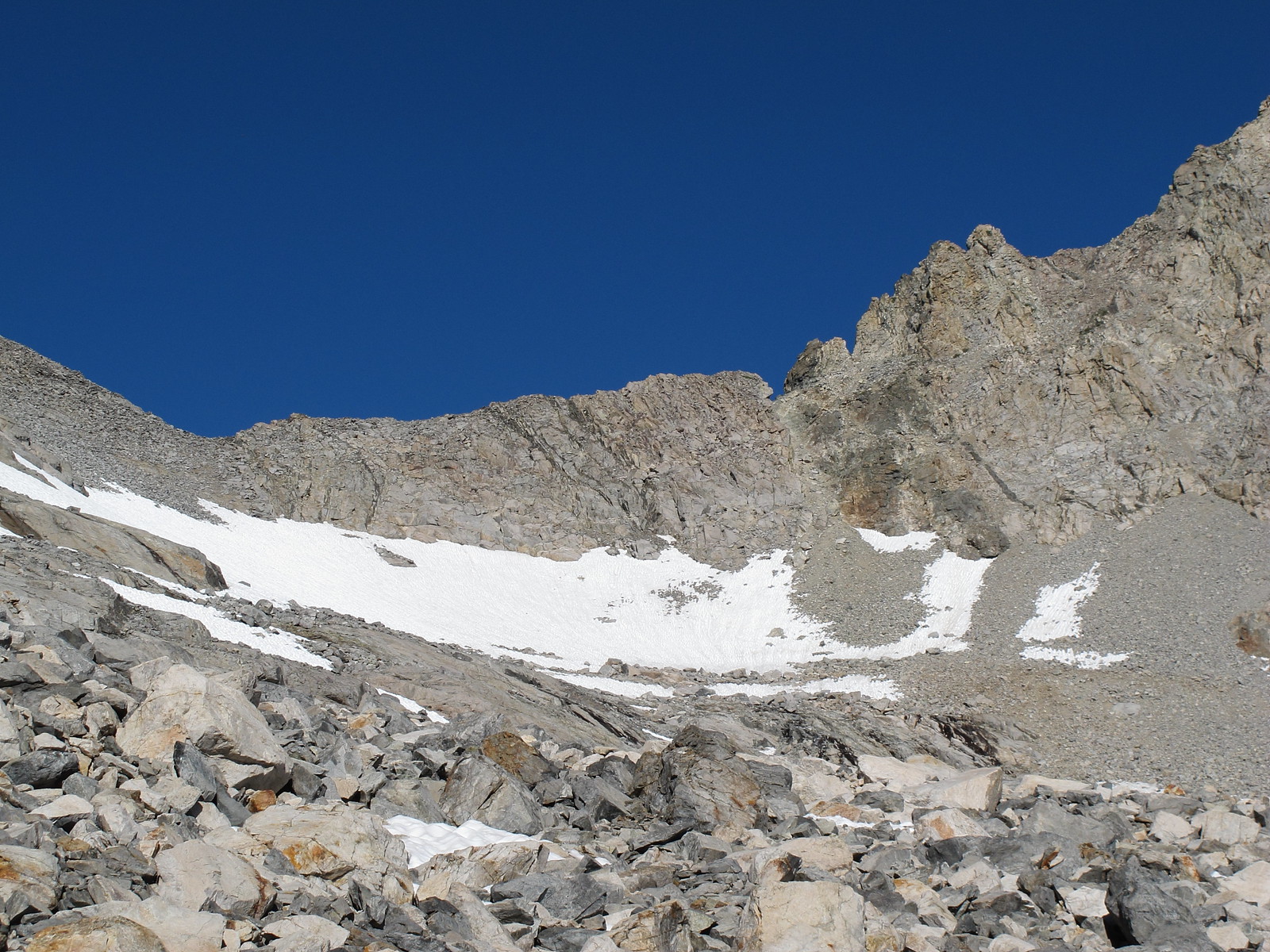
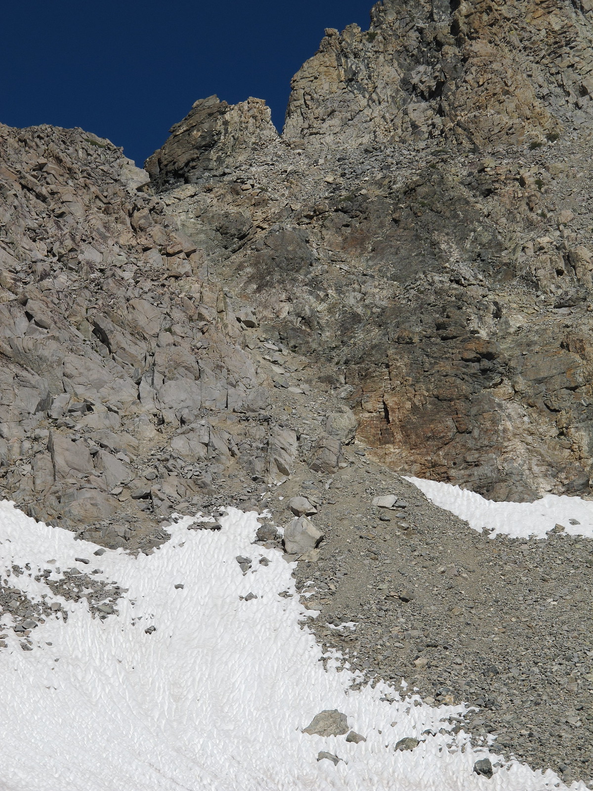
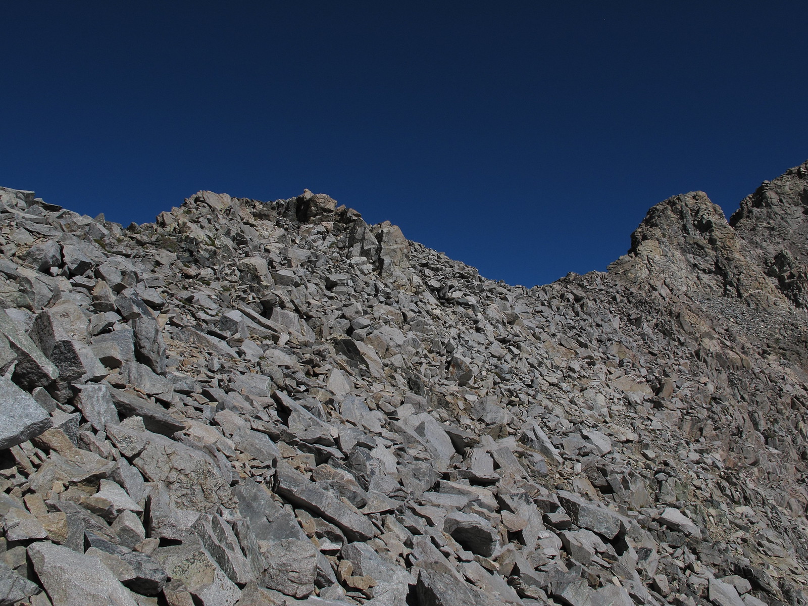
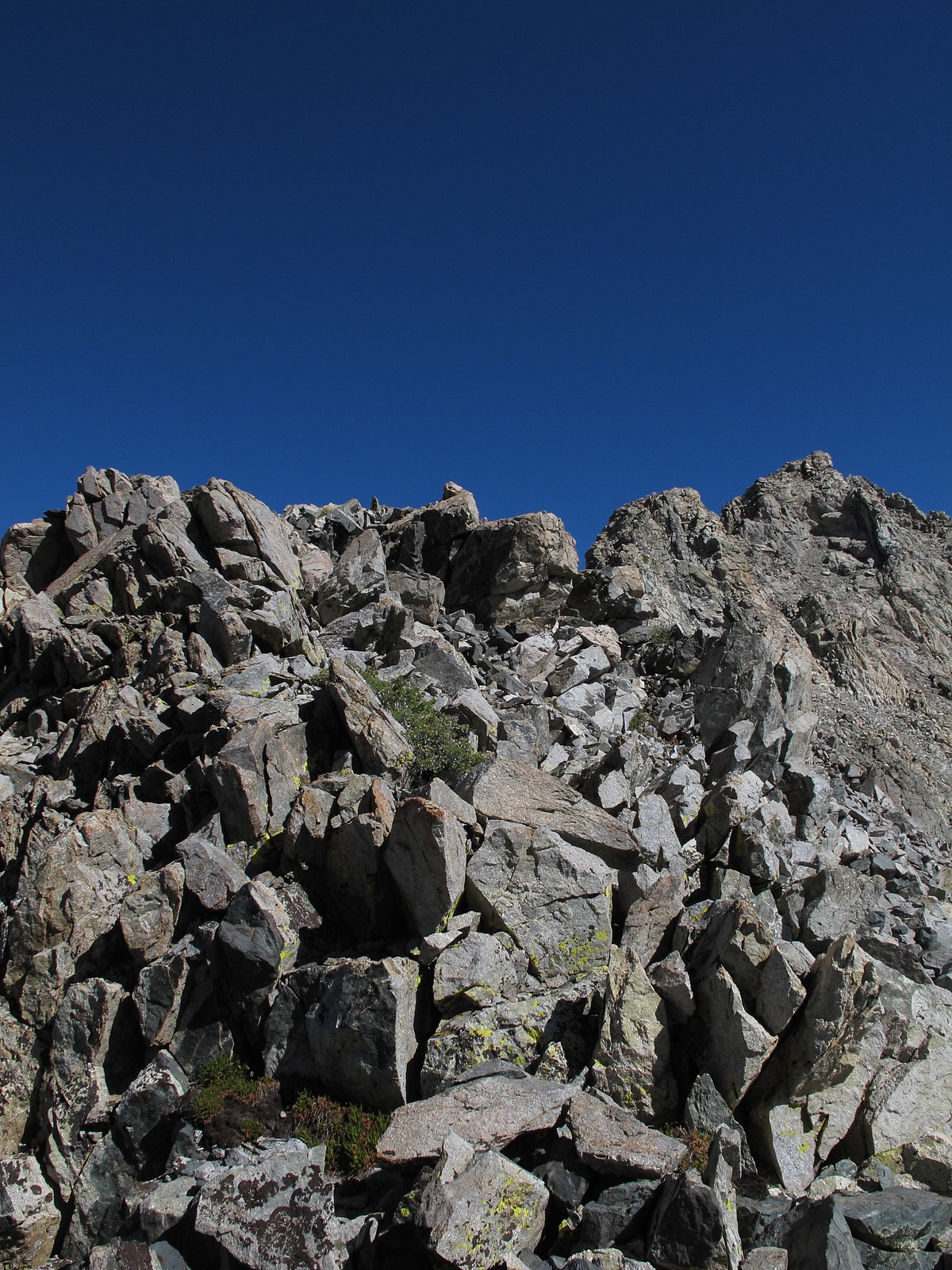
ROUTE DESCRIPTION: This pass has two general options for it's Eastern side. There is a Col. that is Pants Pass itself that consists of very steep loose rock and sand that may require you to utilize hand holds on the cliff walls to maintain a controlled ascent/descent but a much better option is available. If coming from the West once you have reached the top turn right and climb some rock moving South that is easy class 3. Continue along the top of the class 2 ridge for about 100 yards until you reach another small saddle which offers easy class 2 slopes down. These slopes are stable rock. If coming from the East you will notice the Col. that is Pants Pass spitting a nasty scree slope out the bottom. Look further left along the ridge for the obvious small saddle and aim for it. When faced with the two choices I can see no reason to ever take the actual Col. that is Pants Pass other then the novelty of saying you did it.
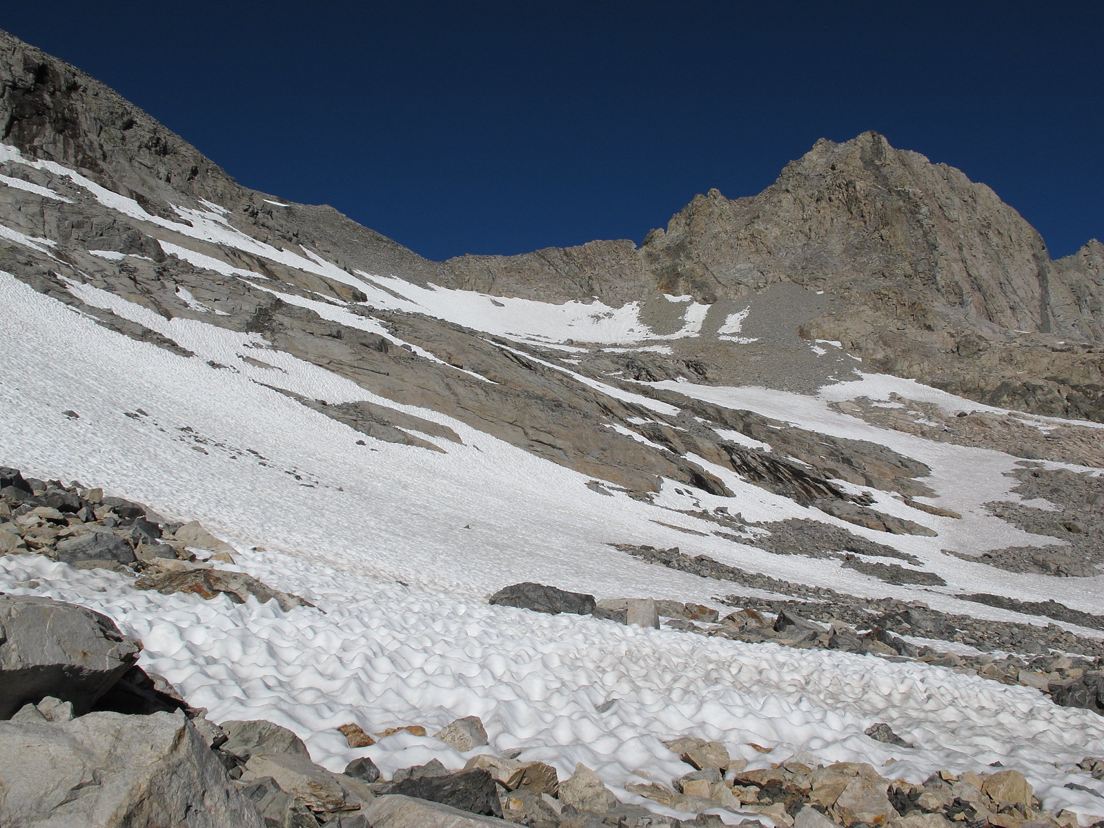
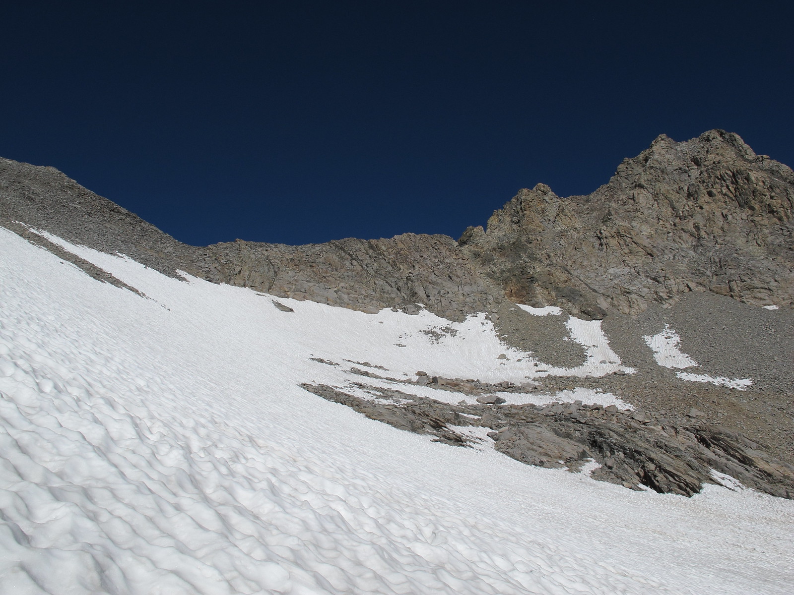
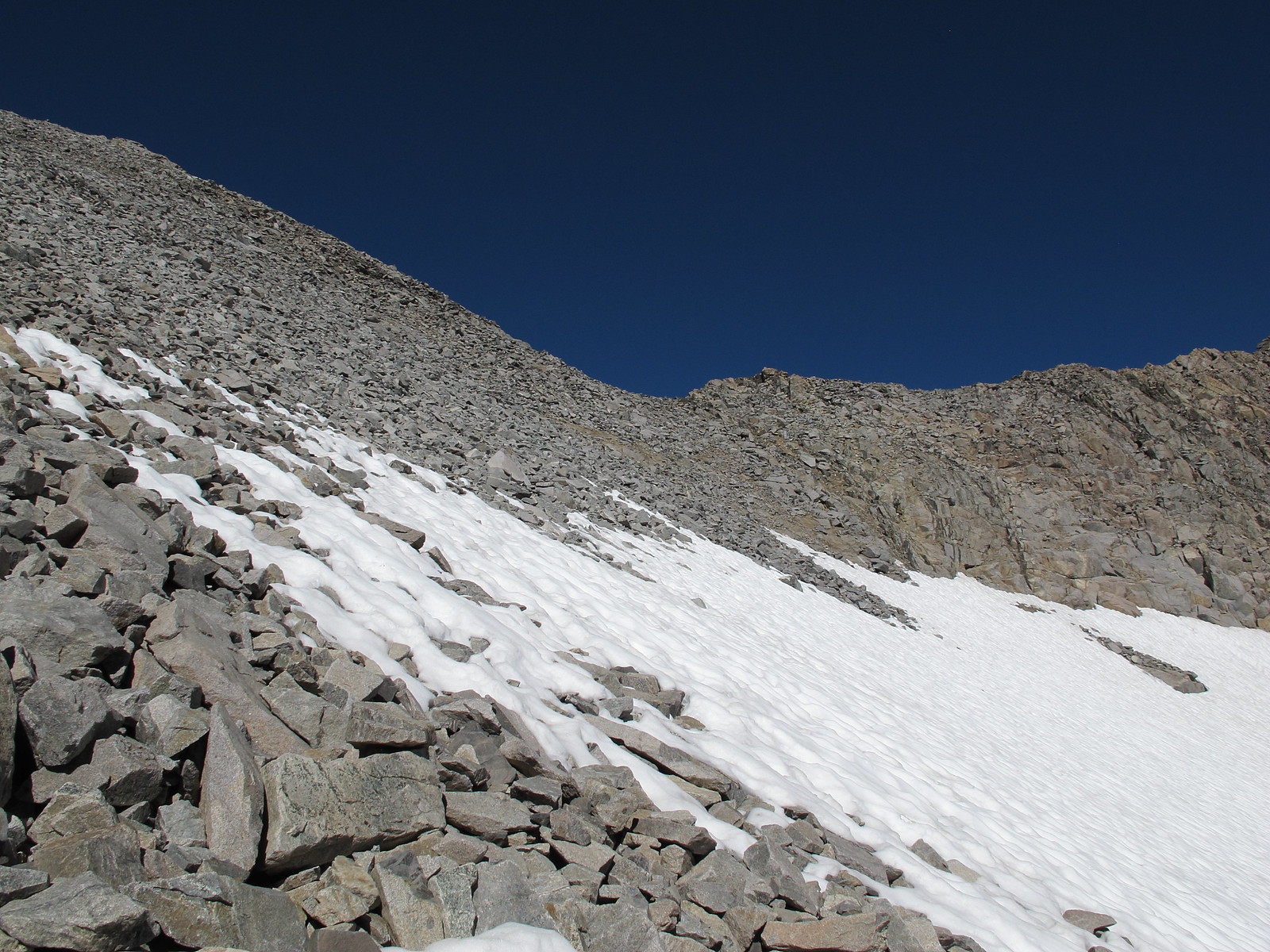
The West side is some what steep very loose scree. Plant each step firmly into the ground to maintain stable footing yet be cautious not to dig your foot in hard and hit a large rock under the soil and slip. This slope demands that you stay completely aware of your surroundings at all times! Read the slope with each step. Stop and look above you constantly and be aware if the slope above you is giving way with each of your steps. Twice I had the entire slope give on me and I had to run out of the way of the avalanche. A third time I fell down and was being taken down hill by a slide. Once you have dropped down aways the path in front of you will start to turn into a mess of cliffs. Turn left and continue down nasty scree and talus slopes.

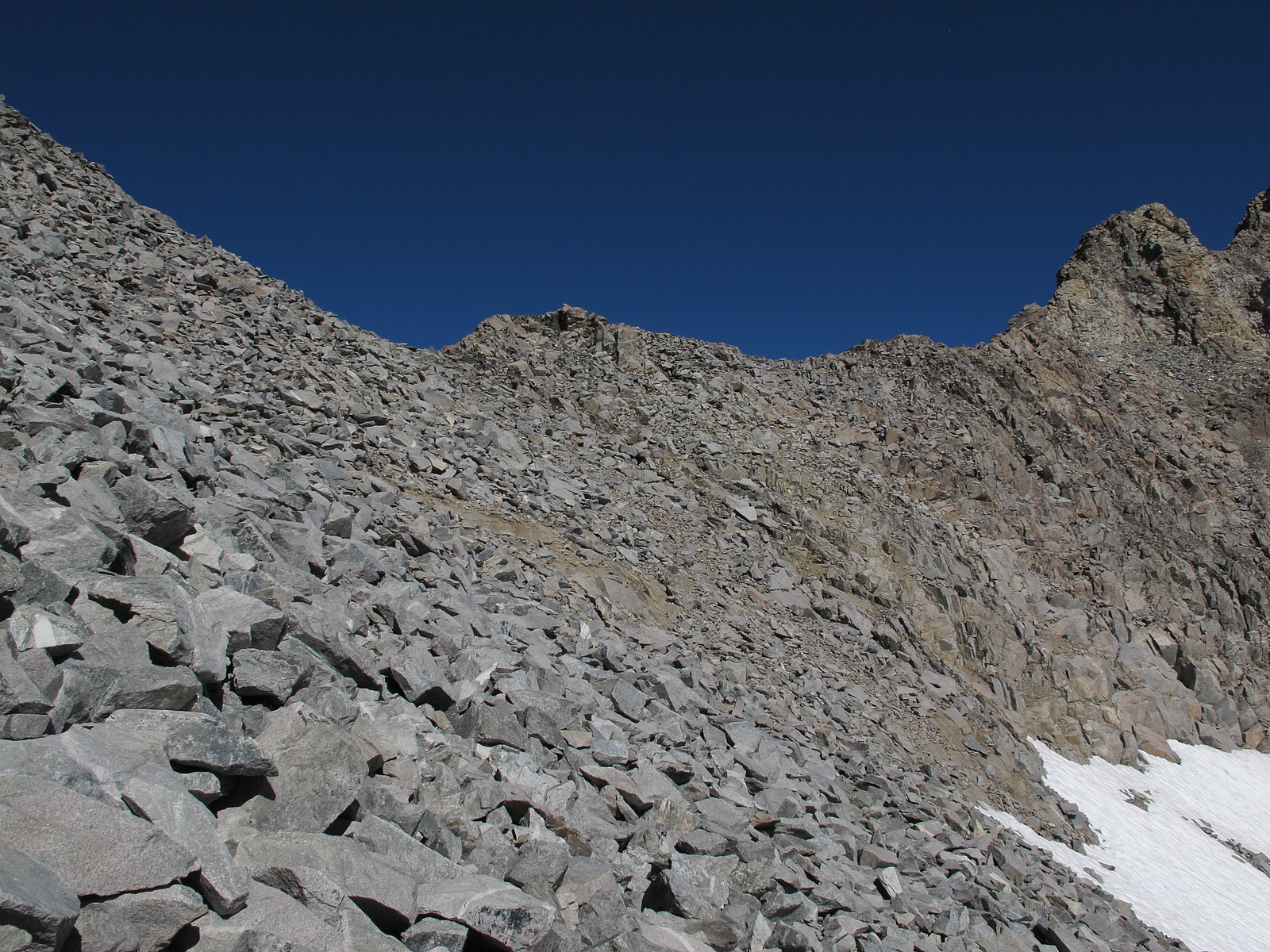

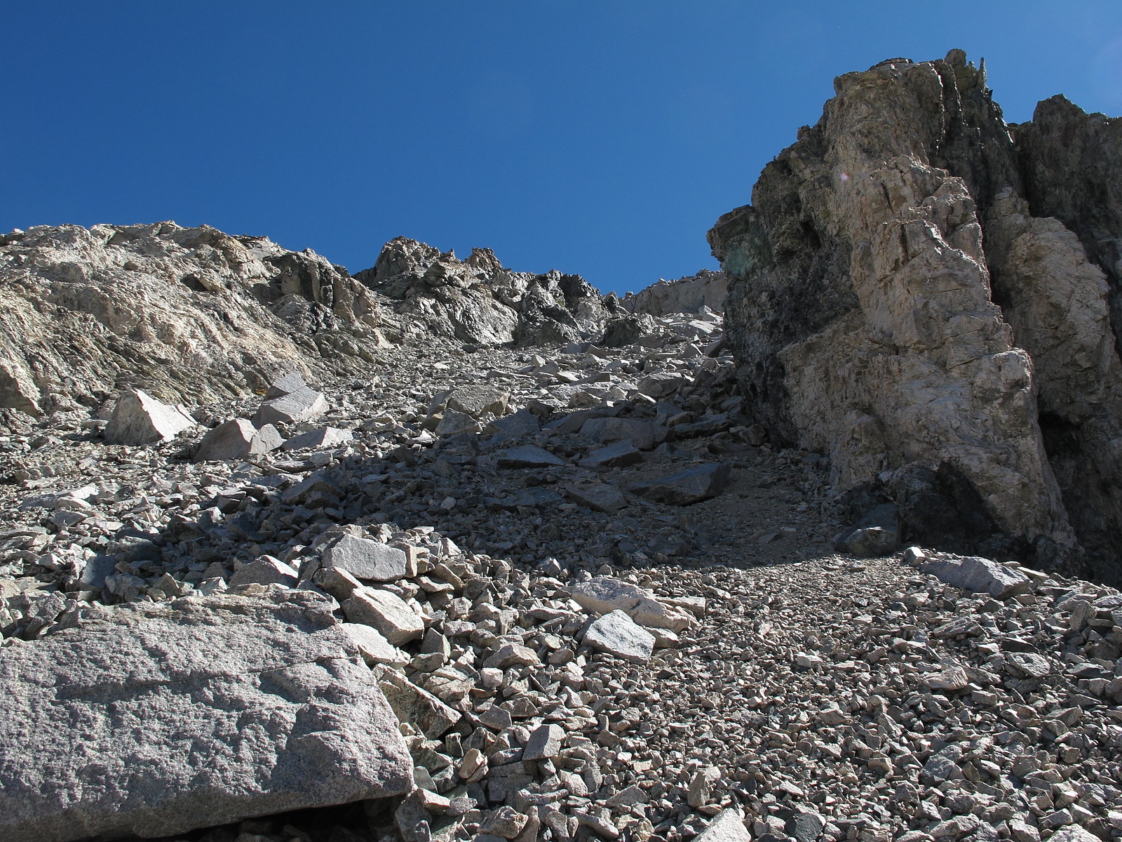
One of the sections of hill side that gave way on me:

GENERAL OVERVIEW: This pass crosses between the upper Kern Kaweah River and 9 Lakes Basin
CLASS/DIFFICULTY: Class 2 - If one takes the ridge route you likely will have to pull at least one class 3 move.
LOCATION: Sequoia National Park along the North Western portion of Kaweah Peaks Ridge - HST Map
ELEVATION: 12,000
USGS TOPO MAP (7.5'): Triple Divide Peak
ROUTE DESCRIPTION: This pass has two general options for it's Eastern side. There is a Col. that is Pants Pass itself that consists of very steep loose rock and sand that may require you to utilize hand holds on the cliff walls to maintain a controlled ascent/descent but a much better option is available. If coming from the West once you have reached the top turn right and climb some rock moving South that is easy class 3. Continue along the top of the class 2 ridge for about 100 yards until you reach another small saddle which offers easy class 2 slopes down. These slopes are stable rock. If coming from the East you will notice the Col. that is Pants Pass spitting a nasty scree slope out the bottom. Look further left along the ridge for the obvious small saddle and aim for it. When faced with the two choices I can see no reason to ever take the actual Col. that is Pants Pass other then the novelty of saying you did it.
The West side is some what steep very loose scree. Plant each step firmly into the ground to maintain stable footing yet be cautious not to dig your foot in hard and hit a large rock under the soil and slip. This slope demands that you stay completely aware of your surroundings at all times! Read the slope with each step. Stop and look above you constantly and be aware if the slope above you is giving way with each of your steps. Twice I had the entire slope give on me and I had to run out of the way of the avalanche. A third time I fell down and was being taken down hill by a slide. Once you have dropped down aways the path in front of you will start to turn into a mess of cliffs. Turn left and continue down nasty scree and talus slopes.
One of the sections of hill side that gave way on me: