R02 TR: Tiltill Creek 10/12-10/15 2011
Posted: Sun Oct 16, 2011 10:51 am
Bumped this up since there seems to be interest.
Hetch Hetchy Bushwhack/Death March
Oct 12-15, 2011
Three major creeks flow into Hetch Hetchy north of the Tuolumne River: Rancheria, Tiltill and Falls. None have trails and all have intrigued me. Late season with low water, less heat, bugs and vegetation provide ideal conditions. The “plan” was to loop via Tiltill and Falls Creeks with side trips to Branigan and Vernon Lakes.
At the parking lot I discovered I had forgotten to pack the rain gear. Oh well, weather reports only had 20% chance rain and I had a large garbage bag. At least my pack was light! I left the parking lot at 11AM hoping to get the 10 miles and 3,400 feet elevation gain to Tiltill Valley before dark. It was hot; the death march began! Other than pit stops, I marched quickly sweating profusely, mind over matter, reaching Tiltill Valley at 4PM, luckily finding a nice established campsite with running water. Little face-swarming gnats added to the death-march ambiance. I quickly abandoned the idea of drinking treated water (I only had chlorine tabs) and filled up on whatever water I could find. As it was, I had plenty of daylight left to hike around Tiltill Valley, check out going directly up the creek and have a leisurely dinner. I could have slowed it down a bit and enjoyed the hike a more. It was dark by 7PM but soon the nearly full moon arose providing enough light to make shadows. I ached; it was a 2 Advil/electrolyte supplement night.

Tiltill Valley
Next morning I got up at 6:30 in moonlight and left at 8AM as the sunlight hit camp. I had decided to go up the trail 600 feet of elevation before traversing into Tiltill Creek. Where I had planned on leaving the trail I found a cairn which gave me hope of a use-trail. Hope soon faded as I repeatedly walked game trails that ended in thickets of scrub oak, Manzanita and cliffs. I would have to bash through the brush, literally climbing on limbs and crawling under tangles and had to drop 400 hard earned feet of elevation to reach the creek at 6,400 feet where the jungle turned into car-to-refrigerator sized talus. I took a snack break at a small pond above the talus. The next 3 miles to another pond at 7,400 feet alternated between easy rock slabs, rock scrambling, dry brush and outright jungle conditions. At one point I had to take off my pack and drag it under a tangle of branches. I swear I went back and forth from the east to west side of the narrow canyon a million times searching for paths through the jungle. Thank goodness there were no more gnats. It was still warm but a nice breeze had picked up. I made steady slow progress upward. I reached the pond at 2PM and ate lunch. Although only 0.8 mile to Branigan Lake, I “zigged” a million “zags” to find a route to the inlet. I had come a bit over 6 miles and 2,200 feet gain in 7 hours- really not bad considering conditions. It really was a more relaxing day than the previous. I immediately jumped in the lake to cool off, washed clothes and drank enough water to make my stomach slosh. I found a sandy campsite on the top of a rock, set up and then tried fishing to no avail. Back at camp I cooked dinner and at 6:30 near dusk the lake became alive with fish. I grabbed my pole and tried but my location was on the shallow side of the lake and all the fish were out of my puny casting distance. I retreated to the tent at 7PM. The moon soon came up as did the wind. It howled all night; I put in earplugs but the tent still shook so I slept poorly.

Tiltill Creek above lower Pond

Upper Pond
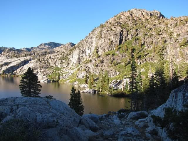
Branigan Lake
Next morning I got up in the moonlight and moved down off the rock to a more sheltered spot to cook breakfast. I was off at 7:30 AM on what was to be a long day. My first objective was to get to the inlet of Middle Branigan Lake; the most difficult terrain so far taking me 2.3 hours to get a bit less than a mile! It was hideous brush again, this time on the steep northwest shore with the addition of cliffs. At times I was hanging precariously on Manzanita where a slip would mean a dunking into the lake. Many times it took two to three tries to find a route that would go; many times my feet never touched solid ground. The large talus blocks were actually a nice relief from the brush. I was in the shadows, kept my “cool”, one step at a time, and concentrated on positive thoughts that I really would make it. At the inlet I decided to bail to the east and bypass Upper Branigan Lake; a good decision as the terrain became more open slabs. In an hour I intersected the trail and in another half hour crossed the beautiful Falls Creek in Jack Main Canyon. I was surprised that there still were large snow patches on the ground (7,700 feet elevation) and the creek was still knee deep. I took my first long break of the day. I abandoned the idea of a side trip to Mahan Lake since I had my fill of off-trail travel at this moment. I walked 3 miles down Jack Main Canyon, full of lush meadows, little lakes and following the beautiful creek until the point where it leaps over the cliffs south to Lake Vernon. The “plan” was to descend the rocky slabs next to the creek, but I was not sure it would work and my appetite for adventure was low at this point. So I trudged up the trail in spite of the trail route being 6 miles and the direct route 2 miles. I found a nice campsite at Lake Vernon about 4:30PM, too tired to fish after a 12-mile day with by far, the most difficult off-trail travel. I built a fire since I did not have enough fuel for both dinner and breakfast. I had forgotten what a pain it is to cook on a fire although I enjoyed the ambiance of the fire. I barely got camp chores done before dark.

Rough northwest shore of Middle Branigan Lake

Lake in Jack Main Canyon

Lake Vernon

Camp at Lake Vernon
The “plan” for my last day was to follow Falls Creek to the top of Wapama Falls then traverse a mile-and-half to the trail. I debated until the last minute. The first two miles would be easy slab walking but the remainder would be difficult and hot. The off-trail route was essentially the same distance and the trail route. When I planned the trip it was supposed to be cloudy, but it was 8AM and already hot. I had strained my arch the day before. I was nearly out of food. I lost my “mojo”. A quick 10-mile walk out the trail won the debate. Falls Creek will have to wait for another trip. As I reached the switchbacks, I now ran into many groups going up the trail, after my three days of solitude. I ate lunch at the dam, ironically observing that here I was, a few hundred yards from a parking lot, and this really was the best view of the trip! I had satisfied my yearning for low-elevation off-trail Yosemite canyons. I am glad I got rid of this “itch” but would never do it again.

Hetch Hetchy
Hetch Hetchy Bushwhack/Death March
Oct 12-15, 2011
Three major creeks flow into Hetch Hetchy north of the Tuolumne River: Rancheria, Tiltill and Falls. None have trails and all have intrigued me. Late season with low water, less heat, bugs and vegetation provide ideal conditions. The “plan” was to loop via Tiltill and Falls Creeks with side trips to Branigan and Vernon Lakes.
At the parking lot I discovered I had forgotten to pack the rain gear. Oh well, weather reports only had 20% chance rain and I had a large garbage bag. At least my pack was light! I left the parking lot at 11AM hoping to get the 10 miles and 3,400 feet elevation gain to Tiltill Valley before dark. It was hot; the death march began! Other than pit stops, I marched quickly sweating profusely, mind over matter, reaching Tiltill Valley at 4PM, luckily finding a nice established campsite with running water. Little face-swarming gnats added to the death-march ambiance. I quickly abandoned the idea of drinking treated water (I only had chlorine tabs) and filled up on whatever water I could find. As it was, I had plenty of daylight left to hike around Tiltill Valley, check out going directly up the creek and have a leisurely dinner. I could have slowed it down a bit and enjoyed the hike a more. It was dark by 7PM but soon the nearly full moon arose providing enough light to make shadows. I ached; it was a 2 Advil/electrolyte supplement night.
Tiltill Valley
Next morning I got up at 6:30 in moonlight and left at 8AM as the sunlight hit camp. I had decided to go up the trail 600 feet of elevation before traversing into Tiltill Creek. Where I had planned on leaving the trail I found a cairn which gave me hope of a use-trail. Hope soon faded as I repeatedly walked game trails that ended in thickets of scrub oak, Manzanita and cliffs. I would have to bash through the brush, literally climbing on limbs and crawling under tangles and had to drop 400 hard earned feet of elevation to reach the creek at 6,400 feet where the jungle turned into car-to-refrigerator sized talus. I took a snack break at a small pond above the talus. The next 3 miles to another pond at 7,400 feet alternated between easy rock slabs, rock scrambling, dry brush and outright jungle conditions. At one point I had to take off my pack and drag it under a tangle of branches. I swear I went back and forth from the east to west side of the narrow canyon a million times searching for paths through the jungle. Thank goodness there were no more gnats. It was still warm but a nice breeze had picked up. I made steady slow progress upward. I reached the pond at 2PM and ate lunch. Although only 0.8 mile to Branigan Lake, I “zigged” a million “zags” to find a route to the inlet. I had come a bit over 6 miles and 2,200 feet gain in 7 hours- really not bad considering conditions. It really was a more relaxing day than the previous. I immediately jumped in the lake to cool off, washed clothes and drank enough water to make my stomach slosh. I found a sandy campsite on the top of a rock, set up and then tried fishing to no avail. Back at camp I cooked dinner and at 6:30 near dusk the lake became alive with fish. I grabbed my pole and tried but my location was on the shallow side of the lake and all the fish were out of my puny casting distance. I retreated to the tent at 7PM. The moon soon came up as did the wind. It howled all night; I put in earplugs but the tent still shook so I slept poorly.
Tiltill Creek above lower Pond
Upper Pond
Branigan Lake
Next morning I got up in the moonlight and moved down off the rock to a more sheltered spot to cook breakfast. I was off at 7:30 AM on what was to be a long day. My first objective was to get to the inlet of Middle Branigan Lake; the most difficult terrain so far taking me 2.3 hours to get a bit less than a mile! It was hideous brush again, this time on the steep northwest shore with the addition of cliffs. At times I was hanging precariously on Manzanita where a slip would mean a dunking into the lake. Many times it took two to three tries to find a route that would go; many times my feet never touched solid ground. The large talus blocks were actually a nice relief from the brush. I was in the shadows, kept my “cool”, one step at a time, and concentrated on positive thoughts that I really would make it. At the inlet I decided to bail to the east and bypass Upper Branigan Lake; a good decision as the terrain became more open slabs. In an hour I intersected the trail and in another half hour crossed the beautiful Falls Creek in Jack Main Canyon. I was surprised that there still were large snow patches on the ground (7,700 feet elevation) and the creek was still knee deep. I took my first long break of the day. I abandoned the idea of a side trip to Mahan Lake since I had my fill of off-trail travel at this moment. I walked 3 miles down Jack Main Canyon, full of lush meadows, little lakes and following the beautiful creek until the point where it leaps over the cliffs south to Lake Vernon. The “plan” was to descend the rocky slabs next to the creek, but I was not sure it would work and my appetite for adventure was low at this point. So I trudged up the trail in spite of the trail route being 6 miles and the direct route 2 miles. I found a nice campsite at Lake Vernon about 4:30PM, too tired to fish after a 12-mile day with by far, the most difficult off-trail travel. I built a fire since I did not have enough fuel for both dinner and breakfast. I had forgotten what a pain it is to cook on a fire although I enjoyed the ambiance of the fire. I barely got camp chores done before dark.
Rough northwest shore of Middle Branigan Lake
Lake in Jack Main Canyon
Lake Vernon
Camp at Lake Vernon
The “plan” for my last day was to follow Falls Creek to the top of Wapama Falls then traverse a mile-and-half to the trail. I debated until the last minute. The first two miles would be easy slab walking but the remainder would be difficult and hot. The off-trail route was essentially the same distance and the trail route. When I planned the trip it was supposed to be cloudy, but it was 8AM and already hot. I had strained my arch the day before. I was nearly out of food. I lost my “mojo”. A quick 10-mile walk out the trail won the debate. Falls Creek will have to wait for another trip. As I reached the switchbacks, I now ran into many groups going up the trail, after my three days of solitude. I ate lunch at the dam, ironically observing that here I was, a few hundred yards from a parking lot, and this really was the best view of the trip! I had satisfied my yearning for low-elevation off-trail Yosemite canyons. I am glad I got rid of this “itch” but would never do it again.
Hetch Hetchy