R01 TR: Center Basin via Bubbs Creek Trail - July 19-23, 2018
Posted: Thu Dec 08, 2022 12:00 am
Having reconsidered my ambivalence about posting a report for this old trip, I felt the need to dust off some photos from 2018 and attempt to whip them into shape.
Photos (mostly mine; a few taken by my son) are concentrated mainly within Center Basin itself, as many of you have hiked Bubbs Creek enough to have this area burned into your brain. Also, I linked a few very short videos; hopefully not so many that you find them annoying.
I did this trip with the younger of my two sons; his typical adventure mode is different than mine; he favors things like Whitney as a day hike, or camping in Havasupai, or motorcycle (or bicycle) road trips, so I was especially pleased to have him join me on this trip.
One-way mileage to our camp at Golden Bear Lake (per my saved GPS tracks) was 18-ish miles with close to 7200’ elevation gain over two days; a feat which I doubt I could perform today.
—- Day 1 —-
Leaving early from the Roads End trailhead to try and beat the heat, we endured the flat slog at the beginning and made it up the initial group of switchbacks in decent time. This is a tough climb, but the magnificent views helped move us along. Eventually, we hit those pleasantly-shaded forest sections (I love those fern-populated stretches), the trail threading between those two unforgettably house-size boulders, and so on.
Eventually, we achieved this day’s goal of making camp at Junction Meadow. After setting up and getting dinner out of the way, I did manage to find some things to like about this place -
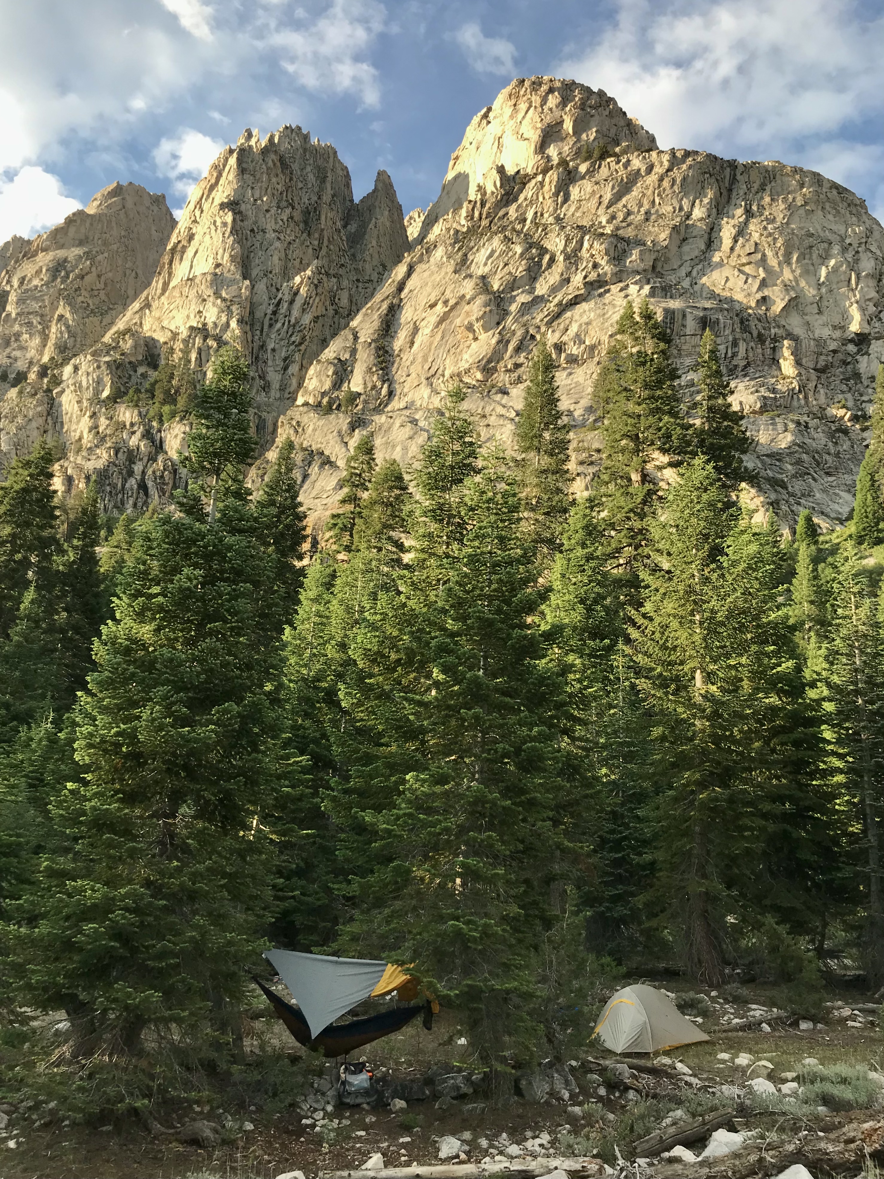 Mt Bago, looming over our nice camp site
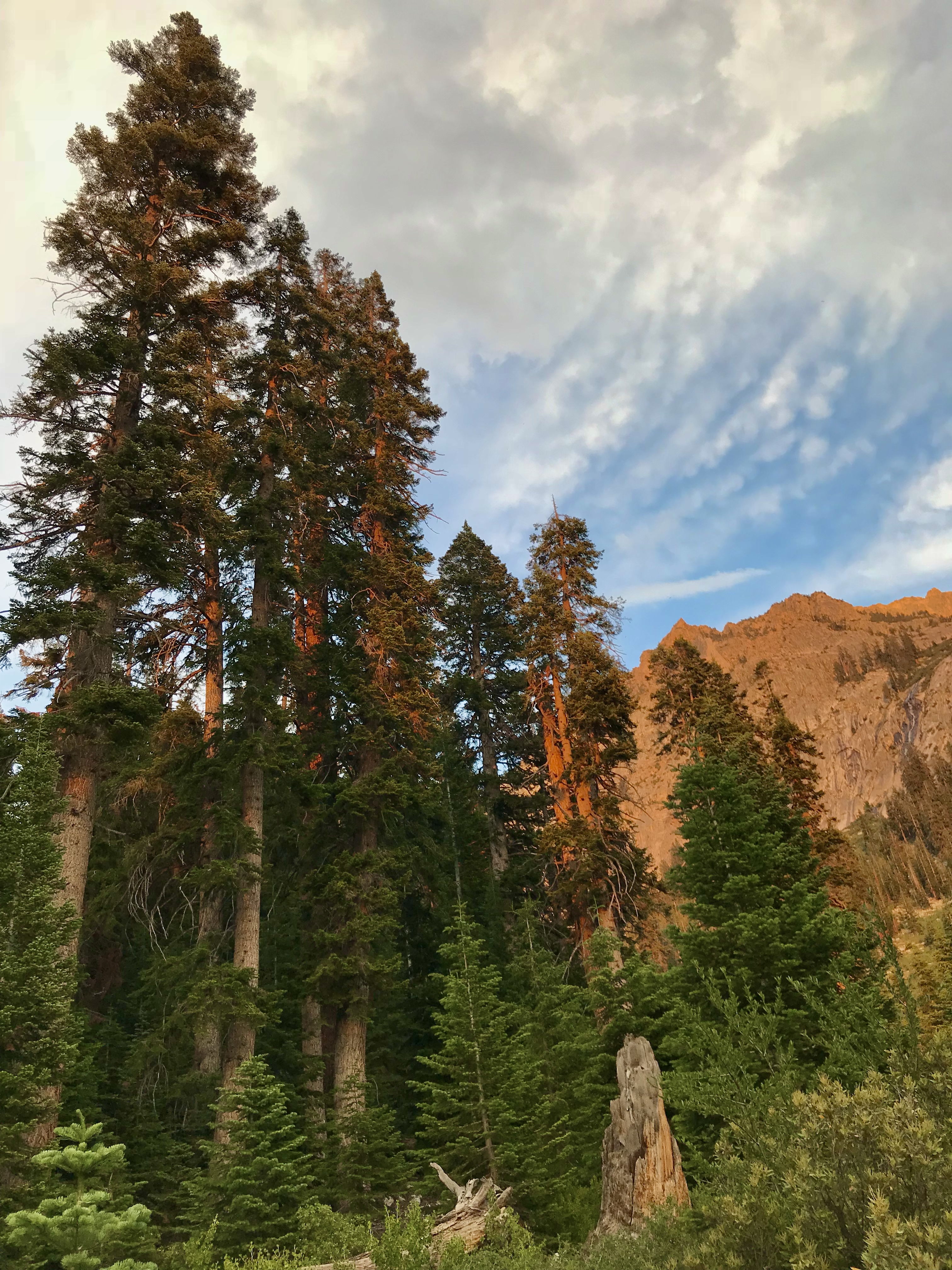 some tall trees in Junction Meadow
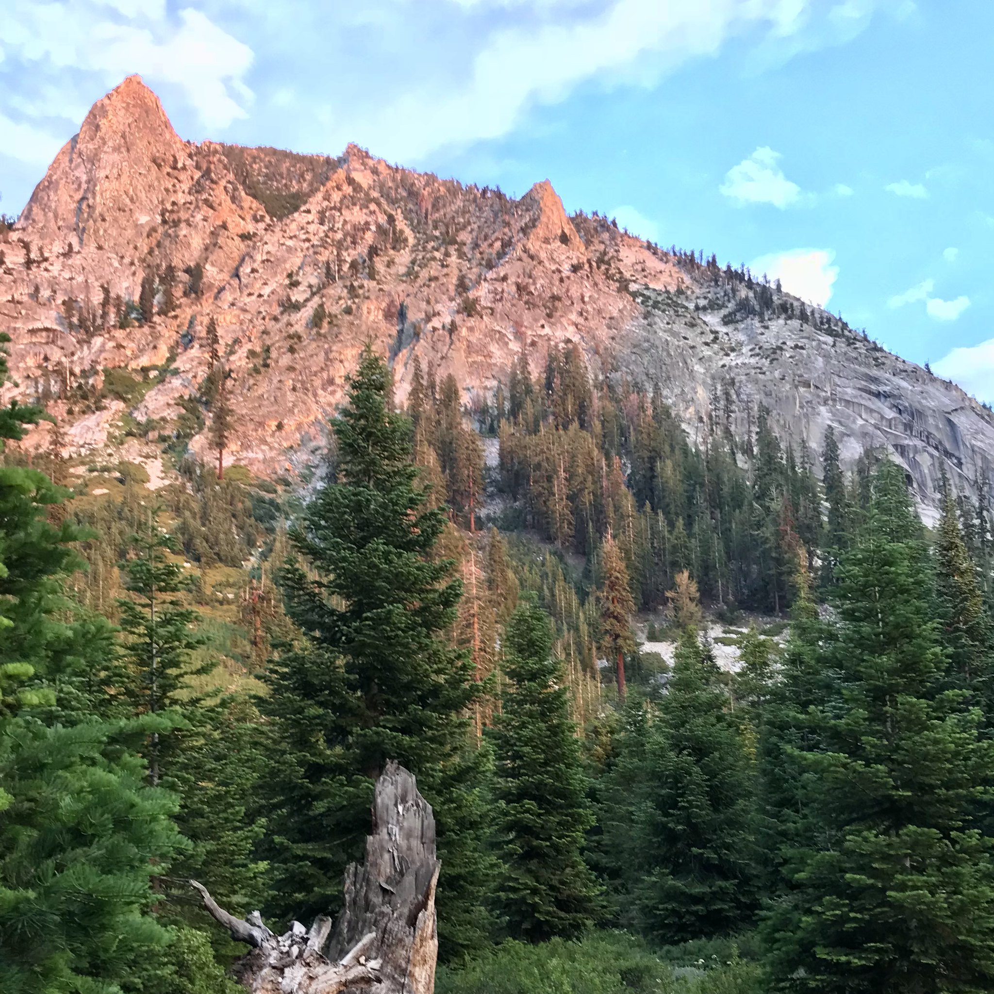 another so-so view from our camp
—- Day 2 —-
Got up, did camp things, and got moving. Nothing too remarkable about our morning. But we did find the steep climb eastward (from Junction Meadow) to be memorable, for the strenuous effort required as well as for its outstanding views. We also encountered a trail crew doing extensive work on some of the water bars and retaining features along the way.
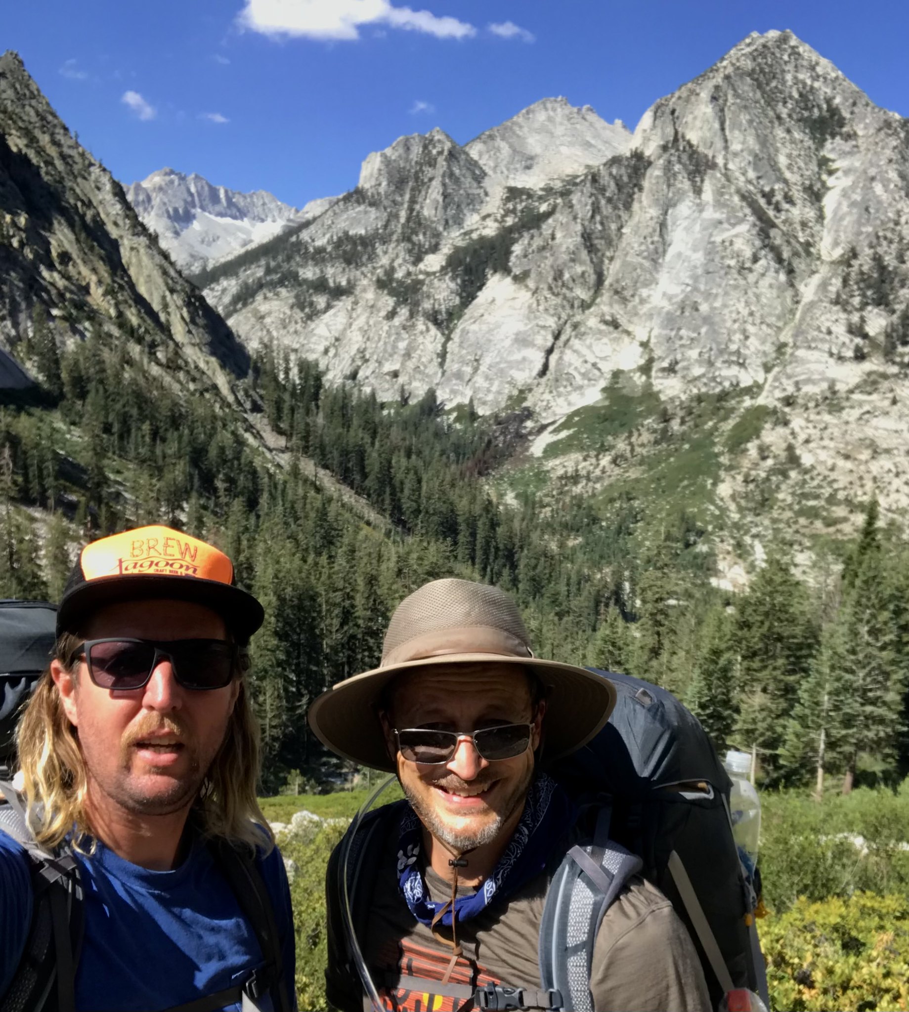 enjoying a fine morning on the Bubbs Creek trail
 but there’s nothing like a little variety in the weather
As the last photo shows, the sky had clouded up considerably by the time we joined the JMT. Upon reaching the upper Vidette Meadow area, we stopped for a nice break along the creek. Moving on, we began to anticipate the (unmarked) turnoff toward Center Basin; keeping some tips on its location (gleaned from previous TRs) in mind. But most maps at that time depicted the junction 200 yards or so north of where it was in reality; I assumed the map was accurate and unwisely started heading us uphill and east-ish, on a course which would never intercept the actual trail, had we blindly stuck to it.
After weaving back and forth up a forested slope for maybe 1/4 mile, we were tired, discouraged and had resigned ourselves to return to the JMT and make camp. Taking one last shot, we veered south, and fortunately picked up the old trail to Center Basin. MUCH easier travel over more reasonable terrain brought us to the broad flat wetland/meadow area of the lower basin; we picked our own way around various ponds and ribbons of the creek, as the old trail (as plotted on my GPS map) didn’t always appear to be the easiest way.
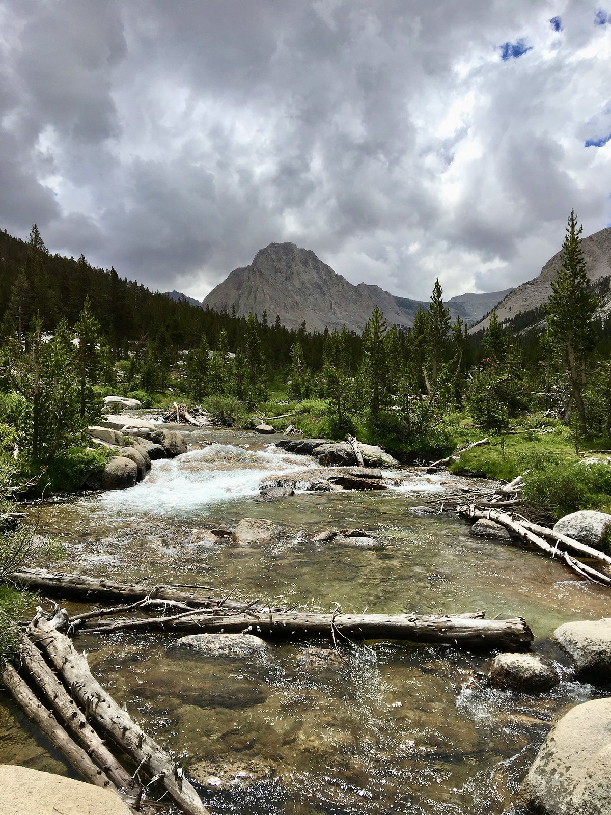
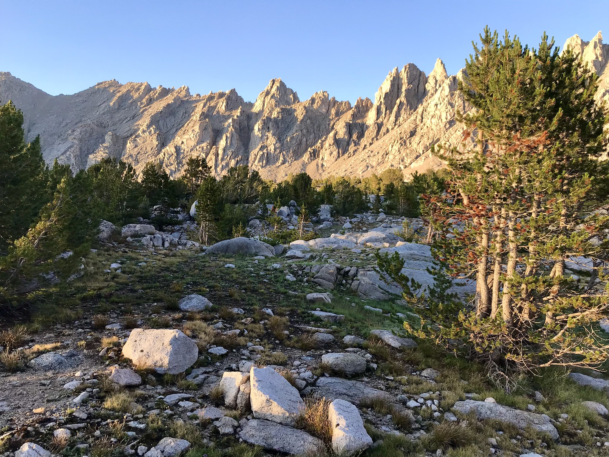
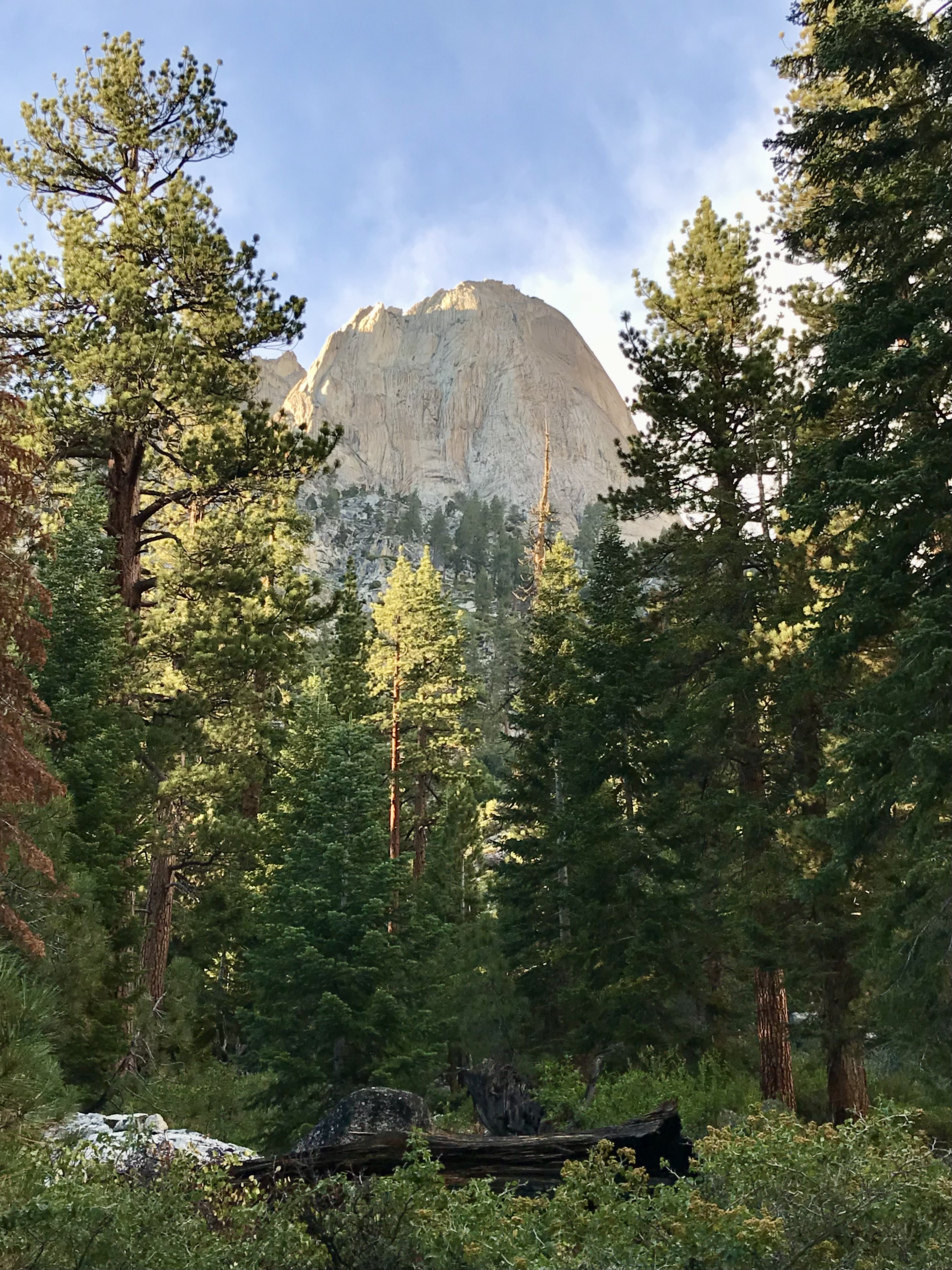
By now, we had been getting light rain off and on, but not so much that we got soaked. We now had a great view of Center Peak, which I found to be wonderfully imposing -
(video):
https://flic.kr/p/2o4y9fH
and a similar view of Center Peak, looking across a large pond/lakelet downstream of the actual lake -
 Center Peak
Soon, we reached Golden Bear Lake itself -
 a light rain falls on Golden Bear Lake
Finding a relatively sheltered spot under some Whitebark Pines, I set up my tent (and my son his hammock), then rested and wandered around for a bit. The rain and mist added a bit of interest to our setting-
(video)
https://flic.kr/p/2o4xEff
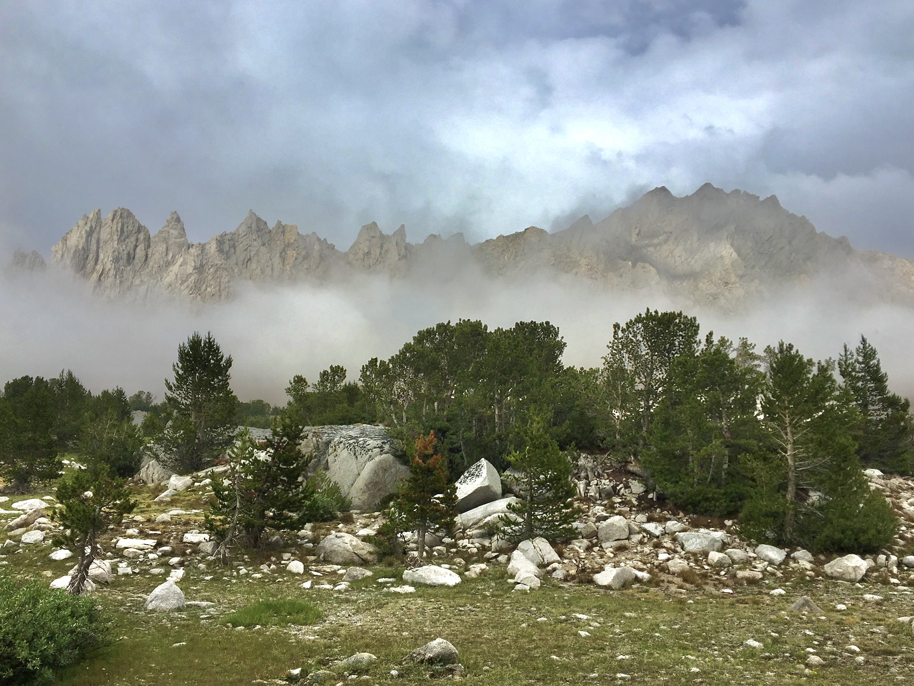 misty view of Center Basin Crags
We didn’t know what the weather would do, so we went ahead and had our dinner (sitting in our rain jackets) while enjoying a bit of bourbon. Eventually, the rain stopped and we got a beautiful clear sky -
 Don’t like the weather? Just wait a couple of hours.
 sunset glow
We spent a nice night here, apparently the only people in the immediate area.
—- Day 3 —-
During the night, we had both been awakened by a tremendous rumble from somewhere across the lake. The rain also resumed for a while, with lots of lightning to our west. Over breakfast, we discussed what had obviously been a large rockfall off Center Peak and also guessed (correctly, as we later learned) that we had been spared from a much worse rain event elsewhere. While we sat, a couple of people walked past us (at a distance); we thought they might set up camp further along the lake shore, but then we never saw them again.
Today was a layover day, so we headed off for a day hike toward Lake 11,785’, and maybe further if we felt like it.
We had beautiful clear weather
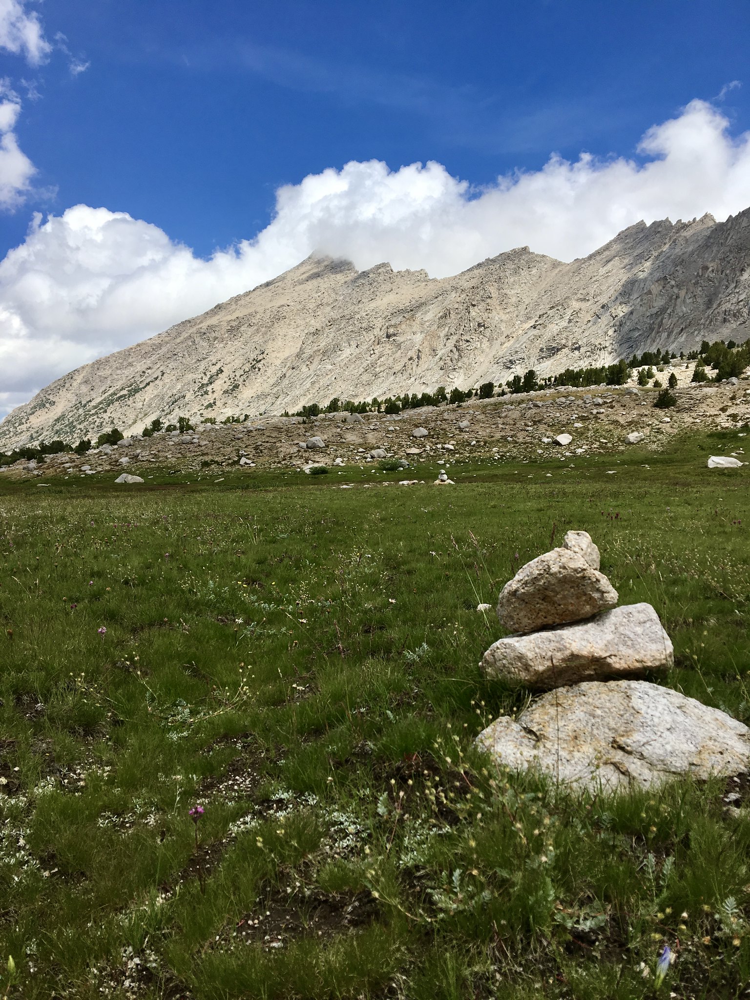 sunny meadow, heading up the basin from GB Lake
 a nice uphill stroll
here are a couple of videos showing the views heading up the basin, with the second one showing our approach to Lake 11,785’ -
https://flic.kr/p/2o4uRji
https://flic.kr/p/2o4xEgn
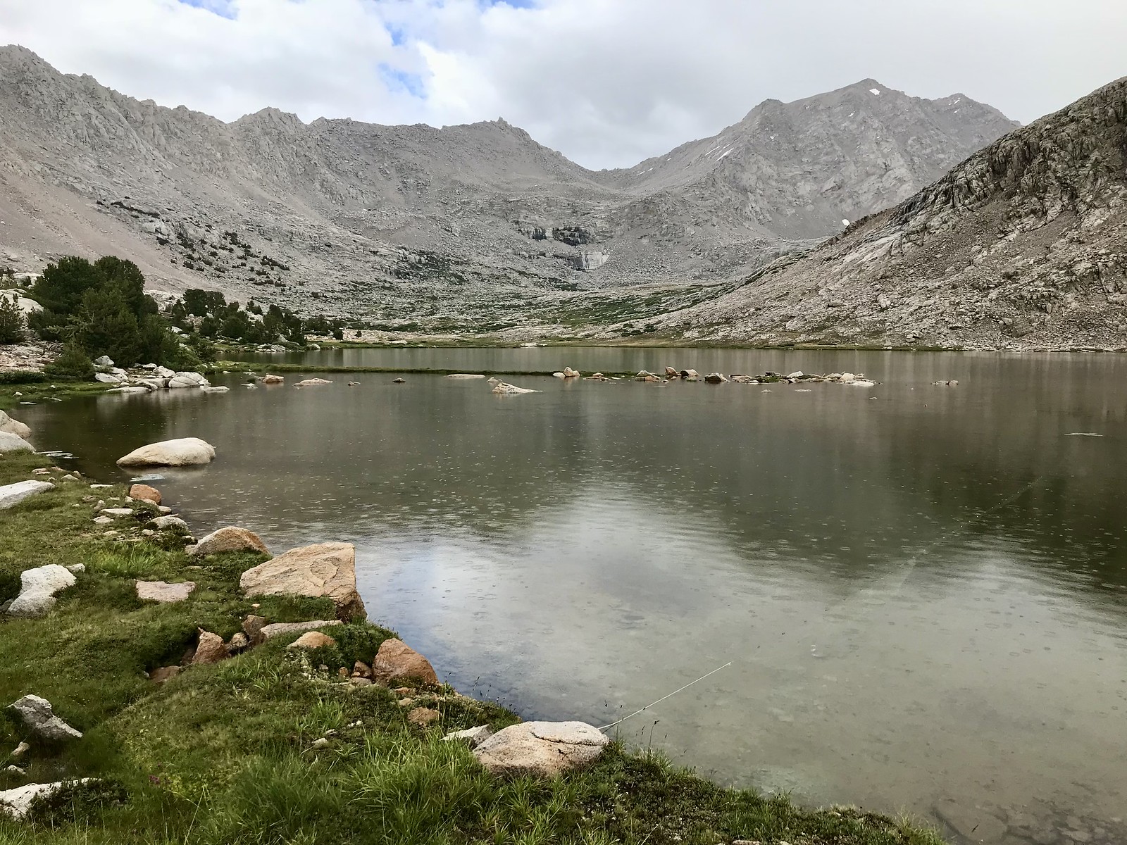
We arrived at the lake, took a nice long break, and just enjoyed the views … although my son did do his “naked jump into the icy lake” thing and got it on video for his Instagram


Anyway, here is what we saw (of the lake):
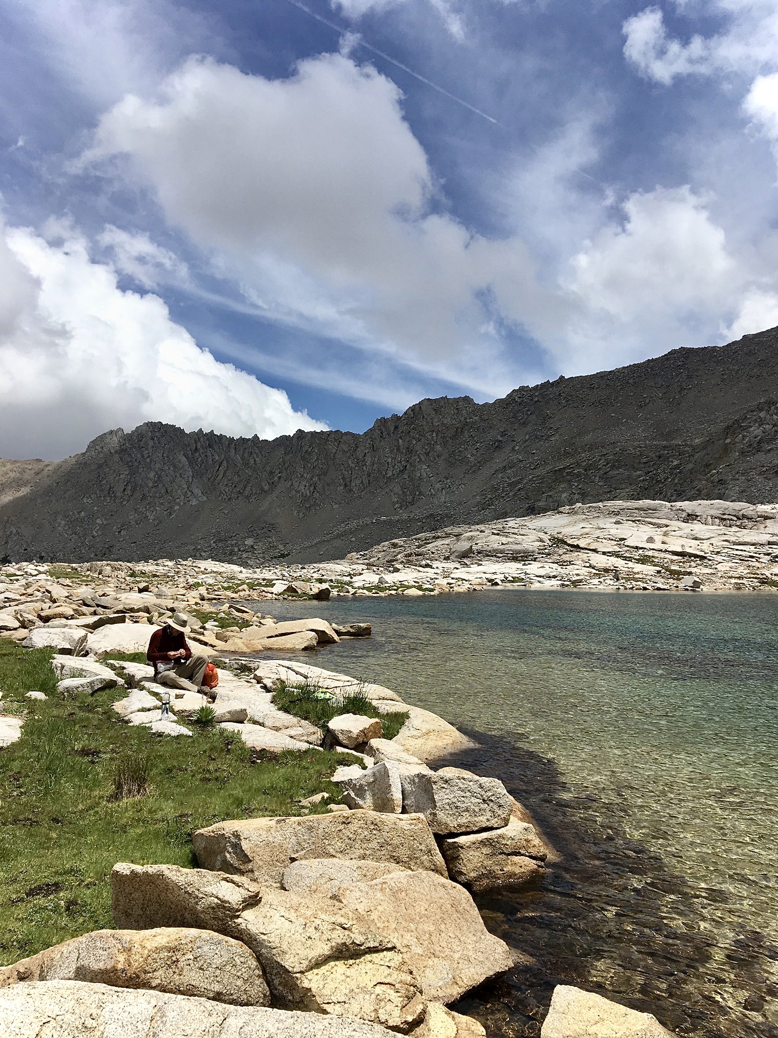 break time at Lake 11,785’
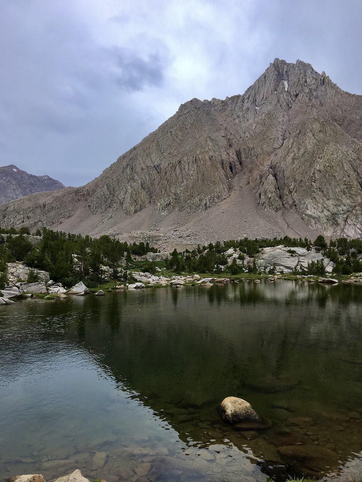
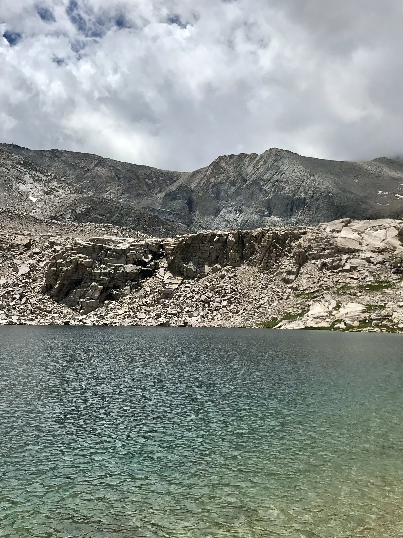 yes, I very much liked the color of this lake
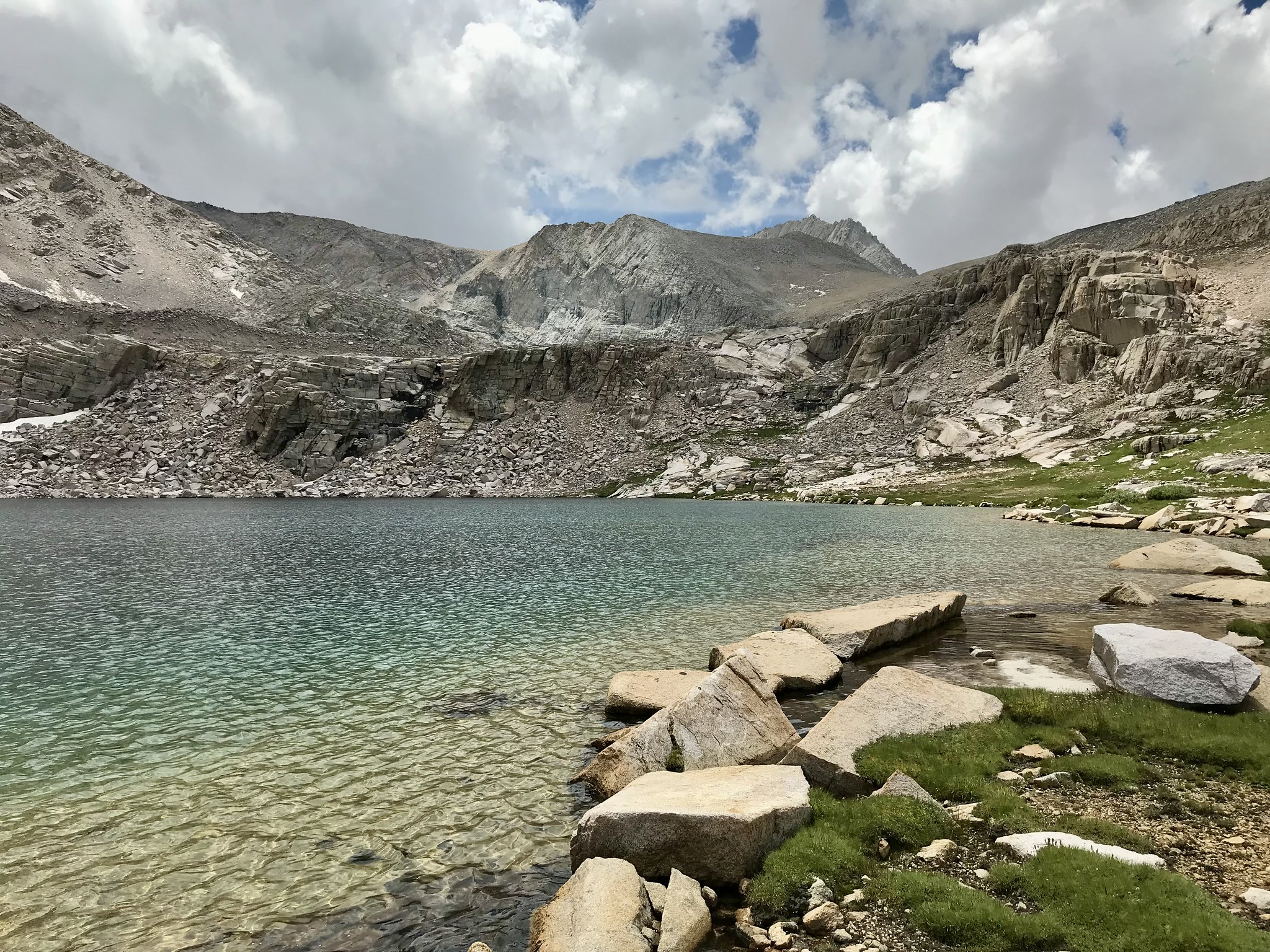 Junction Pass is up that ridge somewhere
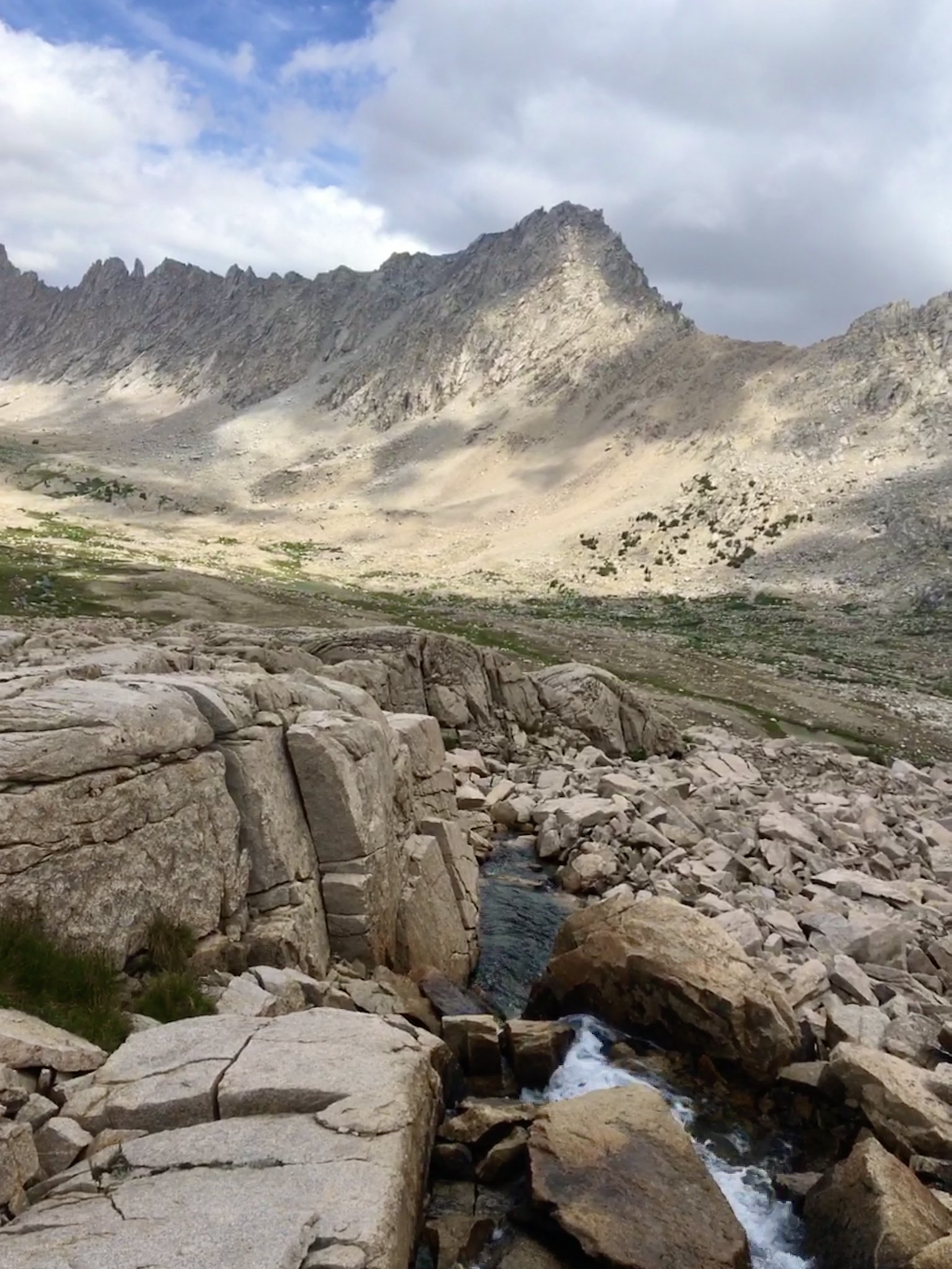
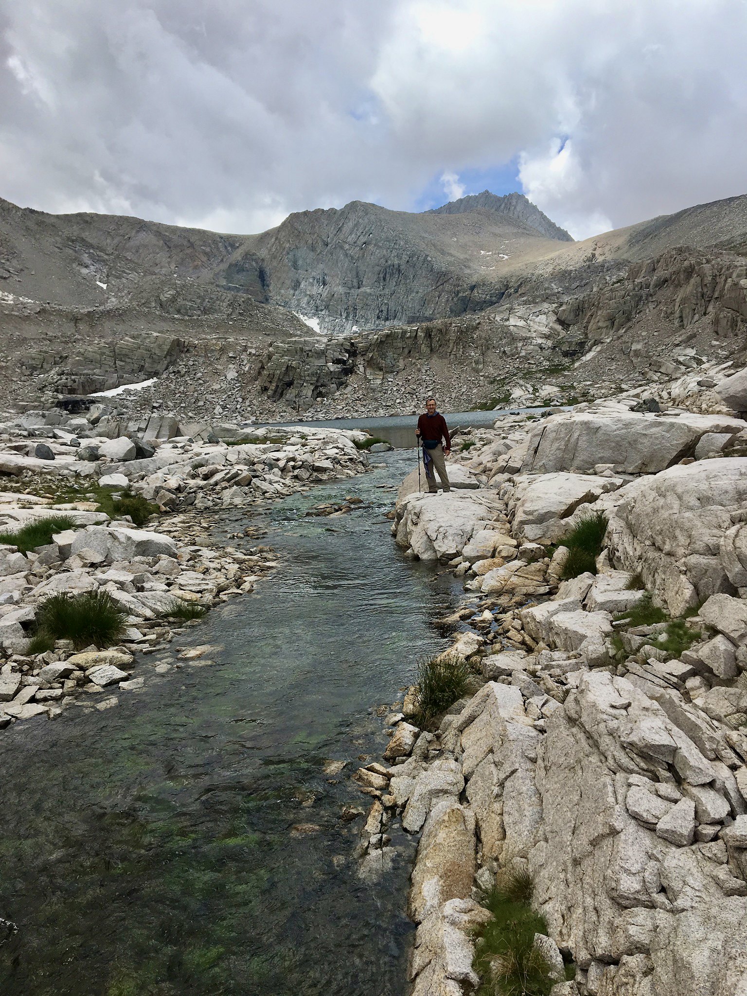 the very nice-looking outlet stream from Lake 11,785
… and of course fed my “video of moving water” obsession …
https://flic.kr/p/2o4suFE
Eventually, we needed to get back to our camp -
 heading back down the basin
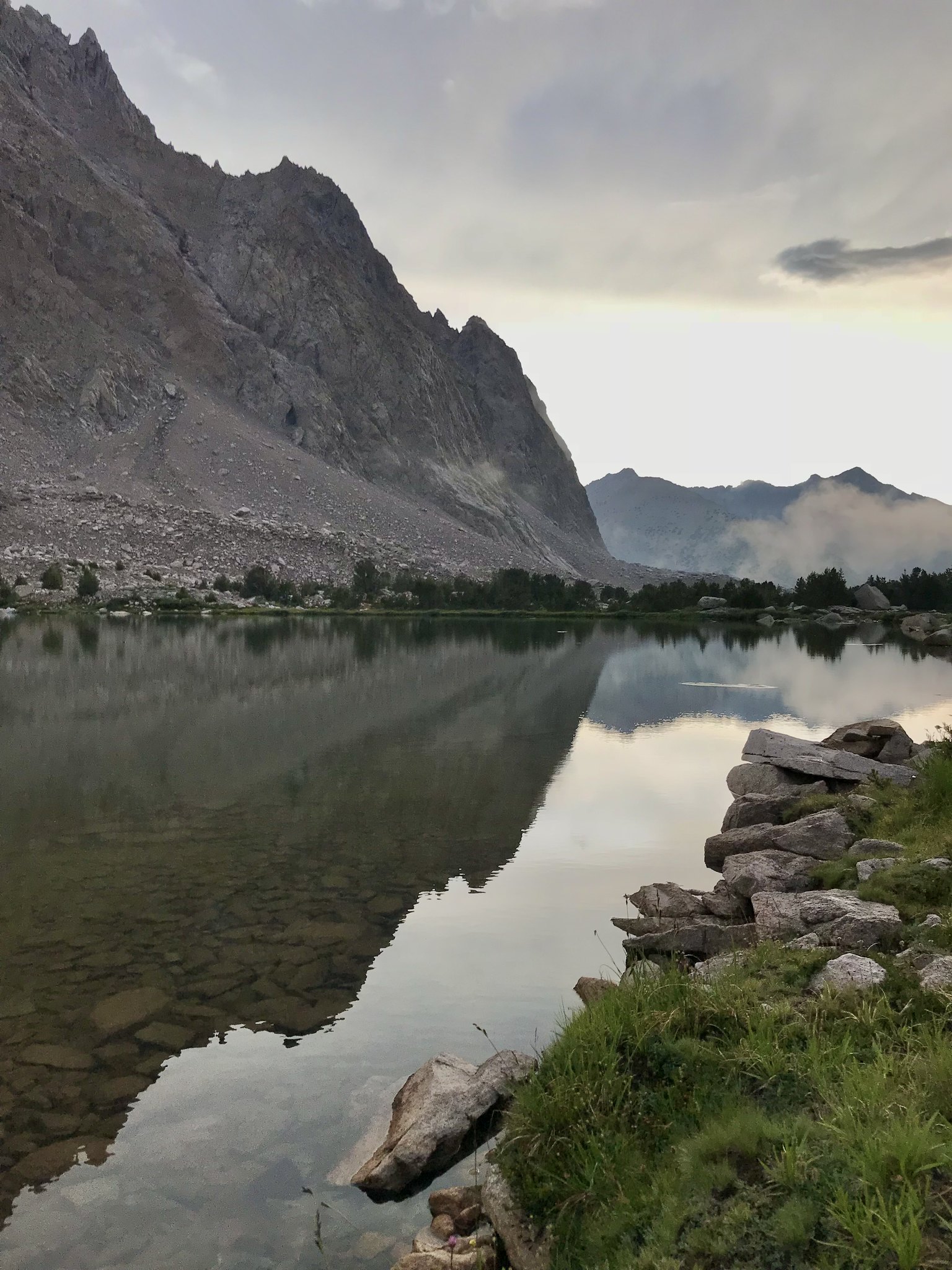 Center Peak reflection
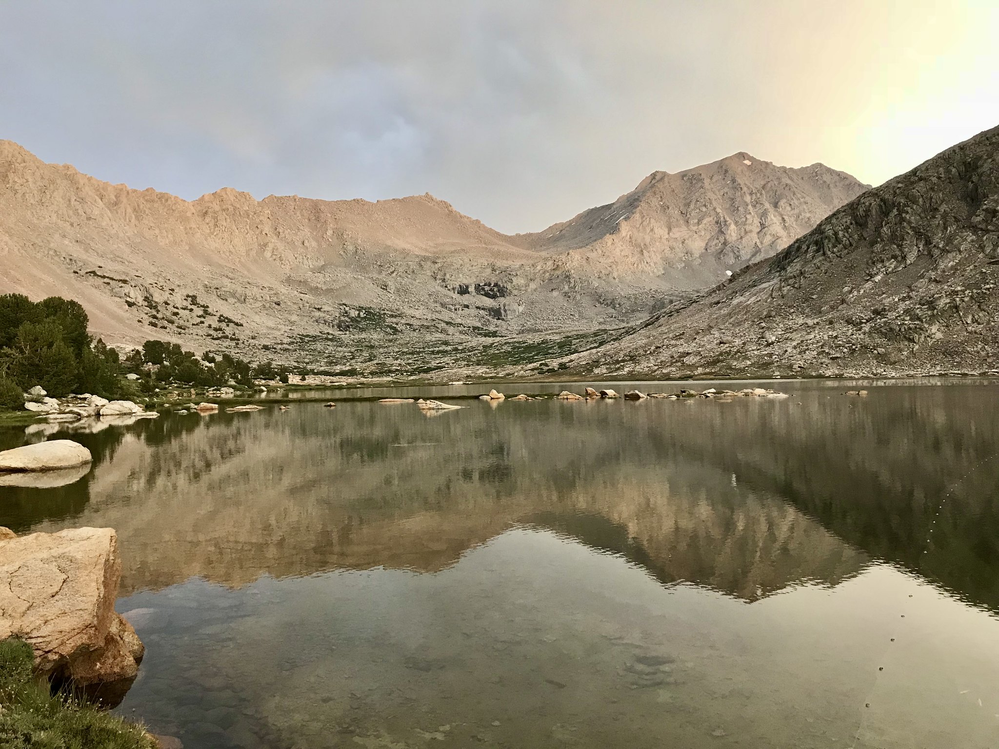 wow, this lake has some moods
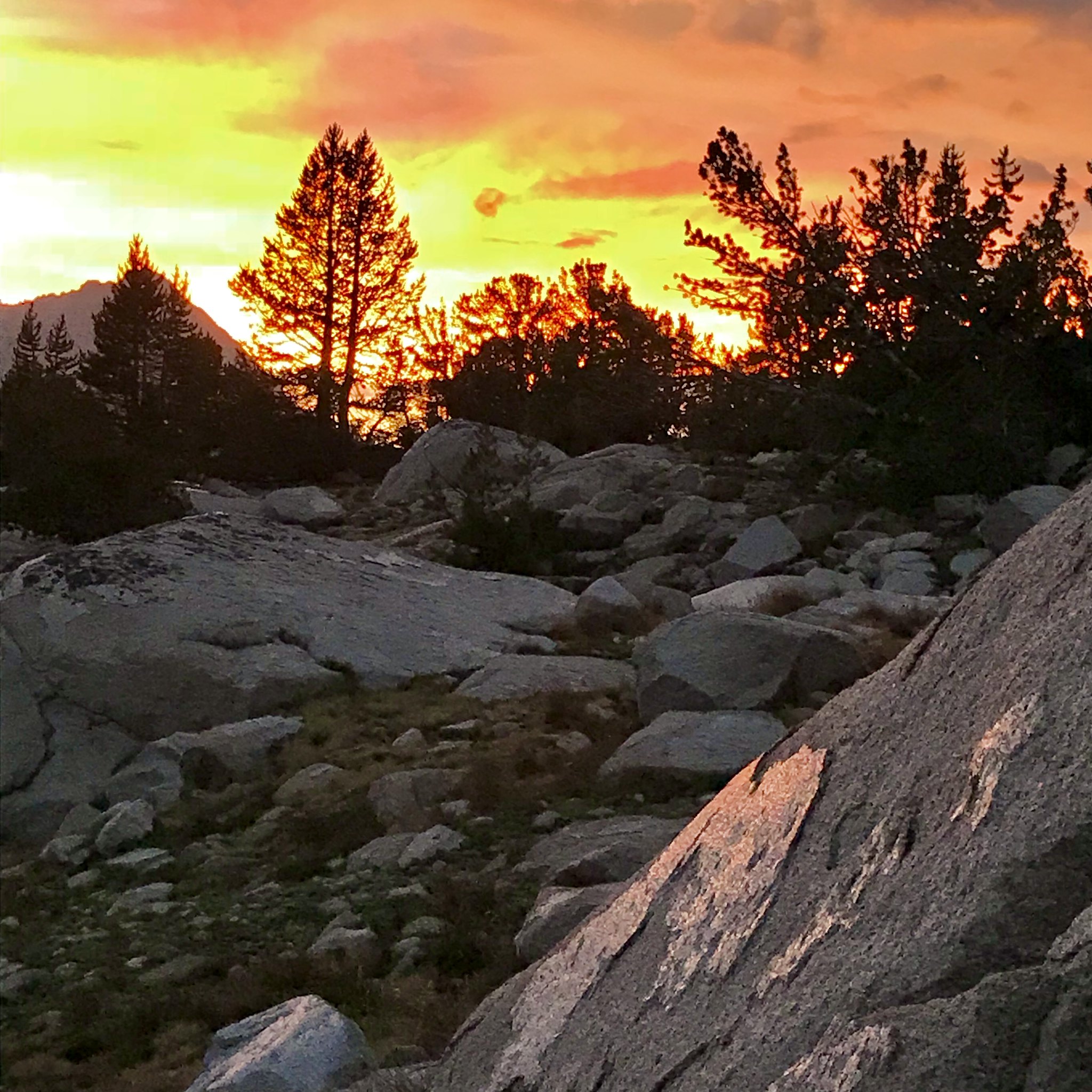 sunset-lit glacial polish
Basically, it was a near-perfect day.
Day 4
Describing our return trip, I’ll try to speed up a bit.
Moving back down the Bubbs Creek trail, we enjoyed views in a different light than we had experienced them heading up -
 Vidette Meadow
Continuing on, we observed that this area had received MUCH heavier rain than we experienced (during the lightning event a couple nights ago); this (sadly) had washed out much of the hard work we had seen the trail crew finishing up on our Day #2 ascent. Later on, we heard that flooding had done some road damage around Cedar Grove Road itself.
When we reached Junction Meadow, we wandered over to check out the crossing of Bubbs Creek here, as a East Lake & Lake Reflection had originally been our possible alternative destination. Once we saw the high/fast flow, we decided that neither of us would have wanted to cross in this condition.
We reached Charlotte Creek, made camp, and had some more nice evening views:
 Charlotte Dome, from our camp at Charlotte Creek
Day 5
An uneventful day, as we made quick progress down toward our starting point. Reaching the flat sandy-slog section, we were in “just get it over with” mode, until we finally had a bear sighting:
(video)
https://flic.kr/p/2o4suKT
… you can hear my son’s note of irony of the situation, but on reflection, seems like actually the most logical place to spot a bear, especially a “collared” one.
Photos (mostly mine; a few taken by my son) are concentrated mainly within Center Basin itself, as many of you have hiked Bubbs Creek enough to have this area burned into your brain. Also, I linked a few very short videos; hopefully not so many that you find them annoying.
I did this trip with the younger of my two sons; his typical adventure mode is different than mine; he favors things like Whitney as a day hike, or camping in Havasupai, or motorcycle (or bicycle) road trips, so I was especially pleased to have him join me on this trip.
One-way mileage to our camp at Golden Bear Lake (per my saved GPS tracks) was 18-ish miles with close to 7200’ elevation gain over two days; a feat which I doubt I could perform today.
—- Day 1 —-
Leaving early from the Roads End trailhead to try and beat the heat, we endured the flat slog at the beginning and made it up the initial group of switchbacks in decent time. This is a tough climb, but the magnificent views helped move us along. Eventually, we hit those pleasantly-shaded forest sections (I love those fern-populated stretches), the trail threading between those two unforgettably house-size boulders, and so on.
Eventually, we achieved this day’s goal of making camp at Junction Meadow. After setting up and getting dinner out of the way, I did manage to find some things to like about this place -
Mt Bago, looming over our nice camp sitesome tall trees in Junction Meadowanother so-so view from our camp—- Day 2 —-
Got up, did camp things, and got moving. Nothing too remarkable about our morning. But we did find the steep climb eastward (from Junction Meadow) to be memorable, for the strenuous effort required as well as for its outstanding views. We also encountered a trail crew doing extensive work on some of the water bars and retaining features along the way.
enjoying a fine morning on the Bubbs Creek trailbut there’s nothing like a little variety in the weatherAs the last photo shows, the sky had clouded up considerably by the time we joined the JMT. Upon reaching the upper Vidette Meadow area, we stopped for a nice break along the creek. Moving on, we began to anticipate the (unmarked) turnoff toward Center Basin; keeping some tips on its location (gleaned from previous TRs) in mind. But most maps at that time depicted the junction 200 yards or so north of where it was in reality; I assumed the map was accurate and unwisely started heading us uphill and east-ish, on a course which would never intercept the actual trail, had we blindly stuck to it.
After weaving back and forth up a forested slope for maybe 1/4 mile, we were tired, discouraged and had resigned ourselves to return to the JMT and make camp. Taking one last shot, we veered south, and fortunately picked up the old trail to Center Basin. MUCH easier travel over more reasonable terrain brought us to the broad flat wetland/meadow area of the lower basin; we picked our own way around various ponds and ribbons of the creek, as the old trail (as plotted on my GPS map) didn’t always appear to be the easiest way.
By now, we had been getting light rain off and on, but not so much that we got soaked. We now had a great view of Center Peak, which I found to be wonderfully imposing -
(video):
https://flic.kr/p/2o4y9fH
and a similar view of Center Peak, looking across a large pond/lakelet downstream of the actual lake -
Center PeakSoon, we reached Golden Bear Lake itself -
a light rain falls on Golden Bear LakeFinding a relatively sheltered spot under some Whitebark Pines, I set up my tent (and my son his hammock), then rested and wandered around for a bit. The rain and mist added a bit of interest to our setting-
(video)
https://flic.kr/p/2o4xEff
misty view of Center Basin CragsWe didn’t know what the weather would do, so we went ahead and had our dinner (sitting in our rain jackets) while enjoying a bit of bourbon. Eventually, the rain stopped and we got a beautiful clear sky -
Don’t like the weather? Just wait a couple of hours.sunset glowWe spent a nice night here, apparently the only people in the immediate area.
—- Day 3 —-
During the night, we had both been awakened by a tremendous rumble from somewhere across the lake. The rain also resumed for a while, with lots of lightning to our west. Over breakfast, we discussed what had obviously been a large rockfall off Center Peak and also guessed (correctly, as we later learned) that we had been spared from a much worse rain event elsewhere. While we sat, a couple of people walked past us (at a distance); we thought they might set up camp further along the lake shore, but then we never saw them again.
Today was a layover day, so we headed off for a day hike toward Lake 11,785’, and maybe further if we felt like it.
We had beautiful clear weather
sunny meadow, heading up the basin from GB Lakea nice uphill strollhere are a couple of videos showing the views heading up the basin, with the second one showing our approach to Lake 11,785’ -
https://flic.kr/p/2o4uRji
https://flic.kr/p/2o4xEgn
We arrived at the lake, took a nice long break, and just enjoyed the views … although my son did do his “naked jump into the icy lake” thing and got it on video for his Instagram
Anyway, here is what we saw (of the lake):
break time at Lake 11,785’yes, I very much liked the color of this lakeJunction Pass is up that ridge somewherethe very nice-looking outlet stream from Lake 11,785… and of course fed my “video of moving water” obsession …
https://flic.kr/p/2o4suFE
Eventually, we needed to get back to our camp -
heading back down the basin Center Peak reflectionwow, this lake has some moodssunset-lit glacial polishBasically, it was a near-perfect day.
Day 4
Describing our return trip, I’ll try to speed up a bit.
Moving back down the Bubbs Creek trail, we enjoyed views in a different light than we had experienced them heading up -
Vidette MeadowContinuing on, we observed that this area had received MUCH heavier rain than we experienced (during the lightning event a couple nights ago); this (sadly) had washed out much of the hard work we had seen the trail crew finishing up on our Day #2 ascent. Later on, we heard that flooding had done some road damage around Cedar Grove Road itself.
When we reached Junction Meadow, we wandered over to check out the crossing of Bubbs Creek here, as a East Lake & Lake Reflection had originally been our possible alternative destination. Once we saw the high/fast flow, we decided that neither of us would have wanted to cross in this condition.
We reached Charlotte Creek, made camp, and had some more nice evening views:
Charlotte Dome, from our camp at Charlotte CreekDay 5
An uneventful day, as we made quick progress down toward our starting point. Reaching the flat sandy-slog section, we were in “just get it over with” mode, until we finally had a bear sighting:
(video)
https://flic.kr/p/2o4suKT
… you can hear my son’s note of irony of the situation, but on reflection, seems like actually the most logical place to spot a bear, especially a “collared” one.