R03/R01 TR: Cottonwood Pass - Wallace/Wales - Miter Basin (Aug 2020)
Posted: Sun Oct 11, 2020 7:46 am
July 27 - August 5, 2020
6 nights backpack & 2 nights hotel
Caltopo says about 60 miles and 12000' of elevation gain
Camera Details: Sony A7ii and Voigtlander 21/3.5 (I decided to go light weight with only one wide angle lens)
I started planning/thinking about this trip in December 2019 with the idea of locking in permits when they opened in Feb. I talked to a backpacking friend about joining me and he was interested. No problems getting permits in Feb but there was this new disease in China that looked "interesting", probably not a big deal, so I booked my plane flight and rental car for the end of July.
Of course that "interesting" disease ended up being COVID and that scrambled everything The most obvious scrambling early on was kids are home from school so I ended up doing less hiking than a normal spring and I basically stopped climbing stairs when the campus shut down, and then family time in early summer ... basically I did not have the legs for a serious 8 night SEKI trip, but I had some potential options if I needed to call an audible.
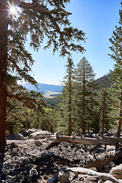
The Cottonwood Pass trail is easy for the most part, very gentle in the beginning but even the switchbacks don't feel hard and there is shade along the way which helps. As you get higher, the views open up a bit. Horseshoe Meadows down below.
Chicken Spring Lake was a good rest and refuel spot, but it appears to be popular and the chipmunks were vicious, I would not want to camp there,
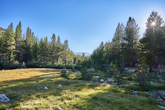
It was a warm and dusty day along the PCT. I decided that I never want to hike the stretch of the PCT between the cutoff to Soldier Lake and Rock Creek again, it was just tiring without much of a payoff. I made it to Rock Creek and headed up the creek towards a potential campsite I had seen online. I found a largish horse packer site with a nice view of a meadow. No one else was there so it was a great place for the first night.
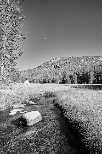
Almost full moon rising over Rock Creek
Next morning down Rock Creek to the PCT and then up and over Guyot Pass. Not the greatest hiking, but occasional views and big trees were very different from hiking in the southeast.

I talked to a couple guys from Oregon who were headed towards Kearsarge Pass and we leapfrogged though the day. We ended up camping near each other Wallace Creek and talking a bit over dinner and then breakfast before saying goodbyes.
The next morning the Oregon guys headed north and I called my first audible of the trip. My original plans had been that the 2nd night was going to be down on the Kern River near Junction Meadow and then climb towards Colby Pass for some off-trail exploration. I was already behind "schedule" and I had realized on the 2nd day that my legs were probably not going to be up the the descent to the Kern and then need to climb back out a couple days later. So let's go off-trail towards Wallace and Wales Lakes. This basin had been on my list for a couple years, so I had done a little reading, but did not remember any details other than I thought there was a user trail on the north side of Wallace Creek. It did not take long to find the user trail and it was very easy to follow for the first couple miles.
I lost the trail at a creek crossing and ended up too far south, but it was easy/fun terrain to walk through. Eventually I realized my error and looking at the GPS map I aimed in the general direction of where I thought I should be going based on contours. After an hour or so of easy hiking, I climbed up a small ridge and ended up on an obvious user-trail that looked to be headed in the right direction.
Up to Wales Lake, as I was unpacking to set up camp, I pulled out the Sawyer "bag" that I use for denatured alcohol and a whole bunch spilled on my hands. It turned out that there was what looked like a 1 inch knife cut in the middle of the bag. It was day three and I had lost most of my fuel for what was supposed to be an eight night trip. I had originally thought of staying at Wales Lake for 2 nights with the idea of trying to find my way to Tulainyo, but now it was obvious I was going to be heading back towards the trailhead. I had enough fuel to cook a couple meals, but I needed to be careful. I also had enough food like GORP and bars and dried fruit that I wasn't going to starve, but I might be uncomfortable. So time to explore while I had the chance.
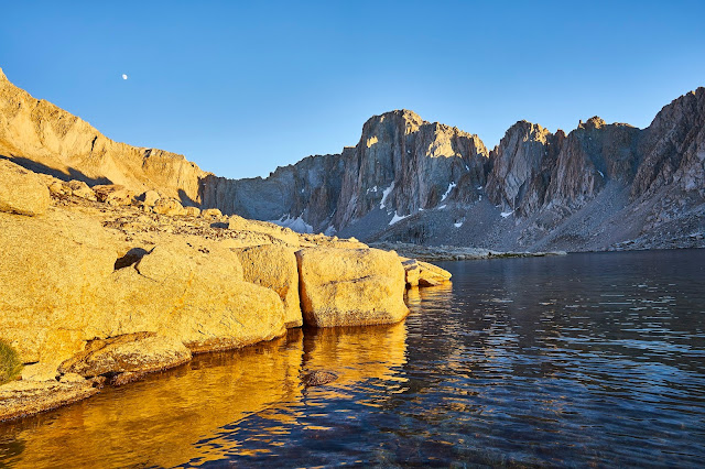
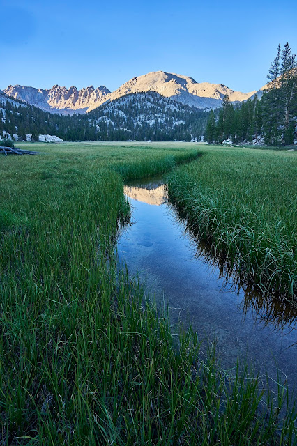
Moonrise, Mt Hale(?) and Wales Lake
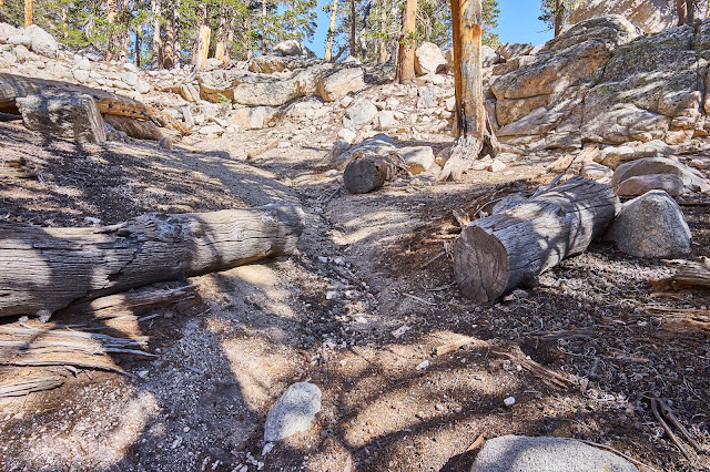
Next morning, time for another audible, back to the PCT and south towards Crabtree. I got to Crabtree Meadow and headed off trail again. I easily found the user-trail to Crabtree Lakes. I was surprised to find these old sawed logs on an unofficial trail and in wilderness where machinery is not allowed. I suspect these were cut 40 or more years ago, before the wilderness was designated in 1984. Anyone know if this used to be an official trail?
Lowest Crabtree Lake
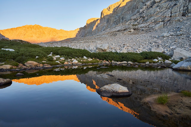
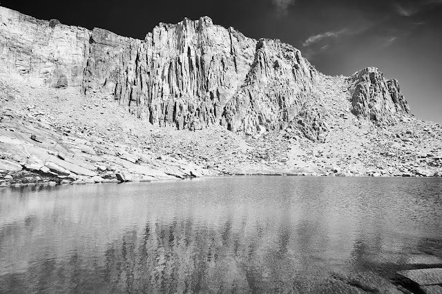
The view from the top of Crabtree Pass looking down on the highest lake.

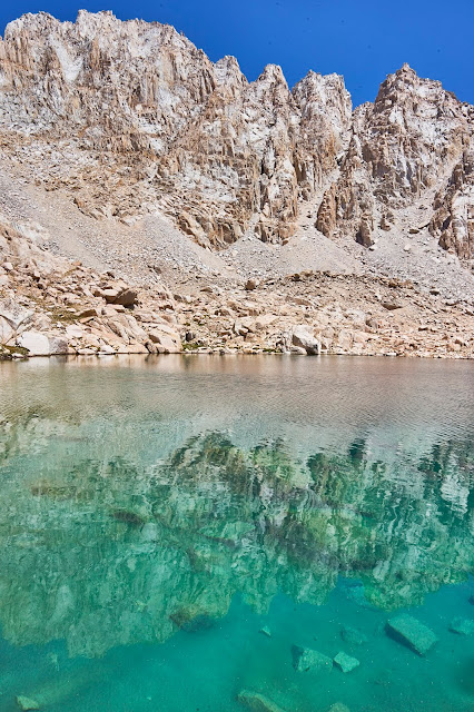
Crazy blue water just below Crabtree Pass
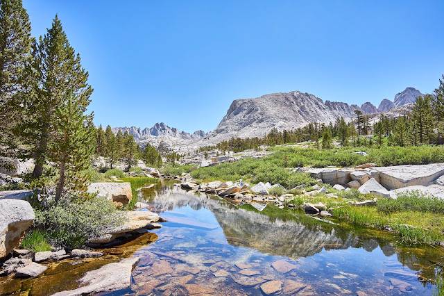
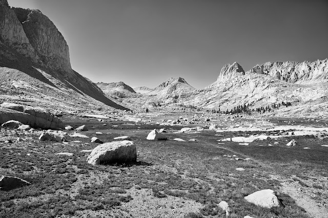
Miter Basin was beautiful to walk through
And then down to Rock Creek where I set up camp near the bear boxes and a bunch of JMT hikers. It felt very crowded compared to the previous three nights where I had no one near me.
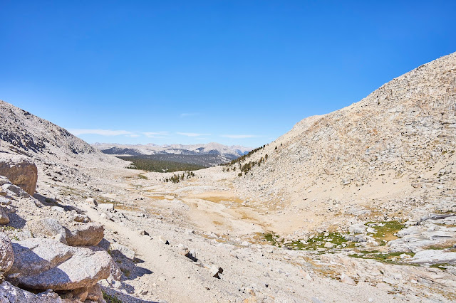
New Army Pass felt hot and tiring, here is looking west from near the top of the pass
High Lake
I had thought about staying at Cirque Lake, but I was out of fuel and did not like the idea of GORP for dinner and then breakfast, so I kept going to the trailhead. I came off the trail two days early, so I had some time to kill.
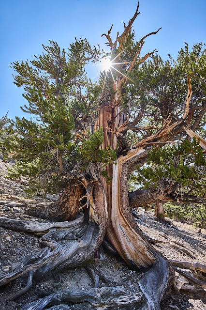
I drove up to the Ancient Bristlecone Pine Forest outside of Big Pine in the White Mountains. This turned out to be a great way to spend a day.
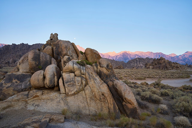
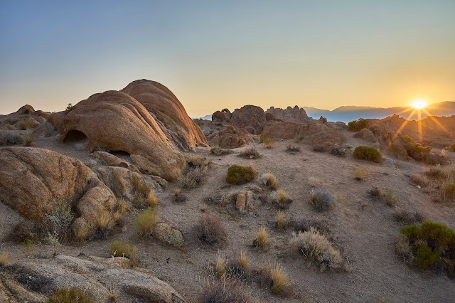
Last day, I woke up in time to see the sunrise in the Alabama Hills
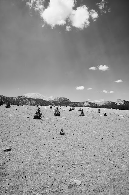
And then did a dayhike up to Mulkey Pass and then over and down from Trail Pass
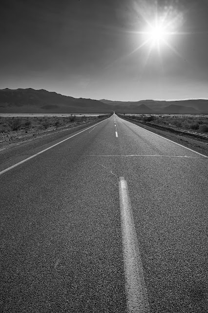
And then shower at Whitney Hostel in Lone Pine and drive through Death Valley to Vegas
lots more photos here (no ads) https://backpackandbeer.blogspot.com/20 ... -2020.html
6 nights backpack & 2 nights hotel
Caltopo says about 60 miles and 12000' of elevation gain
Camera Details: Sony A7ii and Voigtlander 21/3.5 (I decided to go light weight with only one wide angle lens)
I started planning/thinking about this trip in December 2019 with the idea of locking in permits when they opened in Feb. I talked to a backpacking friend about joining me and he was interested. No problems getting permits in Feb but there was this new disease in China that looked "interesting", probably not a big deal, so I booked my plane flight and rental car for the end of July.
Of course that "interesting" disease ended up being COVID and that scrambled everything
The Cottonwood Pass trail is easy for the most part, very gentle in the beginning but even the switchbacks don't feel hard and there is shade along the way which helps. As you get higher, the views open up a bit. Horseshoe Meadows down below.
Chicken Spring Lake was a good rest and refuel spot, but it appears to be popular and the chipmunks were vicious, I would not want to camp there,
It was a warm and dusty day along the PCT. I decided that I never want to hike the stretch of the PCT between the cutoff to Soldier Lake and Rock Creek again, it was just tiring without much of a payoff. I made it to Rock Creek and headed up the creek towards a potential campsite I had seen online. I found a largish horse packer site with a nice view of a meadow. No one else was there so it was a great place for the first night.
Almost full moon rising over Rock Creek
Next morning down Rock Creek to the PCT and then up and over Guyot Pass. Not the greatest hiking, but occasional views and big trees were very different from hiking in the southeast.
I talked to a couple guys from Oregon who were headed towards Kearsarge Pass and we leapfrogged though the day. We ended up camping near each other Wallace Creek and talking a bit over dinner and then breakfast before saying goodbyes.
The next morning the Oregon guys headed north and I called my first audible of the trip. My original plans had been that the 2nd night was going to be down on the Kern River near Junction Meadow and then climb towards Colby Pass for some off-trail exploration. I was already behind "schedule" and I had realized on the 2nd day that my legs were probably not going to be up the the descent to the Kern and then need to climb back out a couple days later. So let's go off-trail towards Wallace and Wales Lakes. This basin had been on my list for a couple years, so I had done a little reading, but did not remember any details other than I thought there was a user trail on the north side of Wallace Creek. It did not take long to find the user trail and it was very easy to follow for the first couple miles.
I lost the trail at a creek crossing and ended up too far south, but it was easy/fun terrain to walk through. Eventually I realized my error and looking at the GPS map I aimed in the general direction of where I thought I should be going based on contours. After an hour or so of easy hiking, I climbed up a small ridge and ended up on an obvious user-trail that looked to be headed in the right direction.
Up to Wales Lake, as I was unpacking to set up camp, I pulled out the Sawyer "bag" that I use for denatured alcohol and a whole bunch spilled on my hands. It turned out that there was what looked like a 1 inch knife cut in the middle of the bag. It was day three and I had lost most of my fuel for what was supposed to be an eight night trip. I had originally thought of staying at Wales Lake for 2 nights with the idea of trying to find my way to Tulainyo, but now it was obvious I was going to be heading back towards the trailhead. I had enough fuel to cook a couple meals, but I needed to be careful. I also had enough food like GORP and bars and dried fruit that I wasn't going to starve, but I might be uncomfortable. So time to explore while I had the chance.
Moonrise, Mt Hale(?) and Wales Lake
Next morning, time for another audible, back to the PCT and south towards Crabtree. I got to Crabtree Meadow and headed off trail again. I easily found the user-trail to Crabtree Lakes. I was surprised to find these old sawed logs on an unofficial trail and in wilderness where machinery is not allowed. I suspect these were cut 40 or more years ago, before the wilderness was designated in 1984. Anyone know if this used to be an official trail?
Lowest Crabtree Lake
The view from the top of Crabtree Pass looking down on the highest lake.
Crazy blue water just below Crabtree Pass
Miter Basin was beautiful to walk through
And then down to Rock Creek where I set up camp near the bear boxes and a bunch of JMT hikers. It felt very crowded compared to the previous three nights where I had no one near me.
New Army Pass felt hot and tiring, here is looking west from near the top of the pass
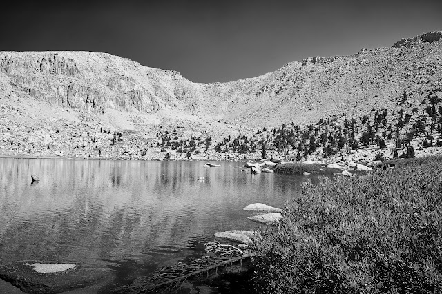
High Lake
I had thought about staying at Cirque Lake, but I was out of fuel and did not like the idea of GORP for dinner and then breakfast, so I kept going to the trailhead. I came off the trail two days early, so I had some time to kill.
I drove up to the Ancient Bristlecone Pine Forest outside of Big Pine in the White Mountains. This turned out to be a great way to spend a day.
Last day, I woke up in time to see the sunrise in the Alabama Hills
And then did a dayhike up to Mulkey Pass and then over and down from Trail Pass
And then shower at Whitney Hostel in Lone Pine and drive through Death Valley to Vegas
lots more photos here (no ads) https://backpackandbeer.blogspot.com/20 ... -2020.html