R03 TR: Golden Trout Wilderness - Labor Day 2019
Posted: Mon May 11, 2020 1:51 pm
My son and his buddy joined me on a three day backpacking trip into the Golden Trout Wilderness on Labor Day Weekend 2019. On the first day, we hiked out of Horseshoe Meadows over Trail Pass, and camped in Tunnel Meadow. The next day we traveled up Golden Trout Creek to the Rocky Basin Lakes. And on the third day we were intending to camp at Chicken Spring Lake near Cottonwood Pass, but on the way there a nearly endless thunderstorm caught us, and we decided to bail out completely. We originally wanted to camp in the Cottonwood Lakes area for a while, but we gave up on that plan as a lot more rain was forecast for the next few days. Being cold and wet for one day can be a fun challenge, but staying wet for days on end really takes the joy out of a vacation. So we headed home early.
Day 1:
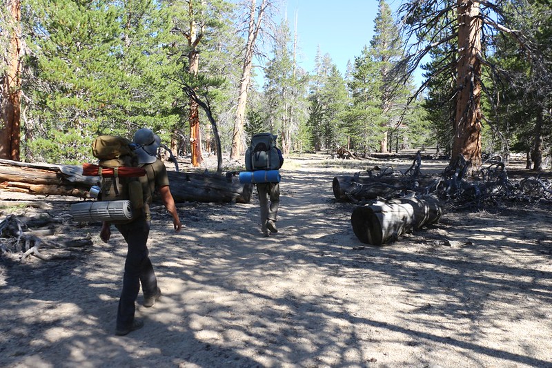
We timed our five hour drive to arrive at the Lone Pine Ranger Station just before the 7am lottery. Then we discovered that there WAS no more lottery! What? Now, it was first come, first served. Well, I usually have bad luck at the lottery, but this was the worst luck of all! What could we do? So we waited in line and discovered that all the trails were booked. It was Labor Day Weekend, and I didn't have a reservation like I usually do. This was a spur of the moment trip. So our plans for the High Sierra were badly damaged, but not completely gone. We opted to get a permit for the quota-less Trail Pass Trail. At least we'd get some backpacking done!
We bought a map of the Golden Trout Wilderness, downloaded some map layers into the Gaia App on my phone, and ate some breakfast in town. It took a long time, but we finally got up to the trailhead by 11am and started hiking. Ten miles to go, and most of it was downhill.

Evan, Keven, and I at the Cottonwood Pass / Trail Pass Trailhead in Horseshoe Meadows

View toward Trailmaster Peak as we crossed Horseshoe Meadows on the Trail Pass Trail

Climbing up through the pines toward Trail Pass

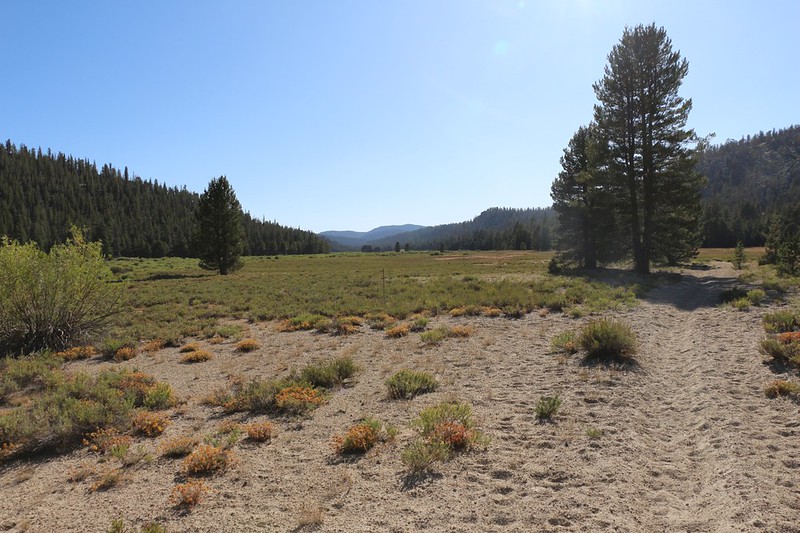
Heading down toward Mulkey Meadow from Trail Pass - easy hiking

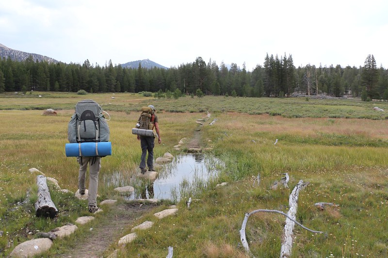
Typical trail across a meadow - three trails (or more) get formed in the Spring when it's wet.

Panorama shot of Mulkey Meadow to the southeast, with smoke from the Cow Fire of 2019. We could smell it in the air, but it wasn't heading our way.

We finally caught a glimpse of the herd of cows that were grazing in a greener section of Mulkey Meadow. There were patties everywhere, and they stank.

Gate and barbed wire fencing at the west end of Mulkey Meadow - we were glad there would be no more cows

We took a break in the cool shade near the water on the upper South Fork Kern River. We also met some fishermen trying for Golden Trout.
View of Tunnel Meadow from the east (upper) end. We camped at the far end.

Evan up on top of the rock pile in Tunnel Meadow near our campsite

Eating dinner in Tunnel Meadow - it had been a long day of hiking and we were hungry

Sunset and a sliver of a Crescent Moon from our campsite.
We were quite tired, so went to bed early. Waking up at 2am will do that.
Day 2:
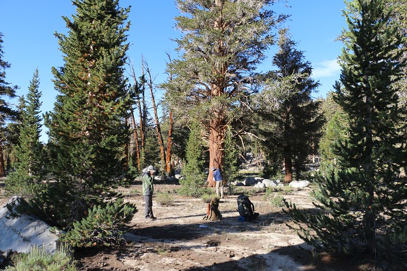
We woke to a lot of frost on our tents. Those meadows really collect the cold air during clear, calm nights. I was the first one up, so I got some coffee boiling and soon enough we were all outside, freezing cold, eating breakfast in the shade while the sun slowly crept across the meadow. It arrived just as we finished packing, at the perfect time to be completely useless!
Our plan for this day's hike was to head up Golden Trout Creek, then continue uphill to the Rocky Basin Lakes, about 10 miles and 2000 feet of elevation gain.

Plenty of steam from the camp stove as we made breakfast, waiting for the sun to reach us
Heading north from Tunnel Meadow along Golden Trout Creek
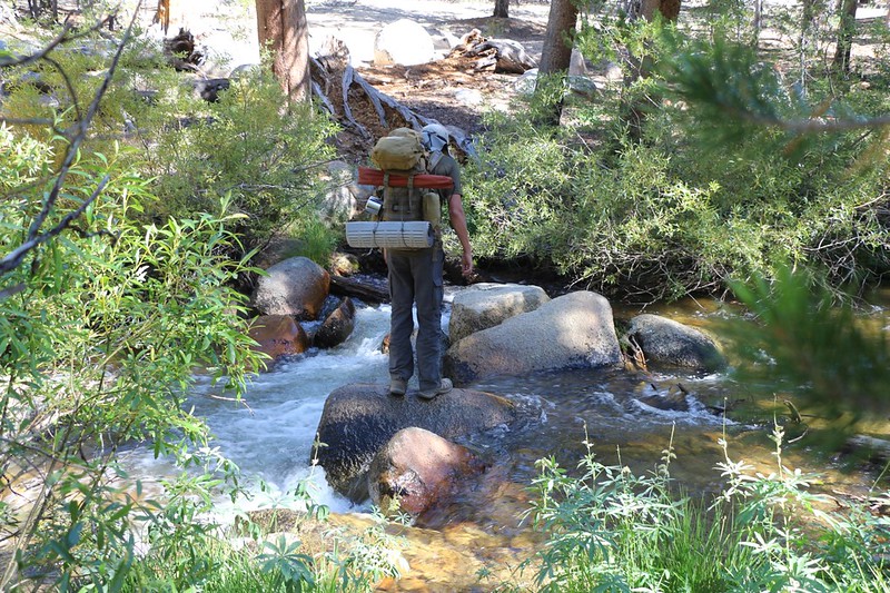
Evan tried crossing Golden Trout Creek here - and he made it, but not without dunking one of his feet

Looking upstream on Golden Trout Creek.
We stopped for lunch and hung out by the creek. I filtered a liter of water because I wanted to taste the "Heart" of the Golden Trout Wilderness. It was quite tasty!
Then we headed left on the old trail to Rocky Basin Lakes. I noticed on my GPS that it wasn't where the USGS map said it was. Then I looked more closely and it said "Location Approximate". Hoo Boy! That was an understatement. It was in the wrong spot entirely, at least where we were. And it looked as if it rarely received any foot traffic. So I told the boys to whip out their woodcraft skills. We had a trail to find! And we used the tell-tale signs of a well-made trail to find it, like sawn logs, drainage diversions, slight depressions on a hillside, blazes on trees, and the small ducks that some kind hiker had left behind. It was a good trail, with minimal deadfall, and it followed Barigan Stringer all the way up to the Big Whitney Meadow Trail. The final spur of the trail to the lakes (after the intersection) was well-traveled, and we had no problems following it.

Trail signs along Golden Trout Creek where the old trail to Rocky Basin Lakes heads northwest

Finding the old trail. Those sawn logs are a clue.

Small pond in a meadow along Barigan Stringer

The water was mostly gone this late in the Summer but the meadow was still green
The Rocky Basin Lakes Trail was much more traveled in this final section

The foot trail roughly followed the outlet from the lowest of the Rocky Basin Lakes
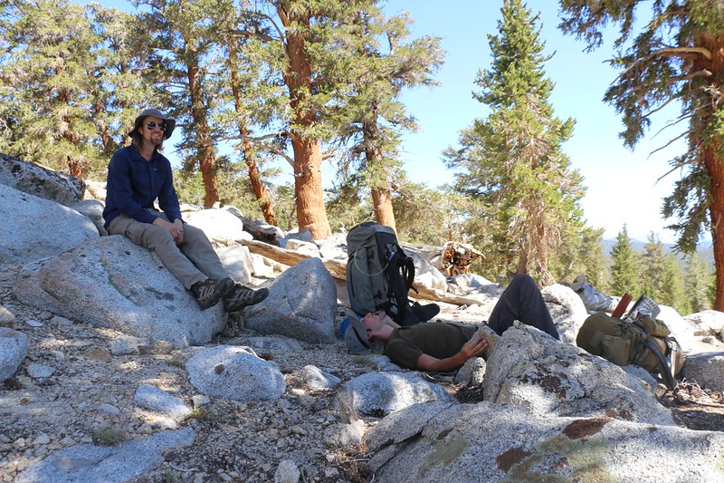
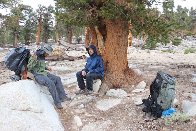
This last bit of climbing, on talus, was a tough way to end a long day of hiking - so we took a rest in the shade

We made it to the lowest of the Rocky Basin Lakes and decided to camp nearby

My tent on a sandy spot
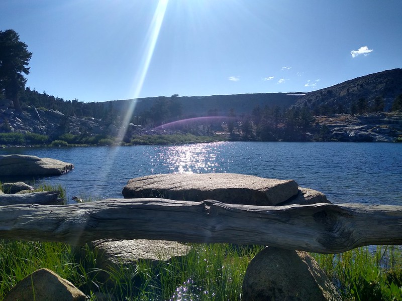
This is the main lake in the Rocky Basin Lakes - very pretty with great water for drinking
Day 3:
This time when we woke up it wasn't all that cold, and we were 2000 feet higher than the day before. Maybe it was the meadow, or maybe it was a change in the weather. The last I heard, afternoon thunderstorms with a 20% chance of rain were due to arrive tomorrow, but today was supposed to be nice. But I wasn't really thrilled that there were already clouds in the sky at dawn. Oh, well. You can't change the weather. Our plan for today was to head for Chicken Spring Lake, about an eight mile hike. We'd head for the Cottonwood Lakes tomorrow.

The morning of our third day on the trek arrived with clouds
We were slow and it took us nearly two hours to pack up camp, and by then the sun was warm and shining

Barigan Stringer and lush grasses as we headed downhill from the lakes

We then started heading east, up some switchbacks and over a ridge on the Big Whitney Meadow Trail

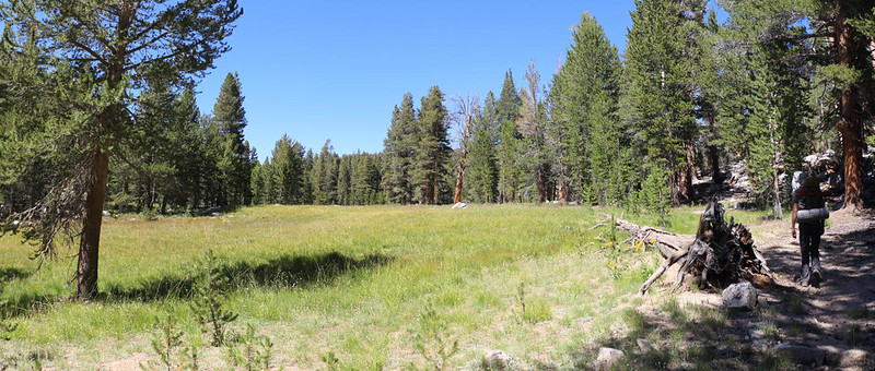
High clouds and easy hiking in the forest west of Big Whitney Meadow
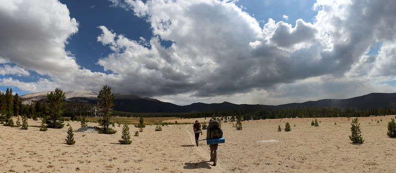
Panorama view of Big Whitney Meadow with Cirque Peak on the left and plenty of cumulus clouds

Panorama of Golden Trout Creek with big clouds forming

Another panorama, with Cirque Peak on the right

We headed upstream from the trail and found a better spot to hop across this branch of Golden Trout Creek
This is when you find out whether you have good balance - hopping on stones across a creek in a meadow
We stopped for lunch in the forest just east of the meadow, and discovered the Snow Survey Cabin. The guys wanted to check it out. We were amazed to see that there was a shovel hanging on a branch of a tree about 20 feet above the ground! The snow must really get deep near the end of Winter, and finding the cabin sounds like quite a chore for the survey crew!

Snow Survey Cabin shelter near Big Whitney Meadow

Keven and Evan enjoying the snow shelter

After lunch, we noticed some rain sprinkles, so we got out our pack covers and readied our rain gear

There was still plenty of blue sky back to the west, but not ahead of us on the Sierra Crest

We put on our rain gear under some pines as the drizzle intensified

Looking west as we climbed toward Cottonwood Pass with dark rain clouds overhead

Yet another brief stop out of the rain under the shelter of a pine tree

There were fewer trees to shelter under as our elevation increased

Looking uphill, eastward toward Cottonwood Pass, from under the last big pine on the trail
It really started raining hard so we took shelter under the tree, hoping to wait it out - but it refused to stop

These guys could cook food at any time, but we needed the warmth to stop the rain from giving us hypothermia
This was when we got out the map and started taking stock of our situation. What were our plans? Were we still going to head for the Cottonwood Lakes for the next few days? We were hoping to maybe bag Cirque Peak, but if the weather was going to be like this, then why bother? Maybe we should just bail. Our car was only about four miles away. A warm dry car was a very tempting image, for cold wet hikers. Then the thunder started booming in earnest, and there we were, standing under a tree! The decision was made by lightning, so we packed up and headed for the pass.

Me with my soaking wet raingear, but I'm warm underneath, and my big camera is safely in that orange dry bag

Trail sign at Cottonwood Pass where the Pacific Crest Trail meets the Cottonwood Pass Trail

Panorama of the view east from Cottonwood Pass, with drifting clouds above Horseshoe Meadows

Dark Skies and green plants, and the rain kept coming down. Thunder, too!

The creek was swollen from the rain but we were able to hop across on the rocks

Keven and Evan posing at the Golden Trout Wilderness boundary sign

We made it back to the car after a long hike in the rain - time to get dry and warm!

We put on dry clothes in the almost-empty parking lot and sat in the car with the heater blasting. We knew we'd made the right decision.

This was where I parked my car just off Horseshoe Meadows Road - I decided to take a nap up there before the long drive
After sunset, we headed home to San Diego through the Labor Day traffic.
It had been a fun trip, we decided, but it wasn't as awesome as the trek we'd hoped to make, bagging Whitney from the west side, via the PCT/JMT. And then we thought about where we'd be right now: Camping at Guitar Lake, soaking wet, three days from the car, getting ready to make the attempt on the summit during tomorrow's thunderstorm! No, we had to agree that we'd made the best decision back in the beginning, by heading for the mellower mountains, streams, and lakes within the Golden Trout Wildeness.
The rest of the trip's photos and videos can be found on my Flickr Album Page.
For a topographic map of our hike, including GPS Tracks, please see my CalTopo Page.
Happy Hiking!
.
Day 1:
We timed our five hour drive to arrive at the Lone Pine Ranger Station just before the 7am lottery. Then we discovered that there WAS no more lottery! What? Now, it was first come, first served. Well, I usually have bad luck at the lottery, but this was the worst luck of all! What could we do? So we waited in line and discovered that all the trails were booked. It was Labor Day Weekend, and I didn't have a reservation like I usually do. This was a spur of the moment trip. So our plans for the High Sierra were badly damaged, but not completely gone. We opted to get a permit for the quota-less Trail Pass Trail. At least we'd get some backpacking done!
We bought a map of the Golden Trout Wilderness, downloaded some map layers into the Gaia App on my phone, and ate some breakfast in town. It took a long time, but we finally got up to the trailhead by 11am and started hiking. Ten miles to go, and most of it was downhill.
Evan, Keven, and I at the Cottonwood Pass / Trail Pass Trailhead in Horseshoe Meadows
View toward Trailmaster Peak as we crossed Horseshoe Meadows on the Trail Pass Trail
Climbing up through the pines toward Trail Pass
Heading down toward Mulkey Meadow from Trail Pass - easy hiking
Typical trail across a meadow - three trails (or more) get formed in the Spring when it's wet.
Panorama shot of Mulkey Meadow to the southeast, with smoke from the Cow Fire of 2019. We could smell it in the air, but it wasn't heading our way.
We finally caught a glimpse of the herd of cows that were grazing in a greener section of Mulkey Meadow. There were patties everywhere, and they stank.
Gate and barbed wire fencing at the west end of Mulkey Meadow - we were glad there would be no more cows
We took a break in the cool shade near the water on the upper South Fork Kern River. We also met some fishermen trying for Golden Trout.
View of Tunnel Meadow from the east (upper) end. We camped at the far end.
Evan up on top of the rock pile in Tunnel Meadow near our campsite
Eating dinner in Tunnel Meadow - it had been a long day of hiking and we were hungry
Sunset and a sliver of a Crescent Moon from our campsite.
We were quite tired, so went to bed early. Waking up at 2am will do that.
Day 2:
We woke to a lot of frost on our tents. Those meadows really collect the cold air during clear, calm nights. I was the first one up, so I got some coffee boiling and soon enough we were all outside, freezing cold, eating breakfast in the shade while the sun slowly crept across the meadow. It arrived just as we finished packing, at the perfect time to be completely useless!
Our plan for this day's hike was to head up Golden Trout Creek, then continue uphill to the Rocky Basin Lakes, about 10 miles and 2000 feet of elevation gain.
Plenty of steam from the camp stove as we made breakfast, waiting for the sun to reach us
Heading north from Tunnel Meadow along Golden Trout Creek
Evan tried crossing Golden Trout Creek here - and he made it, but not without dunking one of his feet
Looking upstream on Golden Trout Creek.
We stopped for lunch and hung out by the creek. I filtered a liter of water because I wanted to taste the "Heart" of the Golden Trout Wilderness. It was quite tasty!
Then we headed left on the old trail to Rocky Basin Lakes. I noticed on my GPS that it wasn't where the USGS map said it was. Then I looked more closely and it said "Location Approximate". Hoo Boy! That was an understatement. It was in the wrong spot entirely, at least where we were. And it looked as if it rarely received any foot traffic. So I told the boys to whip out their woodcraft skills. We had a trail to find! And we used the tell-tale signs of a well-made trail to find it, like sawn logs, drainage diversions, slight depressions on a hillside, blazes on trees, and the small ducks that some kind hiker had left behind. It was a good trail, with minimal deadfall, and it followed Barigan Stringer all the way up to the Big Whitney Meadow Trail. The final spur of the trail to the lakes (after the intersection) was well-traveled, and we had no problems following it.
Trail signs along Golden Trout Creek where the old trail to Rocky Basin Lakes heads northwest
Finding the old trail. Those sawn logs are a clue.
Small pond in a meadow along Barigan Stringer
The water was mostly gone this late in the Summer but the meadow was still green
The Rocky Basin Lakes Trail was much more traveled in this final section
The foot trail roughly followed the outlet from the lowest of the Rocky Basin Lakes
This last bit of climbing, on talus, was a tough way to end a long day of hiking - so we took a rest in the shade
We made it to the lowest of the Rocky Basin Lakes and decided to camp nearby
My tent on a sandy spot
This is the main lake in the Rocky Basin Lakes - very pretty with great water for drinking
Day 3:
This time when we woke up it wasn't all that cold, and we were 2000 feet higher than the day before. Maybe it was the meadow, or maybe it was a change in the weather. The last I heard, afternoon thunderstorms with a 20% chance of rain were due to arrive tomorrow, but today was supposed to be nice. But I wasn't really thrilled that there were already clouds in the sky at dawn. Oh, well. You can't change the weather. Our plan for today was to head for Chicken Spring Lake, about an eight mile hike. We'd head for the Cottonwood Lakes tomorrow.
The morning of our third day on the trek arrived with clouds
We were slow and it took us nearly two hours to pack up camp, and by then the sun was warm and shining
Barigan Stringer and lush grasses as we headed downhill from the lakes
We then started heading east, up some switchbacks and over a ridge on the Big Whitney Meadow Trail
High clouds and easy hiking in the forest west of Big Whitney Meadow
Panorama view of Big Whitney Meadow with Cirque Peak on the left and plenty of cumulus clouds
Panorama of Golden Trout Creek with big clouds forming
Another panorama, with Cirque Peak on the right
We headed upstream from the trail and found a better spot to hop across this branch of Golden Trout Creek
This is when you find out whether you have good balance - hopping on stones across a creek in a meadow
We stopped for lunch in the forest just east of the meadow, and discovered the Snow Survey Cabin. The guys wanted to check it out. We were amazed to see that there was a shovel hanging on a branch of a tree about 20 feet above the ground! The snow must really get deep near the end of Winter, and finding the cabin sounds like quite a chore for the survey crew!
Snow Survey Cabin shelter near Big Whitney Meadow
Keven and Evan enjoying the snow shelter
After lunch, we noticed some rain sprinkles, so we got out our pack covers and readied our rain gear
There was still plenty of blue sky back to the west, but not ahead of us on the Sierra Crest
We put on our rain gear under some pines as the drizzle intensified
Looking west as we climbed toward Cottonwood Pass with dark rain clouds overhead
Yet another brief stop out of the rain under the shelter of a pine tree
There were fewer trees to shelter under as our elevation increased
Looking uphill, eastward toward Cottonwood Pass, from under the last big pine on the trail
It really started raining hard so we took shelter under the tree, hoping to wait it out - but it refused to stop
These guys could cook food at any time, but we needed the warmth to stop the rain from giving us hypothermia
This was when we got out the map and started taking stock of our situation. What were our plans? Were we still going to head for the Cottonwood Lakes for the next few days? We were hoping to maybe bag Cirque Peak, but if the weather was going to be like this, then why bother? Maybe we should just bail. Our car was only about four miles away. A warm dry car was a very tempting image, for cold wet hikers. Then the thunder started booming in earnest, and there we were, standing under a tree! The decision was made by lightning, so we packed up and headed for the pass.
Me with my soaking wet raingear, but I'm warm underneath, and my big camera is safely in that orange dry bag
Trail sign at Cottonwood Pass where the Pacific Crest Trail meets the Cottonwood Pass Trail
Panorama of the view east from Cottonwood Pass, with drifting clouds above Horseshoe Meadows
Dark Skies and green plants, and the rain kept coming down. Thunder, too!
The creek was swollen from the rain but we were able to hop across on the rocks
Keven and Evan posing at the Golden Trout Wilderness boundary sign
We made it back to the car after a long hike in the rain - time to get dry and warm!
We put on dry clothes in the almost-empty parking lot and sat in the car with the heater blasting. We knew we'd made the right decision.
This was where I parked my car just off Horseshoe Meadows Road - I decided to take a nap up there before the long drive
After sunset, we headed home to San Diego through the Labor Day traffic.
It had been a fun trip, we decided, but it wasn't as awesome as the trek we'd hoped to make, bagging Whitney from the west side, via the PCT/JMT. And then we thought about where we'd be right now: Camping at Guitar Lake, soaking wet, three days from the car, getting ready to make the attempt on the summit during tomorrow's thunderstorm! No, we had to agree that we'd made the best decision back in the beginning, by heading for the mellower mountains, streams, and lakes within the Golden Trout Wildeness.
The rest of the trip's photos and videos can be found on my Flickr Album Page.
For a topographic map of our hike, including GPS Tracks, please see my CalTopo Page.
Happy Hiking!
.