Day 3
The weather was better the next morning. The storm broke around 9 am. @xelanil's view from his tent:

Alex's thermometer read a hair less than 30F. A cold front was rolling in.

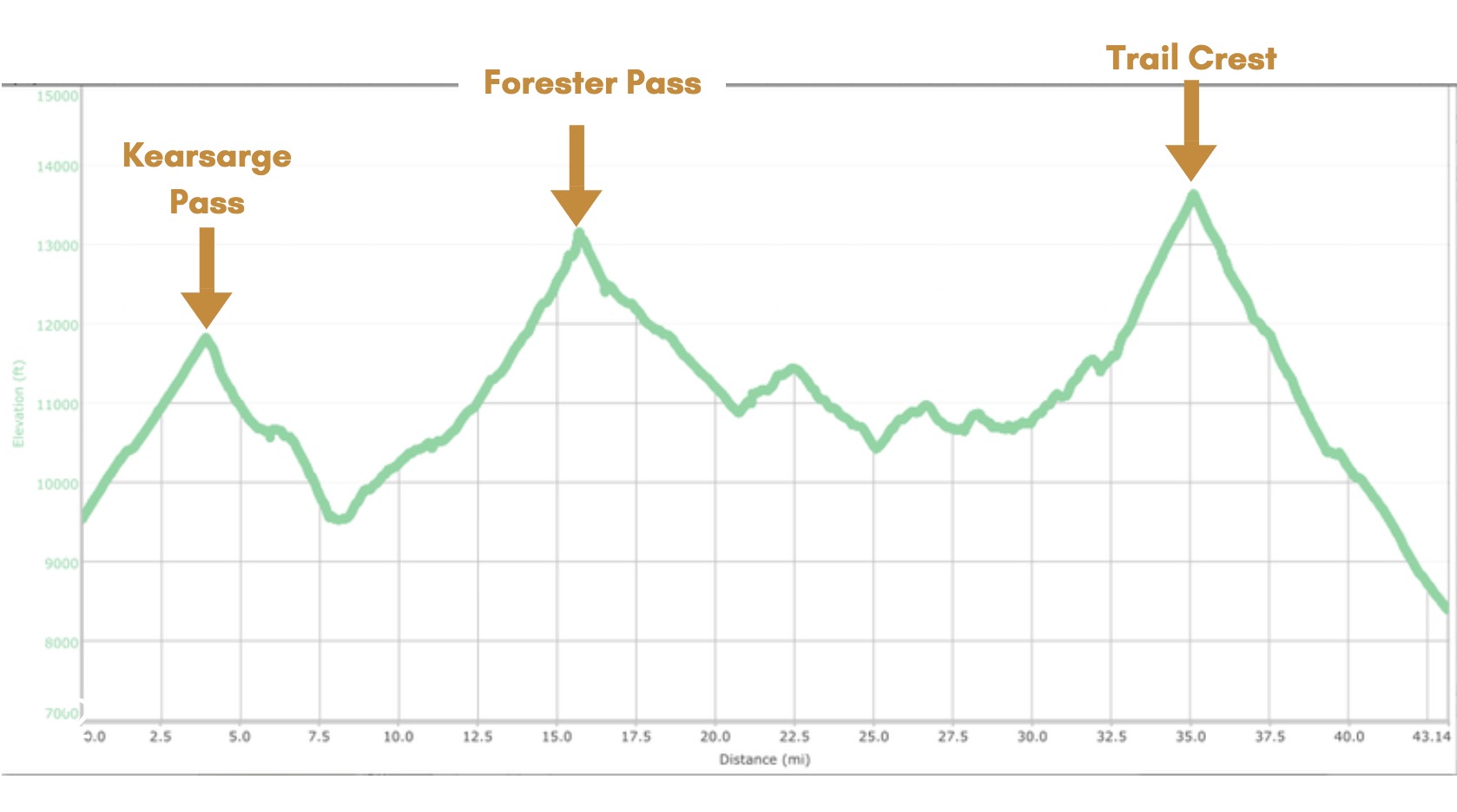
We were only 11.7 miles in. And we had 3 more days to finish the 43 mile journey. We had 72% the distance left even though we spent about 60% of our time already. The remaining trail had two major obstacles, Forester and Trail Crest Passes, both dwarf Kearsarge Pass at over 13,000 ft.

We had to make up some serious miles on Day 3 if we were going to complete the journey on time. We got an earlier start on the trail. The first half of the day was spent climbing Forester pass. We had to constantly stop to add and remove layers to regulate our body temperatures. We didn't want to sweat in freezing temperatures to fear of the sweat freezing to our bodies.

We were stoked we were making good progress.


The landscape looked like the Himalayas.

We made it to the top of Forester Pass around 2 pm.

The crossing from Kings Canyon to Sequoia National Park was epic. The trail did not disappoint. It was etched out of a 1000ft cliff.


We cruised through the first valley of Sequoia National Park. It was absolutely beautiful.


But so so cold, even on a sunny day. Icicles had formed between rocks, and not even direct sunlight at 12,000ft could melt them.

We made it to an ancient forest at near sunset. I'd never seen anything like it. These were huge 2000-year-old trees thriving at 11,000 ft where the air is thin and most trees can't grow.

That day we made it to the 20.0 miles mark. That meant we had 23 miles left in the last 2 of 5 days. Days were too cold and too short to get more than a few hours of hiking in. Our packs were heavy. And we were not acclimatized properly. It was clear we couldn't finish the journey on time without killing ourselves.
We had enough food to draw out our trip, but we told our loved ones back at home to call the ranger station if we didn't report back to them by 11 pm on Day 5.
There is a pass that exits to a trailhead halfway between Whitney Portal and Onion Valley called Shepherd Pass. It was 14.5 miles from our camp to the trailhead of Shepherd pass. It was much closer than any other trailhead, and only have 2000 ft of climbing as opposed to 5000 ft of climbing if we turned around or continued to the Whitney portal.
The Shepherd pass had three downsides. First, we would have to arrange a ride to one of our cars from the Shepherd pass trailhead. Second, the map said "Stock not recommended" which meant it could be really steep and dangerous. And third, it was 7000 ft of vertical descent. This is an extreme amount that would put a lot of stress on our joints.
Our group of three made the unanimous vote to exit Shepherd Pass the next day.


