R03 TR: North Fork Big Pine Creek July 5-8, 2018
Posted: Fri Jul 20, 2018 6:39 pm
My son, his friend, their two dogs, and I backpacked into the North Fork of Big Pine Creek for four days over the 4th of July weekend. We managed to check out every major lake in the valley, plus Sam Mack Meadow, the Palisade Glacier, and the summit of Cloudripper Peak. It was an excellent trip!
Since there is so much to see in that area, I'm going to fill the Trip Report with lots of photos and try to keep the verbiage to a minimum. Let's hope it works!
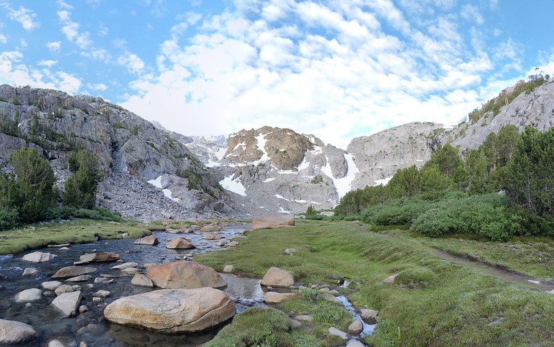
Day 1 was the toughest day. We climbed nearly 5000 feet, camping at Sam Mack Meadow, then day-hiked up to the Palisade Glacier.
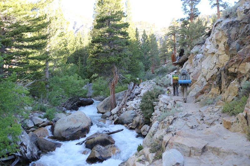
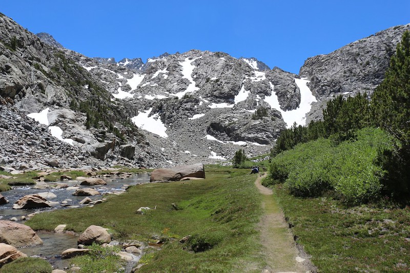
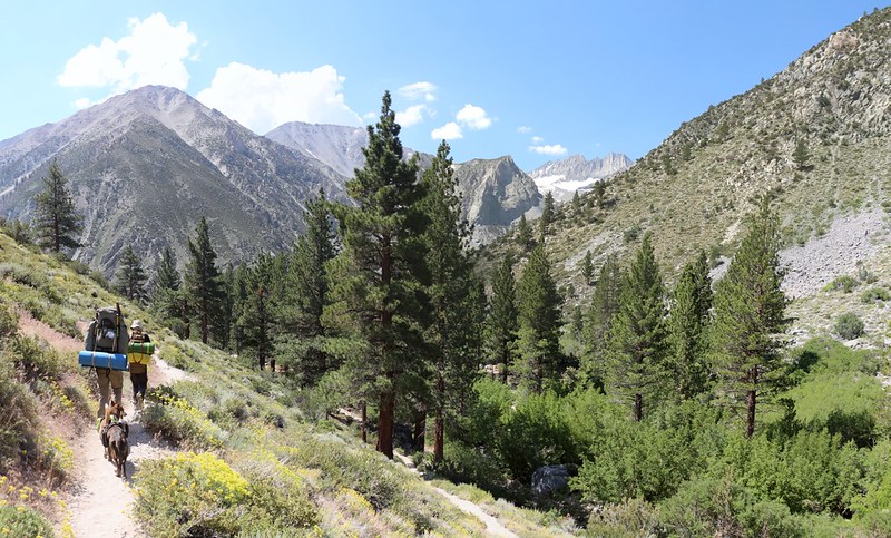
The trail just above Second Falls was blasted through this gorge alongside the creek
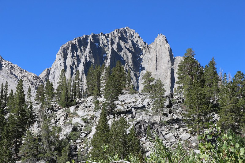
Our first view of Temple Crag as we near First Lake
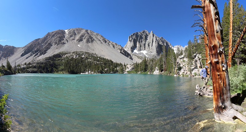
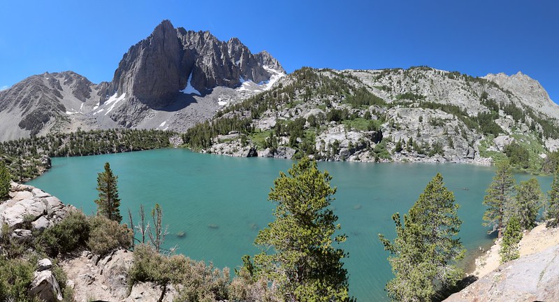
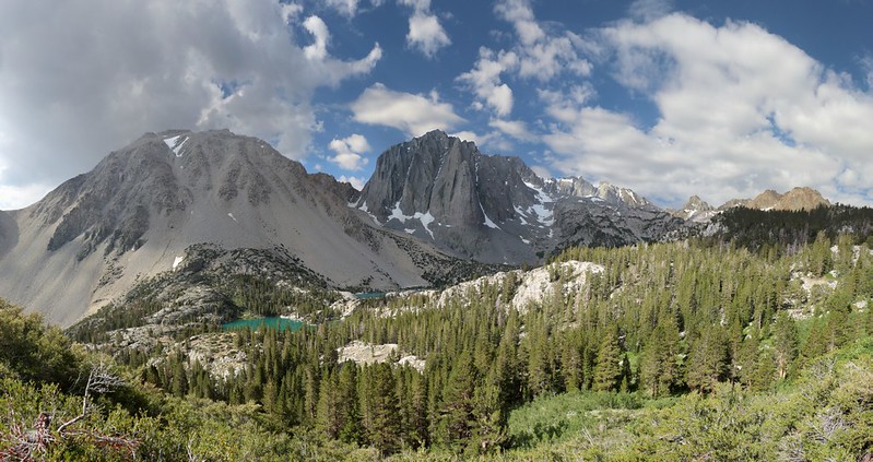
Panorama view of First Lake with Temple Crag and Buck Peak
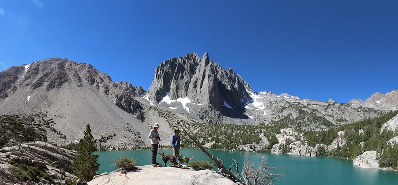
Obligatory posed shot at Second Lake with Temple Crag looking awesome in the background
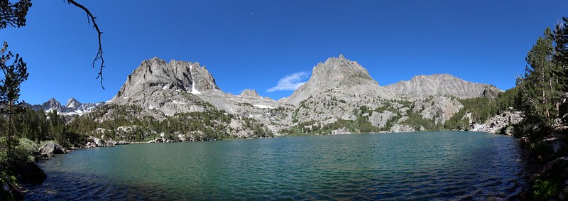
Panorama view over Third Lake with Temple Crag
Most people camp near one of these three lakes, as it's a decent climb to get there. But not us. Two weeks before this we'd done a practice 5000-foot climb down in Southern Cal to San Bernardino Peak, and we knew that we had it in us. So we turned left and continued upward to Sam Mack Meadow, where we found a few nice LNT camping spots up in the pines on the right side.
My son sitting near that big boulder while waiting for us at Sam Mack Meadow
Panorama view of Sam Mack Meadow
After a good rest we set up camp and got ready with our day-packs for the next part of the day's adventure: The Palisade Glacier. It was late enough in the afternoon that we simply wanted to see it, up close and personal. We'd purposely left our ice axes back in the car to save weight. The glacier truly deserved a day all to itself, but we didn't have the time. Sorry about that, Mr. Glacier.

Panorama view of Sam Mack Meadow from high above on the Palisade Glacier Trail
Panorama view of First, Second, and Third Lakes as we climbed ever-higher
The Palisade Glacier Trail is marked with cairns beyond a certain point, as it is more of a route than a trail
Sill, Polomonium, Starlight, North Palisade, Thunderbolt, Winchell, and Agassiz above the Palisade Glacier
Hiking downhill on slabs of granite as the sun gets lower and the shadows longer
Day 2 was meant to be an easy day. We mainly wanted to check out a few more beautiful lakes while eventually making camp all the way up the valley at Seventh Lake. We woke up late and took our time, taking long rests whenever we felt like it. This is the sort of day that fishermen like, and there were plenty of trout to be seen along the way.
Sam Mack Meadow at Dawn
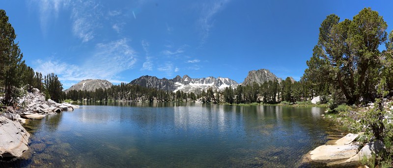
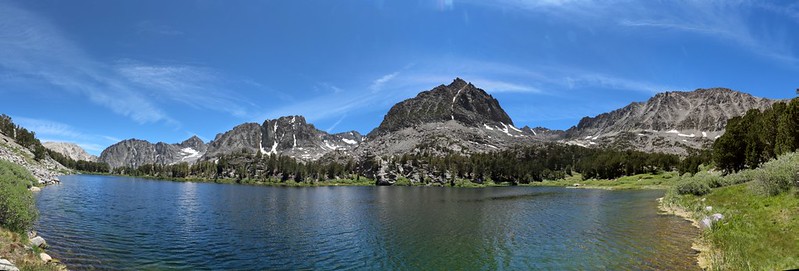
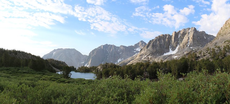
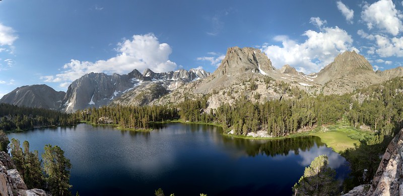
Panorama shot at Fifth Lake with Mount Robinson, Two Eagle Peak, and Cloudripper
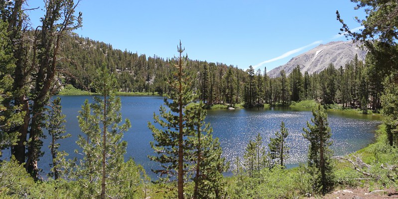
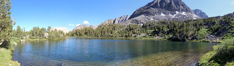
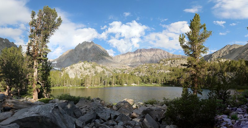
Fourth Lake with Mount Alice on the right
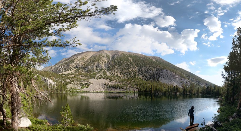
View south to the Palisade Glacier from Summit Lake.
I liked Summit Lake the best. We hung out there for over an hour, eating lunch and watching the dogs swim in the cold water. It was such an extraordinary view. It was hard to realize that we had been standing all the way up there by that glacier only yesterday afternoon.
Mount Robinson and Two Eagle Peak above Sixth Lake
Panorama shot from the shore of Sixth Lake - the trail peters out completely at this point
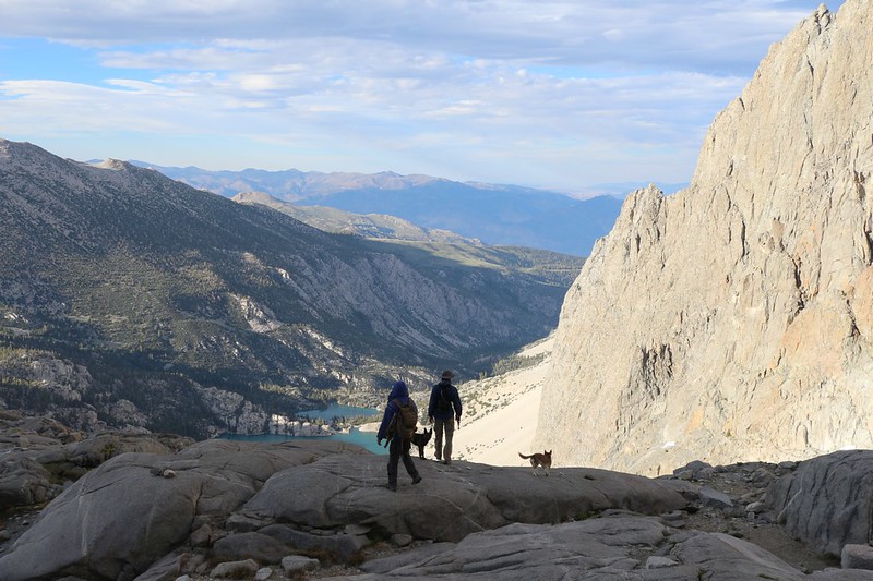
Looking south from the shore of Seventh Lake - our camp was on that small granite rise on the left
Day 3 was our "Layover Day", if you can call spending it climbing 2500 feet up to the 13525-foot summit of Cloudripper Peak a relaxing way to spend your day. But at least we didn't have to carry our big packs, and it was nice to know that we'd be staying here another night. We were the only ones up at this lake, and we liked it that way.
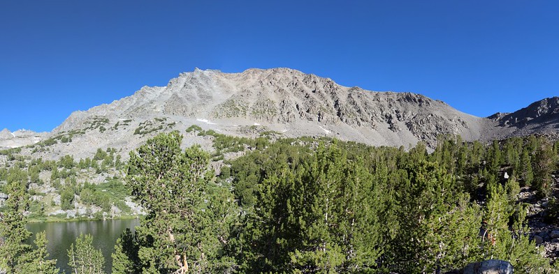
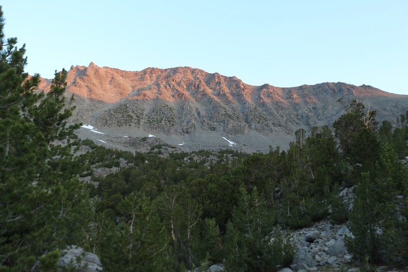
Cloudripper in the morning sun - we would ascend to the saddle on the right, then climb the ridge to the top
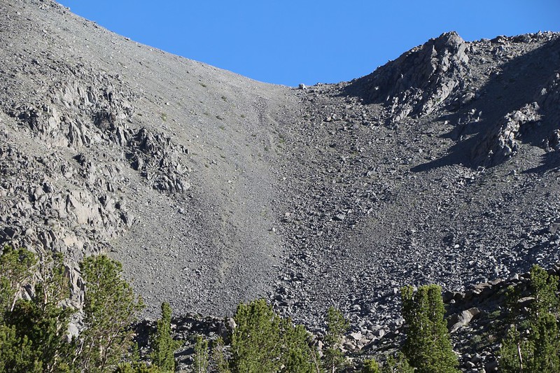
View of the scree and talus below the saddle - we would stay on the bigger rocks on the right, not the scree
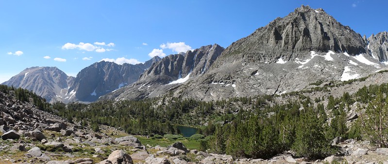
Buck Peak, Temple Crag, Mt Robinson, and Two Eagle Peak with Seventh Lake in the center
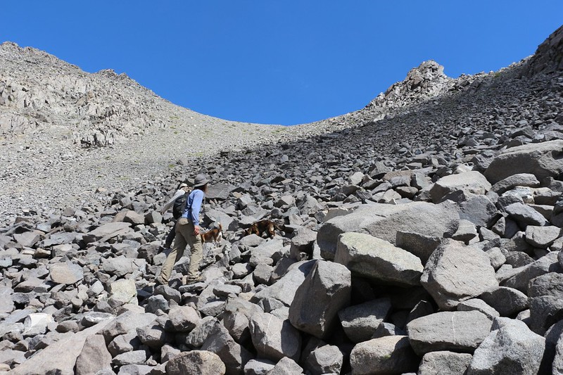
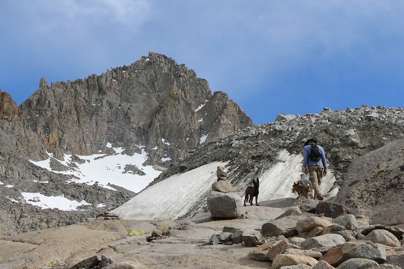
The dogs seem to be climbing the large blocks of talus just fine as we head to the saddle
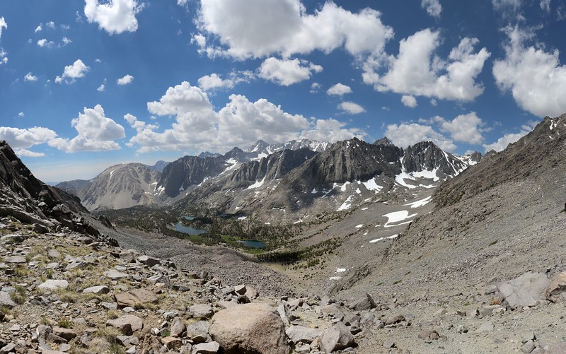
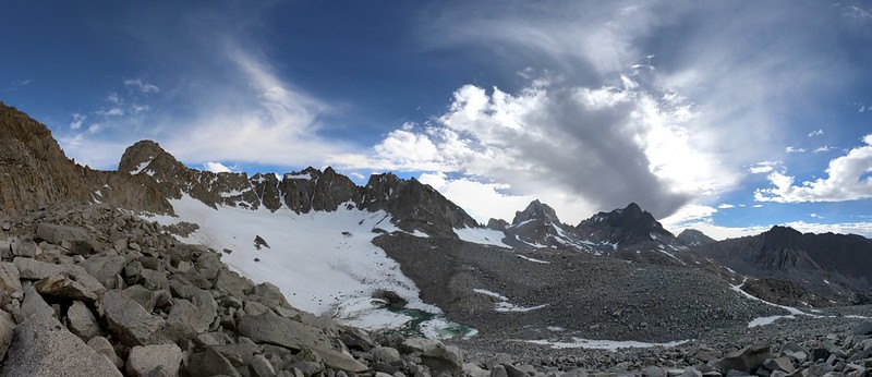
Panorama view from the saddle east of Cloudripper Peak - elevation 12300 feet - and the view is awesome!
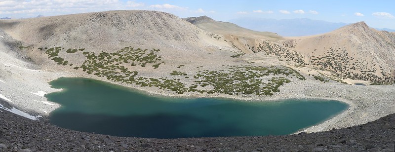
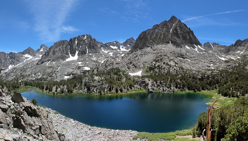
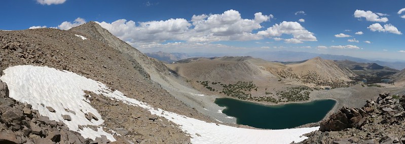
Thunder and Lightning Lake from the saddle
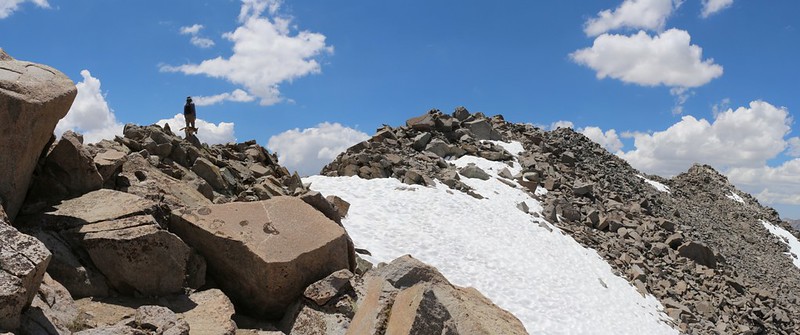
The route-finding is easy, mostly second and easy third class scrambling on the way up the ridge to the summit
Vagabond Peak (13112 feet elevation) on the left and Thunder and Lightning Lake down below us
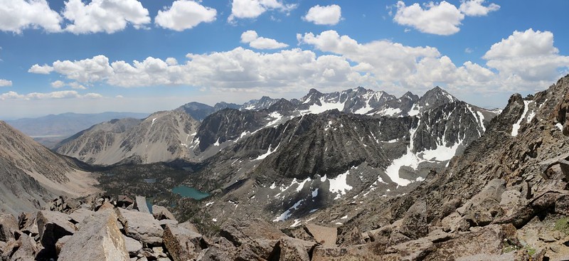
Lots of mountains and lakes to the south as we climb up Cloudripper's eastern ridge
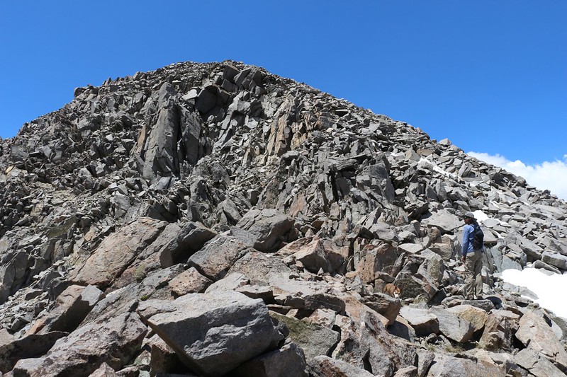
Getting near the summit and we were hiking strong - we must've been partly acclimated to the elevation
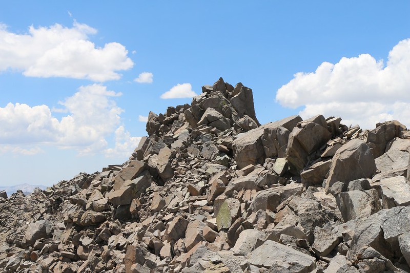
The summit of Cloudripper is right in front of us
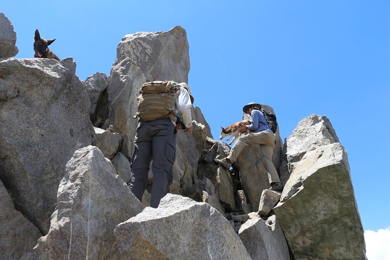
Passing the two dogs up to the summit - it wouldn't be fair to leave them ten feet shy of the top
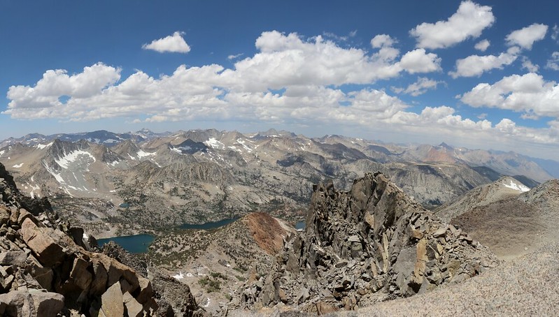
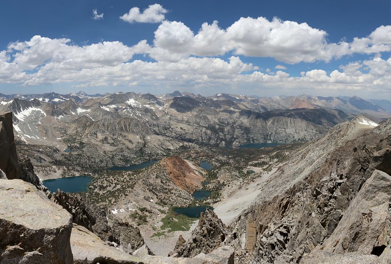
View northwest from the summit
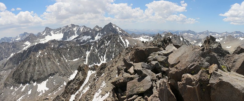
View south from the summit
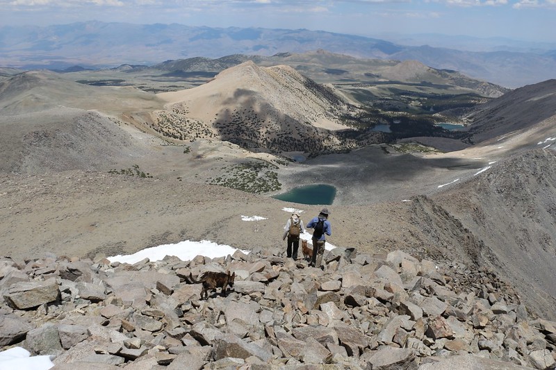
Looking down into the Bishop Creek drainage from the summit
Heading back down from the top of Cloudripper - it's afternoon and time to head for camp
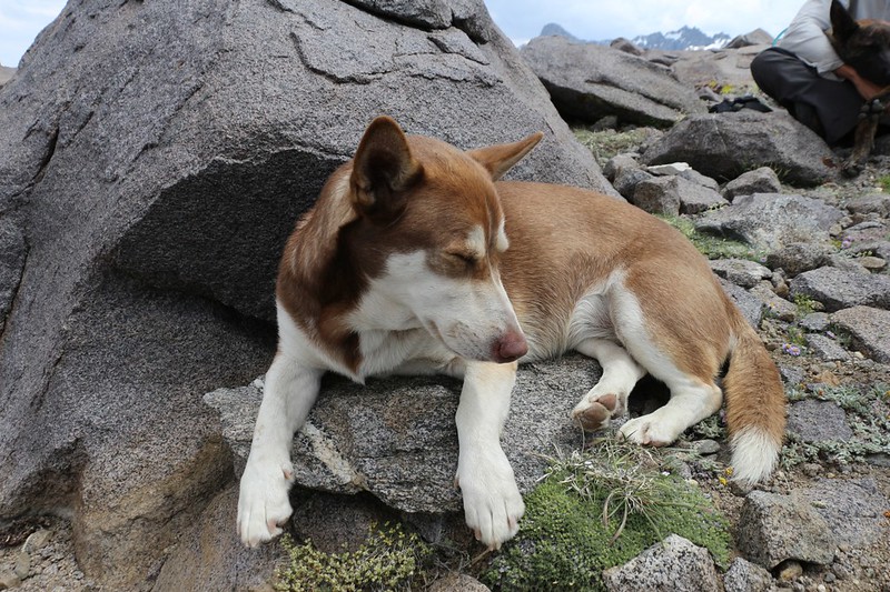
A tired puppy at the saddle, taking a well-earned break after climbing Cloudripper
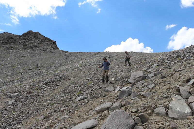
Descending the scree slope via shoe-skiing - lots of mini-avalanches but we descended rapidly
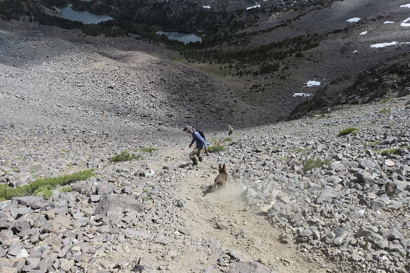
Shoe-skiing the scree slope with plenty of dust - we were having a great time!
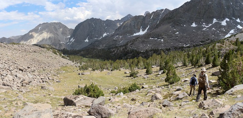
Now it's easy hiking back to camp at Seventh Lake
Day 4 was our final day, and our plan was to take the high trail to Black Lake on the way out. It made the hike a bit of a loop, and that way we'd manage to visit every major lake in the valley. We woke up pretty early, packed our gear, and were headed out of camp by 7am, which is quite respectable.
Alpenglow at dawn on Cloudripper from our campsite at Seventh Lake
Sixth Lake in the morning light with Buck Peak, Temple Crag, Mount Gayley, and Mount Robinson
Panorama view of Fourth Lake from the cliff-tops on the northern shore
Fourth Lake from the eastern shore, with Two Eagle Peak and Cloudripper in the distance
Black Lake with Sky Haven behind it
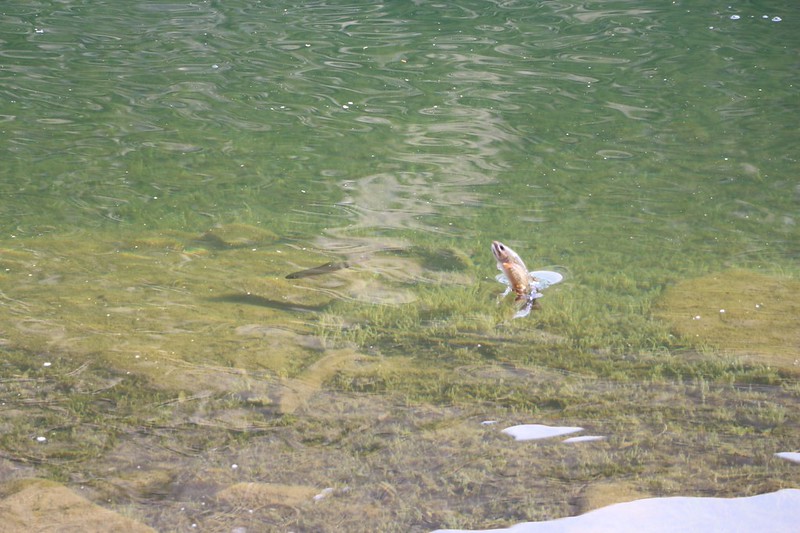
I couldn't believe it but I lucked out and caught a trout jumping out of the water at Black Lake!
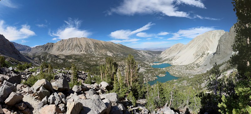
Panorama looking down over First and Second Lakes, with Buck Peak and Temple Crag from the Black Lake Trail
We're back at the top of First Falls, with Middle Palisade in the South Fork in the far distance on the right
Well, I hope this trip report wasn't too long, but there sure is an awful lot to see in the North Fork of Big Pine Creek. I'd never been there before, as the avaliable permits were always scooped up too quickly. And now I know why. It's absolutely gorgeous! I'm glad I made my permit reservations online at exactly 7am, precisely six months prior to our day of entry. Sometimes it pays to plan ahead. Buy a 2019 Calendar right now, and mark the date for yourself! You'll be glad you did...
Tons more photos and videos can be found on my Flickr Album Page
Our GPS tracks can be seen and exported from my Caltopo Page
Happy hiking!
Since there is so much to see in that area, I'm going to fill the Trip Report with lots of photos and try to keep the verbiage to a minimum. Let's hope it works!
Day 1 was the toughest day. We climbed nearly 5000 feet, camping at Sam Mack Meadow, then day-hiked up to the Palisade Glacier.
The trail just above Second Falls was blasted through this gorge alongside the creek
Our first view of Temple Crag as we near First Lake
Panorama view of First Lake with Temple Crag and Buck Peak
Obligatory posed shot at Second Lake with Temple Crag looking awesome in the background
Panorama view over Third Lake with Temple Crag
Most people camp near one of these three lakes, as it's a decent climb to get there. But not us. Two weeks before this we'd done a practice 5000-foot climb down in Southern Cal to San Bernardino Peak, and we knew that we had it in us. So we turned left and continued upward to Sam Mack Meadow, where we found a few nice LNT camping spots up in the pines on the right side.
My son sitting near that big boulder while waiting for us at Sam Mack Meadow
Panorama view of Sam Mack Meadow
After a good rest we set up camp and got ready with our day-packs for the next part of the day's adventure: The Palisade Glacier. It was late enough in the afternoon that we simply wanted to see it, up close and personal. We'd purposely left our ice axes back in the car to save weight. The glacier truly deserved a day all to itself, but we didn't have the time. Sorry about that, Mr. Glacier.
Panorama view of Sam Mack Meadow from high above on the Palisade Glacier Trail
Panorama view of First, Second, and Third Lakes as we climbed ever-higher
The Palisade Glacier Trail is marked with cairns beyond a certain point, as it is more of a route than a trail
Sill, Polomonium, Starlight, North Palisade, Thunderbolt, Winchell, and Agassiz above the Palisade Glacier
Hiking downhill on slabs of granite as the sun gets lower and the shadows longer
Day 2 was meant to be an easy day. We mainly wanted to check out a few more beautiful lakes while eventually making camp all the way up the valley at Seventh Lake. We woke up late and took our time, taking long rests whenever we felt like it. This is the sort of day that fishermen like, and there were plenty of trout to be seen along the way.
Sam Mack Meadow at Dawn
Panorama shot at Fifth Lake with Mount Robinson, Two Eagle Peak, and Cloudripper
Fourth Lake with Mount Alice on the right
View south to the Palisade Glacier from Summit Lake.
I liked Summit Lake the best. We hung out there for over an hour, eating lunch and watching the dogs swim in the cold water. It was such an extraordinary view. It was hard to realize that we had been standing all the way up there by that glacier only yesterday afternoon.
Mount Robinson and Two Eagle Peak above Sixth Lake
Panorama shot from the shore of Sixth Lake - the trail peters out completely at this point
Looking south from the shore of Seventh Lake - our camp was on that small granite rise on the left
Day 3 was our "Layover Day", if you can call spending it climbing 2500 feet up to the 13525-foot summit of Cloudripper Peak a relaxing way to spend your day. But at least we didn't have to carry our big packs, and it was nice to know that we'd be staying here another night. We were the only ones up at this lake, and we liked it that way.
Cloudripper in the morning sun - we would ascend to the saddle on the right, then climb the ridge to the top
View of the scree and talus below the saddle - we would stay on the bigger rocks on the right, not the scree
Buck Peak, Temple Crag, Mt Robinson, and Two Eagle Peak with Seventh Lake in the center
The dogs seem to be climbing the large blocks of talus just fine as we head to the saddle
Panorama view from the saddle east of Cloudripper Peak - elevation 12300 feet - and the view is awesome!
Thunder and Lightning Lake from the saddle
The route-finding is easy, mostly second and easy third class scrambling on the way up the ridge to the summit
Vagabond Peak (13112 feet elevation) on the left and Thunder and Lightning Lake down below us
Lots of mountains and lakes to the south as we climb up Cloudripper's eastern ridge
Getting near the summit and we were hiking strong - we must've been partly acclimated to the elevation
The summit of Cloudripper is right in front of us
Passing the two dogs up to the summit - it wouldn't be fair to leave them ten feet shy of the top
View northwest from the summit
View south from the summit
Looking down into the Bishop Creek drainage from the summit
Heading back down from the top of Cloudripper - it's afternoon and time to head for camp
A tired puppy at the saddle, taking a well-earned break after climbing Cloudripper
Descending the scree slope via shoe-skiing - lots of mini-avalanches but we descended rapidly
Shoe-skiing the scree slope with plenty of dust - we were having a great time!
Now it's easy hiking back to camp at Seventh Lake
Day 4 was our final day, and our plan was to take the high trail to Black Lake on the way out. It made the hike a bit of a loop, and that way we'd manage to visit every major lake in the valley. We woke up pretty early, packed our gear, and were headed out of camp by 7am, which is quite respectable.
Alpenglow at dawn on Cloudripper from our campsite at Seventh Lake
Sixth Lake in the morning light with Buck Peak, Temple Crag, Mount Gayley, and Mount Robinson
Panorama view of Fourth Lake from the cliff-tops on the northern shore
Fourth Lake from the eastern shore, with Two Eagle Peak and Cloudripper in the distance
Black Lake with Sky Haven behind it
I couldn't believe it but I lucked out and caught a trout jumping out of the water at Black Lake!
Panorama looking down over First and Second Lakes, with Buck Peak and Temple Crag from the Black Lake Trail
We're back at the top of First Falls, with Middle Palisade in the South Fork in the far distance on the right
Well, I hope this trip report wasn't too long, but there sure is an awful lot to see in the North Fork of Big Pine Creek. I'd never been there before, as the avaliable permits were always scooped up too quickly. And now I know why. It's absolutely gorgeous! I'm glad I made my permit reservations online at exactly 7am, precisely six months prior to our day of entry. Sometimes it pays to plan ahead. Buy a 2019 Calendar right now, and mark the date for yourself! You'll be glad you did...
Tons more photos and videos can be found on my Flickr Album Page
Our GPS tracks can be seen and exported from my Caltopo Page
Happy hiking!